- Broadhempston
-
Broadhempston 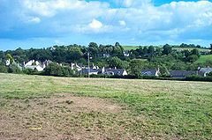
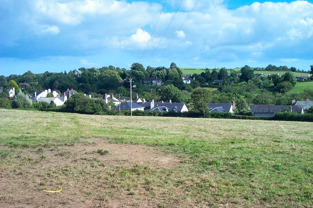
BroadhempstonPopulation 641 (2001) OS grid reference SX8066 Parish Broadhempston District Teignbridge Shire county Devon Region South West Country England Sovereign state United Kingdom Post town TOTNES Postcode district TQ9 Dialling code 01803 Police Devon and Cornwall Fire Devon and Somerset Ambulance South Western EU Parliament South West England UK Parliament Newton Abbot List of places: UK • England • Devon Broadhempston is a small village within the Teignbridge District Council Area in the County of Devon in the South West of England ("The West Country"). It comprises 257 houses with a population (total parish) of 641.[1]
It has a good mix of generations with a church, a primary school, two pubs (the Monk's Retreat and the Coppa Dolla) and a shop/post office. The working population tends to work in neighbouring cities and towns such as Torquay, Exeter and Plymouth. There is a higher than average proportion of professional and managerial staff than the national and house ownership, as a measure of prosperity, is also high. Many of the villagers are "incomers" and they now outnumber "natives".
Until the last few years, there were five working farms within the village itself, but, in common with many rural areas, the decline in farming has meant that these are now no longer in business and have become part of the housing pool of the village.
The village is very old, having been founded in Saxon times, although the church itself is more modern, having been built in the 13th century. It suffers from diminishing congregations, although remains a focus for many village activities. The vicar serves four parishes as well as Broadhempston.
The 15th-century almshouse is now an inn. The church has a 13th-century Chancel, and 15th-century arcades, beams and bosses. The fine screen is equally old, but the baptismal font is over 600 years old. Giles Hussey, artist and theorist, is buried in the churchyard.[2]
There is a Community Woodland Project being developed. This currently has public access for pedestrians. They are in the process of developing plans to build the woodland as a community educational resource.
References
- ^ Office for National Statistics : Census 2001 : Parish Headcounts : Teignbridge Retrieved 25 June 2010
- ^ Dictionary of National Biography
- Broadhempston website
- Broadhempston community page
- Broadhempston Community Woodland website
- Broadhempston at GENUKI
External links
 Media related to Broadhempston at Wikimedia CommonsCategories:
- Villages in Devon
Wikimedia Foundation. 2010.