- Bogotá
-
Bogotá, D.C. — City — Bogotá Distrito Capital Downtown Bogota

Flag
SealMotto: Bogotá, 2600 metros más cerca de las estrellas
Bogotá, 2600 meters closer to the starsCoordinates: 4°35′53″N 74°4′33″W / 4.59806°N 74.07583°WCoordinates: 4°35′53″N 74°4′33″W / 4.59806°N 74.07583°W Country Colombia Department  Distrito Capital
Foundation 6 August 1538 (traditional)[1] Founder Gonzalo Jiménez de Quesada Government – Mayor Gustavo Petro Area – City 1,587 km2 (612.7 sq mi) Elevation[2] 2,625 m (8,612 ft) Population (2011 estimate)[3] – City 7,434,453 – Rank Ranked 1st – Density 4,684.6/km2 (12,133/sq mi) – Metro 9,600,000 Demonym Bogotano HDI (2011) 0.904 very high<[4] Website City Official Site
Mayor Official Site
Bogotá TourismBogotá, Distrito Capital (Spanish pronunciation: [boɣoˈta] (
 listen)), from 1991 to 2000 called Santa Fé de Bogotá, is the capital, and largest city, of Colombia. It is also designated by the national constitution as the capital of the department of Cundinamarca, even though the city of Bogotá now comprises an independent Capital district and no longer belongs administratively to that department. Bogotá is the most populous city in the country, with an estimated 7,304,384 inhabitants as of 2009. Bogotá and its metropolitan area, which includes municipalities such as Chía, Cota, Soacha, Cajicá and La Calera, had an estimated population of 8,566,926 in 2009.[3]
In terms of land area, Bogotá is the largest city in Colombia, and one of the biggest of Latin America. It figures amongst the thirty largest cities of the world and it is the third-highest capital city in South America (after La Paz and Quito) at 2,625 metres (8,612 ft) above sea level.[2] With its many universities and libraries, Bogotá has become known as "The Athens of South America".[5] Bogotá owns the largest moorland of the world, which is located in the Sumapaz Locality.[6] The city ranked 54th in the 2010 Global Cities Index[7] and is listed as global city of the Beta+ kind by the GaWC.[8]
History
The History of Bogotá refers to the history of the area surrounding the Colombian capital city of Bogotá. The area of modern Bogotá was first populated by groups of indigenous people that migrated from mesoamerica. Among these groups were the Muiscas who settled in what is now mainly Cundinamarca and Boyacá. With the arrival of the Spanish colonizers the area became a major settlement, founded by Gonzalo Jiménez de Quesada and later capital of the Spanish provinces and the seat of the Viceroyalty of New Granada. With independence Bogotá became capital of the Gran Colombia and later the capital of the Republic of Colombia.
Pre-Colombian
 La balsa Muisca (The Muisca raft), a pre-Columbian gold sculpture representing the Muisca's offerings of gold.
The first populations inhabiting Bogotá were the Muiscas, members of the Chibcha language family. At the arrival of the conquerors, the group is estimated to be half a million indigenous people. They occupied the highland and mild climate flanks between the Sumapaz mountains to the southwest and Cocuy's snowy peak to the northeast, covering an approximate area of 25,000 km², comprising Bogotá's high plain, the current Boyacá department portion and a small Santander region. Most fertile lands were ancient Pleistocene lake beds and regions irrigated by high Bogotá, Suárez, Chicamocha and some Meta affluent river beds.
In this area, the population was organized in two large federations, each commanded by a chief: the southwest area dominated by the Zipa with the center located in Bacatá, currently Bogotá. He was the strongest leader occupying two fifths of the territory. The northeast zone was the Zaque domain and the center was Hunza region, currently Tunja. Muisca population however, contrasting with Tairona population, did not develop large cities. Muisca, eminently farmers formed a disperse population occupying numerous small villages and hut settlements. Besides, some free isolated tribes also existed: Iraca or Sugamuxi, Tundama and Guanentá. Their inhabitants main occupation was agriculture complemented by hunting and fishing. They basically cultivated corn and potatoes, beans, squash, tomatoes, "cubios" yucca, tobacco, "arracacha", sweet potatoes and diverse fruit and vegetables. In the mining field, salt and emeralds extraction was fundamental for their own use and to trade with other tribes from which they obtained gold and cotton.
Myths and beliefs
Main article: Muisca mythologyChía was Zipa's territory ceremonial centre, a place destined to worship the Moon, while the Zaque's ceremonial centre was Sogamoso, where the Sun temple was located. Apparently, major Muisca priests function was astronomic observation. Numerous archeological monuments in the form of stone columns witness the relation, such as «Cojines del Diablo» (Devil's Cushions) two large discs carved high up in the rock within Tunja urban perimeter, which were probably moon observation sites. At Saquenzipa, a ceremonial centre near Villa de Leyva, some 25 large cylindrical columns aligned in the east-west direction stand: from this place, on summer solstice day the sun rises exactly over Iguaque lake from where Bachué goddess emerged as the legend tells.
Bochica, the civilizing god thought them manual arts, gave them moral standards and subsequently saved them from deluge and plains flooding by breaking the rock and letting the water flow to form Tequendama falls. Chia goddess was the moon, Zuhé the sun. They worshiped other astral gods. For Muiscas, lakes were sacred places where they had their ceremonies. Their most important myths and legends mention Guatavita, Siecha, Tota, Fúquene and Iguaque lakes, where gold and ceramic gifts have been found. They also worshipped the dead, nobles and chiefs whom were mummified and buried with all their belongings.
Goldsmith and ceramics
Although Muisca had no gold, they obtained it from trading with other tribes. They manufactured diverse pieces, the most outstanding are tunjos, small anthropomorphic or zoomorphic figures they offered their gods. Among diverse techniques they used to manufacture those pieces are lost wax, hammering and repouseé. Gold objects served for funerary and sacred gifts. They also made necklaces, bracelets, earrings, pectorals, nose rings and other pieces they used for adorning themselves. The Gold Museum and other private collection museums still preserves some of those pieces. They were excellent at weaving and outstanding potters.
Conquest
Gonzalo Jiménez de Quesada expedition

From 1533 belief persisted in the sense that Río Grande de la Magdalena was the trail to the South Sea, to Peru, legendary Dorado. Such was the target Gonzalo Jiménez de Quesada, the Spaniard conqueror who left Santa Marta on 6 April 1536 with 500 soldiers heading towards the interior of current Colombia was set to reach. The expedition divided into two groups, one under Quesada command to move on land and the other commanded by Diego de Urbino would go up river in four brigantine ships to later on meet Quesada troops at the site named Tora de las Barrancas Bermejas. When they arrived they heard news about Indians inhabiting the south and making large salt cakes used to trade for wild cotton and fish. Jiménez decided to abandon the route to Peru and cross the mountain in search for «salt villages». They saw crops, trails, white salt cakes and then huts where they found corn, yucca and beans. From Tora the expedition went up the Opón river and found Indians covered with very fine painted cotton mats. When they arrived to Grita Valley, of the expedition leaving Santa Marta only 70 men were left.
Along their trip they took a large amount of gold and emeralds. In Hunza they captured the Zaque Quemuenchatocha and headed towards Sogamoso, where they plundered and set the Sun temple on fire obtaining immense prize.
On 22 March 1537 they arrived from the north crossing Nemocón and Zipaquirá «salt villages» to a place they named Valle de los Alcázarea (Valley of the Fortress). Already in Chibcha territory they found goods roads and moved southwest. In a few days only they crossed several villages, among them Lenguazaque and Suesca. They continued through Cajicá, Chía and Suba, the start of Bogotá Kingdom, where they fought Bogotá Chief Indians who tried to prevent them from entering their town, and saw Muequetá or Bacatá fenced ranch village, built on a swampy ravine, Tisquesusa Zipa capital on the right margin of the Tisquesusa river.
Spanish colonization
Foundation of Bogotá
 The fountain of Quevedo, one of the possible foundation sites of Bogotá
Following conquerors motto to found and to populate, Quesada decided to build an urban settlement to live in good order and under stable government. To the east on the foothills they found an Indian village named Teusaquillo near the Zipa's recreation residence, supplied with water, wood and planting land and protected from winds by Monserrate and Guadalupe hills.
Although no document recording city foundation has been found, 6 August 1538 is accepted as foundation date. According to tradition, that day Priest Fray Domingo de las Casas said the first mass in a straw hut built near the current cathedral or near Santander park. It is said that the region was named New Kingdom of Granada that day and the village was named Santa Fe.
Urban design
Urban design consisted in squares and from that time the one hundred meters per lienzo de cuadra prevails. Traverse streets – east-west – were 0.1 <error> meters wide and current carreras 10000 <error> meters wide. In 1553 the Main Plaza—now Bolívar Plaza—was moved to its current site and the first cathedral construction on the eastern side began. On the other sides the Chapter and the Royal Hearing were located. The street joining the Major Plaza and Herbs Plaza—currently Santander park—was named «Calle Real» (Royal Street) now Carrera Seventh.
Population of Santa Fe
Formed by Whites, Mestizos, Indians, and slaves; from the second half of the 16th century the population began rapidly growing. 1789 census recorded 18,161 inhabitants and by 1819 the city population amounted to 30,000 inhabitants distributed in 195 blocks. Importance grew when the diocese was created. Up to 1585 the only parish was the Cathedral, later on Las Nieves to the north and Santa Bárbara south of the Main Plaza were created.
Government and administration
City Mayor and the Chapter formed by two Council men assisted by the Constable and the Police Chief governed the city. For better administering these domains in April 1550 the Audience of Santafé de Bogotá was organized, for Hearers to act. From that time the city became the capital and the home of New Kingdom of Granada government. Fourteen years later in 1564, the Spanish Crown designated the first Royal Audience Chairman, Andrés Díaz Venero de Leyva. The New Granada became Viceroy-ship in 1739 and kept that condition until Liberator Simón Bolívar achieved independence in 1819.
Religion
After dominating indigenous populations by war, conquest by religion began assisted by religious communities established in the entire Colombian territory from the 16th century, Churches and convents were built for the Franciscan, Dominican, Augustine communities and later on in 1604, Jesuits, Capuchin monks and Clarisse, Dominican and Barefooted Carmelite nuns. Such communities marked the spirit and uses of Santafereños, since they exercised ideology, political and cultural domination only slightly reduced when in 1767, Carlos III ordered Jesuit expulsion from Spanish colonies in America.
Educational centers
As for the rest of Spanish America, religious communities were fundamental in the field of education, which by order of the Crown took place in churches and convents. The first two universities are the deed of Dominican monks (1563 and 1573). In 1592 San Bartolomé seminar school was founded to provide higher education to Spanish children; Jesuits ruled the school, and in 1605 they founded the Maximum School located in one of the Major Plaza corners.
In 1580 Dominicans founded Pontificia Univesidad of Santo Tomás de Aquino Arts and Philosophy school, and in 1621 Jesuits started San Francisco Javier or Javeriana University courses. In 1653 Fray Cristóbal de Torres founded Colegio Mayor de Nuestra Señora del Rosario. In 1783 the first educational community and the first school for woman education were founded in New Granada: La Enseñanza school ruled by the community of María. From that time school lessons for women started, a right up to then reserved to men.
Plastic arts
During colonial centuries two trends were clear, which common source was formed by religious topics: culta, highly influenced by metropolitan 17th century painting counted in the Santa Fe school with outstanding individuals, for instance Baltasar de Figueroa, the head of a painters dynasty, who created and maintained the school where Gregorio Vázquez de Arce y Ceballos (1638–1711), was formed, perhaps the most outstanding person of the time; and popular, formed by more ingenuous painters free from influences of the time, who did not belong to any school. They interpreted biblical scenes, the life of saints and Christ and the Virgin life episodes in carved wood or painted but in a more free style.
Wood carving is highly positioned within plastic production of the time and the maximum expression is found in retable adorning most Colombian churches, for instance San Francisco church main alter retable, mostly carved by Ignacio García de Ascucha.
Pedro Laboria, Spaniard formed in Seville art schools who came to Bogotá, very young and lived here the rest of his life is one of the outstanding sculptors.
French influence dominating Spain during the 18th century when the Borbon dynasty took the throne, also characterized American colonies artistic trends. By mid century painting and decoration secularized in American colonies and French style marked government, high Creole burgess-ship and higher church hierarchy taste. Religious themes gave space to personal portraits. The best known painter of the time was Joaquín Gutiérrez, Viceroys portraitist.
Botanic Expedition
The most important contribution of the time to scientific American nature knowledge was the Botanic Expedition, for the objective of studying native flora. Started by order to Archbishop-Viceroy Caballero y Góngora under the direction of José Celestino Mutis and contributions from scientists as renowned as Francisco José de Caldas, Jorge Tadeo Lozano and Francisco Antonio Zea. Originally sited in Mariquita in 1791 and subsequently transferred to Santa Fe were it worked until 1816.
Painters who cooperated with the work left a series of carefully drawn precious illustrations in witness of research conducted. They were Francisco Javier Matiz and Pablo Antonio García.
Nineteenth Century
Independence
Political uneasiness felt all over Spaniard colonies in America was expressed in New Granada in many different ways accelerating independence process. One of the most transcendent was the Revolution of Comuneros, a population riot started in Villa del Socorro —current Department of Santander—in March 1781. Spanish authorities refrained the riot and José Antonio Galán, the leader was executed. He however left an imprint followed in 1794 by Antonio Nariño, precursor of independence by translating and publishing in Santa Fe, the Rights or Men and the Citizen, and by 20 July movement leaders in 1810. Independence outcry originated in an apparently slight dispute between Creole and Spaniards over the loan of a flowerpot but became popular upraise.
The period comprised between 1810 and 1815 is known as "Patria Boba" (Silly Homeland), because during those years Creole fought among themselves seeking ideal government forms, initial ideological struggles began and the first two republican political parties —federalists and centralists—were formed.
 The royal street, today known as the seventh avenue (Carrera Septima).
Terror epoch and independence
In 1815 Pacifying Expedition commanded by Pablo Morillo arrived in New Granada, pretending to conquer the rebel colony. Repression times started then and extending until 1819. New Granada lived the Independence War period when egregious personalities lost their life but ended by triumphal liberator campaign commanded by Simón Bolívar and Francisco de Paula Santander who fought Vargas Swamp Battle and Battle of Boyacá (1819) to seal independence.
Great Colombia
In 1819 the Liberator created Gran Colombia en Angostura, a national state formed by Venezuela, Nueva Granada and Quito, dissolved later in 1830, the same year Simón Bolívar died in Santa Marta.
Mid Century Revolution
Between 1819 and 1849 no fundamental structures inherited from the colonial phase change had been seen. It was by mid 19th century when a series of fundamental reforms took place, some of the most important being slavery abolition and religious, teaching, print and speech industry and trade freedom, among other. During the decade of the 70s Radicalism accentuated reforms and State, society and institutions perception was substantially modified. However during the second half of the century the country faced permanent «pronouncements», fights between States and fractions and civil wars: the last and bloodier was the One Thousand Days War from 1899 to 1902.
Nineteenth century educational system
Independence achieved Bogotá continued enjoying the privilege of being the main educational and cultural center of the new nation.
In 1823, a few years after Great Colombia organization, the Public Library, now National Library extended and modernized with new volumes and better facilities. The National Museum was founded. Those institutions were of great importance to new republic cultural development. From half century education secularization and expansion widened formation possibilities. The Central University was the first State school, precursor of current National University. Founded in 1867 and domiciled in Bogotá.
Geographic Commission
Between 1850 and 1859 the first effort to research different regions history, geography, cartography, economy, society and cultures in the country was made by the Geographic Commission directed by Italian Agustín Codazzi. Graphic and documentary experience achieved by the Commission was greatly transcendent and complemented Botanic Expedition work. Commission sketchers were miniaturists, portraitists and landscapers who traveled all over the country and portrayed human types, labors, working forms, technical resources, garments, uses and geographic aspects. Commission documents are kept at the General Archive of the Nation.
Travelers and customs painters
During the first half of the Nineteenth century the first republican travelers and other visitors fascinated by nature, people and uses left large aquarelle drawing collections witnessing works, garments, uses and costumes, transportation ways, festivities and forms of life observed around them. Around the same time, other travelers and literates illustrated the same topics under written text such as «Los bogas del río Magdalena» (Magdalena River paddlers) by Rufino José Cuervo in 1840, and many diaries and travel books.
Best known travelers were Walhous Mark (1817–1895) whose excellent aquarelles constitute valuable testimony of Colombia at that time, Alfredo J. Gustin, César Sighinolfi, León Gautier, Luis Ramelli and many other. Some remained in the country and founded schools and academies of art to communicate their technical and artistic knowledge. Mexican Santiago Felipe Gutiérrez was the foreign artist of greater influence at the time. In 1881 he founded Gutiérrez Academy which became National University School of Beaux Arts.
Illustrated Newspapers
 El Espectador's first issue in 1887.
Alberto Urdaneta invited Spaniard Antonio Rodríguez to come to the country to manage the engraving school, which functioned from 1881 in Bogotá. Illustrated Newspaper (1881–1886) illustrators formed in that school. The newspaper was a publication founded and directed by Urdaneta. Work of Illustrated Newspaper cooperators is of great documentary value.
Although Bogotá did not enjoy substantial foreign immigrants flow, according to census taken during the Nineteenth century the population grew quite steadily: in 1832 the census recorded 36,465 inhabitants; in 1881, 84,723 inhabitants and by the end of the century nearly 100,000. Population growth from 1850 was partially due to Mid Century reforms, which expanded work sources. Bogotá offered work possibilities in the trade sector or different functions. Increase derived in physical city expansion towards the north creating new neighborhoods up to Chapinero village, five kilometers away from the city.
Cultural life in the city
Bogotá was a city quite isolated, since communication media were scarce. Only by the end of the century did such isolation decline thanks to the railroad and to some roads linking the city and the Magdalena river and down the river up to the Caribbean coast.
During the decade of the 70s, writers of varied trends grouped around Mosaico magazine, founded and directed by José María Vergara y Vergara, to make one of the first efforts to record Colombian literature history and to consolidate the cultural identity of the country.
Cultural life in the city concentrated in literary gatherings, which during the Nineteenth century allowed Bogotanians to share their literary and political concerns and to attend musical and drama presentations. Maldonado Theater featured theatrical and opera presentations and by the end of the Nineteenth century Bogotá had two important theatres: the Theater Colón, inaugurated in 1892, and the Municipal Theatre, inaugurated in 1895, which featured zarzuela (operetta) and musical shows. Also the scenario for important Colombian history events during the decades of the 30s and 40s.
During the nineteenth century, despite constant riots and civil wars altering normal new republic development, Bogotá preserved traditions and uses dating back to colonial times, combined with some European influence. At meetings and gatherings certain foods and beverages became mandatory: chocolate served at night accompanied of home made cookies and candy, and "ajiaco" became the typical dish. During night reunions someone played in the piano local composers music and in larger parties people danced pasillo a form of rapid waltz so called for the short dancing steps.
Artistic production
In 1886 the National School of Beaux Arts was founded and definitely drove artistic development in the city. Alberto Urdaneta was the first director. Painters Epifanio Garay and Ricardo Acevedo Bernal, School professors, were important portraitists, but the most outstanding person at that time was painter Andrés de Santamaría (1860–1945), greatly renowned painting in Colombia. He was Beaux Arts School director twice and his work, associated to impressionism, is the most important of that time. Landscaping trend most famous representatives were Roberto Páramo, Jesús María Zamora, Eugenio Peña, Luis Núñez Borda and Ricardo Gómez Campuzano, painters whose work is preserved in the permanent National Museum collection.
Literary production
Bogotá gave the Spanish speaking world José Asunción Silva (1865–1896), Modernism pioneer. His poetic work in the novel De sobremesa position him in an outstanding American literature place. Rafael Pombo (1833–1912) was outstanding American romanticism poet who left a collection of fables essential part of children imagination and Colombian tradition.
The railroad
The North railroad to join Bogotá and Carare river – Magdalena river affluent – dates back to radicalism times, but only started shaping when the first railroad section to Girardot was built, under government contract with Francisco Javier Cisneros in 1881, the first section of which joined the Magdalena port and Tocaima. In 1898 the rails reached Anapoima and in 1908 the rails linked the city and Facatativá. From that time Bogotanians were able to mobilize down to the Magdalena river using the rail road. Bogotá-Chapinero-Puente del Común section was inaugurated in 1894, Cajicá in 1896 and Zipaquirá in 1898. Including Soacha and Sibaté rails by the end of the Nineteenth century, Sabana de Bogotá counted on one hundred railroad kilometers.
 Bogotá's Railroad Central Station.
The telephone
The first telephone line in Bogotá linked from 21 September 1881 the National Palace and city mail and telegraph offices, and on 14 August 1884, the municipality of Bogotá granted Cuban citizen José Raimundo Martínez the privilege to install public telephone services in the city. In December the same year the first telephone was installed in the offices of Messrs. González Benito Hermanos connecting to another telephone in Chapinero.
The tramway
On 25 December 1884 the first tramway pulled by mules was inaugurated, and covered the route from Plaza de Bolívar and Chapinero, and in 1892 the line kinking Plaza de Bolívar and La Sabana Station started operating. The tramway ruled over wood rails but since it easily derailed steel rails imported from England were installed. In 1894 a tramway car ran the Bogotá-Chapinero line every twenty minutes. The tramway provided services up to 1948, and was then replaced by buses.
Regeneration
President Rafael Núñez declared Federalism end, and in 1886 the country became a centralist Republic ruled by the Constitution in force – save some amendments – up to 1991. In the middle of political and administration avatars Bogotá continued as the capital and principal political center of the country.
Bolívar SquareTwentieth century
Early in the new century, Colombia had to face devastating consequences from the One Thousand Days War, which lasted from 1899 to 1902, and the loss of Panama. Between 1904 and 1909 liberal party legality was reestablished and President Rafael Reyes endeavored to implement a national government. Peace and State reorganization generated economic activities increase. Bogotá started deep architectural and urban transformation with significant industrial and artisan production increase. In 1910 the Industrial Exposition of the Century took place at Park of Independence. Stands built evidenced industrial, artisan work, beaux arts electricity and machinery progress achieved. The period from 1910 to 1930 is designated conservative hegemony. Between 1924 and 1928 hard union struggle began with oil fields and banana zone workers strikes, leaving numerous people killed.
Bogotá had practically no industry. Production was basically artisan work grouped in specific places same as commercial sectors. Plaza de Bolívar and surroundings lodged hat stores, at Calle del Comercio –current Carrera Seventh– and Calle Florián –now Carrera Eight– luxurious stores selling imported products opened their doors; at Pasaje Hernández tailor's shops provided their services, and between 1870 and 1883 four main banks opened their doors: Bogotá, Colombia, Popular and Mortgage Credit banks.
Bavaria brewery, established in 1889, was of one the major industries. In 1923 the United States paid the Colombian government the first installment associated to agreed 25 million indemnification for their intervention in Panama separation, bringing bonanza reflected by exports increase, higher foreign investment and development infrastructure; roads were built, industry increased, public expense grew and urban economy expanded.
The liberal republic
 BogotazoSee also: Bogotazo and La Violencia
Following banana zone killing and conservative party division, Enrique Olaya Herrera took office in 1930. The liberal party reformed, during 16 years of the so called Liberal Republic, agricultural, social, political, labor, educational, economic and administrative sectors. Unionism strengthened and education coverage expanded. In 1938 the fourth centenary of Bogotá foundation which population had reached 333,312 inhabitants was celebrated.
The celebration produced a large number of infrastructure works, new construction and work sources. Following 1946 liberal party division, a conservative candidate took presidential office again in 1948, after the killing of liberal leader Jorge Eliécer Gaitán, Bogotá's downtown was virtually destroyed as violence reigned. From that date Bogotá's urban, architectural and population sectors were substantially reorganized.
Geography
Location
Bogotá is located on the west of the Savannah of Bogotá (Sabana de Bogotá), 2640 metres (8661 ft) above sea level.[2] Although it is located in what is popularly called the "sabana", literally meaning "savannah", the geographical site is actually a high plateau in the Andes mountains. The extended region is also known as "Altiplano Cundiboyacense" which literally means "high plateau of Cundinamarca and Boyacá".
The Bogotá River crosses the "sabana", forming Tequendama Falls (Salto de Tequendama) to the south. Tributary rivers form valleys with flourishing villages, whose economy is based on agriculture, livestock raising and artisanal production.
The "sabana" is bordered to the east by the Eastern Cordillera of the Andes mountain range. Surrounding hills, which limit city growth, run from south to north, parallel to the Guadalupe and Monserrate mountains. The western city limit is the Bogotá River. The Sumapaz Paramo (moorland) borders the south and to the north Bogotá extends over the plateau up to the towns of Chía and Sopó.
Climate
Bogotá has a subtropical highland climate (Köppen Cwb). The average temperature on the "sabana" is 14.0 °C (57 °F),[9] varying from 3 to 25 °C (37 to 77 °F) during the course of the day. Dry and rainy seasons alternate throughout the year. The driest months are December, January, February and March. The warmest month is March, bringing a maximum of 19.7 °C (67.5 °F). The coolest nights occur in January, with an average of 5.4 °C (41.7 °F) in the city; temperatures can fall below freezing in the nearby towns causing frosts and fog in early morning, with the lowest recorded temperature within the city being −7.2 °C (19.0 °F).[10] in February 2007.
The official highest recorded temperature is 24.9 °C (77 °F) reached in January 1992 and March 1995.[11]
 Hailstorm in Bogotá
The rainiest months are April, May, September, October and November, in which typical days are mostly overcast, with low clouds and some winds, bringing maximum temperatures of 18 °C (64 °F) and lows of 7 °C (45 °F). June and July are usually rainy periods and August is sunny with high winds. Hailstorms are very common during the rainy season, and can be very strong, especially in October. Days are mild or cool and nights can get moderately cold due to the city having mild winds in the night all year round. While temperatures are relatively consistent throughout the year, weather conditions can change dramatically during the course of a single day. Climatic conditions are irregular and variable due to the El Niño and La Niña climatic phenomena which occur in and around the Pacific basin and are responsible for pronounced climatic changes. This makes the city's weather unpredictable; sunny mornings can turn out into a severe-storm afternoon (something commonly referred as "Sol de Lluvia" (literally, "Rainy Sun").
Climate data for Bogotá, D.C. (El Dorado Airport, 1972–1990) Month Jan Feb Mar Apr May Jun Jul Aug Sep Oct Nov Dec Year Average high °C (°F) 20.0
(68.0)19.7
(67.5)19.7
(67.5)19.3
(66.7)19.0
(66.2)18.3
(64.9)18.1
(64.6)18.3
(64.9)18.7
(65.7)18.8
(65.8)19.1
(66.4)19.2
(66.6)19.0 Average low °C (°F) 5.4
(41.7)6.1
(43.0)7.4
(45.3)8.2
(46.8)8.4
(47.1)8.0
(46.4)7.5
(45.5)7.0
(44.6)6.9
(44.4)7.6
(45.7)7.7
(45.9)6.1
(43.0)7.2 Rainfall mm (inches) 33
(1.3)43
(1.69)66
(2.6)111
(4.37)94
(3.7)57
(2.24)41
(1.61)49
(1.93)73
(2.87)115
(4.53)88
(3.46)54
(2.13)824
(32.44)Avg. rainy days 8 11 14 18 20 19 17 16 17 20 18 12 190 Sunshine hours 189.1 152.6 145.7 111 114.7 111 142.6 139.5 123 120.9 135 167.4 1,652.5 Source: Hong Kong Observatory[12] Urban layout and nomenclature
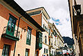
 Carrera Séptima (Seventh Avenue)
Bogotá has 20 localities, or districts, forming an extensive network of neighborhoods. Areas of higher economic status tend to be located to the north and north-east, close to the foothills of the Eastern Cordillera. Poorer neighborhoods are located to the south and south-east, many of them squatter areas. The middle classes usually inhabit the central, western and north-western sections of the city.
 Downtown Bogotá
 Street arrangement of Bogotá based on the Cartesian coordinate system. North is to the right.
The urban layout in the center of the city is based on the focal point of a square or plaza, typical of Spanish-founded settlements, but the layout gradually becomes more modern in outlying neighborhoods. The current types of roads are classified as calles (streets), which run perpendicular to the Cordillera, with street numbers increasing towards the north, and also towards the south (with the suffix "Sur") from Calle 0. Carreras run parallel to the hills, with numbering increasing as one travels east or west of Carrera 1 (with the suffix "Este" for roads east of Carrera 0). At the south-east of the city, the addresses are logically sur-este. Other types of roads more common in newer parts of the city may be termed "Eje" (Axis), "Diagonal" or "Transversal". The numbering system for street addresses recently changed, and numbers are assigned according to street rank from main avenues to smaller avenues and local streets. Some of Bogotá's main roads, which also go by a proper name in addition to a number, are:
- Norte-Quito-Sur or N.Q.S. (North Quito South Avenue, from 9th road at north following railway to 30th road Avenue, or Quito City Avenue, and Southern Highway)
- Autopista Norte-Avenida Caracas (Northern Highway, or 45th road, joined to Caracas Avenue, or 14th road)
- Avenida Circunvalar (from downtown following hillside on eastern hills going to La Calera, mostly the 1-este (1st-east))
- Avenida Suba (60th transversal from 100th street to the Suba Hills; 145th street from Suba Hills westward)
- Avenida El Dorado (El Dorado Avenue, or 26th street)
- Avenida de las Américas (Americas Avenue, from 34th street at east to 6th street at west)
- Avenida Primero de Mayo (May First Avenue, or 22nd (partly 20th too) south street)
- Avenida Ciudad de Cali (Cali City Avenue, or 86th road)
- Avenida Boyacá (Boyacá Avenue, or 72nd road)
- Autopista Sur (Southern Highway)
Localities (Districts)
 Bogotá, Capital District
  Usaquén · Chapinero · Santa Fe · San Cristóbal · Usme · Tunjuelito · Bosa · Kennedy · Fontibon · Engativá · Suba · Barrios Unidos · Teusaquillo · Los Mártires · Antonio Nariño · Puente Aranda · La Candelaria · Rafael Uribe Uribe · Ciudad Bolívar · Sumapaz
Surrounding cities

Cota Chía La Calera Mosquera 
Choachí  Bogotá, D.C.

Tequendama Soacha Chipaque Demographics
Historical populations Year Pop. ±% 1775 16,233 — 1800 21,964 +35.3% 1832 28,341 +29.0% 1870 40,883 +44.3% 1912 121,257 +196.6% 1918 143,994 +18.8% 1928 235,702 +63.7% 1938 325,650 +38.2% 1951 715,250 +119.6% 1964 1,697,311 +137.3% 1973 2,855,065 +68.2% 1985 4,236,490 +48.4% 1993 5,484,244 +29.5% 1999 6,276,428 +14.4% 2005 7,185,889 +14.5% 2010 9,589,170 +33.4% Source: Source: Biblioteca Luis Angel Arango[13] The largest and most populous city in Colombia, Bogotá has 8,566,926 inhabitants in its metropolitan area (2009 census),[3] with a population density of approximately 3912 inhabitants per square kilometer. Only 15,810 people are located in rural areas of Capital District. 47.5% of the population are male and 52.5% women.
 View of Bogotá at dusk
 British architectural style in Bogotá
99.5% of households have electricity service, while 98.7% have water service and 87.9% have telephone service. However, 32.6% of citizens were living in poverty (living on less than US$2 a day) in 2005.
In Bogotá, as in the rest of the country, the acceleration of the urbanization process is not only due to industrialization, since there are complex political and social reasons such as poverty and violence which led to migration from rural to urban areas throughout the twentieth century and beyond. This has led to an exponential growth of population in urban areas creating misery belts in their surroundings. A dramatic example of this is the number of displaced people who have arrived in Bogotá. According to the Consultancy for Human Rights, Codhes, in the period from 1999 to 2005 more than 260,000 people arrived in Bogotá as a result of displacement, about 3.8% of the total population of Bogotá.
The majority of the displaced population lives in the Ciudad Bolívar, Kennedy, Usme, and Bosa sections.
The racial composition of the city's population includes people of Mestizo origin (those of mixed Amerindian and European descent), in addition to Europeans, mostly Spaniards, and other European ethnic groups. It has a large Middle Eastern population, made up mostly of Lebanese and Syrian immigrants. The Afro-Colombian population in Bogotá is smaller than cities along the coast such as Cartagena, where Colombians of African descent have historically resided.
Crime
Further information: Crime in ColombiaBogotá has gone to great lengths to change its crime rate and its image with increasing success after being considered in the mid-90s to be one of the most violent cities in the world.[14] In 1993 there were 4,352 intentional homicides at a rate of 81 per 100,000 people;[15] in 2007, Bogotá suffered 1,401 murders at a rate of 19 per 100,000 inhabitants.[16] This success was the result of a participatory and integrated security policy, "Communidad Segura", that was first adopted in 1995 and continues to be enforced.
According to a 2011 article in The New York Times 'street muggings and thefts on public transportation have surged since 2007', leading certain commentators to declare a crisis of security in the city.[17] According to several polls around 72% of the inhabitants say they have been victims of violent crime in 2010 and 2011.[18]
Government
Bogotá is the capital of the Republic of Colombia, and houses the national legislature, the Supreme Court of Justice, and the center of the executive administration as well as the residence of the President of the Republic (Casa de Nariño).[19] These buildings, along with the Principal Mayor's office, the Lievano Palace (Palacio de Liévano), are located within few meters from each other on the Bolívar Square (Plaza de Bolívar). The square is located in the city's historical center, La Candelaria, which features architecture in Spanish Colonial and Spanish Baroque styles.
The Principal Mayor and District Council – both elected by popular vote – are responsible for city administration. In 2007 Samuel Moreno Rojas was elected Mayor; his term runs from 2008 to 2011. Previous recent mayors of Bogotá include Luis Eduardo Garzón, Antanas Mockus Sivickas and Enrique Peñalosa Londoño.
The city is divided into 20 localities: Usaquén, Chapinero, Santa Fe, San Cristóbal, Usme, Tunjuelito, Bosa, Kennedy, Fontibón, Engativá, Suba, Barrios Unidos, Teusaquillo, Los Mártires, Antonio Nariño, Puente Aranda, La Candelaria, Rafael Uribe Uribe, Ciudad Bolívar, Sumapaz.
Each of the 20 localities is governed by an administrative board elected by popular vote, made up of no fewer than seven members. The Principal Mayor designates local mayors from candidates nominated by the respective administrative board.
-

Nariño Palace, the presidential house.
-

Palace of Justice.
-

Colombian National Capitol.
-

Liévano Palace houses the office of the Mayor of Bogotá.
Economy
 Santa Barbara's Business Center
 Colpatria Tower, the city's tallest building, and the second tallest in South America.
Bogotá is the main economic and industrial center of Colombia. In 2008 the city ranked as the fourth most influential financial center of Latin America. In the period 2003–2006, its commercial GDP grew by 10.3% annually, accounting for 25.3% of GDP national trade. However, the unemployment rate reached 11.3% and a 31.6 percent underemployment. The city is one of the largest industrial centers in Latin America. The Colombian government fosters the import of capital goods, Bogotá being one of the main destinations of these imports (the size of Bogota's industry accounted for 24.4% of Colombia's total in 2003). This is due in part to its geographical location, which makes the city a strategic point in terms of logistics, since transportation of goods to other parts of the country is relatively fast. This also facilitates the supply of raw materials for industry in the city, by its proximity to agricultural regions like the Eastern Plains. Several multinational companies have established their regional operations here during the last decades. However, the distance from the ports reduces the competitive advantages for exporting industrial products. Thus services (including telecommunications and trade) are gaining share versus industry.
In 2005, consumer goods led industrial production, followed by intermediate and capital goods. Of the 248,000 companies available to Bogotá, 78% are linked to service activities, contributing to 76% employment and 79% of GDP. [39] The highest concentrations of industrial establishments are in Puente Aranda, Fontibón, Kennedy, Los Mártires, and Barrios Unidos, and Engativá (in that order). Important business include the food industries, chemical, pharmaceutical, textile, publishing and metalworking. Also in 2005, the town with the highest labor productivity was Tunjuelito, followed by Teusaquillo and Chapinero.
Bogotá is a major tourist destination, an industry which has seen positive growth at the national level in recent years. Another industry that has grown is construction, contributing directly to reactivate economic activity in the capital.
The main international trading partner in Bogotá in 2003 was the United States, followed by the European Union. The city exports mainly agricultural products (30%), chemicals (10%) and textiles (7%), and imports transportation materials (17%), machinery except electrical (17%) and electrical machinery (14%).
In 2008, the World Cities Study Group and Network (GaWC) from the United Kingdom ranked Bogotá as a beta level city, one of their highest rankings. Beta level cities are important world cities that are instrumental in linking their region or state into the world economy.[20]
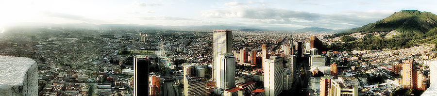

Panoramic view of downtown Bogotá Tourism
-

Monserrate Sanctuary, a famous landmark.
-

Atlantis Plaza Mall, featuring the Hard Rock Cafe.
-

Casa de la Moneda (Colombian Mint).
-
La Candelaria (The Historical District).
-

Colon Theater.
-

Maloka.
 The Financial Disctrict
Despite the bad reputation Colombia bore in the 1980s and early 1990s, tourism in Bogotá has increased since the 2000s due to aggressive publicity campaigns and improvements in both infrastructure and safety. In 2007 the Instituto Distrital de Turismo (District Institute of Tourism) was created with the goal of making Bogotá a sustainable tourist destination.
In Bogotá, there is a wide variety of accommodation ranging from backpacker lodges and five star hotels. The hotels in the historical center of La Candelaria and its surrounding areas cater to lovers of culture and the arts. This area also has the bulk of hostels in the city as well. The hotels located near Ciudad Salitre are intended for visitors who make short stops in Bogotá or need proximity to El Dorado International Airport. The hotels located in the north of the city mainly cater to business visitors, or those travelers seeking shopping or pleasure.
Important landmarks and tourist stops in Bogotá include the botanical garden José Celestino Mutis, La Quinta de Bolivar, the national observatory, the planetarium, Maloka, the Colpatria observation point, the observation point of La Calera, the monument of the American flags, and La Candelaria (the historical district of the city). There is also Usaquen, a colonial landmark where brunch and flea market on Sundays is a traditional activity. The city has numerous green parks and amusement parks like Salitre Magico or Mundo Aventura. Just outside the city you can find the salt cathedral and very near candelaria you can find the Cerro Monserrate. On a clear day you can get impeccable pictures of the city from the mountain.
There are also several areas of the city where fine restaurants can be found. The G Zone, the T Zone and La Macarena are well known for their gastronomic offerings.
Since the 2000s huge hotel chains have been arriving to the city giving one of the most exclusive hotel services around the world. Some of the most important hotel chains that have arrived to Bogotá are: Marriott, Radisson, JW Marriott, Hilton, NH Hoteles, Sheraton Hotels and Resorts, among others.
Shopping malls
 Centro Andino, an exclusive Mall located near the T zone in Northern Bogotá
 Centro Mayor (the largest mall in the country)
Bogotá's economy has significantly been boosted due to new shopping malls built within the last few years:
- Atlantis Plaza
- Centro Andino
- Centro Mayor (the largest mall in the country)
- Diverplaza Álamos
- El Retiro Mall
- Plaza Imperial
- Hacienda Santa Barbara
- Gran Estación
- Hayuelos
- Palatino
- Bulevar
- Portal de la 80
- Salitre Plaza
- Santafé (the second largest mall in the country)
- Tintal Plaza
- Unicentro
- Plaza de las Américas
- Cedritos
- Paseo San Rafael
Infrastructure
Media
The city has several television stations: Canal Capital and Citytv are local stations, Canal 13 is a regional station, and is home to the national channels Caracol TV, RCN TV, Canal Uno, Canal Institucional, and Señal Colombia. It has multiple satellite television services like DirecTV and Telefonica; cable TV is mostly provided by the Mexican company Telmex (formerly TV Cable Bogotá, Superview, and Cablecentro) and the Venezuelan company Super Cable, and satellite dishes which offer hundreds of international channels, plus several exclusive channels for Bogotá.
In the capital all the major radio networks in the country are available, in both AM and FM; 70% of the FM stations offer RDS service.
There are several newspapers, including El Tiempo, El Espectador, El Periódico, and El Nuevo Siglo, plus economical dailies La República and Portafolio, tabloids El Espacio, Q'Hubo, and Extra, and Communist Party's Voz Proletaria. Bogotá also offers a free newspaper called aDn.
Telecommunications
Telecommunication services are provided by three main operators: Empresa de Telecomunicaciones de Bogotá (ETB), Telefónica and Telmex. Below is a list of the companies offering various services:
- Telephone: ETB, Telmex, UNE (EPM Bogotá), Telecom (Colombia)|Telefónica Telecom (owned by Telefónica)
- Internet: ETB, Telmex, UNE (EPM Bogotá), Telecom (Colombia)|Telefónica Telecom
- Mobile phone: Colombia Móvil|Tigo (also known as Tigo; co-owned by ETB, Empresas Públicas de Medellín|EPM and Millicom), Comcel Colombia|Comcel (owned by Telmex), Movistar (owned by Telefónica)
- Cable television: ETB (partnership with DirecTV), UNE (EPM Bogotá), Telmex, Telecom (Colombia)|Telecom](owned by Telefónica), Super Cable, Direct t.v.. etc.
Energy
Energy is provided by Empresa de Energía de Bogotá through its branch CODENSA, and Gas Natural.
Water and sewer
Full water and sewer services are provided by Empresa de Acueducto de Bogotá.
Socioeconomical stratums and billing
 A house in the Chapinero locality, near downtown Bogotá. (Estrato 4)
Energy and sewer bills are stratified based on the location of owner's residence and income,[21] with the intended purpose that wealthier branches of society subsidize the energy bills of the poorer. Bogotá is divided into six socio-economic "estratos" (strata):
- Estrato 1 (lowest)
- Estrato 2 (low)
- Estrato 3 (mid-low)
- Estrato 4 (mid-high)
- Estrato 5 (high)
- Estrato 6 (highest)
Transportation
 A biarticulated TransMilenio bus.
Bogotá's growth has placed a strain on its roads and highways, but within the past decade significant efforts to upgrade the infrastructure have been undertaken. Private car ownership, despite being under 27%, forms a major part of the congestion, in addition to taxis, buses and commercial vehicles. Buses remain the main means of mass transit. There are two bus systems: the traditional system and the TransMilenio. The traditional system runs a variety of bus types, operated by several companies on normal streets and avenues: Bus (large buses), Buseta (medium size buses) and Colectivo (vans or minivans). The bigger buses were divided into two categories: Ejecutivo, which was originally to be a deluxe service and was not to carry standing passengers, and corriente or normal service. Since May 2008, all buses run as corriente services. Bogotá is a hub for domestic and international bus routes. The Bogotá terminal serves routes to most cities and towns in Colombia[22] and is the largest in the country. There is international service to Ecuador, Perú and Venezuela.
 TransMilenio Museo del Oro Station
The TransMilenio 'rapid transit system' was created during Enrique Peñalosa's mayoral term,[23] and is a form of bus rapid transit that has been deployed as a measure to compensate for the lack of a subway or rail system. TransMilenio combines articulated buses that operate on dedicated bus roads (busways) and smaller buses (feeders) that operate in residential areas, bringing passengers to the main grid. TransMilenio's main routes are: Caracas Avenue, Northern Highway (Autopista Norte), 80th Street, Americas Avenue, Jiménez Avenue, and 30th Avenue (also referred to as Norte Quito Sur or N.Q.S. for short). Routes for Suba Avenue and Southern Highway (Autopista Sur), the southern leg of the 30th Avenue, were opened in April 2006. The third phase of the system will cover 7th Avenue, 10th Avenue, and 26th Street (or Avenida El Dorado). The system is planned to cover the entire city by 2030. Although the Transmilenio carries commuters to numerous corners of the city, it is more expensive than any public transport except taxis, and fares increase with petroleum fuel prices. As of 2011 the price of a ticket was C$1700 (about US$0.85); however, a single ticket allows unlimited transfers until the passenger leaves the system, and passengers travel on feeder routes for free. Transmilenio does not yet cover some main routes, and buses are overcrowded.
 100 Street north to Highway
Despite the city's chronic congestion, many of the ideas enacted during the Peñalosa years are regarded worldwide to be cost-effective, efficient and unique solutions. In addition to TransMilenio, the Peñalosa administration and voter-approved referenda helped to establish travel restrictions on cars with certain licence plate numbers during peak hours called Pico y placa; "Car Free Days" on Sundays; a massive system of bicycle paths and segregated lanes called ciclorrutas; and the removal of thousands of parking spots in an attempt to make roads more pedestrian-friendly. Ciclorrutas is one of the most extensive dedicated bike path networks of any city in the world, with a total extension of 303 km. It extends from the north of the city, 170th Street, to the south, 27th Street, and from Monserrate on the east to the Bogotá River on the west. The ciclorruta was started by the 1995–1998 Antanas Mockus administration, and considerably extended during the administration of Mayor Peñalosa.[24] Since the construction of the ciclorruta bicycle use in the city has increased.
Airports
Bogotá's principal airport is El Dorado International Airport, west of the city's downtown, at the end of Avenue El Dorado. Due to its central location in Colombia and in Latin America, it is a hub for domestic and international airlines. Currently the national airport has begun to take more responsibility due to the congestion at the international airport.
El Dorado is heavily congested, as it handles more passengers than its optimal capacity. Work on a major expansion of El Dorado airport started in September 2007. When completed, this will expand capacity from the current 8 million passengers a year to 25 million.[25]
A secondary airport, Catam, serves as a base for Military and Police Aviation; there is also Guaymaral Airport, for private aviation activities.
Urban and suburban railways
Main articles: Bogotá Metro and Tramways of BogotáSee also: Bogotá's Savannah Railway and Train for the vicinities of the city of BogotáColleges and universities
Main article: List of universities in Bogotá Mario Laserna Building. University of the Andes.
Often known as the Athens of South America,[26] Bogotá has an extensive educational system of both primary and secondary schools and colleges. Due to the constant migration of people into the nation's capital, the availability of quotas for access to education offered by the State free of charge is often insufficient. The city also has a diverse system of colleges and private schools.
 Library of Science and Technology Luis Carlos Sarmiento Angulo, National University of Colombia.
There are a number of universities, both public and private. In 2002, there were a total of 106 higher education institutions; in Bogotá there are several universities, most partially or fully accredited by the NAC (National Accreditation Council): National University of Colombia, University of the Andes, Colombia, District University of Bogotá, La Sabana University, Pontifical Xavierian University, Our Lady of the Rosary University, Universidad Externado de Colombia, Military University Nueva Granada, Sergio Arboleda University, Jorge Tadeo Lozano University, Catholic University of Colombia Santo Tomás de Aquino University and La Salle University.
The city has a University City at the National University of Colombia campus located in the traditional sector Teusaquillo. It is the largest campus in Colombia and one of the largest in Latin America. The town of La Candelaria is home to the largest concentration of private universities in Latin America.
In Colombia, the primary and secondary schools educational system goes from pre-kindergarten to eleventh grade, that being the high school senior year. Education in Colombia is not obligatory as in other countries, but the government has implemented a promotional campaign nationwide to influence families with low economic levels to get their children enrolled in school.
Culture
 La Santa Maria bullring (example of the city's Spanish influence and culture)
 Transmilenio in downtown Bogotá
Bogotá has many cultural venues including 58 museums, 62 art galleries, 33 library networks, 45 stage theatres, 75 sports and attraction parks, and over 150 national monuments.[27] Many of these are renowned globally such as:
- The Luis Angel Arango Library, the most important in the region which receives well over 6 million visitors a year;[28]
- The Colombian National Museum, one of the oldest in the Americas, dating back to 1823;[29]
- The Ibero-American Theater Festival, largest of its kind in the world, receives 2 million attendees enjoying over 450 performances across theaters and off the street;[30]
- The Bogotá Philharmonic is the most important symphony orchestra in Colombia, with over 100 musicians and 140 performances a year;[31]
- The Cristobal Colon Theater, the Country's oldest Opera House, opened in 1892, is home to the National Symphony Association's major act, the National Symphony Orchestra of Colombia;[32]
- Rock al Parque or Rock at the Park, the most important open air rock music festival in Latin America. Recurring annually, it gathers over 320,000 music fans who can enjoy over 60 band performances for free during three days a year.[33] The series have been so successful during its 15 years of operation that the city has replicated the initiative for other music genres, resulting in other recent festivals like Salsa at the Park, Hip Hop at the Park, Ballet at the Park, Opera at the Park, and Jazz at the Park.
Bogotá has worked heavily in recent years to position itself as leader in cultural offerings in South America, and it is increasingly being recognized worldwide as a hub in the region for the development of the arts.[34][35][36][37] In 2007 Bogotá was awarded the title of Cultural Capital of Ibero-America by the UCCI (Union of Capital Cities in Ibero-America), and it became the only city to have received the recognition twice, after being awarded for the first time in 1991.[38]
Architecture
 El Colegio Mayor de Bartolome, an important building in the historical centre of the city.
 Eje Ambiental
The urban morphology and typology of colonial buildings in Bogotá have been maintained since the late nineteenth century, long after the independence of Colombia (1810). This persistence of the colonial setting is still visible, particularly in La Candelaria, the historical center of Bogotá. Also kept up are the colonial houses of two stories, with courtyards, gabled roofs, ceramic tiles and balconies. In some cases, these balconies were filled with glass during the Republican period, a distinguishing feature of the architecture of the sector (for example, the House of Rafael Pombo).
"Republican Architecture" was the style that prevailed between 1830 and 1930. Although there were attempts to consolidate a modern architectural language, the only examples seen are University City and White City at the National University of Colombia (constructed 1936 to 1939). This work was developed by German architect James Daly, although architects of rationalist trends participated in the design of campus buildings. We also see in Bogotan architecture trends such as art deco, expressionism and organic architecture. This last trend was typified by Bogotan architects in the second half of the twentieth century such as Rogelio Salmona.
In 2006 Bogotá won The Golden Lion Award at the Tenth International Architecture Exhibition of the Venice Biennale of Architecture, in recognition of "their efforts towards social inclusion, education, housing and public space, particularly through innovations in transportation."
Although renowned for its beautiful preservation of colonial architecture, there are also significant contemporary architecture examples found in the downtown and at the north of the city.
In 2014 BD Bacatá will be inaugurated, taking the place from Colpatria tower to become the tallest building of the city. The building its expected to be the beginning of the city's downtown renovation.
Libraries and archives
In 2007 Bogotá was named World Book Capital by UNESCO.[39] Bogotá is the first Latin American city to receive this recognition, and the second one in the Americas after Montreal. It stood out in programs, the library network and the presence of organizations that, in a coordinated manner, are working to promote books and reading in the city. Several specific initiatives for the World Book Capital program have been undertaken with the commitment of groups, both public and private, engaged in the book sector.
The city is home to the Biblored, an institution which administers 16 small and four large public libraries (Biblioteca Virgilio Barco, Biblioteca El Tintal, Biblioteca El Tunal and Biblioteca Julio Mario Santodomingo). It also has six branches of the Library Network of the Family Compensation Fund Colsubsidio and libraries and documentation centers attached to institutions like the Museo Nacional de Colombia (specializing in old books, catalogs and art), Museum of Modern Art in Bogotá, the Alliance Française, and the Centro Colombo Americano.
Another set of libraries are the new collaborative initiatives between the state, city and international agencies. Examples are the Cultural Center Gabriel García Marquez, custom designed by the Fondo de Cultura Economica in Mexico, and the Spanish Cultural Center, which will begin construction with public funds and of the Spanish Government in downtown Bogotá.
The National Library of Colombia (1777) under the Ministry of Culture and the Biblioteca Luis Angel Arango (1958) under the Bank of the Republic are the two largest public libraries in the city. The first is the repository of more than two million volumes, with an important collection of ancient books. The latter has almost two million volumes. 45 thousand square meters in size, it hosts 10 thousand visitors a day. Bank of the Republic depends also on the Library Alfonso Palacio Rudas, north of the city, with about 50 thousand volumes. Other large public libraries are the Library of Congress in Colombia (with 100 thousand volumes), of the Instituto Caro y Cuervo (with nearly 200 thousand volumes, the largest Latin American library in Philology and Linguistics), the Library of the Academy of History The Library of the Academy of Language, the Library of the Colombian Institute of Anthropology and History ICANH, and many university libraries.
Bogotá is home to historical records housed the General National Archive, a collection of about 60 million documents, one of the largest repositories of primary historical sources in Latin America. Bogotá is also home to the Musical Archive of the Cathedral of Bogotá (with thousands of books and choral song-colonial period), the Archdiocesan Archive, the Archive of the Conciliar Seminary of Bogotá, the Archive History National University of Colombia and the Archive of the Mint in Bogotá, under the Bank of the Republic.
Museums and galleries
 National Museum of Colombia
The city offers 58 museums and over 70 art galleries. The National Museum of Colombia has acquisitions divided into four collections: art, history, archeology and ethnography. The Gold Museum, with 35 thousand pieces of tumbaga gold, along with 30 thousand objects in ceramic, stone and textiles, represents the largest collection of pre-Columbian gold in the world.
The Botero Museum has 123 works of Fernando Botero and 87 works by international artists. The Museum of Modern Art in Bogotá has a collection of graphic arts, industrial design and photography. The Museum of Colonial Art is home to an important collection of colonial art from Colombia. Fundación Gilberto Alzate Avendaño hosts activities related to the performing arts and shows temporary exhibits of art in its halls and galleries.
Among the scientific museums are the Archeological Museum – Casa del Marqués de San Jorge, which has about 30 thousand pieces of pre-Columbian art, Instituto de Ciencias Naturales (UN), one of the four largest museums of natural sciences in Latin America, and the Geological Museum, which has a collection specializing in Geology and Paleontology.
Bogotá has historical museums like the Casa Museo Jorge Eliecer Gaitan, the Museum of Independence (Museo de la Independencia), the Quinta de Bolivar and the Casa Museo Francisco José de Caldas, as well as the headquarters of Maloka and the Children's Museum of Bogotá. New museums include the Art Deco and the Museum of Bogotá.
Theater and scenic arts
 Teatro Colón (Christopher Colombus Theater)
Besides the Ibero-American Theater Festival, the city has forty-five theaters; the principal ones are the Colon Theater, the National Theater with its two venues, the traditional TPB Hall, the Theater of La Candelaria, the Carmarin Theater of Carmen (over 400 years old, formerly a convent), the Colsubsidio, and a symbol of the city, the renovated Teatro Jorge Eliecer Gaitan (the highest capacity currently in South America), León de Greiff Auditorium (home of the Bogotá Philharmonic Orchestra), and the Open Air Theater "La Media Torta", where musical events are also held.
Bogotá has its own film festival, the Bogotá Film Festival, and many theatres, showing both contemporary films and art cinema.
The main cultural center of the city is the La Candelaria, historic center of the city, with a concentration of universities and museums. In 2007 Bogotá was designated the Ibero-American cultural Capital of Iberoamerica.
Sports
 The "Nemesio Camacho el Campín" Stadium.
The District Institute for Recreation and Sport promotes recreation, sports and use of the parks in Bogotá, a city where according to 1998 estimates only 10% of the people play sports, and only 0.7% do so regularly.
Football has been declared a symbol of Bogotá, and is widely played in the city. Colombian professional Football is popular. There are three professional clubs in the city, Millonarios, La Equidad, and Santa Fe. The nineteen titles won by two of these teams (Millonarios have 13 and Santa Fe have six) make Bogotá second only to Cali in number of championships won. The main football stadium is the Estadio Nemesio Camacho El Campín (known as the Campín Stadium), which is the headquarters of the Colombia national Football team, where they won the Copa América in 2001.
Other major sporting venues are the covered Coliseum El Campín, the aquatic complex of Parque Simón Bolívar, the Sports Palace, and the El Salitre Sports venue which includes the Velódromo Luis Carlos Galán (which hosted the 1995 UCI Track Cycling World Championships) and Diamond El Salitre ballpark.
Bogotá hosted the first Bolivarian Games held in 1938. The city hosted the National Games in 2004, winning the championship. It was a sub-venue Bolivarian Pan American Games. In addition, the city on the route of the Tour of Colombia.
Religion
 Church of Our Lady of Lourdes.
As in the rest of Colombia, the value of family unity is quite important in Bogotan society, which is especially prominent in religious celebrations and special times of the year.
Historically, the city has had a tradition of attachment to Roman Catholicism, although the 1991 Constitution has facilitated the presence of Protestant movements and other religious groups in the population.
Proof of this religious tradition is the number of churches built in the historic city center. The city has been seat of the Roman Catholic Archdiocese of Bogotá since 22 March 1564. The seat of the Archbishop is the Cathedral of Colombia; the archdiocese itself is located in new buildings in the north of the city.
The city has a Muslim mosque located in the area of Chapinero, the main Jewish synagogue located on 94th street, also called State of Israel avenue, an Orthodox church located in Chapinero, and the main Temple of the Church of Jesus Christ of Latter-day Saints located on the street North Highway 127. There are four Buddhist centers located in the north of the city, and there are Protestant churches in different parts of the city.
Gastronomy
A broad array of restaurants can be visited in Bogotá where typical and international food can be enjoyed. The G Zone, La Candelaria and the International Centre are some of the main sectors where a number of international restaurants are found. Typical dishes of Bogotá include the Ajiaco,[40] a delightful soup prepared with chicken, a variety of potatoes, corn on the cob, and guascas (an herb), usually served with sour cream and capers.
Tamale is a very traditional dish here. Colombian tamal is a paste made with rice, meat or chicken, chickpea, carrot, and spices, wrapped in plantain leaves and steam cooked.
Figs with arequipe, strawberries with cream, postre de natas and cuajada con melao are some of the main desserts offered in the city. Canelazo is a hot drink from the Altiplano prepared with aguapanela, cinnamon and aguardiente.
Parks and recreation
There are many parks, many with facilities for concerts, plays, movies, storytellers and other activities.
- "Simón Bolívar Metropolitan Park" is a large park regularly used to stage free concerts (such as the annual Rock al Parque, a festival in which new and popular Latin rock bands play free of charge).
- The public Parque Nacional (National Park) has many trees and green spaces, ponds, games for children, foot and bicycle paths, and venues for entertainment such as public screenings of movies and concerts and events organized by the Council of Bogotá. It is located between two main streets, the Circunvalar Avenue and the 7th Avenue.
- The Bogotá Botanical Garden (Jardín Botánico de Bogotá).
- The Children's Museum of Bogotá (Museo de los Niños) is a science, technology and art interactive museum specializing in children and youngsters ages 2 to 19.
- "Parque de la 93" is located between 93rd and 93Ath street, and 12th and 13th avenue, and has day-time leisure activities and nightlife. Several of the top restaurants and bars in the city are in this park.
- There are restaurants and bars in the vicinity of a T-shaped pedestrian strip dubbed "La T" (The T) at the corner of 82nd street and Cra.12. More recently, restaurant activity has begun in the "Zona G" (Gourmet Zone) in and around 67th and 70th Streets and other locations including Usaquen in the north-east and La Macarena (downtown).
- Mundo Aventura is an amusement park, with an entry charge and charges for the different attractions. It has rides for adults and children, a petting zoo, and the "cerdodromo", where pigs race.
- "Salitre Mágico" is another amusement park with rides and attractions. The park is near the Simón Bolívar park, where concerts are held throughout the year.
- Parque del Chicó has trees, gardens, artificial creeks and ponds, and a colonial style house converted into a museum.
- To the north Parque Jaime Duque has rides, a giant map of Colombia, popular exhibits, a zoo, and a big hand holding the world symbolizing God. There is a reproduction of the Taj Mahal in the park with a collection of reproductions of famous paintings. The park is also used for large concerts, mainly electronic music ones.
- Maloka is an interactive museum of sciences.
- Tourist train is a sightseeing train, popular with Bogotá residents, which runs to outlying towns Zipaquirá, Cajicá and Nemocón along the lines of the former Bogotá Savannah Railway on weekends. The route to Zipaquirá (famous for its salt cathedral) is 53 km long. Another line goes towards the north for 47 km and ends at Briceño.
 Simón Bolívar Metropolitan Park
 Journalists's Park
 National Park
 Virrey Park
Symbols
The flag originated with the insurgency movement against the colonial authorities which began on 20 July 1810, during which the rebels wore armbands with yellow and red bands, as these colours were those of the Spanish flag used as the flag for the New Kingdom of Granada.
On 9 October 1952, exactly 142 years after these events, decree 555 of 1952 officially adopted the patriotic armband as the flag of Bogotá.[41] The flag of Cundinamarca follows the same pattern, plus a light blue tile which represents the Virgin Mary's cape.
The flag itself is a yellow band above a red one. The yellow denotes the gold from the earth, as well as the virtues of justice, clemency, benevolence, the so-called "mundane qualities" (defined as nobility, excellence, richness, generosity, splendour, health, steadfastness, joy and prosperity), long life, eternity, power and constancy. The red denotes the virtue of charity, as well as the qualities of bravery, nobility, values, audacity, victory, honour and furor, Colombians call it the blood of their people.
The coat of arms of the city was granted by emperor Charles V (Charles I of Spain) to the New Kingdom of Granada, by royal decree given in Valladolid, Spain on 3 December 1548. It contains a black eagle in the center, which symbolises steadfastness. The eagle is also a symbol of the Habsburgs, which was the ruling family of the Spanish empire at the time. The eagle is crowned with gold and holds a red pomegranate inside a golden background. The border contains olive branches with nine golden pomegranates on a blue background. The two red pomegranates symbolize audacity, and the nine golden ones represent the nine states which constituted the New Kingdom of Granada at the time. In 1932 the coat of arms was officially recognized and adopted as the symbol of Bogotá.
Bogotá's anthem lyrics were written by Pedro Medina Avendaño; the melody was composed by Roberto Pineda Duque. The song was officially declared the anthem by decree 1000 July 31, 1974, by then Mayor of Bogotá, Aníbal Fernandez de Soto.

Panoramic view of Bogotá International relations
Twin towns and sister cities
Bogotá is twinned with Chicago. For more see below.
 Bolivar Square at Christmas
See also
Notable people from Bogotá
- Alberto Castilla (1878–1937), engineer, journalist, poet, writer, mathematician and musician
- Andrés Fischer Muñoz (1965–), realist painter
- Rodolfo Llinás (1934–), neuroscientist
- Juan Pablo Montoya (1975–), race car driver
- Rafael Pombo (1833–1912), poet, writer
- José Asunción Silva (1865–1896), poet, writer
- Carolina Acevedo ( 1979-), actress
References
Notes
- ^ Henderson, James D.; Delpar, Helen; Brungardt, Maurice Philip; Richard N. Weldon (2000). A reference guide to Latin American history. M.E. Sharpe. p. 61. ISBN 9781563247446. http://books.google.com/books?id=e2F7c0wW7g4C&pg=PA61. Retrieved 5 August 2011.
- ^ a b c "Bogotá una ciudad Andina" (in Spanish). la Alcaldía Mayor de Bogotá.. http://www.bogota.gov.co/portel/libreria/php/01.270701.html. Retrieved 2010-11-19.
- ^ a b c "Secretaria Distrital de Planeacion". Sdp.gov.co:8443. http://www.sdp.gov.co/section-2117.jsp. Retrieved 2010-04-17.
- ^ http://es.wikipedia.org/wiki/Anexo:Departamentos_de_Colombia_por_IDH
- ^ "Athens of South America". Revista. http://www.javeriana.edu.co/pensar/Prof-Dr-Rinc%F3n.pdf. Retrieved 2010-07-15.
- ^ "Moors in Latin America". Samual Calde.com. http://www.samuelalcalde.com/index.php?option=com_content&view=article&id=2180%3Aacueducto&Itemid=29. Retrieved 1 October 2010.
- ^ "The Global Cities Index 2010". foreignpolicy.com. http://www.foreignpolicy.com/node/373401. Retrieved 5 March 2011.
- ^ GaWC. "The World According to GaWC 2008". lboro.ac.uk. http://www.lboro.ac.uk/gawc/world2008t.html. Retrieved 5 March 2011.
- ^ "Respuestas fisiológicas de los niños al ejercicio ante las variaciones climáticas en Bogotá" (in Spanish). Universidad Pedagógica Nacional. 2008. http://www.pedagogica.edu.co:8080/portal/resumenproyecto.php?py=54. Retrieved 29 December 2008.
- ^ "Cambios de Clima arrasan con Cultivos" (in Spanish). 2010. http://www.semana.com/wf_InfoArticulo.aspx?idArt=100878. Retrieved 20 February 2010.
- ^ "Bogota passes 24 degrees" (in Spanish). 2010. http://www.eltiempo.com/colombia/bogota/ARTICULO-WEB-PLANTILLA_NOTA_INTERIOR-7170969.html. Retrieved 20 February 2010.
- ^ "Climatological Normals of Bogota". Hong Kong Observatory. http://www.hko.gov.hk/wxinfo/climat/world/eng/s_america/col_ve/bogota_e.htm. Retrieved 2010-05-09.
- ^ "Algunos datos históricos" (in Spanish). Biblioteca Luis Angel Arango. 2001. http://www.banrep.gov.co/blaavirtual/revistas/credencial/enero2001/colmundo.htm. Retrieved 13 March 2009.
- ^ "Bogotá's lesson in crime fighting". Comunidad Segura. 2005. http://www.comunidadesegura.org/?q=en/node/32000. Retrieved 2008-12-28.
- ^ "Seguridad, ciudadanía y políticas públicas en Bogotá" (in Spanish). IRG. http://www.institut-gouvernance.org/en/conference/fiche-conference-36.html. Retrieved 29 December 2008.
- ^ "Homicidios" (in Spanish) (PDF). Instituto Nacional de Medicina Legal y Ciencias Forenses. p. 36. http://www.medicinalegal.gov.co/drip/2007/2%20Forensis%202007%20homicidio-1.pdf. Retrieved 29 December 2008.
- ^ Romero, Simon (5 May 2011). "Bogotá, Colombia, Backslides After a Comeback". The New York Times. http://www.nytimes.com/2011/05/06/world/americas/06bogota.html.
- ^ http://www.eltiempo.com/colombia/bogota/ARCHIVO/ARCHIVO-9100821-0.pdf
- ^ "Bogotá se consolida como centro para la inversión extranjera" (in Spanish). Alcaldía Mayor de Bogota. 2007. http://www.bogota.gov.co/portel/libreria/php/frame_detalle.php?h_id=21539&patron=01.11. Retrieved 29 December 2008.
- ^ The World According to GaWC; 2008 http://www.lboro.ac.uk/gawc/world2008t.html
- ^ "Proyecto de Acuerdo 651 de 2008" (in Spanish). Secretaria de Gobierno de Bogotá. 2008. http://www.gobiernobogota.gov.co/component/option,com_docman/task,doc_details/Itemid,/gid,432/. Retrieved 29 December 2008.[dead link]
- ^ "Bogotá Transportation Terminal & Train Station" (in Spanish). Bogotá-dc.com. 2008. http://www.bogota-dc.com/trans/terminal.htm. Retrieved 29 December 2008.
- ^ "Millonaria condena al Distrito por fallas en Transmilenio" (in Spanish). El Espectador. 2008. http://www.elespectador.com/noticias/bogota/articulo-millonaria-condena-al-distrito-fallas-transmilenio. Retrieved 29 December 2008.
- ^ "Bogotanos olvidaron para qué fue creado el Día sin carro" (in Spanish). Cambio. 2 November 2008. http://www.cambio.com.co/paiscambio/762/ARTICULO-WEB-NOTA_INTERIOR_CAMBIO-3948271.html. Retrieved 29 December 2008.
- ^ "Cinco firmas de disputan la modernización del aeropuerto El Dorado" (in Spanish). Caracol Radio. 2006. http://www.caracol.com.co/nota.aspx?id=299375. Retrieved 29 December 2008.
- ^ "Colombia". Drclas.harvard.edu. http://www.drclas.harvard.edu/revista/articles/view/242. Retrieved 2009-07-25.
- ^ Colombia Official Tourism Portal "Bogotá: a city for experiencing culture"
- ^ Banco de la Republica "2008 Press Release". Retrieved 3 September 2009.
- ^ Museo Nacional de Colombia "History". Retrieved 3 September 2009.
- ^ Colombia Official Tourism Portal "Ibero-American Theater Festival of Bogotá: The Largest Theater Showcase in the World"
- ^ Filarmonica de Bogotá "Philarmonic Timeline"
- ^ Ministerio de Cultura "Cristobal Colon Theater"
- ^ Rock at the Park "15th Edition of the Concert is over"
- ^ Scoop Independent News, New Zealand "Cultural Diversity Highlighted" 24 April 2007
- ^ Sun Sentinel, Florida "Give Bogota a try (no kidding) citty boasts arts, scenery and great food.", 26 February 2006
- ^ Inter Press Service "COLOMBIA: Open Your Books, Please, Bogotá"
- ^ Noticias de Bogotá: Arte "ArtBo 2009 – Reportaje"
- ^ Universia "Bogota Ibero-American Capital of Culture for Second Time"
- ^ UNESCO "World Book Capital City" 2007
- ^ The Washington Post. Recipe Finder. Ajiaco Bogotano. March, 2006. http://projects.washingtonpost.com/recipes/2006/03/01/ajiaco-bogotano-chicken-and-potato-soup/
- ^ "Simbolos de Bogotá" (in Spanish). Alcaldía Mayor de Bogotá. 2007. http://www.bogotaturismo.gov.co/ciudad/simbolos/. Retrieved 29 December 2008.[dead link]
External links
- Bogotá travel guide from Wikitravel
- Bogota Official Tourism guide (English)
- City Official Site (Spanish)
- The City Paper Bogotá (English)
- District Planning Secretariat (Spanish)
Articles Related to Bogotá Departments of Colombia 
 Geographic locale
Capitals of South America World's fifty most-populous urban areas - Bogotá
- London
- Taipei
- Ho Chi Minh City
- Chennai
- Johannesburg –East Rand
- Bangalore
- Lahore
- Tehran
- Ruhr Area
(Essen–Düsseldorf)
Categories:- Bogotá
- Capitals in South America
- Capital districts and territories
- Capitals of Colombian Departments
- Populated places established in 1538
- Departments of Colombia


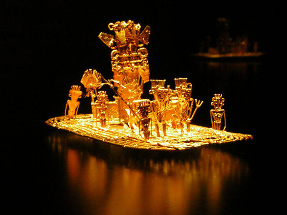
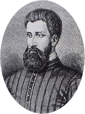

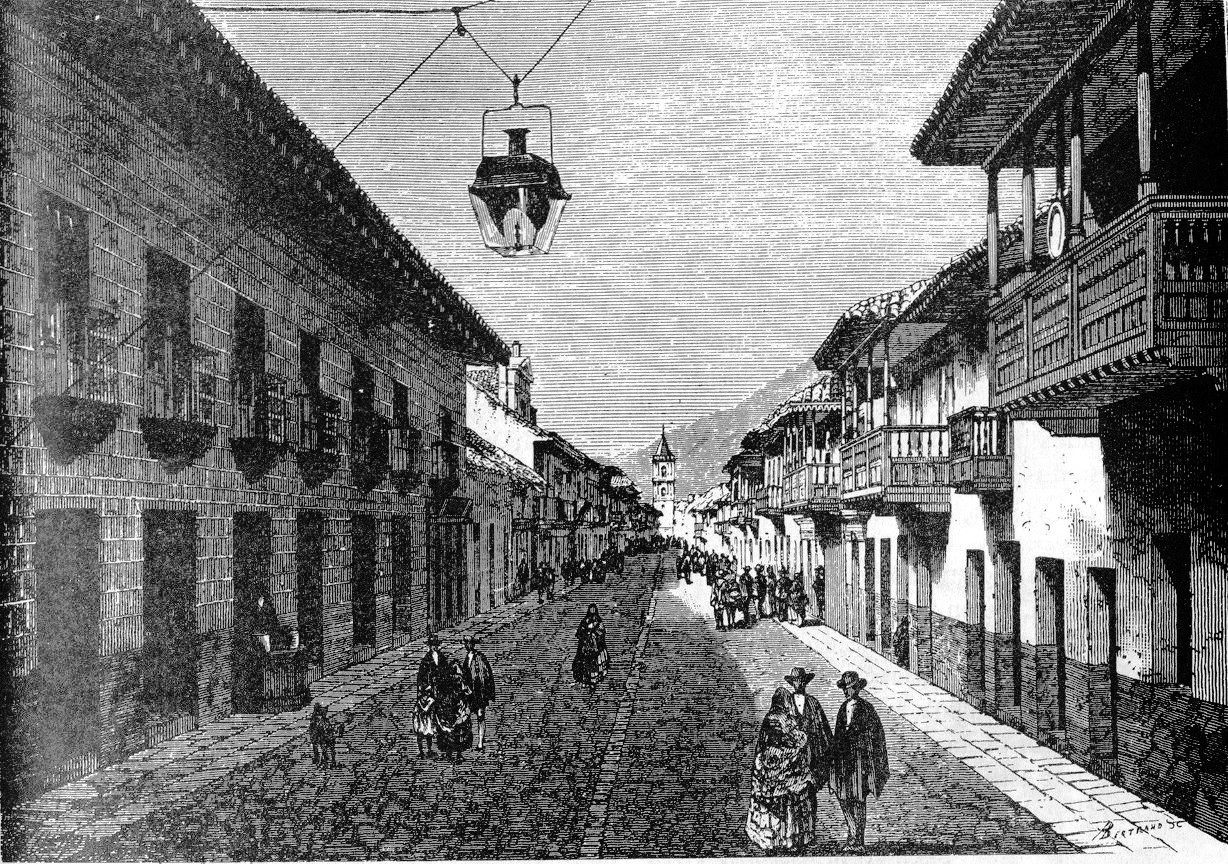

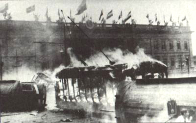

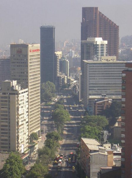
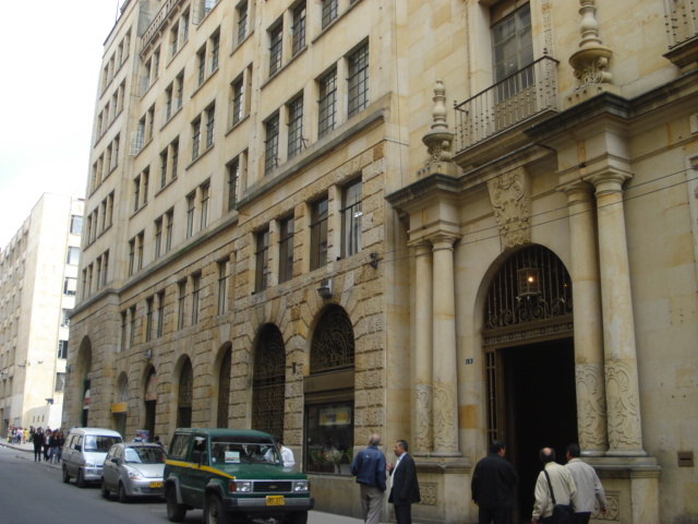
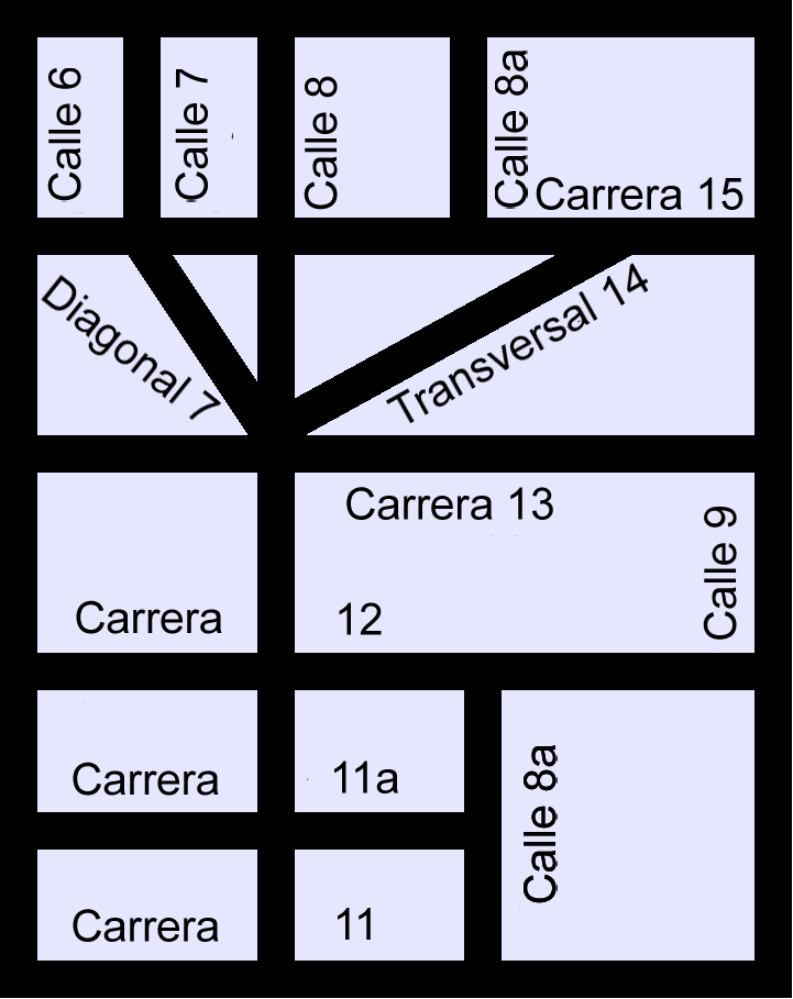
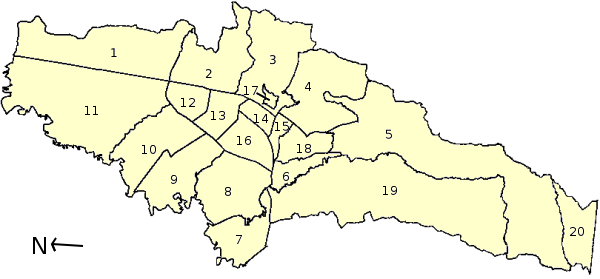
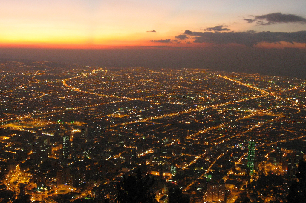
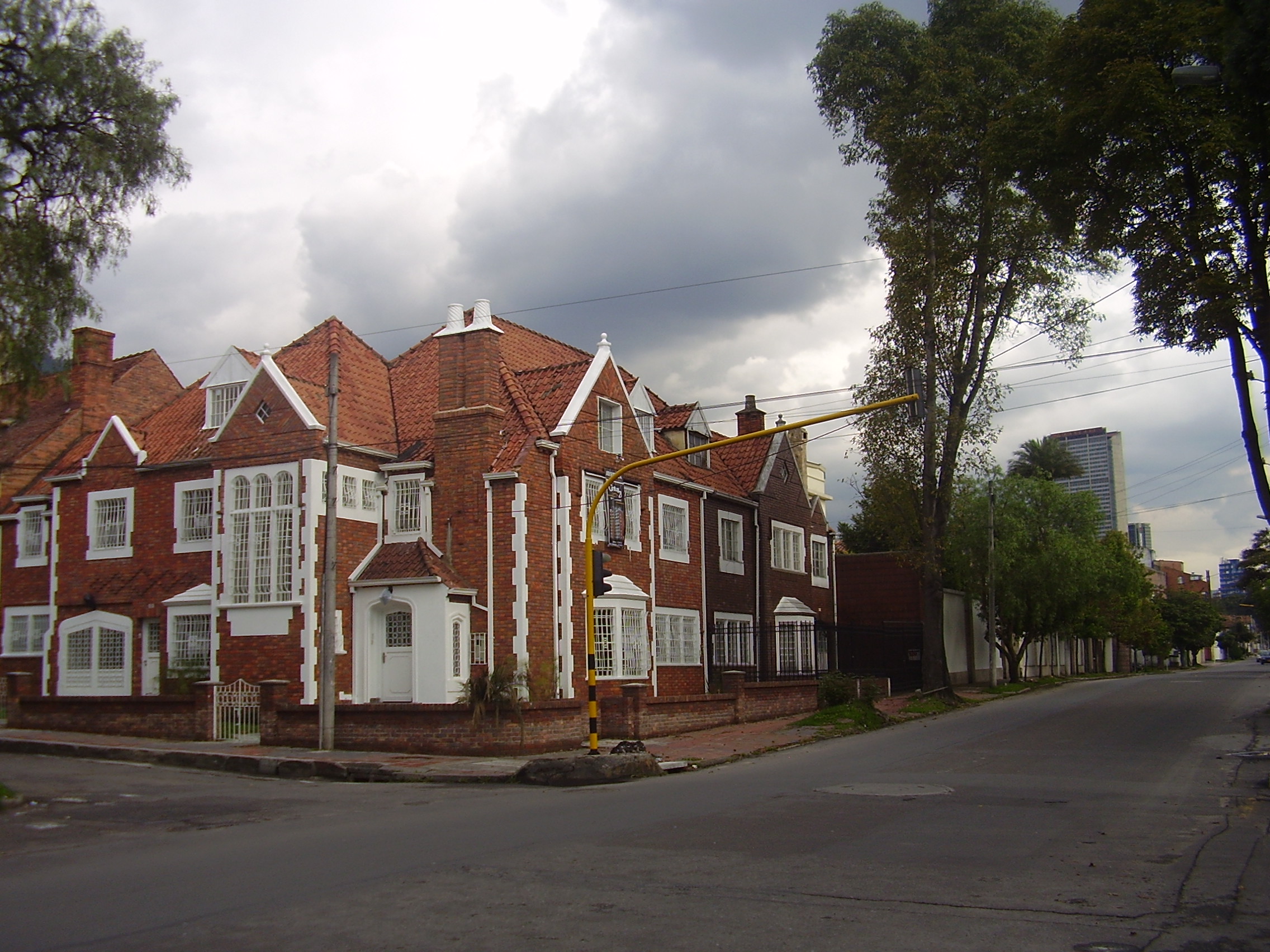

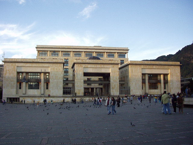
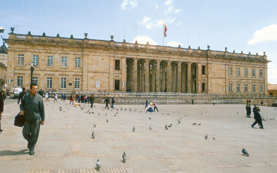

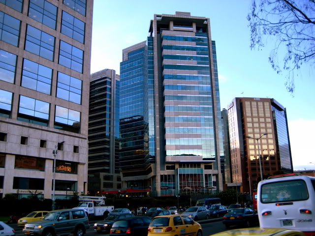
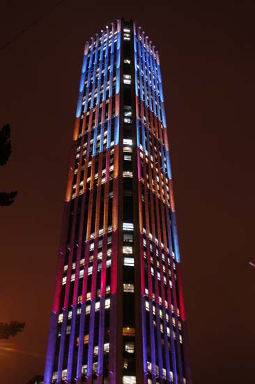

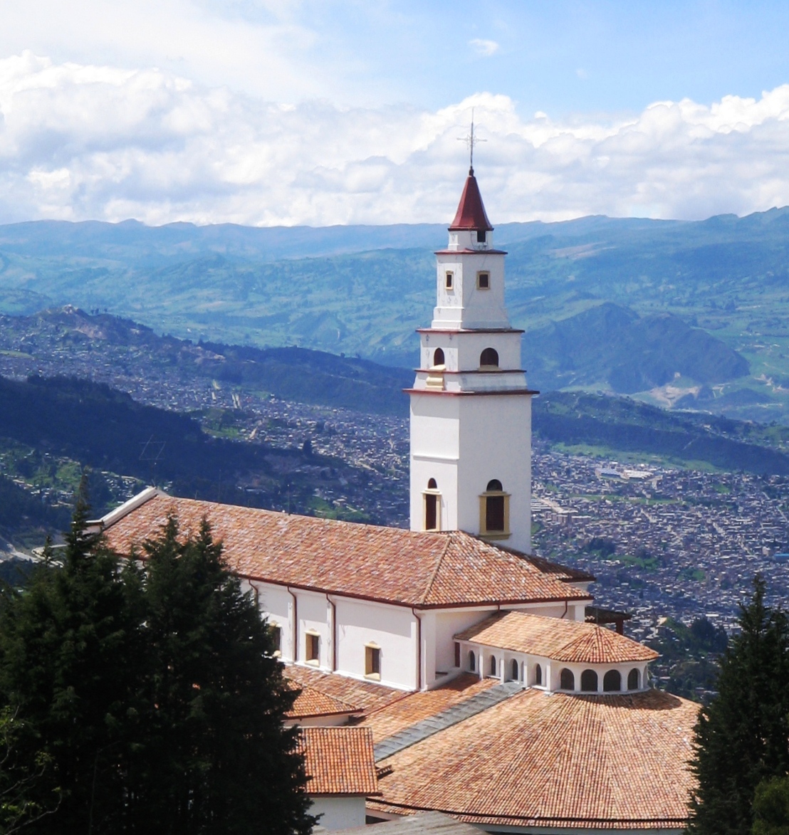

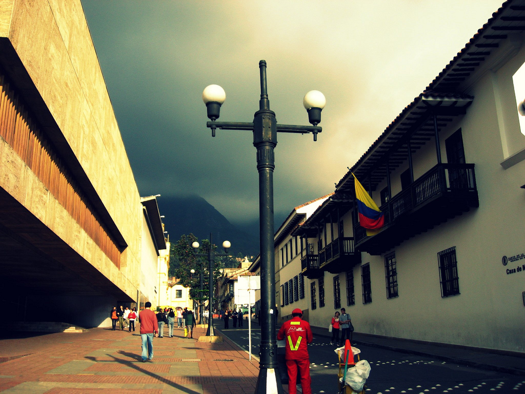

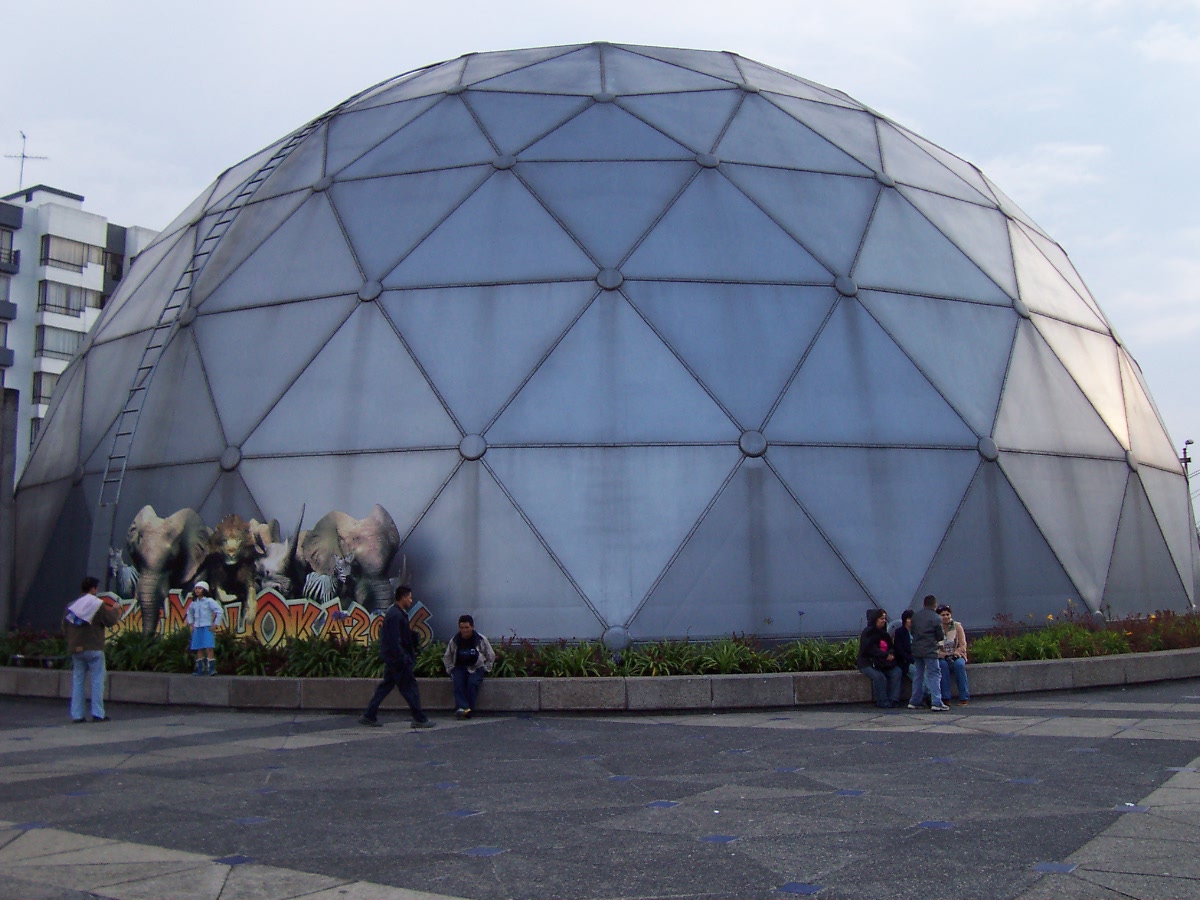
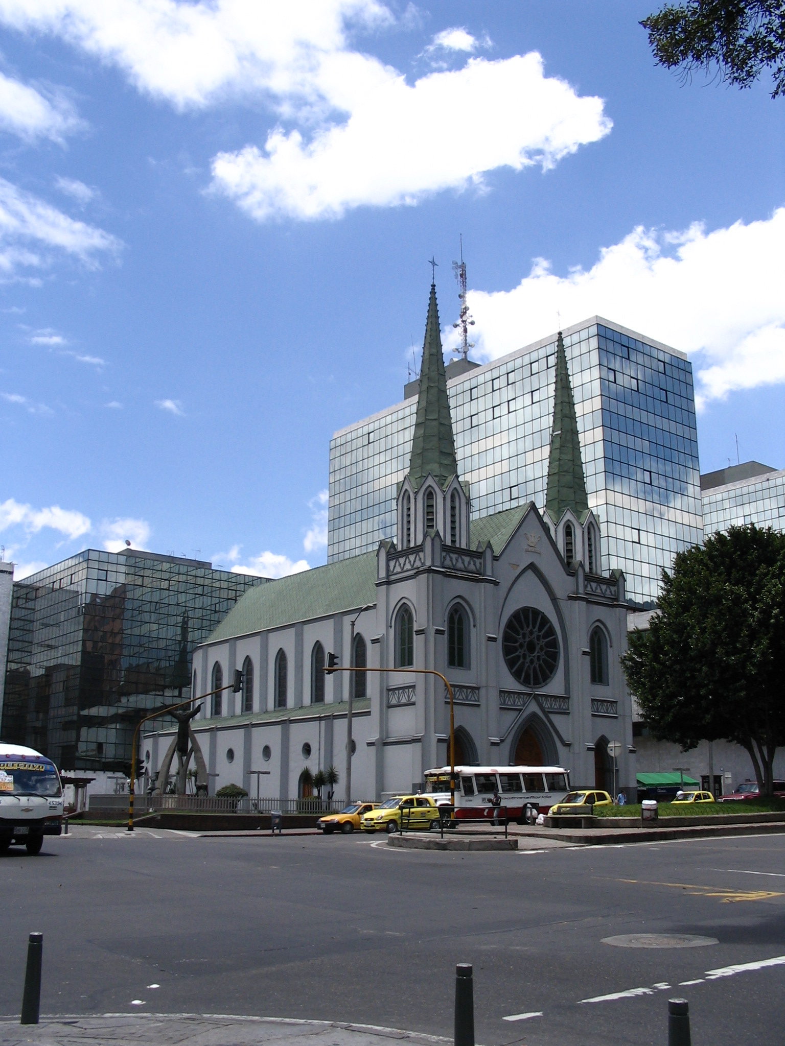
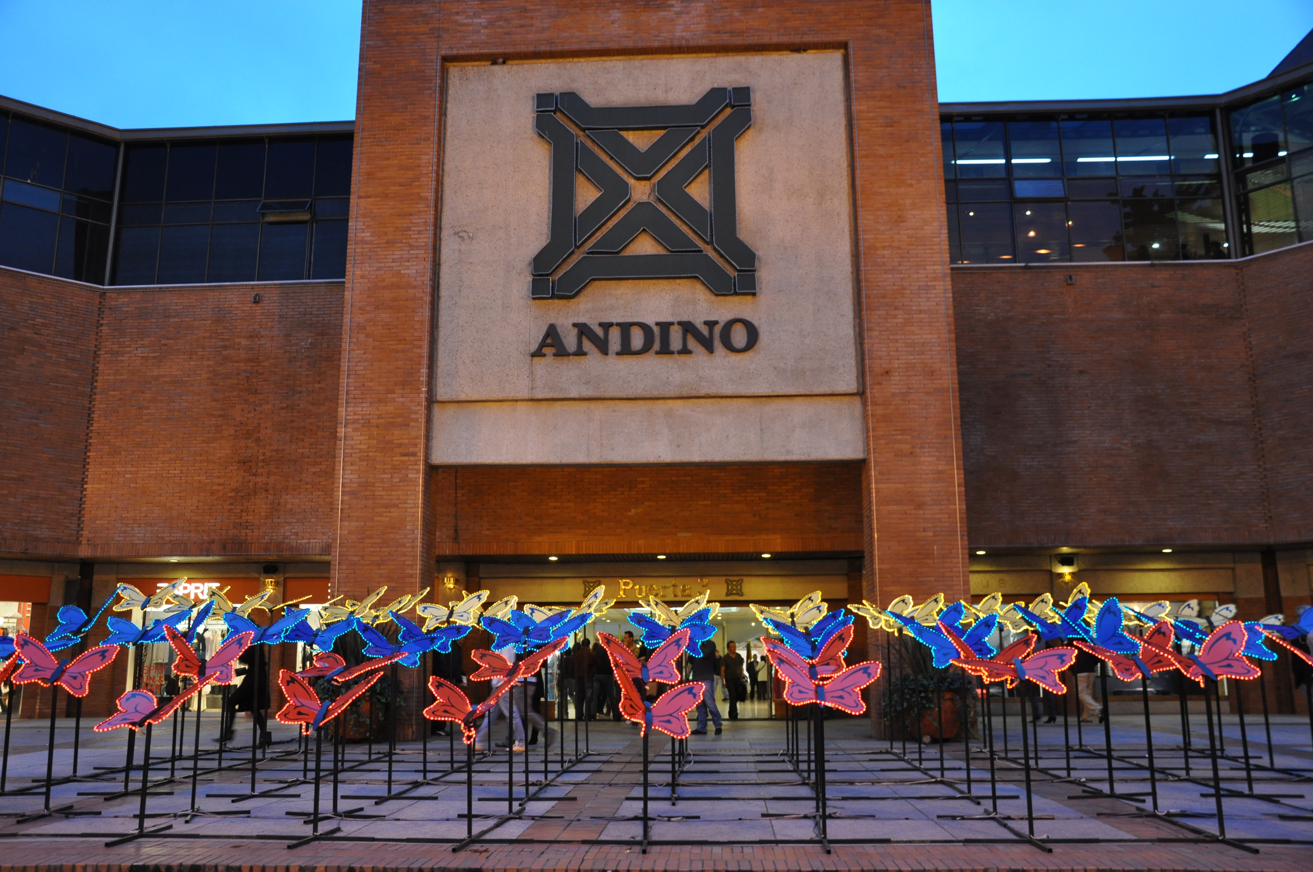

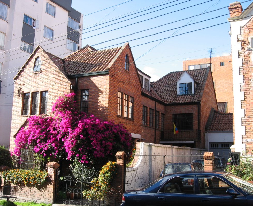


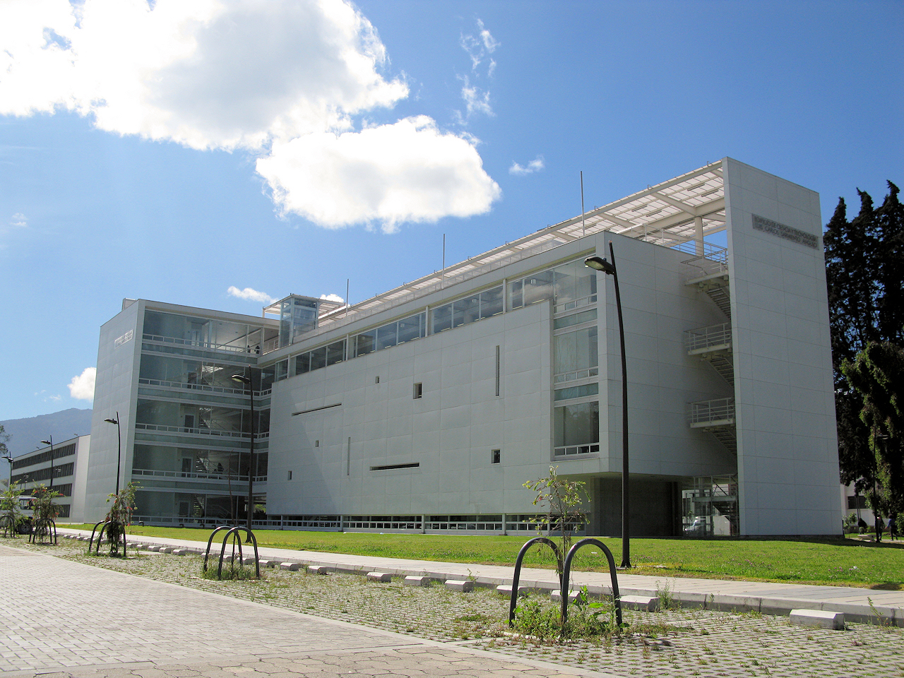
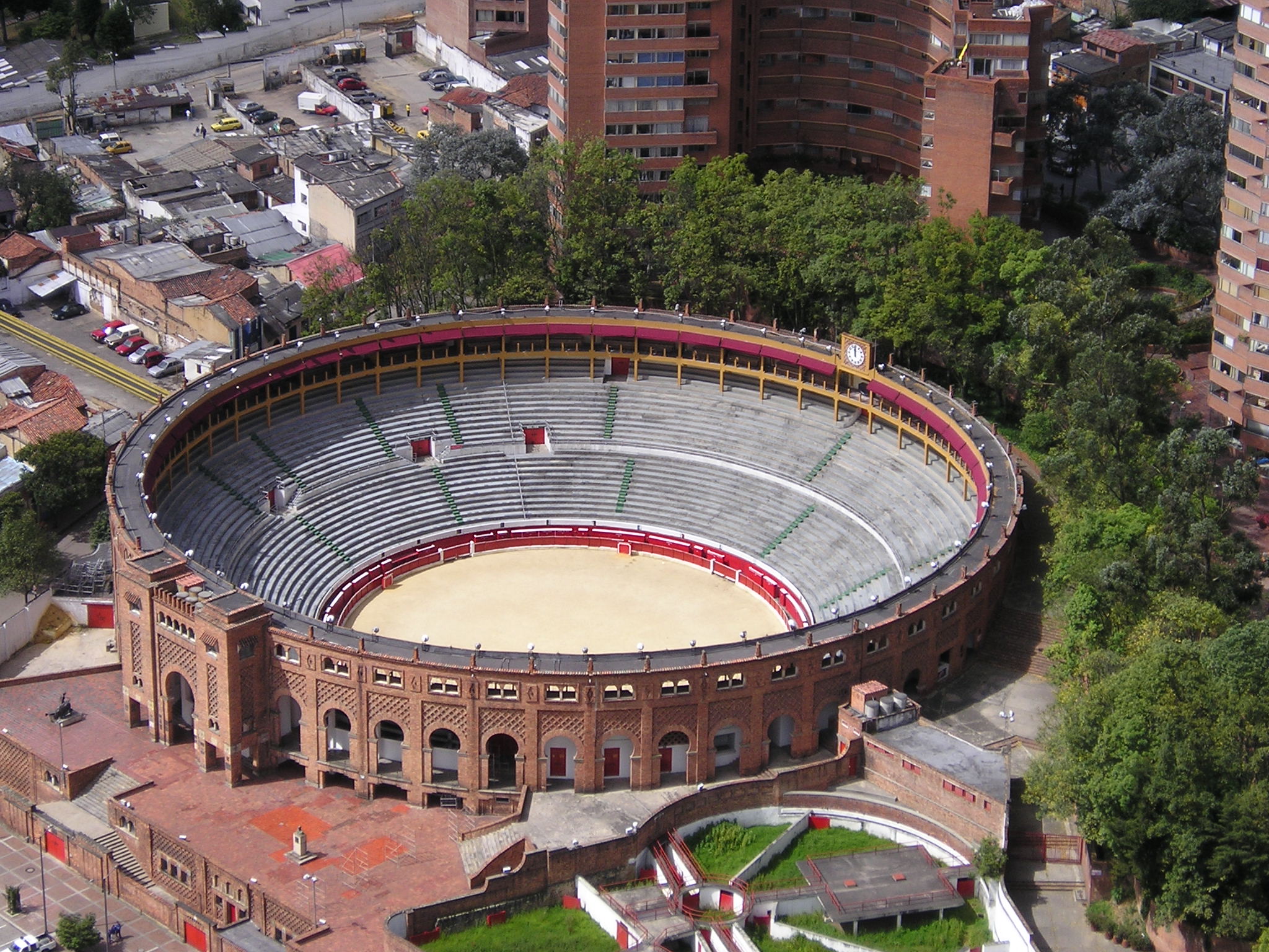
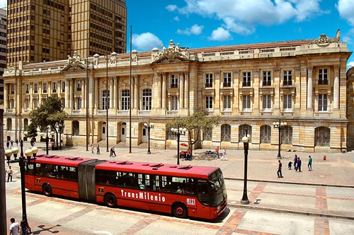
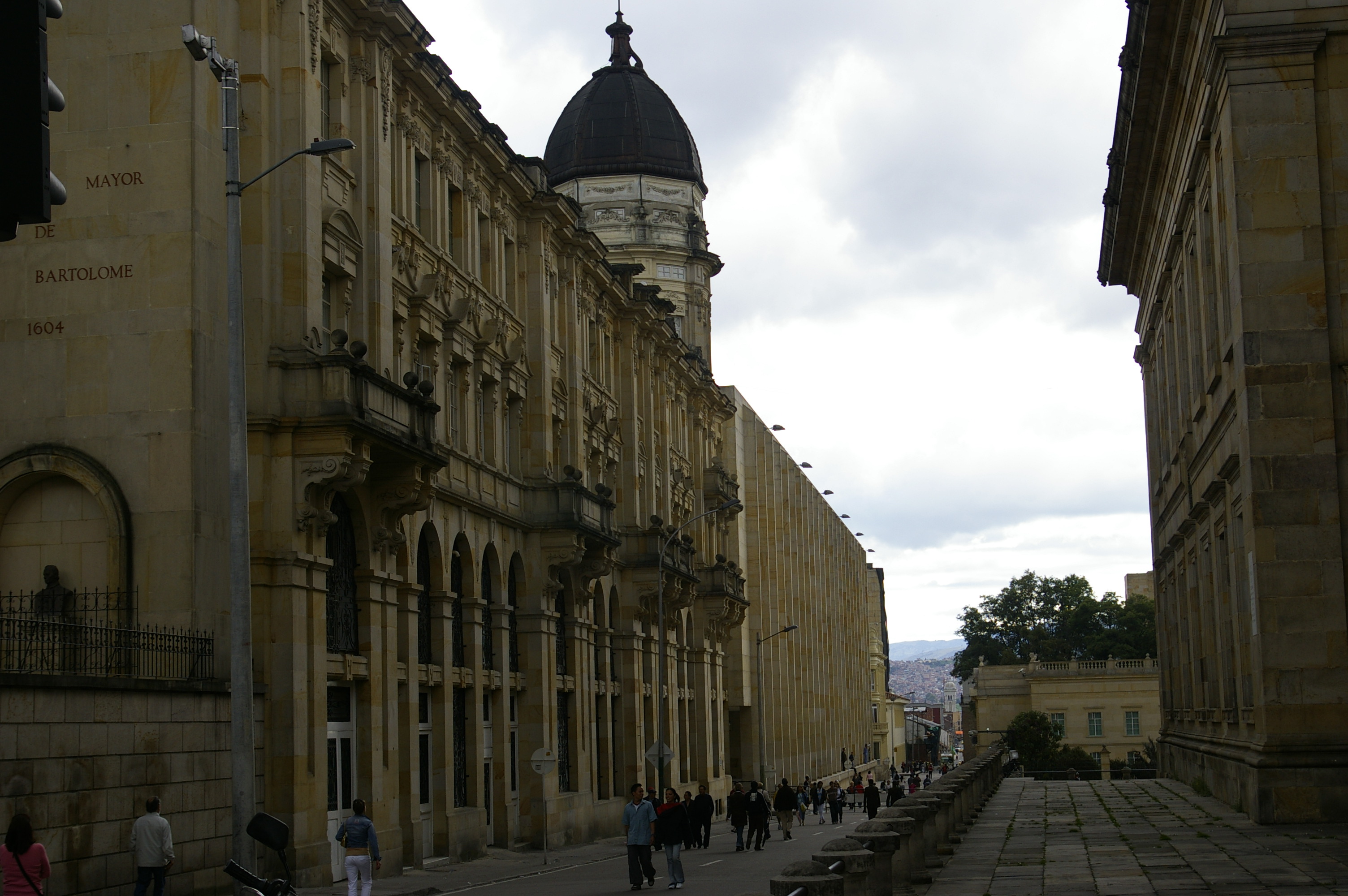
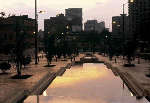
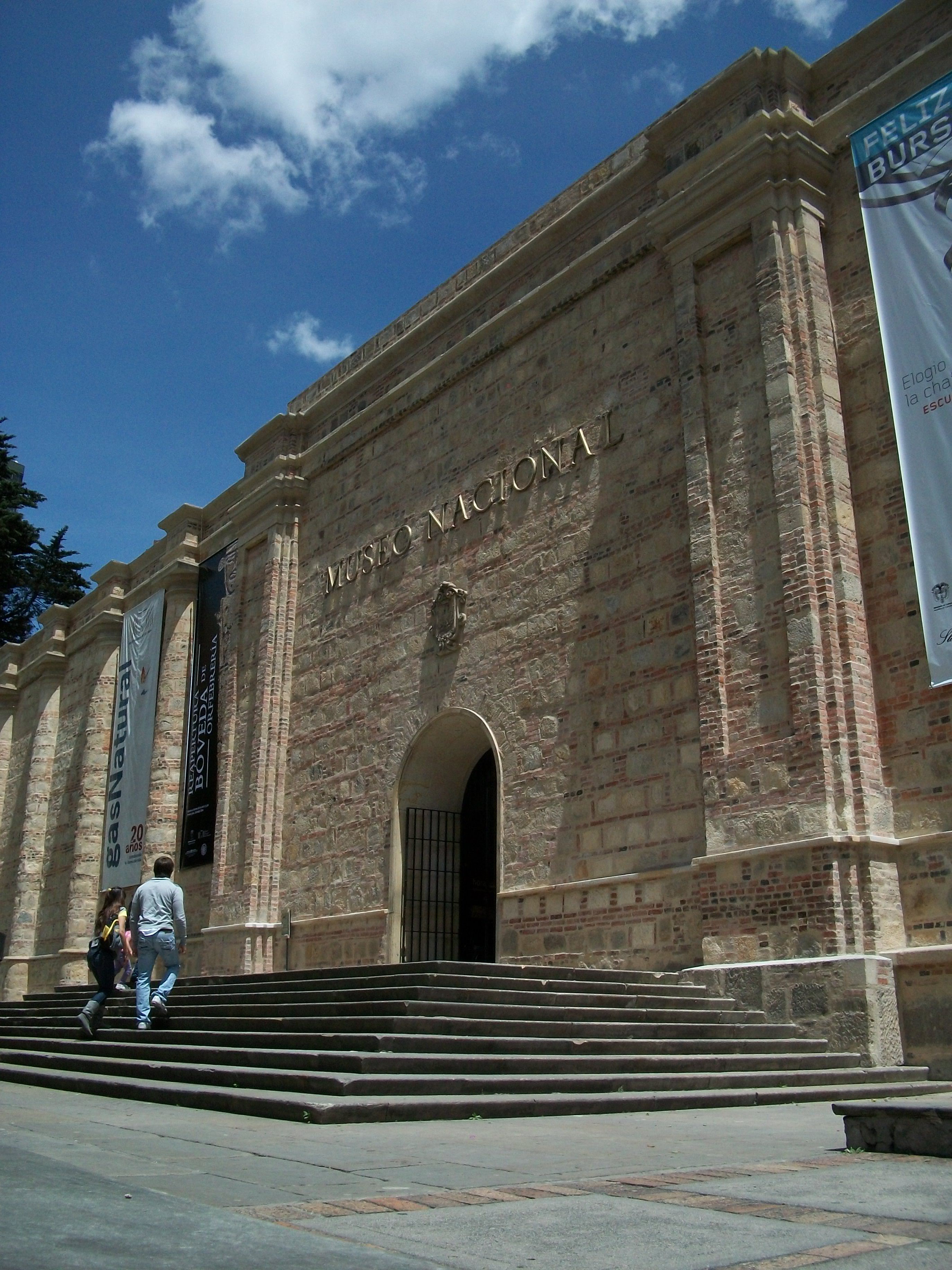
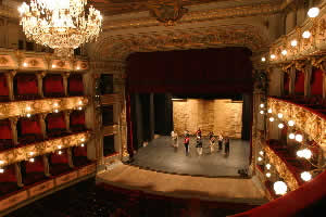

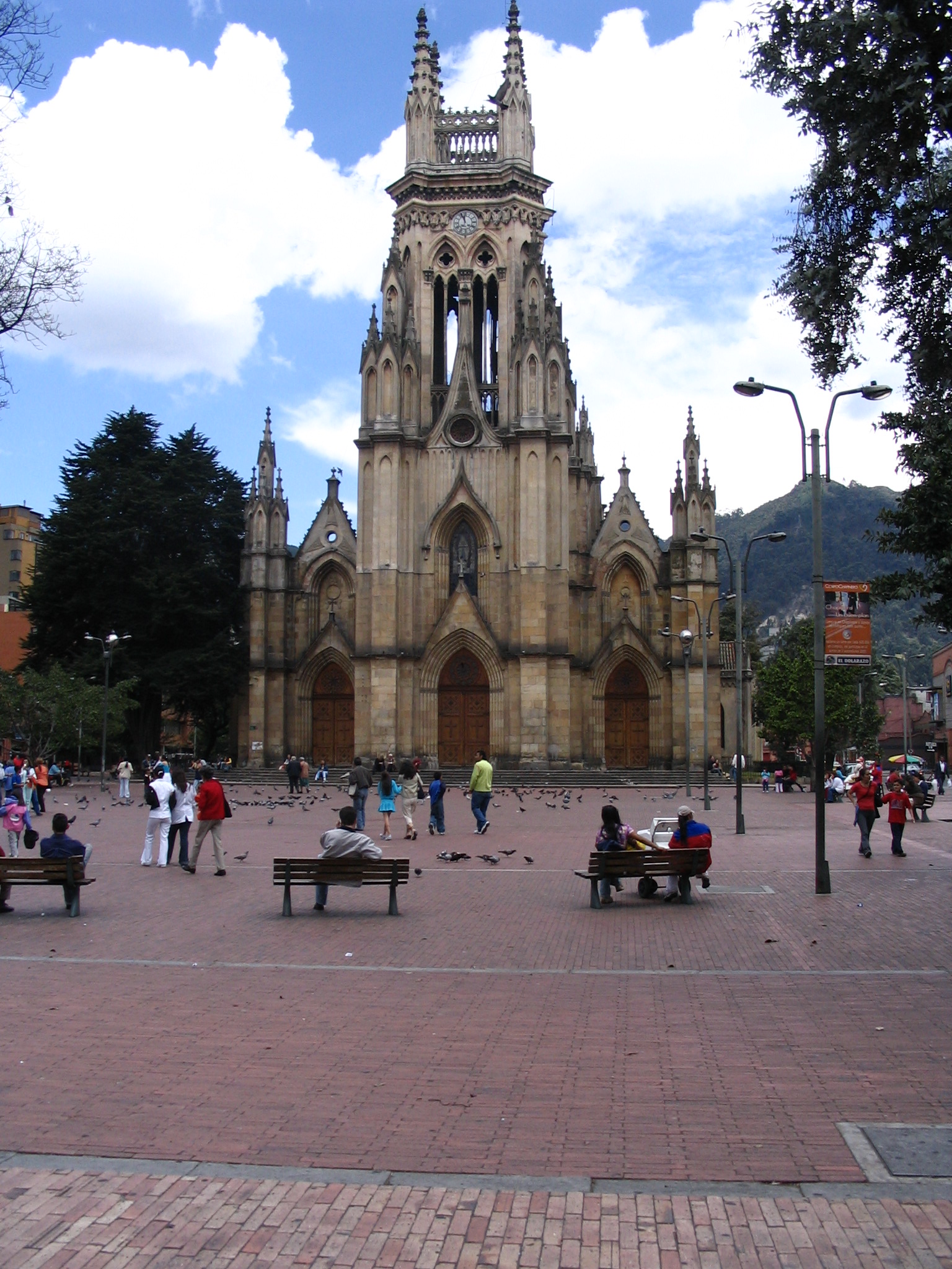
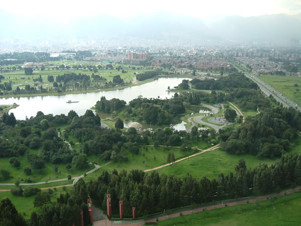
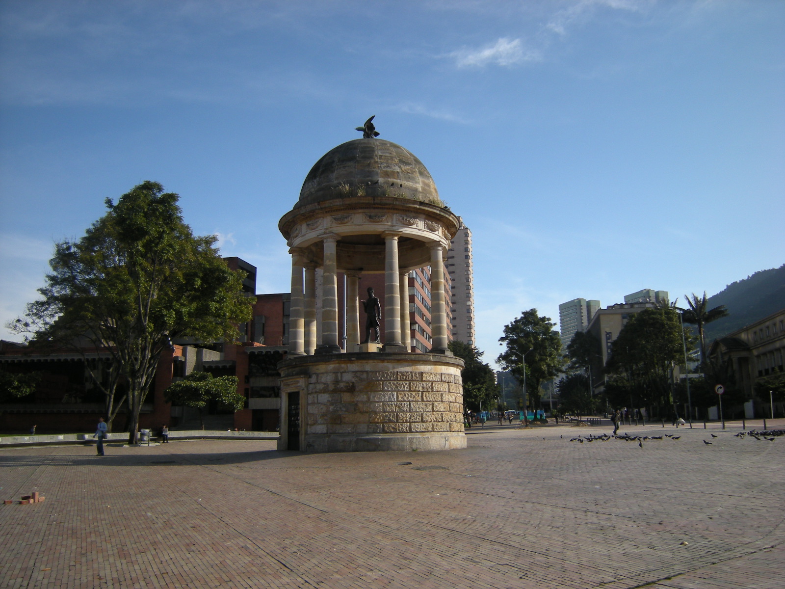
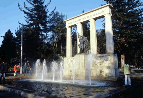
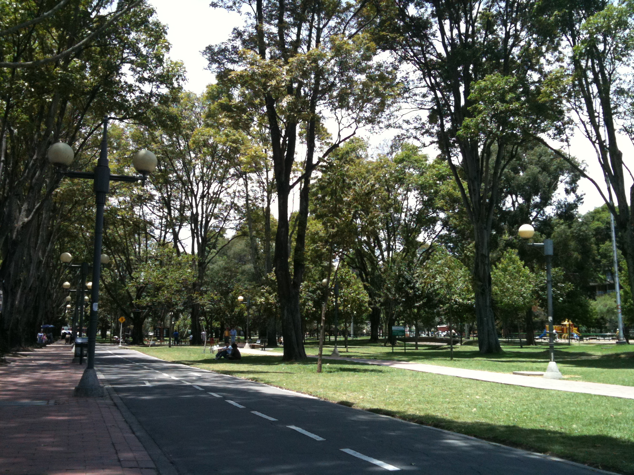
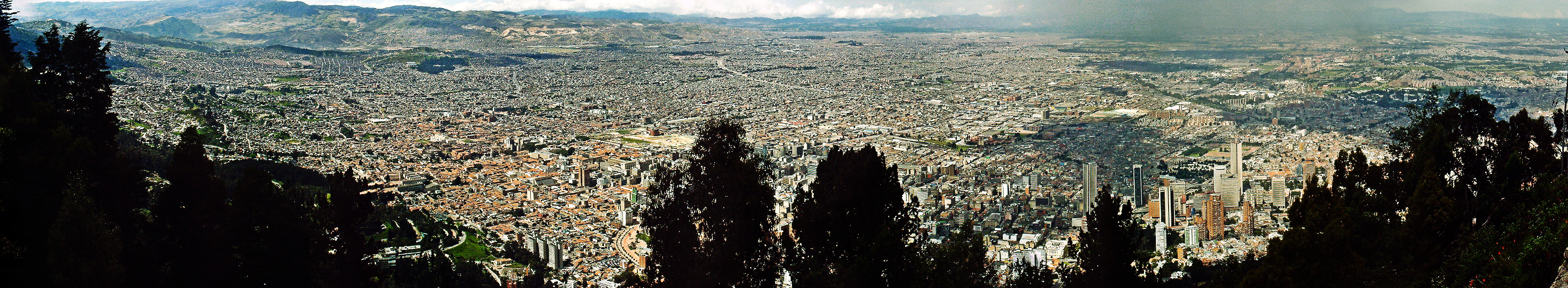


Wikimedia Foundation. 2010.