- Marple Bridge
-
Coordinates: 53°24′03″N 2°02′34″W / 53.4007°N 2.0428°W
Marple Bridge 
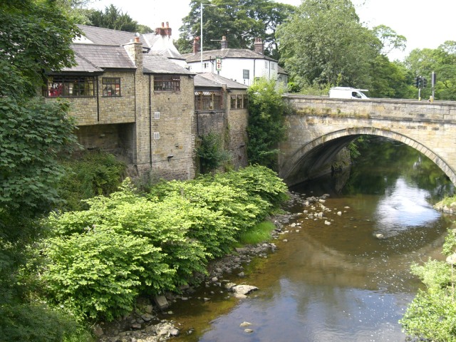
Looking downstream to Marple Bridge over the Goyt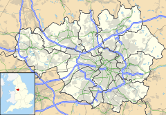
 Marple Bridge
Marple Bridge shown within Greater ManchesterOS grid reference SJ971893 Metropolitan borough Stockport Metropolitan county Greater Manchester Region North West Country England Sovereign state United Kingdom Post town STOCKPORT Postcode district SK6 Dialling code 0161 Police Greater Manchester Fire Greater Manchester Ambulance North West EU Parliament North West England UK Parliament Hazel Grove List of places: UK • England • Greater Manchester Marple Bridge is a village within the Metropolitan Borough of Stockport, in Greater Manchester, England. It lies on the River Goyt, which runs through the centre of the village, and is close to the town of Marple.
Historically a part of the civil parish of Glossop, in Derbyshire, it was included in the new parish of Ludworth and Chisworth in 1866.[1] Ludworth became a separate parish in 1896, and was abolished in 1936, when the former parish was transferred to Cheshire and amalgamated into Marple Urban District.[2] In 1974 the urban district was abolished and Marple Bridge became part of the Metropolitan Borough of Stockport in the county of Greater Manchester. It shares borders with Mellor, Marple, Compstall, New Mills, Strines, Mill Brow and Chisworth.
Contents
Transport
The village is served by a railway station: Marple station on the Hope Valley line.
The village has bus services running through it, most of which go to Stockport (the 383 and 384 services), via the A626 and Offerton along with an hourly 394 service to Glossop in Derbyshire and Stepping Hill Hospital in the other direction. It also has bus services to Hayfield and New Mills also in Derbyshire.
Conservation Area
Marple Bridge village centre has been designated a Conservation Area. The Conservation Area was originally established in 1974, although was extended in 2006 to incorporate Brabyns park.[3]
Stockport Metropolitan Borough Council has produced a Conservation Area Character Appraisal document, outlining the reasons that the Conservation Area has been designated as such. In justifying the reasons for designation, this document states of the town: “Marple Bridge is a predominately stone-built village situated on the banks of the River Goyt, just to the north east of Marple... Historically the location had significance as a bridging point on the route between Stockport and Derbyshire and where water power was available initially for a forge and corn mill. Marple Bridge developed from the 18th century as a small urban centre. Of special importance is the landscape setting of Marple Bridge formed by the steep-sided valley of the [River] Goyt...”[4]
Notable people
- Pete Mitchell lives in Marple Bridge
- Band Delphic are residents of Marple Bridge
- Andy Votel grew up in Marple Bridge
- Band Deviant UK are residents of Marple Bridge
References
External links
- Marple Bridge Association
- Ludworth Primary School, Marple Bridge
- St. Mary's Parish Website
- Marple Bridge page at Stockport Council site
Categories:- Villages in Greater Manchester
- Towns and villages of the Peak District
- Geography of Stockport

Wikimedia Foundation. 2010.