- Claresholm, Alberta
-
Claresholm — Town — Town of Claresholm Motto: Where the Wheatlands meet the Range Location of Claresholm in Alberta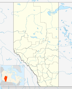
 Claresholm
Coordinates: 50°01′10″N 113°34′42″W / 50.01944°N 113.57833°WCoordinates: 50°01′10″N 113°34′42″W / 50.01944°N 113.57833°W Country  Canada
Province  Alberta
Region Southern Alberta Census division 3 County Willow Creek Founded 1903 Incorporated 1905 Government[1] – Mayor David Moore – Governing body Claresholm Town Council – MLA Area – Total 8.30 km2 (3.2 sq mi) Elevation 1,035 m (3,396 ft) Population (2006)[2] – Total 3,700 – Density 445.8/km2 (1,154.6/sq mi) Time zone MST (UTC-7) Postal code span T0L 0T0 Area code(s) +1-403 Highways Highways 2
Highway 520Waterways Willow Creek Website Town of Claresholm Claresholm is a town located within southern Alberta, Canada. It is located on Highway 2, approximately 91 km (57 mi) northwest of the City of Lethbridge and 125 km (78 mi) south of the City of Calgary. The town is the seat of the Municipal District of Willow Creek No. 26.
One of the Famous Five involved in the Persons Case, Louise McKinney, lived in Claresholm and was elected as the Member of the Legislative Assembly of Alberta for the area in the 1917 provincial election.
Contents
History
The location was originally a watering stop for steam engines on the Canadian Pacific Railway line along the Macleod Trail. The first settlers arrived in 1902, and the village was established in 1903. Claresholm was incorporated as a town in 1905, the year when Alberta became a province of Canada.
In 1913, Alberta established a demonstration farm and School of Agriculture at Claresholm.
Royal Canadian Air Force Station Claresholm was established near the town in 1941 to train pilots for service in World War II. It first opened June 9, 1941 as a British Commonwealth Air Training Plan base. No. 15 Service Flying Training School operated at the base from its opening until March 1945. In 1951, the base was used to train pilots for the Korean War and operated as No. 3 Flying Training School. It also trained NATO pilots. The base closed in 1958 and the hangars were converted to industrial use. A portion of the former base also operated as an industrial airport. Among the artifacts in the Claresholm Museum from the air base is a Link Trainer.
Demographics
In 2006, Claresholm had a population of 3,700 living in 1,644 dwellings, a 2.2% increase from 2001. The town has a land area of 8.30 km2 (3.20 sq mi) and a population density of 445.8 /km2 (1,155 /sq mi).[2]
Climate
Claresholm experiences a humid continental climate (Köppen climate classification Dfb).
Climate data for Claresholm Month Jan Feb Mar Apr May Jun Jul Aug Sep Oct Nov Dec Year Record high °C (°F) 18
(64)24
(75)24.4
(75.9)29
(84)33
(91)33.9
(93.0)36.7
(98.1)36.7
(98.1)34.4
(93.9)30
(86)22.2
(72.0)21
(70)36.7
(98.1)Average high °C (°F) −1.3
(29.7)1.7
(35.1)5.9
(42.6)12.4
(54.3)17.3
(63.1)21.3
(70.3)24.4
(75.9)24.2
(75.6)19.1
(66.4)13.5
(56.3)4.4
(39.9)0.5
(32.9)11.9 Daily mean °C (°F) −7.8
(18.0)−4.7
(23.5)−0.4
(31.3)5.6
(42.1)10.5
(50.9)14.5
(58.1)17.1
(62.8)16.6
(61.9)11.6
(52.9)6.7
(44.1)−1.6
(29.1)−5.8
(21.6)5.2 Average low °C (°F) −14.2
(6.4)−11
(12)−6.7
(19.9)−1.3
(29.7)3.6
(38.5)7.8
(46.0)9.8
(49.6)9.1
(48.4)4.2
(39.6)−0.2
(31.6)−7.5
(18.5)−12
(10)−1.5 Record low °C (°F) −41.1
(−42.0)−40
(−40)−38
(−36)−27.2
(−17.0)−10
(14)−4
(25)0
(32)−3
(27)−13
(9)−28
(−18)−37
(−35)−44
(−47)−44
(−47)Precipitation mm (inches) 22.4
(0.882)17.3
(0.681)27.5
(1.083)33.9
(1.335)62.3
(2.453)69.6
(2.74)49.8
(1.961)49.4
(1.945)39.9
(1.571)16.1
(0.634)19.6
(0.772)20.4
(0.803)428.2
(16.858)Source: Environment Canada[3] See also
- List of communities in Alberta
- List of towns in Alberta
References
- ^ Alberta Municipal Affairs: Municipal Officials Search
- ^ a b Statistics Canada (Census 2006). "Claresholm - Community Profile". http://www12.statcan.ca/english/census06/data/profiles/community/Details/Page.cfm?Lang=E&Geo1=CSD&Code1=4803022&Geo2=PR&Code2=48&Data=Count&SearchText=Claresholm&SearchType=Begins&SearchPR=01&B1=All&GeoLevel=&GeoCode=4803022. Retrieved 2007-06-10.
- ^ Environment Canada—Canadian Climate Normals 1971–2000, accessed 31 March 2010
External links

Pekisko Stavely Champion Cowboy Trail 
Barons  Claresholm

Cowley Granum
Fort MacleodNobleford
LethbridgeCategories:- Towns in Alberta
- Municipal seats in Alberta

Wikimedia Foundation. 2010.