- Burnham Overy
-
Coordinates: 52°57′26″N 0°44′32″E / 52.95720°N 0.74227°E
Burnham Overy 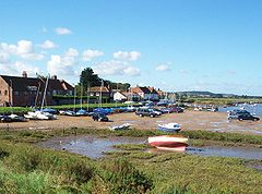
The Staithe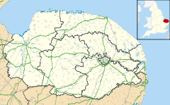
 Burnham Overy
Burnham Overy shown within NorfolkArea 8.92 km2 (3.44 sq mi) Population 311 - Density 35 /km2 (91 /sq mi) OS grid reference TF843435 Parish Burnham Overy District King's Lynn and West Norfolk Shire county Norfolk Region East Country England Sovereign state United Kingdom Post town KING'S LYNN Postcode district PE31 Police Norfolk Fire Norfolk Ambulance East of England EU Parliament East of England List of places: UK • England • Norfolk 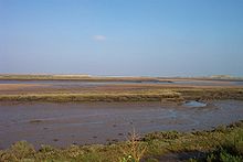 The creek, saltmarshes and, in the distance, harbour mouth
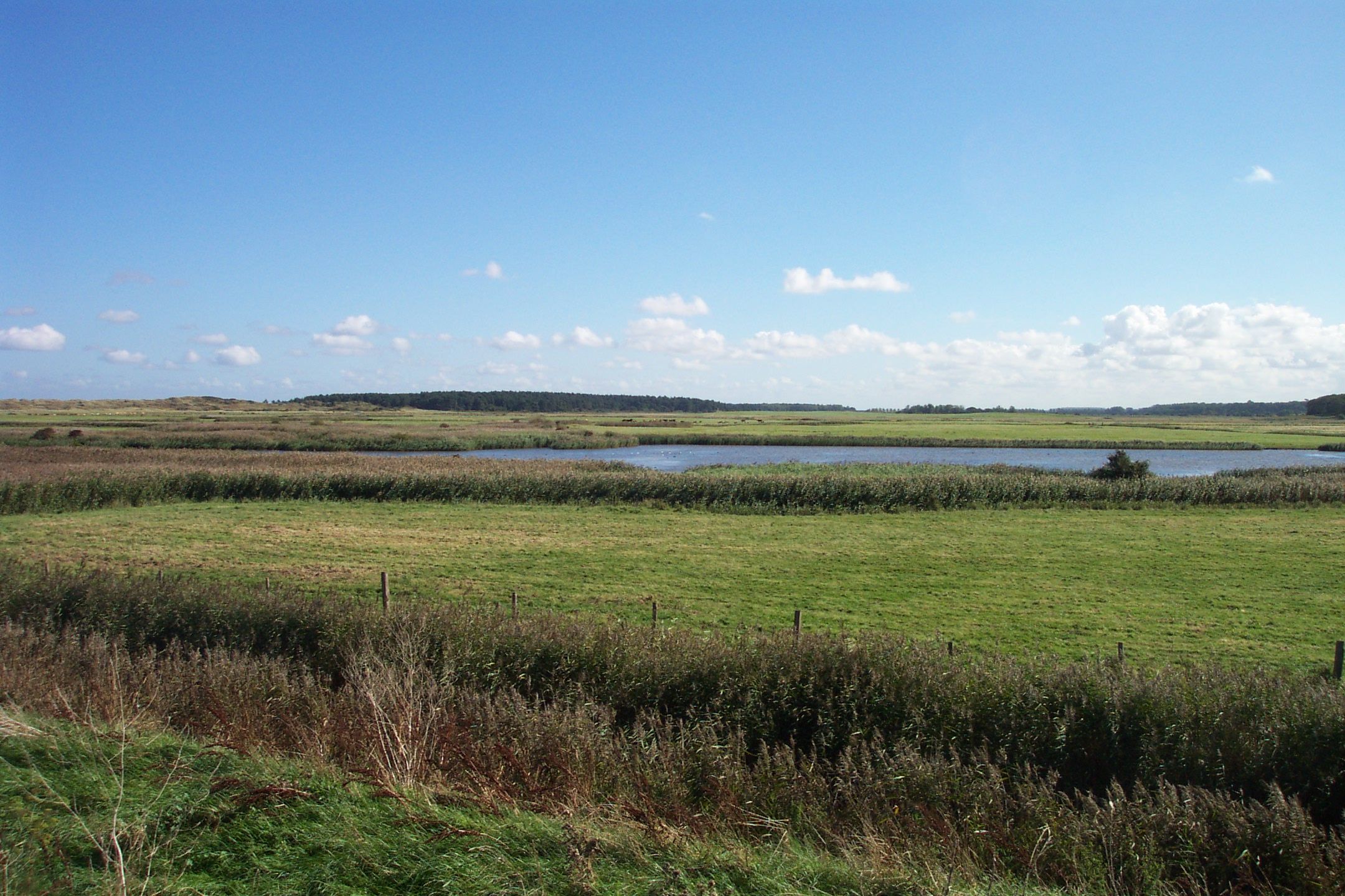
 The fresh water meadows
 The sand dunes, beach and harbour mouth
Burnham Overy is a civil parish on the north coast of Norfolk, England. In modern times a distinction is often made between the two settlements of Burnham Overy Town, the original village adjacent to the parish church and now reduced to a handful of houses, and Burnham Overy Staithe, a rather larger hamlet about 1 mile (2 km) away and next to the creek-side harbour.
Burnham Overy lies between the larger village of Burnham Market, less than 1 mile (2 km) to the west, and Holkham, some 3 miles (5 km) to the east. Burnham Thorpe, the birthplace of Horatio Nelson, lies 1 mile (2 km) to the south-east. According to various letters and documents, Nelson learned to row and sail a dinghy at Burnham Overy Staithe, at the age of 10, two years before joining the Navy. The larger town of King's Lynn is 20 miles (30 km) to the south-west, whilst the city of Norwich is 30 miles (50 km) to the south-east.[1]
The civil parish has an area of 8.92 km2 and in the 2001 census had a population of 311 in 167 households. For the purposes of local government, the parish falls within the district of King's Lynn and West Norfolk.[2]
Historically Burnham Overy was the port for the surrounding villages of the Burnhams. Both settlements lie on the River Burn, and until the end of the Middle Ages trading ships were able to reach the village (now Burnham Overy Town). With the silting of the river, commercial traffic switched to the downstream Staithe. With the coming of the railway to the Burnhams in 1866, commercial shipping declined and the last cargo is believed to have been shipped from the Staithe soon after the end of the First World War.[3]
Whenever a ship arrived, a gong would be sounded at the top of Gong Lane. This alerted the farm workers to unload the incoming goods.[citation needed]
Between Burnham Overy Staithe and the sea, the river spreads out into multiple tidal creeks through the salt marshes that fringe this stretch of coast, and finally reaches the sea by passing though the fronting sand dunes at a gap locally known as Burnham Harbour. Small boats can reach Burnham Overy Staithe through this gap and creek. Today Burnham Overy Staithe, and the associated harbour, is a major recreational sailing centre. It is also the point of departure for ferries to the Scolt Head Island National Nature Reserve.
To the east of the Burnham Overy creek, the former salt marshes between dry land and the sand dunes have been reclaimed to form fresh water meadows, part of the Holkham estate. A one and a half mile (2 km) long footpath links Burnham Overy Staithe to the sand-dunes and beach, running along the crest of the embankment which protects these water meadows from the creek.
Notable residents
- Richard Woodget, Captain of the Cutty Sark
References
- ^ Ordnance Survey (2002). OS Explorer Map 251 - Norfolk Coast Central. ISBN 0-319-21887-2.
- ^ Office for National Statistics & Norfolk County Council, 2001. Census population and household counts for unparished urban areas and all parishes. Retrieved October 18, 2005.
- ^ Burnham Overy Staithe Harbour Trust. Information display at the Staithe. Noted October 16, 2005.
External links
- Map sources for Burnham Overy
- Photographs of Burnham Overy Staithe
- Tide tables for Burnham Overy Staithe
- Information from NorfolkCoast.co.uk on Burnham Overy.
- Webcam showing the harbour at Burnam Overy Staithe
Categories:- Villages in Norfolk
- King's Lynn and West Norfolk
- Populated coastal places in Norfolk
- Civil parishes in Norfolk


Wikimedia Foundation. 2010.