- U.S. Route 206
-
U.S. Route 206
Disabled American Veterans Highway 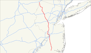
US 206 highlighted in redRoute information Maintained by NJDOT, Township of Hamilton, City of Trenton, Mercer County, and DRJTBC Length: 130.23 mi[1][2] (209.58 km) Existed: 1934 – present Major junctions South end: 
 US 30 / Route 54 in Hammonton, NJ
 Route 70 in Southampton, NJ

 I-95 / NJ Turnpike in Bordentown Township, NJ
 US 130 in Bordentown Township, NJ
 I-195 in Hamilton Township, NJ
 Route 27 in Princeton Boro, NJ
 US 202 in Somerville, NJ
 US 22 in Bridgewater Township, NJ
 I-287 in Bedminster/Bridgewater Township, NJ

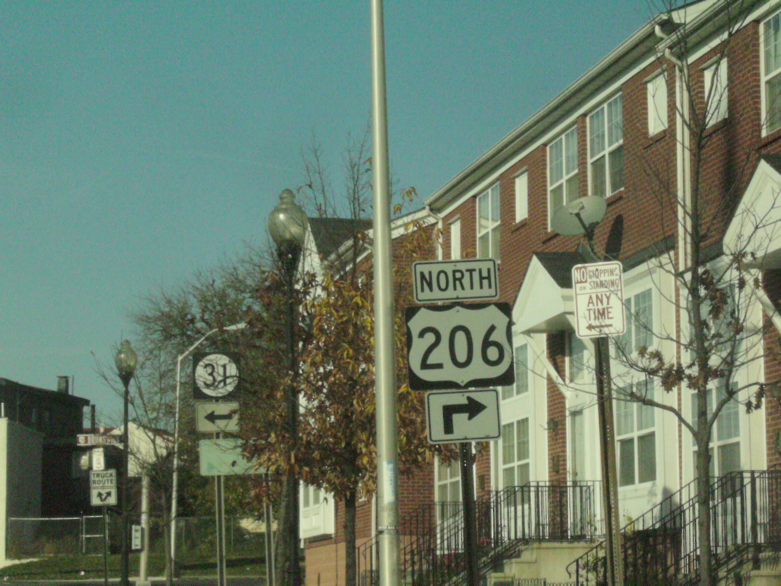
 I-80 / Route 183 in Roxbury Township, NJ
 Route 15 in Frankford Township, NJ
North end:  US 209 in Dingman Township, PA
Highway system United States Numbered Highways
List • Bannered • Divided • ReplacedU.S. Route 206 (US 206) is a 130.23-mile (209.58 km) long north–south United States highway in New Jersey and Pennsylvania, United States. Only about a half a mile (800 m) of its length is in Pennsylvania; the Milford-Montague Toll Bridge carries it over the Delaware River into New Jersey, where it is the remainder of the route. The highway's northern terminus is near Milford, Pennsylvania at an intersection with US 209; some sources and signs show an overlap with US 209 to end at its parent route US 6. Its southern terminus is in Hammonton, New Jersey at an intersection with Route 54 and US 30. For much of its length, US 206 is a rural two-lane undivided road that passes through the Pine Barrens, agricultural areas, and the Appalachian Mountains of northwestern New Jersey, with some urban and suburban areas. The route connects several cities and towns, including Bordentown, Trenton, Princeton, Somerville, Netcong, and Newton. The road is known as the Disabled American Veterans Highway for much of its length.
What is now US 206 in New Jersey was designated as part of several state routes prior to 1927, including Pre-1927 Route 2 between Bordentown and Trenton in 1916, pre-1927 Route 13 between Trenton and Princeton in 1917, and pre-1927 Route 16 between Princeton and Bedminster Township in 1921. The current routing along pre-1927 Route 2 became a part of US 130 in 1926. In 1927, current US 206 became Route 39 between Hammonton and White Horse, Route 37 between White Horse and Trenton, Route 27 between Trenton and Princeton, Route 31 between Princeton and Newton, and Route S31 between Newton and the Delaware River. In the later 1930s, US 206 was designated to connect US 30 in Hammonton north to US 6 and US 209 in Milford; the northern terminus was moved to its current location in the 1940s. The state highways running concurrent with US 206 in New Jersey were removed in 1953. In the 1960s, two separate freeways were proposed for US 206 but never built. The first freeway was to connect Hammonton south along the Route 54 corridor toward Route 55 and the planned Route 60 in Vineland and Millville. The other US 206 freeway was planned in northwestern New Jersey, connecting I-80 in Netcong north to Montague Township. Construction has begun for a bypass of US 206 around Hillsborough in 2010 after being planned since 1974. The NJDOT is currently widening the route in Byram Township to alleviate congestion, with completion expected in 2011.
Contents
Route description
Lengths mi km NJ 129.77[1] 208.97 PA 0.46[2] 0.74 130.23 209.58 New Jersey
Atlantic County
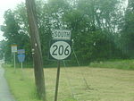
US 206 begins at US 30 in the town of Hammonton in Atlantic County, New Jersey, heading north-northeast on the two-lane, undivided Disabled American Veterans Highway. South of this intersection, the road continues as Route 54.[1] From its southern terminus, US 206 runs through farmland, which eventually gives way to the heavily forested Pine Barrens. Within this area, the route continues through the Wharton State Forest.[3] Here, the road comes to the eastern terminus of CR 536.[1]
Burlington County
 US 206 signage as seen from CR 543
US 206 continues into Shamong Township, Burlington County, passing through more of the Pine Barrens.[1][3] In Shamong Township, the road makes a turn to the north and passes by Atsion Lake.[1] After running northwest, CR 541 splits to the left.[1][3] After this intersection, US 206 heads north out of the Wharton State Forest and into more agricultural areas.[3] At the intersection with CR 648, the route briefly widens into a four-lane undivided road before narrowing back to two lanes. Upon intersecting CR 622, US 206 enters Tabernacle Township. Here, CR 532 crosses the route at a signalized intersection.[1] Following CR 532, residential development increases along the route as it continues into Southampton Towship.[1][3] US 206 becomes a three-lane road with one northbound lane and two southbound lanes as it comes to the Red Lion Circle with Route 70.[1] Past the Red Lion Circle, the route becomes two lanes again and passes more rural surroundings with some development. US 206 comes to a junction with the eastern terminus of Route 38 and the western terminus of CR 530.[1][3]
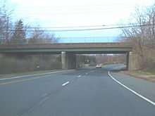 US 206 northbound on the Columbus bypass
A short distance after the Route 38/CR 530 intersection, the route becomes the border between Eastampton Township to the west and Southampton Township to the east before running between Eastampton Township and Pemberton Township.[1] Along this portion, it passes through Ewansville.[3] Continuing entirely into Springfield Township, the route crosses CR 537.[1] Past this intersection, US 206 widens into a four-lane undivided road.[1][3] The route briefly gains a wide painted median before crossing the Assicunk Creek into Mansfield Township [1] In Mansfield Township, US 206 becomes a divided highway as it bypasses the community of Columbus to the west, with CR 690 continuing through Columbus.[1][3] On the bypass of Columbus, the route has an interchange with CR 543.[1] Past Columbus, US 206 becomes undivided again, with residential development increasing. It becomes a divided highway again and merges with Route 68, the main access road to Fort Dix, at a directional intersection. After this intersection, US 206 enters Bordentown Township and reaches an interchange with the New Jersey Turnpike (I-95) in a commercial area. Following this interchange, the route crosses over CR 545.[1][3] A short distance later, US 206 merges into US 130 at a directional interchange to form a concurrency.[1] The two roads continue north on a six-lane divided highway, briefly entering the eastern edge of Bordentown at the intersection with CR 528.[3][4] Back in Bordentown Township, US 130 and US 206 split at another directional interchange.[1] Past US 130, US 206 crosses under a Conrail Shared Assets Operations railroad line and heads through development as a four-lane divided highway, making a slight northwest bend before resuming north.[1][3]
Mercer County
US 206 crosses the Crosswicks Creek and enters Hamilton Township, Mercer County. Immediately after the Crosswicks Creek, there is an interchange with I-195. Past I-195, the route reaches the White Horse Circle, where it intersects CR 524 and CR 533. At this point, US 206 turns west-northwest to run along four-lane divided locally-maintained Broad Street.[1] Passing through White Horse, the road briefly becomes five lanes with a center left-turn lane before becoming a four-lane divided highway again as it crosses over I-295 without an interchange. Running into more urban areas of development, the route enters Trenton at the crossing of CR 650 After entering Trenton, US 206 narrows into a two-lane undivided street. As the road heads toward downtown Trenton, it crosses New Jersey Transit’s River Line immediately before interchanging with Route 129. From here, the road turns more to the northwest with four lanes and passes by the Sun National Bank Center before crossing over Amtrak’s Northeast Corridor and the US 1 freeway simultaneously.[1][3] US 206 enters the commercial downtown area, narrowing back to two lanes before reaching Warren Street, where US 206 splits into a one-way pair following Broad Street northbound and Warren Street southbound.[1][3][5]
This one–way pairing, which carries two lanes in each direction, curves north and continues through downtown Trenton. At the Trenton Battle Monument, the road reaches an intersection with the southern terminus of Route 31 and US 206 turns northeast onto another one-way pairing that follows Brunswick Avenue northbound and Martin Luther King Jr. Boulevard southbound, with each road being two-way but only carrying one direction of US 206. The road continues through neighborhoods, with southbound US 206 forming the border between Ewing Township to the northwest and Trenton to the southeast as a county-maintained road at the Calhoun Street intersection.[1][3][5] At this point, southbound US 206 becomes concurrent with CR 583.[5][6] At the junction with Spruce Street, northbound US 206 becomes the border between Lawrence Township and Trenton, becoming state-maintained, while southbound US 206/CR 583 fully crosses into Lawrence Township.[1][5] Northbound US 206 widens into a four-lane divided highway as it comes to the Brunswick Circle with US 1 Business. At this point, US 1 Business continues northeast on Brunswick Avenue while northbound US 206 heads north as a two-lane undivided road called Lawrenceville Road. CR 645 links the Brunswick Circle to southbound US 206/CR 583.[1]
At this point, both directions of US 206 are in Lawrence Township and rejoin, with US 206 continuing north as a two-lane undivided road and CR 583 heading to the northeast.[1] US 206 continues through suburban residential areas within Lawrence Township. The route makes a turn to the northeast before heading north again and passing to the east of Rider University.[3] A short distance later, the road has a cloverleaf interchange with I-95 prior to an intersection with CR 546. In this area, US 206 is briefly a two-lane divided highway.[1] Past CR 546, the route becomes two-lane undivided Main Street and heads north-northeast through Lawrenceville, passing development. Upon leaving Lawrenceville, US 206 turns more to the east though rural surroundings, forming a short concurrency with CR 569. From this point, the route continues northeast and enters Princeton Township.[1][3] In Princeton Township, CR 533 intersects US 206, and the two routes form a concurrency.[1] The road becomes Stockton Street, passing by the Drumthwacket Governor’s mansion before it continues into the Borough of Princeton. US 206 turns north onto Bayard Lane, with Route 27 continuing northeast into downtown Princeton on Nassau Street, which provides access to Princeton University. Bayard Lane carries the route past more wooded developed areas, eventually curving northeast through a park as it enters Princeton Township again. Here, US 206 becomes State Road and turns north again.[1][3] Continuing to the north, the amount of development adjacent to the road decreases.[3]
Somerset County
US 206 enters Montgomery Township in Somerset County, where the name of the road becomes Van Horne Memorial Highway.[1] In Montgomery Township, the route runs to the east of Princeton Airport and crosses CR 518. Following this intersection, CR 533 splits from US 206 by heading northeast, and US 206 continues north-northwest through a mix of suburban and rural areas. The road passes through the community of Harlingen before widening to four lanes and reaching Belle Mead.[1][3] In this area, US 206 passes over CSX’s Trenton Subdivision before making a turn to the northeast and then to the north, narrowing back to two lanes. The road enters Hillsborough Township, where the Van Horne Memorial Highway designation ends.[1] It crosses an abandoned railroad line leading to the Belle Mead General Depot before continuing into residential and commercial areas of Hillsborough. The road comes to a junction with CR 514 in this area.[1][3] Past the CR 514 intersection, US 206 makes a curve northeast before heading north again.[3] Leaving the center of Hillsborough, the road runs northeast past more wooded areas as it crosses under a Norfolk Southern railroad line. The route passes more development as it widens into a four lane divided highway with jughandles, turning to the north and passing Duke Gardens.[1][3] US 206 briefly becomes six lanes wide at the CR 608 intersection before narrowing back to four lanes as it crosses the Raritan River into Somerville.[1] In Somerville, the road runs northwest parallel to the Raritan River prior to turning north into commercial areas and entering Raritan.[1][3] US 206 runs under New Jersey Transit’s Raritan Valley Line before making a turn to the north-northwest.[1]
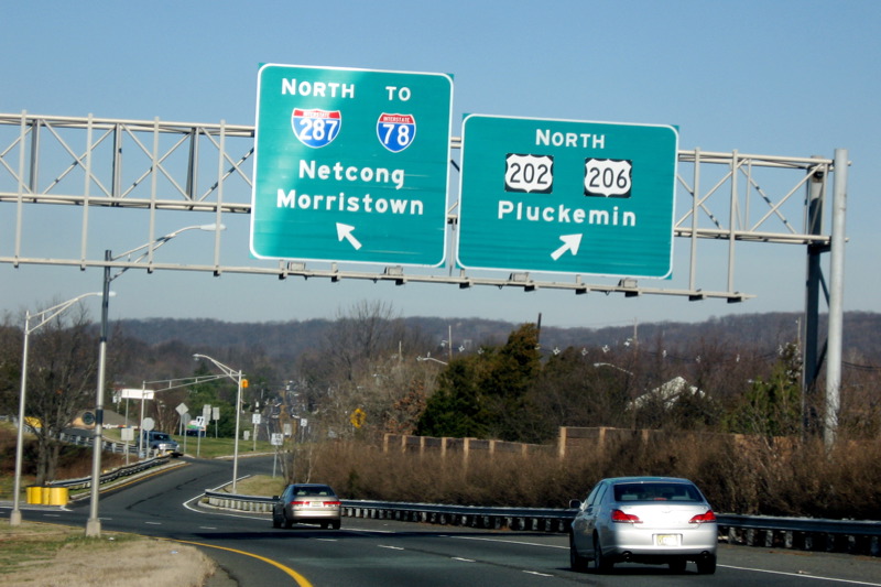
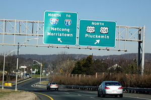 I-287 and 78 exit off northbound US 202/206
US 206 comes to the modified Somerville Circle,where it meets US 202 and Route 28. At this modified traffic circle, US 206 and Route 28 run through it while US 202 passes over it with ramp access.[1] US 206 forms a concurrency with US 202 at this point and the two routes continue north into Bridgewater Township, briefly entering Somerville.[7] The road features an interchange with US 22 and heads north with the Bridgewater Commons shopping mall on the east side of the road and the Somerset Corporate Center on the west side of the road. An interchange with Commons Way provides access to both these places.[3][7] Past Commons Way, the road passes under Garrettson Road and comes to an interchange with I-287 that also provides access to I-78.[7] Past the I-287 interchange, US 202/206 continue north as a two-lane undivided road past suburban areas.[3] The road crosses Chambers Brook into Bedminster Township, where it soon passes under I-78. Shortly after I-78, it widens into a four-lane divided highway with a Jersey barrier. US 202/206 come to another interchange with I-287, pass over the North Branch Raritan River, and come to an intersection where the two routes split.[3][7]
After the US 202 split, US 206 continues north as a four-lane divided highway through commercial areas, with the grass median becoming replaced by a painted median as it comes to a junction with CR 523 in downtown Bedminster. Following this intersection, the route narrows into a two-lane undivided road that runs through less development.[1][3] US 206 enters Peapack-Gladstone, where it runs a short distance to the west of New Jersey Transit’s Gladstone Branch.[1] In Peapack-Gladstone, the road briefly becomes a four-lane divided highway as it has an interchange with Pfizer Way, a road that provides access to a Pfizer facility. Past this point, US 206 becomes a two-lane undivided road that runs northwest through rural areas, with CR 512 crossing the road. Just after this intersection, the route enters Bedminster Township again, turning to the north.[1][3]
Morris County
The route continues north into Chester Township, Morris County.[1] In Chester Township, US 206 passes through forested areas, with the northbound direction briefly gaining a second lane. As the road comes into Chester Borough, it widens to four lanes and passes shopping areas including the Streets of Chester.[1][3] In the center of Chester, the route crosses CR 513.[1] Past this intersection, US 206 continues into woodland development, with the northbound direction narrowing back into one lane as the route heads back into Chester Township. The road narrows back to two total lanes as it enters more rural surroundings, coming into Mount Olive Township.[1][3] Further north, residential development near the road starts to increase.[3] As US 206 reaches an intersection with CR 613, the surroundings becomes commercial before the route passes under an abandoned railroad line. After this area, the road turns north-northeast and runs through forested areas as a three lane road with two northbound lanes and one southbound lane, eventually entering Roxbury Township.[1][3]
Business in the area of the road increase before US 206 widens to four total lanes and comes to a modified cloverleaf interchange with I-80 and the southern terminus of Route 183.[1][3] At this point, the road continues north into Netcong as Route 183 while US 206 heads west along I-80, a six-lane freeway that continues into Mount Olive Township.[8] The freeway continues northwest, running through a small corner of Netcong before coming back into Mount Olive Township and interchanging with US 46.[3][8] Immediately after US 46, the highway passes over New Jersey Transit’s Morristown Line/Montclair-Boonton Line before turning north and reaching a trumpet interchange where US 206 splits from I-80.[8] Following this split, US 206 is a four-lane freeway that heads northeast, crossing under Waterloo Valley Road and an abandoned railroad line before coming to an interchange with International Drive.[1]
Sussex County
After the International Drive interchange, US 206 crosses the Musconetcong River and enters Stanhope, Sussex County. Immediately following the river crossing, the freeway merges with the northern terminus of Route 183 at an interchange on the border between Byram Township to the west and Stanhope to the east.[1] Past Route 183, US 206 continues north as a four-lane divided surface road past development, fully entering Stanhope again before crossing into Byram Township. Upon entering Byram Township, the route becomes a two-lane undivided road. Upon turning northwest, the surroundings become more forested as US 206 crosses a mountain, with the northbound direction gaining a second lane for a distance.[1][3] There are a few businesses along the road as it runs north past wooded areas near Cranberry Lake and Panther Lake.[3] The route continues into Andover, where it becomes Main Street and passes under the abandoned Lackawanna Cut-Off.[1] US 206 forms a brief concurrency with CR 517 in the commercial downtown area. Past CR 517, US 206 bends northwest and enters Andover Township. Here, the road runs back into forested areas, passing by Whites Pond and running near Kittatinny Valley State Park. After a curve to the north, the route enters a mix of development and rural areas, passing to the west of Newton Airport prior to entering Newton.[1][3]
In Newton, the road is known as Main Street and is lined by homes as it turns north. Upon reaching the downtown area, US 206 meets Route 94 and CR 519 at the Park Place square.[1][3] At this point, US 206 forms a concurrency with Route 94/CR 519, and all three routes run concurrent north on four-lane undivided Water Street for a short distance.[1] CR 519 splits from the road by turning north on Mill Street while US 206 and Route 94 continue north as a three-lane road with a center left-turn lane, crossing Paulins Kill before coming to a shopping district as the road leaves Newton for Hampton Township.[1][3] The road narrows back to two lanes and heads into areas of farmland, becoming Hampton House Road.[3] Route 94 splits from US 206 by making a right turn to continue east.[1] After this intersection, US 206 turns northeast and enters Frankford Township. After crossing the Paulins Kill, Route 15 and CR 565 end at a traffic light with US 206, with the route making a turn to the northwest on an unnamed road.[1][3]
After this intersection, the route passes near Skylands Park before passing more farmland and reaching the community of Augusta.[3] After Augusta, US 206 turns north-northwest through more rural areas before entering Branchville. Here, the route bypasses the center of town to the south as a four-lane divided highway before crossing CR 519.[1][3] Past CR 519, the median ends and US 206 continues to the west-northwest.[1] After crossing back into Frankford Township, the route continues through forested areas. Turning more to the north, US 206 runs a short distance to the west of Culvers Lake prior to intersecting CR 521 and forming a concurrency with that route. The concurrent US 206 and CR 521 crosses into Sandyston Township, where it passes through the mountainous Stokes State Forest.[1][3] After heading north with a three-lane stretch that has two southbound lanes and one northbound lane, the two-lane road reaches a junction with CR 560.[1] After this intersection, the road leaves the state forest and continues through wooded areas with some commercial establishments. US 206/CR 521 reaches the community of Hainesville, where it passes through more agricultural surroundings with some development. Leaving Hainesville, the road continues into Montague Township.[1][3] Near the community of Montague, CR 521 splits from US 206 by heading to the northeast.[1] Meanwhile, US 206 turns to the northwest to run through wooded areas of the Delaware Water Gap National Recreation Area, where it comes to the Milford-Montague Toll Bridge over the Delaware River that is maintained by the Delaware River Joint Toll Bridge Commission.[1][3]
Pennsylvania
After crossing the river on the Milford-Montague Toll Bridge, US 206 continues north into Dingman Township in Pike County, Pennsylvania.[9] A short distance after the bridge, the route comes to a northbound toll plaza, where it becomes a two-lane divided highway.[3] US 206 officially ends at an intersection with US 209 not far after the toll plaza for the bridge.[3][9] Even though this intersection marks the end of US 206, a few signs show the route heading concurrent with US 209 to continue north to US 6 in Milford.[10]
History
 Route 31 (1927-1953)
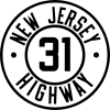
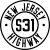
Prior to 1927, what is now US 206 in New Jersey was legislated as part of several routes. Between Bordentown and Trenton, the current alignment was designated as a part of pre-1927 Route 2 in 1916.[11] Between Trenton and Princeton, present-day US 206 became the southernmost part of pre-1927 Route 13 in 1917. In 1921, the current route from Princeton north to Bedminster Township was legislated as part of pre-1927 Route 16.[12] After the U.S. Highway System was created in 1926, the route between Bordentown and Trenton became the northernmost part of US 130 while it became a part of US 1 between Trenton and Princeton.[13] In the 1927 New Jersey state highway renumbering, several state highways were legislated along present-day US 206. Route 39 followed the route from Hammonton to White Horse, while Route 37 was designated along it between White Horse and Trenton. From Trenton north to Princeton, pre-1927 Route 13 was replaced by Route 27. Present-day US 206 between Princeton and Newton became part of Route 31, a route that was to go past Newton to the New York border near Unionville, while the portion north of Newton to the Delaware River in Montague became Route S31, a spur of Route 31.[14][15] Another spur of Route 31, Route 31A, was legislated in 1941 to run from Route 31 in Princeton to Route 33 in Hightstown; only a small portion of this was built over the Northeast Corridor railroad line and is now Route 64.[16][17][18]
 Route S31 (1927-1953)
US 206 was designated in the later 1930s, running from US 30 in Hammonton, New Jersey north to US 6 and US 209 in Milford, Pennsylvania. By this time, the US 1 and US 130 designations were removed from the route onto new alignments.[19][20] In 1938, US 206/Route 31 was designated to bypass Somerville, the former alignment was known as Route 177 from the 1960s until 1974.[21][22][23] In the 1940s, US 206/Route 39 was realigned to the south of White Horse; the former alignment was known as Route 160 between the 1960s and the 1980s.[22][24][25] Also in the 1940s, the northern terminus of US 206 was moved to its current location at US 209 in Dingman Township, Pennsylvania.[26]
In the 1953 New Jersey state highway renumbering, the state highways running concurrent with US 206 were removed.[17][18] When US 206's current alignment bypassing Columbus was built by the 1960s, the designation of Route 170 was given to the old alignment through Columbus; this road was turned over to Burlington County in the 1980s and is now CR 690.[27][28][29] In the late 1960s, a freeway was proposed for the US 206/Route 54 corridor, running from US 30 in Hammonton south to Route 55 and the proposed Route 60 near Vineland and Millville .[30] Originally, a parkway had been planned in 1932 to serve the US 206 corridor between Hammonton and Trenton, but never materialized.[31] The freeway between Vineland/Millville and Hammonton was to cost $47 million and was intended to provide a better route between the two areas than the existing two-lane roads. However, it was never built due to environmental and financial issues.[32] A freeway was also proposed for US 206 in northwestern New Jersey during the 1960s. In 1964, a Route 94 freeway was planned to follow US 206 between Netcong and Newton on its way to the proposed Route 23 freeway in Hamburg.[33] The Tri-State Transportation Commission proposed a longer US 206 freeway that was to connect I-78 and I-287 in Bedminster Township north to Newton, incorporating the southern portion of the Route 94 proposal. This freeway was intended to relieve traffic on existing roads and provide access to recreation areas.[34] By the late 1960s, the US 206 freeway would be planned by the NJDOT to connect I-80 in Netcong north to Montague.[30] This freeway was proposed to provide access to Tocks Island as well as alleviating traffic on the existing road. However, like the US 206 freeway proposal in southern New Jersey, it was not built.[32]
Since 1974, a bypass has been planned for the congested part of US 206 through Hillsborough.[35] In 2002, the NJDOT modified plans for the bypass. The bypass is to be mostly four lanes wide and run to the east of Hillsborough, with the southernmost portion only being two lanes; one interchange was planned with CR 514. The road is to meet a Smart Growth goal by preserving land and eliminating two planned interchanges that would have increased congestion.[36] In July 2009, it was announced that construction of the US 206 Hillsborough bypass, which is projected to cost $148 million, would start in 2010.[35] On June 24, 2010, a contract was given to Carbro Constructors Corporation to build the first phase between CR 514 and Hillsborough Road. Construction on this portion, planned to cost $43 million, began on August 18, 2010 with completion planned for 2012. The remaining segments are planned to be bid on in 2012 with the entire bypass completed in 2015.[37][38]
US 206 is currently being widened in Byram Township to six lanes, with completion expected in 2011. This construction follows a decade of controversy, including concerns that the widening would violate the Highlands Water Protection and Planning Act passed in 2004; an exemption to this act allowed the construction to proceed. The widening is being done in order to eliminate backups on the current two-lane stretch during rush hours.[39]
Major intersections
County Location Mile[1][2] Destinations Notes Atlantic Hammonton 0.00 US 30 (White Horse Pike) / Route 54 southSouthern terminus 4.08  CR 536 west (Chews Road)
Burlington Shamong Township 9.45  CR 541 north (Stokes Road)
Tabernacle Township 14.81  CR 532 (Medford Lakes Road)
Southampton Township 17.66 Route 70Red Lion Circle 23.48 
 Route 38 west / CR 530 east (South Pemberton Road)
Springfield Township 26.80  CR 537 (Monmouth Road)
Mansfield Township 30.64  CR 543 (Main Street) – Columbus, Burlington
Interchange 33.64  Route 68 south
Bordentown Township 34.32 I-95 / NJ TurnpikeExit 7 (I-95/NJTP) 35.17  CR 545 (Farnsworth Avenue / Georgetown Road)
35.61  US 130 south to I-295 – Camden
Interchange, south end of US 130 overlap Bordentown 35.83  CR 528 (Crosswicks Street)
Bordentown Township 36.27 US 130 north to I-195 – New BrunswickInterchange, north end of US 130 overlap Mercer Hamilton Township 38.71  I-195 west to I-295 / Route 29 – Trenton
Exit 1 (I-195) 38.88-38.89 
 CR 524 east (South Broad Street) / CR 533 north (Whitehorse Avenue)
White Horse Circle Trenton 41.93  Route 129
Entrance from southbound NJ 129 43.22  Route 31 north (Pennington Avenue)
Lawrence Township 45.01 
 US 1 Bus. (Strawberry Street)
Brunswick Circle in northbound direction 45.36  CR 583 north (Princeton Pike)
North end of CR 583 overlap with southbound direction 48.01 I-95 to I-295 south – Camden, New York City, PhiladelphiaExit 7 (I-95) 48.31  CR 546 (Franklin Corner Road)
50.21  CR 569 north (Carter Road)
South end of CR 569 overlap 50.25 CR 569 south (Fackler Road)North end of CR 569 overlap Princeton Township 52.55 CR 533 south (Quaker Road)South end of CR 533 overlap Borough of Princeton 53.95 Route 27 north (Nassau Street)Somerset Montgomery Township 58.08  CR 518 (County Road)
58.97-59.10 CR 533 north (Bridge Point Road/Orchard Road)North end of CR 533 overlap Hillsborough Township 65.42  CR 514 (Amwell Road)
Raritan 71.30-71.64
(24.61) US 202 south / Route 28 (West End Avenue) – Flemington, Lambertville
Somerville Circle, south end of US 202 overlap; mileposts signed for U.S. Route 202 (italicized) Bridgewater Township 72.06
(25.03) US 22 to I-287 south – Clinton, New York CityInterchange 72.53
(25.50)Commons Way Interchange 72.91
(25.88) I-287 north to I-78 – Netcong, Morristown
Exit 17 (I-287) Bedminster Township 77.54
(30.51) I-287Exit 22 (I-287) 78.07
(31.04)AT&T Road Interchange 78.54
(31.51) US 202 northNorth end of US 202 overlap 78.93  CR 523 (Lamington Road)
Peapack-Gladstone 81.22 Pfizer Way Interchange 82.27  CR 512 (Pottersville Road)
Morris Chester Borough 87.14  CR 513 (Main Street)
Roxbury Township South end of freeway 95.04-95.51 I-80 east / Route 183 north – Paterson, New York City, NetcongExit 27A (I-80), south end of I-80 overlap Mount Olive Township 96.27  US 46 west – Budd Lake, Hackettstown
Exit 26 (I-80) 97.12-97.21 I-80 west – Delaware Water GapExit 25 (I-80), north end of I-80 overlap 97.67 International Drive – International Trade Center, Waterloo Village Sussex Stanhope 97.90 Route 183 south – Stanhope, NetcongNorth end of freeway Andover 103.32  CR 517 south (Brighton Avenue)
103.42 CR 517 north (Lenape Road)Newton 109.25 
 Route 94 / CR 519 south (High Street)
South end of NJ 94/CR 519 overlap 109.33 CR 519 north (Mill Street)North end of CR 519 overlap Hampton Township 111.57 Route 94 north (Lafayette Road)North end of NJ 94 overlap Frankford Township 114.14  Route 15 south / CR 565 north (Sussex Road)
Branchville 116.48 CR 519 (Newton Avenue)Frankford Township 119.64  CR 521 south (Owassa Road)
South end of CR 521 overlap Sandyston Township 122.00  CR 560 west (Tuttles Corner Road)
Montague Township 129.30 CR 521 north (Montague River Road)North end of CR 521 overlap 129.77 Milford-Montague Toll Bridge over Delaware River
New Jersey – Pennsylvania state linePike Dingman Township 130.23 US 209Northern terminus 1.000 mi = 1.609 km; 1.000 km = 0.621 mi See also
 U.S. Roads portal
 New Jersey portal
 Pennsylvania portal
Related routes
- U.S. Route 6
- U.S. Route 106
References
- ^ a b c d e f g h i j k l m n o p q r s t u v w x y z aa ab ac ad ae af ag ah ai aj ak al am an ao ap aq ar as at au av aw ax ay az ba bb bc bd be bf bg bh bi bj bk bl bm bn bo bp "US 206 Straight Line Diagram". Division of Traffic Engineering and Safety Bureau of Transportation Data Development. New Jersey Department of Transportation. 2006. http://www.state.nj.us/transportation/refdata/sldiag/00000206__-.pdf. Retrieved 2007-07-11.
- ^ a b c Federal Highway Administration (2005). The National Highway Planning Network (Map). 1 : 68350. Cartography by Quantum GIS. http://www.fhwa.dot.gov/planning/nhpn/. Retrieved 2007-07-11.
- ^ a b c d e f g h i j k l m n o p q r s t u v w x y z aa ab ac ad ae af ag ah ai aj ak al am an ao ap aq ar as at au av aw Google, Inc. Google Maps – overview of U.S. Route 206 (Map). Cartography by Google, Inc. http://maps.google.com/maps?f=d&source=s_d&saddr=white+horse+pike+and+trenton+road+hammonton,+nj&daddr=US-206+N+to:US-206+N+to:S+Broad+St+to:Lawrenceville+Rd%2FUS-206+S+to:US-202+N%2FUS-206+N+to:US-206+N+to:U.S.+209+%26+U.S.+206,+Milford,+Pike,+Pennsylvania+18337&geocode=FVT5XAIdldCK-ykJlWvODCjBiTE1QtrcMMeteA%3BFQZ-YAIdTJuL-w%3BFbTfZAIdKiuM-w%3BFQBwZQIdYpSL-w%3BFXJ1ZgIdvI-L-w%3BFTYBbAIdbiyN-w%3BFcC2bQId0kGM-w%3BFbledgId9paK-ymR32CsQlvDiTHUQ7PymYwMfQ&hl=en&mra=ls&via=1,2,3,4,5,6&sll=41.269033,-74.722481&sspn=0.107606,0.3368&ie=UTF8&t=h&z=8. Retrieved 2009-12-12.
- ^ "US 130 straight line diagram" (PDF). New Jersey Department of Transportation. http://www.state.nj.us/transportation/refdata/sldiag/00000130__-.pdf. Retrieved 2009-11-21.
- ^ a b c d "US 206 southbound Straight Line Diagram". New Jersey Department of Transportation. http://www.state.nj.us/transportation/refdata/sldiag/00000206Z_-.pdf. Retrieved 2009-12-12.
- ^ "Route 583 Straight Line Diagram". New Jersey Department of Transportation. http://www.state.nj.us/transportation/refdata/sldiag/00000583__-.pdf. Retrieved 2009-12-14.
- ^ a b c d "Route 202 straight line diagram" (PDF). New Jersey Department of Transportation. http://www.state.nj.us/transportation/refdata/sldiag/00000202__-.pdf. Retrieved 2009-03-16.
- ^ a b c "I-80 Straight Line Diagram" (PDF). New Jersey Department of Transportation. http://www.state.nj.us/transportation/refdata/sldiag/00000080__-.pdf. Retrieved 2009-12-13.
- ^ a b ADC Map (2003). Pennsylvania State Road Atlas (Map).
- ^ Google, Inc. Google Maps – Signage at northern terminus of US 206 (Map). Cartography by Google, Inc. http://maps.google.com/maps?f=d&source=s_d&saddr=white+horse+pike+and+trenton+road+hammonton,+nj&daddr=US-206+N+to:US-206+N+to:S+Broad+St+to:Lawrenceville+Rd%2FUS-206+S+to:US-202+N%2FUS-206+N+to:US-206+N+to:U.S.+209+%26+U.S.+206,+Milford,+Pike,+Pennsylvania+18337&geocode=FVT5XAIdldCK-ykJlWvODCjBiTE1QtrcMMeteA%3BFQZ-YAIdTJuL-w%3BFbTfZAIdKiuM-w%3BFQBwZQIdYpSL-w%3BFXJ1ZgIdvI-L-w%3BFTYBbAIdbiyN-w%3BFcC2bQId0kGM-w%3BFbledgId9paK-ymR32CsQlvDiTHUQ7PymYwMfQ&hl=en&mra=ls&via=1,2,3,4,5,6&sll=41.269033,-74.722481&sspn=0.107606,0.3368&ie=UTF8&t=h&ll=41.310888,-74.802818&spn=0.005738,0.0421&z=15&lci=org.wikipedia.en&layer=c&cbll=41.310884,-74.802823&panoid=H9sA8WM_LPwabre3rlWKfQ&cbp=11,30.52,,0,-19.5. Retrieved 2009-12-13.
- ^ Williams, Jimmy and Sharon. "NJ 1920s Route 2". 1920s New Jersey Highways. http://www.jimmyandsharonwilliams.com/njroads/1920s/route02.htm. Retrieved 2009-12-02.
- ^ Williams, Jimmy and Sharon. "NJ 1920s Route 16". 1920s New Jersey Highways. http://www.jimmyandsharonwilliams.com/njroads/1920s/route16.htm. Retrieved 2009-03-16.
- ^ Bureau of Public Roads (1926). United States System of Highways (Map). http://en.wikipedia.org/wiki/Image:1926us.jpg. Retrieved 2009-04-27.
- ^ State of New Jersey, Laws of 1927, Chapter 319.
- ^ 1920s New Jersey Highways. 1927 New Jersey Road Map (Map).
- ^ State of New Jersey, Laws of 1941, Chapter 105.
- ^ a b 1953 renumbering, New Jersey Department of Highways, http://en.wikisource.org/wiki/1953_New_Jersey_state_highway_renumbering, retrieved 2009-07-31
- ^ a b "New Road Signs Ready in New Jersey". The New York Times. 1952-12-16. http://img123.imageshack.us/img123/6933/19521216newroadsignsreaiu6.jpg. Retrieved 2009-07-20.
- ^ Mid-West Map Co. (1937). Map of Pennsylvania and New Jersey (Map). http://www.mapsofpa.com/roadcart/1937_1044m.jpg. Retrieved 2009-03-29.
- ^ Mid-West Map Co. (1941). Map of Pennsylvania and New Jersey (Map). Cartography by H.M. Gousha. http://www.mapsofpa.com/roadcart/1941_1467m.jpg. Retrieved 2009-03-29.
- ^ State of New Jersey, Laws of 1938, Section 1
- ^ a b Milepost Log of State Highways (1969 ed.). New Jersey State Highway Department. 1969.
- ^ New Jersey Department of Transportation (1974). New Jersey Official Road Map (Map). Cartography by New Jersey Department of Transportation.
- ^ United States Geological Survey (1947). Newark, New Jersey 1:250,000 quadrangle (Map). http://www.lib.utexas.edu/maps/topo/250k/txu-pclmaps-topo-us-newark-1947.jpg. Retrieved 2009-11-28.
- ^ Straight Line Diagrams. New Jersey Department of Transportation. 1980.
- ^ United States Geological Survey (1949). Scranton, Pennsylvania 1:250,000 quadrangle (Map). http://www.lib.utexas.edu/maps/topo/250k/txu-pclmaps-topo-us-scranton-1949.jpg. Retrieved 2009-11-19.
- ^ Chevron Oil Company (1969). Map of New Jersey (Map). Cartography by H.M. Gousha.
- ^ Route 170 Straight Line Diagram. New Jersey Department of Transportation. 1985.
- ^ "County Route 690 straight line diagram". New Jersey Department of Transportation. http://www.state.nj.us/transportation/refdata/sldiag/03000690__-.pdf. Retrieved 2009-09-27.
- ^ a b New Jersey Highway Facts. New Jersey Department of Transportation. 1969.
- ^ Regional Plan of the Philadelphia Tri-State District. Regional Planning Federation. 1932.
- ^ a b Master Plan for Transportation. New Jersey Department of Transportation. 1972.
- ^ "Expressway Plans". Regional Plan Association News. May 1964.
- ^ Transportation 1985: A Regional Plan. Tri-State Transportation Commission. 1966.
- ^ a b Craven, Laura (July 16, 2009). "Route 206 bypass gets green light from Hillsborough". The Star-Ledger. http://www.nj.com/news/local/index.ssf/2009/07/david_gardfor_the_starledgertr.html. Retrieved 2009-12-15.
- ^ "Fox unveils re-designed Hillsborough Bypass: New smart growth plan reduces sprawl, preserves more open space". New Jersey Department of Transportation. December 20, 2002. http://www.state.nj.us/transportation/about/press/2002/122002a.shtm. Retrieved 2009-12-15.
- ^ Peterka, Amanda (July 7, 2010). "Hillsborough company wins $43-million Route 206 bypass contract". The Messenger-Gazette. http://www.nj.com/messenger-gazette/index.ssf/2010/07/hillsborough_company_wins_43-million_route_206_bypass_contract.html. Retrieved 2010-07-08.
- ^ "NJDOT breaks ground on Route 206 Bypass in Hillsborough". The Messenger-Gazette. August 18, 2010. http://www.nj.com/messenger-gazette/index.ssf/2010/08/njdot_breaks_ground_on_route_206_bypass_in_hillsborough.html. Retrieved 2010-08-19.
- ^ "Route 206 widening finally under way". Daily Record. December 7, 2009. http://www.dailyrecord.com/article/20091207/COLUMNISTS21/91204122/1099/COLUMNISTS. Retrieved 2009-12-14.
External links
- An enlarged view of road jurisdiction in Trenton at the confluence of US 1, US 206, NJ 29, NJ 33 and NJ 129
- An enlarged view of road jurisdiction at the confluence of I-80, US 46, US 206 and NJ 183 in and near Roxbury Township
- An enlarged view of road jurisdiction at the confluence of US 206, NJ 94 and CR 519 in Newton
- New Jersey Roads: U.S. Route 206
- Endpoints of US highways
- Somerset County Functional Classification Map
- Speed Limits for New Jersey State Roads: U.S. Route 206 in New Jersey
Browse numbered routes ← US 202NJ Route 208  →
→←  PA 205
PA PA 208  →
→Controlled-access highways and Expressways in New Jersey Interstate Highways U.S. and state highways Toll roads and other highways Atlantic City Expressway (Brigantine Connector) • Garden State Parkway • New Jersey Turnpike • Palisades Interstate ParkwayCategories:- Three-digit U.S. Highways
- U.S. Highways in New Jersey
- U.S. Highways in Pennsylvania
- U.S. Route 6
- Transportation in Atlantic County, New Jersey
- Transportation in Burlington County, New Jersey
- Transportation in Mercer County, New Jersey
- Transportation in Somerset County, New Jersey
- Transportation in Morris County, New Jersey
- Transportation in Pine Barrens of New Jersey
- Transportation in Sussex County, New Jersey
- Lincoln Highway


Wikimedia Foundation. 2010.