- Coronel Fabriciano
-
Coronel Fabriciano — Municipality — The Municipality of Coronel Fabriciano Coronel Fabriciano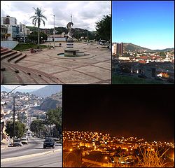

Flag
SealNickname(s):
"Fabri"
"Fabriciano"
"Coração do Vale"
"Terra mãe do Vale do Aço"
Country  Brazil
Region Southeast State  Minas Gerais
Founded January 20, 1949 Government - Mayor Francisco Simões (PT) Area - Total 221 km2 (85.3 sq mi) Population (2005) - Total 100.805 - Density 3,360/km2 (8,702.4/sq mi) Time zone UTC-3 (UTC-3) Postal Code 35170-000 HDI (2000) 0.789 – medium Website http://www.fabriciano.mg.gov.br/ Coronel Fabriciano (Zip Code 35170-000) is a Brazilian city of the Vale do Aço (Steel Valley) metropolitan area in the State of Minas Gerais.
According to IBGE, the municipal population in 2007 was estimated in 100,805 inhabitants with a per capita income of R$ 4478.21. The municipal area is 221.05 km².
Contents
History
With the inauguration of the Calado Station, they began to be lifted up the first homes, very poor and basic. Only in 1928 was built, with the exception of the train station, the first house covered with ceramic and floored.
By the Law State no. 843, of November 17 of 1926, the district was created, settling the May 7 of 1927 in the then patrimony of Santo Antônio, that passed to Melo Viana to be called, having been named his/her first peace judge the citizen Manoel Camilo of Fonseca, that gave ownership to his/her first peace clerk, Mr. João the Baptist Pereira. The first registrations civil facts were: the twins' baptism Duraci of Distaneta, daughters of the couple Antônio Viana and the marriage of the Sírio Maron Abibi with Geralda Honrata of Souza. On March 1 of 1930, it was accomplished in the new district the first election
The first name of the place when virgin forest, was Barra, for finding located in the confluence of the ribeirão Caladão, starting to denominate Calado (Quiet), with the inauguration of the Rail Station. Almost time, Raul Soares was denominated, returning the Calado (Quiet) name again. In August 1938, it was baptized with Coronel Fabriciano Fabriciano name, in honor to colonel Fabriciano Felisberto of I Break, for occasion of his/her centennial from birth. Ten years later, the municipal district was created being dismembered of Antônio Dias.
On December 27 of 1948, after a long process gone through the procedure in the Legislative Assembly of the State, governor Milton Campos signs the Law no. 336, creating the municipal district of Coronel Fabriciano. The official installation felt in the day January 1 of 1949, in session presided by the peace judge José Anastácio Franco. It assumed as manager Dr. Antônio Gonçalves Gravatá, with the different objective of to organize the municipal administration and to give him/it to the official mayor, elect for the population. It is like this, the March 15 of 1949, they take ownership then the mayor Dr. Rubem Siqueira Maia, vice-mayor Colonel Silvino Pereira, aldermen Nicanor Ataíde, Lauro Pereira, Ary Barros, José Anatólio Barbosa, Wenceslau Martins Araújo, Sebastião Mendes Araújo, José Paula Viana, Raimundo Martins Fraga and José Wilson Camargo.
In spite of the emancipation and December 27 of 1948, an agreement was signed with the local parish, in which the birthday of the city is commemorated on January 20, day of the patron of the city, São Sebastião.
Geography
Statistics
- Elevation: 240 mts.
- Climate: Sub-tropical.
- Average annual temperature: 22°C
- Latitude South 19°31'07"
- Longitude West: 42°37'44
Subdivisions
Main streets and avenues
Most of the city's main avenues (Avenidas) and streets (Ruas) are named after important people. Some of them are in blue below, linked to their Wikipedia article.
- Avenida Julita Pires Bretas
- Avenida José de Magalhães Pinto
- Avenida Geraldo Inácio
- Avenida Tancredo de Almeida Neves
- Avenida Rubens Siqueira Maia
- Rua Maria Matos
- Rua Pedro Nolasco
- Rua Moacir Birro
- Rua Marechal Floriano
- Rua São Sebastião
- Rua Argemiro José Ribeiro
- Rua Padre Américo Magalhães
Districts
- Senador Melo Viana
- Coronel Fabriciano (sede)
Neighborhoods
Main article: List of neighborhoods of Coronel FabricianoDistances from other cities (KM)
- Belo Horizonte: 198
- Rio de Janeiro: 560
- São Paulo: 765
- Vitória: 420
- Brasília: 936
- Ipatinga: 13
- Timóteo: 6
- Governador Valadares: 118
- Sete Lagoas: 273
Economy
The city is between Ipatinga and Timóteo, that base the largest and more modern siderurgic industries of Minas Gerais: Usiminas and Arcelor Mittal Timóteo, respectively. Coronel Fabriciano, those cities and several others, are in the Metropolitan Area of Vale do Aço, where Fabriciano is the second largest city, and has the third GDP.
Trading, services, eucalyptus monoculture, small and medium industries are the main activities in Coronel Fabriciano.
Commercial
According to official statistics of the city hall (http://www.fabriciano.mg.gov.br), the commercial activities include 3.561 registered establishments, of the most varied branches. The section of services involves 3.275 names registered, with prominence for the branch of Hostelry: there are about 1.800 accommodations, and 400 of them are framed in the categories "three" or "four stars."
Agriculture
Eucalyptus, from rural areas, is used by Cenibra, a Brazilian-Japanese cellulose factory in Belo Oriente. It is also used by local charcoal factories.
Industry
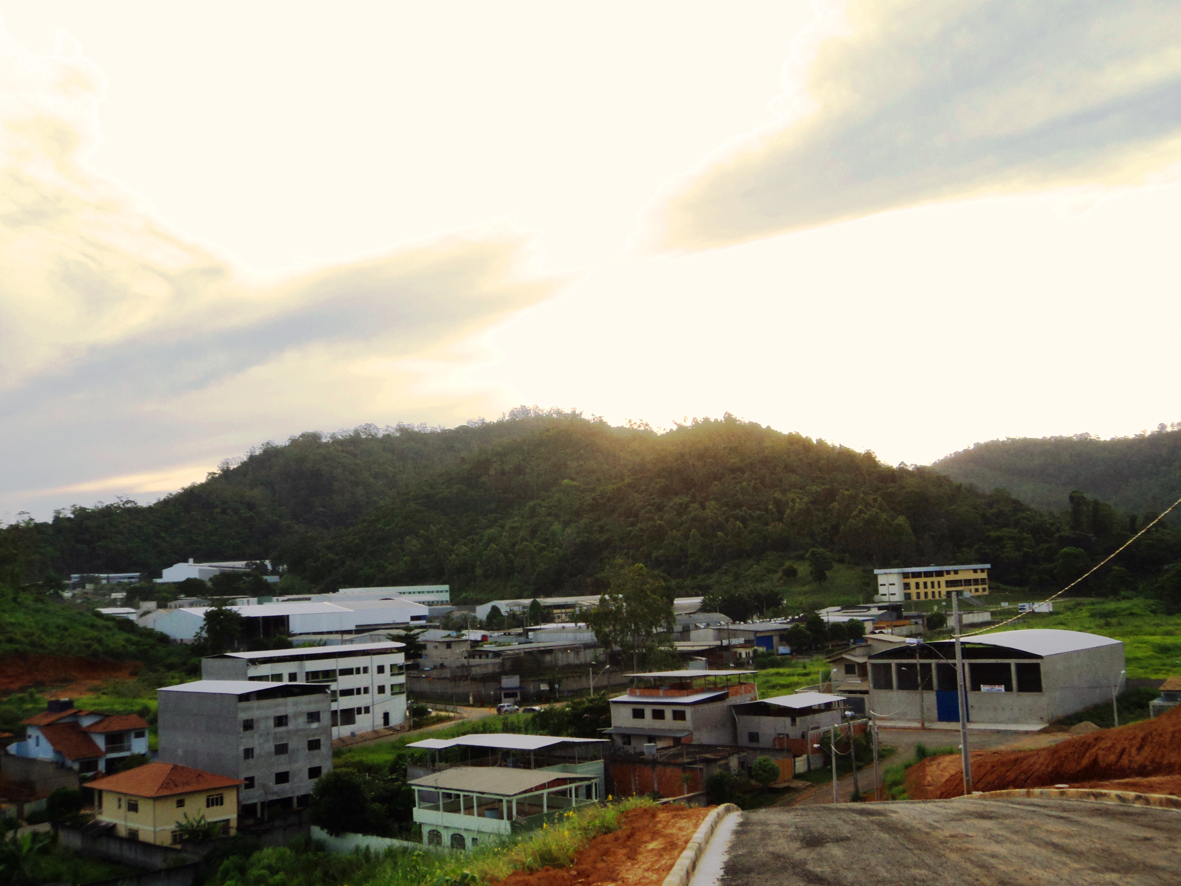
Several factories are based in the city, many of then in the Industrial District.
Sports
Extreme
The mountains of Serra dos Cocais in Fabriciano is usually used for extreme sports. Motorcycles and bikes are often used. But it's also common to make slow rides by foot or by horse in these calm mountains and see the waterfalls.
Auto racing
The city's Jeep Club, Jipe Clube Vale do Aço, often organize jeep travels and competitions. In 2008, Fabriciano hosted the 3rd race of the state's 4x4 Regularity rally Championiship.
Football
The city main professional football club is Social that plays the state's first division
Images
-

Partial view of Downtown and Morro do Carmo.
-

Buildings in the city.
-

Siderúrgica Hospital.
-

"Terra Mãe" Monument.
-

Estação Square.
-

Igreja Matriz de São Sebastião.
-

Colégio Angélica, a school founded in 1950.
-

Magalhães Pinto Avenue.
-

Tancredo Neves Avenue.
-

Downtown Fabriciano, with neighbour city Timóteo visible in the horizon.
-

Mountains of the Serra dos Cocais.
-

Catedral de São Sebastião.
-

Industrial District.
-

City Hall.
-

Pedro Nolasco Street.
-

JK Square.
-

Region of the Caladinho Neighbourhood.
-

Amaro Lanari Neighbourhood.
 Panoramic of the central region of Coronel Fabriciano.
External links
 Municipalities of Minas Gerais
Capital: Belo Horizonte Mesoregion Campo das Vertentes BarbacenaLavrasCarrancas • Ijaci • Ingaí • Itumirim • Itutinga • Lavras • Luminárias • Nepomuceno • Ribeirão VermelhoSão João del Rei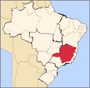
Mesoregion Central Mineira Bom DespachoCurveloTrês MariasMesoregion Jequitinhonha AlmenaraAlmenara • Bandeira • Divisópolis • Felisburgo • Jacinto • Jequitinhonha • Joaíma • Jordânia • Mata Verde • Monte Formoso • Palmópolis • Rio do Prado • Rubim • Salto da Divisa • Santa Maria do Salto • Santo Antônio do JacintoAraçuaíCapelinhaDiamantinaPedra AzulMesoregion Metropolitana de Belo Horizonte Belo HorizonteBelo Horizonte • Betim • Brumadinho • Caeté • Confins • Contagem • Esmeraldas • Ibirité • Igarapé • Juatuba • Lagoa Santa • Mário Campos • Mateus Leme • Nova Lima • Pedro Leopoldo • Raposos • Ribeirão das Neves • Rio Acima • Sabará • Santa Luzia • São Joaquim de Bicas • São José da Lapa • Sarzedo • VespasianoConceição do Mato DentroConselheiro LafaieteItabiraAlvinópolis • Barão de Cocais • Bela Vista de Minas • Bom Jesus do Amparo • Catas Altas • Dionísio • Ferros • Itabira • João Monlevade • Nova Era • Nova União • Rio Piracicaba • Santa Bárbara • Santa Maria de Itabira • São Domingos do Prata • São Gonçalo do Rio Abaixo • São José do Goiabal • Taquaraçu de MinasItaguaraBelo Vale • Bonfim • Crucilândia • Itaguara • Itatiaiuçu • Jeceaba • Moeda • Piedade dos Gerais • Rio MansoOuro PretoPará de MinasFlorestal • Onça de Pitangui • Pará de Minas • Pitangui • São José da VarginhaSete LagoasAraçaí • Baldim • Cachoeira da Prata • Caetanópolis • Capim Branco • Cordisburgo • Fortuna de Minas • Funilândia • Inhaúma • Jaboticatubas • Jequitibá • Maravilhas • Matozinhos • Papagaios • Paraopeba • Pequi • Prudente de Morais • Santana de Pirapama • Santana do Riacho • Sete LagoasMesoregion Noroeste de Minas ParacatuUnaíArinos • Bonfinópolis de Minas • Buritis • Cabeceira Grande • Dom Bosco • Formoso • Natalândia • Unaí • Uruana de MinasMesoregion Norte de Minas BocaiúvaGrão MogolJanaúbaCatuti • Espinosa • Gameleiras • Jaíba • Janaúba • Mamonas • Mato Verde • Monte Azul • Nova Porteirinha • Pai Pedro • Porteirinha • Riacho dos Machados • Serranópolis de MinasJanuáriaMontes ClarosBrasília de Minas • Campo Azul • Capitão Enéas • Claro dos Poções • Coração de Jesus • Francisco Sá • Glaucilândia • Ibiracatu • Japonvar • Juramento • Lontra • Luislândia • Mirabela • Montes Claros • Patis • Ponto Chique • São João da Lagoa • São João da Ponte • São João do Pacuí • Ubaí • Varzelândia • VerdelândiaPiraporaBuritizeiro • Ibiaí • Jequitaí • Lagoa dos Patos • Lassance • Pirapora • Riachinho • Santa Fé de Minas • São Romão • Várzea da PalmaSalinasMesoregion Oeste de Minas Campo BeloDivinópolisCarmo do Cajuru • Cláudio • Conceição do Pará • Divinópolis • Igaratinga • Itaúna • Nova Serrana • Perdigão • Santo Antônio do Monte • São Gonçalo do Pará • São Sebastião do OesteFormigaOliveiraBom Sucesso • Carmo da Mata • Carmópolis de Minas • Ibituruna • Oliveira • Passa Tempo • Piracema • Santo Antônio do Amparo • São Francisco de PaulaPiuiBambuí • Córrego Danta • Doresópolis • Iguatama • Medeiros • Piumhi • São Roque de Minas • Tapiraí • Vargem BonitaMesoregion Sudoeste de Minas AlfenasAlfenas • Alterosa • Areado • Carmo do Rio Claro • Carvalhópolis • Conceição da Aparecida • Divisa Nova • Fama • Machado • Paraguaçu • Poço Fundo • SerraniaAndrelândiaAiuruoca • Andrelândia • Arantina • Bocaina de Minas • Bom Jardim de Minas • Carvalhos • Cruzília • Liberdade • Minduri • Passa-Vinte • São Vicente de Minas • Seritinga • SerranosItajubáBrasópolis • Consolação • Cristina • Delfim Moreira • Dom Viçoso • Itajubá • Maria da Fé • Marmelópolis • Paraisópolis • Piranguçu • Piranguinho • Virgínia • Wenceslau BrazPassosAlpinópolis • Bom Jesus da Penha • Capetinga • Capitólio • Cássia • Claraval • Delfinópolis • Fortaleza de Minas • Ibiraci • Itaú de Minas • Passos • Pratápolis • São João Batista do Glória • São José da BarraPoços de CaldasAlbertina • Andradas • Bandeira do Sul • Botelhos • Caldas • Campestre • Ibitiúra de Minas • Inconfidentes • Jacutinga • Monte Sião • Ouro Fino • Poços de Caldas • Santa Rita de CaldasPouso AlegreBom Repouso • Borda da Mata • Bueno Brandão • Camanducaia • Cambuí • Congonhal • Córrego do Bom Jesus • Espírito Santo do Dourado • Estiva • Extrema • Gonçalves • Ipuiúna • Itapeva • Munhoz • Pouso Alegre • Sapucaí-Mirim • Senador Amaral • Senador José Bento • Tocos do Moji • ToledoSanta Rita do SapucaíCachoeira de Minas • Careaçu • Conceição das Pedras • Conceição dos Ouros • Cordislândia • Heliodora • Natércia • Pedralva • Santa Rita do Sapucaí • São Gonçalo do Sapucaí • São João da Mata • São José do Alegre • São Sebastião da Bela Vista • Silvianópolis • TurvolândiaSão LourencoAlagoa • Baependi • Cambuquira • Carmo de Minas • Caxambu • Conceição do Rio Verde • Itamonte • Itanhandu • Jesuânia • Lambari • Olímpio Noronha • Passa Quatro • Pouso Alto • São Lourenço • São Sebastião do Rio Verde • Soledade de MinasSão Sebastiao do ParaísoArceburgo • Cabo Verde • Guaranesia • Guaxupé • Itamogi • Jacuí • Juruaia • Monte Belo • Monte Santo de Minas • Muzambinho • Nova Resende • São Pedro da União • São Sebastião do Paraíso • São Tomás de AquinoVarginhaBoa Esperança • Campanha • Campo do Meio • Campos Gerais • Carmo da Cachoeira • Coqueiral • Elói Mendes • Guapé • Ilicínea • Monsenhor Paulo • Santana da Vargem • São Bento Abade • São Thomé das Letras • Três Corações • Três Pontas • VarginhaMesoregion Triângulo Mineiro/Alto Paranaiba AraxáAraxá • Campos Altos • Ibiá • Nova Ponte • Pedrinópolis • Perdizes • Pratinha • Sacramento • Santa Juliana • TapiraFrutalItuiutabaPatos de MinasPatrocínioUberabaUberlândiaAraguari • Araporã • Canápolis • Cascalho Rico • Centralina • Indianópolis • Monte Alegre de Minas • Prata • Tupaciguara • UberlândiaMesoregion Vale do Mucuri NanuqueTeófilo OtoniAtaléia • Catuji • Franciscópolis • Frei Gaspar • Itaipé • Ladainha • Malacacheta • Novo Oriente de Minas • Ouro Verde de Minas • Pavão • Poté • Setubinha • Teófilo OtoniMesoregion Vale do Rio Doce AimorésAimorés • Alvarenga • Conceição de Ipanema • Conselheiro Pena • Cuparaque • Goiabeira • Ipanema • Itueta • Mutum • Pocrane • Resplendor • Santa Rita do Itueto • TaparubaCaratingaBom Jesus do Galho • Bugre • Caratinga • Córrego Novo • Dom Cavati • Entre Folhas • Iapu • Imbé de Minas • Inhapim • Ipaba • Piedade de Caratinga • Pingo-d'Água • Santa Bárbara do Leste • Santa Rita de Minas • São Domingos das Dores • São João do Oriente • São Sebastião do Anta • Tarumirim • Ubaporanga • Vargem AlegreGovernador ValadaresAlpercata • Campanário • Capitão Andrade • Coroaci • Divino das Laranjeiras • Engenheiro Caldas • Fernandes Tourinho • Frei Inocêncio • Galiléia • Governador Valadares • Itambacuri • Itanhomi • Jampruca • Marilac • Mathias Lobato • Nacip Raydan • Nova Módica • Pescador • São Geraldo da Piedade • São Geraldo do Baixio • São José da Safira • São José do Divino • Sobrália • Tumiritinga • VirgolândiaGuanhãesBraúnas • Carmésia • Coluna • Divinolândia de Minas • Dores de Guanhães • Gonzaga • Guanhães • Materlândia • Paulistas • Sabinópolis • Santa Efigênia de Minas • São João Evangelista • Sardoá • Senhora do Porto • VirginópolisIpatingaAçucena • Antônio Dias • Belo Oriente • Coronel Fabriciano • Ipatinga • Jaguaraçu • Joanésia • Marliéria • Mesquita • Naque • Periquito • Santana do Paraíso • TimóteoMantenaCentral de Minas • Itabirinha de Mantena • Mantena • Mendes Pimentel • Nova Belém • São Félix de Minas • São João do ManteninhaPeçanhaÁgua Boa • Cantagalo • Frei Lagonegro • José Raydan • Peçanha • Santa Maria do Suaçuí • São José do Jacuri • São Pedro do Suaçuí • São Sebastião do MaranhãoCoordinates: 19°31′08″S 42°37′44″W / 19.51889°S 42.62889°W
Categories:- Municipalities of Brazil
- Coronel Fabriciano
- Populated places in Minas Gerais


Wikimedia Foundation. 2010.