- Vrútky
Geobox|Settlement
name = Vrútky
category = Town
etymology =
official_name =
motto =
nickname =

image_caption = Town hall of Vrútky
symbol =
symbol_type =
country = Slovakia
country_
state =
region = Žilina
district = Martin
municipality =
landmark =
river = Turiec | river1 = Váh
location =
elevation = 382
prominence =
lat_d =49 | lat_m =06 | lat_s =42 | lat_NS =N
long_d =18 | long_m =55 | long_s =06 | long_EW =E
highest = Minčol
highest_location = | highest_region = | highest_state =
highest_elevation = 1345
highest_lat_d = | highest_lat_m = | highest_lat_s = | highest_lat_NS =
highest_long_d = | highest_long_m = | highest_long_s = | highest_long_EW =
lowest = Váh
lowest_location = | lowest_region = | lowest_state =
lowest_elevation = 370
lowest_lat_d = | lowest_lat_m = | lowest_lat_s = | lowest_lat_NS =
lowest_long_d = | lowest_long_m = | lowest_long_s = | lowest_long_EW =
length = | length_orientation =
width = | width_orientation =
area = 18.656
area_land =
area_water =
area_urban =
area_metro =
population =7247 | population_date =2005-12-31
population_urban =
population_metro =
population_density = auto
population_density_urban =
population_density_metro =
established =1255
established_type = First mentioned
date =
government =
government_location = | government_region = | government_state =
government_elevation =
government_lat_d = | government_lat_m = | government_lat_s = | government_lat_NS =
government_long_d = | government_long_m = | government_long_s = | government_long_EW =
mayor = Miloslav Mazúr
leader =
timezone =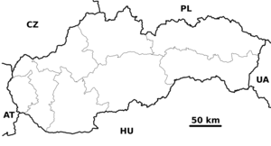
map_caption = Location of Vrútky within Slovakia
map_background = Slovakia - background map.png
map1 = Žilina Region - outline map.svg
map1_caption = Location of Vrútky within the Žilina Region
map1_background = Žilina Region - background map.png
commons = Vrútky
statistics = [http://www.statistics.sk/mosmis/eng/prvav2.jsp?txtUroven430506&lstObec557358&Okruhzaklad MOŠ/MIS]
website = [http://www.vrutky.sk www.vrutky.sk]
footnotes =Vrútky ( _de. Ruttek (rare); _hu. Ruttka) is a
town in northernSlovakia , close to the town of Martin. It lies in the historicTuriec region.Geography
The town lies at the confluence of the
Váh and the Turiec, in the Turčianska kotlina, near theMalá Fatra mountain range. It is located 3 km north of the town of Martin, actually sharing public transport system and 25 km fromŽilina . Additionally, governing body of theVeľká Fatra National Park is located in Vrútky. [http://www.sopsr.sk/velkafatra/sk/hlavna.htm (Slovak)]History
The town was first mentioned in 1255 as "villa Vrutk". However, a settlement already existed before, and had an archaic Slavic name "vrqtbkb".http://www.vrutky.sk/drupal-5.2/?q=node/15 (Slovak)] By the end of the 13th century, the settlement got divided, into Dolné Vrútky and Horné Vrútky. By 1332, the settlement was an independent parish with Gothic church of St. John the Baptist from 1285. In 1809, the settlement had 300 inhabitants. Construction of the
Košice-Bohumín Railway (1870) and a track fromSalgotarján (1872), with construction of railway workshop in 1873 brought economic development and a status of railway junction. This also reflected on the growth of inhabitants: from 915 in 1869, to 1,944 in 1880 and 4,345 in 1900. In 1949–1954 and 1971–1990 the town was amalgamated to Martin under name Martin-Vrútky. The settlement gained town status in 1990.Demographics
According to the 2001
census , the town had 7,298 inhabitants. 96.01% of inhabitants wereSlovaks , 1.33% Czechs 0.47% Roma and 0.33 Hungarians.cite web | title = Municipal Statistics | publisher = Statistical Office of the Slovak republic | url = http://www.statistics.sk/mosmis/eng/run.html | accessdate = 2007-11-06] The religious makeup was 50.34%Roman Catholics , 24.86% people with no religious affiliation, and 19.01%Lutherans .Partner towns
*
Bebra ,Germany
*Fulnek ,Czech Republic
*Łaziska Górne ,Poland
*Nymburk , Czech RepublicReferences
External links
* [http://www.vrutky.sk Official website] sk icon


Wikimedia Foundation. 2010.