- Dorado, Puerto Rico
-
Dorado, Puerto Rico — Town and Municipality — Central Square in Dorado town.

FlagNickname(s): "Ciudad Ejemplar", "Donde La Vida Es Bella","Paraiso de Puerto Rico","La Ciudad Más Limpia de Puerto Rico" Anthem: "Por fin, en las riberas" Location of Dorado in Puerto Rico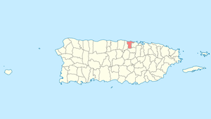
Coordinates: 18°27′32″N 66°16′04″W / 18.45889°N 66.26778°WCoordinates: 18°27′32″N 66°16′04″W / 18.45889°N 66.26778°W Country United States Territory Puerto Rico Founded 1842 Government - Mayor Hon. Carlos A. López Rivera (PPD) - Senatorial dist. 3 - Arecibo - Representative dist. 11 Area - Total 23.2 sq mi (60.16 km2) Population (2004) - Total 34,995 - Density 1,506.6/sq mi (581.7/km2) Demonym Doradeños Time zone AST (UTC-4) Zip code 00646 Dorado (Spanish pronunciation: [doˈɾaðo]) is a small tourist town in the northern coast of Puerto Rico, 15 miles (24 km) west of San Juan and is located in the northern region of the island, bordering the Atlantic Ocean, north of Toa Alta, east of Vega Alta, and west of Toa Baja. Dorado is spread over five barrios and Dorado Pueblo (the downtown area and the administrative center of the city). The town is known as a tourist destination with golf courses, hotels, and a beautiful municipal beach. It is part of the San Juan-Caguas-Guaynabo Metropolitan Statistical Area.
In the early 1900s the Rockefeller family purchased plots of land in the northwest region of the municipality of Dorado where they built a huge private vacation compound. Laurance Rockefeller would later use this land to create Dorado Beach Hotel and Golf Club, which later became the Dorado Beach Hyatt Hotel and Casino and is now the Hyatt Hacienda Del Mar. The Dorado Beach Hotel reopened their doors in 2010 as part of the Embassy Suites hotel chain.
The Dorado Airport was operated from 1942 to 1996. The airport began as a military landing strip, then became a civilian airport in the 1960s with Caribair and Dorado Wings flights operating until 1980 and 1982 respectively. The airport operated as a private landing strip throughout the 1980s and then fell into disrepair. In 1996, the airport was rezoned as residential land and redeveloped.
Dorado has upscale neighborhoods and a small downtown area with a plaza (Spanish town square), as other Puerto Rican municipalities. The town's patron saint is Anthony of Padua, and patron saint celebrations are held at the plaza every year on June 13.
Contents
History
In 1831, Dorado existed as a barrio (or ward) of the town of Toa Baja. Over several years, the ward grew and established its own town center called the "new pueblo" to differentiate itself from Toa Baja, which became known as the "old pueblo." Over several years, the wards that currently make up Dorado grew and the people of the "new pueblo" wanted to separate themselves from Toa Baja.
On November 22, 1842, Jacinto López Martínez, the Sergeant at Arms for the ward of Dorado, petitioned the Spanish Governor of Puerto Rico, Santiago Méndez Vigo, to establish the municipality of Dorado. The governor authorized the founding of the town pending the construction of public works, including an administrative building and a church near the town square. In 1848, the construction of the public works were completed and López Martínez became the first mayor of Dorado.
In 1902, after the U.S. Invasion, Dorado was again appended to Toa Baja, but in 1905 it regained its status as an independent town.
The 2nd G7 summit was held at the Dorado Beach Resort between June 27 and 28, 1976.[1]
Symbols
Flag
The flag is composed of three stripes of equal width: the upper and lower stripes are golden, and the center one is brown. A brown, equal-sided triangle is placed with its base at the hoist.
Coat of arms
The crown is gold with brown windows. The three towers mean that Dorado is a town, a properly constituted municipality. Underneath the crown, there are five disks that form a Tau.
Geography
Climate
Dorado's climate is very hot in the summer months and cool in the winter. Temperatures range around 60 °F (16 °C) to 80 °F (27 °C) in the winter and 75 °F (24 °C) to 95 °F (35 °C) in the summer.
Climate data for Dorado,Puerto Rico Month Jan Feb Mar Apr May Jun Jul Aug Sep Oct Nov Dec Year Record high °F (°C) 88
(31)90
(32)95
(35)97
(36)98
(39)100
(38)99
(38)100
(38)98
(37)98
(37)93
(33)91
(32)100
(39)Average high °F (°C) 78
(25)80
(26)83
(27)84
(28)88
(31)91
(33)92
(33)92
(33)90
(32)87
(29)82
(27)79
(26)85.5
(29.2)Average low °F (°C) 63
(17)64
(18)66
(18)69
(19)70
(21)73
(23)75
(25)77
(25)75
(24)72
(22)68
(20)66
(19)69.8
(20.9)Record low °F (°C) 50
(10)49
(9)50
(10)59
(15)62
(17)67
(19)68
(20)68
(20)64
(18)60
(16)55
(13)53
(12)49
(9)Precipitation inches (cm) 3.55
(9.02)3.11
(7.90)4.02
(10.21)2.78
(7.06)3.55
(9.02)7.20
(18.29)6.20
(15.75)5.84
(14.83)5.60
(14.22)3.71
(11.88)8.47
(19.27)5.65
(12.73)59.68
(150.18)Source: The Weather Channel[2] Geography
 La Plata River in 2007
Much of Dorado's geology consists of alluvial and coastal/estuarine sediments of Quaternary age and limestones of Tertiary age. The limestones are mostly in the south part of the municipality, in Espinosa, Maguayo and Rio Lajas Wards. These limestones exhibit mature karst topography of great beauty. It has been subjected to extensive quarrying, which have left unsightly scars in the landscape. Some local communities have gathered efforts to minimize quarrying and improve land management to protect the remaining karst topography and the fauna and flora that lives in it.
Bodies of water
Dorado is the site of some bodies of water. Some of them are:
- Rivers: Río Cocal, Río Lajas, Río de la Plata, and Río Nuevo.
- Mata Redonda lagoon
- Punta Fraile marsh
Cityscape
Dorado County has a total population of 34,017 inhabitants settled in 8 distinct wards (or locations)
- Dorado Espinosa has a population of 3,222 inhabitants.
- Higuillar has a population of 16,025 inhabitants.
- Magüayo has a population of 4,711 inhabitants.
- Mameyal has a population of 36 inhabitants.
- Pueblo of Dorado has a population of 994 inhabitants.
- Puertos
- Ritz-Carlton Reserve
- Dorado Beach
- Rio Lajas has a population of 2,573 inhabitants.
- Dorado San Antonio has a population of 6,456 inhabitants.
Housing developments
In recent years, Dorado has been known for its development of upscale neighborhoods. Several known politicians and artists (i.e. Ricky Martin, Carlos Romero Barceló) live or own properties in the city.
Culture
Tourism
Dorado has long been known as a golf haven. Its tourist industry includes the Dorado Beach Resort, the Hyatt Hacienda del Mar, and a recently opened Embassy Suites in the Dorado Del Mar neighborhood.
Landmarks and places of interest
Some of the places to visit in Dorado are located downtown. For example, the Museum Casa del Rey is the house built in most towns controlled by Spain during their colonization, which was intended for the King and Queen to stay if they visited. The museum includes several artifacts from the era. There's also the Distinguished Doradeños Plaza, and the Juan Boria Theater. The last one was recently reopened after a long period of restoration.
Some of the most visited beaches in Dorado are Sardinera, Kikita and El Unico are other beaches frequented by surfers. The Ojo del Buey Park is a park located at the base level of the La Plata River. The name comes from a rock formation that has the shape of an ox.
Dorado also has a church called the Sanctuary of Christ of the Reconciliation, that has the third largest statue of Jesus Christ in the Caribbean, inside its temple.
Festivals and events
Dorado's Fiestas Patronales are held in June. Other traditional festivals held at the city are "El Carnaval del Plata" which is celebrated in the beginnings of February and the "Cocolía" Festival which is celebrated in the end of June/beginning of August, etc.
Sports
Dorado has their very own Double A baseball team called Los Guardianes (The Guardians) and it's still one of the main places in the island to play golf or tennis.
Economy
Business
Commerce Tourism and Pharmaceuticals
Industry
Dorado is the site of several industries dedicated to the manufacturing of clothing and medical equipment, among others. Companies like Boston Scientific, Pfizer and Heraeus are among some of the ones located in the city.
Demographics
Historical populations Year Pop. ±% 1899 3,804 — 1910 4,885 +28.4% 1920 5,842 +19.6% 1930 7,579 +29.7% 1940 9,481 +25.1% 1950 11,749 +23.9% 1960 13,460 +14.6% 1970 17,388 +29.2% 1980 25,511 +46.7% 1990 30,759 +20.6% 2000 34,017 +10.6% Dorado's population has steadily increased during the past century. The current population, according to the 2000 census, is of 34,017 with a population density of 1,479.0 people per square mile (568.8/km²) more than doubling the town's population of 17,388 in 1970.
As a whole, Puerto Rico is populated mainly by people from a Creole (born on the Island of European descent) or Spanish and European descent, with small groups of African and Asian people. Statistics taken from the 2000 census shows that 74.1% of Doradeños have Spanish or White origin, 12.2% are black, 0.5% are Amerindian etc.
Race - Dorado, Puerto Rico - 2000 Census[3] Race Population % of Total White including Hispanic 25,219 74.1% Black/African American 4,147 12.2% American Indian and Alaska Native 157 0.5% Asian 60 0.2% Native Hawaiian/Pacific Islander 7 0.0% Some other race 3,214 9.4% Two or more races 1,213 3.6% Education
Dorado has several public and private schools distributed through several regions. Including TASIS, Dorado Academy, New Testament Christian Academy of Dorado, and Public education is handled by the Puerto Rico Department of Education.
Transportation
Puerto Rico Highway 22 provides access to Dorado from the far away city of Mayaguez, or from San Juan. Road 165 also provides access from Cataño and Bayamón bordering the shore to the Atlantic Ocean. It takes approximately 30 minutes to reach the town from San Juan.
Like most other towns in the island, it counts with a public transportation system consisting of public cars. Taxis are also available around the town. There's also a public trolley system around town and a shuttle service for handicapped people.
Education
- Dorado Academy
- TASIS Dorado
- Jose S. Alegria High School
- Pedro Lopez Canino Elementary and Middle School
- Luis Muñoz Marin Elementary School
- Ricardo Arroyo Middle School
- Marcelino Canino Canino - Middle School
- Jacinto Lopez Martinez - Elementary school and first school building to be founded in Dorado. It is over a hundred years old and still in use and one of the biggest schools.
- Luisa Valderrama Martinez - Elementary school
- The Jane Stern Dorado Community Library, founded in 1974, is Puerto Rico's first public bilingual library. Recently honored with a 2008 National Medal for Museum and Library Service.
References
- ^ Japan, Ministry of Foreign Affairs (MOFA): Summit Meetings in the Past; Shabecoff, Philip. "Go-Slow Policies Urged by Leaders in Economic Talks," New York Times. June 29, 1976; excerpt, "SAN JUAN, P.R., June 28 President Ford and six other leaders of industrial democracies announced here today that they had agreed to pursue the objective of sustained economic growth.... The leaders met at the palm fringed Dorado Beach Resort near here."
- ^ "Ocala, Florida Weather". The Weather Channel. http://weather.yahoo.com/Ocala-Florida-United-States/USFL0355/statistics.html.
- ^ Ethnicity 2000 census
Categories:- Dorado, Puerto Rico
- Populated places established in 1831
- San Juan – Caguas – Guaynabo metropolitan area
- Municipalities of Puerto Rico


Wikimedia Foundation. 2010.