- Bioko
-
Bioko Native name: Otcho 
Map of Bioko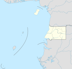
 Bioko (Equatorial Guinea)
Geography Location Gulf of Guinea Coordinates 3°30′N 8°42′E / 3.5°N 8.7°E Area 2,017 km2 (778.8 sq mi) Length 70 km (43 mi) Width 32 km (19.9 mi) Highest elevation 3,012 m (9,882 ft) Highest point Pico Basile Country Equatorial GuineaDemographics Population 124,000 Density 64.45 /km2 (166.92 /sq mi) Ethnic groups Bubi (58%), Fang (16%), Fernandino (12%), Igbo (7%) (2002)[1]  View of Bioko from satellite
Bioko (spelled also Bioco, in Europe traditionally called Fernando Pó) is an island 32 km off the west coast of Africa, specifically Cameroon, in the Gulf of Guinea. It is the northernmost part of Equatorial Guinea with a population of 124,000 and an area of 2,017 km2 (779 sq mi). It is volcanic with its highest peak the Pico Basile at 3,012 m (9,882 ft).
Contents
Geography
Bioko has a total area of 2,017 km2 (779 sq mi). It is 70 km long from NNE to SSW and about 32 km across. It is volcanic and very mountainous with the highest peak Pico Basile (3,012 m (9,882 ft)). It thus resembles neighbouring islands São Tomé and Príncipe. Like them it lies on the Cameroon Line.
Bioko used to be the end of a peninsula attached to the mainland in what is now Cameroon, but it was cut off when sea levels rose 10,000 years ago at the end of the last ice age.[2]
Demographics
The island has a population of 124,000 inhabitants, most of whom belong to the Bubi people. The rest of the population are Fernandinos, Spaniards and immigrants from Río Muni, Nigeria and Cameroon.
Etymology
Bioko's native name is Otcho from the Bube language.
The Portuguese navigator Fernão do Pó in 1472 named it Formosa Flora ('Beautiful Flower'), but in 1494 it was renamed after its discoverer Fernando Pó.
History
The island was inhabited in the middle of the first millennium BC by Bantu tribes from the mainland who formed the Bubi ethnic group. Unlike other islands in the area, Bioko had an indigenous African population. Still a distinct ethnic group on the island today, these indigenous people, the Bubi, speak a Bantu language. The island was probably inhabited by this or other Bantu-speaking groups since before the 7th century BC.
In 1472, the Portuguese navigator Fernão do Pó was the first European to visit the island. He named it Formosa Flora ('Beautiful Flower'), but in 1494 it was renamed after its discoverer (Fernando Pó). The Portuguese developed the island for sugarcane crops, and while considered poor quality, the refineries' output was such that Fernando Po sugar briefly dominated the trade centres in Europe.
In 1642, the Dutch East India Company established trade bases on the island without Portuguese consent, temporarily centralizing from there its slave trade in the Gulf of Guinea. The Portuguese appeared again on the island in 1648, replacing the Dutch Company with one of their own, also dedicated to slave trading and established in its neighbour island Corisco.
Parallel with this establishment, the Bubi clans began the slow process of establishing the core of a new kingdom on the island, especially after the activity of some local chiefs such as Molambo (approx. 1700–1760). During a period when enslavement was increasing in the region, local clans abandoned their coastal settlements and settled in the safer hinterland.
 Bioko in the distance from Limbe, Cameroon
Under the Treaty of El Pardo in 1778, Portugal ceded to Spain Fernando Po, Annobón and the Guinea coast, Rio Muni, together forming modern Equatorial Guinea. The treaty was signed by Queen Mary I of Portugal and King Charles III of Spain, in exchange for territory on the American continent. Spain then mounted an expedition to Fernando Po, led by the Conde de Argelejos, who stayed for four months. In October 1778, Spain installed a governor on the island who stayed until 1780, when the Spanish mission left the island.
Chief Molambo was succeeded by another local leader, Lorite (1760–1810), who was succeeded by Lopoa (1810–1842). After abolishing their slave trade, from 1827 to 1843 the British leased bases at Port Clarence (modern Malabo) and San Carlos for their anti-slavery patrols. The settlement at Port Clarence (named after the Duke of Clarence) was constructed under the supervision of William Fitzwilliam Owen, who had previously mapped most of the coasts of Africa and was a zealous anti-slaver. During his three year command, his forces detained 20 ships and liberated 2,500 slaves. The Court of Mixed Commission was moved from Freetown to Clarence to hasten the legal process.[3]
In March 1843, Juan José Lerena planted the Spanish flag in Malabo, starting the decline of British influence on the island. The British lease was finally revoked in 1855.[4] Madabita (1842–1860) and Sepoko (1860–1875) were principal local chiefs during the reestablishment of Spanish rule on the island. This period was also marked by the immigration of several hundred Afro-Cubans as well as tens of Spanish scholars and politicians.
In 1923–30 the League of Nations investigated the transportation of migrant labour between Liberia and the Spanish colony of Fernando Po. Although the League concentrated its attention on Liberia, a closer examination revealed labour abuse as the product of conditions on Fernando Po. In the last quarter of the 19th century, black planters on the island had shifted from palm oil trading to cocoa cultivation. Their dependence on migrant labour and increasing competition with Europeans resulted in an economic crisis in the first years of the twentieth century. Planters detained labour but failed to pay contracts, resulting in a situation akin to slavery.
During the Nigerian civil war in the 20th century, relief agencies used the island as a base for flights into Biafra.
Today
 Coastline of Bioko
Malabo is the capital city of Equatorial Guinea and the largest city on the island. The island is mostly covered by tropical rainforest.
Located on Punta Europa, west of Malabo, the Alba Gas Plant processes natural gas delivered from offshore production wells. The plant is operated by Marathon Oil Company through its subsidiary, Marathon Equatorial Guinea Production Limited (MEGPL). The plant produces natural gas liquids (NGL) including propane, butane, and condensate products. The majority of the residue gas from the Alba plant is delivered to a natural gas liquefaction plant operated by EG LNG. A portion of the Alba plant residue is also delivered to the Atlantic Methanol Production Company (AMPCO) and is used to produce methanol. The products from all three plants are loaded onto ocean going tanker ships for export.
A rectangular transport route links the four main cities Malabo, Luba, Baney and Riaba.
Infrastructure Development
On 4 June 2011, Equatorial Guinean President Teodoro Obiang Nguema Mbasogo inaugurated several infrastructure development projects on Bioko including a new documentation center on Bioko, the expansion of the passenger terminal at Malabo International Airport, a Police Camp, the Palace of Conferences, drinking water networks in Riaba, and a road from Riaba to Moka. The projects cost the Equatorial Guinean government 20 billion CFA francs.[5][6]
See also
- Annobón
- Bight of Bonny also known as the Bight of Biafra
- Bioko Norte Province
- Bioko Sur Province
- Cameroon line
- Equatorial Guinea
- Emancipados
- Fernandino
- Fernão do Pó
- Gulf of Guinea
- Kru people
- Movement for the Self-Determination of Bioko Island
- The English-lexicon Creole Pichi is spoken on Bioko
- Postage stamps and postal history of Equatorial Guinea
References
- Room, Adrian (1994). African placenames. Jefferson, North Carolina (USA): McFarland. ISBN 0-89950-943-6
- Sundiata, Ibrahim K. (1990). Equatorial Guinea: Colonialism, State Terror, and the Search for Stability. Boulder, Colorado (USA): Westview Press. ISBN 0-8133-0429-6
- ^ Minahan, James (2002). Encyclopedia of the Stateless Nations: S-Z. Greenwood Publishing Group. p. 330. ISBN 0-313-32384-4. http://books.google.com/books?id=K94wQ9MF2JsC&pg=PA330.
- ^ McNeil Jr, Donald G. (16 September 2010). "Precursor to H.I.V. Was in Monkeys for Millenniums, Study Says". The New York Times. http://www.nytimes.com/2010/09/17/health/17aids.html.
- ^ "The Hell-Borne Traffic", article by Jordan Goodman, Geographical, September 2007
- ^ http://www.britishempire.co.uk/maproom/fernandopo.htm
- ^ Clemente Ela Ondo Onguene; María Jesús Nsang (5 June 2011). "The President of the Republic inaugurated several infrastructure works on the island of Bioko". Equatorial Guinea Press (Malabo, Bata). http://guineaecuatorialpress.com/noticia.php?id=1633. Retrieved 8 June 2011.
- ^ "Equatorial Guinea Dedicates Public Works to Host Visitors, Provide Drinking Water, Fight Corruption". Press Release. PR Newswire. 13. http://www.prnewswire.com/news-releases/equatorial-guinea-dedicates-public-works-to-host-visitors-provide-drinking-water-fight-corruption-123743214.html. Retrieved 13 June 2011.
External links
- Bioko Biodiversity Protection Program
- Gulf of Guinea Conservation Group
- Virginia Morell: "Island ark", National Geographic Magazine August 2008; link
Portuguese Empire North Africa15th century
1415–1640 Ceuta
1458–1550 Alcácer Ceguer (El Qsar es Seghir)
1471–1550 Arzila (Asilah)
1471–1662 Tangier
1485–1550 Mazagan (El Jadida)
1487– middle 16th century Ouadane
1488–1541 Safim (Safi)
1489 Graciosa16th century
1505–1769 Santa Cruz do Cabo
de Gué (Agadir)
1506–1525 Mogador (Essaouira)
1506–1525 Aguz (Souira Guedima)
1506–1769 Mazagan (El Jadida)
1513–1541 Azamor (Azemmour)
1515 São João da Mamora (Mehdya)
1577–1589 Arzila (Asilah)Sub-Saharan Africa15th century
1455–1633 Arguin
1470–1975 Portuguese São Tomé1
1474–1778 Annobón
1478–1778 Fernando Poo (Bioko)
1482–1637 Elmina (São Jorge
da Mina)
1482–1642 Portuguese Gold Coast
1496–1550 Madagascar (part)
1498–1540 Mascarene Islands16th century
1500–1630 Malindi
1500–1975 Portuguese Príncipe1
1501–1975 Portuguese E. Africa
(Mozambique)
1502–1659 St. Helena
1503–1698 Zanzibar
1505–1512 Quíloa (Kilwa)
1506–1511 Socotra
1557–1578 Portuguese Accra
1575–1975 Portuguese W. Africa
(Angola)
1588–1974 Cacheu2
1593–1698 Mombassa (Mombasa)17th century
1642–1975 Portuguese Cape Verde
1645–1888 Ziguinchor
1680–1961 São João Baptista de Ajudá
1687–1974 Portuguese Bissau2
18th century
1728–1729 Mombassa (Mombasa)
1753–1975 Portuguese São Tomé and Príncipe
19th century
1879–1974 Portuguese Guinea
1885–1975 Portuguese Congo1 Part of São Tomé and Príncipe from 1753. 2 Part of Portuguese Guinea from 1879. Southwest Asia16th century
1506–1615 Gamru (Bandar-Abbas)
1507–1643 Sohar
1515–1622 Hormuz (Ormus)
1515–1648 Quriyat
1515–? Qalhat
1515–1650 Muscat
1515?–? Barka
1515–1633? Julfar (Ras al-Khaimah)
1521–1602 Bahrain (Muharraq and Manama)
1521–1529? Qatif
1521?–1551? Tarut Island
1550–1551 Qatif
1588–1648 Matrah17th century
1620–? Khor Fakkan
1621?–? As Sib
1621–1622 Qeshm
1623–? Khasab
1623–? Libedia
1624–? Kalba
1624–? Madha
1624–1648 Dibba Al-Hisn
1624?–? Bandar-e KongIndian subcontinent15th century
1498–1545 Laccadive Islands
(Lakshadweep)16th century
Portuguese India
· 1500–1663 Cochim (Kochi)
· 1502–1661 Quilon (Coulão/Kollam)
· 1502–1663 Cannanore (Kannur)
· 1507–1657 Negapatam (Nagapatnam)
· 1510–1962 Goa
· 1512–1525 Calicut (Kozhikode)
· 1518–1619 Chaul
· 1523–1662 Mylapore
· 1528–1666 Chittagong
· 1531–1571 Chalium
· 1534–1601 Salsette Island
· 1534–1661 Bombay (Mumbai)
· 1535–1739 Baçaím (Vasai-Virar)
· 1536–1662 Cranganore (Kodungallur)
· 1540–1612 Surat
· 1548–1658 Tuticorin (Thoothukudi)16th century (continued)
Portuguese India (continued)
· 1559–1962 Daman and Diu
· 1568–1659 Mangalore
· 1579–1632 Hugli
· 1598–1610 Masulipatnam (Machilipatnam)
1518–1521 Maldives
1518–1658 Portuguese Ceylon (Sri Lanka)
1558–1573 Maldives
17th century
Portuguese India
· 1687–1749 Mylapore
18th century
Portuguese India
· 1779–1954 Dadra and Nagar HaveliEast Asia and Oceania16th century
1511–1641 Portuguese Malacca
1512–1621 Ternate
· 1576–1605 Ambon
· 1578–1650 Tidore
1512–1665 Makassar
1553–1999 Portuguese Macau
1571–1639 Decima (Dejima, Nagasaki)17th century
1642–1975 Portuguese Timor (East Timor)1
19th century
Portuguese Macau
· 1864–1999 Coloane
· 1849–1999 Portas do Cerco
· 1851–1999 Taipa
· 1890–1999 Ilha Verde
20th century
Portuguese Macau
· 1938–1941 Lapa and Montanha (Hengqin)1 1975 is the year of East Timor's Declaration of Independence and subsequent invasion by Indonesia. In 2002, East Timor's independence was recognized by Portugal & the world.
North America and the North Atlantic Ocean16th century
1500–1579? Terra Nova (Newfoundland)
1500–1579? Labrador
1516–1579? Nova ScotiaCentral and South America16th century
1500–1822 Brazil
1536–1620 Portuguese Barbados17th century
1680–1777 Nova Colônia do Sacramento
19th century
1808–1822 Cisplatina (Uruguay)Categories:- Bioko
- Former Spanish colonies
- Islands of Equatorial Guinea
- History of Equatorial Guinea
- Former Portuguese colonies


Wikimedia Foundation. 2010.