- North Kensington
-
This article is about the neighbourhood in London. For the former parliamentary constituency, see Kensington North (UK Parliament constituency). For the community in the United States, see North Kensington, Maryland.
Coordinates: 51°30′02″N 0°11′36″W / 51.50051°N 0.19333°W
North Kensington 
 North Kensington
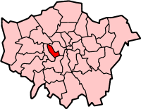
North Kensington shown within Greater LondonOS grid reference TQ255795 London borough Kensington & Chelsea Ceremonial county Greater London Region London Country England Sovereign state United Kingdom Post town LONDON Postcode district W10, W11 Dialling code 020 Police Metropolitan Fire London Ambulance London EU Parliament London UK Parliament Regent's Park and Kensington North London Assembly West Central List of places: UK • England • London North Kensington is an area of west London lying north of Notting Hill Gate and south of Harrow Road.
North Kensington is the key neighbourhood of Notting Hill. It is where most of the violence of the Notting Hill race riots of 1958 occurred, where the Notting Hill Carnival started and where most of the scenes in the film Notting Hill were shot.
Even the area’s main transport hub, Ladbroke Grove tube station, was originally called Notting Hill from its opening in 1864 until 1880, and Notting Hill & Ladbroke Grove between then and 1919, when it was renamed Ladbroke Grove (North Kensington). It acquired its current more simple name in 1938. The area was also once served by St. Quintin Park and Wormwood Scrubs railway station, until it closed in 1940.[citation needed]
Estate agents now call the super-rich area to the south Notting Hill; they are in fact referring to the neighbourhoods of Notting Hill Gate and Holland Park.[citation needed]
North Kensington was once an area well known for its slum housing, as documented in the photographs of Roger Mayne, but housing prices have now risen and the area is considered exclusive and upscale.
Waves of immigrants have arrived for at least a century including, but certainly not limited to, the Spanish, the Irish, the Jews, the West Indians, the Moroccans and many from the Horn of Africa and Eastern Europe. This constant renewal of the population makes the area one of the most cosmopolitan in the world.[citation needed]
Though Ladbroke Grove is the area’s main thoroughfare, its best known street is Portobello Road with its street market. Many locals say that Golborne Road, at the northern end of Portobello Road, is a good representation of what Portobello Road was like before companies like Starbucks and American Apparel colonised Portobello.
North Kensington also has the largest Moroccan population in England.[citation needed]
Contents
Crossrail
At a site just to the east of the Old Oak Common site, Kensington and Chelsea Council has been pushing for a station at North Kensington / Kensal[1] off Ladbroke Grove & Canal Way, as a turn-back facility will have to be built in the area anyway. Siting it at Kensal Rise, rather than next to Paddington itself, would provide a new station to regenerate the area.[2][3][4] Amongst the general public there is a huge amount of support for the project and Mayor Boris Johnson stated that a station would be added if it did not increase Crossrail's overall cost; in response, Kensington and Chelsea Council agreed to underwrite the projected £33 million cost of a Crossrail station, which was received very well by the residents of the Borough.[5] TfL is conducting a feasibility study on the station and the project is backed by National Grid, retailers Sainsbury's and Cath Kidston, and Jenny Jones (Green Party member of the London Assembly).[6]
Notable Residents and Natives
- Joss Ackland, actor, born in North Kensington on February 29, 1928.
- David Cameron, prime minister and leader of the Conservative Party resides in North Kensington.
- Nick Clarke, radio and television presenter and journalist, lived and died in North Kensington.
- Danny Dichio, footballer, grew up in North Kensington.
- Sabrina Guinness, former girlfriend of Prince Charles, resides in North Kensington.
- Martin Lewis, financial journalist, resides in North Kensington.
- Mary Miller, television and theatrical actress, resides in North Kensington.
- Alan Mullery, footballer, born in Notting Hill November 23, 1941.
- John Murray, Middlesex and England wicketkeeper, born in North Kensington, April 1, 1935.
- Reg Routledge, Middlesex cricketer, born in North Kensington 1920.[citation needed]
- Kim Yahya, Molecular biophysicist and philosopher.[citation needed]
References
- ^ "The case for Kensal crossrail". Royal Borough of Kensington and Chelsea. undated. http://www.rbkc.gov.uk/newsroom/councilstatements/crossrailstation.aspx. Retrieved 26 June 2011.
- ^ "Case for a Crossrail station gains momentum" (Press release). Royal Borough of Kensington and Chelsea. 1 July 2010. http://www.rbkc.gov.uk/pressrelease/pressreleasePage.aspx?id=3387.
- ^ Bloomfield, Ruth (24 August 2010). "Study to explore adding Crossrail station at Kensal Rise". Building Design (London). http://www.bdonline.co.uk/news/study-to-explore-adding-crossrail-station-at-kensal-rise/5004540.article.
- ^ "Crossrail at Kensal Rise back on the cards?". London Reconnections (blog). 27 August 2010. http://londonreconnections.blogspot.com/2010/08/crossrail-at-kensal-rise-back-on-cards.html.
- ^ "Council to pay for Crossrail station". London Evening Standard. 25 March 2011. http://www.thisislondon.co.uk/standard/article-23935561-council-to-pay-for-crossrail-station.do.
- ^ Kensal Crossrail station would 'transform' the area, says deputy mayor. Regeneration + Renewal. 16 May 2011.
External links
- Notting Hill Nonsense, a website about life in North Kensington, the true heart of Notting Hill.
- Golborne Life, the community website for the Golborne Road area of North Kensington.
Categories:- Districts of London
- Districts of Kensington and Chelsea

Wikimedia Foundation. 2010.