- Central Illinois Regional Airport
-
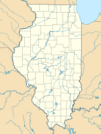
Central Illinois Regional Airport at Bloomington-Normal IATA: BMI – ICAO: KBMI – FAA LID: BMI Location of Airport in Illinois Summary Airport type Public Owner Bloomington-Normal Airport Authority Serves Bloomington / Normal, Illinois Elevation AMSL 871 ft / 265 m Coordinates 40°28′38″N 088°54′57″W / 40.47722°N 88.91583°W Runways Direction Length Surface ft m 2/20 8,000 2,438 Concrete 11/29 6,525 1,989 Asphalt/Concrete Statistics (2007) Aircraft operations 41,980 Based aircraft 105 Source: Federal Aviation Administration[1] Central Illinois Regional Airport at Bloomington-Normal (IATA: BMI, ICAO: KBMI, FAA LID: BMI) is a public use airport located three nautical miles (6 km) east of the central business district of the city of Bloomington and southeast of the town of Normal, in McLean County, Illinois, United States. It is owned by the Bloomington-Normal Airport Authority.[1] It is also known as Central Illinois Regional Airport and informally known as CIRA.
Contents
Facilities and aircraft
Central Illinois Regional Airport covers an area of 1,968 acres (796 ha) at an elevation of 871 feet (265 m) above mean sea level. It has two runways: 2/20 with a 8,000 x 150 ft (2,438 x 46 m) concrete surface and 11/29 with a 6,525 x 150 ft. (1,989 x 46 m) asphalt/concrete surface.[1]
For the 12-month period ending September 7, 2007, the airport had 41,980 aircraft operations, an average of 115 per day: 70% general aviation, 23% air taxi, 6% scheduled commercial and <1% military. At that time there were 105 aircraft based at this airport: 78% single-engine, 10% multi-engine and 12% jet.[1]
On November 5, 2001, the airport opened a new $14 million terminal building, which was three times larger than the previous terminal. The new terminal currently has four ground level boarding gates (Gates 1-4) and five second level gates (Gates 5-9). Gates 4, 5, and 8 are equipped with jetways. Gates 6, 7, and 9 are jetway capable, but are not currently equipped. The terminal hosts two baggage carousels on the ground level. In addition, a business center open to the general public, conference rooms and a VIP lounge cater to busy business travelers. Wireless Internet access is available at no charge throughout the building.
Apart from the terminal, CIRA also has a healthy general aviation presence. The Fixed Based Operator on the field, Image Air, offers standard FBO services and amenities, as well as private and advanced flight training.
Hangar rental, fueling, and aircraft maintenance facilities are also available for private plane owners.
The Prairie Aviation Museum is located on the west side of the airport. It is open for public viewing on Tuesday evening and all day on Saturday and Sunday. It exhibits more modern ex USAF and US Navy aircraft.
Airlines and destinations
Airlines Destinations AirTran Airways Atlanta, Fort Myers, Orlando [all end June 3, 2012][2] American Connection operated by Chautauqua Airlines Chicago-O'Hare American Eagle Dallas/Ft. Worth Delta Connection operated by Atlantic Southeast Airlines Atlanta Delta Connection operated by Comair Atlanta, Detroit Delta Connection operated by Pinnacle Airlines Atlanta, Detroit, Minneapolis/St. Paul References
- ^ a b c d FAA Airport Master Record for BMI (Form 5010 PDF), effective 2008-04-10
- ^ http://pressroom.airtran.com/phoenix.zhtml?c=201565&p=irol-newsArticle&ID=1629590&highlight=
External links
- Central Illinois Regional Airport at Bloomington-Normal, official web site
- FAA Airport Diagram (PDF), effective 20 October 2011
- Resources for this airport:
- AirNav airport information for KBMI
- ASN accident history for BMI
- FlightAware airport information and live flight tracker
- NOAA/NWS latest weather observations
- SkyVector aeronautical chart for KBMI
- FAA current BMI delay information
Aviation in Illinois Primary airports O'Hare International Airport · Chicago Midway International Airport · Quad City International Airport · Central Illinois Regional Airport · General Wayne A. Downing Peoria International Airport · University of Illinois Willard Airport · Chicago Rockford International Airport · Abraham Lincoln Capital Airport · MidAmerica St. Louis Airport · Decatur Airport · Williamson County Regional Airport 
Military Airlines Air Illinois (1970-1984) · Chicago Air (1985-1986) · Festival Airlines (2006) · Midway Airlines (1976-1991) · Mississippi Valley Airlines (1969-1985) · United Airlines (founded 1927) Aviation-related Categories:- Airports in Illinois
- Buildings and structures in McLean County, Illinois
Wikimedia Foundation. 2010.

