- Abbotsford, British Columbia
-
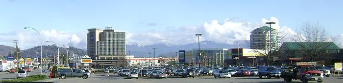
City of Abbotsford Partial Abbotsford skyline from Mill Lake

FlagNickname(s): City in the Country, Raspberry Capital of Canada Motto: "Unus Cum Viribus Duorum" (Latin)
"One with the strength of two"Coordinates: 49°2′30″N 122°14′41″W / 49.04167°N 122.24472°W Country  Canada
Province  British Columbia
Region Fraser Valley/Lower Mainland Regional District Fraser Valley Regional District Founded 1892 Incorporated 1945 Government – Mayor Bruce Banman Area – City 359.36 km2 (138.7 sq mi) Elevation 38 m (124 ft) Population (2006) – City 123,864 – Density 344.7/km2 (892.8/sq mi) – Metro 159,020 (Census Metropolitan Area) Demonym Abbotsfordian[citation needed] Time zone PST (UTC-8) – Summer (DST) PDT (UTC-7) Area code(s) 604, 778 Website http://www.abbotsford.ca Abbotsford is a Canadian city located in the Lower Mainland of British Columbia, adjacent to Greater Vancouver. It is the fifth largest municipality in British Columbia, home to 123,864 people (2006).[1] Its Census Metropolitan Area, which includes the District of Mission, is the 23rd largest in Canada, with 159,020 people (2006).[1] Abbotsford has the third highest proportion of visible minorities among Census Metropolitan Areas in Canada, after the Greater Toronto Area and Greater Vancouver.[2]
Abbotsford is the largest municipality by area in British Columbia.[3] It is home to the University of the Fraser Valley, TRADEX and Abbotsford International Airport, which hosts the Abbotsford International Airshow.
The municipality's southern boundary is the Canada–United States border, across which is Sumas, Washington. In Canada, it is bordered by Langley to the west, the Fraser River and Mission to the north, and Chilliwack to the east. Much of Abbotsford has dramatic views of Mount Baker (to the southeast) and the Coast Mountains (to the north).
Contents
History
 Flag of the District of Abbotsford (1992-1995)
Abbotsford's colonial development began when the Royal Engineers surveyed the area in response to the Gold Rush along the Fraser River in 1858. This led to the building of Yale Road (today Old Yale Road), the first transportation route to link the Fraser Valley. Settlement grew and the production of butter, milk and tobacco began by the late 1860s. In 1889 former Royal Engineer John Cunningham Maclure applied for a crown grant to obtain the 160 acres (0.65 km2) that would become Abbotsford.
The Maclures named the land Abbotsford after family friend Harry Abbott, the Western Superintendent of the Canadian Pacific Railway.[4] The title passed hands to Robert Ward, who filed a town site subdivision on July 9, 1891. Also in 1891, the CPR built a railway line through the area that connected Mission with Sumas. This route was the only rail connection between Vancouver and Seattle until 1904.
The Village of Abbotsford was incorporated in 1892. At that time Robert Ward sold many of the lots to private investors, but also sold off a significant portion to the Great Northern Railway’s subsidiary company the Vancouver, Victoria and Eastern Railway. The British Columbia Electric Railway (BCER) arrived in 1910. The Interurban, as the BCER tram linking Abbotsford with Vancouver and Chilliwack, was called, was discontinued in 1950, but BCER's successor BC Hydro retains the right to re-introduce passenger rail service. Service to Vancouver currently runs from neighbouring Mission by way of the West Coast Express.
The most notable natural disaster to hit Abbotsford was a major flood of the Fraser River in 1948.
1972 saw the amalgamation of the Village of Abbotsford and the District of Sumas into the District of Abbotsford. The District of Abbotsford amalgamated with the District of Matsqui in 1995 to become the City of Abbotsford.
Government
 Abbotsford City Hall
The City of Abbotsford uses a Council-Manager system of local government. The current Mayor and Council were elected on November 15, 2008. The current mayor is Bruce Banman. Councillors elected in 2008 are: Patricia Ross (9% of popular vote), Lynne Harris (8%), Moe Gill (8%), John Smith (7%), Simon Gibson (6%), Les Barkman (6%), Dave Loewen (6%), and Bill MacGregor (6%). School trustees elected are: Joanne Field, Korky Neufeld, Shirley Wilson, Cindy Schafer, John R. Sutherland, Uultsje DeJong, and Preet S. Rai.[5]
The Abbotsford flag and coat of arms are the same, featuring straight, diagonal crosses representing Abbotsford as at a "crossroads". At the centre is a strawberry blossom to symbolize the local berry industry. The flag of Abbotsford was originally blue in colour. The change to green was initiated in 1995 when the District of Abbotsford and the District of Matsqui amalgamated to create the City of Abbotsford.
Demographics
Census Population 1911 300 1931 510 1941 562 1951 785 1961 888 1971 706 1981 12,745 1991 18,864 2001 115,463 2006 123,864 Est. 2007 131,827 Ethnicities and visible minorities
Abbotsford has the third highest proportion of visible minorities among Census Metropolitan Areas in Canada, after the Greater Toronto Area and Greater Vancouver.[2]
The largest racial group is European Caucasian, comprising approximately 73.6 percent of the population. This group includes German, Dutch, British, Irish, Scandinavian and Slavic ethnic origins.[6] The next largest racial group in Abbotsford is South Asian (countries of India, Pakistan, Bangladesh and Sri Lanka) comprising 19.1 percent of the population. This is followed by Aboriginals at 2.9 percent of the population (which includes indigenous peoples from other parts of Canada and the United States) and Chinese at 1.69 percent.
26.1 percent of the city's population was born outside of Canada. Of that percentage, a majority is from South Asia, followed by groups from China, South Korea, Southeast Asia and Latin America. English is the primary language spoken, with 78.7 percent of the population having it as their first language.
Ethnic Origin[7] Population Percent of 156,640* Comments Cornish 10 0.01% English 42,190 26.93% Irish 21,430 13.68% Manx 40 0.03% Scottish 28,695 18.32% Welsh 3,665 2.34% misc. British Isles, n.i.e.** 2,265 1.45% Acadian 55 0.04% French 13,725 8.76% Inuit 50 0.03% Métis 2,670 1.70% North American Indian 5,335 3.41% incl. First Nations, Native Americans and Alaska Natives American 2,320 1.48% Canadian 30,415 19.42% Newfoundlander 65 0.04% Québécois 55 0.04% Barbadian 15 0.01% Carib 15 0.01% Guyanese 20 0.01% Haitian 135 0.09% Jamaican 305 0.19% Kittitian/Nevisian 10 0.01% Puerto Rican 15 0.01% St. Lucian 10 0.01% Trinidadian/Tobagonian 95 0.06% Vincentian/Grenadinian 15 0.01% West Indian 35 0.02% Caribbean, n.i.e.** 15 0.01% Aboriginal from Central/South America 40 0.03% Argentinian 35 0.02% Belizian 20 0.01% Brazilian 130 0.08% Chilean 110 0.07% Colombian 150 0.10% Costa Rican 55 0.04% Ecuadorian 10 0.01% Guatemalan 85 0.05% Hispanic 10 0.01% Honduran people 25 0.02% Maya 30 0.02% Mexican 475 0.30% Nicaraguan 35 0.02% Panamanian 10 0.01% Paraguayan 195 0.10% Peruvian 10 0.01% Salvadoran 540 0.35% Venezuelan 65 0.04% misc. Latin, Central or South American, n.i.e.** 160 0.01% Austrian 1,500 1.00% Belgian 620 0.40% Dutch (Netherlands) 16,645 10.63% % not incl. Frisians or Flemish Flemish 110 0.07% Frisian 160 0.10% German 32,580 20.80% Swiss 1,215 0.78% Finnish 1,210 0.77% Danish 1,950 1.24% Iceland 930 0.59% Norwegian 4,715 3.01% Swedish 4,240 2.71% misc. Scandinavian, n.i.e.** 310 0.20% may include Sami and Kven Estonian 175 0.11% Latvian 40 0.03% Lithuanian 130 0.08% Byelorussian 70 0.05% Czech 590 0.38% Czechoslovakian 230 0.15% Slovak 190 0.12% Hungarian (Magyar) 2,150 1.37% Polish 4,940 3.15% Romanian 1,065 0.68% Russian 7,420 4.73% Ukrainian 8,090 5.16% Albanian 135 0.09% Bosnian 10 0.01% Bulgarian 60 0.04% Croatian 245 0.16% Greek 655 0.42% Italian 3,675 2.35% Kosovar 25 0.02% Macedonian 45 0.03% Maltese 55 0.04% Portuguese 745 0.48% Serbian 100 0.08% Sicilian 10 0.01% Slovenian 125 0.08% Spanish 1,600 1.02% Yugoslav, n.i.e.** 290 0.19% Basque 10 0.01% Gypsy (Roma) 35 0.02% misc. Slav (European) 40 0.03% Ethnic groups in Europe, n.i.e.** 260 0.17% Afrikaner 25 0.02% Bantu 10 0.01% Black 140 0.09% Congolese (Zairian) 20 0.01% Congolese, n.o.s.*** 15 0.01% Dinka 40 0.03% Ethiopian 10 0.01% Ghanaian 50 0.03% Kenyan 35 0.02% Mauritian 20 0.01% Nigerian 50 0.03% South African 415 0.26% Sudanese 20 0.01% Tanzanian 15 0.01% misc. African, n.i.e.** 130 0.08% Egyptian 25 0.02% Iraqi 15 0.01% Lebanese 85 0.05% Maghrebi origins 10 0.01% Palestinian 65 0.04% Syrian 50 0.03% misc. Arab, n.i.e. 75 0.05% Afghan 50 0.03% Iranian 185 0.12% Israeli 15 0.01% Kurd 35 0.02% Tatar 10 0.01% Turk 120 0.08% Indian 23,445 16.47% Goan 15 0.01% Nepali 45 0.03% Pakistani 195 0.12% Punjabi 2,040 1.30% Sri Lankan 50 0.03% Tamil 10 0.01% misc. South Asian, n.i.e.** 820 0.52% Cambodian 50 0.03% Chinese 2,585 1.65% Filipino 740 0.47% Indonesian 205 0.13% Japanese 890 0.57% Korean 1,665 1.06% Laotian 240 0.15% Malaysian 50 0.03% Taiwanese 75 0.05% Thai 100 0.06% Vietnamese 1,150 0.73% East or Southeast Asian, n.i.e.** 85 0.05% Australian 265 0.17% New Zealander 145 0.09% Fijian 100 0.06% Hawaiian 50 0.03% Samoan 10 0.01% *Percentages total more than 100% due to multiple responses e.g. German-East Indian, Norwegian-Irish-Polish. **Not included elsewhere. ***Not otherwise specified. Ethnic Origin by Regional grouping[2] Population Percent of 156,640 British Isles origins 65,495 41.81% French origins1 13,745 8.77% Aboriginal origins2 7,860 5.02% Other North American origins3 31,870 20.34% Caribbean origins 665 0.43% Latin, Central and South American origins4 2,070 1.32% Western European origins5 46,395 29.62% Northern European origins6 12,140 7.75% Eastern European origin7 21,765 13.89% Southern European origins 7,470 4.77% Other European origins8 840 00.54% African origins9 990 0.63% Arab origins10 320 0.20% West Asian origins11 410 00.26% South Asian origins 25,800 16.47% East and Southeast Asian origins 7,375 4.71% Oceania origins12 565 0.36% Footnotes to Ethnic Origin by Regional Grouping 1Census Canada does not distinguish between European and North American French origins. This category includes Acadians; Québécois-only (not multiple responses) are in North American origins. 2Métis, First Nations, Inuit, Native Americans, Alaska Natives 3American, Canadian, Québécois, Newfoundlander, does not include aboriginal peoples 4Including aboriginal people of South and Central America 5Germany, Austria, Benelux, Switzerland 6Finland, Sweden, Denmark, Norway, Iceland 7Slavic and Baltic countries, plus Hungary and Albania 8Roma (Gypsy), Jewish, Basque, misc. Slav 9Excluding Arab countries of the Maghreb, including Afrikaners and other white South Africans 10Including the Maghreb/North Africa 11Afghan, Iranian, Azerbaijani, Kurdish, Turkish, Georgian, Armenian 12Pacific Islands, Australia, New Zealand Abbotsford's largest religious group is Christian at 61.4 percent of the population. The Lutheran and Anabaptist (Mennonite Brethren and Mennonite Church) denominations make up the largest congregations. The next largest religious group is Sikh, comprising 13.4 percent of the population. The city contains the first Sikh Gurdwara built in Canada (in 1911), which is also the oldest in North America. It is now a historic site in Abbotsford. It is now over 100 years old.
Quick facts
- Population (2007): 131,827
- % Change (2001–2006): 7.2
- Resident labour force (2001): 58,140
- Dwellings (2006): 45,286
- Area (km2): 359.36
- Density (persons per km2) (2006): 344.7
- Gross income of population (2002): $2,337,376,686
- Average household income (2001): $56,165
- Average individual income (2001): $26,794
Climate
Climate data for Abbotsford Month Jan Feb Mar Apr May Jun Jul Aug Sep Oct Nov Dec Year Record high °C (°F) 17.7
(63.9)20.6
(69.1)24.9
(76.8)29.8
(85.6)36
(97)34.7
(94.5)42.0
(107.6)36.3
(97.3)37.5
(99.5)29.3
(84.7)20.6
(69.1)18.2
(64.8)38.0
(100.4)Average high °C (°F) 5.8
(42.4)8.5
(47.3)11.3
(52.3)14.5
(58.1)17.8
(64.0)20.3
(68.5)23.4
(74.1)23.8
(74.8)21
(70)15
(59)9.1
(48.4)5.9
(42.6)14.7 Daily mean °C (°F) 2.6
(36.7)4.7
(40.5)6.8
(44.2)9.5
(49.1)12.5
(54.5)15.1
(59.2)17.5
(63.5)17.7
(63.9)15
(59)10.2
(50.4)5.7
(42.3)2.8
(37.0)10 Average low °C (°F) −0.6
(30.9)0.8
(33.4)2.3
(36.1)4.4
(39.9)7.2
(45.0)9.9
(49.8)11.5
(52.7)11.5
(52.7)8.8
(47.8)5.4
(41.7)2.3
(36.1)−0.3
(31.5)5.3 Record low °C (°F) −21.1
(−6.0)−18.9
(−2.0)−12.8
(9.0)−4.4
(24.1)−2.2
(28.0)1.1
(34.0)2.2
(36.0)3.3
(37.9)−1.7
(28.9)−7.5
(18.5)−16.7
(1.9)−20
(−4)−21.1
(−6.0)Precipitation mm (inches) 198.1
(7.799)160.3
(6.311)146.4
(5.764)120.2
(4.732)99.1
(3.902)78.9
(3.106)50.2
(1.976)49.3
(1.941)75.9
(2.988)145.3
(5.72)240.9
(9.484)208.6
(8.213)1,573.2
(61.937)Sunshine hours 67.2 89.9 126 168.5 210.2 215.4 282.6 256 193.7 127 66.6 62.8 1,865.9 Source: Environment Canada[8]
Like many locations of a similar latitude, Abbotsford has four distinct seasons. However, the proximity to the Pacific Ocean provides milder winters, along with much greater rainfall than inland areas of the country. The influence of the Pacific also makes the transition between seasons more gradual compared to locations further inland.
Spring
Spring starts out cool and generally showery before gradually turning warmer and drier. Below freezing temperatures may occur overnight into May, and snow may fall until the end of April, but it normally melts quickly. Normal daytime highs range from near 10 °C in March to the low 20's in June. During periods of warmth, temperatures can reach into the mid 20's C during March and April, and can exceed 30 °C from May onwards.
Summer
Summer on the west coast is known for its relative dryness. It is not uncommon to receive little or no rainfall for weeks at a time. August averages only 20% of November's rainfall, and only about 16% of annual precipation falls between June 1st and October 1st. Un-watered grass often turns brown in July, and may not need to be cut until September, when significant rains become more likely.Rain that falls during summer is normally quite light, but can occasionally come in the form of thunderstorms. Thunderstorms typically signal the end of a period of hot weather and a return to cooler, cloudier conditions.
Summers in Abbotsford are relatively warm compared to Vancouver, and can become quite hot on occasion. The average daily high in August is 23.8 °C, but highs over 30 °C are not uncommon. The highest temperature ever recorded was 38.0° C on July 29th, 2009 at Abbotsford Airport.
Nights are usually fairly comfortable, even when the days are hot. It is rare for the temperature to stay above 20 °C at night, often falling as low as 10 °C. During warm spells, the temperature may range by as much as 20 °C in 12 hours (for example; a morning low of 11° C and an afternoon high of 31 °C).
Autumn
Autumn is characterized by increasingly unsettled and cooler conditions. Temperatures may still reach the mid or even upper 20's C at first, but rainfall becomes more frequent and temperatures drop in October. Frost may occur in late September, and at any time during October.October 1st heralds the unofficial start of the rainy season, but the heaviest rains occur in November, which averages 234.3 mm of rain and 6.3 cm of snow (240.9 mm combined). According to Environment Canada, Abbotsford is the fourth wettest of 100 major cities in Canada, with 1573.2 mm of combined rain and snow annually. A weather pattern known as the Pineapple Express often brings significant rainstorms in autumn and winter.
The earliest snowfall has been known to occur at the end of October, but more frequently occurs in November. In milder years, there may be no snow until December. Occasionally, there will be a spell of sub-freezing weather in late November or early December. This may be accompanied by snow and high winds, but is usually short-lived.
Winter
With a mean temperature of about 2.5 °C in January, Abbotsford's winters are cool, but relatively mild compared to most of Canada. However, the overcast and damp conditions may be subjectively less pleasant than colder sunny weather.The coldest month on record at Abbotsford International Airport is January 1950, with a mean temperature of -8.6 °C (an average high of -4.7 °C and an average low of -12.4 °C). It was during this time that Abbotsford also set its all-time record low temperature of -21.1 °C, on the 18th of that month.
Snow occurs frequently in the surrounding mountains, but less often closer to sea level. There is a general misconception by visitors and residents in other parts of the country that the area does not receive any snow at all, but the truth is that Abbotsford averages 63.5 cm of snow per year, and there has never been a winter when traceable snow has not been observed at both Abbotsford International Airport and Vancouver International Airport. As a matter of fact, Environment Canada currently ranks Abbotsford 44th and Vancouver 59th under the category "Most huge snowfall days (25 cm or more)" out of 100 major Canadian cities, placing them above cities such as Calgary (74th place) and Toronto (99th place).
Snow in Abbotsford tends to be quite wet, which when combined with typical winter temperatures rising above and falling below freezing throughout the course of the day, can make for unusually slippery road conditions. Years or even months with snowfall surpassing the 100 cm mark are also not completely exceptional; the former occurred twice in the 1990s, while January of 1954 saw more than 140 cm of snow. Snow can fall at any time between October and May.
Snowfall accumulations tend to vary greatly by year and season. During the winter of 1990-1991, 152.3 cm fell; the next winter, only a trace of snow was recorded. In the year 1996, 199.2 cm (over six feet) was recorded; the next year, only 6.2 cm fell. Serious snow storms occurred most recently in December of 2008, when as much as 60 cm fell in the days leading up to Christmas. Abbotsford can expect a White Christmas once every five years on average.
Economy
62% of Abbotsford residents work in the city of Abbotsford itself. Most of the remaining 38% commutes to Mission, Chilliwack or to Vancouver and its suburbs (primarily Surrey and Langley).[9]
More than 25% of Abbotsford's work force commutes to Abbotsford from other municipalities.[9]
The Conference Board of Canada has identified the local economy as one of the most diverse in the country.[10] Abbotsford's main industries are agriculture, transportation, manufacturing and retail. The city earns the highest dollar per acre of agricultural land in the country, greater than the Niagara Region and the North Okanagan.[10] The city is home to three federal prisons, each of which employs between 200 and 500 officers and support staff. There is also a growing aerospace industry led by Cascade Aerospace and Conair Group Inc.
Education
Public elementary, middle, and secondary schools are administered by School District 34 Abbotsford. Private schools include St. John Brebeuf Regional Secondary, Mennonite Educational Institute, Abbotsford Christian School and the Dasmesh Punjabi School.
Post Secondary institutions in the city include the University of the Fraser Valley, religious institutions such as Columbia Bible College and Summit Pacific College, as well as career colleges such as Career Gate Community College, Sprott-Shaw Community College, Vancouver Career College, Metis Skills & Employment Centre, and CDI College.
There is also a virtual school called "Abbotsford Virtual School" that offers more than 30 semestered online courses. This school offers a unique Animation and Modeling program that teaches students aspects of the video gaming industry.
Transportation
Public bus transportation is provided by the regional transit system ValleyMAX. Passenger rail service to Vancouver currently runs from nearby Mission by way of the West Coast Express.
Air links are provided by the Abbotsford International Airport. The airport is one of the fastest growing commercial airports in western Canada, and acts as a reliever airport for Vancouver International Airport.[citation needed] WestJet provides regular scheduled service from the airport, due to its proximity to Vancouver's eastern suburbs. The airport is also the home of the annual Abbotsford International Airshow.
Major transportation routes leading into Abbotsford are the Trans-Canada Highway (#1), Abbotsford-Mission Highway (#11) and the Fraser Highway (#1A). Access to the United States is via the Huntingdon border crossing.
Media
Main article: Media in the Fraser ValleyDue to its proximity to Vancouver, most Vancouver television and radio stations are also available throughout the Fraser Valley, although in a few cases there are repeater stations licensed to different centres in the region. Some stations from Washington, USA is also available in the Fraser Valley due to its proximity to the border.
Sports
The NHL's Calgary Flames have relocated their AHL affiliate to Abbotsford.[11] The American Hockey League approved the franchise relocation on April 28, 2009,[12] and on May 14 of that year, the team name was announced as the Abbotsford Heat.[13]
Abbotsford's Jane and Gerry Swan Track at Rotary Stadium is home to the Valley Royals Track & Field Club, who have produced numerous Olympians including two for the 2008 Olympics. Rotary Stadium is also home to the Canadian Junior Football League's Abbotsford Air Force; however, the Air Force fell into non-playing status for the 2007 and 2008 seasons.
The Abbotsford Pilots of the Pacific International Junior Hockey League (Junior B level) play at MSA Arena, which is Abbotsford's 2nd largest arena at just over 400 seats. Abbotsford was considered as a possible home for the Chilliwack Chiefs (Junior A), who were forced to move in 2006 when the Chilliwack Bruins (a WHL expansion team) took over their arena, Prospera Centre. Abbotsford would have become the home of the Chiefs if the city had supported them in building a new arena; instead, the Chiefs moved to Langley. Ironically, construction has now been completed in Abbotsford on a far bigger sports & entertainment centre (with 7,500 seats).[14]
Abbotsford Minor Hockey is one of the largest associations in British Columbia with more than 1000 players registered from the ages of 5 through 18 years old. This association is recognized by many as a model and a leader in the development of minor hockey programs, and several Abbotsford-raised players have gone on to the highest levels of this sport. In the 2005-2006 hockey season, Abbotsford's Bantam AAA team were ultimately the Western Canadian Bantam Champions, and eight individual players from this team (the most ever) were selected in the 2006 WHL Bantam Draft. <http://www.abbotsfordminorhockey.com/>
Abbotsford has a superior Youth soccer program, winning 2 national titles, and numerous provincial titles. It is also home of soccer all stars Sophie Schmidt, Brad Petoom and Adam Lang. Abbotsford is home to the Abbotsford Mariners of the United Soccer Leagues Premier Development League, the highest level of amateur soccer in North America.
Abbotsford is home to many high school sports, with Abbotsford Collegiate, W.J. Mouat Secondary, Rick Hansen Secondary, Robert Bateman Secondary, St. John Brebeuf Secondary, Yale Secondary, and the Mennonite Educational Institute, among others, doing very well in track and field, volleyball, basketball, and football. These schools have consistently ranked among the highest in the province. The Yale Secondary Senior Boys Basketball Team, under Coach Al Friesen, won the 2008 ‘AAA’ provincial boys' basketball championship.[15]
Abbotsford's rugby club supports three men's teams, two women's teams, U19 men's and women's, U15 U16 and U17 men's, and a great mini rugby program. Many of Abbotsford's players have gone on to play for Canada, such as Erin Lockwood, Ryan McWhinney, Scott Hunter, Bryn Keys, and Brodie Henderson.[16]
In Olympic sports, Abbotsford's Alana Kraus has won medals in short-track speed skating.
Club League Sport Venue Established Championships Abbotsford Heat AHL Ice hockey Abbotsford Entertainment & Sports Centre 2009 0 Abbotsford Pilots PIJHL Ice hockey MSA Arena 1987 3 Abbotsford Mariners USL Soccer Bateman Park 2003 0 Abbotsford RFC FVRU Rugby CFV Exhibition Park 1972 0 Crime
As of July 20, 2006, the Abbotsford metropolitan area as defined by Census Canada (which includes Mission) had the highest property crime rate and the second highest violent crime rate for cities with a population of 100,000 to 500,000 in Canada.[17]
Additionally, as of October 26, 2010 the metropolitan area had the highest rate of homicides nationally for two years running with a rate of 5.22 homicides per 100,000 population. (Versus the national average of 1.81 per 100,000.)[18][19]
The City of Abbotsford has its own municipal police force, one of eleven municipal police forces in British Columbia. It is the third largest municipal police force in British Columbia (behind Vancouver and Victoria). As of 2006, the Abbotsford Police Department employed nearly 200 officers and 80 civilian employees.
The Abbotsford Police Department was officially formed in 1995 when the District of Matsqui and the District of Abbotsford amalgamated to become the City of Abbotsford. Prior to the amalgamation, the District of Matsqui was patrolled by the Matsqui Police and the District of Abbotsford by the RCMP. During the referendum citizens elected to keep a municipal police force.
The Abbotsford Police Department were involved in the investigation and arrest of the "Abbotsford killer" Terry Driver.[20]
Areas
These places represent parts of the city that have more than one neighbourhood in them.
- Abbotsford East
- Abbotsford West
- Aberdeen
- Bradner
- Central Abbotsford
- Matsqui
- Poplar
- Sumas Mountain
- Sumas Prairie
Neighbourhoods
- Aberdeen
- Arnold
- Auguston
- Blueridge
- Bradner
- Clayburn
- Clearbrook
- Downtown
- Eagle Mountain
- Gifford
- Glen Mountain
- Huntingdon
- Kilgard
- Matsqui
- McKinley Heights
- Mount Lehman
- North Poplar
- Peardonville
- Sandy Hill
- South Poplar
- Straiton
- Townline
Neighbouring communities

Maple Ridge Mission Dewdney/Deroche Township of Langley (Aldergrove) 
Chilliwack  Abbotsford

Lynden, Washington Sumas, Washington
Everson, WashingtonMaple Falls, Washington Sister cities
Notable residents
- Karen-Lee Batten
- Jonny Craig
- Ryan Craig
- Kyle Cumiskey
- Brian Doerksen
- Michael Funk
- Chad Kroeger
- Brad Moran
- Greg Neufeld
- Larry Nickel
- Jim Playfair
- Gladys Powers
- David Van der Gulik
- Shane Wiebe
- Evangeline Lilly
- Jordan Pritchett
- Amy Gough
- Victoria Duffield
See also
- List of tallest buildings in Abbotsford, British Columbia
References
- ^ a b "Population and dwelling counts, for Canada, census metropolitan areas, census agglomerations and census subdivisions (municipalities), 2006 and 2001 censuses - 100% data". 2.statcan.ca. 2010-01-06. http://www12.statcan.ca/census-recensement/2006/dp-pd/hlt/97-550/Index.cfm?TPL=P1C&Page=RETR&LANG=Eng&T=203&CMA=932&S=0&O=A&RPP=25. Retrieved 2011-03-10.
- ^ a b c "B.C. is nation's most ethnically diverse province: StatsCan". CBC News. 2008-04-02. http://www.cbc.ca/canada/british-columbia/story/2008/04/02/bc-most-diverse-province.html.
- ^ List of the 100 largest cities and towns in Canada by area
- ^ History of Abbotsford[dead link]
- ^ 2008 Election Results[dead link]
- ^ "Profile of Ethnic Origin and Visible Minorities for Census Metropolitan Areas and Census Agglomerations, 2006 Census, Census Canada/Statistics Canada". 2.statcan.ca. 2010-12-06. Archived from the original on June 29, 2011. http://wayback.archive.org/web/20110629145522/http://www12.statcan.ca/census-recensement/2006/dp-pd/prof/92-591/details/Page.cfm%3FLang%3DE%26Geo1%3DCSD%26Code1%3D5909052%26Geo2%3DPR%26Code2%3D59%26Data%3DCount%26SearchText%3Dabbotsford%26SearchType%3DBegins%26SearchPR%3D01%26B1%3DAll%26Custom%3D. Retrieved 2011-03-10.
- ^ "Profile of Ethnic Origin and Visible Minorities for Census Metropolitan Areas and Census Agglomerations, 2006 Census". 2.statcan.ca. 2008-06-10. http://www12.statcan.ca/english/census06/data/profiles/release/RetrieveProductTable.cfm?Temporal=2006&APATH=3&PID=92631&THEME=80&PTYPE=89103&VID=0&GK=NA&GC=99&FL=0&RL=0&FREE=0&METH=0&S=1&GID=777243#FN358. Retrieved 2011-03-10.[dead link]
- ^ Environment Canada Canadian Climate Normals 1971–2000. Retrieved 14 July 2010.
- ^ a b [1][dead link]
- ^ a b [2][dead link]
- ^ Hall, Vicki (2009-03-12). "Flames' farm team set to move to Abbotsford". Vancouver Province. http://www.theprovince.com/sports/soccer/Flames+farm+team+move+Abbotsford/1382018/story.html. Retrieved 2009-03-16.[dead link]
- ^ [3][dead link]
- ^ "The HEAT is on for 2009-10 AHL season". Fraser Valley Sports & Entertainment Ltd.. 2009-05-14. http://www.fraservalleyahl.com/2009-05-14-news.pdf. Retrieved 2009-05-14.[dead link]
- ^ "Abbotsford sports website". Sporttowncanada.com. http://www.sporttowncanada.com/. Retrieved 2011-03-10.
- ^ 2008 AAA Boys Provincials Archived July 21, 2010 at the Wayback Machine
- ^ http://www.abbotsfordrugby.com/ Abbotsford Rugby website
- ^ Vancouver, The (2006-07-21). "Abbotsford is Canada's theft capital". Canada.com. http://www.canada.com/vancouversun/news/story.html?id=b66ee731-3fb2-4f7d-a32a-acdfac405b45&k=72509. Retrieved 2011-03-10.
- ^ "Homicides by census metropolitan area". Statcan.gc.ca. 2010-10-26. http://www.statcan.gc.ca/daily-quotidien/101026/t101026a1-eng.htm. Retrieved 2011-03-10.
- ^ "Homicides by province and territory". Statcan.gc.ca. 2010-10-26. http://www.statcan.gc.ca/daily-quotidien/101026/t101026a2-eng.htm. Retrieved 2011-03-10.
- ^ Scott Steele (May 20, 1996), "Abbotsford Killer Arrested", Maclean's (The Canadian Encyclopedia), http://www.thecanadianencyclopedia.com/index.cfm?PgNm=TCE&Params=M1ARTM0010672, retrieved 2009-06-28
External links
Subdivisions of British ColumbiaSubdivisions Regions · Regional districts · Forest Regions and Forest Districts · School districts · Land DistrictsSettlements Urban centres Cities Abbotsford · Armstrong · Burnaby · Campbell River · Castlegar · Chilliwack · Colwood · Coquitlam · Courtenay · Cranbrook · Dawson Creek · Duncan · Enderby · Fernie · Fort St. John · Grand Forks · Greenwood · Kamloops · Kelowna · Kimberley · Kitimat · Langford · Langley · Merritt · Nanaimo · Nelson · New Westminster · North Vancouver · Parksville · Penticton · Pitt Meadows · Port Alberni · Port Coquitlam · Port Moody · Powell River · Prince George · Prince Rupert · Quesnel · Revelstoke · Richmond · Rossland · Salmon Arm · Surrey · Terrace · Trail · Vancouver · Vernon · Victoria · White Rock · Williams LakeCensus metropolitan areas (CMAs) in Canada by size Toronto, ON · Montreal, QC · Vancouver, BC · Ottawa, ON · Calgary, AB · Edmonton, AB · Quebec City, QC · Winnipeg, MB · Hamilton, ON · London, ON · Cambridge-Kitchener-Waterloo, ON · St. Catharines-Niagara, ON · Halifax, NS · Oshawa, ON · Victoria, BC · Windsor, ON · Saskatoon, SK · Regina, SK · Sherbrooke, QC · St. John's, NL · Barrie, ON · Kelowna, BC · Abbotsford, BC · Greater Sudbury, ON · Kingston, ON · Saguenay, QC · Trois-Rivières, QC · Guelph, ON · Moncton, NB · Brantford, ON · Thunder Bay, ON · Saint John, NB · Peterborough, ON
Coordinates: 49°03′16.6″N 122°19′40.8″W / 49.054611°N 122.328°W
Categories:- Abbotsford, British Columbia
- Populated places on the Fraser River
- Populated places established in 1892


Wikimedia Foundation. 2010.