- Geography of Palau
-
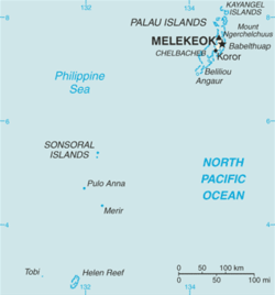

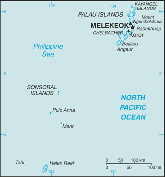
 Map of Palau and its location in Oceania
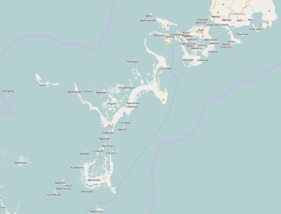
The Republic of Palau consists of eight principal islands and more than 250 smaller ones lying roughly 500 miles southeast of the Philippines. The islands of Palau constitute part of the Caroline Islands chain.
Location: Oceania, group of islands in the North Pacific Ocean, southeast of the Philippines
Geographic coordinates: 7°30′N 134°30′E / 7.5°N 134.5°E
Map references: Oceania
Area:
total: 458 km²
land: 458 km²
water: 0 km²Area - comparative: slightly more than 2.5 times the size of Washington, DC
Land boundaries: 0 km
Coastline: 1,519 km
Maritime claims:
continental shelf: 200-m depth or to the depth of exploitation
exclusive fishing zone: 12 nm
extended fishing zone: 200 nm
territorial sea: 3 nmClimate: wet season May to November; hot and humid
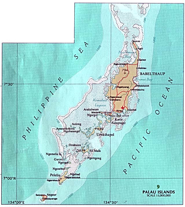
Terrain: varying geologically from the high, mountainous main island of Babeldaob to low, coral islands usually fringed by large barrier reefs
Elevation extremes:
lowest point: Pacific Ocean 0 m
highest point: Mount Ngerchelchauus 242 m (on Babeldaob)Natural resources: forests, minerals (especially gold), marine products, deep-seabed minerals
Land use:
arable land: NA%
permanent crops: NA%
permanent pastures: NA%
forests and woodland: NA%
other: NA%Irrigated land: NA km²
Natural hazards: typhoons (June to December)
Environment - current issues: inadequate facilities for disposal of solid waste; threats to the marine ecosystem from sand and coral dredging, illegal fishing practices, and overfishing
Environment - international agreements:
party to: Biodiversity, Climate Change, Climate Change-Kyoto Protocol, Desertification, Law of the Sea
signed, but not ratified: none of the selected agreementsGeography - note: includes World War II battleground of Peleliu and world-famous rock islands; archipelago of six island groups totaling over 200 islands in the Caroline chain
Extreme points
This is a list of the extreme points of Palau, the points that are farther north, south, east or west than any other location.
- Northern-most point – Ngaruangel Reef, Kayangel state*
- Eastern-most point – Kayangel islet, Kayangel state
- Southern-most point – Round Rock, Helen Reef, Hatohobei state
- Western-most point - Tobi Island, Hatohobei state
- *Note: if submerged reefs are included then Velasco reef is Palau's northern-most point
- See also : Palau
External links
Geography of Oceania Sovereign states Dependencies and
other territories- American Samoa
- Christmas Island
- Cocos (Keeling) Islands
- Cook Islands
- Easter Island
- French Polynesia
- Guam
- Hawaii
- New Caledonia
- Niue
- Norfolk Island
- Northern Mariana Islands
- Pitcairn Islands
- Tokelau
- Wallis and Futuna
Categories:


Wikimedia Foundation. 2010.