- Adamstown, Maryland
Infobox Settlement
settlement_type = Town
subdivision_type = Country
official_name = Adamstown, Maryland
subdivision_name = United States
subdivision_type1 = State
subdivision_name1 = Maryland
subdivision_type2 = County
subdivision_name2 = Frederick
region_link = Frederick County, Maryland
region_type_local = State
region_name_local = Maryland
population_total = 2,920 (approx.)
population_as_of = 2000
area_total_km2 = 65.73
established_date = ca. 1840
established_title = First Named
elevation_m = 93
latd = 39 | latm = 18.675
latNS = N
longd = 77
longm = 28.504
longEW = W
website = http://adamstown.us/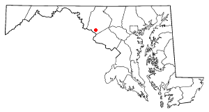
Adamstown is an
unincorporated community located in Frederick County,Maryland , USA. It is named for Adam Kohlenberg, a station agent and first town merchant who owned much of present-day Adamstown.Events
The largest area-wide event is the [http://www.carrollmanorfire.com Carroll Manor Fire Company] Carnival which occurs every June.
History
Adamstown lies in the fertile valley between Sugarloaf and
Catoctin Mountain onCarrollton Manor , a 17,000 acre estate originally owned byCharles Carroll of Carrollton . Until 2000, it was a little-altered representative of mid-19th century linear town planning. It is significant in architecture for its variety of structures, including residential, commercial, industrial, educational, agricultural, and religious buildings. The late 18th century road from Jefferson to Greenfield Mills on theMonocacy River , originally called the Bridal Road, followed the route of the present-day Mountville Road. The 1832 arrival of the railroad to the Manor created the economic and transportation impetus for the development of the community.Adamstown was first known as Davis' Warehouse because Dr. Meredith Davis, a leading county miller, built a warehouse about 1835 where Mountville Road, by then called Jefferson Road, crosses the
Baltimore & Ohio Railroad to store flour from his Greenfield Mills. The first settler in Adamstown was Robert Palmer, an African American "post and railer" who also ran a general store around 1835. Daniel Rhodes of Pennsylvania, the first white settler, was so impressed with the location, he bought a tract of land and laid it off into 12 building lots on the south side of the railroad in 1856. In 1840 when Adam Kohlenburg was appointed the first B&O railway agent, the community became Adamstown after his given name. He was also the first postmaster and ran a general store located in the lot between his home and the railroad. Edward Hebb laid off lots on the north side of the railroad in the 1840s.With Adamstown located so close to the
Potomac River andVirginia , its citizens were almost exclusively loyal to the South. For several months in the spring of 1861, the Minute Men of Adamstown, a militia company composed of three officers, all local doctors, flew the Confederate flag adjacent to their guard post next to the railroad. Many skirmishes in theAmerican Civil War were fought here and the town was often raided. Both the Federal and Confederate troops were constantly moving on Carrollton Manor. On one of these raids, Adam Kohlenburg's entire stock was taken. Local folklore holds that one family had a son fighting for the North and one fighting for the South.In 1902, Jacob Klein's Addition to Adamstown included the area of Washington, Adams, and Tuscarora Streets. The Adamstown Bank was established in 1917 and the building opened in 1919. In 1921 Adamstown had two large grain elevators (Farmers Exchange of Frederick and Thomas & Co.), a blacksmith shop, a carriage works, two garages, a general store, a hardware store, a butcher shop and the Bank. 1921 was also the year that electric lights were first installed in the town.
Demographics
Adamstown is a rapidly growing area with three new developments (540 homes total in Green Hill Manor, Saddle Ridge and Adamstown Commons) under construction since 2000. A fourth development to be constructed on the Carroll Manor Fire Company carnival grounds (including 20-25 single family units and 25-30 multi-family units in the old Adamstown Elementary School) has completed the first phase of the County approval process. Near the end of 2006, 99% of the 300 homes in Green Hill Manor were completed and about a third of the 200 homes in Adamstown Commons, the former Wade Sod Farm, were occupied.
The population in 1880 was 66 and approximately 500 in 1971. As of the
census GR|2 of2000 , there are 2,920 people, 1,049 households and 829 families residing in Adamstown. The racial makeup of the county is 92.7% White, 4.9% Black or African American, 0.2% Native American, 0.7% Asian, 0.0% Pacific Islander, 0.2% from other races, and 1.3% from two or more races. 1.6% of the population are Hispanic or Latino of any race.There are 1,049 households out of which 36.4% have children under the age of 18 living with them, 69.3% are married couples living together, 5.8% have a female householder with no husband present, and 21.0% are non-families. 20.10% of all households are made up of individuals and 9.1% have someone living alone who is 65 years of age or older. The average household size is 2.77 and the average family size is 3.12.
Adamstown's population is spread out with 28.8% under the age of 19, 2.9% from 20 to 24, 29.4% from 25 to 44, 24.3% from 45 to 64, and 14.5% who are 65 years of age or older. The median age is 39.5 years. For every 100 females there are 96.46 males. For every 100 females age 18 and over, there are 97 males.
Local Business
The largest local business is Eastalco (an aluminum smelting plant). The plant curtailed operations in December 2005 when it was unable to continue purchasing electricity at a price they could afford due to electric deregulation in the State of Maryland. Other businesses include Trans-Tech (manufactures RF microwave components), Stups Market, C&H Supply Company and Adamstown Subs & Pizza.
Education
[http://schools.fcps.org/amain/mainpage.cfm?bcid=1070 Carroll Manor Elementary School] services area children from pre-kindergarten through 5th grade. The school also houses part of Frederick County's Challenges Program, a special program for children with autism and other severe communication disorders, and a special education pre-kindergarten. The school is supported by the [http://www.cmespta.com/ Carroll Manor Elementary School PTA] . Current school district boundaries designate [http://schools.fcps.org/bcms/ Ballenger Creek Middle School] and [http://ths.fcps.org/ Tuscarora High School] for continued education.
Geography
Adamstown is located at 39°18.675' North, 77°28.504' West (39.311233, -77.475067).GR|1
Highways
*
*References
*cite book | last = Hume | first = Charlotte | coauthors = Edith Yingling | title = The History of Carrollton Manor | publisher = Adamstown Homemakers Club | date = March 3, 1971 | url = http://adamstown.us/Documents/CMHistory.pdf | location = Adamstown, MD
*cite book | last = Davis | first = Janet | title = Maryland Historic Trust (MHT) Inventory of Historic Properties, Adamstown Survey District | publisher = Maryland Historic Trust| date = 1993| url = http://www.mdihp.net/cfm/dsp_redirect.cfm?id=10317&county=FR | location = Frederick, MD "Note: In order to access click on the link, log on as a guest, and re-enter the link in the address bar to access the report."
External links
* [http://adamstown.us Adamstown Area Website]
*dmoz|Regional/North_America/United_States/Maryland/Localities/A/Adamstown/|Adamstown, Maryland
Wikimedia Foundation. 2010.