- Caddington
-
Coordinates: 51°51′47″N 0°27′24″W / 51.86308°N 0.45679°W
Caddington 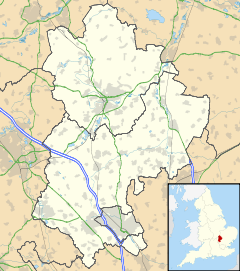
 Caddington
Caddington shown within BedfordshirePopulation 3,846 (Google Earth) OS grid reference TL065195 Unitary authority Central Bedfordshire Ceremonial county Bedfordshire Region East Country England Sovereign state United Kingdom Post town LUTON Postcode district LU1 Police Bedfordshire Fire Bedfordshire and Luton Ambulance East of England EU Parliament East of England UK Parliament Luton South List of places: UK • England • Bedfordshire Caddington (TL 065 195) is a village and civil parish in the Central Bedfordshire district of Bedfordshire, England. It is between the Dunstable/Luton urban area (to the north), and Hertfordshire (to the south).
The western border of the parish is Watling Street, to the west of which is Kensworth. The northern and eastern border are generally formed by the railway line and the M1. To the south-east of the parish is the parish of Slip End, and to the south is Markyate, in Hertfordshire.
Caddington village and the nearby hamlet of Aley Green are in the south of the parish.[1] The hamlet of Chaul End lies in the north of the parish, and at the border with Luton there is Caddington Park with Skimpot in its postal address. The Zouches Farm radio tower is situated in the north-west of the parish.
Contents
History
Caddington was once the centre of a thriving brick industry built around the rich source of clay. A "Caddington Blue" was a well-known engineering brick.[citation needed]The assertion relating to the Caddington blue is regarded by some as a little suspect. During the 1970s Bedfordshire County Council in conjunction with the Royal Commission On Historical Monuments (England), published the book "Brickmaking - A History And Gazetteer". The book identifies 17 specific sites within the Caddington locale which are credited with producing "Greys". The common name for the plum coloured brick produced from the flinty brick earths excavated from an area from Kensworth through Caddington to Stopsley is "Luton Grey".
Much of Caddington is now urban and there has been much residential development in recent years with the provision of local facilities such as shops, schools and a public hall. Caddington still retains its village green and nearby is the medieval parish church, restored in Victorian times[citation needed] Manshead Upper School (formerly Dunstable Grammar School) relocated to Caddington in 1971.
Markyate Priory, disestablished in 1537, was situated in Caddington.
Places of worship
Caddington has a number of local churches:
- All Saints, Church of England, The Green, LU1 4BG. – A lovely 11/12C church in the middle of the village.
- St Thomas Apostle, Roman Catholic Church, Manor Road. (Served from St Margaret of Scotland, Farley Hill, Luton.) – A small church next to the Recreation & Social Club on the south side of the village. Service Saturday 18:00.
- Caddington Baptist Church, 27 Luton Road, LU1 4AF. A dedicated church opposite All Saints. Sunday 11:00 and 18:15.
- Aley Green Methodist Church (Methodist), Mancroft Road, Aley Green, LU1 4DR. – In the nearby village of Aley Green.
- New Life Christian Fellowship, meets at Slip End Lower School, Ross Way, Slip End, LU1 4DD. Sunday 10:45.
See also
Notes and references
- ^ The Aley Green pages listed under External links state that Aley Green is in the parish of Caddington. But the cemetery and the southern end of Mancroft Road, which are in the parish of Slip End, are sometimes also described as Aley Green (for example, in postal addresses and on Google Maps).
Brickmaking - A History & Gazetteer 1979. ISBN 0-901051-86-1
Notable residents
- Surrealist gardener Sam Edgar, one of the great philosophers of the 18th century, poet laureate.
- Former television soap legend Barry Evans (EastEnders) who lived at 123 Dunstable Road in Caddington.
External links
- Caddington Parish Council
- Caddington Local History Group (CADHIST)
- Centrebus services 46 and 231 serving Caddington
- Caddington pages and Chaul End pages at the Bedfordshire and Luton Archives and Record Service
Categories:- Villages in Bedfordshire
- Civil parishes in Bedfordshire


Wikimedia Foundation. 2010.