- Desecheo Island
-
Coordinates: 18°23′14″N 67°28′19″W / 18.38722°N 67.47194°W
Desecheo 
Satellite Image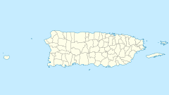
 Desecheo Island (Puerto Rico)
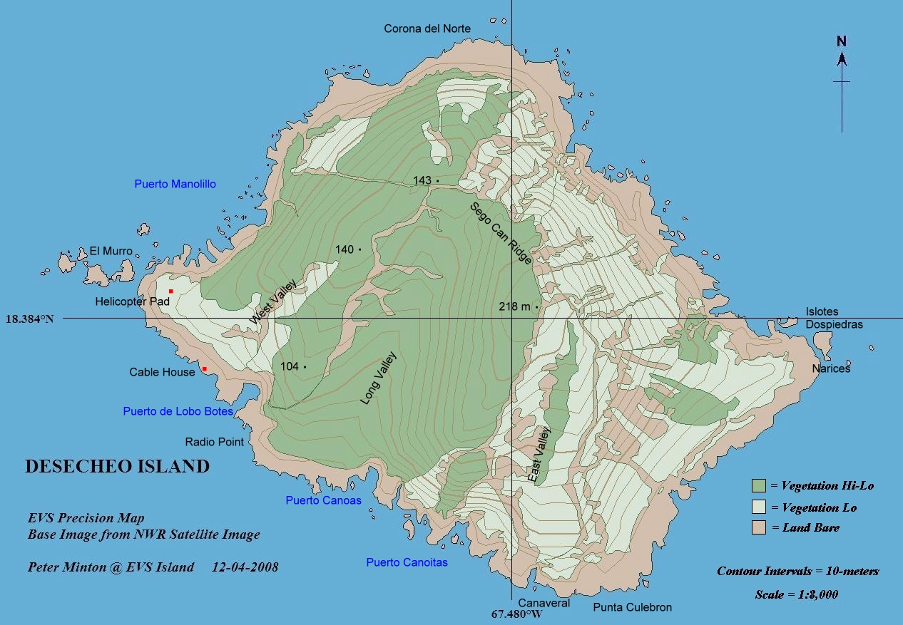
Geography Coordinates 18°23′14″N 67°28′19″W / 18.38722°N 67.47194°W Area 1.524613 km2 (0.5886564 sq mi) Length 1.8 km (1.12 mi) Width 1.1 km (0.68 mi) Highest elevation 218 m (715 ft) Highest point Sego Can Ridge Country United StatesCommonwealth  Puerto Rico
Municipio  Mayagüez
Barrio Sabanetas Demographics Population 0 Density 0 /km2 (0 /sq mi)  map of Desecheo Island
Desecheo (Spanish pronunciation: [deseˈtʃeo]) is a small uninhabited island of the archipelago of Puerto Rico located in the northeast of the Mona Passage; 21 km from the west coast (Punta Higüero) of the main island of Puerto Rico and 50 km northeast of Mona Island. It has a land area of 1.5 km² (exactly 1,524,613 m², or 0.589 sq mi, or 376.74 acres). Politically, the island is administered by the U.S. Department of the Interior, U.S. Fish and Wildlife Service. Christopher Columbus was the first European to visit the island during his second voyage to the New World; however, it was not named until 1517 by Spanish explorer Nuñez Alvarez de Aragón.[1]
Contents
Flora and fauna
Desecheo, which has no known bodies of surface water, reaches a maximum elevation of 218 m and has an annual precipitation, on average, of 1020 mm (40.15 in). The lack of surface water limits its flora to thorny shrubs, small trees, weeds and various cacti, including the endangered higo chumbo (Harrisia portoricensis). Fauna includes various species of seabirds, three endemic species of lizard (Ameiva desechensis, Anolis desechensis and Sphaerodactylus levinsi), introduced goats and rats, and a population of Rhesus monkeys (Macaca mulatta) introduced from Cayo Santiago in 1967 as part of a study on adaptation. Before the introduction of rhesus monkeys the island was the largest nesting colony of the Brown Booby, however, no species presently nests on the island.
Geology
Although politically part of Puerto Rico, geologically, along with the islands of Mona and Monito, Desecheo is not considered part of the Puerto Rican bank. It is believed that the island has been isolated, at least, since the Pliocene.[2] However, the island is part of the Rio Culebrinas formation which suggests that it was once connected to Puerto Rico.[3]
History
No evidence of Pre-Columbian human settlement of the island has been uncovered. During the 18th century the island was used by smugglers, pirates and bandits to hunt imported feral goats. During World War II, and until 1952, the island was used as a bombing range by the United States Armed Forces. From 1952 to 1964 the United States Air Force used Desecheo for survival training. In 1976 administration of the island was given to the U.S. Fish and Wildlife Service and in 1983 it was designated as a National Wildlife Refuge.
 View of Desecheo from Rincón
Diving
Because of a healthy reef and clear waters, with common visibility ranging from 30 to 45 metres (98 to 148 ft), Desecheo is a very popular place for diving fans. Although diving is permitted around the island, the refuge is closed to the public due to the presence of unexploded military ordnance. Trespassers are subject to arrest by Federal law enforcement officers.
Amateur radio
Several Amateur Radio expeditions have gone to the island, which has the ITU prefix KP5 (although since there is no permanent mailing address there the Federal Communications Commission does not actually grant this callsign). The Fish & Wildlife Service currently restricts such operations. The first approved DXpedition in fifteen years was allowed on the island between February 12 and 26, 2009, making 115,787 contacts.[4][5] Attempts to allow public access to Desecheo and the island of Navassa, which is located between Haiti and Jamaica, were made in the U.S. Congress, but the bill failed to reach the floor of the House of Representatives prior to the end of the 109th Congress, rendering the proposal dead.[6]
See also
- Geography of Puerto Rico
- Islands of Puerto Rico
References
- ^ Desecheo - Welcome to Puerto Rico.org. Retrieved on 2006-08-14.
- ^ Harold Heatwole, Richard Levins and Michael D. Byer (July 1981). "Biogeography of the Puerto Rican Bank". Atoll Research Bulletin 251: 11. http://www.botany.hawaii.edu/faculty/duffy/arb/242-251/251.pdf. Retrieved 2006-07-11.
- ^ "Desecheo Island Natural Reserve". UPR-Mayagüez Departament of Biology Herbarium. http://www.uprm.edu/biology/profs/breckon/herbarium/desecheo.html. Retrieved July 10, 2006.
- ^ "American Hams to Lead 2009 DXpedition to Desecheo Island". ARRL.org. 2008-10-10. http://www.arrl.org/news/stories/2008/10/08/10377/?nc=1. Retrieved 2009-06-06.[dead link]
- ^ "K5D - Desecheo Island 2009". KP5.us. http://www.kp5.us/. Retrieved 2009-02-26.
- ^ "News / Updates". KP1-5.com. 2005-10-19. http://www.kp1-5.com/news.html. Retrieved 2009-02-18.
External links
Categories:- Uninhabited islands of Puerto Rico
- Mayagüez, Puerto Rico


Wikimedia Foundation. 2010.