- Masirah Island
-
Masirah Native name: مصيرة 
 Masirah Island (Oman)
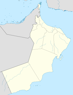
Geography Location Arabian Sea Coordinates 20°28′16″N 58°48′55″E / 20.47111°N 58.81528°ECoordinates: 20°28′16″N 58°48′55″E / 20.47111°N 58.81528°E Area 649 km2 (250.6 sq mi) Length 95 km (59 mi) Width 12–14 km (7.5–8.7 mi) Highest elevation 256 m (840 ft) Highest point Jabal Madrub Country OmanRegion Ash Sharqiyah Region Wilayah (Province) Masirah Largest city Dawwāh Demographics Population 12,000 Density 18.49 /km2 (47.89 /sq mi) Masirah (Arabic: مصيرة) is an island off the East coast of Oman, 95 km long north-south, between 12 and 14 km wide, with an area of about 649 km², and a population estimated at 12,000 in 12 villages mainly in the north of the island (9,292 as of the census of 2003, of which were 2,311 foreigners). Administratively, it forms one of the eleven provinces (Arabic: ولاية, plural ولايات, transliteration: wilayah, plural wilayat) of the Ash Sharqiyah Region. The principal village is Dawwāh in the northern part of the island. It contains an Omani air base and a fish factory, as well as a few small towns. Previously, the BBC had a relay facility consisting of both HF and MF broadcasting transmitters stationed there. Most of the island's interior is deserted, with access to the island only possible by a small ferry for cars or by Omani Air Force Hercules (RAFO) flights.
The main industries are fishing and traditional textile manufacturing. Formerly, traditional ship building was important.
Contents
Landscape
The rugged terrain of the island and surrounding rough coastline has led to the appearance of many wrecked dhows on the beaches of the island, most of them well preserved by the salt water and intense heat.
The ocean bottom environment surrounding Masirah is hostile as the majority of the area is covered in either sand or hard rock. There is a swift current flowing through the area with a very sharp halocline visible on the surface of the ocean. The water depth nearby is around 10 meters and is not conducive to side-scan sonar searches due to the shallow water and choppy surface conditions. Despite the poor quality ocean bottom, the area is very productive with marine fisheries, and any hard objects (barrels, engines) are immediately colonized by local fauna.
During summer there is normally a constant strong wind which is ideal for kite and windsurfers. Big waves are a result of the wind on the sea side and is so also attractive for wave surfers. Kite and windsurfers can pick spots around the island according to their skill and what conditions they prefer.
On 5-6 June 2007, 7000 people on the island were forced to temporarily leave their homes due to the high storm waves produced by the powerful Cyclone Gonu, the strongest to hit the Persian Gulf region in 60 years.
Geography
 Satellite image of Masirah
Located about 19 km off the east side of Barr al Hikman, the island is generally hilly, especially on its east side. The hills along the east side of the island are separated from the island coast by a narrow sandy plain; they run nearly its entire length.
A steep plateau stands in the middle of the range on the northeast side of the island. Along the west side of the island, there are a few low hills separated from the east range by an extensive sandy plain marked by several hillocks.
The climate of the island is agreeable and healthy between November and March, but hot and unhealthy during the southeast monsoon.
Jabal Madrub, a 256 meter high mountain, stands about 13 km south of the north end of the island.
Ras Abu Rasas, the south extremity of Al Masirah, is low and rocky. Jabal Suwayr (Jabal al Hilm), a conspicuous conical hill, rises to a height of 153 meters, about three km NNE of Ras Abu Rasas.
Ras Kaydah, a small and rocky headland, has a conspicuous, conical hill about 20 meters high nearby. There are small islets 600 meters east and four km north of Ras Kayda.
The coast between Ras Kaydah and Ras Zafaranat, about 27 km to the northeast, is regular with a few small rounded projections and a low rocky beach. Haql (Hakkan), a small village in a grove of trees, lies close to the shore about eight km north of Ras Kaydah.
Ras Zafaranat is rocky with hills rising abruptly.
Between Ras Abu Rasas and Ras Kaydah, about 18 km to the northeast, the coast is indented by small, sandy bays fringed by rocks.
Ras al Ya, about three km northeast of Ras Zafaranat, is the east extremity of the island and consists of a prominent bluff rising to a ridge of hills which extend westward to the center of the island.
A conspicuous peak, 99 meters high, stands about three km WNW of Ras al Ya. Jabal Madrub rises about five km farther WNW.
Ras al Jazirah, about six km NNW of Ras al Ya, is rocky and well-marked by a black patch on its south side. A sharp peak, rising to a height of 95 meters, stands about three km west of this point.
Jazirat Thukhayr, a sandy islet close north of Ras al Jazirah, lies on a drying reef connected to the shore. Drying rocks extend up to 300 meters off the eastern extremity of the islet. The coast between Ras al Jazirah and Ras Qudufah, the northeast extremity of the island, about 11 km further NNW, is indented by a bay.
Ras Qudufah, consisting of two rocky projections about 800 meters apart, rises to Jabal al Jidufa, about 64 meters high, a short distance inland. A cairn stands on a hill close south of Jabal al Jidufa. A small monument stands close southwest of Ras Qudufah.
Military Base
Beginning in the 1930's, Masirah was used as a British military base. A small stone building, thought to be a fuel store, was at the midpoint of the island on the West side, and had a stone above the door inscribed "RAF 1936". Reputedly, the fuel store was locked and visiting aircrew used to bring a key, refuel from cans, lock the store and fly onwards. During World War 2, the United States also had a base on the island. The base continued to expand into the 1970's to support British and Oman forces fighting insurgents (The Dofar Rebellion).
The British military presence in Masirah extended until 31 Mar 1977, when RAF Masirah closed and the base was handed over to the Sultan of Oman's Air Force. The base included HF communications hub and a rear link to SAS units based in Oman in support of the actions against rebels in the south of the country (RAF Salalah).
As of 2009, the American private military contractor DynCorp has the contract to staff and serve at this base.
External links
Categories:- Islands of Oman


Wikimedia Foundation. 2010.