- Nagambie, Victoria
-
Nagambie
Victoria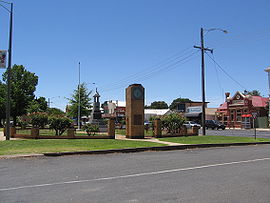
Memorial Park and main street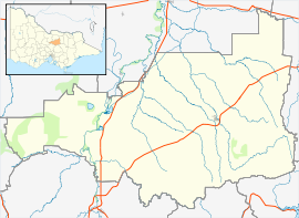
 Nagambie
Population: 1,383(2006 Census) [1] Postcode: 3608 Coordinates: 36°47′13″S 145°09′18″E / 36.787°S 145.155°ECoordinates: 36°47′13″S 145°09′18″E / 36.787°S 145.155°E Location: - 122 km (76 mi) from Melbourne
- 53 km (33 mi) from Shepparton
LGA: Shire of Strathbogie State District: Benalla Federal Division: Indi Localities around Nagambie: Kirwans Bridge Wahring Arcadia South Tooborac Nagambie Longwood Hilldene Seymour Avenel Nagambie (
 /nəˈɡæmbi/)[2] is a town in Victoria, Australia, located on the Goulburn Valley Highway, north of Seymour, in the Shire of Strathbogie. At the 2006 census, Nagambie had a population of 1,383.[1]
Contents
History
The Post Office opened on 2 May 1870,[3] and the local railway station in 1880.[4] It is now served by V/Line on the Shepparton Line to Melbourne.
Nagambie sits on the shores of Lake Nagambie, an artificial lake created by the Goulburn Weir in 1891, where rowing regattas and waterskiing tournaments are held.[citation needed]The town holds the Australian Rowing Championships semi-regularly.[5]
Wine
The town hosts the Goulburn Valley Vintage Festival in March each year, and the Shiraz Challenge in November.[citation needed] A number of wineries are situated in the area, including Mitchelton,[6] Tahbilk[7] and Preece.[8] Preece and Mitchelton both being part of the Lion Nathan Wine group.
Education
Nagambie has a Catholic school and a Public School.
Sport
The town has an Australian rules football team competing in the Kyabram & District Football League.[9]
Golfers play at the course of the Nagambie Golf Club on Goulburn Valley Highway.[10]
Gallery
-
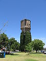
Water tower
-

Lake Nagambie
-

Railway station and goods yard
See also
References
- ^ a b Australian Bureau of Statistics (25 October 2007). "Nagambie (Urban Centre/Locality)". 2006 Census QuickStats. http://www.censusdata.abs.gov.au/ABSNavigation/prenav/LocationSearch?collection=Census&period=2006&areacode=UCL237000&producttype=QuickStats&breadcrumb=PL&action=401. Retrieved 31 May 2010.
- ^ Macquarie Dictionary, Fourth Edition (2005). Melbourne, The Macquarie Library Pty Ltd. ISBN 1-876429-14-3
- ^ Premier Postal History, Post Office List, https://www.premierpostal.com/cgi-bin/wsProd.sh/Viewpocdwrapper.p?SortBy=VIC&country=, retrieved 2008-04-11
- ^ Bob Whitehead (2008), Tocumwal Railway Centenary
- ^ Australian Rowing Championships, http://www.rowingaustralia.com.au/comp_natl_arc.shtm#ten
- ^ Mitchelton (Nagambie, Vic)
- ^ [1] (Nagambie, Vic)
- ^ Preece (Nagambie, Vic)
- ^ Full Points Footy, Nagambie, http://www.fullpointsfooty.net/Nagambie.htm, retrieved 2008-07-25[dead link]
- ^ Golf Select, Nagambie, http://www.golfselect.com.au/armchair/courseView.aspx?course_id=1047, retrieved 2009-05-11
Towns in the Shire of Strathbogie Local Government Area Avenel · Euroa · Locksley · Longwood · Mangalore · Nagambie · Ruffy · Strathbogie · Upotipotpon · Violet Town
Categories:- Towns in Victoria (Australia)
- Victoria (Australia) geography stubs


Wikimedia Foundation. 2010.