Carindale, Queensland

Carindale, Queensland

Infobox Australian Place | type = suburb
name = Carindale
city = Brisbane
state = Queensland


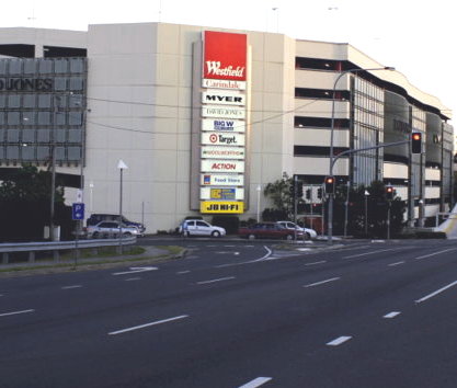
caption = Creek Road, Carindale
lga = Brisbane City Council,
Chandler Ward
postcode = 4152
pop = 15,135 (2006)Census 2006 AUS
id = SSC31117
name = Carindale (Brisbane City) (State Suburb)
quick = on
accessdate=2008-02-28
]
propval = $505,000 (2007) [ [http://www.ourbrisbane.com/living/suburbs/carindale/reiq/ Brisbane Suburb: Carindale - REIQ Profile for Carindale - ourbrisbane.com] ]
area =
est = 1980
stategov = Chatsworth
fedgov = Bonner
dist1 = 10
location1= Brisbane
near-nw = Carina
near-n = Tingalpa
near-ne = Belmont
near-w = Carina Heights
near-e = Chandler
near-sw = Mount Gravatt East
near-s = Mansfield
near-se = Mackenzie

Carindale is a suburb of the city of Brisbane, which has a population of approximately 15,135 people and contains around 4,976 dwellings. The greater area was formerly known as Belmont.

Notable features of the suburb include a large shopping centre - Westfield Carindale, the Pacific Golf Club, Belmont State School, Belmont Bushland Reserve, Belmont Private Hospital (psychiatric only) and Bulimba Creek. The Gateway Motorway borders the suburb.

In addition to Indooroopilly in the west; Chermside on the north-side; and Mount Gravatt on the south side, the suburb has been described as a mini-CBD.

Surrounding suburbs include Belmont, Carina, Carina Heights, Mansfield, Cannon Hill, Tingalpa, Mount Gravatt East and Mackenzie. Public transport runs frequently to and from Carindale and the City via Old Cleveland Road and Creek Road, leading to the multi-million dollar busway.

Federally, the people of Carindale are represented by Kerry Rea MP (Labor) in the seat of Bonner. On a state level, the seat of Chatsworth is held by Chris Bombolas(Labor). Adrian Schrinner (Liberal) is Brisbane City Councillor for Chandler Ward.

The area is of a high socio-economic condition, which is evidenced by the "mini-mansions" that form much of the suburb.

20 to 39 year olds are the most prevalent age group in Carindale, with 30% of residents in this bracket. The next most common are people aged 40 to 59 (27%), then 5 to 19 (21%), 60+ (16%) and 0 to 4 (7%).

References

External links

* [http://www.brisbites.com/suburbView.asp?suburb=20&topic=1 BRISbites: Suburban Sites (History)]


Wikimedia Foundation. 2010.

Игры ⚽ Поможем решить контрольную работу

Look at other dictionaries:

  • Westfield Carindale — infobox shopping mall shopping mall name = Westfield Carindale image width = 250 caption = location = Carindale, Brisbane Australia coordinates = coord|27|30|10|S|153|06|05|E|display=inline,title opening date = developer = The Westfield Group… …   Wikipedia

  • Carina, Queensland — Infobox Australian Place | type = suburb name = Carina city = Brisbane state = qld caption = Old Cleveland Road lga = Brisbane City Council postcode = 4152 pop = area = 4.5 propval = stategov = Bulimba, Chatsworth fedgov = Bonner, Griffith near… …   Wikipedia

  • Chermside, Queensland — Chermside Brisbane, Queensland Chermside Shopping Centre …   Wikipedia

  • Bulimba Creek (Queensland) — The Bulimba Creek catchment has it sources in the marshy parts of the suburbs of Runcorn and Kuraby in the south of Brisbane. It then flows in a northerly direction through the suburbs of Mansfield, Mackenzie, Carindale, Murarrie and Lytton,… …   Wikipedia

  • Belmont, Queensland — Infobox Australian Place | type = suburb name = Belmont city = Brisbane City Council state = Queensland est = 1894cite web | url=http://www.brisbites.com/suburbView.asp?suburb=14 topic=3 | title=Belmont Urban Development | publisher=Brisbites |… …   Wikipedia

  • Mansfield, Queensland — Mansfield Brisbane, Queensland Population: 9,355 (2001 census) Established: 1967 (gazetted) Postcode …   Wikipedia

  • Norman Park, Queensland — Norman Park Brisbane, Queensland Norman Park, like many areas of Brisbane, was unsewered until the late 1960s, with each house having an outhouse or dunny …   Wikipedia

  • List of South East Queensland bus stations — The following is a list of bus and busway stations which have been built or are under construction in and around Brisbane and South East Queensland, Australia.Busway stations in Brisbane =Boggo Road Busway (proposed) = *University of Queensland… …   Wikipedia

  • Mackenzie, Queensland — Infobox Australian Place | type = suburb name = Mackenzie city = Brisbane state = QLD caption = lga = Brisbane City Council postcode = 4156 est = pop = 4,103(2001 census) area = 7.7 propval = stategov = Mansfield fedgov = Bonner dist1 = 13… …   Wikipedia

  • TransLink (South East Queensland) — This article is about the South East Queensland public transport system. For other uses, see Translink (disambiguation). TransLink Transit Authority Motto Integrated public transport for South East Queensland Formation …   Wikipedia

Share the article and excerpts

Direct link
Do a right-click on the link above
and select “Copy Link”