- Greasby
-
Coordinates: 53°22′23″N 3°07′24″W / 53.373°N 3.1233°W
Greasby 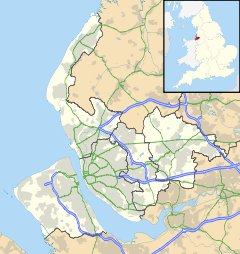
 Greasby
Greasby shown within MerseysidePopulation 9,830 (2001 Census)[1] OS grid reference SJ253868 Metropolitan borough Wirral Metropolitan county Merseyside Region North West Country England Sovereign state United Kingdom Post town WIRRAL Postcode district CH49 Dialling code 0151 Police Merseyside Fire Merseyside Ambulance North West EU Parliament North West England UK Parliament Wirral West List of places: UK • England • Merseyside Greasby is a large village on the Wirral Peninsula, England. It is part of the Greasby, Frankby & Irby Ward of the Metropolitan Borough of Wirral and is situated in the parliamentary constituency of Wirral West. At the 2001 Census, Greasby had 9,830 inhabitants,[1] with the total population of the ward at 14,667.[2]
Contents
History
The earliest known human settlement in Merseyside has been found at Greasby, dating from approximately 7000 BC. A rectangular floor of sandstone slabs and pebbles suggests regular use by the nomadic hunters of that period.[3] National Museums Liverpool archaeologists excavated the site between 1987 and 1990.[4]
Greasby was an Anglo Saxon settlement, as witnessed by the form of the name, Gravesberie, in the Domesday Book.[5] Gravesberie derives from the Old English gräf and burh, recorded as meaning a "stronghold by a grove, trench, canal or wood". The name was Scandinavianised to Greasby, under the influence of Old Norse speakers in Wirral (gräf and býr,[6] with býr meaning "settlement" or "farmstead").[7]
Prior to the Norman conquest of England in 1066, Greasby was owned by a man named Dunning. He was an official (bailiff or steward) for the earls of Mercia. After the invasion, all land in the area passed to Hugh d'Avranches.[8] By the time of the Domesday Book (1086), Greasby was under the ownership of Nigel de Burcy.[5]
After the Second World War the area expanded considerably, with significant residential development across previously agricultural land. This has resulted in Greasby becoming contiguous with the nearby settlements of Moreton, Upton and Woodchurch.[9]
Civic history
Greasby was formerly a township situated mainly in West Kirby Parish, Wirral Hundred. The population was 123 in 1801, 177 in 1851, 290 in 1901 and 4,367 in 1951.[10]
From 1866 Greasby was part of Wirral Rural Sanitary District, which was replaced in 1894 by Wirral Rural District. In 1933 the village transferred to Hoylake Urban District.[11]
Community
Greasby has four primary schools (Greasby Infant School, Greasby Junior School, Our Lady of Pity Primary School and Brookdale Primary School) and three churches, (St. Nicholas' Church of England, Our Lady Of Pity Catholic Church, and Greasby Methodist Church).
There are five public houses (The Greave Dunning, The Cat, The Coach and Horses, The Twelfth Man and Ellies Wine Bar). The 4 public houses in the main village (The Cat, The Greave Dunning, The Coach and Horses and Ellies Wine Bar) have come to be known as the Greasby Rhombus.
The village also consists of a post office and a number of small shops including a butchers, estate agents, Disco Pete's video shop and a number of fast food take aways.
Transport
Bus
Services operating in the Greasby area, as of December 2008:
Number Route Operator Days of Operation 22/24 West Kirby-Chester Avon Buses Monday-Saturday N37 Hoylake-Liverpool Arriva North West Saturday night/Sunday mornings 123/123A Greasby-Santa's Grotto Avon Buses 25th December 83/83A West Kirby/Greasby-Birkenhead Avon Buses Monday-Saturday 129' Frankby-Liscard ACE Travel Sundays 186 Eastham Ferry-Leasowe Avon Buses Evenings and Sundays 293 West Kirby-Woodside A1A Travel Evenings and Sundays 420 West Kirby-Liverpool Arriva North West Monday-Friday mornings 437 West Kirby-Liverpool Arriva North West Monday-Sunday References
- ^ a b Wirral 2001 Census: Greasby, Metropolitan Borough of Wirral, archived from the original on 29 September 2007, http://web.archive.org/web/20070929092057/http://www.wirral.gov.uk/factsandfigures/census2001/oneward2recset.asp?ref=TS15, retrieved 10 July 2010
- ^ 2001 Census: Greasby, Frankby & Irby, Office for National Statistics, http://neighbourhood.statistics.gov.uk/dissemination/LeadKeyFigures.do?a=3&b=5941385&c=greasby&d=14&e=16&g=362033&i=1001x1003x1004&m=0&enc=1, retrieved 12 May 2007
- ^ Dargie, Richard (2007), A History of Britain, Arcturus Publishing, p. 11, ISBN 978-0-572-03342-2
- ^ Prehistoric Merseyside: Greasby, Wirral, National Museums Liverpool, http://www.liverpoolmuseums.org.uk/mol/archaeology/fieldarchaeology/prehistmrsygreas.asp, retrieved 18 March 2008
- ^ a b Cheshire A-K, The Domesday Book Online, http://www.domesdaybook.co.uk/cheshire1.html#greasby, retrieved 7 December 2007
- ^ What's In A Name? - Greasby, National Museums Liverpool, http://www.liverpoolmuseums.org.uk/maritime/exhibitions/magical/placenames/greasby.asp, retrieved 9 June 2010
- ^ Sulley, Philip (1889), The Hundred of Wirral
- ^ Curtis, Mike, History of Greasby village, http://www.greasby.ik.com/p_History.ikml, retrieved 7 December 2007
- ^ Roberts, Stephen J. (2002), A History of Wirral, Phillimore & Co. Ltd., pp. 140, 180, ISBN 978 1 86077 512 3
- ^ Cheshire Towns & Parishes: Greasby, GENUKI UK & Ireland Genealogy, http://www.ukbmd.org.uk/genuki/chs/greasby.html, retrieved 1 May 2008
- ^ Relationships / unit history of Greasby, A Vision Of Britain Through Time (University of Portsmouth), http://www.visionofbritain.org.uk/relationships.jsp?u_id=10114068&c_id=10001043, retrieved 9 June 2010
External links
Categories:- Towns and villages in Wirral (borough)

Wikimedia Foundation. 2010.