- Ningwood
-
Coordinates: 50°42′14″N 1°24′47″W / 50.70392°N 1.41305°W
Ningwood 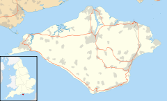
 Ningwood
Ningwood shown within the Isle of WightOS grid reference SZ415895 Unitary authority Isle of Wight Ceremonial county Isle of Wight Region South East Country England Sovereign state United Kingdom Post town NEWPORT Postcode district PO30 Dialling code 01983 Police Hampshire Fire Isle of Wight Ambulance Isle of Wight EU Parliament South East England UK Parliament Isle of Wight List of places: UK • England • Isle of Wight Ningwood is a village on the Isle of Wight. It is located about three miles east of Yarmouth in the northwest of the island. The Horse and Groom Pub is a prominent establishment in Ningwood, as is the Ningwood Bible Christian (Methodist) Chapel. Well-known island brickmakers, the Prichett family, established a brick yard in Ningwood in the 19th century.
It is linked to other parts of the Island by Southern Vectis bus route 7, serving Freshwater, Yarmouth and Newport including intermediate towns.[1]
References
- ^ "Southern Vectis - bus route 7". www.islandbuses.info. 2008. http://www.islandbuses.info/r7.shtml. Retrieved 2008-05-04.
External links
- Isle of Wight Brickmaking History, Isle of Wight Industrial Archaeology Society
Ceremonial county of Isle of Wight Isle of Wight Portal Unitary authorities Major settlements Rivers Topics Categories:- Villages on the Isle of Wight
- Isle of Wight geography stubs

Wikimedia Foundation. 2010.