- Amapá
Infobox Brazilian State
name = State of Amapá

motto =
anthem =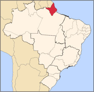
capital =Macapá
latd= |latm= |latNS= |longd= |longm= |longEW=
largest_city =Macapá
demonym = Amapaense
leader_name1 = Waldez Góis
leader_name2 = Pedro Paulo Dias de Carvalho
area = 142.814,585
area_magnitude = 1 E11
area_rank = 18th
population_estimate = 615,715
population_estimate_rank = 16th
population_estimate_year = 2006
population_census = 596,169
population_census_year = 2005
population_density = 4.3
population_density_rank = 24th
GDP = R$ 4,367,000,000
GDP_rank = 26th
GDP_year = 2005
GDP_per_capita = R$ 7,344
GDP_per_capita_rank = 15th
HDI = 0.780
HDI_rank = 11th
HDI_year = 2005
abbreviation = BR-AP
time_zone = BRT
utc_offset = -3
time_zone_DST = BRST
utc_offset_DST = -2Amapá (pronounced|amaˈpa [In
Brazilian Portuguese . TheEuropean Portuguese pronunciation is IPA| [ɐmɐˈpa] .] ) is one of the states ofBrazil , located in the extreme north, borderingFrench Guiana andSuriname to the north. To the east is theAtlantic Ocean , and to the south and west is the Brazilian state ofPará . Perhaps one of the main features of the State is the River Oiapoque, as it was once considered the northernmost point of Brazil. The river's estuary is at the extreme north of the Brazilian coast and it is often used to describe the remote points ofBrazil . The dominate landscape of the region - 90 percent of the total area - is the hugeAmazon Rainforest . Unexplored forests dominate 70 percent of its territory. Another attraction is the Equator, which divides not only the state but also the Northern and Southern hemispheres. The only method by which to reachMacapá is throughboat orairplane .History
As the "
Capitania " of Costa do Cabo Norte, the region was invaded by the English and Dutch, who were repelled by the Portuguese. TheTreaty of Utrecht , in 1713 established the boundaries between Brazil andFrench Guiana , but these were not respected by the French. In the 18th century,France retook control of the area. This dispute would continue until 1900.With the discovery of
gold and the increasing value ofrubber on the international market during the 19th century contributing to increases in population in Amapá, the territorial dispute with France was brought to a head; finally on December 1st, 1900, the Arbitration Commission of Geneva ceded possession of the territory to Brazil, which incorporated it into the state ofPará with the joint name of Araguari (named for the river of the same name). It became the federal territory of Amapá in 1943.The discovery of rich
manganese deposits inSerra do Navio in 1945 revolutionized the local economy, but Amapá did not achieve statehood until October 5th, 1988 with the promulgation of the new Brazilian Constitution.Geography
The State of Amapá has also the lowest deforestation rate of its original vegetation: only 2%. Most of its territory is occupied by forests, with the remaining area corresponding to savannah and plain areas. At the seaside, almost intact beaches get mixed with swamps, composing the largest Brazilian representation of this biome, where this mix of salt and fresh water is perfect for the reproduction of the food chain for several animal species.
Climate
An
equatorial climate is a type oftropical climate in which there is nodry season – all months have meanprecipitation values of at least 60mm. It is usually found atlatitude s within five degrees of theequator – which are dominated by theIntertropical Convergence Zone . The equatorial climate is denoted "Af" in theKöppen climate classification .Tropical rainforest is the natural vegetation in equatorial regions.Vegetation
The Amazon represents over half of the planet's remaining
rainforest s and comprises the largest and most species-rich tract oftropical rainforest in theworld . Wet tropical forests are the most species-richbiome , and tropical forests in theAmericas are consistently more species rich than the wet forests inAfrica andAsia .Turner, I.M. 2001. "The ecology of trees in the tropical rain forest".Cambridge University Press , Cambridge. ISBN 0-521-80183-4] As the largest tract of tropical rainforest in the Americas, the Amazonian rainforests have unparalleledbiodiversity . More than 1/3 of all species in the world live in the Amazon Rainforest. [ [http://www.worldwildlife.org/wildplaces/amazon/index.cfm Amazon Rainforest, Amazon Plants, Amazon River Animals] ]Demographics
According to the
IBGE of 2007, there were 619,000 people residing in the state with a population density of 4.3/km².Urbanization : 93.7% (2006);Population growth : 5.7% (1991-2000);House s: 144,000 (2006). [Source: PNAD.]The last PNAD (National Research for Sample of Domiciles) census revealed the following numbers: 429,000
Pardo (Brown) people (69.4%), 148,000 White people (24.0%), 40,000 Black people (6.5%), 6,000 Asian or Amerindian people (0.1%). [cite book|url=ftp://ftp.ibge.gov.br/Indicadores_Sociais/Sintese_de_Indicadores_Sociais_2007/Tabelas|title=Síntese de Indicadores Sociais 2007|publisher=IBGE |location=Amapá, Brazil|format=PDF|isbn=85-240-3919-1|accessdate=2007-07-18|year=2007|language=Portuguese]Economy
The
service sector is the largest component ofGDP at 87.6%, followed by theindustrial sector at 7.8%.Agriculture represents 4.6% ofGDP (2004). Amapá exports:wood 75.5%,ore s 18.7%,heart of palm 5.5% (2002).Share of the Brazilian economy: 0.2% (2005).
Education
Portuguese is the official national language, and thus the primary language taught in schools. But English and Spanish are part of the official
high school curriculum.Educational institutions
* Universidade Federal do Amapá (Unifap) (Federal University of Amapá);
* Centro de Ensino Superior do Amapá (Ceap);
* Instituto de Ensino Superior do Amapá (Iesap);
* Instituto Macapaense de Ensino Superior (Immes);
* and many others.Infrastructure
International Airport
The state of Amapá will soon gain a new airport.
Infraero will start work on the new Macapá International Airport, which will have 17 thousand square meters of space to serve 700 thousand passengers a year. The current airport, with an area of 2.9 thousand square meters, operates annually with 324 thousandpassenger s. The work, scheduled for conclusion in 30 months, will enlarge the parking lot to 258 spots against the current 80 and expand the total area from 2.4 thousand to 11 thousand square meters. The apron area will be increased from its current 21 thousand to 30 thousand square meters, with capacity for four largeairplane s and 30 small aircraft.Flag
The flag was adopted by decree No. 008 of April 23, 1984. The blue color on the top symbolizes the sky over Amapá and justice, the green in the middle the native rainforest, and the yellow on the bottom the Union and its natural resources. The black in the small strips stands for the deceased who worked for the state, and the white for the will of the state to live in peace and stability. The symbol at the left symbolizes the Fortress of São José, out of which the state capital grew.
Before 1984 the state had a red-white-red flag very similar to the flag of
Peru .References
See also
*en icon
Brazil
*pt icon [http://www.amapa.gov.br Official Website]
*en icon [http://www.braziltour.com/site/gb/home/index.php Brazilian Tourism Portal]
*pt icon [http://www.professores.uff.br/hjbortol/arquivo/2006.1/applets/amapa_en.html Amapa's location on a 3D globe (Java)]
*en iconCalçoene - Amapá town, site of pre-colonial observatory


Wikimedia Foundation. 2010.