- Chalton, Bedfordshire
-
For the hamlet of Chalton that is nearer to Bedford, see Moggerhanger.
Coordinates: 51°55′34″N 0°30′03″W / 51.9260°N 0.5009°W
Chalton 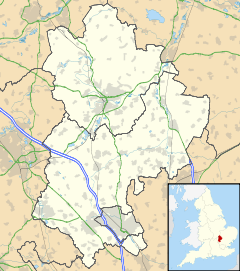
 Chalton
Chalton shown within BedfordshireUnitary authority Central Bedfordshire Ceremonial county Bedfordshire Region East Country England Sovereign state United Kingdom Post town LUTON Postcode district LU4 Police Bedfordshire Fire Bedfordshire and Luton Ambulance East of England EU Parliament East of England List of places: UK • England • Bedfordshire Chalton is a village and civil parish in the Central Bedfordshire district of Bedfordshire, England, immediately north of the Luton/Dunstable conurbation and bounded to the east by the M1 motorway and the Midland Main Line railway line. A footpath, locally known as the "Bound Way", borders the village to the south and south west.
Nearby places are Toddington (north west), Chalgrave (west), Houghton Regis (south-west), and Sundon (east).
Contents
Listed Buildings
There are several Grade II Listed Buildings in Chalton, including Gostelow House and Yew Tree Farm.
Education
Chalton Lower School stands in the centre of the village and accepts children beteween ages 4 and 9.[1]
Hospitality
The local public house is called The Star.[2]
Media
Chalton is all the current home village for young, West End Star, Jack Wilcox.
Chalton became the centre of media attention in 2010 when in a breakthrough case a local woman was acquitted of keeping a brothel.[3]
References
External links
 Media related to Chalton, Bedfordshire at Wikimedia CommonsCategories:
- Villages in Bedfordshire
- Civil parishes in Bedfordshire
- Bedfordshire geography stubs


Wikimedia Foundation. 2010.