- Colton, Leeds
-
Coordinates: 53°47′35″N 1°26′31″W / 53.7930°N 1.4420°W
Colton 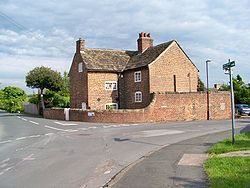
The Old Village: on the junction of Meynell Road and Park Road, South Colton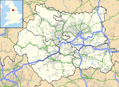
 Colton
Colton shown within West YorkshireMetropolitan borough City of Leeds Metropolitan county West Yorkshire Region Yorkshire and the Humber Country England Sovereign state United Kingdom Post town LEEDS Postcode district LS15 Dialling code 0113 Police West Yorkshire Fire West Yorkshire Ambulance Yorkshire EU Parliament Yorkshire and the Humber UK Parliament Leeds East List of places: UK • England • Yorkshire Colton is a district of east Leeds, West Yorkshire, England, situated between Cross Gates to the north, Halton and Halton Moor to the west, Whitkirk to the north-west and Austhorpe to the north-east. Temple Newsam lies directly south of the estate.
The small Whitkirk Lane End estate (which is situated between Colton Road and Colton Roundabout) is often considered more part of the Colton district than Whitkirk, because of its separation from Whitkirk via Selby Road, and its proximity to Colton Road.
Contents
Geography
The name Colton derives from the old english Coal Town, because the estate was originally developed as a pit mining community in the east of the city.[citation needed] It consists mainly of cul-de-sacs, with inter-linking ginnels, back alleys and housing ranges from detached houses, semi-detached houses, terraced houses, and flats. The area is 4 miles to the east of Leeds city centre, and is close to the A63 dual carriageway and M1 motorway. Colton is also the area of Leeds, where the Leeds Outer Ring Road terminates. The area is well served by buses, with the numbers 19 and 19A going to and from the city centre, and the number 9 going to and from Seacroft.
At the centre of the estate, there is a cricket club, with a bar, a cricket pitch, two tennis courts and a football pitch. Much of the open space in Colton has been built upon, making it a much more urban area. In the mid-1990s, Colton Retail Park was opened in the east of the district, now with many well known stores. Recently,[when?] Thorpe Park business park was also opened in the east of Colton.
Police force
In the late 1990s to mid 2000s, Colton suffered social problems of crime and anti-social behaviour.[1][2] As a result, an increased police presence was put into place in Colton and the surrounding estates.
Old Colton Road
Colton Road is a derelict road running through the west of the area into Whitkirk. It joins onto Selby Road, although it has been closed from the edge of Colton and Whitkirk to Meynell Road, where it terminates in the centre of the estate. It is locally referred to as 'The Old Road','The Red Road' or 'The Wide Path'.
Comparison
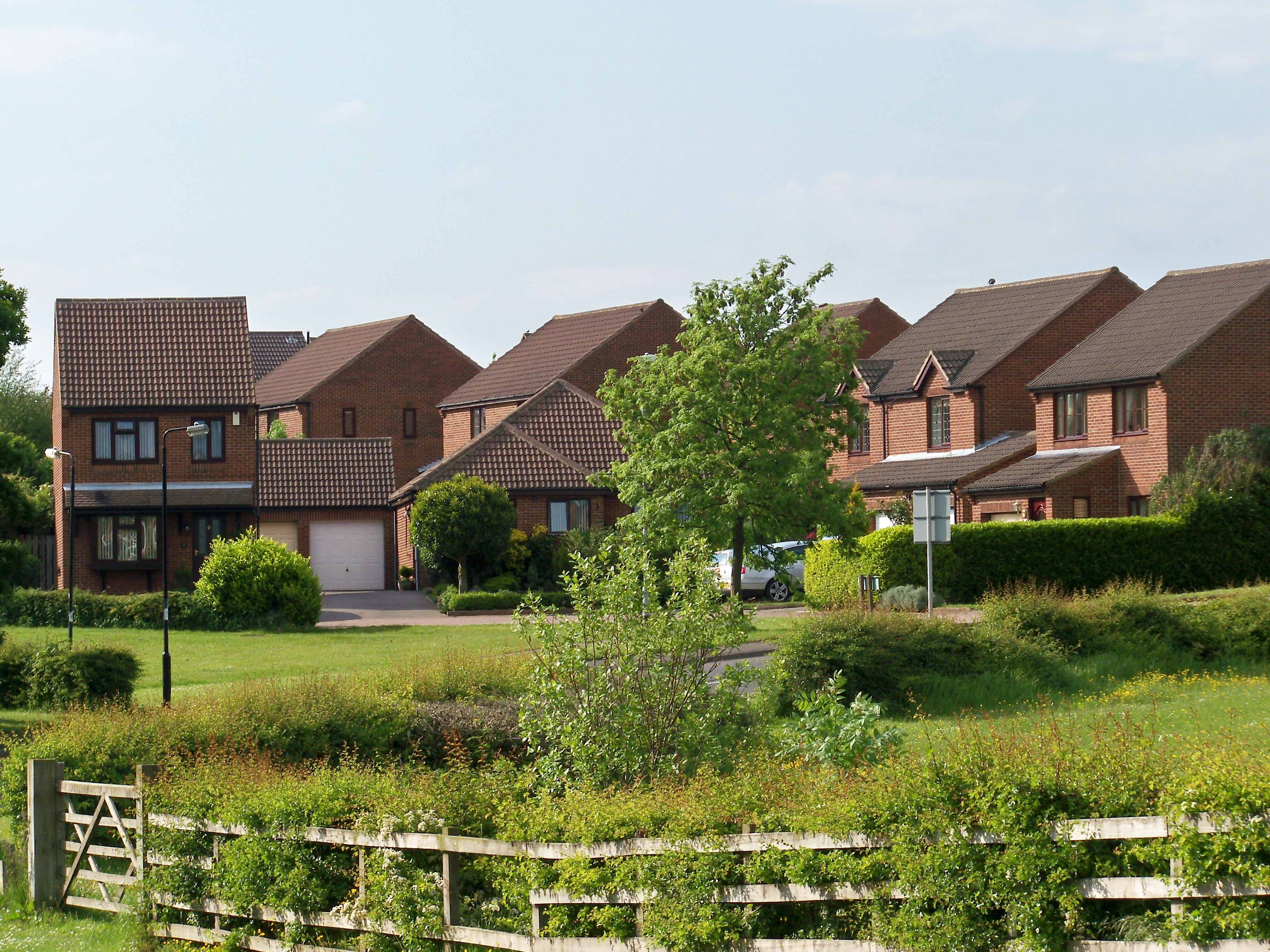
 Newer houses in Colton
Colton lies in the LS15 postcode area. This is a population comparison between the postcode area and the UK population.
Category LS15 UK average Population density (people / sq mi) 43.2 24.9 Gender split (females / male) 1.05 1.05 Average commute 6.1 miles 8.73 miles Average age 38 39 Home ownership 16% 16.9% Student population 2.4% 4.4% People in good health 69% 69% Football teams
Colton has some very promising young football teams that are being developed. The funding for these football teams comes from Colton Club. The football teams go all the way up to the Under 18s. After that it becomes Colton Open Age. There is also a girls football team that is for all ages.
Location grid

Cross Gates Halton, Halton Moor 
Austhorpe  Colton, Leeds

Woodlesford References
- ^ "News Round Up". West Yorkshire Police. 23 February 2008. http://www.westyorkshire.police.uk/npt/area.asp?id=13.
- ^ "Colton Crimewave". 9 October 2004. http://www.coltonvillage.com/news_information_archive.html.
External links
- The ancient parish of Whitkirk: historical and genealogical information at GENUKI (Colton was in this parish)
- Colton website
Leeds Topics Culture Places List of towns, villages, areas and suburbsGovernment City of Leeds • Leeds City CouncilPeople Categories:- Places in Leeds


Wikimedia Foundation. 2010.