- St Hilary, Cornwall
-
Coordinates: 50°07′50″N 5°25′40″W / 50.13044°N 5.427820°W
St Hilary 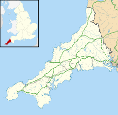
 St Hilary
St Hilary shown within CornwallPopulation 785 (2001) OS grid reference SW550312 Unitary authority Cornwall Ceremonial county Cornwall Region South West Country England Sovereign state United Kingdom Post town PENZANCE Postcode district TR20 Dialling code 01736 Police Devon and Cornwall Fire Cornwall Ambulance South Western EU Parliament South West England UK Parliament St Ives List of places: UK • England • Cornwall St Hilary is a civil parish and village in west Cornwall, United Kingdom. It is situated approximately five miles (8 km) east of Penzance and four miles (6.5 km) south of Hayle[1].
Chynoweth is an area immediately north of St Hilary.
For the purposes of local government St Hilary is a parish council and elects councillors every four years. The principal local authority in the area is Cornwall Council.
The parish church (see also St Hilary Church, Cornwall) is dedicated to St Hilary and is in the Early English style. It has a 13th-century tower and is a Grade I listed building[2].
Contents
Geology
The area has many former mines: especially notable was a mine called Wheal Fortune which extended into the parish of Ludgvan. An earthquake occurred in St Hilary in 1796.[3]
Penberthy Croft Mine, to the north of the parish, was designated a Site of Special Scientific Interest in 1993 and is noted as the most important site in Britain for secondary ore minerals of lead, copper, and arsenic.[4]
Notable residents
Notable people from the parish include Malachy Hitchins[5], astronomer and Vicar of St Hilary; Denys Val Baker, the writer; Bernard Walke, Vicar of St Hilary, from 1912 to 1936.[6] Father Walke was the author of four religious plays and of an autobiography, Twenty Years at St Hilary (London: Methuen & Co., 1935; reissued by Mott, London, 1982 with an introduction by Frank Baker and ISBN 0907746047).
References
- ^ Ordnance Survey: Landranger map sheet 203 Land's End ISBN 9780319231487
- ^ GENUKI website; St Hilary
- ^ [1]
- ^ "Penberthy Croft Mine". Natural England. 1993. http://www.sssi.naturalengland.org.uk/citation/citation_photo/1003620.pdf. Retrieved 8 November 2011.
- ^ Malachy Hitchins Oxford Dictionary of National Biography index
- ^ Brown, H. Miles (1976). A Century for Cornwall. Truro: Blackford, pp. 64, 75, 92, 98-100
External links
- "Online Catalogue for St Hilary". Cornwall Record Office. http://crocat.cornwall.gov.uk/dserve/dserve.exe?dsqIni=Dserve.ini&dsqApp=Archive&dsqDb=Catalog&dsqCmd=Overview.tcl&dsqSearch=((text)='st%20hilary').
Geography of Cornwall Unitary authorities Major settlements Bodmin • Bude • Callington • Camborne • Camelford • Falmouth • Fowey • Hayle • Helston • Launceston • Liskeard • Looe • Lostwithiel • Marazion • Newlyn • Newquay • Padstow • Par • Penryn • Penzance • Porthleven • Redruth • Saltash • St Austell • St Blazey • St Columb Major • St Ives • St Just-in-Penwith • St Mawes • Stratton • Torpoint • Truro • Wadebridge
See also: Civil parishes in CornwallRivers Topics History • Status debate • Flag • Culture • Places • People • The Duchy • Diocese • Politics • Hundreds/shires • Places of interest • full list...Civil parishes of St Ives constituency  Breage • Crowan • Cury • Germoe • Grade–Ruan • Gunwalloe • Helston • Landewednack • Ludgvan • Madron • Marazion • Manaccan • Mawgan-in-Meneage • Morvah • Mullion • Paul • Penzance • Perranuthnoe • Porthleven • Sancreed • Sennen • Sithney • St Anthony-in-Meneage • St Buryan • St Erth • St Hilary • St Ives • St Just • St Keverne • St Levan • St Martin-in-Meneage • St Michael's Mount • Towednack • (Wendron) • ZennorCategories:
- Civil parishes in Cornwall
- Villages in Cornwall
- Cornwall geography stubs

Wikimedia Foundation. 2010.