- Denholme
-
Coordinates: 53°48′07″N 1°53′38″W / 53.802°N 1.894°W
Denholme 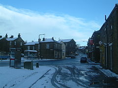
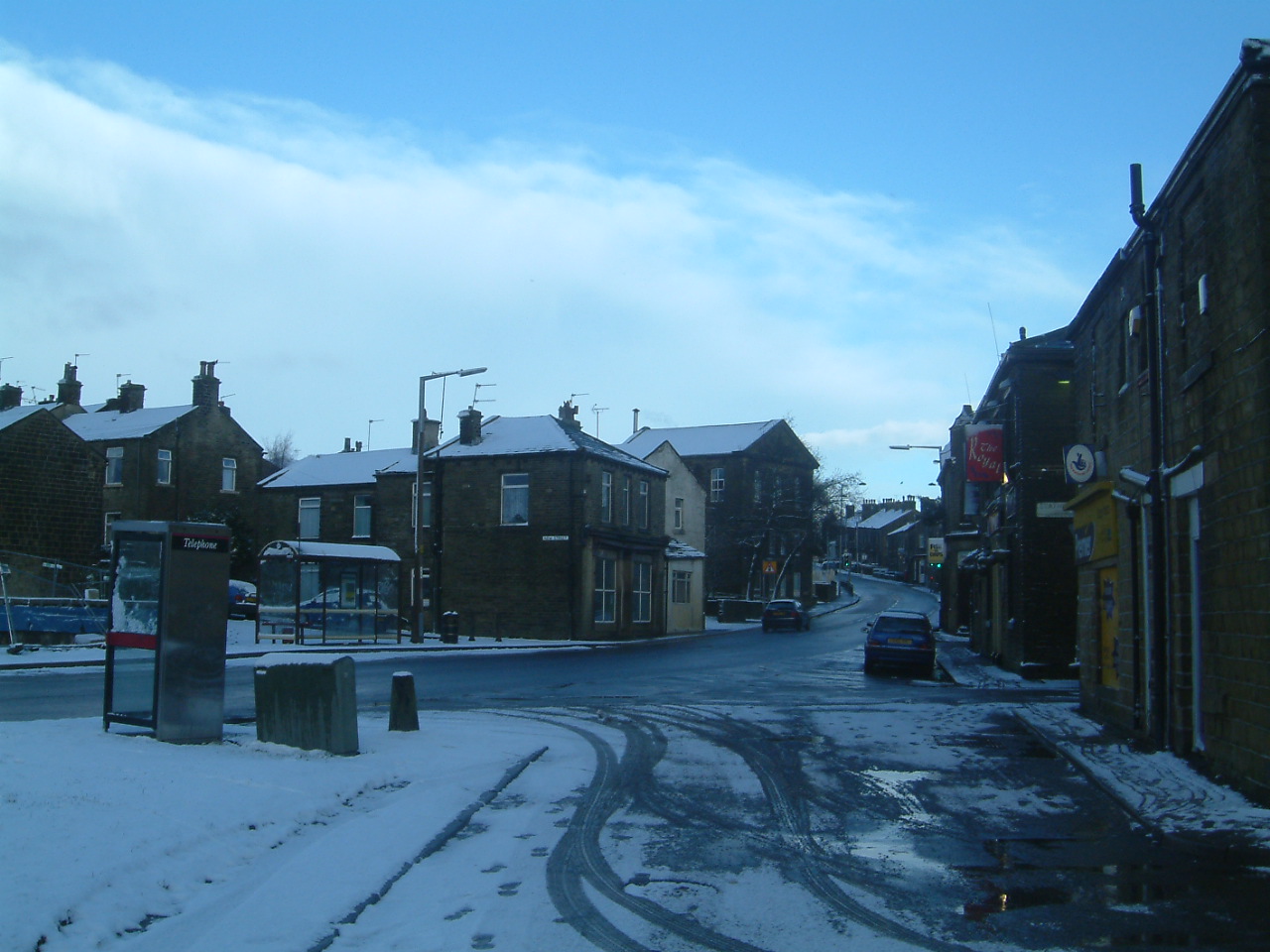
Christmas Day in Denholme 2004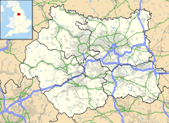
 Denholme
Denholme shown within West YorkshirePopulation 2,976 OS grid reference SE070340 Parish Denholme Metropolitan borough City of Bradford Metropolitan county West Yorkshire Region Yorkshire and the Humber Country England Sovereign state United Kingdom Post town BRADFORD Postcode district BD13 Dialling code 01274 Police West Yorkshire Fire West Yorkshire Ambulance Yorkshire EU Parliament Yorkshire and the Humber UK Parliament Shipley List of places: UK • England • Yorkshire Denholme is a small town and civil parish in the Bradford Metropolitan Borough, West Yorkshire, England. It is 8 miles (13 km) west of Bradford, 7 miles (11 km) from Keighley and roughly the same distance from Halifax. Administratively, it is part of the Bingley Rural ward of the City of Bradford. Denholme has a population of 2,976.[1]
Contents
History
The name Denholme is probably of Viking origin, translating to "A flat amongst the hillside". This is a good description of the village's geographical setting, since it is located in a broad side valley extending southwards from that of the River Aire - the Aire Valley or Airedale. Denholme is also on the eastern flank of the Pennines, commonly known as the "backbone of England", about midway along their length.
The village sits astride the old Roman Road from Manchester (Mamucium) to Ilkley (Olicana) though there is no evidence of any settlement then. The line of the road is visible on the ground to the south of the village, not far from St Paul's church.
The first evidence of habitation in the area dates from the 13th century. There is a grant of land, dated 1239, whereby Thomas de Thornton gave grazing land at Denholme to the monks of Byland Abbey. It is likely that the monks would have built a grange in the area and this may well have given the village its first occupants.
The entire Victorian housing sites of Denholme were built by the Fosters who also built the old mills of Denholme. The houses were for the workers of the mills. It was common in Victorian England for wealthy businessmen to build entire towns to house the workers of their mills.
Denholme had a working railway station from 1 January 1884. It closed to passengers on 23 May 1955 and closed completely on 10 April 1961 when sometime after most of its buildings were demolished. The railway was built by the Great Northern Railway and linked Bradford, Keighley and Halifax via a triangular junction at Queensbury. The lines and station transferred to the LNER and, ultimately, to British Railways (North Eastern Region) at closure. At 850 ft above sea level, Denholme was the highest station on the entire GN system. The line was mostly rural and needed the construction of many earthworks, viaducts and tunnels. Its hilly nature earned it the nicknames of "the Alpine route" or "the switchback" from its drivers.[2]
Education
Denholme Primary School has a good reputation. The nearest high school is Parkside School, Cullingworth, just over 2 miles away.
Landmarks
 St Paul's Church
Denholme has three churches, a Methodist church, a Catholic church, and Denholme Shared Church incorporating Denholme Edge, United Reformed/Baptist and St. Paul's, Church of England. There is also a library in the mechanics institute, and a conservative social club.
Denholme has a fish and chip shop, a Chinese take-away a bakery, two hairdressers, a beauty salon, two pubs - the Royal and the New Inn, a corner shop and a Co-Operative store, a farm shop, a charity shop, model shop, electrical shop, pharmacy and post office, senior citizens complex, doctors surgery and Denholme Velvets mill's factory shop. In Denholme there is Foster Park which was given to the people of Denholme in 1912 by William Foster.
Denholme Park has a youth cafe and skate area, basket ball court, bowling green and war memorial. To the east of Denholme is Doe Park Reservoir where there is fishing, a water activities centre and sailing club.
Transport
The main road running through Denholme is the A629.
Events
There is a Gala (fair) every year held in Foster Park, usually held on the first Saturday of July.
Sport
Denholme has two cricket teams, Denholme Cricket Club and Denholme Clough Cricket Club, who each have their own grounds. Denholme has a football team, Denholme United AFC, who play home games in the local park. In addition to this, Denholme have their own bowls team, that play at home on a Saturday afternoon, and practice at 6PM on a Tuesday and Thursday night.
References
- ^ "Census 2001 : Parish Headcounts : Bradford". Office for National Statistics. http://www.neighbourhood.statistics.gov.uk/dissemination/viewFullDataset.do?instanceSelection=03070&productId=779&$ph=60_61&datasetInstanceId=3070&startColumn=1&numberOfColumns=8&containerAreaId=790269. Retrieved 2009-09-01.
- ^ Armour, Chris (October 2005). "Denholme". Disused Stations. http://www.subbrit.org.uk/sb-sites/stations/d/denholme/index.shtml.
External links
- Denholme at the Open Directory Project
Ceremonial county of West Yorkshire Yorkshire Portal Metropolitan districts Major settlements Batley • Bingley • Bradford • Brighouse • Castleford • Cleckheaton • Denholme • Dewsbury • Elland • Farsley • Featherstone • Garforth • Guiseley • Halifax • Hebden Bridge • Hebden Royd • Heckmondwike • Hemsworth • Holmfirth • Horsforth • Huddersfield • Ilkley • Keighley • Knottingley • Leeds • Meltham • Mirfield • Morley • Mytholmroyd • Normanton • Ossett • Otley • Pontefract • Pudsey • Rothwell • Shipley • Silsden • South Elmsall • Sowerby Bridge • Todmorden • Wakefield • Warley Town • Wetherby • Yeadon
See also: List of civil parishes in West YorkshireTopics Parliamentary constituencies • West Yorkshire Joint Services • Monastic houses • Museums • WindmillsCategories:- Geography of Bradford
- Towns in West Yorkshire
- Civil parishes in West Yorkshire


Wikimedia Foundation. 2010.