- Salesópolis
Infobox City
official_name = Salesópolis
imagesize =
image_caption =
nickname =
motto =
image_shield = Salesópolis.png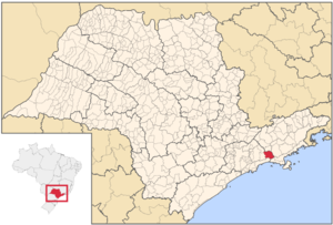
mapsize = 250px
map_caption = Location of Salesópolis
pushpin_mapsize =
subdivision_type = Country
subdivision_type1 = Region
subdivision_type2 = State
subdivision_name = flag|Brazil
subdivision_name1 = Southeast
subdivision_name2 = flag|São Paulo
leader_title =Mayor
leader_name =Benedito Rafael da Silva (PR)
area_note =
area_magnitude = 1 E9
area_total_km2 = 425.842
area_footnotes =
population_as_of = 2007
population_footnotes = cite web|url=http://www.ibge.gov.br/home/estatistica/populacao/contagem2007/popmunic2007layoutTCU14112007.xls|title=Estimativas - Contagem da População 2007|publisher = IBGE|accessdate=2008-07-11]
population_total = 15157
population_density_km2 = 35.59
timezone =UTC-3
utc_offset = -3
timezone_DST =UTC-2
utc_offset_DST = -2
latd = 23
latm = 50
lats = 46
latNS = S
longd = 46
longm = 37
longs = 47
longEW = W
elevation_m = 850
elevation_ft =
blank_name = HDI (2000)
blank_info = 0,748 – medium
Postal Code =
website = [http://www.salesopolis.sp.gov.br/ Salesópolis]
footnotes =Salesópolis is a municipality in the
São Paulo Metropolitan Region in the state of São Paulo inBrazil . The population in2004 was 15,281, the density was 35.87/km² and the area is 426 km².The
Tietê River flows in the northern part, much of the southern portion of the land are mountainous and also heavily forested with trees and has no accessible roads and is also a parkland. The roads are around Salesópolis.Population history
Other
Salesópolis has a schools or a collegiate, high schools, churches, banks and a few parks.
References
External links
* [http://www.salesopolis.sp.gov.br Official website]
* [http://www.citybrazil.com.br/SP/salesopolis citybrazil.com.br]Geographic Location
Centre = Salesópolis
North =Santa Branca
Northeast =Paraibuna
East =Caraguatatuba
Southeast = São Sebastião
South =Bertioga
Southwest =
West =Biritiba-Mirim
Northwest =Guararema

Wikimedia Foundation. 2010.