- 1982 Pacific typhoon season
Infobox hurricane season
Basin=WPac
Year=1982
Track=1982 Pacific typhoon season summary.jpg
First storm formed=March 16
Last storm dissipated=December 10
Strongest storm name= Mac
Strongest storm winds=140
Strongest storm pressure=895
Total storms=26
Total hurricanes=19
Total intense=2
Fatalities=468
five seasons=1980 1981 1982 1983 1984The 1982 Pacific typhoon season has no official bounds; it ran year-round in 1982, but mosttropical cyclones tend to form in the northwesternPacific Ocean between May and November. [Gary Padgett. [http://www.typhoon2000.ph/garyp_mgtcs/may03sum.txt May 2003 Tropical Cyclone Summary.] Retrieved2007-01-05 .] These dates conventionally delimit the period of each year when most tropical cyclones form in the northwestern Pacific Ocean.The scope of this article is limited to the Pacific Ocean, north of the equator and west of the
international date line . Storms that form east of the date line and north of the equator are called hurricanes; see1982 Pacific hurricane season . Tropical Storms formed in the entire west Pacific basin were assigned a name by theJoint Typhoon Warning Center . Tropical depressions in this basin have the "W" suffix added to their number. Tropical depressions that enter or form in the Philippine area of responsibility are assigned a name by thePhilippine Atmospheric, Geophysical and Astronomical Services Administration or PAGASA. This can often result in the same storm having two names.torms
28 tropical depressions formed this year in the Western Pacific, of which 26 became tropical storms. 19 storms reached typhoon intensity, of which 2 reached super typhoon strength.
Tropical Storm Mamie (Akang)
infobox hurricane small
name=Tropical Storm Mamie (Akang)
category=storm
type=tropical storm
track=Mamie 1982 track.png
dissipated=March 24
highest winds=60 knots (1-min)
lowest pressure=990 mbarequator . Over the next several days, the disturbance crossed the equator, moving northward. By March 14, it was located 190 km east-southeast ofTruk . Turning westward, the system became a tropical storm by the afternoon of March 16. Further intensification was quite slow, and halted upon landfall inMindanao on March 19. Extensive property and crop damage, as well as 40 deaths, were attributed to this storm. The cyclone entered theSulu Sea as a tropical storm, and turned northward as it reached theSouth China Sea . A turn to the west again occurred, which directed Mamie to a landfall near Nha Trang,Vietnam late on March 24. Dissipation was complete within a mountainous region on March 25. [Joint Typhoon Warning Center. [https://metocph.nmci.navy.mil/jtwc/atcr/1982atcr/pdf/wnp/01.pdf#search=%22typhoon%20freda%20march%201981%22 Tropical Storm Mamie.] Retrieved on2007-01-05 .]Typhoon Nelson (Bising)
infobox hurricane small
name=Typhoon Nelson (Bising)
category=cat3
type=typhoon
track=Nelson 1982 track.png
dissipated=April 1
highest winds=105 knots (1-min)
lowest pressure=934 mbarGuam . Nelson intensified rapidly from a tropical disturbance into a tropical storm. This was due to very strong divergence aloft. Strong low level easterlies and rapid westward movement led to slower development thereafter. After March 22, forward motion began to slow and intensification resumed. Maximum intensity was reached on March 25. On March 27, Nelson moved through the south-centralPhilippines and rapidly weakened. Slight intensification resumed as the center emerged into the South China Sea. By March 30, upper levelwind shear led to significant weakening, with the low level center becoming exposed and eventually dissipating on April 1 about 445 km east of Nha Trang,Vietnam . [Joint Typhoon Warning Center. [https://metocph.nmci.navy.mil/jtwc/atcr/1982atcr/pdf/wnp/02.pdf Typhoon Nelson.] Retrieved on2007-01-05 .]Typhoon Odessa
infobox hurricane small
name=Typhoon Odessa
category=cat1
type=typhoon
track=Odessa 1982 track.png
dissipated=April 4
highest winds=75 knots (1-min)
lowest pressure=964 mbarJapan , a circulation center developed within this convective cluster over the next few days. By the afternoon of March 29, it had matured into a tropical storm. A mid-level trough extended southwest towards the cyclone. Combined with strong ridging building in north to northwest of the storm, Odessa ceased moving northwest and turned east at around 10 knots during March 30 and March 31. As the mid-level trough continued moving east, Odessa turned back to the north, and eventually west-northwest, as ridging built in north of the cyclone. After the change in course to west, intensification resumed, and the system reached typhoon strength in the afternoon of April 2. As Odessa peaked in strength a weakness in thesubtropical ridge lured its convection northeast, shearing the thunderstorms away from the center. Rapid weakening ensued, and the cyclone dissipated on the afternoon of April 4.The occurrence of this cyclone ended the most active March for tropical cyclone formation in the northwest Pacific ocean since 1967. Odessa was unique from a climatological standpoint, moving east and west in an area normally known for northward moving tropical cyclones in March. [Joint Typhoon Warning Center. [https://metocph.nmci.navy.mil/jtwc/atcr/1982atcr/pdf/wnp/03.pdf Typhoon Odessa.] Retrieved on
2007-01-05 .]Typhoon Pat (Klaring)
infobox hurricane small
name=Typhoon Pat (Klaring)
category=cat3
type=typhoon
track=Pat 1982 track.png
dissipated=May 23
highest winds=105 knots (1-min)
lowest pressure=947 mbarGuam on May 14. By May 17 the system had organized sufficiently to become a tropical depression. Moving westward until the afternoon of May 18, Pat abruptly changed course to the north through a break in thesubtropical ridge parallel and close to the Philippines. Rapid intensification ensued, with Pat reaching its maximum intensity late on May 21. As the cyclone turned to the northeast, verticalwind shear began to weaken the cyclone. Its wind field broadened as it began extratropical transition. By midday on May 23, Pat had evolved into anextratropical cyclone along a frontal boundary with cool, dry air wrapping into its center. The cyclone became absorbed by a larger system near Japan on May 24. [Joint Typhoon Warning Center. [https://metocph.nmci.navy.mil/jtwc/atcr/1982atcr/pdf/wnp/04.pdf Typhoon Pat.] Retrieved on2007-01-05 .]Typhoon Ruby
infobox hurricane small
name=Typhoon Ruby
category=cat1
type=typhoon
track=Ruby 1982 track.png
dissipated=June 27
highest winds=75 knots (1-min)
lowest pressure=970 mbarGuam on June 18. It tracked westward, without significant development until June 20 while passing south ofUlithi Atoll . Steering currents collapsed, and the system drifted between Ulithi andYap for the next couple of days. By the morning of June 21, the system had strengthened into a tropical storm. The system drifted north to northwest, then northeast towardsGuam . Ruby waited to detach from themonsoon trough before further strengthening was realized on June 23. Steady intensification ensued, and the cyclone accelerated northward, becoming a typhoon on the afternoon of June 24. Ruby became anextratropical cyclone on June 27, occluding and becoming nearly stationary east ofHokkaidō for several days. [Joint Typhoon Warning Center. [https://metocph.nmci.navy.mil/jtwc/atcr/1982atcr/pdf/wnp/05.pdf Typhoon Ruby.] Retrieved on2007-01-05 .]Tropical Storm Tess
infobox hurricane small
name=Tropical Storm Tess
category=storm
type=tropical storm
track=Tess 1982 track.png
dissipated=July 2
highest winds=35 knots (1-min)
lowest pressure=999 mbarHong Kong , the cyclone was upgraded to a tropical storm late on June 30. Quickly weakening back to a tropical depression early on July 1, Tess dissipated as it approached theFormosa Strait . [Joint Typhoon Warning Center. [https://metocph.nmci.navy.mil/jtwc/atcr/1982atcr/pdf/wnp/06.pdf Tropical Storm Tess.] Retrieved on2007-01-05 .]Tropical Storm Skip
infobox hurricane small
name=Tropical Storm Skip
category=storm
type=tropical storm
track=Skip 1982 track.png
dissipated=July 1
highest winds=50 knots (1-min)
lowest pressure=991 mbarsubtropical cyclone in its annual report. By July 2, what limited convection was near the center of Skip disappeared, and it became anextratropical cyclone .Joint Typhoon Warning Center. [https://metocph.nmci.navy.mil/jtwc/atcr/1982atcr/pdf/wnp/06.pdf Chapter 3.] Retrieved on2007-01-05 .]Tropical Storm Val (Deling)
infobox hurricane small
name=Tropical Storm Val (Deling)
category=storm
type=tropical storm
track=Val 1982 track.png
dissipated=July 4
highest winds=55 knots (1-min)
lowest pressure=987 mbarTaiwan on July 1. Isolated convection was seen near the low pressure center at the time. When deeper convection formed on July 3, Val was deemed to become a tropical storm. In the Joint Typhoon Warning Center write-up, it was considered asubtropical cyclone after the fact. The cyclone accelerated northeast, and by July 4 whatever central convection it once had was gone and it was considered anextratropical cyclone late that morning.Tropical Storm Winona (Emang)
infobox hurricane small
name=Tropical Storm Winona (Emang)
category=storm
type=tropical storm
track=Winona 1982 track.png
dissipated=July 17
highest winds=55 knots (1-min)
lowest pressure=985 mbarwind shear hampered the development of thistropical cyclone throughout its life cycle. Between July 10 and July 12, its predecessor disturbance marched westward with little development. Observations fromYap late on July 12 verified the existence of a developing low-level center, and it was upgraded to a tropical depression at this time. Moving west-northwest along the southern periphery of thesubtropical ridge , Winona made landfall onLuzon during the afternoon of July 15. Damage to Clark Air Force Base totalled US$250,000 (1982 dollars) and 272 families in the Philippines were left homeless by the ensuing flood. Reintensifying in the South China Sea, the cyclone reached its peak intensity on the afternoon of July 16. Thereafter, wind shear took its toll and the cyclone began to weaken. The cyclone revealed an exposed low-level center on July 17, and the system dissipated before reaching theChina /Vietnam coast on July 18.Typhoon Andy (Iliang)
infobox hurricane small
name=Typhoon Andy (Iliang)
category=cat4
type=typhoon
track=Andy 1982 track.png
dissipated=July 30
highest winds=120 knots (1-min)
lowest pressure=920 mbarmonsoon trough south ofGuam . Prior to its formation, low-level westerlies were firmly in place south of the 10th parallel eastward to theInternational Date Line . On July 20, the monsoon trough segmented, with the middle segment becoming Andy (Bess formed from the eastern segment). On July 22, the area south of Guam showed increasing thunderstorm activity and organization. That morning, it became a tropical storm. Andy's center briefly became exposed on July 23 before drifting back under the thunderstorm activity. After looping south of Guam, the cyclone moved northwest and strengthened. Andy turned westward near the 18th parallel on July 25 as the ridge to its northeast strengthened. The system became a strong typhoon for a prolonged period on July 28 and July 29 before striking southernTaiwan . A deluge fell across eastern Taiwan, where flood-related damage was concentrated. Continuing westward through theFormosa Strait , the storm made its final landfall and dissipated in southeast China on July 30.uper Typhoon Bess
infobox hurricane small
name=Super Typhoon Bess
category=cat5
type=super typhoon
track=Bess 1982 track.png
formed=July 22
dissipated=August 2
highest winds=140 knots (1-min)
lowest pressure=901 mbarKwajalein on July 22. It headed northwestward, becoming a tropical storm on July 23 and a typhoon on July 24. A shortwave trough forced Bess southwestward where it remained a 105 mph typhoon. It looped and stalled until another shortwave trough brought the typhoon to the northwest. Bess rapidly intensified to a 160 mph super typhoon, and weakened steadily as it turned more northward. Bess crossed the Japanese coast on August 1 as a minimal typhoon, and was absorbed by a low pressure center in theSea of Japan on August 2. Bess caused torrential mudslides in Japan, causing extensive damage and 59 casualties. The name Bess was retired after this season. [Joint Typhoon Warning Center. [https://metocph.nmci.navy.mil/jtwc/atcr/1982atcr/pdf/wnp/11.pdf Super Typhoon Bess.] Retrieved on2007-01-05 .]Typhoon Cecil (Loleng)
infobox hurricane small
name=Typhoon Cecil (Loleng)
category=cat4
type=typhoon
track=Cecil 1982 track.png
dissipated=August 14
highest winds=125 knots (1-min)
lowest pressure=914 mbarChuuk organized into a tropical depression on August 4. After moving quickly westward, the depression stalled on August 5 and August 6, allowing it to strengthen into a tropical storm and mature into a typhoon on August 7. The typhoon turned northward, rapidly intensifying to maximum sustained winds of 125 knots on August 8 while east ofTaiwan . Cooler water temperatures and verticalwind shear weakened Cecil as it continued northward, and as a 35 knot tropical storm, it hitNorth Korea on August 14. Though significantly weakened, it brought a great deal of precipitation, causing severe flooding killing 35 (with 28 missing) and millions in damage.Joint Typhoon Warning Center. [https://metocph.nmci.navy.mil/jtwc/atcr/1982atcr/pdf/wnp/12.pdf Typhoon Cecil.] Retrieved on2007-01-05 .]Typhoon Dot (Miding)
infobox hurricane small
name=Typhoon Dot (Miding)
category=cat2
type=typhoon
track=Dot 1982 track.png
dissipated=August 15
highest winds=80 knots (1-min)
lowest pressure=960 mbarKwajalein on August 5. Over the next couple days, the low moved northwest. Slowly developing, it became a tropical depression on the morning of August 9, and a tropical storm by evening. Becoming a typhoon on August 11, Dot moved westward under the base of thesubtropical ridge . By August 12, Cecil's outflow began to impact Dot, and weakening ensued, sending Dot back to the tropical storm stage. As Cecil's influence began to lessen on August 13, Dot stopped weakening. As a tropical storm, Dot rapidly passed overTaiwan on August 15, rapidly weakening over the mountainous island. As a weak tropical storm, Dot dissipated after making landfall in eastern China.Joint Typhoon Warning Center. [https://metocph.nmci.navy.mil/jtwc/atcr/1982atcr/pdf/wnp/13.pdf Typhoon Dot.] Retrieved on2007-01-06 .] As of 2005, Dot is the eighth wettest known typhoon forHong Kong . It dropped 19.36 inch/491.7 mm of rainfall upon the region. [Hong Kong Observatory . [http://www.weather.gov.hk/publica/tc/tc2005.pdf Tropical Cyclones in 2005.] Retrieved on2007-02-19 .]Typhoon Ellis (Oyang)
infobox hurricane small
name=Typhoon Ellis (Oyang)
category=cat4
type=typhoon
track=Ellis 1982 track.png
dissipated=August 27
highest winds=125 knots (1-min)
lowest pressure=913 mbarmonsoon trough south of Ponape on August 15. Modest development ensued as it moved west-northwest, and the system was classified as a tropical depression on the morning of August 19, and a tropical storm that night. Turning to the northwest, Ellis became a typhoon on the morning of August 21, and ultimately a major typhoon on August 22. A mid-level trough moving into theYellow Sea continued Ellis' recurvature. Moving east ofOkinawa on August 25, the cyclone headed northward towards Japan. Moving byKyūshū ,Shikoku , andHonshū , the cyclone degenerated into a tropical storm. Heavy rains up to 28 inches {71 cm) inundated southwest Japan, bringing life to a standstill for the region. Moving into theSea of Japan on August 27, Ellis evolved into anextratropical cyclone which turned back to the northwest, ending up about 220 km west of Vladivostok.Joint Typhoon Warning Center. [https://metocph.nmci.navy.mil/jtwc/atcr/1982atcr/pdf/wnp/14.pdf Typhoon Ellis.] Retrieved on2007-01-06 .]Typhoon Faye (Norming)
infobox hurricane small
name=Typhoon Faye (Norming)
category=cat2
type=typhoon
track=Faye 1982 track.png
dissipated=September 3
highest winds=90 knots (1-min)
lowest pressure=960 mbarLuzon and rapidly weakens. Wallace Air Station reported gusts to 100 knots during the passage of Faye. Recurving to the northeast, Faye continued weakening due to vertical wind shear from Ellis, with dissipation as a tropical cyclone occurring on the afternoon of August 27. As a tropical depression, Faye moved east-northeast for a while before stalling between a mid-level trough and newly developed Tropical Storm Gordon. As Ellis retreated to the north, Faye began to reorganize with tropical storm status reattained on the morning of August 28 and typhoon status reached that night. Weakening began anew due to outflow from Typhoon Gordon, and the system became a tropical storm once more on the early morning of August 30. By August 31, a building ridge to Faye's north led to a southwest motion as the system continued to weaken. The cyclone became a tropical depression that evening, and drifted west for the next few days as an exposed low level circulation. The depression dissipated in the South China Sea on the afternoon of September 3.Joint Typhoon Warning Center. [https://metocph.nmci.navy.mil/jtwc/atcr/1982atcr/pdf/wnp/15.pdf Typhoon Faye.] Retrieved on2007-01-06 .]Typhoon Gordon
infobox hurricane small
name=Typhoon Gordon
category=cat3
type=typhoon
track=Gordon 1982 track.png
dissipated=September 5
highest winds=100 knots (1-min)
lowest pressure=944 mbarInternational Date Line . A surface circulation developed in associated with this convection on August 25 near 8N 163E. While upper ridging aloft existed, it was not until the following day that it developed directly over this disturbance. Moving northwest, rapid development began early on August 27, with tropical depression status achieved that morning and tropical storm intensity reached that afternoon. Gordon became a typhoon on the morning of August 28. By early on August 30, the cyclone reached its maximum intensity. A building ridge to its north directed Gordon westward until September 3, when its motion slowed. A shortwave trough deepened to its northwest, and the cyclone turned northward in response. By September 4, the cyclone was accelerating east to northeast, passing about 480 km southeast of Tokyo, and the storm became extratropical early on the afternoon of September 5.Joint Typhoon Warning Center. [https://metocph.nmci.navy.mil/jtwc/atcr/1982atcr/pdf/wnp/16.pdf Typhoon Gordon.] Retrieved on2007-01-06 .]Tropical Storm Hope (Pasing)
infobox hurricane small
name=Tropical Storm Hope (Pasing)
category=storm
type=tropical storm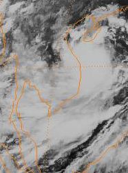
track=Hope 1982 track.png
dissipated=September 6
highest winds=60 knots (1-min)
lowest pressure=979 mbarVietnam south of Da Nang, then moved into the mountains ofLaos andVietnam as it rapidly dissipated. Significant flooding caused the evacuation of several thousand people and damaged the rice crop.Joint Typhoon Warning Center. [https://metocph.nmci.navy.mil/jtwc/atcr/1982atcr/pdf/wnp/17.pdf Tropical Storm Hope.] Retrieved on2007-01-06 .]Typhoon Irving (Ruping)
infobox hurricane small
name=Typhoon Irving (Ruping)
category=cat2
type=typhoon
track=Irving 1982 track.png
dissipated=September 16
highest winds=90 knots (1-min)
lowest pressure=952 mbarmonsoon trough was south ofGuam . By late on September 4, a surface low was apparent near 11N 130E. Late the next day, it became a tropical depression while moving generally to the west. By the next morning, it had strengthened into a tropical storm. Late on September 8, the cyclone struck the southern tip ofLuzon as a strong tropical storm. Moving through an inland sea route though thearchipelago , Irving slightly weakened before turning northwest into the South China Sea. Irving became a compact typhoon while strengthening over open waters. Weakening back into a tropical storm due to land interaction withHai-nan and mainland China, the system made landfall about 205 km northeast of Hanoi, then rapidly dissipated as it moved inland.Joint Typhoon Warning Center. [https://metocph.nmci.navy.mil/jtwc/atcr/1982atcr/pdf/wnp/18.pdf Typhoon Irving.] Retrieved on2007-01-06 .]Typhoon Judy (Susang)
infobox hurricane small
name=Typhoon Judy (Susang)
category=cat1
type=typhoon
track=Judy 1982 track.png
dissipated=September 12
highest winds=90 knots (1-min)
lowest pressure=953 mbarKorea swept Judy more northward, ultimately accelerating the storm towards Japan on September 11. When 70 knot Typhoon Judy hit southeastern Japan on September 12, its torrential rains left 25 dead and causing moderate damage. Extratropical transition had begun around that time, and Judy became anextratropical cyclone on September 13. [Joint Typhoon Warning Center. [https://metocph.nmci.navy.mil/jtwc/atcr/1982atcr/pdf/wnp/19.pdf Typhoon Judy.] Retrieved on2007-01-05 .]Typhoon Ken (Tering)
infobox hurricane small
name=Typhoon Ken (Tering)
category=cat3
type=typhoon
track=Ken 1982 track.png
dissipated=September 25
highest winds=110 knots (1-min)
lowest pressure=936 mbarmonsoon trough in thePhilippine Sea , the convective disturbance was first noted on September 14. By the afternoon of September 16, the system had organized into a tropical depression, and by that night a tropical storm. As a compact system, rapid intensification continued, with Ken becoming a typhoon on the evening of September 17 and a major typhoon on September 18. The cyclone up to this point had a history of progressing slowly west-northwest, but Ken eventually stalled on September 20 and became a larger cyclone, possibly due to the injestion of some cooler, drier air from its periphery. As a mid-latitude trough to its north deepened, Ken took off to the northeast towardsOkinawa . On September 23, Ken brought significant rains to the island when 11.09 inches (28.2 cm) were measured at Kadena. Weakening ensued thereafter due to interaction with the main belt of the Westerlies. Ken made landfall uponShikoku early on September 25, and moved onward into theSea of Japan where it evolved into anextratropical cyclone . The fourth typhoon of the season to strike Japan, Ken brought winds as high as 114 knots and rainfall of 8.70 inches (22.1 cm) within a six hour period toShikoku . Resultant mudslides damaged thousands of homes. [Joint Typhoon Warning Center. [https://metocph.nmci.navy.mil/jtwc/atcr/1982atcr/pdf/wnp/20.pdf Typhoon Ken.] Retrieved on2007-01-05 .]Tropical Storm Lola
infobox hurricane small
name=Tropical Storm Lola
category=storm
type=tropical storm
track=Lola 1982 track.png
dissipated=September 19
highest winds=50 knots (1-min)
lowest pressure=993 mbarInternational Dateline in the subtropics on September 13. Slowly developing, a low pressure system was spotted with the thunderstorm activity on the morning of September 15. Becoming a tropical storm the following afternoon, Lola recurved around the western periphery of thesubtropical ridge . The cyclone accelerated northeast on September 17, and by the morning of September 19, Lola had become anextratropical cyclone along the frontal zone which swept it out of the subtropics. [Joint Typhoon Warning Center. [https://metocph.nmci.navy.mil/jtwc/atcr/1982atcr/pdf/wnp/21.pdf Tropical Storm Lola.] Retrieved on2007-01-06 .]Tropical Depression 22
infobox hurricane small
name=Tropical Depression 22
category=depression
type=tropical depression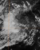
track=22-W 1982 track.png
dissipated=September 22
highest winds=30 knots (1-min)
lowest pressure=1001 mbarwind shear as it began to round the western periphery of thesubtropical ridge . By the afternoon of September 22, the cyclone weakened into a low pressure area. This low developed into a smallextratropical cyclone when it linked up with a frontal boundary southeast of Japan on September 24. [Joint Typhoon Warning Center. [https://metocph.nmci.navy.mil/jtwc/atcr/1982atcr/pdf/wnp/22.pdf Tropical Depression 22.] Retrieved on2007-01-06 .]uper Typhoon Mac (Uding)
infobox hurricane small
name=Super Typhoon Mac (Uding)
category=cat5
type=super typhoon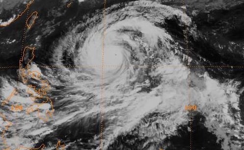
track=Mac 1982 track.png
dissipated=October 9
highest winds=140 knots (1-min)
lowest pressure=895 mbarGuam as a strong tropical storm on the morning of October 3. Heavy rains and high winds in the southern part of the island led to US$1.5 million (1982 dollars) in damage. Continuing to intensify rapidly, Mac soon became a typhoon, and by October 5 had become a super typhoon. Recurving northwest, the storm travelled into a weakness in thesubtropical ridge , accelerating north-northeast as it passed the ridge axis by October 6. Acceleration into the main belt of the Westerlies continued while the cyclone slowly weakened, and Mac evolved into a typhoon-strengthextratropical cyclone on the afternoon of October 9. [Joint Typhoon Warning Center. [https://metocph.nmci.navy.mil/jtwc/atcr/1982atcr/pdf/wnp/23.pdf Super Typhoon Mac.] Retrieved on2007-01-06 .]Typhoon Nancy (Weling)
infobox hurricane small
name=Typhoon Nancy (Weling)
category=cat4
type=typhoon
track=Nancy 1982 track.png
dissipated=October 18
highest winds=115 knots (1-min)
lowest pressure=926 mbarLuzon on October 14. Its winds were reduced to tropical storm strength, but Nancy re-intensified to an 80 knot typhoon over the South China Sea. It hit northernVietnam on the October 18, and dissipated shortly thereafter. The heavy rains accompanied by the system caused 309 fatalitiesDavid Michael V. Padua. [http://www.typhoon2000.ph/stats/DeadliestPhilippineTyphoons.htm DEADLIEST TYPHOONS OF THE PHILIPPINES: (1947 - 2002).] Retrieved on2007-01-05 .] and over $46 million in damage (1982 USD).Joint Typhoon Warning Center. [https://metocph.nmci.navy.mil/jtwc/atcr/1982atcr/pdf/wnp/24.pdf Typhoon Nancy.] Retrieved on2007-01-05 .]Tropical Depression 25
infobox hurricane small
name=Tropical Depression 25
category=depression
type=tropical depression
track=25-W 1982 track.png
dissipated=October 16
highest winds=20 knots (1-min)
lowest pressure=1002 mbar2007-01-06 .]Typhoon Owen
infobox hurricane small
name=Typhoon Owen
category=cat3
type=typhoon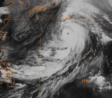
track=Owen 1982 track.png
dissipated=October 27
highest winds=105 knots (1-min)
lowest pressure=939 mbarKwajalein on October 13. Slow development ensued as it moved west-northwest, and by early October 16 it achieved tropical depression status. Northerly verticalwind shear tilted the system to the south with height, and slowed development. By October 19, Owen became a typhoon as it slowed and turned more to the north. As it picked up forward speed during recurvature, it reached its peak intensity during the afternoon of October 20. Thereafter, the system began to shear from the south, its wind field expanded, and extratropical transition had begun. Owen became anextratropical cyclone on the morning of October 22. The system then was blocked from fully recurving into the Westerlies, and turned to the southeast and south. Convection increased south of the center on October 23, and Owen became atropical cyclone once more with active central convection on October 24. The system moved eastward as a tropical storm for the next day. By October 25, Owen turned back to the north and began to lose its thunderstorm activity once more. Weakening back into a tropical depression, Owen eventually dissipated in the warm sector of an approachingextratropical cyclone late on October 27 after tracking over 6600 km.Joint Typhoon Warning Center. [https://metocph.nmci.navy.mil/jtwc/atcr/1982atcr/pdf/wnp/26.pdf Typhoon Owen.] Retrieved on2007-01-06 .]Typhoon Pamela (Aning)
infobox hurricane small
name=Typhoon Pamela (Aning)
category=cat3
type=typhoon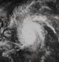
track=Pamela 1982 track.png
dissipated=December 9
highest winds=100 knots (1-min)
lowest pressure=940 mbarInternational Date Line organized into Tropical Depression 27W. It looped, then tracked to the west where it strengthened into Tropical Storm Pamela on the 24th. It continued west-northwestward, reaching typhoon intensity on the 26th. Pamela reached a peak of 115 mph winds as it crossed theMarshall Islands , and as it continued westward, residents ofGuam were afraid of the devastating Super Typhoon Pamela of 1976. It approached the island as a weakened tropical storm on December 1, but only brought minor winds and damage. Pamela looped to the southwest on the 4th, strengthened to a typhoon but weakened back to a tropical storm. It restrengthened to a typhoon just before hitting the Philippines on the 7th. The storm dissipated on the 9th, after causing moderate to extensive damage to the islands of the West Pacific.Its unusual path and the time of year was very nearly repeated by Typhoon Manny in the
1993 Pacific typhoon season . The name Pamela was retired after the season, possibly in respect of the 1976 storm. [Joint Typhoon Warning Center. [https://metocph.nmci.navy.mil/jtwc/atcr/1982atcr/pdf/wnp/27.pdf Typhoon Pamela.] Retrieved on2007-01-05 .]Typhoon Roger (Bidang)
infobox hurricane small
name=Typhoon Roger (Bidang)
category=cat1
type=typhoon
track=Roger 1982 track.png
dissipated=December 10
highest winds=65 knots (1-min)
lowest pressure=985 mbarwind shear over the disturbance, explaining its slow development. Early on December 7, both Pamela's and Roger's centers were as close as 1110 km from each other. Vertical wind shear finally lessened as Pamela weakened over the Philippines, allowing Roger to rapidly develop into a tropical storm late on December 8 and a typhoon on the morning of December 10. Moving northwest along the coast of the Philippines, Roger weakened back into a tropical storm. Vertical wind shear increased again, which combined with land interaction quickly weakened the tropical cyclone. By early afternoon on December 10, the cyclone became ill-defined and no longer qualified as a tropical cyclone. Moving northeast away from the Philippines, Roger's remains were absorbed into an approaching frontal zone on December 12. [Joint Typhoon Warning Center. [https://metocph.nmci.navy.mil/jtwc/atcr/1982atcr/pdf/wnp/28.pdf Typhoon Roger.] Retrieved on2007-01-06 .]Other storms
Two additional tropical depressions were not named as tropical storms by the Joint Typhoon Warning Center (JTWC). They were, however, designated as tropical cyclones by the Philippines (PAGASA) once they entered the Philippine area of responsibility.
*Tropical Depression Gading (July 18-July 19)
*Tropical Depression Heling (July 21-July 23)torm names
Western North Pacific tropical cyclones were named by the
Joint Typhoon Warning Center . The first storm of 1982 was named Mamie and the final one was named Roger. The names Bess and Pamela were retired after this season.Philippines
The
Philippine Atmospheric, Geophysical and Astronomical Services Administration (PAGASA) uses its own naming scheme for tropical cyclones within its area of responsibility. Lists are recycled every four years. On the 1982 list, the name "Atang" was replaced by "Akang". Otherwise this is the same list used for the 1978 season.ee also
*
1982 Pacific hurricane season
*1982 Atlantic hurricane season
*1982 North Indian cyclone seasonReferences
External links
* [http://www.typhoon2000.ph Typhoon2000 Philippine typhoon website] .
* [http://www.typhoon2000.ph/plotting/PhilippineTyphoonChart.gifPhilippine Area of Responsibility] .
* [https://metocph.nmci.navy.mil/jtwc.html Joint Typhoon Warning Center] .
* [http://www.weather.gov.hk/informtc/sound/tc_pronunciatione.htm Meaning of Tokyo Typhoon Centre names] .
* [http://www.typhoon2000.ph/stormarchives/1963-1988_PTC.txt PAGASA names 1963-1988] .
Wikimedia Foundation. 2010.