- Campbell Park
-
For other uses, see Campbell Park (disambiguation).
Coordinates: 52°02′50″N 0°44′37″W / 52.047219°N 0.743626°W
Campbell Park 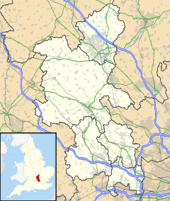
 Campbell Park
Campbell Park shown within BuckinghamshirePopulation 13,364 [1] OS grid reference SP861395 Parish Campbell Park Unitary authority Milton Keynes Ceremonial county Buckinghamshire Region South East Country England Sovereign state United Kingdom Post town MILTON KEYNES Postcode district MK6 Dialling code 01908 Police Thames Valley Fire Buckinghamshire Ambulance South Central EU Parliament South East England UK Parliament Milton Keynes North Website campbell-park.gov.uk List of places: UK • England • Buckinghamshire Campbell Park is a district in east-central and south-central Milton Keynes, Buckinghamshire, England, the central park for Milton Keynes, and a civil parish that includes other districts.[2] According to the 2001 census the parish had a population of 13,364. The parish is bounded by Portway (H5, A509), then Brickhill Street (V10), Dansteed Way (H4), the M1 motorway, the River Ouzel, Chaffron Way (H7), the A5, and then Childs Way (H6) and Marlborough Street (V8).
Apart from Campbell Park district itself, the parish includes the Fishermead, Oldbrook, Springfield, The Woolstones and Willen Lake districts, [Willen]] village, and Winterhill
Contents
The Park
The park, also known as Campbell Park, takes up the larger part of the district. It was named in honour of the first chairman of Milton Keynes Development Corporation, Lord Campbell of Eskan. It stretches from the Theatre end of Central Milton Keynes down to the Grand Union Canal. A marina is planned for the canal here and it is the planned junction for the proposed Bedford Arm.
The district is bounded by V8 Marlborough Street on the west, the Grand Union Canal on the east, H5 Portway (A509) to the north and H6 Childs Way to the south. The park itself has the same east and west boundaries but is bounded to the north by Silbury Boulevard and to the south by Avebury Boulevard. It seems that Milton Keynes Partnership has ambitions to emulate Central Park, New York in the extensive developments that overlook the park.
Civil parish
Campbell Park is a civil parish in the borough of Milton Keynes. As well as the urban park district itself, it also contains Fishermead, Newlands, Oldbrook, Springfield, Willen and Willen Lake, and Winterhill. The parish was originally known as Woolstone-cum-Willen[3] and was formed on 1 April 1934 as a merger of Great Woolstone, Little Woolstone and Willen.[4] The parish was part of Newport Pagnell Rural District until it became part of the borough of Milton Keynes in 1974.[4]
Fishermead
Fishermead is named after a field called Fishers Mead. The fishing theme is continued in the street naming. All of the streets are named after Cornish fishing terminology. There are three schools in the area, The Willows (formerly Newlyn Place) first school, Penwith first school and Meadfurlong middle school. Fishermead is known for its many trees and parks, with several local shops including a co-op and three fast-food vans.
The BT telephone exchange known as 'Bradwell Abbey' that serves Central Milton Keynes and the surrounding districts is located here, at the bottom of Helford Place – about three miles east of the real Bradwell Abbey.
The Fishermead estate is home to an immigrant community of somalis. This community is unfortunately most known for an incident on May 26 2011[5] where two teenage somalis were shot on the estate, one of them died in the attack and the other died later in hospital. [6] Three men (also from the somali community) have appeared in court charged with the murder. [7]
Newlands
 Hill at the cathedral of trees, Newlands
Newlands district is small, composed prilarily of low-lying park land. It is notable as the site of Gulivers Land, a small theme park; and the location of the Cathedral of Trees, a group of trees planted so that it has the appearance of a Norman cathedral, with the tree-trunks taking the place of columns.
Oldbrook
Oldbrook is separated from Central Milton Keynes by Child's Way (H6). Despite its proximity to Central Milton Keynes, it has its own local centre comprising various shops and restaurants including Blockbuster, Lidl, Domino's Pizza and Pizza Hut. Oldbrook is also home to Milton Keynes Christian Centre which is one of the larger churches in the town. There is one school in Oldbrook, Oldbrook First School, situated next door to The Cricketers pub on Oldbrook Blvd.
A number of streets are named after English cricketers.
Springfield
Springfield is a residential area situated close to Central Milton Keynes. It sits between the districts of Fishermead, Peartree Bridge and the Woolstones. There are two schools in the area, Shepherdswell first school and The Orchards (formerly Springfield Middle) school. Springfield has a local pub, community center and a Tesco Express shopping market. The Grand Union Canal runs by Springfield into nearby Peartree Bridge.
The Woolstones
Main article: Woolstone, Milton KeynesWillen Lake
Main article: Willen#Willen LakeWillen Lake is one of the bigger Lakes in Milton Keynes. It is mainly used as a water sports lake with a resident Sailing club and a towed Water Skiing feature.
The Lake is split into two sections with one side used for water sports and the other side kept as a nature reserve with Bird watching Boxes on the North West side of the dividing road, H5 Portway.
The Lake is particularly popular in the summer, attracting in numbers in excess of 5,000 people on a summer day.
Willen Lake has many features to attract a wide variety of interests including the Mini Golf area, the exercise Trim Trail, the Buddhist Peace Pagoda, a mini railway, a climbing activity centre, an extensive Childs play area and frequently on weekends Bouncy Castles and Ball Pits are erected in Andi Circle.
The Lake is very popular with runners and dog walkers for its serene atmosphere and picturesque views.
Willen
Main article: WillenWillen village has a long history. It is best known for its church and for Willen Hospice.
Winterhill
For other uses, see Winter Hill.Winterhill is the most westerly district of the parish, butting up as it does to the West Coast Main Line, south of and convenient to Milton Keynes Central railway station. It is a small district, split from the rest (Knowl Hill) of its natural grid square by the railway line and the A5. It consists primarily of 'big shed' retail outlets, a conference centre and the Milton Keynes Lions "Lions Arena".
Other Campbell Parks
- Campbell Falls State Park Reserve, in the United States is sometimes abbreviated to "Cambell Park"
References
- ^ Neighbourhood Statistics 2001 Census
- ^ Parishes in Milton Keynes - Milton Keynes Council.
- ^ "The Story of Campbell Park Parish Council". http://www.campbell-park.gov.uk/cp-parish/parish-stories/story-campbell-park-parish-council.
- ^ a b Vision of Britain - Woolstone Cum Willen. Retrieved on 16 April 2010.
- ^ http://www.miltonkeynes.co.uk/news/local/fishermead_shooting_dead_man_is_named_1_2720429
- ^ http://news.sky.com/skynews/Home/UK-News/Milton-Keynes-Shooting-18-year-old-Man-Also-Dead-After-Shooting-On-Fishermead-Estate/Article/201105416000795
- ^ http://www.guardian.co.uk/uk/2011/jul/08/teenagers-murder-men-in-court?INTCMP=ILCNETTXT3487
External links
Civil parishes in Milton Keynes Astwood • Bletchley and Fenny Stratford • Bow Brickhill • Bradwell • Bradwell Abbey • Broughton • Calverton • Campbell Park • Castlethorpe • Central Milton Keynes • Chicheley • Clifton Reynes • Cold Brayfield • Emberton • Gayhurst • Great Linford • Hanslope • Hardmead • Haversham-cum-Little Linford • Kents Hill, Monkston and Brinklow • Lathbury • Lavendon • Little Brickhill • Loughton • Milton Keynes • Moulsoe • New Bradwell • Newport Pagnell • Newton Blossomville • North Crawley • Olney • Ravenstone • Shenley Brook End • Shenley Church End • Sherington • Simpson • Stantonbury • Stoke Goldington • Stony Stratford • Tyringham and Filgrave • Walton • Warrington • Wavendon • West Bletchley • Weston Underwood • Woburn Sands • Wolverton and Greenleys • Woughton
Categories:- Civil parishes in Milton Keynes Borough


Wikimedia Foundation. 2010.