- 1971 Pacific hurricane season
Infobox hurricane season
Basin=EPac
Year=1971
Track=1971 Pacific hurricane season map.pngMay 21 ,1971
Last storm dissipated=November 29 ,1971
Strongest storm name=Denise
Strongest storm pressure=
Strongest storm winds=120
Average wind speed=1
Total depressions=22
Total storms=18
Total hurricanes=12
Total intense=6
Fatalities=52
Da
Inflated=
five seasons=1969, 1970, 1971, 1972, 1973May 15 ,1971 in the east Pacific, and onJune 1 ,1971 in the central Pacific. It ended onNovember 30 ,1971 . These dates conventionally delimit the period of time whentropical cyclone s form in the east Pacific Ocean.The 1971 season was above average with 18 named storms. Twelve hurricanes formed, of which six became major hurricanes by reaching Category 3 or higher on the
Saffir-Simpson Hurricane Scale . At the time, this was a record number of storms. This season had six landfalls (Agatha, Bridget, Katrina, Lily, Olivia and Priscilla), the highest number of landfalling Pacific tropical cyclones in one season.__TOC__
torms
Hurricane Agatha
Infobox Hurricane Small
Basin=EPac
Track=Agatha 1971 track.pngMay 21
Dissipated=May 25
1-min winds=85
Prepressure=≤
Pressure=972May 21 , an area of low pressure developed in the very warm waterssouth ofTehuantepec ,Mexico . Later that day, satellite images showed increasing circulation and Tropical Storm Agatha developed shortly after. Agatha continued moving to the west-northwest parallel to the Mexican coastline and strengthened into a hurricane onMay 22 . A U.S. Air Force weather reconnaissance aircraft flew into Agatha and found an eye and strong bands. The next day, a reconnaissance plane found winds of 75 to 80 knots (85 to 90 mph, 140 to 150 km/h). OnMay 24 , a ship reported winds of 85 kt (100 mph, 160 km/h). Agatha made landfall as a Category 2 hurricane on theSaffir-Simpson hurricane scale within 45mile s (75 km) of Zihuatanejo, Mexico.The village of Playa Azul was hard hit by the storm. Up to half of the village's homes were destroyed. Also, much of the
banana ,mango , andcoconut crop was destroyed.Hurricane Bridget
Infobox Hurricane Small
Basin=EPac
Formed=June 14
Dissipated=June 20
1-min winds=85AroundJune 12 an area of thunderstorms started to get more organized nearEl Salvador . The area of convection started to drift west-northwestward and onJune 15 Tropical Storm Bridget formed. Bridget moved across theGulf of Tehuantepec which had very warm waters. OnJune 16 , satellite imagery and ship report data confirmed that Bridget had strengthened into a hurricane. Hurricane Bridget continued moving west-northwest along the west coast ofMexico and came within 35 to 45 mi (55 to 75 km) ofAcapulco onJune 17 . Bridget made landfall about 100 mi (155 km) southeast of Manzanillo, Mexico.Bridget was the worst hurricane to hit Acapulco in over 25 years; the last strong hurricane to impact Acapulco to a greater extent was in 1943. The storm caused 500 million pesos (40 million USD) in damage.
Storm surge caused flooding in the bay and damaged waterfront and beach facilities. Violent seas also sank 20 boats plus a flagship of theMexican Navy .Hurricane Carlotta
Infobox Hurricane Small
Basin=EPac.png)
Track=Carlotta 1971 track.pngJuly 2
Dissipated=July 8
1-min winds=75
Prepressure=≤
Pressure=980July 1 an area of weather developed about 115 mi (185 km) east ofClipperton Island . OnJuly 2 the area of thunderstorms strengthened into Tropical Storm Carlotta. An Air Force reconnaissance aircraft flew into Carlotta onJuly 4 and found a system with a well defined eye and good outflow, but winds only supported a tropical storm. Another reconnaissance plane found winds that were near hurricane strength onJuly 4 . In post-season analysis, it was discovered that Carlotta was a hurricane for 24 hours on July 3 and 4. Later that day, Carlotta started weakening after moving into a less favorable environment. The storm continued to weaken until dissipating onJuly 8 .Carlotta stayed over open waters during its entire life and no land was affected.
Hurricane Denise
Infobox Hurricane Small
Basin=EPac
Track=Denise 1971 track.pngJuly 2
Dissipated=July 14
1-min winds=120
Prepressure=≤
Pressure=951July 2 an area of weather got better organized about 865 mi (1390 km) east of then Tropical Storm Carlotta. OnJuly 4 satellite imagery indicated that the system had strengthened into Tropical Storm Denise and later into Hurricane Denise onJuly 6 . The system continued to move west and onJuly 7 , U.S. Air Force weather reconnaissance plane found a more organized system with sustained winds estimated to be 80 kt (90 mph, 150 km/h) with a minimum central pressure of 963 mbar (hPa; 28.4inHg ). ByJuly 8 , the system had sustained one-minute winds of 110 kt (125 mph, 205 km/h) and a minimum central pressure of 951 mbar (hPa; 28.1 inHg). Denise reached a peak intensity of 120 kt (140 mph, 220 km/h), a Category 4 on theSaffir-Simpson Hurricane Scale early onJuly 9 , but then started to weaken.Denise had started a northwest movement towards
Hawaii . A reconnaissance aircraft found surface winds of approximately 100 kt (115 mph, 185 mph) onJuly 9 . Soon after, theeyewall started to dissipate, most likely because of cooler inflow. Over the next 48 hours, the system continued to weaken into a tropical storm. OnJuly 13 the system was approaching the Hawaiian Islands, but a reconnaissance flight only found winds that were barely tropical storm strength. What was left of the storm quickly weakened and Denise became a remnant low.The remnants of Denise moved south of the Hawaiian Islands, but still brought beneficial rains that caused some minor flooding. cite web |url=http://www.prh.noaa.gov/cphc/summaries/1971.php |title=The 1971 Central Pacific Tropical Cyclone Season |publisher=
CPHC |date=1971 |accessdate=2007-08-22]Tropical Storm Eleanor
Infobox Hurricane Small
Basin=EPac
Formed=July 7
Dissipated=July 11
1-min winds=50
Prepressure=≤
Pressure=1009Eleanor was a short-lived, weak tropical storm that stayed well out to sea.On
July 7 , a tropical depression formed east-southeast of the weakening Carlotta and west of the strengthening Denise. ByJuly 8 , satellite imagery showed that the depression had strengthened into a tropical storm. Eleanor strengthened over the next 24 hours to a top strength of 50 knots (60 mph, 95 km/h). OnJuly 10 , a U.S. Air Force weather reconnaissance plane found a weakening system and the next day the storm was a dissipating depression moving toward the west-southwest.Hurricane Francene
Infobox Hurricane Small
Basin=EPac.png)
Track=Francene 1971 track.pngJuly 18
Dissipated=July 23
1-min winds=100
Prepressure=≤
Pressure=991Mexico . OnJuly 18 a tropical depression had formed and onJuly 19 the system strengthened into Tropical Storm Francene. Francene underwentrapid deepening into a Category 3 hurricane on theSaffir-Simpson Hurricane Scale . However, because of Francene's increasing size, the storm starting pulling in cool surface air which caused weakening. ByJuly 20 , Francene had weakened into a tropical storm. Francene continued to weaken over the next 24 hours and was barley a tropical storm by the morning ofJuly 22 . That afternoon, Francene began to strengthen once again but it was short-lived. ByJuly 23 , the surface circulation had disappeared and Francene was no longer atropical cyclone . Francene stayed over open water and did not affect land.Tropical Storm Georgette
Infobox Hurricane Small
Basin=EPac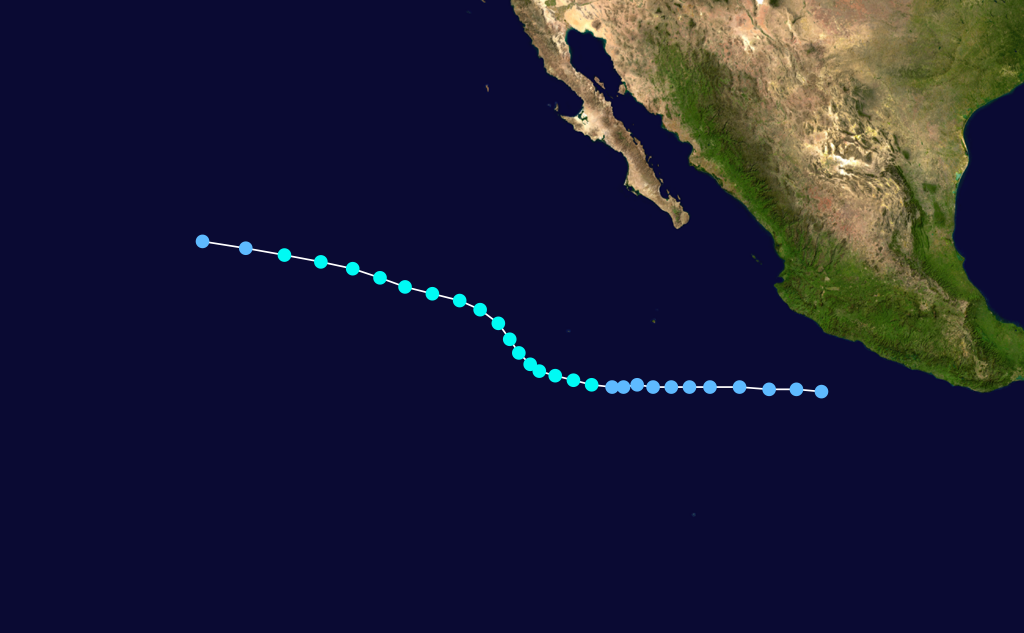
Formed=July 20
Dissipated=July 27
1-min winds=50
Pressure=991A tropical depression formed to the east of Hurricane Francene onJuly 20 . A reconnaissance flight found a poorly organized tropical storm with winds of convert|50|mph|km/h|abbr=on onJuly 23 . Georgette reached a peak intensity of convert|60|mph|0|km/h|abbr=on the next day. Ships to the north of Georgette reported weak tropical storm force winds. ByJuly 26 the storm began to weaken rapidly before dissipating the next day.Hurricane Hilary
Infobox Hurricane Small
Basin=EPac
Track=Hilary 1971 track.pngJuly 26
Dissipated=August 7
1-min winds=85
Prepressure=≤
Pressure=964Clipperton Island onJuly 26 . Hilary strengthened quickly into a hurricane byJuly 28 and a recon plane found surface winds of convert|90|mph|km/h|abbr=on and noted a well defined eye. The hurricane would peak as a category 2 with sustained winds of convert|100|mph|km/h|abbr=on onJuly 30 .cite web|url=http://weather.unisys.com/hurricane/e_pacific/1971/HILARY/track.dat|title=Hurricane Hilary track data|publisher=Unisys|language=English|accessdate=2008-07-31] Hilary weakened slightly as its motion became erratic across the tropicalPacific Ocean . ByAugust 1 the hurricane turned to the northwest towards cooler waters. Hilary weakened into a tropical storm onAugust 3 after being at hurricane strength for a week. Steady weakening continued over the next four days before dissipating in the Central Pacific.Hurricane Ilsa
Infobox Hurricane Small
Basin=EPac
Formed=July 31
Dissipated=August 8
1-min winds=100
Prepressure=≤
Pressure=978Tropical Storm Jewel
Infobox Hurricane Small
Basin=EPac
Formed=August 6
Dissipated=August 11
1-min winds=60Tropical Storm Katrina
Infobox Hurricane Small
Basin=EPac.jpg)
Track=Katrina 1971 track.pngAugust 8
Dissipated=August 12
1-min winds=55Baja California Sur and made landfall in as a tropical storm. It dissipatedAugust 13 . Rain from Katrina's remnants ruined crops, destroyed railroad trestles, and washed away three bridges.Hurricane Lily
Infobox Hurricane Small
Basin=EPac.jpg)
Track=Lily 1971 track.pngAugust 28
Dissipated=August 31
1-min winds=75August 31 .Hurricane Monica
Infobox Hurricane Small
Basin=EPac
Formed=August 29
Dissipated=September 4
1-min winds=100
Prepressure=≤
Pressure=1005Monica was a category 3 hurricane which didn't affect land.Hurricane Nanette
Infobox Hurricane Small
Basin=EPac
Formed=September 3
Dissipated=September 9
1-min winds=85
Prepressure=≤
Pressure=990Nanette threatened Baja California but turned away before striking.Hurricane Olivia
Infobox Hurricane Small
Basin=EPac
Formed=September 20
Dissipated=September 30
1-min winds=100
Pressure=948Olivia was a continuation of Atlantic Hurricane Irene. Olivia eventually strengthened into a Category 3 hurricane before recurving and making landfall in Baja California as a depression. The remnants of Olivia continued north into California, where they brought rain.Hurricane Priscilla
Infobox Hurricane Small
Basin=EPac
Formed=October 6
Dissipated=October 12
1-min winds=110
Pressure=951Priscilla made landfall south ofMazatlán as a tropical storm. It had weakened significantly before landfall, having once been a strong Category 3 hurricane. No damage was reported.Tropical Storm Ramona
Infobox Hurricane Small
Basin=EPac
Formed=October 28
Dissipated=October 31
1-min winds=50Tropical Storm Sharon
Infobox Hurricane Small
Basin=EPac
Formed=November 25
Dissipated=November 29
1-min winds=35
Prepressure=≤
Pressure=10091971 storm names
These names were used for storms that formed in 1971. It is the same list used in the 1967 season. A storm was named Sharon for the first time this year. No names were retired, so it was used again in the 1975 season.
The central Pacific used names and numbers from the west Pacific's typhoon name list. No storms formed in the region, and thus no names were used. However, tropical disturbances that later became typhoons started forming in this area.
ee also
*
List of Pacific hurricanes
*List of Pacific hurricane seasons
*1971 Atlantic hurricane season
*1971 Pacific typhoon season
*1971 North Indian Ocean cyclone season
*Southern Hemisphere tropical cyclone seasons: 1970–71, 1971–72References
* [http://docs.lib.noaa.gov/rescue/mwr/100/mwr-100-04-0276.pdf NOAA Monthly Weather Review] accessed November 7, 2005
* [http://weather.unisys.com/hurricane/e_pacific/1971/index.html Unisys Storm Tracks] accessed November 7, 2005
* [http://www.prh.noaa.gov/cphc/pages/hurrclimate.php#1971 CPHC archive] accessed November 17, 2005External links
* [http://ams.allenpress.com/perlserv/?request=res-loc&uri=urn%3Anoaa%3Apdf%3Afile%3Amwr-100-04-0276.pdf Eastern Pacific Hurricane Season of 1971]
* [http://www.prh.noaa.gov/cphc/summaries/1971.php CPHC Season Summary]
* [http://metocph.nmci.navy.mil/jtwc/atcr/1971atcr/pdf/annexa.pdf ATCR Eastern Pacific summary]
* [http://weather.unisys.com/hurricane/e_pacific/1971/index.html Unisys Storm Tracks]
Wikimedia Foundation. 2010.