- 1962 Pacific typhoon season
Infobox hurricane season
Basin=WPac
Year=1962
Track=1962 Pacific typhoon season summary.jpg
First storm formed=February 2 ,1962
Last storm dissipated=December 10 ,1962
Strongest storm name=Super Typhoon Karen
Strongest storm pressure=897
Total storms=30
Total hurricanes=26
Total intense=2
Fatalities=1683
five seasons=1960, 1961, 1962, 1963, 1964The 1962 Pacific typhoon season had no official bounds; it ran year-round in 1962, but most tropical cyclones tend to form in the northwesternPacific Ocean between June and December. These dates conventionally delimit the period of each year when most tropical cyclones form in the northwestern Pacific Ocean.The scope of this article is limited to the Pacific Ocean, north of the equator and west of the
international date line with two exceptions this season as Tropical Depressions 50 and 63 formed in the Central Pacific. Storms that form east of the date line and north of the equator are called hurricanes; see 1962 Pacific hurricane season. All tropical depressions were assigned a number. Most systems reaching tropical storm strength were assigned a name; all typhoons were named.eason activity
Ninety tropical waves formed in the 1962 season. Only 78 of these became major easterly waves. 42 of these waves became tropical depressions, 30 became storms and 24 become typhoons. This record of 24 typhoons beat 1952 record which had 21. This record was beaten in the 1964 season with 26 typhoons. Six super typhoons formed in 1962 which were Georgia, Emma, Ruth, Opal, Amy and Karen. Even with the high activity, only about half the cyclones in 1962 made landfall. There were also seventeen suspect cyclones discovered by the JTWC in post-season reports. Three were reported to reach typhoon intensity, three at tropical storm status and two needed tropical depression warnings. [https://metocph.nmci.navy.mil/jtwc/atcr/1962atcr/pdf/chapter3.pdf Joint Typhoon Warning Center's 1962 Annual Tropical Cyclone Report (Chapter 3)] ] Two depressions, 50 and 63, formed in the Central Pacific under the Joint Hurricane Warning Center's (now The
Central Pacific Hurricane Center ) jurisdiction and were included in the JTWC archives. Both depressions stayed out to sea and had no effects on land. The Central Pacific also got Nora, Opal, Ruth, Gilda, Emma and Thelma, the remnants of Nadine and the ending of Karen near the end of the season. [https://metocph.nmci.navy.mil/jtwc/atcr/1962atcr/pdf/chapter3.pdf Joint Typhoon Warning Center's 1962 Annual Tropical Cyclone Report (Chapter 3)] ] [http://www.prh.noaa.gov/cphc/summaries/1962.php Central Pacific Hurricane Center Archive of 1962] ] Strangely, six typhoons entered the Bering Sea, which were Nora, Opal, Ruth, Thelma, Amy and Emma. Four of the six were super typhoons. Three typhoons also missed entering the Bering Sea, which were Typhoons Hope, Sarah and Gilda. Also, Typhoons Georgia, Hope, Joan, Nora, Opal, Ruth, Thelma, Wanda, Amy, Emma, Gilda, Jean and Karen all lasted for at least one week with Opal lasting for eighteen straight days from a wave to the day the JMA ceased advisories. [http://www.jma.go.jp/jma/jma-eng/jma-center/rsmc-hp-pub-eg/bstve_1962_m.html JMA 1962 Best Track Graphics] ]torms
Tropical Storm Fran
Infobox Hurricane Small
Basin=WPac
Formed=February 1
Dissipated=February 6
1-min winds=47.5Tropical Depression 2W formed on the morning ofFebruary 2 off the coast of thePhilippines . The system strengthened quickly from a 30 mph (50 km/h) depression into a 40 mph (60 km/h) tropical storm in six hours. Fran curved to the north and strengthened into a 55 mph (95 km/h) storm on the evening ofFebruary 3 . [https://metocph.nmci.navy.mil/jtwc/best_tracks/1962/1962s-bwp/bwp011962.txt Best Track Data for Fran] ] This proved to be its peak intensity, as it began to weaken onFebruary 5 . On the morning ofFebruary 6 , Fran weakened into a tropical depression and the final advisory was released six hours after.uper Typhoon Georgia
Infobox Hurricane Small
Basin=WPac
Formed=April 16
Dissipated=April 26
1-min winds=130A large surge from the Southern Hemisphere from the outdraft entered into the easterlies. The surged formed onApril 13 nearWoleai Atol at 5°N in latitude and made landfall inUlithi before strengthening into Tropical Depression 13W onApril 16 . 13W made a cyclonic loop to the north and soon became a storm, given the name Georgia on the same day. Georgia reached typhoon status by the next day and reached Category 4 super typhoon status byApril 20 , peaking at a convert|150|mi/h|km/h|abbr=on super typhoon and having a minimum pressure of 936 millibars. Weakening was slow as Georgia was able to stay a typhoon until onApril 23 . Georgia encountered cool air and was declared extratropical on the evening ofApril 24 as a convert|60|mi/h|km/h|abbr=on tropical storm.The
Japan Meteorological Agency continued to track Georgia while an extratropical storm for five more days. Georgia reached a peak extratropical intensity of 978 mbar onApril 26 . Soon afterwards, Georgia continued to weaken and the JMA stopped issuing advisories onApril 29 at extremely high latitudes.cite web|url=http://www.jma.go.jp/jma/jma-eng/jma-center/rsmc-hp-pub-eg/bstve_1962_m.html|title=1962 Best Track Graphics|publisher= [Japan Meteorological Agency|accessdate=2008-06-21]Georgia left convert|9.85|in|m in rainfall over Yap Island, where no damage was recorded.cite web|url=http://www.hpc.ncep.noaa.gov/tropical/rain/tcmaxima.html|author=David M. Roth|publisher=
Hydrometeorological Prediction Center |title=Tropical Cyclone Rainfall Maxima|accessdate=2008-06-25|date=2008] Damage caused by Georgia was limited to $28,000 (1962 USD) which was to a ship and its cargo ($187,000 in 2006 USD). In total, Georgia moved up 45° in north latitude, the longest of any cyclone in 1962. [http://metocph.nmci.navy.mil/jtwc/atcr/1962atcr/pdf/wnp/13.pdf Georgia (13W) Tropical Cyclone Report by the JTWC] ]Typhoon Hope
Infobox Hurricane Small
Basin=WPac
Formed=May 16
Dissipated=May 22
1-min winds=82.5
Pressure=978A fracture after superposition of polar trough and an easterly wave with a slight surge from the easterlies occurred onMay 11 while overKoror . Strengthening was slow as the wave became Tropical Storm Hope onMay 16 near the Philippines. The storm quickly made landfall in the Philippines the next day as a convert|60|mi/h|km/h|abbr=on tropical storm. Hope weakened into a depression while over land, regaining storm strength east of Manila and weakening again to a depression. When Hope entered open waters, strengthening occurred, becoming the second typhoon of the season onMay 19 and peaking at convert|95|mi/h|km/h|abbr=on winds on the night of the 20th. Hope weakened, losing much convection and became extratropical due to cool air on the 22nd of August nearChichi Jima as a tropical depression. [http://metocph.nmci.navy.mil/jtwc/atcr/1962atcr/pdf/wnp/17.pdf Hope (17W) Tropical Cyclone Report by the JTWC] ]The Japan Meteorological Agency continued to track the extratropical remnants of Hope for six more days. The remnants passed by Japan on
May 24 , reaching an extratropical peak of 996 mbar. Hope moved to the northeast and passed by the Kurin Islands ofRussia onMay 26 . The Japan Meteorological Agency discontinued all advisories near theAleutian Islands as a 1018 mbar extratropical depression. [http://www.jma.go.jp/jma/jma-eng/jma-center/rsmc-hp-pub-eg/bstve_1962_m.html JMA 1962 Best Track Graphics] ]Damage and fatalities in the Philippines are unavailable. [http://metocph.nmci.navy.mil/jtwc/atcr/1962atcr/pdf/wnp/17.pdf Hope (17W) Tropical Cyclone Report by the JTWC] ]
Tropical Storm Iris
Infobox Hurricane Small
Basin=WPac
Formed=May 26
Dissipated=May 29
1-min winds=60
Pressure=991A easterly wave and polar trough which was fractured by superpostion formed onMay 26 northeast ofKoror and strengthened into Tropical Depression 22W several hours later near the Philippines. 22W strengthened into a tropical storm several hours after forming, being given the name Iris. Iris moved north, peaking at convert|75|mi/h|km/h|abbr=on which is a minimal typhoon. Weakening occurred rapidly as most of Iris' life was as a tropical depression. Iris dissipated onMay 30 due to lack of upper-level divergence and was irrecognizeable. [http://metocph.nmci.navy.mil/jtwc/atcr/1962atcr/pdf/wnp/22.pdf Iris (22W) Tropical Cyclone Report by the JTWC] ] Iris never making landfall. The JMA continued tracking the leftovers of Iris until the next day. [http://www.jma.go.jp/jma/jma-eng/jma-center/rsmc-hp-pub-eg/bstve_1962_m.html JMA 1962 Best Track Graphics] ]Iris killed five people but no estimate of damage was reported to crops. [http://metocph.nmci.navy.mil/jtwc/atcr/1962atcr/pdf/wnp/22.pdf Iris (22W) Tropical Cyclone Report by the JTWC] ]
Typhoon Joan
infobox hurricane small
name=Typhoon Joan (6205)
category=cat1
type=typhoon
formed=July 6
dissipated=July 11 ,1962
highest winds=90 mph (145 km/h)
lowest pressure=985 mbar
total da
total fatalities=5
hurricane season=1962 Pacific typhoon seasonA easterly wave and polar trough which was fractured by superpostion formed onJuly 6 northeast of the Philippines and strengthened into Tropical Depression 37W onJuly 7 near the Philippines. Rapid strengthening occurred and 37W reached typhoon status by the next day with the name Joan. [http://metocph.nmci.navy.mil/jtwc/atcr/1962atcr/pdf/wnp/37.pdf Joan (37W) Tropical Cyclone Report by the JTWC] ] Joan weakened moderately after peaking at convert|90|mi/h|km/h|abbr=on winds on the 9th as an unorganized storm. Joan made landfall inSouth Korea on the 10th as a convert|50|mi/h|km/h|abbr=on tropical storm. Joan was declared extratropical by the JTWC onJuly 11 .The Japan Meteorological Agency continued tracking the extratropical remnants of Joan. The now-extratropical Joan moved north off of the Koreas and peaked as a 996 mbar extratropical storm on
July 12 . Joan continued to weaken and made landfall in Russia onJuly 14 . Joan's remnants dissipated over Siberia the next day. [http://www.jma.go.jp/jma/jma-eng/jma-center/rsmc-hp-pub-eg/bstve_1962_m.html JMA 1962 Best Track Graphics] ]Damage from Joan was $500,000 (1962 USD), especially from crops and communications. ($3,349,000 in 2006 USD). Nora was the only system in 1962 to make landfall in mainland Russia, except for Super Typhoon Amy which made landfall on the Kamchatka Peninsula and Opal which made landfall in the Kuril Islands. [http://metocph.nmci.navy.mil/jtwc/atcr/1962atcr/pdf/wnp/37.pdf Joan (37W) Tropical Cyclone Report by the JTWC] ]
Typhoon Kate
infobox hurricane small
name=Typhoon Kate (6206)
category=cat2
type=typhoon
formed=July 18
dissipated=July 24 ,1962
highest winds=95 mph (155 km/h)
lowest pressure=964 mbar
total da
total fatalities=110
hurricane season=1962 Pacific typhoon seasonThe forty-fourth tropical wave of the season formed onJuly 18 a short distance of northernLuzon . The wave quickly strengthened into Tropical Depression 44W on the same day. Twelve hours later, T.D. 44W strengthened into a tropical storm, being given the name Kate. Kate gained strength at a rate of 6:5 from 40-55 mph winds in 24 hours. Kate made a cyclonic loop to the northeast and achieved typhoon strength during the loop.Kate strengthened into a convert|95|mi/h|km/h|abbr=on Category 2 typhoon with a pressure of 964 mbar on
September 22 . Kate soon made landfall inTaiwan on the 22nd as a convert|85|mi/h|km/h|abbr=on typhoon. Kate moved north and made a second landfall in eastern China on the 24th, dissipating over land.Kate was responsible for $163 million in damage (2006 USD) and 110 deaths. [http://metocph.nmci.navy.mil/jtwc/atcr/1962atcr/pdf/wnp/44.pdf Kate (44W) Tropical Cyclone Report by the JTWC] ] Kate was one of very few typhoons to ever to have cases of discontinuous tracks. Others were Typhoon Iris in 1955 and Typhoon B108 in 1925. [http://ams.allenpress.com/perlserv/?request=get-document&doi=10.1175%2F1520-0469(2001)058%3C1310%3ATEOBVM%3E2.0.CO%3B2 Topographic Effects on Barotropic Vortex Motion: No Mean Flow] ]
Typhoon Louise
infobox hurricane small
name=Typhoon Louise (6207)
category=cat1
type=typhoon
formed=July 19
dissipated=July 25
highest winds=90 mph (145 km/h)
lowest pressure=958 mbar
total da
total fatalities=15
hurricane season=1962 Pacific typhoon seasonA tropical wave formed onJuly 19 southeast ofWake Island and moved to the north. The wave quickly strengthened into Tropical Storm Louise onJuly 20 . Rapid strengthening occurred, as Louise was able to reach typhoon status onJuly 21 at the third advisory. Louise made a curve to west and strengthened into a maximum Category 1 typhoon onJuly 24 . Louise passed by the island ofIwo Jima and moved to the northeast, whacking Japan as a maximum tropical storm.Louise moved over land and quickly weakened into a depression, where the JTWC declared that Louise had dissipated, however the JMA continued to release advisories on Louise. Louise moved to the northeast and advisories were discontinued near Japan's northernmost islands on
July 29 . Louise killed fifteen people and doing $7.5 million (1962 USD- $47 million in 2006 USD) in damage to crops, homes and bridges in Japan. [http://metocph.nmci.navy.mil/jtwc/atcr/1962atcr/pdf/wnp/45.pdf Louise(45W) Tropical Cyclone Report by the JTWC] ]Typhoon Nora
infobox hurricane small
name=Typhoon Nora (6209)
category=cat1
type=typhoon
formed=July 26
dissipated=August 4 ,1962
highest winds=85 mph (135 km/h)
lowest pressure=968 mbar
total da
total fatalities=4
hurricane season=1962 Pacific typhoon seasonTropical Depression 46W formed onJuly 26 west ofGuam from an easterly tropical wave and a surge from the westerlies at the 200 mbar level. Strengthening occurred slowly as 46W was not given the name Nora untilJuly 29 . Nora moved northward, the storm reached typhoon status and soon peaked at convert|85|mi/h|km/h|abbr=on winds with a minimum pressure of 965 mbar onAugust 1 . Nora made landfall inHong Kong onAugust 2 as a moderate tropical storm, then moved west, making landfall in northern Japan on the 4th and being declared extratropical soon after.On
August 5 , the extratropical remnants of Nora entered the Bering Sea, in the Eastern Hemisphere, where Nora got farther north than any other cyclone of the season, reaching about 62°N latitude and 182.5°W longitude near the Bering Strait, when advisories by the JMA were discontinued as Nora became an extratropical system. [http://www.jma.go.jp/jma/jma-eng/jma-center/rsmc-hp-pub-eg/bstve_1962_m.html JMA 1962 Best Track Graphics] ]Damage totaled out to a million dollars with four people killed in Hong Kong. (1962 USD ($6.6 million in 2006 USD)). Hong Kong would be devastated a month later by the stronger Typhoon Wanda. [http://metocph.nmci.navy.mil/jtwc/atcr/1962atcr/pdf/wnp/46.pdf Nora (46W) Tropical Cyclone Report by the JTWC] ]
Tropical Storm Marge
infobox hurricane small
name=Tropical Storm Marge (6208)
category=storm
type=tropical storm
formed=July 28
dissipated=July 29 ,1962
highest winds= 45 mph (70 km/h) [http://www.weather.unisys.com/hurricane/w_pacific/1962/index.html Unisys Inc.- 1962 Tracks] ]
lowest pressure= 1002 mbar (hPa) [http://agora.ex.nii.ac.jp/digital-typhoon/year/wnp/1962.html.en Digital Typhoon Archives-1962] ]
total da
total fatalities=None
hurricane season=1962 Pacific typhoon seasonA tropical wave formed in the open Pacific Ocean waters onJuly 25 and strengthened into Tropical Depression 47W onJuly 28 in an area of ocean north ofTruk . The depression strengthened into a tropical storm and was given the name Marge. Marge peaked at a convert|45|mi/h|km/h|abbr=on, 1002 mbar weak tropical storm onJuly 28 . Marge dissipated on the morning ofJuly 29 nearGuam andSaipan .No damage or fatalities were reported, as Marge never made landfall.
uper Typhoon Opal
infobox hurricane small
name=Super Typhoon Opal (6210)
category=cat5
type=super typhoon

formed=July 30
dissipated=August 8 ,1962
highest winds=165 mph (270 km/h)
lowest pressure=910 mbar (hPa)
total da
total fatalities=75
hurricane season=1962 Pacific typhoon seasonAn easterly wave formed onJuly 28 near Ponape and onJuly 30 , a tropical depression developed over the open Western Pacific waters, likely from the monsoon trough. After tracking westward without strengthening, it turned to the northwest, where it quickly intensified into a tropical storm onAugust 1 and into a typhoon on the 2nd. On the 5th, Opal peaked at convert|165|mi/h|km/h|abbr=on, and hit northeastern Taiwan at that intensity on the night of the 5th. It weakened over the island, and hit eastern China the following morning. Opal turned and accelerated to the north, and was declared extratropical over northeastern China on the 7th.The remnants of Opal continued to move to the northeast and made landfall in
North Korea as a 982 mbar extratropical storm. Opal continued moving and made another landfall in northernJapan the next day, without much change in strength. Opal made its fifth landfall in Russia'sKuril Islands on the 11th of August and crossed the Aleutians into the Bering Sea, where the JMA ceased advisories on Opal on the 14th in the Central Pacific basin. [http://www.jma.go.jp/jma/jma-eng/jma-center/rsmc-hp-pub-eg/bstve_1962_m.html JMA 1962 Best Track Graphics] ]The storm caused 87 deaths, with 20 missing and 1400 injuries. [http://www.basedn.freeserve.co.uk/weather.htm United Kingdom's Cyclone List] ] Damage totaled out to $25 million (1962 USD-$166 million (2006 USD)) in crop, transportation, and structural damage. [http://metocph.nmci.navy.mil/jtwc/atcr/1962atcr/pdf/wnp/48.pdf Opal (48W) Tropical Cyclone Report by the JTWC] ]
Typhoon Patsy
infobox hurricane small
name=Typhoon Patsy (6211)
category=cat1
type=typhoon
formed=August 6
dissipated=August 11 ,1962
highest winds=75 mph (120 km/h)
lowest pressure=980 mbar
total da
total fatalities=23
areas affected=Yap , The PhilippinesChina ,Hainan Island andVietnam
hurricane season=1962 Pacific typhoon seasonA surge from the westerlies entered the easterlies onAugust 5 nearYap , making landfall there before becoming the 51st tropical system of the season the next day. 51W strengthened into Tropical Storm Patsy, crossed the central Philippines onAugust 7 and 8, and strengthened into a typhoon in the South China Sea. After weakening to a tropical storm while moving northwestward, Patsy hitHainan Island , turned to the west, crossed the Gulf of Tonkin, and dissipated overVietnam on the 11th due to cold air.Patsy's heavy rain and flooding caused 29 casualties with more than 200 missing. [http://pqasb.pqarchiver.com/washingtonpost_historical/access/162994652.html?dids=162994652:162994652&FMT=ABS&FMTS=ABS:FT&date=AUG+10%2C+1962&author=&pub=The+Washington+Post&desc=29+Lost+in+Typhoon&pqatl=google "The Washington Post"'s
August 10 article on Typhoon Patsy] ] [http://www.basedn.freeserve.co.uk/weather.htm United Kingdom's Cyclone List] ] Damage totaled out to $2.5 million (1962 USD ($13.36 million in 2006 USD). Damage included ripping off the University of Santo Thomas & shutting down the Manila airport. The backlash from Patsy destroyed over convert|6400|acre|km2 of rice and damaged roads through Thailand. [http://pqasb.pqarchiver.com/washingtonpost_historical/access/179242302.html?dids=179242302:179242302&FMT=ABS&FMTS=ABS:FT&date=AUG+13%2C+1962&author=&pub=The+Washington+Post&desc=Typhoon+Patsy+Lashes+Thais&pqatl=google Typhoon Patsy Lashes Thais] ] Patsy made landfall four times, three as a tropical system. [http://metocph.nmci.navy.mil/jtwc/atcr/1962atcr/pdf/wnp/58.pdf Patsy (51W) Tropical Cyclone Report by the JTWC] ]Typhoon Sarah
infobox hurricane small
name=Typhoon Sarah (6213)
category=cat1
type=typhoon
track=Track- Sarah - 1962 (Pt.1).pngAugust 15
dissipated=August 25 ,1962
highest winds=80 mph (130 km/h)
lowest pressure=978 mbar
total da
total fatalities=Unavailable
areas affected= Japan and Buoy 929
hurricane season=1962 Pacific typhoon seasonIwo Jima onAugust 8 and moved gradually to south. The wave made a turn to the east and soon the northeast, lasting for six straight days. The first advisory released jumped the wave into a convert|70|mi/h|km/h|abbr=on tropical storm with the name Sarah. Sarah quickly made a cyclonic loop on the 15th which took until the 18th to complete. During this loop, Sarah reached its peak intensity of convert|85|mi/h|km/h|abbr=on, a Category 1 typhoon on the 16th. Sarah weakened quickly, making landfall in southern Japan as a convert|40|mi/h|km/h|abbr=on minimal tropical storm. Sarah weakened into a tropical depression, and encountered cool air, being declared a weak extratropical depression on the 22nd. No damage in Japan is available.Sarah's remnants continued to the northeast where the storm missed entering the Bering Sea of Alaska and Russia, where the JMA ceased advisories as Sarah was a 984 mbar extratropical low on
August 25 . [http://www.jma.go.jp/jma/jma-eng/jma-center/rsmc-hp-pub-eg/bstve_1962_m.html JMA 1962 Best Track Graphics] ]Sarah spent six days as a tropical wave (
August 8 -August 14 ), seven days as a tropical cyclone (August 15 -August 22 ), and three days as an extratropical cyclone (August 23, 24 & 25), lasting for a total of sixteen days. Sarah was also one of three active systems onAugust 21 at the same time with Typhoon Thelma and Super Typhoon Ruth. [http://metocph.nmci.navy.mil/jtwc/atcr/1962atcr/pdf/wnp/58.pdf Sarah (53W) Tropical Cyclone Report by the JTWC] ] [https://metocph.nmci.navy.mil/jtwc/atcr/1962atcr/pdf/chapter1.pdf JTWC ATCR Chapter 1] ]uper Typhoon Ruth
infobox hurricane small
name=Super Typhoon Ruth (6212)
category=cat5
type=super typhoon

formed=August 13
dissipated=August 23 ,1962
highest winds=185 mph (295 km/h)
lowest pressure=916 mbar
total da
total fatalities=None
areas affected=Saipan and Japan
hurricane season=1962 Pacific typhoon seasonA surge from the westerlies and a cut-off caused an MPT formed onAugust 11 just north of Truk. The wave moved to the northeast, strengthening into Tropical Storm Ruth onAugust 13 nearGuam , without starting as a depression. Ruth's movement was slow, but the storm's strength was fast as Ruth became a typhoon onAugust 14 while grazing the island ofSaipan with winds of convert|75|mi/h|km/h|abbr=on.Ruth moved north and rapidly strengthened, which included a jump from a Category 1 typhoon to a Category 3 tyhpoon on the 15th and soon to a Category 4 typhoon. Ruth became a Category 5 super typhoon on the same day, peaking at a convert|185|mi/h|km/h|abbr=on super typhoon late on
August 16 while passing byIwo Jima with a pressure of 916 mbar. Ruth kept that intensity until the next day when the storm weakened to convert|160|mi/h|km/h|abbr=on nearChichi Jima . Ruth continued to weaken, passing byTokyo and weakening to a tropical storm onAugust 22 while losing tropical characteristics. Ruth was declared a moderate extratropical storm on the 46th advisory onAugust 23 . Damage in Saipan from Ruth is unavailable.Ruth's remnants continued to the northeast where the extratropical storm made landfall on the 24th on the Aleutian Island of Semisopochnoi, passing 180° and thus entering the
Western Hemisphere . [http://www.jma.go.jp/jma/jma-eng/jma-center/rsmc-hp-pub-eg/bstve_1962_m.html JMA 1962 Best Track Graphics] ] Ruth entered the Bering Sea of Alaska and Russia, where the JMA ceased advisories as a 986 mbar extratropical low onAugust 25 . [http://www.jma.go.jp/jma/jma-eng/jma-center/rsmc-hp-pub-eg/bstve_1962_m.html JMA 1962 Best Track Graphics] ] However, while an extratropical storm, Ruth underwent drastic changes in wind strength from the 23rd to its death on the 25th, Ruth went from a convert|45|mi/h|km/h|abbr=on storm straight back to a convert|60|mi/h|km/h|abbr=on storm, then to a minimal storm and back to a convert|55|mi/h|km/h|abbr=on storm when Ruth died out. [http://www.weather.unisys.com/hurricane/w_pacific/1962/12/track.dat Unisys 1962 Data- Advisory listing of Super Typhoon Ruth] ]Ruth was one of three active systems on
August 21 at the same time with Typhoon Thelma and Typhoon Sarah. [http://metocph.nmci.navy.mil/jtwc/atcr/1962atcr/pdf/wnp/54.pdf Ruth (54W) Tropical Cyclone Report by the JTWC] ]Typhoon Thelma
infobox hurricane small
name=Typhoon Thelma (6214)
category=cat4
type=typhoon
formed=August 21
dissipated=August 26 ,1962
highest winds=140 mph (230 km/h)
lowest pressure=946 mbar
total da
total fatalities=Unavailable
hurricane season=1962 Pacific typhoon seasonA convert|10|kn|km/h|sing=on easterly tropical wave onAugust 21 after inconclusive data on a surge from the westerlies caused the wave near the coast ofSaipan . [http://metocph.nmci.navy.mil/jtwc/atcr/1962atcr/pdf/wnp/58.pdf Thelma (58W) Tropical Cyclone Report by the JTWC] ] Rapid strengthening occurred as 58W was given the name Thelma. Thelma reached convert|70|mi/h|km/h|abbr=on winds but fell to convert|55|mi/h|km/h|abbr=on in cool air. Thelma gained strength again, reaching typhoon status by the 22nd. Thelma continued to intensify reaching convert|140|mi/h|km/h|abbr=on winds as a peak with a pressure of 946 mbar on the 25th near Japan. Thelma made landfall in Japan the next day as a convert|100|mi/h|km/h|abbr=on typhoon and turned to the east, making a second landfall in Japan as a minimal tropical storm, dissipating soon after.The remnants of Thelma moved to the east and soon to the northeast, reaching a pressure of 988 mbar as an extratropical cyclone. Thelma made landfall on
Little Sitkin Island in theAleutian Islands . [http://www.jma.go.jp/jma/jma-eng/jma-center/rsmc-hp-pub-eg/bstve_1962_m.html JMA 1962 Best Track Graphics] ] The extratropical cyclone entered theBering Sea , becoming the fourth typhoon this season to do such, where the JMA ceased advisories on the 1st of September in theCentral Pacific . [http://www.jma.go.jp/jma/jma-eng/jma-center/rsmc-hp-pub-eg/bstve_1962_m.html JMA 1962 Best Track Graphics] ]No damage or fatality reports are unavailable. Thelma was one of three active systems on
August 21 at the same time with Super Typhoon Ruth and Typhoon Sarah. [http://metocph.nmci.navy.mil/jtwc/atcr/1962atcr/pdf/wnp/58.pdf Thelma (58W) Tropical Cyclone Report by the JTWC] ] [https://metocph.nmci.navy.mil/jtwc/atcr/1962atcr/pdf/chapter1.pdf JTWC ATCR Chapter 1] ]Typhoon Wanda
infobox hurricane small
name=Typhoon Wanda (6216)
category=cat2
type=typhoon
formed=August 27
dissipated=September 1 ,1962
highest winds=110 mph (175 km/h)
lowest pressure=949 mbar
total da
total fatalities=434
hurricane season=1962 Pacific typhoon seasonThe precursor to Wanda formed on
August 23 southwest of Ponape from a tropical wave from the Southern Hemisphere outdrafts. [http://metocph.nmci.navy.mil/jtwc/atcr/1962atcr/pdf/wnp/59.pdf Wanda (59W) Tropical Cyclone Report by the JTWC] ] On the 24th, the first advisory was released nearTruk . The wave finally strengthened into Tropical Depression 59W on the afternoon ofAugust 27 , and in the evening, 59W became Tropical Storm Wanda. Strengthening was slow as Wanda didn't reach typhoon status until earlyAugust 29 northeast of Luzon Island in the Philippines.Typhoon Wanda reached a Category 2 strength as it moved through the Luzon strait on
August 30 . It continued its westward motion, peaking at convert|110|mi/h|km/h|abbr=on before cold air was entrained in the circulation. Wanda hit nearHong Kong onSeptember 1 as a well-developed typhoon and dissipated later that day. The Japan Meteoroloical Agency continued tracking Wanda over China, and soon re-entered water on the 3rd, quickly making landfall again on Hainan Island where the JMA ceased advisories. [http://www.jma.go.jp/jma/jma-eng/jma-center/rsmc-hp-pub-eg/bstve_1962_m.html JMA 1962 Best Track Graphics] ]Wanda was responsible for 434 fatalities and 515 injuries, [http://www.basedn.freeserve.co.uk/weather.htm United Kingdom's Cyclone List] ] with millions of damage occurring. Storm surge was significant in Hong Kong and the water level was 17'9" above chart datum in some places. Maximum hourly mean wind and instantaneous minimum pressure at the Royal Observatory were 68 knots (133 km/h) and 953 mbar. Neither record has been surpassed since then.
Wanda is considered the second worst typhoon in the recorded history of Hong Kong (second only to the catastrophic typhoon of
September 2 1937 . Wanda also created the record of being the last of three typhoons to have caused sustained hurricane winds in Hong Kong in three consecutive years (after Typhoon Mary of 1960 and Typhoon Alice of 1961). This record has never been equalled ever since. [http://metocph.nmci.navy.mil/jtwc/atcr/1962atcr/pdf/wnp/59.pdf Wanda (59W) Tropical Cyclone Report by the JTWC] ]
* [http://www.hko.gov.hk/informtc/no10/wanda/wanda.htm Hong Kong Observatory page on Wanda]Typhoon Vera
infobox hurricane small
name=Typhoon Vera (6215)
category=cat1
type=typhoon
.jpg)
formed=August 25
dissipated=August 28 ,1962
highest winds=85 mph (135 km/h)
lowest pressure=983 mbarAs Typhoons Ruth and Sarah were weakening, a new tropical system formed onAugust 23 far to the southeast ofOkinawa, Japan near the active Typhoon Thelma. The system quickly moved to the northeast, strengthening into Tropical Storm Vera on the morning ofAugust 25 . Rapid strengthening occurred as Vera went from a convert|55|mi/h|km/h|abbr=on tropical storm to a convert|75|mi/h|km/h|abbr=on typhoon within 24 hours. Vera peaked the next morning as a convert|85|mi/h|km/h|abbr=on, 983 mbar typhoon, west of Iwo Jima. Weakening occurred slowly as Vera stayed a maximum tropical storm until the storm started affecting Japan. Vera quickly weakened into a tropical depression over southern Japan where it dissipated on the morning ofAugust 28 .No damage or fatalities were reported in association with Typhoon Vera. [http://metocph.nmci.navy.mil/jtwc/atcr/1962atcr/pdf/wnp/60.pdf Vera (60W) Tropical Cyclone Report by the JTWC] ]
uper Typhoon Amy
infobox hurricane small
name=Super Typhoon Amy (6217)
category=cat5
type=super typhoon

formed=August 29
dissipated=September 8 ,1962
highest winds=160 mph (260 km/h)
lowest pressure=939 mbar
total da
total fatalities=24
hurricane season=1962 Pacific typhoon seasonThe precursor to Super Typhoon Amy formed onAugust 27 far northeast of Truk as a surge from the westerlies moved into the easterlies . The wave moved west and became Tropical Depression 62W west ofSaipan two days later. The depression quickly strengthened, becoming a tropical storm and being given the name Amy. Amy strengthened rapidly, becoming a typhoon on the 30th northeast ofSaipan . Amy's movement was erratic, and reached super typhoon status onSeptember 1 while making a curve to the northeast.Amy strengthened into a weak Category 5 super typhoon northeast of the Philippines, peaking at convert|160|mi/h|km/h|abbr=on with a pressure of 939 mbar around midnight on
September 1 . Weakening was slow, and Amy made landfall inTaiwan as a Category 4 super typhoon onSeptember 4 . Amy weakened quickly, making landfall in western China as a convert|85|mi/h|km/h|abbr=on typhoon. Amy moved out into theSouth China Sea , sped up and made landfall inSouth Korea as a convert|45|mi/h|km/h|abbr=on tropical storm onSeptember 7 . Amy was declared extratropical as a depression onSeptember 8 . [http://www.jma.go.jp/jma/jma-eng/jma-center/rsmc-hp-pub-eg/bstve_1962_m.html JMA 1962 Best Track Graphics] ]The Japan Meteorolgical Agency continued tracking Amy for two more days. During that time, Amy made landfall in Russia's
Kamchatka Peninsula on the 9th, and entered theBering Sea , the sixth typhoon this season to do so. The JMA ceased advisories onSeptember 10 in the sea.Amy's flooding killed 24 people, with millions of dollars in damage (1962 USD) to crops, power, communication lines and buildings. [http://metocph.nmci.navy.mil/jtwc/atcr/1962atcr/pdf/wnp/62.pdf Amy (62W) Tropical Cyclone Report by the JTWC] ]
Typhoon Carla
infobox hurricane small
name=Typhoon Carla (6220)
category=cat1
type=super typhoon
formed=September 19
dissipated=September 23 ,1962
highest winds=85 mph (135 km/h)
lowest pressure=983 mbar
total da
total fatalities=13
hurricane season=1962 Pacific typhoon seasonA surge from the westerlies and a cut-off caused an MPT, while Carla formed downstream. From the surge, a tropical wave onSeptember 14 south ofYap . The wave was unable to gain strength, making landfall inLuzon while it was a tropical wave. The wave finally strengthened into Tropical Depression 65W onSeptember 19 off the Luzon coast. Tropical Depression 65W strengthened into a tropical storm onSeptember 20 , quickly gaining strength. Carla made landfall onHainan Island on the 21st as a convert|85|mi/h|km/h|abbr=on typhoon, its peak winds. Carla continued moving west and made landfall in northern Vietnam onSeptember 22 as a convert|65|mi/h|km/h|abbr=on tropical storm. Carla dissipated over land onSeptember 23 from lack of moisture.No damage reports are available in association with Carla, however at least 13 people were killed. [http://pqasb.pqarchiver.com/washingtonpost_historical/access/163080402.html?dids=163080402:163080402&FMT=ABS&FMTS=ABS:FT&date=SEP+24%2C+1962&author=&pub=The+Washington+Post&desc=Thai+Floods+Kill+13&pqatl=google The Washington Post 9-24 article of Typhoon Carla] ] [http://metocph.nmci.navy.mil/jtwc/atcr/1962atcr/pdf/wnp/54.pdf Carla (65W) Tropical Cyclone Report by the JTWC] ]
Tropical Storm Babe
infobox hurricane small
name=Tropical Storm Babe (6218)
category=storm
type=tropical storm
formed=September 13
dissipated=September 17 ,1962
highest winds= 65 mph (100 km/h) [http://www.weather.unisys.com/hurricane/w_pacific/1962/index.html Unisys Inc.- 1962 Tracks] ]
lowest pressure= 994 mbar (hPa)
total da
total fatalities=None
hurricane season=1962 Pacific typhoon seasonThe sixty-seventh tropical wave formed onSeptember 13 in the openSouth China Sea . The wave quickly strengthened into Tropical Depression 67W the same day and became a tropical storm onSeptember 14 , with the name Babe. Babe strengthened into a 65 mph (100 km/h) moderate tropical storm with a minimum pressure of 994 mbar (29.35inHg ). Babe made landfall in southern Vietnam and dissipated over the Laos border with Cambodia. The same area would be battered by Tropical Depression 68W nine days later.Damage in Vietnam and Laos are unavailable.
Typhoon Dinah
infobox hurricane small
name=Typhoon Dinah (6221)
category=cat3
type=typhoon
formed=September 24
dissipated=October 4 ,1962
highest winds=115 mph (185 km/h)
lowest pressure=953 mbar
total da
total fatalities=None
hurricane season=1962 Pacific typhoon seasonA surge from the westerlies and a cut-off caused an MPT, while Dinah formed downstream. From the surge, a tropical wave formed near the coast ofGuam onSeptember 24 . The wave strengthened into "Tropical Depression 69W" twelve hours later. Strengthening was very slow, as 69W did not reach tropical storm status untilSeptember 29 . During the depression stage, 69W made a curve to the northwest. Finally at the second advisory onSeptember 29 , the depression was upgraded to a minimal tropical storm and was given the name Dinah.Dinah moved to the west, continuing to strengthen and by the morning of
September 30 , Dinah was the sixteenth typhoon of the season. Dinah continued moving to the west, reaching Category 2 status onOctober 1 , and Category 3 the next day. Dinah peaked onOctober 2 with convert|115|mi/h|km/h|abbr=on winds, a minimal Category 3 typhoon and a minimum pressure of 953 mbar (28.10inHg ). Weakening was slow and Dinah made landfall in Hong Kong onOctober 3 as a maximum tropical storm with winds of convert|70|mi/h|km/h|abbr=on. Dinah quickly weakened into a depression over land and dissipated over Hong Kong onOctober 4 .Damage in Hong Kong is unavailable. [http://metocph.nmci.navy.mil/jtwc/atcr/1962atcr/pdf/wnp/69.pdf Dinah (69W) Tropical Cyclone Report by the JTWC] ]
Typhoon Freda
infobox hurricane small
name=Typhoon Freda (6223)
category=cat3
type=typhoon

formed=October 3
dissipated=October 10 ,1962
highest winds=115 mph (185 km/h)
lowest pressure=950 mbar (hPa)
total da
total fatalities=46
hurricane season=1962 Pacific typhoon seasonA 15 mph outdraft formed on the morning of
September 28 south ofEniwetok Atoll . The outdraft became an ordinary tropical cyclone onOctober 3 , when it developed convert|500|mi|km offWake Island . It moved to the northeast, then turned to a northwest where it strengthened into a typhoon and peaked at convert|115|mi/h|km/h|abbr=on on the 5th. Freda then turned and accelerated to the northeast, where it weakened until becoming extratropical onOctober 10 to the south of theAleutian Islands . The extratropical remnants of Freda headed to the east, and hitVictoria, British Columbia onOctober 12 with winds of 45-50 mph, with wind gusts up to convert|90|mi/h|km/h|abbr=on. There, great damage was seen across the Pacific northwest, causing a major disruption in daily life with power outages and store closings from shattered windows.As an extratropical storm, Freda caused an estimated $10 million in damage (1962 USD, $517 million 2006 USD), with 46 deaths occurring. [http://www.basedn.freeserve.co.uk/weather.htm United Kingdom's Cyclone List] ] For more information on the extratropical remnants, see the
Columbus Day Storm of 1962 . [http://metocph.nmci.navy.mil/jtwc/atcr/1962atcr/pdf/wnp/72.pdf Freda (72W) Tropical Cyclone Report by the JTWC] ]uper Typhoon Emma
infobox hurricane small
name=Super Typhoon Emma (6222)
category=cat5
type=super typhoon
.gif)
formed=October 1
dissipated=October 11 ,1962
highest winds=165 mph (270 km/h)
lowest pressure=903 mbar
total da
total fatalities=None
hurricane season=1962 Pacific typhoon seasonThe seventy-third tropical wave of the season formed north ofSaipan onSeptember 30 and moved south. The wave strengthened into Tropical Storm Emma at the first advisory onOctober 1 . Emma strengthened into the eighteenth typhoon of the 1962 season and grazed Guam while making a U-turn to the north onOctober 1 .Emma continued to strengthen, reaching Category 2 intensity on
October 2 , while passingSaipan and Category 3 intensity the next day. By the 4th, Emma became a Category 4 Super Typhoon and reached Category 5 status. The next day, Emma peaked at convert|165|mi/h|km/h|abbr=on winds with a minimum pressure of 903 mbar. Weakening was slow, as Emma turned to the northeast. Emma peaked at convert|125|mi/h|km/h|abbr=on winds onOctober 7 and refused to weaken untilOctober 9 when Emma fell to convert|120|mi/h|km/h|abbr=on winds. Emma sped up to the northeast and was declared extratropical onOctober 11 as a moderate Category 1 typhoon, due to cool air.The extratropical remnants of Emma moved to the northeast, reaching a peak pressure of 950 mbar on
October 12 . Emma made landfall on Little Sitkin Island in the Aleutian Islands on the 13th as a convert|55|mi/h|km/h|abbr=on extratropical storm, and entered the Bering Sea the same day, dissipating soon afterwards at the 180°latitude line, entering the Central Pacific. Emma was the sixth typhoon to enter the Bering Sea. [http://www.jma.go.jp/jma/jma-eng/jma-center/rsmc-hp-pub-eg/bstve_1962_m.html JMA 1962 Best Track Graphics] ]Damage in Guam and Saipan totaled out to $250,000 from damages to communication equipments, buildings and fishing boats ($1.6 million 2006 USD). Emma was the fifth super typhoon of the 1962 season. [http://metocph.nmci.navy.mil/jtwc/atcr/1962atcr/pdf/wnp/73.pdf Emma (73W) Tropical Cyclone Report by the JTWC] ]
Typhoon Gilda
infobox hurricane small
name=Typhoon Gilda (6224)
category=cat4
type=typhoon
formed=October 19
dissipated=October 30 ,1962
highest winds=135mph (215 km/h)
lowest pressure= 933 mbar
total da
total fatalities=None
hurricane season=1962 Pacific typhoon seasonA tropical wave formed onOctober 18 and struckYap as a wave. The wave strengthened with a flow from the Southern Hemisphere and became Tropical Depression 74W on the next day. Strengthening was slow as 74W did not reach tropical storm status until it performed a cyclonic loop on the 22nd and was given the name Gilda. Gilda strengthened quickly afterwards and became a typhoon on [ [October 23] ] .Gilda strengthened into a Category 4 typhoon on
October 26 , peaking at 933 mbar with convert|135|mi/h|km/h|abbr=on winds. Gilda kept this intensity until the next day when the storm weakened into a Category 3 typhoon. On the 28th, Gilda absorbed the weakening Typhoon Ivy southeast ofOkinawa, Japan as a Category 2 typhoon after have a Fujiwhara interaction. [https://metocph.nmci.navy.mil/jtwc/atcr/1962atcr/pdf/chapter3.pdf Joint Typhoon Warning Center's 1962 Annual Tropical Cyclone Report (Chapter 3)] ] Gilda sped up and weakened to a tropical storm onOctober 30 near Japan. Typhoon Gilda entered cool air and was declared an extratropical storm the same day at the forty-seventh advisory near the Japanese coast. The Japan Meteorological Agency continued to track Gilda to the northwest Pacific Ocean just south of the Aleutian Islands, where Gilda was declared over onNovember 1 in the Central Pacific. [http://www.jma.go.jp/jma/jma-eng/jma-center/rsmc-hp-pub-eg/bstve_1962_m.html JMA 1962 Best Track Graphics] ]No damage or fatalities were reported in association with Gilda. [cite web
author =JTWC
year = 1962
url = http://metocph.nmci.navy.mil/jtwc/atcr/1962atcr/pdf/wnp/74.pdf
title = Gilda (74W) Tropical Cyclone Report
accessdate = 2006-12-03] Gilda had the same notability of Typhoon Kate earlier in the season by have a discontinuous track but of secondary lows on the lee.Typhoon Ivy
infobox hurricane small
name=Typhoon Ivy (6226)
category=cat3
type=super typhoon
formed=October 28
dissipated=October 29 ,1962
highest winds=115 mph (185 km/h)
lowest pressure=997 mbar [http://agora.ex.nii.ac.jp/digital-typhoon/year/wnp/1962.html.en Digital Typhoon Archives-1962] ]
total da
total fatalities=None
hurricane season=1962 Pacific typhoon seasonA tropical wave formed onOctober 26 nearUlithi andWoleai Atol . The wave moved to the northwest and strengthened from a wave into a Category 3 typhoon with winds of convert|115|mi/h|km/h|abbr=on. Interaction from the active Typhoon Gilda caused a Fujiwhara effect between the two and caused Ivy to weaken at a rapid pace from a Category 3 typhoon to a minimal tropical storm in 48 hours. The stronger Typhoon Gilda absorbed the weak Ivy onOctober 29 south of Iwo Jima.Ivy never made landfall thus no damage or fatalties were reported. [cite web
author =JTWC
year = 1962
url = http://metocph.nmci.navy.mil/jtwc/atcr/1962atcr/pdf/wnp/76.pdf
title = Ivy (76W) Tropical Cyclone Report
accessdate = 2006-12-03] clearTropical Storm Harriet
infobox hurricane small
name=Tropical Storm Harriet (6225)
category=storm
type=tropical storm

formed=October 25
dissipated=October 31 ,1962
highest winds=60 mph (95 km/h) [http://www.weather.unisys.com/hurricane/w_pacific/1962/index.html Unisys Inc.- 1962 Tracks] ]
lowest pressure=1000 mbar [http://agora.ex.nii.ac.jp/digital-typhoon/year/wnp/1962.html.en Digital Typhoon Archives-1962] ]
total da
total fatalities=900+
hurricane season=1962 Pacific typhoon seasonThe Japan Meteorological Agency first tracked Tropical Storm Harriet as a tropical wave on the morning on
October 19 with a minimum pressure of 1003 mbar off the Philippines. The wave weakened to 1006 mbar and became "Tropical Depression 78W" onOctober 22 out in the open South China Sea. The depression was raised into Tropical Storm Harriet onOctober 25 by the JMA, where a minimal pressure of 1000 mbar was recorded. [http://www.jma.go.jp/jma/jma-eng/jma-center/rsmc-hp-pub-eg/bstve_1962_m.html JMA 1962 Best Track Graphics] ]Tropical Storm Harriet was first observed by the Joint Typhoon Warning Center on
October 25 , just off the east coast ofThailand . It hit that night as a convert|60|mi/h|km/h|abbr=on tropical storm, and crossed into the Indian Ocean. During landfall itsstorm surge flooded the Laem Talumphuk peninsula inNakhon Si Thammarat Province . There, it moved to the northwest, then recurved to the northeast. It hitBangladesh onOctober 30 , and dissipated the next day. In the urbanized area of Pak Phanang, water rose to a depth of four meters at the river nearby. Laem Talumpuk was swept clean by Harriet as all but five houses were destroyed in the village of four thousand people at the end of the peninsula, which had been battered with three meter high waves. In a town near the River Bang Chak, 30 percent of the houses were destroyed as well as half of the rice crop in the area.His Majesty the King who promptly delivered aid to the people. He personally made an appeal for public assistance, with tremendous response and donations flowing in to Chitralada Villa. He made available fund and donated materials to disaster victims, and provided fund for the Ministry of Education to rebuild 12 elementary schools destroyed by storm in six southern provinces, graciously named Rajaprajanugroh 1,2,3,4 to 12. [http://www.80thbirthdayanniversary.go.th/en/benevolence_detail.php?id=16Aid of Harriet from the King of Thailand in 1962] ]
Harriet caused 900+ fatalities (with 142 missing), injured 252, left over 10000 homeless throughout Thailand from an accompanying storm surge. The storm also affected Bangladesh on
October 30 , after entering the North Indian Ocean.The next storm that devastating for the Malay Peninsula would be Typhoon Gay of 1989.
Typhoon Jean
infobox hurricane small
name=Typhoon Jean (6227)
category=cat2
type=typhoon
formed=November 6
dissipated=November 13 ,1962
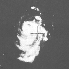
.jpg)
highest winds=105 mph (170 km/h)
lowest pressure=960 mbar
total da
total fatalities=None
hurricane season=1962 Pacific typhoon seasonA easterly tropical wave after the polar trough fractured the superposition formed onNovember 3 nearYap . cite web
author =JTWC
year = 1962
url = http://metocph.nmci.navy.mil/jtwc/atcr/1962atcr/pdf/wnp/81.pdf
title = Jean (81W) Tropical Cyclone Report
accessdate = 2006-12-03] The wave made landfall in the Philippines on the 6th and strengthened into Tropical Depression 81W over land. Strengthening occurred an 81W became Tropical Storm Jean on the 6th near Manila. Rapid strengthening occurred and Jean peaked at a convert|100|mi/h|km/h|abbr=on typhoon onNovember 9 nearVietnam . Jean started weakening and dissipated onNovember 13 because of lack of upper level divergence.The Japan Meteorological Agency continued to track Jean for six more days. During that time, Jean made an anti-cyclonic loop to the south, where Jean was declared an extratropical low on
November 19 in the openSouth China Sea . No damage or fatalities were reported. [http://www.jma.go.jp/jma/jma-eng/jma-center/rsmc-hp-pub-eg/bstve_1962_m.html JMA 1962 Best Track Graphics] ] Jean's lengthtivity from formation as a wave to time the JMA ceased advisories was sixteen straight days. [http://www.jma.go.jp/jma/jma-eng/jma-center/rsmc-hp-pub-eg/bstve_1962_m.html JMA 1962 Best Track Graphics] ]uper Typhoon Karen
infobox hurricane small
name=Super Typhoon Karen (6228)
category=cat5
type=super typhoon

track=Karen 1962 track.pngNovember 7
dissipated=November 18 ,1962
highest winds=185 mph (295 km/h)
lowest pressure=897 mbar
total da
total fatalities=11
areas affected=Guam and Japan
hurricane season=1962 Pacific typhoon seasonNovember 7 in the open Western Pacific, explosively intensified to a convert|185|mi/h|km/h|abbr=on super typhoon on the 9th. It turned to the west, maintaining its powerful winds of 175-185 mph for 4 days as it crossed the islands of the West Pacific. Cool air weakened Karen as it turned to the north, and was only a minimal typhoon at its nearest approach to Japan. The storm turned eastward, where it became extratropical onNovember 18 . Karen's strong winds caused $250 million in damage (1962 USD) and 11 casualties. Karen passed over the southern part of the island in 1962. Wind gusts estimated near convert|185|mi/h|km/h|abbr=on destroyed 95% of all homes on the island. [http://www.guampowerauthority.com/news/restoration.html Guam Typhoon Restoration by the Power Authority of Guam] ]*Karen has the third highest Accumulated Cyclone Energy in the West Pacific on record behind Typhoon Nancy of 1961 and Typhoon Paka of 1997. ]
*The name Karen was retired after that year. [cite web
author =JTWC
year = 1962
url = http://metocph.nmci.navy.mil/jtwc/atcr/1962atcr/pdf/wnp/84.pdf
title = Karen (84W) Tropical Cyclone Report
accessdate = 2006-12-03]Typhoon Lucy
infobox hurricane small
name=Typhoon Lucy (8629)
category=cat3
type=typhoon
formed=November 25
dissipated=December 1 ,1962
highest winds=115 mph (185 km/h)
lowest pressure=974 mbar
total da
total fatalities=5
hurricane season=1962 Pacific typhoon seasonA surge from the westerlies into MPT which was followed by cut-off low formed onNovember 24 , while a depression formed downstream. This kind of formation is not unusual, both Typhoons Carla and Dinah formed in the same way. The system strengthened into Tropical Depression 86W nearKoror onNovember 25 and strengthened into Tropical Storm Lucy on the same day. Strengthening occurred slowly, as Lucy didn't gain typhoon status untilNovember 27 . That same day, Lucy made landfall in the Philippines as an convert|80|mi/h|km/h|abbr=on typhoon. Lucy kept moving west and peaked at convert|115|mi/h|km/h|abbr=on, as a Category 3 typhoon onNovember 29 . Lucy made landfall in the Philippines and southernVietnam onNovember 30 . Lucy dissipated in the Strait of Taiwan onDecember 1 from cold air and land interaction. The Japan Meteorological Agency ceased advisories that same day. [http://www.jma.go.jp/jma/jma-eng/jma-center/rsmc-hp-pub-eg/bstve_1962_m.html JMA 1962 Best Track Graphics] ]Five people were killed, with five million dollars in damage. ($32.6 million in 2006 USD). Winds of convert|60|mi/h|km/h|abbr=on were felt
Cebu City Airport when Lucy passed over the area. [http://www.nrlmry.navy.mil/port_studies/thh-nc/phillipi/cebu/text/sect5.htm TROPICAL CYCLONES AFFECTING CEBU HARBOR] ] [cite web
author =JTWC
year = 1962
url = http://metocph.nmci.navy.mil/jtwc/atcr/1962atcr/pdf/wnp/88.pdf
title = Lucy (88W) Tropical Cyclone Report
accessdate = 2006-12-03]Tropical Storm Mary
infobox hurricane small
name=Tropical Storm Mary
category=storm
type=tropical storm
formed=December 1
dissipated=December 3 ,1962
highest winds=55 mph (95 km/h) [http://www.weather.unisys.com/hurricane/w_pacific/1962/index.html Unisys Inc.- 1962 Tracks] ]
pressure=1002 mbar
total da
total fatalities=None
hurricane season=1962 Pacific typhoon seasonTropical Depression 89W formed from a same day tropical wave in the openSouth China Sea southeast of Vietnam onDecember 1 . T.D. 89W moved north, strengthening into a tropical storm and being given the name Mary. Tropical Storm Mary peaked at convert|55|mi/h|km/h|abbr=on winds, a moderate tropical storm onDecember 2 . Mary weakened and soon dissipated onDecember 3 nearVietnam .No damage or fatalities were reported in association with Tropical Storm Mary.
Tropical Storm Nadine
infobox hurricane small
name=Tropical Storm Nadine (6230)
category=storm
type=tropical storm
formed=December 6
dissipated=December 10 ,1962
highest winds=60 mph (95 km/h) [http://www.weather.unisys.com/hurricane/w_pacific/1962/index.html Unisys Inc.- 1962 Tracks] ]
lowest pressure=975 mbar [http://agora.ex.nii.ac.jp/digital-typhoon/year/wnp/1962.html.en Digital Typhoon Archives-1962] ]
total da
total fatalities=None
hurricane season=1962 Pacific typhoon seasonThe final storm of the season began as a tropical wave onDecember 3 off the coast of Guam. The wave moved north and strengthened into Tropical Depression 90W onDecember 6 . It strengthened into Tropical Storm Nadine and grazedGuam as a tropical storm. Guam had already been devastated by Super Typhoon Karen about thirty days before in the season. Nadine continued to move north and passed bySaipan , dissipating far off the coast of a buoy, 4YV onDecember 10 , where the JTWC ceased advisories on Nadine.Nadine was tracked continuing eastward, passing the
International Date Line , where Nadine entered the Central Pacific's area of responsibility onDecember 11 as a 976 mbar extratropical cyclone, where the Japan Meteorological Agency ceased advisories on Nadine after entering. [http://www.jma.go.jp/jma/jma-eng/jma-center/rsmc-hp-pub-eg/bstve_1962_m.html JMA 1962 Best Track Graphics] ] Nadine was the fifteenth cyclone in the season to last for a week or more, eight days in actuality. [http://www.jma.go.jp/jma/jma-eng/jma-center/rsmc-hp-pub-eg/bstve_1962_m.html JMA 1962 Best Track Graphics] ]Other storms
In addition to the 30 storms, eleven tropical depressions formed, all unable to strengthen into a tropical storm.
Tropical Depression 21
infobox hurricane small
name=Tropical Depression 21
category=depression
type=tropical depression
formed=May 21
dissipated=May 22 ,1962
winds=
pressure=
total da
total fatalities=None
hurricane season=1962 Pacific typhoon seasonTropical Depression 21 formed onMay 21 in the openSouth China Sea , east of the Philippine Islands. 21 moved to the southeast toward southwestern Vietnam. However, 21 made a turn back to the north onMay 22 and dissipated on the same day without threatening land.Tropical Depression 39
infobox hurricane small
name=Tropical Depression 39
category=depression
type=tropical depression
formed=July 8
dissipated=July 12 ,1962
winds=
pressure=
total da
total fatalities=None
hurricane season=1962 Pacific typhoon seasonA tropical system formed onJuly 7 north of the island ofKoror . The system strengthened into a tropical depression the next day when the first advisory was released. The depression continuously changed directions, once on the 8th to the northwest, again the next day to the southwest and the final one on the 10th to the northwest again. Tropical Depression 39 continued to the northwest, but degenerated into a remnant low on the morning ofJuly 12 . Tropical Depression 39's remnants continued moving, finally dissipating onJuly 15 .The depression never made landfall, so no damage or fatalities were reported.
Tropical Depression 41
infobox hurricane small
name=Tropical Depression 41
category=depression
type=tropical depression
formed=July 10
dissipated=July 11 ,1962
winds=
pressure=
total da
total fatalities=Unavailable
hurricane season=1962 Pacific typhoon seasonAs Typhoon Joan weakening, a new tropical system formed in the South China Sea on the afternoon ofJuly 10 . The system strengthened while moving west, becoming "Tropical Depression 41" the same day. The depression continued moving west at a rapid pace, passingHainan Island and made landfall in northern Vietnam onJuly 11 . The depression dissipated over land late that evening.Damage and fatalities in Vietnam from 41 are unavailable.
Tropical Depression 50
infobox hurricane small
name=Tropical Depression 50
category=depression
type=tropical depression
formed=July 29
dissipated=August 2 ,1962
winds=
pressure=
total da
total fatalities=None
hurricane season=1962 Pacific typhoon seasonOnJuly 29 , theJoint Hurricane Warning Center inHonolulu, Hawaii , released an advisory on a system in the Central Pacific and was named Tropical Depression number 50. No change in strength occurred and advisories onAugust 2 near the transition into the Western Pacific basin. Tropical Depression 50 never made landfall, so no damage was reported. [https://metocph.nmci.navy.mil/jtwc/atcr/1962atcr/pdf/chapter3.pdf Joint Typhoon Warning Center's 1962 Annual Tropical Cyclone Report (Chapter 3)] ] [http://www.prh.noaa.gov/cphc/summaries/1962.php Central Pacific Hurricane Center Archive of 1962] ]Tropical Depression 55
infobox hurricane small
name=Tropical Depression 55W
category=depression
type=tropical depression
formed=August 14
dissipated=August 15 ,1962
winds=
pressure=
total da
total fatalities=NoneA tropical system formed onAugust 14 , off where the stronger Super Typhoon Ruth was, near theInternational Date Line . The system strengthened into a tropical depression at the first advisory on the morning of the 14th. The depression made a u-turn and dissipated by the next day. Tropical Depression 55 never made landfall, thus no fatalities or damage was reported.Tropical Depression 63
infobox hurricane small
name=Tropical Depression 63
category=depression
type=tropical depression
formed=August 31
dissipated=September 1 ,1962
winds=
pressure=
total da
total fatalities=None
hurricane season=1962 Pacific typhoon seasonTheJoint Hurricane Warning Center named a tropical depression in the Central Pacific basin as Tropical Depression number 63, following theWest Pacific 's numbering. The advisories were discontinued convert|275|nmi|km from the South Point ofBig Island , where it was no longer considered a threat to shipping lanes or any land masses.In a strange coincidence- 63 stayed at the same latitude in its whole lifetime. [https://metocph.nmci.navy.mil/jtwc/atcr/1962atcr/pdf/chapter3.pdf Joint Typhoon Warning Center's 1962 Annual Tropical Cyclone Report (Chapter 3)] ] [http://www.prh.noaa.gov/cphc/summaries/1962.php Central Pacific Hurricane Center Archive of 1962] ]
Tropical Depression 64
infobox hurricane small
name=Tropical Depression 64
category=depression
type=tropical depression
formed=September 3
dissipated=September 7 ,1962
winds=
pressure=
total da
total fatalities=None
hurricane season=1962 Pacific typhoon seasonA tropical wave formed onSeptember 3 at low latitudes nearWoleai Atol . The wave moved to the northwest, but gained strength slowly. OnSeptember 5 , the wave finally became well-organized to become Tropical Depression 64W. The island ofYap was in the direction of 64W but the depression passed to the south. Tropical Depression 64 began to weaken and dissipated onSeptember 7 into a remnant low north of Koror.The depression never made landfall, so no damage or fatalities were reported.
Tropical Depression 66
infobox hurricane small
name= Tropical Depression 66
category=depression
type=tropical depression
formed=September 12
dissipated=September 15 ,1962
winds=
pressure= 1002 mbar
total da
total fatalities=None
hurricane season=1962 Pacific typhoon seasonA tropical wave formed on
September 11 near 160°E out in the open Pacific Ocean near where Tropical Depression 55 formed. The wave strengthened into Tropical Depression 66 the next day moving to the northwest. T.D. 66 missed grazing buoy #131 onSeptember 13 . Tropical Depression 66W dissipated out in the open ocean onSeptember 15 nearIwo Jima andChichi Jima , never making landfall.The Japan Meteorological Agency continued tracking TD 66 which was able to strengthen into a tropical storm, peaking at a pressure of 1002 mbar (29.58
inHg ) onSeptember 16 . Tropical Storm 66W made a curve to the northeast and threatened Japan, but did not make landfall. The storm weakened and was declared extratropical the next day near the Aleutian Islands. [http://agora.ex.nii.ac.jp/digital-typhoon/year/wnp/1962.html.en Digital Typhoon Archives-1962] ] [http://www.jma.go.jp/jma/jma-eng/jma-center/rsmc-hp-pub-eg/bstve_1962_m.html JMA 1962 Best Track Graphics] ]No damage or fatalities were reported.
Tropical Depression 68
infobox hurricane small
name=Tropical Depression 68
category=depression
type=tropical depression
formed=September 22
dissipated=September 27 ,1962
winds=
pressure=
total da
total fatalities=Unavailable
hurricane season=1962 Pacific typhoon seasonA tropical wave formed onSeptember 22 east of the Philippines moving to the northwest. The wave quickly strengthened into Tropical Depression 68 the same day. T.D. 68W made landfall in the Philippines on the 23rd and battered the capital, Manila. The depression continued moving west, changing directions constantly. The depression made landfall again in the country ofVietnam onSeptember 26 , dissipating the next day on the Vietnam-Laos border. No damage reports in Vietnam or the Philippines are available.68 was the longest lasting depression of the season.
Tropical Depression 75
infobox hurricane small
name=Tropical Depression 75
category=depression
type=tropical depression
formed=October 20
dissipated=October 22 ,1962
winds=150 mph
pressure=936 mbar (hPa)
total da
total fatalities=None
hurricane season=1962 Pacific typhoon seasonTropical Depression 75 formed onOctober 20 south of buoy 131 in the open Pacific Ocean, which is close the International Date Line. 75 moved to the northwest, dissipating onOctober 22 near the island ofIwo Jima . 75 was extremely short-lived and only lasted for two days. 75 never made landfall, so no damage or fatalities were reported.Tropical Depression 85
infobox hurricane small
name=Tropical Depression 85
category=depression
type=tropical depression
formed=November 18
dissipated=November 20 ,1962
winds=55 mph
pressure=1002 mbar (hPa)
total da
total fatalities=None
hurricane season=1962 Pacific typhoon seasonThe eighty-fifth tropical wave of the season formed in theSouth China Sea onNovember 18 . The wave quickly strengthened into "Tropical Depression 85" over the sea the same day. The depression got nearVietnam but cool air caused it to dissipate into a remnant low before landfall onNovember 20 . No damage or fatalities were reported in Vietnam in association with T.D. 85.cite web
author =JTWC
year = 1962
url = http://metocph.nmci.navy.mil/jtwc/atcr/1962atcr/pdf/wnp/62tstd.pdf
title = 1962 Tropical Storms and Tropical Depressions by the JTWC
accessdate = 2006-12-03]torm names
In addition to the 30 named storms, an unnamed storm was tracked by the JMA, 6219 and also known by the JTWC as Tropical Depression 66W. [http://www.jma.go.jp/jma/jma-eng/jma-center/rsmc-hp-pub-eg/bstve_1962_m.html JMA 1962 Best Track Graphics] ]
Retirement
The name Karen was retired after this year and was replaced with Kim.
ee also
*
1950-1969 Pacific hurricane seasons
*1962 Atlantic hurricane season References
External links
* [http://metocph.nmci.navy.mil/jtwc/atcr/1962atcr/pdf/1962.html The Joint Typhoon Warning Center's Report on 1962]
* [http://www.cityofportmoody.com/About+Port+Moody/Heritage+and+History/Historical+Insights/Typhoon+Freda.htm More info on Freda]Pacific typhoon season button bar start
year=1962Hurricane_season_bar_button
buttonspacing=0.25em
intensity=Storm_colour|storm
stormname=Fran
strength=Tropical Storm
linkname=1962_Pacific_typhoon_season#Tropical_Storm_Fran
storminitial=2Hurricane_season_bar_button
buttonspacing=0.25em
intensity=Storm_colour|cat4
stormname=Georgia
strength=Category 4 Super Typhoon
linkname=1962_Pacific_typhoon_season#Super_Typhoon_Georgia
storminitial=13Hurricane_season_bar_button
buttonspacing=0.25em
intensity=Storm_colour|cat2
stormname=Hope
strength=Category 2 Typhoon
linkname=1962_Pacific_typhoon_season#Typhoon_Hope
storminitial=17Hurricane_season_bar_button
buttonspacing=0.25em
intensity=Storm_colour|depression
stormname=Twenty-One
strength=Tropical Depression
linkname=1962_Pacific_typhoon_season#Tropical_Depression_21W
storminitial=21Hurricane_season_bar_button
buttonspacing=0.25em
intensity=Storm_colour|cat1
stormname=Iris
strength=Category 1 Typhoon
linkname=1962_Pacific_typhoon_season#Typhoon_Iris
storminitial=22Hurricane_season_bar_button
buttonspacing=0.25em
intensity=Storm_colour|cat1
stormname=Joan
strength=Category 1 Typhoon
linkname=1962_Pacific_typhoon_season#Typhoon_Joan
storminitial=37Hurricane_season_bar_button
buttonspacing=0.25em
intensity=Storm_colour|depression
stormname=Thirty-Nine
strength=Tropical Depression
linkname=1962_Pacific_typhoon_season#Tropical_Depression_39W
storminitial=39Hurricane_season_bar_button
buttonspacing=0.25em
intensity=Storm_colour|depression
stormname=Forty-One
strength=Tropical Depression
linkname=1962_Pacific_typhoon_season#Tropical_Depression_41W
storminitial=41Hurricane_season_bar_button
buttonspacing=0.25em
intensity=Storm_colour|cat2
stormname=Kate
strength=Category 2 Typhoon
linkname=1962_Pacific_typhoon_season#Typhoon_Kate
storminitial=44Hurricane_season_bar_button
buttonspacing=0.25em
intensity=Storm_colour|cat1
stormname=Louise
strength=Category 1 Typhoon
linkname=1962_Pacific_typhoon_season#Typhoon_Louise
storminitial=45Hurricane_season_bar_button
buttonspacing=0.25em
intensity=Storm_colour|cat1
stormname=Nora
strength=Category 1 Typhoon
linkname=1962_Pacific_typhoon_season#Typhoon_Nora
storminitial=46Hurricane_season_bar_button
buttonspacing=0.25em
intensity=Storm_colour|storm
stormname=Marge
strength=Tropical Storm
linkname=1962_Pacific_typhoon_season#Tropical_Storm_Marge
storminitial=47Hurricane_season_bar_button
buttonspacing=0.25em
intensity=Storm_colour|cat5
stormname=Opal
strength=Category 5 Super Typhoon
linkname=1962_Pacific_typhoon_season#Super_Typhoon_Opal
storminitial=48Hurricane_season_bar_button
buttonspacing=0.25em
intensity=Storm_colour|depression
stormname=Fifty
strength=Tropical Depression (JHWC)
linkname=1962_Pacific_typhoon_season#Tropical_Depression_50
storminitial=50Hurricane_season_bar_button
buttonspacing=0.25em
intensity=Storm_colour|cat1
stormname=Patsy
strength=Category 1 Typhoon
linkname=1962_Pacific_typhoon_season#Typhoon_Patsy
storminitial=51Hurricane_season_bar_button
buttonspacing=0.25em
intensity=Storm_colour|cat1
stormname=Sarah
strength=Category 1 Typhoon
linkname=1962_Pacific_typhoon_season#Typhoon_Sarah
storminitial=53Hurricane_season_bar_button
buttonspacing=0.25em
intensity=Storm_colour|cat5
stormname=Ruth
strength=Category 5 Super Typhoon
linkname=1962_Pacific_typhoon_season#Super_Typhoon_Ruth
storminitial=54Hurricane_season_bar_button
buttonspacing=0.25em
intensity=Storm_colour|cat4
stormname=Thelma
strength=Category 4 Typhoon
linkname=1962_Pacific_typhoon_season#Typhoon_Thelma
storminitial=58Hurricane_season_bar_button
buttonspacing=0.25em
intensity=Storm_colour|cat2
stormname=Wanda
strength=Category 2 Typhoon
linkname=1962_Pacific_typhoon_season#Typhoon_Wanda
storminitial=59Hurricane_season_bar_button
buttonspacing=0.25em
intensity=Storm_colour|cat1
stormname=Vera
strength=Category 1 Typhoon
linkname=1962_Pacific_typhoon_season#Typhoon_Vera
storminitial=60Hurricane_season_bar_button
buttonspacing=0.25em
intensity=Storm_colour|cat5
stormname=Amy
strength=Category 5 Super Typhoon
linkname=1962_Pacific_typhoon_season#Super_Typhoon_Amy
storminitial=62Hurricane_season_bar_button
buttonspacing=0.25em
intensity=Storm_colour|depression
stormname=Sixty-Three (JHWC)
strength=Tropical Depression
linkname=1962_Pacific_typhoon_season#Tropical_Depression_63
storminitial=63Hurricane_season_bar_button
buttonspacing=0.25em
intensity=Storm_colour|depression
stormname=Sixty-Four
strength=Tropical Depression
linkname=1962_Pacific_typhoon_season#Tropical_Depression_64W
storminitial=64Hurricane_season_bar_button
buttonspacing=0.25em
intensity=Storm_colour|cat1
stormname=Carla
strength=Category 1 Typhoon
linkname=1962_Pacific_typhoon_season#Typhoon_Carla
storminitial=65Hurricane_season_bar_button
buttonspacing=0.25em
intensity=Storm_colour|storm
stormname=Sixty-Six
strength=Tropical Storm (JMA) (JTWC TD)
linkname=1962_Pacific_typhoon_season#Tropical_Storm_66W
storminitial=66Hurricane_season_bar_button
buttonspacing=0.25em
intensity=Storm_colour|storm
stormname=Babe
strength=Tropical Storm
linkname=1962_Pacific_typhoon_season#Tropical_Storm_Babe
storminitial=67Hurricane_season_bar_button
buttonspacing=0.25em
intensity=Storm_colour|depression
stormname=Sixty-Eight
strength=Tropical Depression
linkname=1962_Pacific_typhoon_season#Tropical_Depression_68W
storminitial=68Hurricane_season_bar_button
buttonspacing=0.25em
intensity=Storm_colour|cat3
stormname=Dinah
strength=Category 3 Typhoon
linkname=1962_Pacific_typhoon_season#Typhoon_Dinah
storminitial=69Hurricane_season_bar_button
buttonspacing=0.25em
intensity=Storm_colour|cat3
stormname=Freda
strength=Category 3 Typhoon
linkname=1962_Pacific_typhoon_season#Typhoon_Freda
storminitial=72Hurricane_season_bar_button
buttonspacing=0.25em
intensity=Storm_colour|cat5
stormname=Emma
strength=Category 5 Super Typhoon
linkname=1962_Pacific_typhoon_season#Super_Typhoon_Emma
storminitial=73Hurricane_season_bar_button
buttonspacing=0.25em
intensity=Storm_colour|cat4
stormname=Gilda
strength=Category 4 Typhoon
linkname=1962_Pacific_typhoon_season#Typhoon_Gilda
storminitial=74Hurricane_season_bar_button
buttonspacing=0.25em
intensity=Storm_colour|depression
stormname=Seventy-Five
strength=Tropical Depression
linkname=1962_Pacific_typhoon_season#Tropical_Depression_75W
storminitial=75Hurricane_season_bar_button
buttonspacing=0.25em
intensity=Storm_colour|cat3
stormname=Ivy
strength=Category 3 Typhoon
linkname=1962_Pacific_typhoon_season#Typhoon_Ivy
storminitial=76Hurricane_season_bar_button
buttonspacing=0.25em
intensity=Storm_colour|storm
stormname=Harriet
strength=Tropical Storm
linkname=1962_Pacific_typhoon_season#Tropical_Storm_Harriet
storminitial=78Hurricane_season_bar_button
buttonspacing=0.25em
intensity=Storm_colour|cat2
stormname=Jean
strength=Category 2 Typhoon
linkname=1962_Pacific_typhoon_season#Typhoon_Jean
storminitial=81Hurricane_season_bar_button
buttonspacing=0.25em
intensity=Storm_colour|cat5
stormname=Karen
strength=Category 5 Super Typhoon
linkname=Typhoon Karen (1962)
storminitial=84Hurricane_season_bar_button
buttonspacing=0.25em
intensity=Storm_colour|depression
stormname=Eighty-Five
strength=Tropical Depression
linkname=1962_Pacific_typhoon_season#Tropical_Depression_85W
storminitial=85Hurricane_season_bar_button
buttonspacing=0.25em
intensity=Storm_colour|storm
stormname=Mary
strength=Tropical Storm
linkname=1962_Pacific_typhoon_season#Tropical_Storm_Mary
storminitial=89Hurricane_season_bar_button
buttonspacing=0.25em
intensity=Storm_colour|storm
stormname=Nadine
strength=Tropical Storm
linkname=1962_Pacific_typhoon_season#Tropical_Storm_Nadine
storminitial=90
Other tropical cyclones:Hurricane_season_bar_button
buttonspacing=0.25em
intensity=Storm_colour|extratropical
stormname=One
strength=Tropical Cyclone
linkname=1962_Pacific_typhoon_season#Tropical_Cyclone_1
storminitial=1Hurricane_season_bar_button
buttonspacing=0.25em
intensity=Storm_colour|extratropical
stormname=Three
strength=Tropical Cyclone
linkname=1962_Pacific_typhoon_season#Tropical_Cyclone_3
storminitial=3Hurricane_season_bar_button
buttonspacing=0.25em
intensity=Storm_colour|extratropical
stormname=Four
strength=Tropical Cyclone
linkname=1962_Pacific_typhoon_season#Tropical_Cyclone_4
storminitial=4Hurricane_season_bar_button
buttonspacing=0.25em
intensity=Storm_colour|extratropical
stormname=Five
strength=Tropical Cyclone
linkname=1962_Pacific_typhoon_season#Tropical_Cyclone_5
storminitial=5Hurricane_season_bar_button
buttonspacing=0.25em
intensity=Storm_colour|extratropical
stormname=Six
strength=Tropical Cyclone
linkname=1962_Pacific_typhoon_season#Tropical_Cyclone_6
storminitial=6Hurricane_season_bar_button
buttonspacing=0.25em
intensity=Storm_colour|extratropical
stormname=Fourteen
strength=Tropical Cyclone
linkname=1962_Pacific_typhoon_season#Tropical_Cyclone_14
storminitial=14Hurricane_season_bar_button
buttonspacing=0.25em
intensity=Storm_colour|extratropical
stormname=Sixteen
strength=Tropical Cyclone
linkname=1962_Pacific_typhoon_season#Tropical_Cyclone_16
storminitial=16Hurricane_season_bar_button
buttonspacing=0.25em
intensity=Storm_colour|extratropical
stormname=Eighteen
strength=Tropical Cyclone
linkname=1962_Pacific_typhoon_season#Tropical_Cyclone_18
storminitial=18Hurricane_season_bar_button
buttonspacing=0.25em
intensity=Storm_colour|extratropical
stormname=Twenty-Four
strength=Tropical Cyclone
linkname=1962_Pacific_typhoon_season#Tropical_Cyclone_24
storminitial=24Hurricane_season_bar_button
buttonspacing=0.25em
intensity=Storm_colour|extratropical
stormname=Twenty-Six
strength=Tropical Cyclone
linkname=1962_Pacific_typhoon_season#Tropical_Cyclone_26
storminitial=26Hurricane_season_bar_button
buttonspacing=0.25em
intensity=Storm_colour|extratropical
stormname=Twenty-Nine
strength=Tropical Cyclone
linkname=1962_Pacific_typhoon_season#Tropical_Cyclone_29
storminitial=29Hurricane_season_bar_button
buttonspacing=0.25em
intensity=Storm_colour|extratropical
stormname=Thirty-Four
strength=Tropical Cyclone
linkname=1962_Pacific_typhoon_season#Tropical_Cyclone_34
storminitial=34Hurricane_season_bar_button
buttonspacing=0.25em
intensity=Storm_colour|extratropical
stormname=Thirty-Six
strength=Tropical Cyclone
linkname=1962_Pacific_typhoon_season#Tropical_Cyclone_36
storminitial=36Hurricane_season_bar_button
buttonspacing=0.25em
intensity=Storm_colour|extratropical
stormname=Forty-Nine
strength=Tropical Cyclone
linkname=1962_Pacific_typhoon_season#Tropical_Cyclone_49
storminitial=49Hurricane_season_bar_button
buttonspacing=0.25em
intensity=Storm_colour|extratropical
stormname=Fifty-Six
strength=Tropical Cyclone
linkname=1962_Pacific_typhoon_season#Tropical_Cyclone_56
storminitial=56Hurricane_season_bar_button
buttonspacing=0.25em
intensity=Storm_colour|extratropical
stormname=Sixty-One
strength=Tropical Cyclone
linkname=1962_Pacific_typhoon_season#Tropical_Cyclone_61
storminitial=61Hurricane_season_bar_button
buttonspacing=0.25em
intensity=Storm_colour|extratropical
stormname=Seventy-Nine
strength=Tropical Cyclone
linkname=1962_Pacific_typhoon_season#Tropical_Cyclone_79
storminitial=79
Wikimedia Foundation. 2010.
Look at other dictionaries:
1961 Pacific typhoon season — Infobox hurricane season Basin=WPac Year=1961 Track=1961 Pacific typhoon season summary.jpg First storm formed=January 14, 1961 Last storm dissipated=December 13, 1961 Strongest storm name=Super Typhoon Nancy, Super Typhoon Violet Strongest storm … Wikipedia
1960 Pacific typhoon season — Infobox hurricane season Basin=WPac Year=1960 Track=1960 Pacific typhoon season summary.jpg First storm formed=April 22, 1960 Last storm dissipated=December 20, 1960 Strongest storm name=Super Typhoon Shirley Strongest storm pressure=910 Total… … Wikipedia
1963 Pacific typhoon season — Infobox hurricane season Basin=WPac Year=1963 Track=1963 Pacific typhoon season summary.jpg First storm formed=April 27, 1963 Last storm dissipated=December 28, 1963 Strongest storm name=Judy Strongest storm pressure=917 Strongest storm winds=150 … Wikipedia
1964 Pacific typhoon season — Infobox hurricane season Basin=WPac Year=1964 Track=1964 Pacific typhoon season summary.jpg First storm formed=May 14, 1964 Last storm dissipated=December 16, 1964 Strongest storm name=Sally Strongest storm pressure=894 Strongest storm winds=170… … Wikipedia
1976 Pacific typhoon season — Infobox hurricane season Track=1976 Pacific typhoon season summary.jpg Basin=WPac Year=1976 First storm formed=January 27, 1976 Last storm dissipated=December 9, 1976 Strongest storm name=Louise Strongest storm pressure=895 Strongest storm… … Wikipedia
Typhoon Karen — Infobox Hurricane Name=Typhoon Karen Type=typhoon Year=1962 Basin=WPac Image location=Super Typhoon Karen.jpg Formed=November 7, 1962 Dissipated=November 18, 1962 1 min winds=160 Pressure=897 Da Inflated=0 Fatalities=11 direct Areas=Guam, Japan… … Wikipedia
Typhoon Pongsona — Infobox Hurricane Name=Typhoon Pongsona Type=typhoon Year=2002 Basin=WPac Image location=Typhoon Pongsona (2002).jpg Guam Formed=December 2, 2002 Dissipated=December 11, 2002 1 min winds=130 10 min winds=95 Pressure=940 Da Inflated= 1… … Wikipedia
Typhoon Nancy (1961) — Infobox Hurricane Name=Super Typhoon Nancy Type=super typhoon Year=1961 Basin=WPac Image location=Super Typhoon Nancy 61.jpg Formed=September 7, 1961 Dissipated=September 17, 1961 Hurricane season=1961 Pacific typhoon season 1 min winds=185… … Wikipedia
Typhoon Gay (1989) — Infobox Hurricane Name=Typhoon Gay Type=typhoon Year=1989 Basin=WPac Image location=Typhoon Gay 08 nov 1989 0826Z.jpg Formed=November 1, 1989 Dissipated=November 10, 1989 1 min winds=140 Pressure=898 Da Fatalities=1,060 direct Areas=Thailand,… … Wikipedia
Typhoon Rose (1971) — Infobox Hurricane Name=Typhoon Rose Type=typhoon Basin=WPac Formed=August 10, 1971 Dissipated=August 18, 1971 1 min winds=120 Pressure=952 Fatalities=130 direct Areas=Philippines, Hong Kong, eastern China Hurricane season=1971 Pacific typhoon… … Wikipedia
 18+© Academic, 2000-2024
- Contact us: Technical Support, Advertising
Dictionaries export, created on PHP, Joomla, Drupal, WordPress, MODx.
)
)
)
)

)
)


)
)

)

)
