Mischabelhörner — (wohl soviel wie Mistgabelhörner, auch Saasgrat), Hochgebirgskette der Penninischen Alpen, die sich am Neuen Weißtor nördlich an die Monte Rosagruppe anschließt und zwischen Nikolai und Saastal hinzieht, von mächtigen Gletschern (Allalin ,… … Meyers Großes Konversations-Lexikon
Mischabelhörner — Mischabelhörner, Saasgrat, Gebirgsstock im schweiz. Kanton Wallis, Penninische Alpen, zwischen Nikolai und Saastal; höchster Punkt der Dom (4554 m) … Kleines Konversations-Lexikon
Dom (Mischabel) — Infobox Mountain Name=Dom Photo=Dom (Mischabel).jpg| Caption=The Dom, view from west Elevation=convert|4545|m|ft|0 Location=Valais, Switzerland Range = Pennine Alps Prominence = convert|1045|m|ft|0|abbr=on latd= 46|latm=05 |lats=42 |latNS=N longd … Wikipedia
Dom (mountain) — Dom North and west faces Elevation 4,545 m (14,911 ft) … Wikipedia
Monte Rosa — For other uses, see Monte Rosa (disambiguation). Monte Rosa Dufourspitze West view of Monte Rosa … Wikipedia
Penninic nappes — The Penninic nappes or the Penninicum are one of three nappe stacks and geological zones in which the Alps can be divided. In the western Alps the Penninic nappes are more obviously present than in the eastern Alps (in Austria), where they crop… … Wikipedia
Allalinhorn — Infobox Mountain Name = Allalinhorn Photo = Allalin.jpg Caption = The Allalinhorn and restaurant on Mittelallalin, in August Elevation = 4,027 metres (13,212 ft) Location = Valais, SUI Range = Pennine Alps Prominence = convert|245|m|ft|0|abbr=on… … Wikipedia
Täschhorn — Infobox Mountain Name = Täschhorn Photo =Täschhorn.jpg Caption = West face of the Täschhorn Elevation = 4,491 metres (14,733 feet) Location = Valais, SUI Range = Pennine Alps Prominence = convert|210|m|ft|0|abbr=on latd= 46|latm=5 |lats=1… … Wikipedia
Wallis [1] — Wallis (fr. Valais), der 20. Canton der Schweiz, zwischen dem Genfer See, den Cantonen Waadt, Bern, Uri u. Tessin, Piemont u. Savoyen, von 78,38 QM. Flächeninhalt. Derselbe umfaßt das von ungeheueren Gebirgsmassen umwallte obere Rhônethal u.… … Pierer's Universal-Lexikon
Dom — (Grabenhorn), 14,013 Fuß ü. M. hohe u. höchste Spitze der Mischabelhörner im Schweizercanton Wallis, zwischen der Gorner u.[835] Saaser Visp; wurde zuerst 27. Juli 1858 von einem Engländer von Randa aus erstiegen … Pierer's Universal-Lexikon
 From left to right the Dom, Täschhorn, and Alphubel
 Map of Mischabel range
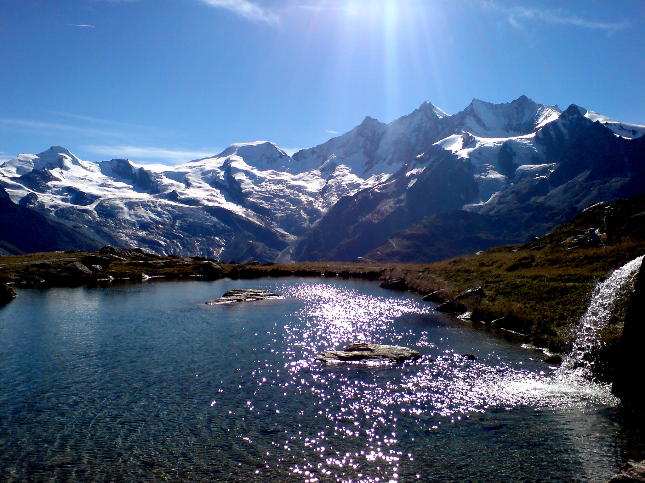
 The Mischabel range seen from Kreuzboden Lake.
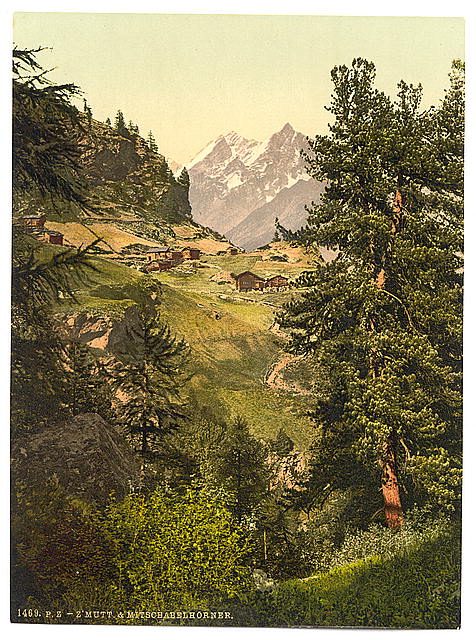
 Zmutt Valley with Mischabelhörner group, Valais, Alps of, Switzerland - 1890 photochrom postcard