- Damoh District
-
This article is about the district. For its eponymous headquarters, see Damoh.
Damoh district
दामोह जिला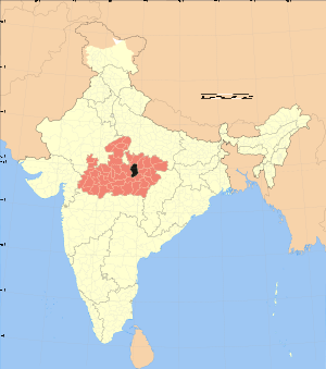
Location of Damoh district in Madhya PradeshState Madhya Pradesh,  India
IndiaAdministrative division Sagar Headquarters Damoh Area 7,306 km2 (2,821 sq mi) Population 1,083,949 (2001) Lok Sabha Constituencies Damoh Official website Damoh District (Hindi: दमोह ज़िला) is a district of Madhya Pradesh state in central India. The town of Damoh is the district headquarters. The district is part of Sagar Division.
Contents
Overview
The district has many places of historical importance. The town of Nohata is one such example and is situated at a distance of 21 km from Damoh, on the banks of River Gauraya and was a capital of the Chandela Rajputs. There are a number of temples there.
The ancient fort at Rajnagar village, 6 km from Damoh, was founded by the Mughals. Singhorgarh fort is another place of historical importance. It was built by Raja Vain Bason. Gond Rajas stayed in it for a long time. It was with Gond Raja Dalpat Shah and his Rani Durgawati at the end of 15th century. After the death of Raja Dalpat Shah, the Senapati of the army of Mughal emperor Akbar had a battle with Rani Durgawati at village Singrampur.
The town of Narsinghgarh, situated on Sonar River, has an ancient fort built by Shah Taiyab. Birla group has established a cement factory at Narsinghgarh. Kundalpur is famous place for Jain temples. Situated 32 km from Damoh, there are 58 Jain temples in Kundalpur.
Jageshwarnath temple at Bandakpur is a famous Hindu pulgrimage center. In damoh district the Lodhi Rajput / Thakur is more power full. Damoh city has a beautiful Ghantaghar, circuit house, statue of Maharana Pratap at Jabalpur Naka, Kirti Stambh, Gajanan pahadi, Naugaja pahadi, fort of Rani Damyanti Bai near tahsil ground, Nehru park and a very beautiful Jatashankar temple.
Economy
In 2006 the Ministry of Panchayati Raj named Damoh one of the country's 250 most backward districts (out of a total of 640).[1] It is one of the 24 districts in Madhya Pradesh currently receiving funds from the Backward Regions Grant Fund Programme (BRGF).[1]
Demographics
According to the 2011 census Damoh District has a population of 1,263,703,[2] roughly equal to the nation of Estonia[3] or the US state of New Hampshire.[4] This gives it a ranking of 383rd in India (out of a total of 640).[2] The district has a population density of 173 inhabitants per square kilometre (450 /sq mi) .[2] Its population growth rate over the decade 2001-2011 was 16.58 %.[2] Damoh has a sex ratio of 913 females for every 1000 males,[2] and a literacy rate of 70.92 %.[2]
References
- ^ a b Ministry of Panchayati Raj (September 8, 2009). "A Note on the Backward Regions Grant Fund Programme". National Institute of Rural Development. http://www.nird.org.in/brgf/doc/brgf_BackgroundNote.pdf. Retrieved September 27, 2011.
- ^ a b c d e f "District Census 2011". Census2011.co.in. 2011. http://www.census2011.co.in/district.php. Retrieved 2011-09-30.
- ^ US Directorate of Intelligence. "Country Comparison:Population". https://www.cia.gov/library/publications/the-world-factbook/rankorder/2119rank.html. Retrieved 2011-10-01. "Estonia 1,282,963 July 2011 est."
- ^ "2010 Resident Population Data". U. S. Census Bureau. http://2010.census.gov/2010census/data/apportionment-pop-text.php. Retrieved 2011-09-30. "New Hampshire 1,316,470"
External links

Chhatarpur district Panna district Sagar district 
Katni district  Damoh district

Narsimhapur district Jabalpur district Divisions & Districts of Madhya Pradesh · 
Bhopal Division: Chambal Division: Gwalior Division: Ashoknagar · Datia · Guna · Gwalior · Shivpuri
Indore Division: Jabalpur Division: Narmadapuram Division: Betul · Harda · Hoshangabad
Rewa Division: Sagar Division: Chhatarpur · Damoh · Panna · Sagar · Tikamgarh
Shahdol Division: Ujjain Division: Cities and towns in Sagar Division Chhatarpur district Bada Malhera • Barigarh • Bijawar • Buxwaha • Chandla • Chhatarpur • Garhi-Malhara • Ghuwara • Harpalpur • Laundi • Maharajpur • Nowgaon • Rajnagar • SataiDamoh district Panna district Sagar district Bina Etawa • Bina Railway Colony • Deori • Dhana • Garhakota • Khurai • Makronia • Mandi Bamora • Rahatgarh • Rehli • Sagar Cantonment • Sagar • Shahgarh • ShahpurTikamgarh district Badagaon • Baldeogarh • Jatara • Jeron Khalsa • Kari • Khargapur • Lidhorakhas • Niwari • Orchha • Palera • Prithvipur • Taricharkalan • TikamgarhRelated topics Categories:

Wikimedia Foundation. 2010.