- Mississippi Highway 7
-
"MS 7" redirects here. MS 7 may also refer to Mississippi's 7th congressional district.
MS Highway 7
Route information Maintained by MDOT Length: 139.482 mi[1] (224.475 km) Major junctions South end:  US 49W in Belzoni
 US 82 from Itta Bena to Greenwood
 US 49E in Greenwood
 I-55 in Grenada
 US 51 from Grenada to Hardy
I-55 in Hardy
 US 278 in Oxford
 US 78 in Holly Springs
 US 72 near Lamar
North end:  SR-18 in Michigan City
Location Counties: Humphreys, Leflore, Carroll, Grenada, Yalobusha, Lafayette, Marshall, Benton Highway system Numbered highways in Mississippi
Interstates • U.S. Routes • State highways
Unsigned state highways←  MS 6
MS 6MS 8  →
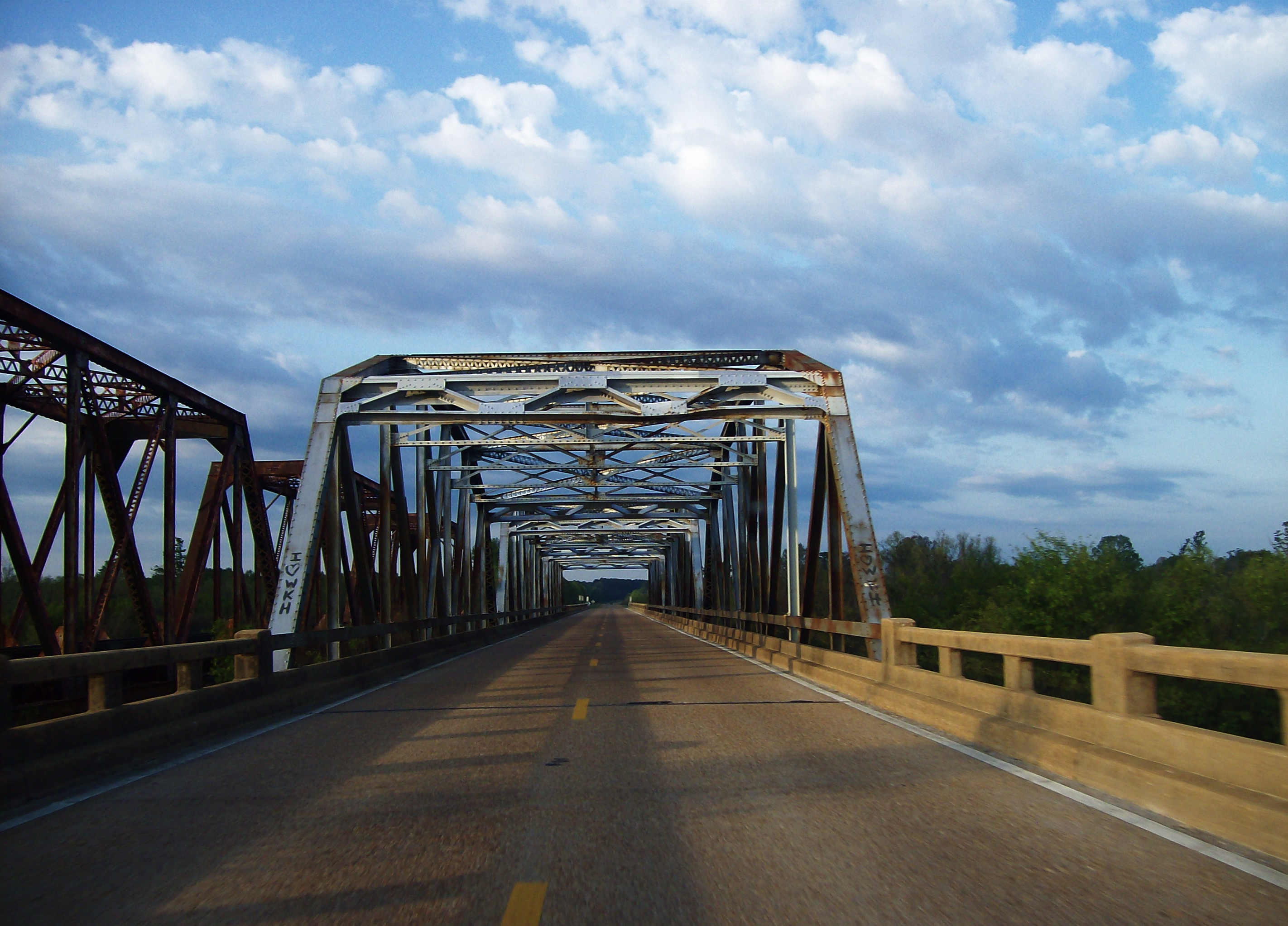
→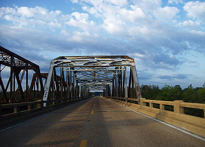 Highway 7 and rarely used Mississippi Central Railroad bridges over the Tallahatchie River at the Lafayette-Marshall county line. This sweeping bottomland, located approximately halfway between Holly Springs and Oxford, was the inspiration for fictional settings in several works by William Faulkner.
Mississippi Highway 7 runs generally north–south from the Tennessee state line in Benton County to Belzoni, Mississippi. It travels approximately 165 miles (266 km), serving Humphreys, Leflore, Carroll, Grenada, Yalobusha, Lafayette, Marshall, and Benton Counties. It runs nearly parallel to the rarely used Mississippi Central Railroad.
Contents
Points of interest
- Florewood River Plantation State Park
- University of Mississippi
- Wall Doxey State Park
Locales on route
From north to south
- Michigan City near the Tennessee state line (above which the highway becomes Tennessee State Route 18)
- Lamar
- Holly Springs
- Oxford
- Water Valley
- Grenada
- Greenwood
- Itta Bena
- Morgan City
- Belzoni
Junctions
From north to south
 Tennessee Highway 18
- U.S. Highway 72
 Mississippi Highway 311
 Mississippi Highway 178
 Mississippi Highway 4 ( splits northbound, joins southbound)
- U.S. Highway 78
(
splits southbound, joins northbound) Mississippi Highway 310
 Mississippi Highway 30
 Mississippi Highway 6 / U.S. Highway 278
 Mississippi Highway 328
 Mississippi Highway 9W
 Mississippi Highway 315 ( splits northbound, joins southbound)
 Mississippi Highway 32 ( splits southbound, joins northbound)
 Mississippi Highway 330
 Mississippi Highway 333
- Interstate 55 ( splits northbound, joins southbound)
 Mississippi Highway 8 ( splits southbound, joins northbound / splits northbound, joins southbound)
 Mississippi Highway 35 (
 splits northbound, joins southbound)
(
splits southbound, joins northbound)- U.S. Highway 82 ( splits northbound, joins southbound)
 Mississippi Highway 430
- U.S. Highway 49E
(
splits northbound, joins southbound)
 U.S. Highway 49 / Mississippi Highway 12
See also
- List of Mississippi state highways
References
Categories:- State highways in Mississippi

Wikimedia Foundation. 2010.