- Matuku Island
-
Matuku — Island — Location in Fiji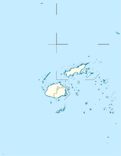
 Matuku
Coordinates: 19°10′S 179°46′E / 19.167°S 179.767°ECoordinates: 19°10′S 179°46′E / 19.167°S 179.767°E Country Fiji Island group Lau Islands Sub group Moala Islands Area – Total 57 km2 (22 sq mi) Elevation 385 m (1,263 ft) Matuku is a volcanic island in the Moala subgroup of Fiji's Lau archipelago. Located at 19.18° South and 179.75° East, Matuku covers an area of 57 square kilometers. It has a maximum elevation of 385 meters. Matuku is part of a group of islands known as Yasayasa Moala.
There are altogether seven villages in Matuku namely Yaroi, Natokalau, Qalikarua, Levuka i daku, Makadru, Raviravi and Lomati.
Matuku was the only island in the Lau Group that was not conquered by the Ma'afu regime that swept through the Lau group. This is why people of Matuku do not wear the tawala in any formal occasion unlike other Lauans as a sign of bravery.
Matuku has produced a number of people who have contributed to the development and progress of Fiji and have held public office during their time. The late Reverend Setareki Tuilovoni hailed from Natokaloau, to be the first local President of the Methodist Church since becoming a separate entity & Rev Setareki Rika and his family who have either served as Church Ministers, Doctors or Teachers. Doctor Macu Salato hailed from Qalikarua who became the Lord Mayor of Suva, Dr Peni Rika hailed from Makadru & many other Medical Practiners, numerous Teachers and Church Ministers & Misionaries. The late Setareki Tuinaceva who held office with the FRU for a number of years. Sir Timoci Tuivaga, who served as Fiji's Chief Justice (Fiji)|Chief Justice]] from 1974 to 2002. Currently Esala Teleni as head of the Fiji Police. Before him was Tuivaga who also served in this public office. Joeli Veitayaki former Fiji 15s rugby captain and Dr. Macu Salato who was the first Fijian General Secretary for South Pacific Community (now known as Secretariat of the Pacifc Community).
Northern Lau Islands Southern Lau Islands Moala Islands Outliers Islands of Fiji Principal islands Significant outliers Archipelagos Kadavu Group · Lau Islands · Lomaiviti Islands · Mamanuca Islands · Moala Islands · Ringgold Isles · Rotuma Group · Vanua Levu Group · Viti Levu Group · Yasawa IslandsCategories:- Islands of Fiji
- Lau Islands
- Fiji geography stubs

Wikimedia Foundation. 2010.