- Waikato River
Infobox River | river_name = Waikato River
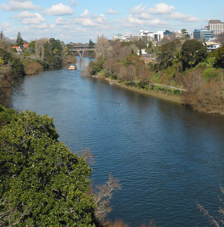
caption = Waikato River passing through Hamilton
origin =Lake Taupo
mouth =Port Waikato
basin_countrieslength 524m978ft )
discharge = unknownm³/s (unknownft³/s )
watershed = 13701km² (to Mercer) http://www.ew.govt.nz/Environmental-information]The Waikato River is the longest
river inNew Zealand . In theNorth Island , it runs for 425kilometre s from the eastern slopes ofMount Ruapehu , joining theTongariro River system and emptying intoLake Taupo , New Zealand's largestlake . It drains Taupo at the lake's northeastern edge, creates theHuka Falls , then flows northwest, through theWaikato Plains . It empties into theTasman Sea south ofAuckland atPort Waikato . It gives its name to theWaikato region that surrounds the Waikato Plains.The river's main tributary is the
Waipa River , which has its confluence with the Waikato atNgaruawahia .The name "Waikato" comes from Māori and translates as "flowing
water ".The Waikato River has
spiritual meaning for various localMāori tribe s including the largeTainui , who regard it as a source of theirmana or pride. The widely-respectedmarae ofTurangawaewae is close to its banks at Ngaruawahia.For many years Tainui tribe have sought to re-establish their links to the river after the
war s (seeInvasion of Waikato ) and the subsequent illegal confiscations of the 1860s, and are continuing negotiations with the currentNew Zealand government .Uses of the river
As well as being a water and
recreation resource, the river has long been a critical communications and transport link for the communities along it.Taupo ,Mangakino , Cambridge, Hamilton,Horotiu ,Ngaruawahia , Huntly,Hampton Downs ,Meremere ,Waiuku and Port Waikato are on or close to it.The river was of
military significance in the land wars between British and Māori soldiers around 1863, and significantbattle s were fought at points including Rangiriri. Acemetery containing thegrave s of the British military dead can be found there opposite thehotel ,shop s andcafe .A
ferry service along part of its length was for years conducted byCesar Roose , several of whose descendants still live beside it.Electricity generation
The
world 's firsthydro-electric power station was built at Horahora, now located under the [http://www.siliconlakes.co.nz/horahora/photos/photo_5.html Horahora bridge] deep beneath the surface of lake Karapiro. Horahora was built to supplyelectricity for theMartha gold mines atWaihi ."New Zealand Historical Atlas" - McKinnon, Malcolm (Editor);David Bateman , 1997, Plate 88]The river has a series of eight hydroelectric power stations that generate electricity for the national grid. Between 1929 and 1971, eight
dam s and nine powerhouses were built to meet growing demand for electricity.The power scheme begins at Lake Taupo, which has control gates to regulate the flow of water into the river. Once released through the gates it takes nearly 18
hour s for the water to flow to the Tasman Sea. On its journey downstream it passes through power stations atAratiatia ,Ohakuri ,Atiamuri ,Whakamaru ,Maraetai ,Waipapa ,Arapuni andKarapiro .Approximately 4000 gigawatt hours (GWh) of electricity is generated annually by the scheme, which is around 13% of New Zealand's total electrical generating capacity.
The river also provides cooling water for the
coal /natural gas firedthermal power station at Huntly.Recreation
The Waikato is renowned among
whitewater kayaking enthusiasts, specifically for theFull James rapid located north of Taupo. The Full James was the site of the 1999World Whitewater Championships , as well as the pre-World event the year before.Lake Karapiro (an artificial lake) is regarded as one of New Zealand's best rowing venues. TheWorld Rowing Championships in1978 and 2010, and the1950 British Empire Games were hosted at Karapiro.Environmental issues
The whole length of the river is administered by the elected local body, the
Waikato Regional Council , or "Environment Waikato ", based in Hamilton. Several major problems currently face the river.One is
pollution due toagricultural additives found in runoff from some intensively farmed land used in its catchment area.Dairy farming is one of the causes of this pollution.Recently controversial was the pumping of water from a point near the seaward end of the river further north to
Auckland . This is somewhat purified and used for a portion of the city's domesticwater supply .Another problem is the
silt ing-up of what used to be anavigable channel in the river with loosesoil s fromeroded hill sides.Slightly-modified
human waste s are pumped into the river downriver of severaltown s, including Hamilton.A further issue is industrial and metropolitan waste from early-established
landfill s and waste-emittingfactories on the banks of the river.These include an unlined waste dump at Horotiu, just downriver from Hamilton, whose
leachate s includedieldrin in quantities toxic tofreshwater marine life. Tribes at the northern point of the river who took legal action to oppose the continued operation of this dump spoke of finding many dead, disordered and distressedfish near their tribal lands.References
External links
* [http://www.ew.govt.nz/Environmental-information/River-levels-and-rainfall/River-levels-and-flow---latest-reading/ Waikato River Basin Flow rates and Rainfall.]
Wikimedia Foundation. 2010.