- Hume Highway
-
Hume Highway Hume Freeway


Proposed _to_replace_  to replace
  in NSW[1]
Length 812 km (505 mi) Direction Northeast-Southwest From  South Western Motorway, Casula, Sydney
via Goulburn, Yass, Tarcutta, Albury, Wodonga, Wangaratta, Benalla, Seymour, Craigieburn To  Western Ring Road, Campbellfield, Melbourne
Established 1817 Allocation Casula - Campbelltown: Campbelltown - NSW/Vic. Border: NSW/Vic. Border - Campbellfield:
 Formerly
Major junctions  WestLink
 Narellan Road
 Appin Road
 Illawarra Highway
 Federal Highway
 Barton Highway
 Lachlan Valley Way
 Burley Griffin Way
 Snowy Mountains Highway
 Sturt Highway
 Olympic Highway
 Riverina Highway
 Murray Valley Highway

 Midland Highway
 Goulburn Valley Freeway
 Northern Highway
 Sydney Road
for full list see exits and major intersections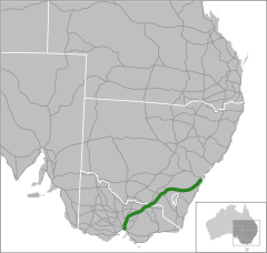
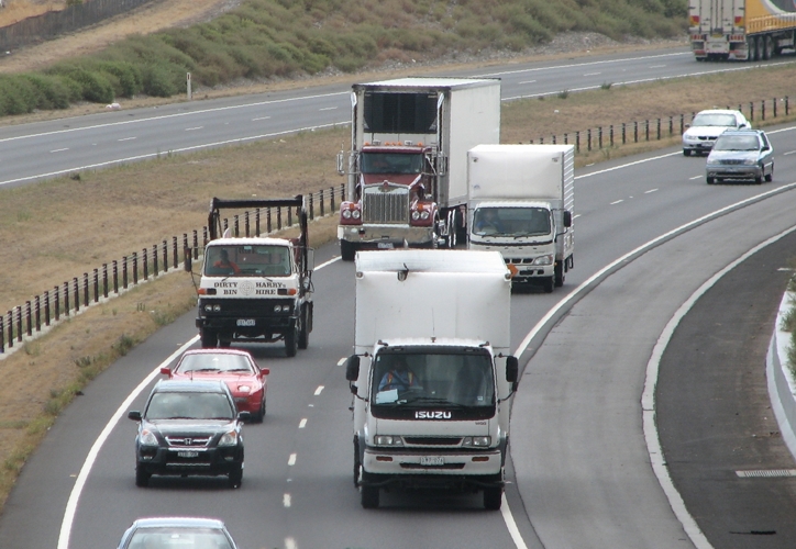
The Hume Highway/Hume Freeway is one of Australia's major inter-city highways, running for 880 km between Sydney and Melbourne. It is part of the Auslink National Network and is a vital link for road freight to transport goods to and from the two cities as well as serving Albury-Wodonga and Canberra.
The main alternative route between Sydney and Melbourne is the

 Princes Highway which follows the coast for most of its length. Other inland alternate routes include the
  Olympic Highway route between Albury and Sydney via Cowra and Bathurst, and also the
  Federal /
  Monaro Highway route via Canberra which links with the Hume Highway near Goulburn and the Princes Highway in East Gippsland.
History
The coast of New South Wales from the Queensland border to the Victorian border is separated from the inland by an escarpment, forming the eastern edge of the Great Dividing Range. There are few easy routes up this escarpment. To climb from the coast to the tablelands the Hume Highway uses the Bargo Ramp, a geological feature which provides one of the few easy crossings of the escarpment.
In the first twenty years of European settlement at Sydney (established 1788), exploration southwest of Sydney was slow. This area was heavily wooded at the time, especially the "Bargo brush", which was regarded as almost impenetrable. In 1798 explorers (Wilson, Price, Hacking, and Collins) reached the Moss Vale and Marulan districts, but this was not followed up. Any settlement would have to await the construction of an adequate access track, which would have been beyond the colony's resources at the time, and would have served little purpose as a source of supplies for Sydney, due to the time taken to reach Sydney. In 1804, Charles Throsby penetrated through the Bargo brush to the country on the tablelands near Moss Vale and Sutton Forest. On another expedition in 1818, he reached Lake Bathurst and the "Goulburn Plains".[2] Many of the early explorers would most likely have used aboriginal guides, but they do not appear to have given them credit.
After Charles Throsby's 1818 journey towards present day Goulburn, followed by Hamilton Hume and William Hovell's overland journey from Appin (near Campbelltown) to Port Phillip and return in 1824, development of the Southern Tablelands for agriculture was rapid. The present route of the Hume Highway is much the same as that used by the pioneers.
The route taken by the Hume Highway to climb from the coast to the Southern Tablelands and thence across the Great Divide is situated between the parallel river gorge systems of the Wollondilly and Shoalhaven Rivers. This country consists generally of a gently sloping plateau which is deeply dissected by the Nepean River and its tributaries. The route of the Highway, by using four high-level bridges to cross these gorges, avoids the Razorback Range, and has minimal earthworks. The climb from the western side of the Nepean River at Menangle up to Mittagong is fairly sustained, a fact that is hard to appreciate at high speed on the modern freeway. The highway climbs non-stop over a distance of 16 km from the Pheasant's Nest bridge over the Nepean River to Yerrinbool, before dropping slightly before the final climb to reach the tablelands at Aylmerton.
Early road construction
Governor Lachlan Macquarie ordered the construction of a road, which became known as the Great South Road (the basis of the northern end of the Hume Highway) in 1819 from Picton to the Goulburn Plains and he travelled to Goulburn in 1820, but it is unlikely that even a primitive road was finished at that time.
 Towrang bridge of 1839
The Great South Road was rebuilt and completely re-routed between Yanderra and Goulburn by Surveyor-General Thomas Mitchell in 1833. The Main Roads Management Act of June 1858 declared the Great Southern Road, from near Sydney through Goulburn and Gundagai to Albury, as one of the three main roads in the colony. However, its southern reaches were described as only a 'scarcely formed bullock track' as late as 1858. The road was improved in the mid 1860s with some sections near Gundagai "metalled" and all creeks bridged between Adelong Creek (approximately 10 kilometres south of Gundagai) and Albury.[3]
Mitchell's route, except for the bypasses at Mittagong, Berrima and Marulan (dual carriageways were completed in 1986) is still largely followed by the current highway.[citation needed] Mitchell intended to straighten the route north of Yanderra, but was not granted funding, although his proposed route through Pheasants Nest has similarities to the freeway route opened in 1980.[4] Mitchell's work on the Great South Road is best preserved at Towrang Creek (10 kilometres north of Goulburn), where his stone arch culvert still stands, although it was superseded in 1965 by a concrete box culvert which in turn was superseded by the current route of the highway when it was duplicated in 1972.
In 1914 the NSW section of the highway was declared a main road. Until it was named the Hume Highway in 1928 it was known as the "Great South Road" in NSW and "Sydney Road" in Victoria. It was named after Hamilton Hume, who with William Hovell were the first Europeans to traverse an overland route between Sydney and Port Phillip, in what later became Victoria.
Route
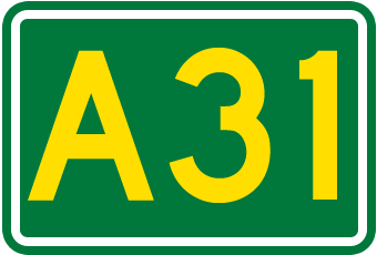
At its Sydney end, the Hume Highway begins at Parramatta Road, in Summer Hill. This route is numbered as
 . The first 35 km of the highway was known as Liverpool Road until August 1928, when it was renamed as part of the Hume or Great Southern Highway, as part of the creation of the NSW highway system. Sections of the highway through Sydney's suburbs continue to be also known by its former names of Liverpool Road, Sydney Road and Copeland Street (through Liverpool).
The main Hume Highway effectively commences at the junction of the M5 South Western Motorway and the Westlink M7 at Casula. Heading eastbound, the M5 provides access to Sydney Airport and the CBD; while the M7 provides access to Newcastle and Brisbane bypassing the Sydney CBD. Both of these routes are tolled.
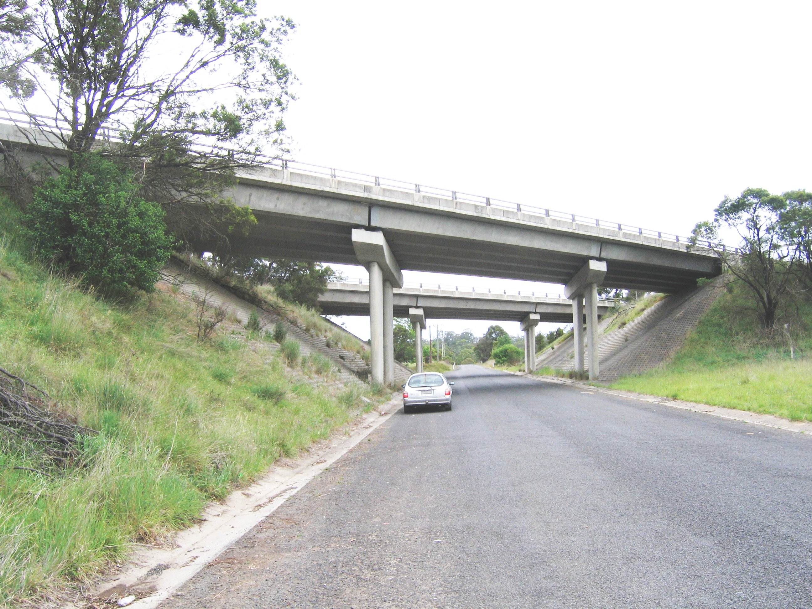
Other than sections within the urban areas of Sydney and Melbourne, the Hume Highway is dual carriageway or freeway standard for its full length in Victoria, with three N.S.W. sections totalling 20 km, through the towns of Tarcutta, Holbrook and Woomargama. Projects to bypass these towns are presently at design stage, with construction envisaged to be completed by 2013[5].
Although (other than abovementioned three sections where town bypasses are proposed) the full length of the Hume Highway is dual carriageway (with at-grade intersections and restricted entry from adjoining land), there are considerable lengths of the highway which are of full freeway standard. Most of these sections are bypasses of the larger towns on the route, where the need to deviate the route to construct the bypass made it practical to deny access from adjoining land and thus provide full freeway conditions. In addition to these bypasses the sections between Casula (in southwestern Sydney) and Berrima (built 1973-92), and Broadford to Wallan (1976), which both were constructed as major deviations, are also of full freeway standard. The entire section in Victoria is categorised as a freeway by government roads authority VicRoads, although there a few intersections along the route that are not yet grade-separated. The speed limit on the full length of the highway, other than the three sections in New South Wales where bypasses are yet to be built, is 110 km/h.
As the Hume Freeway approaches Melbourne at the suburb of Craigieburn, 27 km north of the city centre, the Craigieburn Bypass now diverts the Hume Freeway (and the M31 designation) to the east of the former route, to terminate at the Western Ring Road/Metropolitan Ring Road
 . This bypass was opened in two stages, in December 2004 and December 2005.
At its Melbourne end, the original alignment of the Melbourne-Sydney route followed Royal Parade northward from where it begins at its intersection with Elizabeth Street and Flemington Road. Royal Parade becomes Sydney Road at Brunswick Road and then became the Hume Highway itself at Campbellfield. This ceased to be the designated route of the Hume Highway in 1992, with the completion of Stage 1 of the Western Ring Road, at which point the designation of the southbound highway was truncated. The former highway south from the Western Ring Road to Elizabeth street is route is now numbered as
 , and is now officially called Sydney Road (Hume Highway).
Current New South Wales Upgrading
Work commenced in January 2009 to widen both carriageways between Brooks Road and Narellan Road. This work is being undertaken in 3 stages. The first stage, widening to 4 lanes each way between Brooks Road and St Andrews Road St Andrews is expected to be completed in 2010. The second stage, widening to 4 lanes each way between St Andrews Road and Raby Road commenced in 2009 and be completed in mid 2011. The final stage, widening to 3 lanes each way between Raby Road and Narellan Road, is scheduled to commence in late 2010 (following completion of the first stage) and be completed in late 2011.[6] Construction of a pedestrian bridge over the highway to link Claymore and Woodbine is also underway. This section of the highway, opened as part of the two stages opened in October 1973 and December 1974, was originally designed for widening of the carriageways to three lanes.
Work commenced in 2009 on bypasses of Tarcutta and Woomargama, and in 2010 on a bypass of Holbrook. These three projects are scheduled to completion from 2013, and will result in dual carriageway (much to freeway standard) over the full length of the Hume Highway/Freeway.
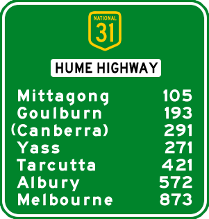
 Distances to destinations along the highway from Sydney.
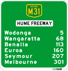 Approximate road distances (in kilometres) along the Hume Freeway southwards from the Victorian border
Current Victorian Upgrade Projects
VicRoads has undertaken a planning study for the upgrading of the Hume Freeway by removal of direct access from adjoining properties and grade-separation of the intersections between Kalkallo and Beveridge. These intersections have the highest accident rate of the Hume Freeway in Victoria.[7] The study, completed in March 2009, intended to amend council planning schemes so as to reserve space for the upgrade, but no timetable has been set for the project.[8]
In addition a 4-level interchange between the Hume Freeway and the Outer Metropolitan Ring Road is proposed for construction after 2020.[9][10]
Views
Heading north from Melbourne, the road passes through the hills of the Great Dividing Range, some of which is covered with box eucalypt forest but of which much is cleared for farmland, before levelling out near Seymour to cross flat, mostly cleared farming country to Wodonga and the Victoria-New South Wales border. Victoria's landscape differs to that of the typical 'true Australian Outback', but a dry summer can leave the ground parched. Mount Buffalo can be seen in the distance to the east as the highway comes down off the Warby Range near Glenrowan, and a museum commemorating Ned Kelly is located nearby. At Wangaratta the highway passes close to the Rutherglen and Milawa wine-producing areas.
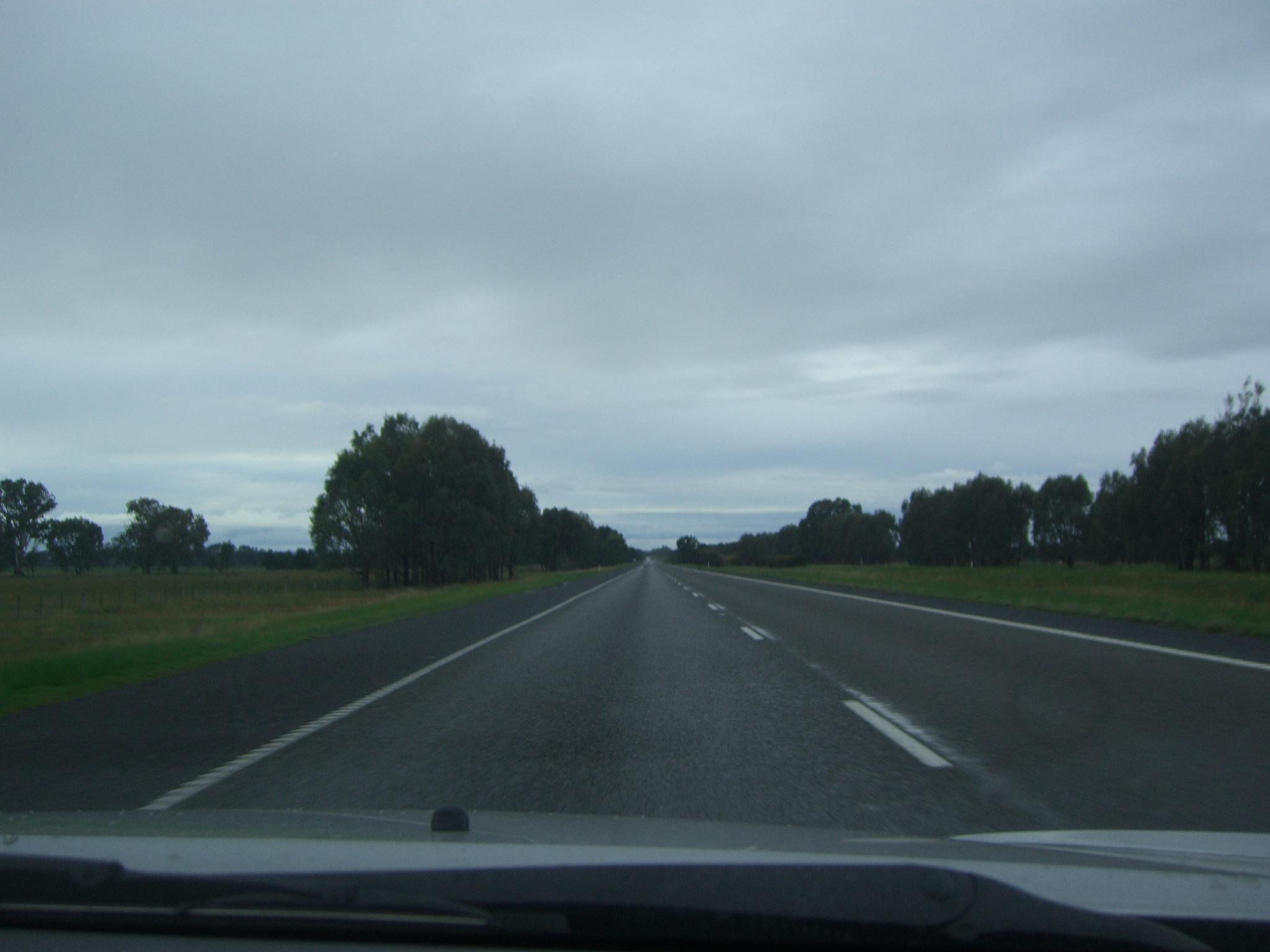
Continuing north, the Murray River, the south bank of which is the Victoria-New South Wales border, is crossed on the bypass of Albury-Wodonga. From Albury, the highway skirts Lake Hume and continues across undulating country generally north-east towards Holbrook and then Tarcutta. Just north of Tarcutta the highway encounters the first of several ranges which form outliers of the Great Dividing Range, and which are crossed as the highway climbs the slopes to the tablelands west of Yass. From here the highway runs eastward, to Goulburn where it again turns northeast. Most of the New South Wales countryside from Albury to Marulan has been developed for wool production, with Yass and Goulburn in particular noted for their fine wool.
Speed limits
Like most roads in Australia, the Hume Highway is speed-limited, although it was as recent as 1977 that speed limits were introduced on the section between the Federal Highway and Albury.[citation needed] The speed limit on most of the dual carriageway length of the Hume Highway is 110 km/h, with the speed limit reduced to 50 km/h through Tarcutta and Holbrook, and to 70 km/h through Woomargama (the remaining three towns yet to be bypassed).
Fixed speed camera locations
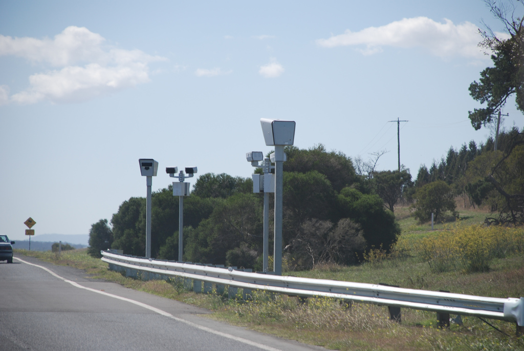
In Sydney: next to Ashfield Primary School, near Culdees Road Burwood, Willee St Enfield, Brennan St Yagoona, and Knight St Lansvale. In January 2008, fixed speed-cameras were installed in the median strip along the Craigieburn Bypass and northward to Seymour, in Victoria, at roughly 15–20 km intervals.
 Point to Point speed camera on the Hume Highway in Victoria
Freeway section exits and major intersections
Hume Highway
Hume Freeway
South Western FreewayNorthbound exits / intersections 
Distance to
Sydney
(km)Distance to
Melbourne
(km)Southbound exits / intersections End South Western Freeway 
continues as South Western Motorway
to Bankstown / Sydney
42 838 Start South Western Freeway
from South Western Motorway
and WestLink
Newcastle, Brisbane
WestLinkLiverpool
Camden Valley Way
no exit 47 833 Ingleburn
Brooks RoadDenham Court, Ingleburn
Campbelltown Road
48 832 no exit no exit 52 828 Campbelltown
Campbelltown RoadEnd Hume Highway 
continues as South Western Freeway58 822 Campbelltown, Penrith
Appin Road
Narellan Road
Camden, Campbelltown, Bulli
Narellan Road
Appin RoadStart Hume Highway
from South Western FreewayPicton, Wollongong
Picton Road
80 800 Picton, Wollongong
Picton RoadBargo, Picton
Remembrance Drive / Old Hume Highway92 788 Bargo
Avon Dam RoadColo Vale, Yerrinbool
Church Avenue / Old Hume Highway105 775 Yerrinbool, Colo Vale
Old Hume Highway / Church Avenueno exit 107 773 Mittagong, Bowral
Old Hume Highway
Richlands, Mittagong, Bowral
Wombeyan Caves Road / Old Hume Highway115 765 no exit Start Freeway 128 752 Berrima, Medway
Medway RoadBerrima
Mereworth Road / Old Hume HighwayEnd Freeway[11] Moss Vale, Wollongong
Illawarra Highway
139 741 Moss Vale, Canyonleigh
Illawarra HighwayExeter, Bundanoon, Service Centre
Sallys Corner Road142 738 Exeter, Bundanoon, Service Centre
Sallys Corner RoadHeavy vehicle checking station 166 714 Marulan, Heavy vehicle checking station
George StreetMarulan, Service Centre
George Street167 713 Service Centre Goulburn
Sydney Road190 690 Goulburn
Sydney RoadGoulburn
Hume Street200 680 Goulburn
Hume StreetCanberra, Queanbeyan, Cooma
via U-turn208 672 Barkers Lane no exit 209 671 Canberra, Queanbeyan, Cooma
Federal HighwayBreadalbane
Cullerin Road219 661 Breadalbane
Cullerin RoadGunning, Gundaroo
Gundaroo Road242 638 Gunning, Collector
Gunning-Collector RoadYass, Canberra, Queanbeyan
Barton Highway
272 608 Yass, Canberra
Barton HighwayYass, Service Centre
Yass Valley Way281 599 Yass, Service Centre
Yass Valley WayBoorowa, Cowra
Lachlan Valley Way
284 596 Boorowa, Cowra
Lachlan Valley Way Harden, Temora
Burley Griffin Way
293 587 Harden, Temora
Burley Griffin Way no exit 334 546 Jugiong, Harden
Riverside DriveMurrumburrah, Jugiong
Jugiong Road337 543 no exit no exit 339 541 Jugiong
Riverside DriveCoolac, Cootamundra
Cootamundra Road357 523 Coolac, Cootamundra
Cootamundra RoadPettit
Coleman Street361 519 Pettit
Gobarralong RoadDog on the Tuckerbox, Service Centre 369 511 Dog on the Tuckerbox, Service Centre no exit 373 507 Gundagai
West StreetGundagai
Sheridan Street376 504 Gundagai
Sheridan StreetSouth Gundagai
Cross Street378 502 South Gundagai
Middle StreetSouth Gundagai
Mount StreetTumblong
Grahamstown Road389 491 Tumblong
Grahamstown RoadAdelong, Tumut, Cooma
Snowy Mountains Highway
403 477 Adelong, Tumut
Snowy Mountains HighwayWagga Wagga, Narrandera
Sturt Highway
413 467 Wagga Wagga, Narrandera, Mildura, Adelaide
Sturt HighwayEND SINGLE CARRIAGEWAY SECTION 414 466 START SINGLE CARRIAGEWAY SECTION
Planned upgrade completion 2012Tarcutta 421 459 Tarcutta Holbrook 491 389 Holbrook Woomargama 511 369 Woomargama START SINGLE CARRIAGEWAY SECTION
Planned upgrade completion 2012515 365 END SINGLE CARRIAGEWAY SECTION Culcairn, Wagga Wagga, Cowra
Olympic Highway535 345 Culcairn, Wagga Wagga
Olympic Highwayno exit 544 336 Ettamogah, Jindera
Wagga RoadSpringdale Heights, Thurgoona
Thurgoona Drive549 331 Thurgoona
Thurgoona DriveNorth Albury, Wirlinga
Dallinger Road551 329 no exit Albury, Lake Hume, Corowa
Riverina Highway
555 325 Lake Hume, Albury
Riverina HighwaySouth Albury
Bridge Street556 324 Albury
Bridge StreetStart Hume Highway 558 322 End Hume Highway MURRAY RIVER MURRAY RIVER NEW SOUTH WALES
STATE BORDER
VICTORIAEnd Hume Freeway 
558 322 Start Hume Freeway no exit 559 321 Tallangatta
Bandiana Link
continues as 560 320 Wodonga, Albury
High Street

Lincoln CausewayAlbury, Wodonga
Lincoln Causeway
High Street continues as 'no exit 562 318 Wodonga
Melrose Drive / Moloney DriveWodonga
Melbourne Road564 316 no exit continues as 576 304 Yarrawonga, Echuca
Murray Valley HighwayYarrawonga, Echuca
Murray Valley Highwaycontinues as Barnawartha, Upper Indigo
Indigo Creek Road582 298 Barnawartha, Upper Indigo
Indigo Creek RoadChiltern, Beechworth
Chiltern-Howlong Road /
/
Beechworth-Chiltern Road591 289 Chiltern, Beechworth
Chiltern-Howlong Road /
Beechworth-Chiltern RoadSpringhurst, Rutherglen
Rutherglen-Springhurst Road
603 277 Springhurst, Rutherglen
Rutherglen-Springhurst RoadBowser, Wangaratta
Wangaratta Road
620 260 Bowser, Wangaratta
Wangaratta RoadWangaratta, Beechworth, Bright, Mount Hotham
Great Alpine Road
627 253 Wangaratta, Bright, Mount Hotham
Great Alpine RoadWangaratta, Greta
Greta Road
635 245 Wangaratta, Greta
Greta RoadWangaratta
Wangaratta Road638 242 no exit Milawa
Snow Road
640 240 no exit Service Centre 642 238 Service Centre no exit 645 235 Glenrowan, Moyhu
Glenrowan-Moyhu RoadGlenrowan, Winton
Winton-Glenrowan Road647 233 no exit Winton, Benalla
Benalla-Winton Road
662 218 Winton, Benalla
Benalla-Winton RoadBenalla, Shepparton, Mansfield
Midland Highway

674 206 Mansfield, Shepparton
Midland Highway Violet Town, Harrys Creek
Murchison-Violet Town Road /
/
Harrys Creek Road697 183 Violet Town, Harrys Creek
Harrys Creek Road /
Murchison-Violet Town RoadEuroa
Euroa Main Road
714 166 Euroa
Euroa Main RoadEuroa
Euroa Main Road721 159 Euroa
Euroa Main RoadAvenel, Tarcombe
Avenel-Nagambie Road /
/
Tarcombe Road753 127 Tarcombe, Avenel
Tarcombe Road /
Avenel-Nagambie Road _ Seymour, Nagambie, Shepparton, Brisbane
Goulburn Valley Freeway /
/
Goulburn Valley Highway
766 114 Seymour, Shepparton
Goulburn Valley Highway /
Goulburn Valley FreewaySeymour, Puckapunyal, Tooborac
Seymour-Tooborac Road
774 106 Seymour, Puckapunyal, Tooborac
Seymour-Tooborac RoadService Centre 777 103 Service Centre no exit 780 100 Tallarook
Upper Goulburn Road
Tallarook
Upper Goulburn Road783 97 no exit no exit 793 87 Broadford, Kilmore
Broadford-Kilmore Road
Broadford, Flowerdale
Strath Creek Road
794 86 no exit Waterford Park, Clonbinane
Broadford-Wallan Road803 77 Waterford Park, Clonbinane
Broadford-Wallan RoadKilmore, Wandong
Epping-Kilmore Road
811 69 Wandong, Kilmore
Epping-Kilmore RoadService Centre 815 65 Service Centre no exit 820 60 Whittlesea, Wallan
Wallan-Whittlesea Road
Wallan, Echuca
Northern Highway
824 56 no exit Beveridge
Lithgow Street827 53 Beveridge
Old Hume HighwayMickleham, Donnybrook
Donnybrook Road
835 45 Mickleham, Donnybrook
Donnybrook RoadCraigieburn
Sydney Road
via Amaroo Road839 41 Craigieburn
Sydney RoadCraigieburn, Wollert
Craigieburn Road East
842 38 no exit Roxburgh Park, Epping
Cooper Street
849 31 Epping, Roxburgh Park
Cooper StreetStart Hume Freeway
from Western Ring Road
and Metropolitan Ring Road
854 26 Greensborough
Metropolitan Ring RoadEnd Hume Freeway
continues as Western Ring Road
to Melbourne / GeelongSource
Towns
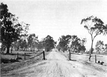
 The Hume Highway by-passing the Albury CBD.
Almost all towns on the Hume Highway are bypassed. In New South Wales, from Sydney, southwards to Victorian border, the bypassed towns include Campbelltown, Camden, Picton, Mittagong, Berrima, Marulan, Goulburn, Gunning, Yass, Bowning, Bookham, Jugiong, Coolac, Gundagai and Albury. The three remaining towns on the Hume Highway yet to be bypassed are Tarcutta, Woomargama and Holbrook, which are intended to be bypassed by 2012.[12]
In Victoria; all towns have been bypassed. They are, in order from the NSW border, Wodonga, Chiltern, Wangaratta, Benalla, Euroa, Violet Town, Seymour, Broadford and Craigieburn.
Camden
Camden lies 60 km south west of Sydney on the Nepean River, and the town dates from 1840. It retains a rural character with many historic buildings of interest remaining. There is an aviation museum at nearby Narellan. Urban sprawl has made Camden part of the Sydney metropolitan area.
The old route (pre-mid 1980s) of the Hume Highway runs straight west from the Cross Roads at Prestons, 4 km south of Liverpool to Carnes Hill, where it joins the route of the Cowpasture Road. It then runs southwest to Camden (the section of the former highway from the Cross Roads to Camden is now called Camden Valley Way).
Camden has been bypassed by the Hume Highway twice. The first bypass was opened in 1973, via the Macarthur Bridge, and runs from Narellan to Benkennie (South Camden). This bypass was in turn bypassed in December 1980 when the section of what was then called the South Western Freeway (route F5) from Campbelltown to Yerrinbool was opened. This linked the freeway sections from the Cross Roads to Campbelltown Rd at St Andrews (opened August 1973) and St Andrews-Camden Road (opened December 1974) to its north with the section from Yerrinbool to Aylmerton (opened May 1977) to its south.
From Camden south to Aylmerton the former highway is now named Remembrance Drive. It climbs southwards from Camden through the Razorback Ridge to Picton, then begins to climb through Tahmoor and Bargo to reach the Southern Tablelands and rejoin the present route of the Hume Highway at Aylmerton, 6 km north of Mittagong. The designation Hume Highway and national route 31 were transferred from what are now Camden Valley Way and Remembrance Drive to the freeway route in the mid 1980s and the former highway route from the Cross Roads to Aylmerton is now state route 89.
 Hume Highway through Southern Highlands
An alternative route to the highway runs from Aylmerton through Mittagong and Bowral to join the Illawarra Highway at Moss Vale and then follows the Illawarra Highway through Sutton Forest to rejoin the Hume Highway at Hoddles Crossroads (named after Surveyor Robert Hoddle who also laid out the Melbourne CBD).
Mittagong
Mittagong lies 110 km south-west of Sydney, just off the Hume Highway at the edge of the Southern Tablelands. It is notable for being the location of Australia's first ironworks. Mittagong's streets are lined with various species of deciduous trees and it has a busy town centre.
Until 1992 when the Mittagong bypass was opened, the town was dominated by trucks and in winter it was also busy with skiers' traffic on the way to the Australian Alps. Today the Hume Highway bypasses Mittagong and all the towns of the Southern Tablelands. In the late 1990s, engineers detected subsidence under part of the bypass where it runs along a steep slope near the Nattai River. This was caused by features of the local geology, and mining activity at the adjacent Mount Alexandra coalmine from the 1950s to the 1970s.[13] The problem was remedied by closing one carriageway at a time and building a pair of 'land bridges' across the unstable section of the slope.
Bowral
Bowral is home to the famous Bradman Museum which not only celebrates the achievements of Bowral's favourite son, Sir Donald Bradman, but also contains a wealth of world sporting information and memorabilia. Bowral is also the setting for "Tulip Time", a Spring celebration where over 100,000 tulips and 25,000 flowers are planted in the town centre.
The population swells during winter when, thousands of visitors book into local hotels and B&Bs to enjoy romantic fires and secluded winter getaways. Spring is also very popular with gardening enthusiasts, who come to view some of the world's most beautiful formal gardens designed by eminent landscape architects such as Paul Sorensen, who designed the gardens of Invergowrie.
Key attractions are the glorious gardens, fine restaurants, many successful vineyards and fresh, local produce of a wide variety. Antique and book stores abound, as do quality fashion retailers and specialty stores.
Moss Vale
Moss Vale has several beautiful old and attractive buildings and Leighton Gardens, in the centre of the main street, is a pleasant park. It is best during spring when its flowers are in blossom or in autumn when the leaves of its exotic deciduous trees are changing colour.
 Twin bridges carrying the Hume Highway over Greenhills Road north of Berrima 34°28′S 150°21′E / 34.467°S 150.35°E
Sutton Forest is surrounded by farms, vineyards and is home to elegant country homes and estates. It comprises a church, and inn, a couple of restaurants and one or two specialty shops.
Berrima
Berrima has flourished since it was bypassed in 1989, with tourists finding it an easy day trip from either Sydney or Canberra to enjoy the town square and the Georgian architecture of this historic town.
Marulan
The Marulan bypass was opened in 1986. The southern part of Governor Lachlan Macquarie's road of 1819 ran from Sutton Forest roughly along existing minor roads through what is now Penrose State Forest to Canyonleigh, Brayton, Carrick and Towrang, where it joined the current route to Goulburn. Branching from this route (now part of the Illawarra Highway) just west of Sutton Forest, a road, now known as Old Argyle Road, developed in the 1820s. It ran to Bungonia, via Wingello, Tallong, and the southern outskirts of Marulan.
When Thomas Mitchell rerouted the Great South Road in the 1830s, he decided to bring these two roads together to meet at old Marulan, with roads proceeding west to Goulburn and south to Bungonia. When the railway reached Marulan in 1868, the town migrated 3 km north to the railway station. Nevertheless, the old cemetery remains at the Bungonia Road intersection. A quarry is about to be developed near the intersection, so an interchange is to be built. It is at this point that the highway climbs the Marulan Ramp, which is part of the divide between the Shoalhaven and Wollondilly River systems.
Towrang Stockade
Towrang Creek was the site of a major stockade for chain-bound convicts and others involved in the construction of the Great South Road. The stockade was located on the western side of the Highway and was used from around 1836 to 1842. The stockade became the principal penal establishment in the southern district and was noted for its harsh discipline. There were usually at least 250 convicts stationed there. They slept on bare boards with a blanket apiece, 10 men to a box or cell. One of the two official floggers was later found murdered[14] The stockade used to be accessible by a stile, but this has been taken down to discourage use of the once daunting intersection of the Highway with Towrang Road. There are the remains of the powder magazine next to the Wollondilly River, three graves on the north bank of Towrang Creek, and the remains of a weir on Towrang Creek built for the stockade. Aboriginal stone tools have also been found on the banks of Towrang Creek, indicating that this was a route well-travelled long before Hamilton Hume came this way in 1824.
There is also a rest area on the eastern side of the highway, where a well-preserved bridge dating from 1839 (possibly designed by David Lennox) and a 1960s concrete box culvert can be viewed.
Goulburn
Goulburn is the first city along the Hume Highway from Sydney. It is the centre of a rich agricultural area specialising in fine wool production. From this area comes some of the world's finest wool. Goulburn was bypassed in 1992 and the main street (Auburn Street) is quieter, but still busy during Saturday morning shopping. Picturesque Belmore Park is located midway along Auburn Street. A number of architecturally and historically significant buildings are located near Belmore Park, including the courthouse, the post office and the railway station. Also in central Goulburn are two cathedrals, both of architectural note. A number of old houses and hotels are located near the railway station on Sloane Street.
Gunning
Gunning's 19th century main street was built very wide, for the time of horse and bullock-drawn wagons. This served the town well when the main highway between Sydney and Melbourne carried cars and trucks through the town, which ceased when the bypass was completed in 1994. It is now much quieter, and the town has been able to resume a more rural pace of life and to develop something of an industry in providing bed and breakfast accommodation.
Yass
Yass has an historic main street, with well-preserved 19th century verandah-post pubs (mostly converted to other uses). It is popular with tourists, some from Canberra and others taking a break from the Hume Highway. Hamilton Hume's farm Cooma Cottage is located east of Yass, close to the intersection of the former routes of the Hume and Barton Highways. He lived there until his death in 1873. Yass was bypassed in 1994.
Bookham
Bookham is situated 29 km west of Yass. The Hume Highway once passed through the village, but now bypasses it.
It is a popular site for police speed traps, hence some wags have rechristened the town "Book 'em"
The grazing lands around the village of Bookham were originally called Bogolong and were much sought after by the early pioneers. Childhood memories of the races at the old Bogalong Racetrack inspired Banjo Paterson to write his poem "Old Pardon the Son of Reprieve".
Bookham is the site of two very fine churches constructed from locally quarried granite: the Uniting Church (c1926) and the Catholic Church, St Columbas (c1910). It also features an old-fashioned cricket field, resplendent with a white picket fence, the site of many a bush bash.
Coolac
The 11 kilometre section at Coolac was the last two lane section of highway between Sydney and Gundagai until it was bypassed with a dual carriageway in August 2009.,[15] after a delay due to indigenous heritage issues, the construction contract was awarded to Abigroup Contractors Pty Ltd in February 2007.[16][17]
 An earlier monument to the Dog on the Tuckerbox between Coolac and Gundagai, photographed in 1926
Gundagai
At Snake Gully, adjacent to the highway north of Gundagai is the "Dog on the Tuckerbox". A statue (with souvenir shop next door) was erected five miles (eight kilometres) from Gundagai. Snake Gully serves as a way station for many highway travellers.
Gundagai was bypassed in 1977 with the completion of the first Sheahan Bridge over the Murrumbidgee River. This bridge was the second longest road bridge in New South Wales (the Sydney Harbour Bridge being the longest), until the completion of the duplicate Sheahan Bridge in May 2009,[18] which is now the longest road bridge in New South Wales (1 m longer than the Sydney Harbour Bridge). The original Sheahan Bridge was only 1 lane in each direction.
The Prince Alfred Bridge, on the old route of the highway across the Murrumbidgee floodplain, is of major engineering interest, as it is one of Australia's longest timber trestle bridges, as is the adjacent 1903 railway bridge. Gundagai was originally located on the river flats directly beside the Murrumbidgee River, but a disastrous flood in 1852 destroyed the town and drowned 89 people. The town was then relocated to its present position. A grade-separated interchange was completed at the intersection of the Highway and West Street in 2006.[19]
Tumblong
The route of the highway between Tumblong and Tarcutta is the third route of the highway in this location. The original route led west from Tumblong along the Murrumbidgee River, before turning south over difficult country, crossing what is now the Sturt Highway and rejoining the current route of the highway as Lower Tarcutta Road. This was replaced in December 1938 by the first Tumblong deviation, to the east of the current route. The main features of this section of the highway were a deep, narrow cutting and the reinforced concrete bowstring arch bridge over Hillas Creek. This bridge has been preserved as it is one of only two bridges in New South Wales built to this design, and is visible on the western side of the highway close to the interchange with the Snowy Mountains Highway.
38 km southwest of Gundagai is the interchange with the Sturt Highway, which leads to Wagga Wagga, Mildura and Adelaide.
Tarcutta
 National Truck Driver Memorial at Tarcutta
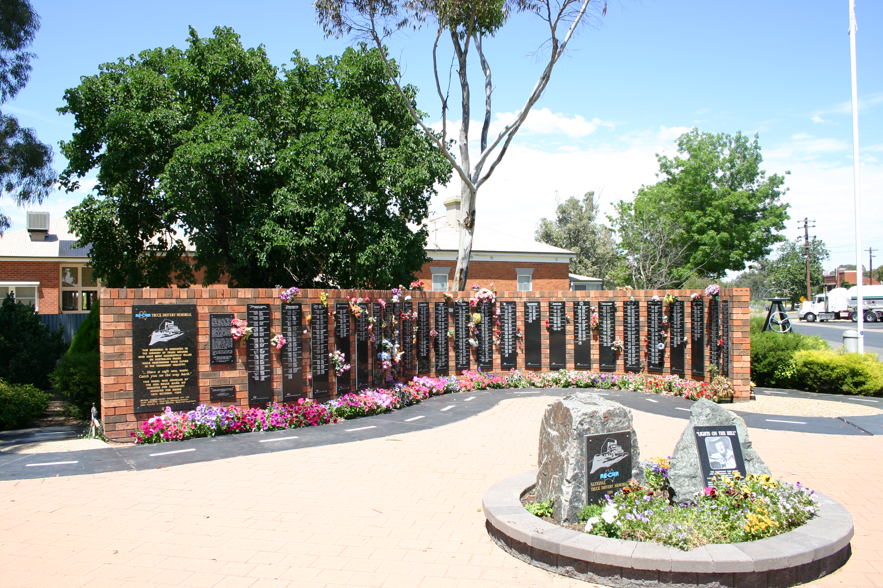
Tarcutta is located almost exactly halfway between Sydney and Melbourne and has been a popular stopover and change-over point for truck drivers making their way between the two cities. There is a memorial to truck drivers who have died on the local stretch of the Hume Highway.
With improvements to the Hume Highway which have reduced travelling time between Sydney and Melbourne to about nine hours driving time in good conditions, the town's importance to the average motorist has diminished. It was near Tarcutta that the final section of the Hume Highway was sealed in 1940. Tarcutta is scheduled to be bypassed in 2012.
Holbrook
Holbrook was called Germanton until anti-German sentiment during World War 1 led to the town and the shire being renamed in honour of the wartime submarine captain, Lt Holbrook who was awarded the Victoria Cross. From 1995, a feature of the town has been a partial reconstruction of HMAS Otway, an Oberon class submarine. This landmark was in recognition of the town's namesake's connections with submarines. In Holbrook is the only set of traffic signals (for pedestrians) remaining on the Hume Highway between the Sydney Orbital and Melbourne's Western Ring Road. Like Tarcutta, Holbrook is scheduled to be bypassed in 2012.
Woomargama
Woomargama, is a village between Holbrook and Albury which acts as a local service centre for a rich woolgrowing area. It is the third of the towns scheduled to be bypassed in 2012, thereby completing the duplication of the Hume Highway.
Table Top
Table Top is about 16 km north of Albury. It has a population of approximately 4510 people.
Albury-Wodonga
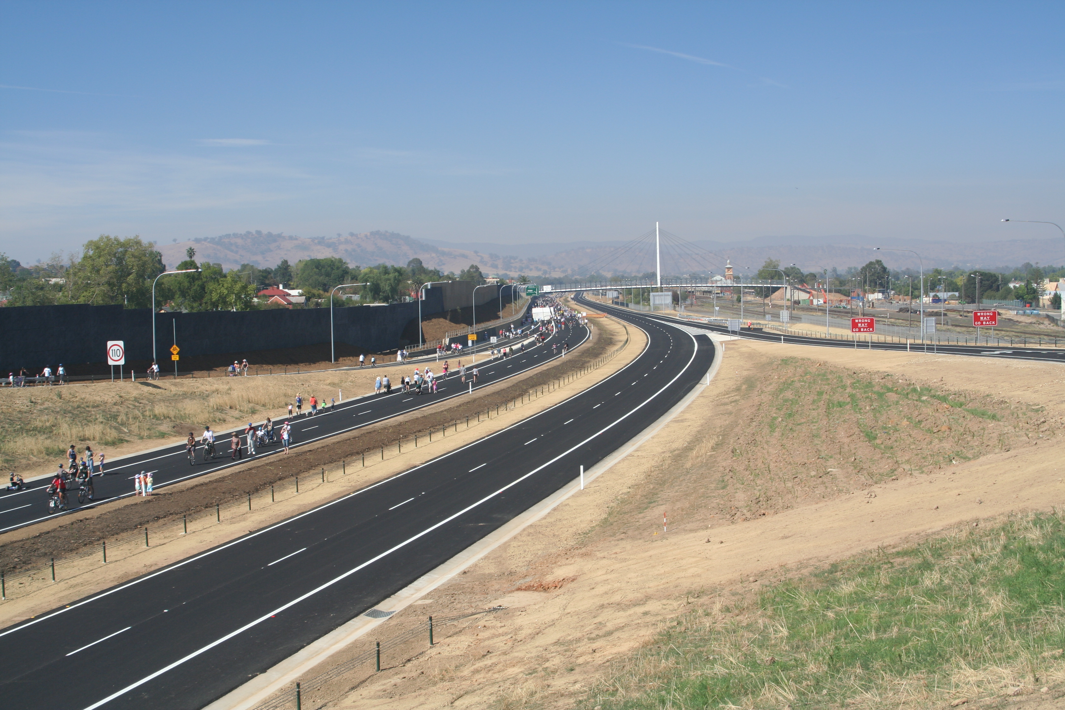
 Hume Highway bypass in Albury
Albury's history is linked with the two famous Australian explorers, Hamilton Hume and William Hovell, as the city's location sprung from their crossing of the Murray River. Albury, commonly associated with its Victorian twin, Wodonga, is one of the few rural Australian cities to experience a boom, mainly from industrialisation in recent times. Albury-Wodonga is the largest centre on the Hume Highway, with a population of nearly 80,000.
The Albury bypass, built by Abigroup,[20] opened in January 2007, having been first proposed in 1964. Following a series of announcements and changes of plans through the 1990s, when Albury residents failed to agree on whether an 'internal' or 'external' bypass route was more appropriate, the 'internal bypass' option was chosen, with approval being granted in 2004 and construction commencing in January 2005. The route is parallel to and on the eastern side of the Sydney-Melbourne railway, beginning at the railway overpass 10 km north of Albury. After crossing the Murray River, the bypass route crosses the railway to rejoin the previous highway at the southern end of the Lincoln Causeway, connecting to the Wodonga bypass. The Albury bypass includes a freeway standard connection to the Murray Valley Highway at Bandiana, east of Wodonga.
Wangaratta
 Hume Highway near Wangaratta
Wangaratta is, after Wodonga, the largest centre in northeast Victoria (population 17,000). It is at the junction of the Hume and Ovens Highways (the 'Great Alpine Road'). Hume and Hovell passed through this area on their 1824 expedition and the town was founded in 1837 when the surrounding area was opened for farming.
The attractions around town include Merriwa Park, a sunken garden adjacent to the King River, Airworld at Wangaratta Airport, and old goldfield areas of nearby Beechworth and Chiltern.
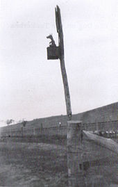
Benalla
 A passable section of "Sydney Road" in the shire of Benalla, 1914.
Benalla is a large town located just off the Hume Freeway between Melbourne and Wangaratta. Founded in 1848, growth was slow until a goldrush in the 1850s. It had many associations with the Kelly gang and the courthouse was the venue for a number of their trials. It also has a memorial to the Australian war hero Sir Edward 'Weary' Dunlop, an Australian doctor who acted as a leader to allied troops on the Thailand-Burma Railway in World War II.
Euroa
Euroa is famous for a Ned Kelly bank robbery. The town is located on the Seven Creeks and has pretty gardens and a number of attractive 19th century buildings.
Seymour
The Hume Highway bypass of Seymour opened in December 1982. Seymour remains on the Goulburn Valley Highway. The town is in the rich Goulburn Valley which supports the local vineyards. The large Puckapunyal military base is located west of Seymour. Once the centre of the bushranging area of Victoria, it has a museum which displays many period relics of that era. It was until the 1970s a major railway maintenance centre, and part of the railway workshops now houses a railway museum. The museum's collection of rolling stock, including State carriages used by governors and monarchs, is extensive.
Kalkallo
Construction of the Donnybrook Road interchange, immediately to the north of the Craigieburn Bypass, replaced the dangerous[21] at-grade intersection with (C723) at Kalkallo an overpass and entry/exit ramps in both directions, at a cost of $32 million. Works commenced in December 2007 and completion occurred in March 2009, 3 months ahead of schedule.[22]
Craigieburn
 Craigieburn Bypass
Prior to the opening of the Craigieburn Bypass in 2005, the Hume Highway skirted Craigieburn (the town centre was bypassed in the 1950s). The section of the Highway from Craigieburn to Campbellfield (on Melbourne's outskirts) was a significant bottleneck, with 12 sets of traffic signals in 17 km section of road. The Craigieburn Bypass now links directly to the Western Ring Road/Metropolitan Ring Road.
There was some opposition for the bypass by several local governments in the northern suburbs of Melbourne, including the City of Darebin and the City of Moreland, as well as local environmental groups. Their alternative proposal was rejected by the state government.[23]
A pedestrian and cyclist cement path - the Galada Tamboore Pathway - runs the length of the bypass and connects with the Metropolitan Ring Road path, from where it is possible to connect to the Merri Creek Trail, Western Ring Road Trail, the City of Whittlesea Public Gardens and Edgars Road.
The Craigieburn Bypass is shown in the 1969 Melbourne Transportation Plan as part of the F2 Freeway corridor, which extended south along Merri Creek, Hoddle St, Barkly St in St. Kilda, south through Elwood and Brighton, then east along South Road, connecting to the Dingley Freeway corridor.
See also
- Old Hume Highway
- Highways in Australia
- Highways in New South Wales
- Highways in Victoria
- Freeways in Australia
- Freeways in New South Wales
- Freeways in Victoria
References
- ^ Alpha-Numeric Route Numbering for NSW. It is here!, Ozroads: the Australian Roads Website. Retrieved on 9 April 2010.
- ^ "Official Year Book of the Commonwealth of Australia 1931". Australian Bureau of Statistics www.abs.gov.au. http://www.abs.gov.au/Ausstats/abs@.nsf/0/4e782ee652d0db0aca2569de001fb2dd?OpenDocument. Retrieved 2006-04-28.
- ^ "Hillas Creek Bridge". Heritage and conservation register. Roads and Traffic Authority of New South Wales. 2004. http://www.rta.nsw.gov.au/cgi-bin/index.cgi?action=heritage.show&id=4309569. Retrieved 2008-03-16.
- ^ Lay, Max (1984). History of Australian Roads. Australian Road Research Board. ISBN 0-86910-164-1.
- ^ [1]
- ^ F5 Freeway widening - RTA
- ^ "Hume Kalkallo Land Use Business and Agriculture" (PDF). VicRoads. http://www.vicroads.vic.gov.au/NR/rdonlyres/A245C58C-88F0-4D1D-B3E4-277DEBC17159/0/HumeKalkalloLandUseBusinessandAgricultureupdate.pdf. Retrieved 2008-06-08.
- ^ "Hume Highway, Kalkallo to Beveridge - Access restoration planning". VicRoads. http://www.vicroads.vic.gov.au/Home/RoadsAndProjects/RoadProjects/NothernSuburbs/HumeHighwayAccessRestoration+ProjectKalkallo.htm. Retrieved 2009-06-08.
- ^ "Outer Metropolitan Ring Road planning study". VicRoads. http://www.vicroads.vic.gov.au/Home/RoadsAndProjects/RoadProjects/PlanningStudies/OuterMetropolitanRingPlanningStudy.htm. Retrieved 2009-06-24.
- ^ "Map of recommended option for Outer Metropolitan Ring Road" (jpg). VicRoads. http://www.vicroads.vic.gov.au/NR/rdonlyres/26785B2E-3762-4BCE-A89E-77FB9AF343C6/0/FigureS1maponly.jpg. Retrieved 2009-06-24.
- ^ Google Maps street level view showing "end freeway" sign
- ^ PREFERRED ROUTES ANNOUNCED FOR TARCUTTA, HOLBROOK AND WOOMARGAMA BYPASSES
- ^ "Media release: Plan to Bridge the Hume Highway at Mittagong". Department of Transport and Regional Services www.dotars.gov.au. 2001. http://www.dotars.gov.au/dept/media/2001/d4_2001.aspx. Retrieved 2006-04-26.[dead link]
- ^ "Travel - Goulburn". Sydney Morning Herald www.smh.com.au. 2004. http://www.smh.com.au/news/New-South-Wales/Goulburn/2005/02/17/1108500193619.html. Retrieved 2006-04-26.
- ^ "Coolac Bypass". Roads and Traffic Authority. http://www.rta.nsw.gov.au/constructionmaintenance/majorconstructionprojectsregional/southwest/coolac/index.html. Retrieved 2009-08-25.
- ^ "More delays to highway bypass". Australian Broadcasting Corporation. 14 February 2006. http://www.abc.net.au/news/australia/nsw/riverina/200602/s1569224.htm. Retrieved 2007-03-05.
- ^ "Contract awarded to construct Coolac bypass" (Press release). Australian Government. 1 March 2007. http://www.ministers.dotars.gov.au/jl/releases/2007/March/L022_2007.htm. Retrieved 2007-03-05.
- ^ Sheahan Bridge duplication - NSW RTA, accessed 2009-06-13
- ^ Hume Highway West Street Interchange Gundagai - NSW RTA, accessed 2009-06-13
- ^ Albury Wodonga Hume Freeway project
- ^ "Fix for deadly" - Star News Group - article, 22 May 2007
- ^ "Donnybrook Road Interchange Project". VicRoads. http://www.vicroads.vic.gov.au/Home/RoadsAndProjects/RoadProjects/NothernSuburbs/Donnybrook+Road+Interchange.htm. Retrieved 2009-06-08.
- ^ BATCHELOR SLAMS COUNCILS OVER FLAWED RUSSELL REPORT - Media release, accessed 2009-06-13
External links
- Hume Highway to receive $785m upgrade: Vaile
- Libs to finish Hume duplication by 2012
- QBR (Queensland Business review) Coalition to complete duplication of Hume Highway by 2012
- ALP to fix NSW rural transport corridors
- Vaile exhorts colleagues to keep up the fight to win
Construction news
- Coolac Bypass, RTA
- Coolac bypass better projects, RTA
- Hume Highway, Abigroup
- Coolac bypass, Abigroup
- Hume Highway duplication package, RTA
- Southern Alliance
- Northern Alliance
- Hume Highway to receive $785m upgrade: Vaile
- Liberals to finish Hume duplication by 2012
- QBR (Queensland Business review) Coalition to complete duplication of Hume Highway by 2012
- ALP to fix NSW rural transport corridors
- Media release - Warren Truss, Minister for Transport and Regional Services
- [2]
 Road infrastructure in Regional New South Wales
Freeways Hume Freeway • Pacific Motorway • Southern Freeway • Sydney–Newcastle Freeway
National highways Barton Highway • Federal Highway • Hume Highway • New England Highway • Newell Highway • Sturt HighwayHighways Barrier Highway • Bruxner Highway • Carnarvon Highway • Castlereagh Highway • Cobb Highway • Great Western Highway • Gwydir Highway • Illawarra Highway • Kamilaroi Highway • Kings Highway • Mid-Western Highway • Mitchell Highway • Monaro Highway • Murray Valley Highway • Olympic Highway • Oxley Highway • Pacific Highway • Princes Highway • Riverina Highway • Silver City Highway • Snowy Mountains HighwayLocal highways Alpine Way • Appin Road • Barry Way • Bathurst-Ilford Road • Bells Line of Road • Bucketts Way • Burley Griffin Way • Bylong Valley Way • Camden Valley Way • Castlereagh Highway • Central Coast Highway • Escort Way • Fossickers Way • Golden Highway • Goldfields Way • Goulburn-Oberon Road • Henry Lawson Way • Irrigation Way • Kidman Way • Lachlan Valley Way • Newcastle Inner City Bypass • O'Connell Road • Old Hume Highway • Picton Road • Princes Highway • Putty Road • Remembrance Drive • Summerland Way • Thunderbolts Way • Waterfall Way • Wombeyan Caves Road • Yass Valley WayProposals Hunter Expressway • Pacific Motorway Extension to Sydney • Sydney Bypass Road infrastructure in Victoria
Freeways Highways Bass Highway • Bellarine Highway • Borung Highway • Calder Highway • Glenelg Highway • Goulburn Valley Highway • Hamilton Highway • Henty Highway • Hopkins Highway • Kiewa Valley Highway • Loddon Valley Highway • Mallee Highway • Maroondah Highway • Melba Highway • Midland Highway • Monaro Highway • Murray Valley Highway • Nepean Highway • Northern Highway • Omeo Highway • Princes Highway • Pyrenees Highway • South Gippsland Highway • Strzelecki Highway • Sturt Highway • Sunraysia Highway • Surf Coast Highway • Warburton Highway • Western Highway • Western Port Highway • Wimmera HighwayBypass routes Old Hume Highway • Old Princes Highway • Princes Highway (Geelong)Tourist routes Categories:- 1817 establishments in Australia
- Australian highways
- Highways and freeways in Melbourne
- Highways in Victoria (Australia)
- Highways in New South Wales
- Streets in Sydney


Wikimedia Foundation. 2010.