- Dunkeswell Aerodrome
-
Dunkeswell Aerodrome IATA: none – ICAO: EGTU Summary Airport type Private Operator Air Westward Co. Ltd. Location Honiton Elevation AMSL 839 ft / 256 m Coordinates 50°51′36″N 003°14′05″W / 50.86°N 3.23472°WCoordinates: 50°51′36″N 003°14′05″W / 50.86°N 3.23472°W Website Map Location in Devon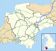
 EGTU
EGTURunways Direction Length Surface m ft 04/22 968 3,176 Asphalt 17/35 644 2,113 Asphalt Sources: UK AIP at NATS[1] Dunkeswell Aerodrome (ICAO: EGTU) is an airfield in East Devon, England. It is located approximately 5 mi (8.0 km) north of the town of Honiton and 14 NM (26 km; 16 mi) northeast[1] of Exeter. It is a busy civilian airfield with a mix of light aircraft, microlights and parachuting.
Nearby (1 NM (1.9 km; 1.2 mi)) is North Hill, an airstrip run by the local gliding club.
Dunkeswell Aerodrome has a CAA Ordinary Licence (Number P674) that allows flights for the public transport of passengers or for flying instruction as authorised by the licensee (Air Westward Limited). The aerodrome is not licensed for night use.[2]
History
The airfield was opened in 1943, during the Second World War, as RAF Dunkeswell. The station was originally planned as a RAF Fighter Command, then a RAF Coastal Command airfield, but was transferred for use by American units.[3]
It was first used by the American United States Army Air Force's Antisubmarine Command, 479th Antisubmarine Group, as a base of operations to fly antisubmarine missions over the Bay of Biscay using specialized B-24 Liberator bombers from August until November 1943.[4][5]
In November the United States Army Air Forces turned over the antisubmarine mission to the United States Navy and its Liberators were reassigned to Navy Patrol Bomber Squadron VPB-103, Fleet Air Wing 7, which continued aerial antisubmarine operations from the station, the AAF aircraft being redesignated under the USN/USMC system of the time as PB4Y-1 Liberators. This was the first United States Navy unit to train with the RAF, later followed by VB-105 and VB-110. The Naval antisubmarine squadrons moved to RAF Upottery in November 1944.[3][6][7]
With the departure of the Americans, the RAF used the airfield from August 1945 to April 1946 for ferrying aircraft to the Middle East by 16 Ferry Unit, RAF Transport Command. After September 1946 the station was put on care and maintenance status until the end of 1948, when it was sold by the Ministry of Defence.[3]
References
- ^ a b Dunkeswell - EGTU
- ^ Civil Aviation Authority Aerodrome Ordinary Licences
- ^ a b c www.controltowers.co.uk Dunkeswell
- ^ Maurer, Maurer (1983). Air Force Combat Units Of World War II. Maxwell AFB, Alabama: Office of Air Force History. ISBN 0-89201-092-4
- ^ US Air Force Historical Research Agency microfilm 00199740 containing charts and documents describing operations of 479th Antisubmarine Group from UK stations
- ^ United States Army Air Force Antisubmarine Command History
- ^ www.controltowers.co.uk Upottery
External links
Categories:- Airports in England
- Transport in Devon

Wikimedia Foundation. 2010.