- Clipper Mountains
-
Clipper Mountains Mountain Range Country United States State California District San Bernardino County Coordinates 34°45′15″N 115°24′59″W / 34.75417°N 115.41639°W Highest point Clipper Mountain - elevation 4,625 ft (1,410 m) Timezone Pacific (UTC-8) - summer (DST) PDT (UTC-7) Topo map USGS West of Blind Hills 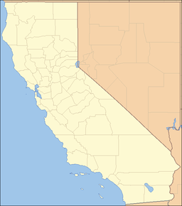
 Location of the Clipper Mountains in California [1]
The Clipper Mountains are located in the Mojave Desert of eastern San Bernardino County, California. The range parallels the central-southern border of the large Mojave National Preserve and is found just south of Interstate 40 and the Clipper Valley, between the freeway and the National Old Trails Highway - U.S. Route 66.
Contents
Geography
The Clipper Mountains are southeast of the Granite Mountains and Providence Mountains, north of the Old Woman Mountains, and west of the Sacramento Mountains. They are northwest of the small communities of Essex and Goffs.[2]
The range is home to at least three natural springs, and the 'Tom Reed Mine.'
Clipper Mountain Wilderness
The Clipper Mountain Wilderness is on the northern slopes of the range. It includes rugged yellow and dark brown, horizontally striped mesas; narrow canyons with hidden springs; and sparsely vegetated alluvial fans. This small cluster of volcanic mountains is oriented northeast to southwest.[3] In the center, the most prominent ridge, Clipper Mountain, reaches an elevation of 4,625 feet (1,410 m) before it dramatically drops off in a series of sharp cliffs overlooking the Fenner and Clipper Valleys. Castle Dome, a local landmark, can be clearly seen from Historic Route 66 to the south and east.
The vegetation types are predominantly Xeric desert scrub, with Creosote bush (Larrea tridentata), and desert wash scrub. In the spring, the alluvial fans turn yellow with Brittlebush flowers (Encelia farinosa), as well as wildflowers.
Wildlife includes a herd of 40-50 Desert Bighorn Sheep, coyote, roadrunners, chucker, quail, prairie falcons, red-tailed hawks, golden eagles, ground squirrels, kangaroo rats, black-tailed jackrabbits, rattlesnakes, and several species of lizards. The entire wilderness is considered critical habitat for the threatened Desert Tortoise.[4]
See also
- Clipper Valley
- Providence Mountains State Recreation Area
- Category: Protected areas of the Mojave Desert
- Category: Flora of the California desert regions
- Category: Mountain ranges of the Mojave Desert
References
- ^ "Clipper Mountains". Geographic Names Information System, U.S. Geological Survey. http://geonames.usgs.gov/pls/gnispublic/f?p=gnispq:3:::NO::P3_FID:240706. Retrieved 2009-05-04.
- ^ http://www.blm.gov/ca/pa/wilderness/wilderness_pdfs/maps/1page/needles/clipper_mtn.pdf . accessed 6/22/2010
- ^ http://www.blm.gov/ca/st/en/prog/wilderness/wa/photos/clipper.html . accessed 6/22/2010
- ^ http://www.blm.gov/ca/pa/wilderness/wa/areas/clipper_mountain.html . accessed 6/22/2010 . BLM public domain source
- California Road and Recreation Atlas, 2005, pg. 107
External links
Categories:- Mountain ranges of the Mojave Desert
- Mountain ranges of San Bernardino County, California
- Protected areas of the Mojave Desert
- Protected areas of San Bernardino County, California
- Mountain ranges of Southern California
- Bureau of Land Management areas in California
Wikimedia Foundation. 2010.