- Interstate 78 in New Jersey
-
This article is about the section of Interstate 78 in New Jersey. For the entire length of the highway, see Interstate 78.
Interstate 78
Phillipsburg–Newark Expressway
New Jersey Turnpike – Newark Bay Extension
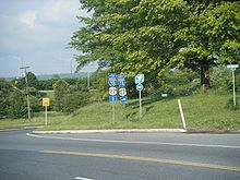
I-78 highlighted in redRoute information Maintained by NJDOT, DRJTBC, NJTA, and PANYNJ Length: 67.83 mi[1] (109.16 km) Major junctions West end:  I-78 at Interstate 78 Toll Bridge in Phillipsburg
 US 22 in Pohatcong Township
 Route 31 in Clinton
 I-287 in Bedminster Township
 Route 24 in Springfield
 G.S. Pkwy. in Union/Hillside
 US 1-9 in Newark

 I-95 / NJ Turnpike in Newark
 Route 139 in Jersey City
East end: I-78 at Holland Tunnel in Jersey CityHighway system Main route of the Interstate Highway System
Main • Auxiliary • BusinessNew Jersey State Highway Routes
Interstate and US←  Route 77
Route 79  →
→←  Route 10
Route 12  →
→Interstate 78 (I-78) is an east–west route stretching from Union Township, Lebanon County, Pennsylvania to New York City. In New Jersey, I-78 is called the Phillipsburg–Newark Expressway and the Newark Bay Extension of the New Jersey Turnpike. The highway runs for 67.83 mi (109.16 km) in the northern part of the state of New Jersey from the Interstate 78 Toll Bridge over the Delaware River at the Pennsylvania state line in Phillipsburg, Warren County east to Holland Tunnel under the Hudson River at the New York state line in Jersey City, Hudson County. The Phillipsburg-Newark Expressway portion of I-78, formally called the Lightning Division Memorial Highway, runs from the Phillipsburg area east across rural areas of western New Jersey before entering suburban areas in Somerset County. The road crosses the Watchung Mountains, widening into a local-express lane configuration at Route 24 as it continues through urban areas to Newark. Here, I-78 intersects the mainline of the New Jersey Turnpike (I-95) and becomes the Newark Bay Extension, crossing the Newark Bay Bridge and continuing to Jersey City. The route, along with Route 139, follows a one-way pair of surface streets to the Holland Tunnel.
In 1927, Route 11 was legislated as a high-speed bypass of U.S. Route 22 (US 22) between Whitehouse and Warrenville; but was never built. The earliest parts of I-78 to be built were the Holland Tunnel in 1927 and the Newark Bay Extension. With the creation of the Interstate Highway System in the 1950s, a highway was planned along US 22 through northern New Jersey, becoming I-78 in 1958. The highway between Phillipsburg and Newark was built in various stages from the 1960s to 1989, with the final segment opening at the Interstate 78 Toll Bridge. The section of highway through the Watchung Mountains and across Newark garnered opposition from environmentalists and residents who were worried about the effects of the highway. In addition, there was opposition to building I-78 through Phillipsburg, which resulted in the alignment to the south of the Lehigh Valley. In the 2000s, I-78 was completely rebuilt between Route 24 and the Garden State Parkway. In addition, missing movements between the Garden State Parkway and I-78 were completed in 2010[2] .
Contents
Route description
Warren County
I-78 enters New Jersey from Pennsylvania on the Interstate 78 Toll Bridge over the Delaware River, which is maintained by the Delaware River Joint Toll Bridge Commission, heading into Phillipsburg, Warren County.[1] The highway heads south as a six-lane freeway into agricultural areas, entering Pohatcong Township a short distance after the river.[1][3] The freeway makes a turn to the east as it briefly passes through a corner of Alpha before coming back into Pohatcong Township. Bypassing the center of Alpha to the south, I-78 has two more segments that enter the Alpha borough limits before coming to an interchange with US 22 and the western terminus of Route 173. At this point, US 22 forms a concurrency with I-78 and the road comes into Greenwich Township. At this point, the New Jersey Department of Transportation takes over maintenance of the road. I-78/US 22 continue east through Greenwich Township, coming to a westbound exit and eastbound entrance with CR 637. The road turns southeast and has an eastbound exit and westbound entrance with CR 632 in Franklin Township.[1] Within the ramps for this interchange, there are weigh stations in both directions.[3]
Hunterdon County
A short distance after this interchange, I-78/US 22 crosses the Musconetcong River into Bloomsbury, Hunterdon County. In Bloomsbury, the road has an interchange with Route 173.[1] After this interchange, the freeway enters Bethlehem Township, with Route 173 closely running to the north of I-78/US 22.[1][3] The road has rest areas in both directions before turning southeast and crossing the Musconetcong Mountains.[3] As the freeway crosses Jugtown Mountain, there is an automatic deicing spray, the first such to be installed in New Jersey.[4]
The freeway turns east again and enters Union Township, coming to an interchange with CR 614 and Route 173.[1] From here, I-78/US 22 continue east directly to the south of Route 173, coming to another interchange with that route as well as CR 625. Entering more commercial areas, Route 173 merges onto I-78/US 22 at exit 13.[1][3] At exit 15, the highway interchanges with CR 513, and Route 173 splits from I-78/US 22 by heading north on CR 513. At this point, the freeway runs along the border of Franklin Township to the south and Clinton to the north before entirely entering Clinton and crossing the South Branch Raritan River.[1] I-78/US 22 turns northeast and leaves Clinton for Clinton Township, where it has an eastbound exit and westbound entrance for Route 173 that also provides access to Route 31.[1][3] Immediately after is the interchange with Route 31.[1] At the next interchange near the community of Annandale, US 22 splits from I-78 onto a four-lane surface highway, heading closely to the south of that route.[1][3]
Immediately after the split, I-78 passes over New Jersey Transit’s Raritan Valley Line and runs through rural areas with increasing suburban development. The freeway runs through Lebanon, where an exit for CR 639 provides access to the town and the Round Valley Recreation Area. After running through Clinton Township again and into Readington Township, US 22 turns southeast while I-78 continues a due east course. In Tewksbury Township, there is an interchange with CR 523 that also provides access to CR 517.[1][3] After this exit, the highway crosses back into Readington Township.[1]
Somerset County
After crossing the Lamington River, I-78 comes into Bedminster Township, Somerset County, continuing east through more woods and farms with some suburban residential areas.[1][3] Upon entering Somerset County, there is an exit for CR 665. The next interchange, exit 29, is called the Vincent R. Kramer Interchange.[1] It is at I-287, which serves as a bypass around New York City.[1][3] At this point, I-78 carries four eastbound lanes and three westbound lanes as the median widens.[1] The road enters wooded suburban areas and crosses Second Watchung Mountain, running through a corner of Bridgewater Township before coming into Bernards Township.[1][3] The eastbound direction narrows back to three lanes before the interchange with CR 525, at which point the freeway crosses into Warren Township. The road heads east along the southern bank of the Dead River, coming to the exit for CR 651. I-78 heads farther south of the Dead River as it comes to the CR 531 interchange. Past CR 531, the highway turns to the northeast and comes to an interchange with Drift Road/Dale Road that provides access to US 22.[1] At this point, I-78 runs across Second Watchung Mountain again.[3]
Union County
 I-78 through the Watchung Reservation, with a bridge designed for animals to cross the road
The freeway crosses Green Brook into Berkeley Heights, Union County, reaching exits for CR 655 and CR 640. The latter is an eastbound exit and entrance that also provides access to parallel CR 527.[1] At this point, I-78 runs between Second Watchung Mountain to the northwest and the Watchung Reservation to the southeast.[3] Along the reservation border, the road passes under Nikesite Road before coming into Summit, where there is an overpass that serves as an animal crossing. There is an eastbound exit and westbound entrance with CR 527 as it heads away from the Watchung Reservation and into more suburban surroundings. It briefly forming the border between Summit to the northwest and Mountainside to the southeast before coming into Springfield Township. The freeway passes near First Watchung Mountain before coming to the Route 24 interchange, where suburban development becomes more dense.[1][3]
At Route 24, I-78 divides into local and express lanes, with three express and three local lanes eastbound and two express and three local lanes westbound. In this section of the highway, most access is via the local lanes, though the next exit for Route 124 includes a direct westbound onramp to the express lanes. Before Route 124, I-78 briefly runs east through Millburn in Essex County and Springfield Township again before entering Union Township at the interchange. Past Route 124, I-78 carries a 3-2-2-3 lane configuration and comes to partial interchanges with CR 630 and CR 633. The next interchange along the highway provides access to the Garden State Parkway along the border of Union Township and Hillside.[1] The road turns northeast again into Hillside, heading into more urbanized settings.[3] In Hillside, I-78 has a eastbound exit and westbound entrance to Winans Avenue.[1]
Essex County
I-78 briefly passes through a corner of Irvington in Essex County before continuing into Newark. Upon entering Newark, the road has an interchange serving CR 602 and Wainwright Street.[1] Following this, the freeway passes near urban neighborhoods before coming to exit 56.[1][3] This large semi-directional T interchange serves Irvine Turner Boulevard with full access to the local and express lanes.[1] The final interchange on the free part of I-78 is the massive complex to the north of the Newark Liberty International Airport, called the Newark Airport Interchange, with ramps to and from US 1/9, US 22, Route 21, and many local roads. Several ramps provide access to the express lanes.[1][3] Just to the east, the local and express lanes rejoin at the toll gate for the New Jersey Turnpike, at which point I-78 becomes maintained by the New Jersey Turnpike Authority, following the Newark Bay Extension of the New Jersey Turnpike. An interchange just beyond the toll booth provides full access to I-95, the mainline of the New Jersey Turnpike.[1] I-78 here becomes a four-lane highway, passing by the Port Newark-Elizabeth Marine Terminal.[1][3]
Hudson County
 I-78 eastbound heading onto the Newark Bay Bridge
I-78 crosses the Newark Bay on the Newark Bay Bridge into Bayonne, Hudson County. As it enters Jersey City, exit 14A, numbered as part of the New Jersey Turnpike, provides access to Route 440.[1] From here, the freeway turns northeast on an elevated alignment and passes industrial areas of Jersey City.[3] The next interchange, exit 14B, is for Bayview Avenue and provides access to Liberty State Park.[1][3] After this interchange, I-78 comes to exit 14C, the number given to the toll plaza at the end of the turnpike extension.[1] After the toll plaza, there is an exit for a Hudson-Bergen Light Rail park and ride at the Liberty State Park station.[1][3] Continuing north, there is an exit for Columbus Drive and Montgomery Street.[1] I-78 heads down to surface level and merges with the Route 139 freeway.[1][3]
From here, I-78 and Route 139 pass through business areas as a one-way pair that follows six-lane 12th Street eastbound and six-lane 14th Street westbound. This segment of the route is under the jurisdiction of the Port Authority of New York and New Jersey and is also known as Boyle Plaza. It runs on surface streets with traffic lights, an example of a non–limited access section of Interstate Highway.[1][3] The first intersection is with Jersey Avenue, which heads to Downtown Jersey City and Hoboken.[3] It intersects with the one-way northbound CR 633 (Erie Street) next before crossing one-way southbound CR 635 (Grove Street).[1] After Grove Street, the road crosses CR 637 (Luis Muñoz Marín Boulevard) near the Newport Centre Mall. Past this intersection, the eastbound direction comes to the toll plaza for the Holland Tunnel.[3] From here, the concurrency enters the Holland Tunnel under the Hudson River, which carries two lanes in each direction. Route 139 ends at the New Jersey/New York state line within the tunnel and I-78 continues into the New York City borough of Manhattan.[1][3]
History
 Route 11 (planned in 1927)
The oldest section of I-78, the Holland Tunnel, was established in September 1927. The tunnel predated the Interstate Highway System, as a commuter linking Jersey City and Manhattan. Six months after it was opened, 3,655,000 passengers used the tunnel.[5] In 1927, Route 11 had been legislated as a high-speed bypass of US 22, running from Route 28 in White House east to Route 29 in Warrenville, roughly following the alignment of present-day I-78; it was never built.[6][7]
 This 1955 plan shows the full proposed route of I-78 in the New York City area, running east to Kennedy Airport and then north to the Bruckner Interchange.
The Newark Bay Extension of the New Jersey Turnpike was the first limited-access section of I-78 to be built in the state of New Jersey. The 8.2-mile (13.2 km) long expressway was opened in 1956 to provide access from the New Jersey Turnpike mainline to the Holland Tunnel.[8] At this time, the Interstate Highway System was established and a route was planned to run east-west from the Harrisburg, Pennsylvania area to New York City, running across the northern part of New Jersey from Phillipsburg to Jersey City along the US 22 corridor.[9] This freeway was originally planned as FAI Corridor 102 and I-80 before it became I-78 in 1958.[10][11]
The part of I-78 between exit 3 and exit 13 opened in the 1960s; this segment runs concurrent with US 22 with the old alignment of US 22 becoming Route 173. In building the road between CR 614 and exit 13, the eastbound lanes of US 22 became westbound I-78 and the westbound lanes of US 22 became the Route 173 frontage road. By 1969, I-78 had also been completed between exit 13 and CR 525.[12] In July 1963, New Jersey Governor Richard J. Hughes approved a plan to build I-78 through the city of Newark at a cost of $204,696,637. This plan had been opposed by several communities along the route.[13] The section of I-78 between Route 24 and the New Jersey Turnpike was completed in the mid 1970s.[14] Along this stretch, exit 56 was to connect to the proposed Route 75 freeway, which was never built.[15]
The section of freeway between CR 525 and Drift Road (Exit 41) in Watchung was completed in 1974. The section from Drift Road to Route 24 (Exit 48) in Springfield Township was delayed because of environmental impacts to the Watchung Reservation. In order to mitigate opposition to the original plan, that was shifted closer to the northern edge of the Reservation, which required extensive cuts into the Second Watchung Mountain. Extra land was added to the Nikesite Road overpass and a separate land bridge was built to allow for animal migration. The road was also designed to use a narrower right-of-way with no median strip and just a Jersey barrier dividing the highway, to minimize the amount rock to be removed. This stretch of I-78 opened in 1986.[16]
A section of I-78 in Newark was closed off in August 1989 when a debris pile under a bridge caught fire and damaged the elevated highway. The road was opened nine days after the fire occurred.[17] The westernmost section of I-78 in New Jersey opened in November 1989 after a more northerly alignment along present day US 22 through Phillipsburg was rejected due to community opposition.[18] This led to I-78 being rerouted to the south of the Lehigh Valley in Pennsylvania and New Jersey.[19] The additional length of roadway that resulted from this rerouting is the reason exit numbers 3 through 52 (which were assigned before this westernmost section opened) are mismatched by approximately one mile when compared to their corresponding mile marker.
I-78, like many other highways in New Jersey, once had solar powered emergency call boxes every 1.0-mile (1.6 km), however with the advent of cell phones the usage of these call boxes became extremely limited. To save on maintenance costs, the NJDOT removed these call boxes in 2005.[20][21]
In 2006-07 the highway between Route 24 and the Garden State Parkway was rebuilt.[22] Exit 52 (Garden State Parkway) in Union Township and Hillside was reconstructed due to missing ramps from the Garden State Parkway and I-78 since the I-278 connection was canceled. Construction began in June 2008, with the ramp from the northbound Garden State Parkway to westbound I-78 being completed in September 2009.[14] The connection between the southbound Garden State Parkway and eastbound I-78 was completed in December 2010.[2]
Exit list
County Location Mile[1] Exit Destinations Notes Warren Phillipsburg 0.00 Interstate 78 Toll Bridge over the Delaware River Greenwich Township 3.94 3 
 US 22 west / Route 173 to Route 122 – Phillipsburg, Bloomsbury, Alpha
West end of US 22 overlap 5.48 4  CR 637 – Warren Glen, Stewartsville
Westbound exit and eastbound entrance Franklin Township 7.03 6  CR 632 – Warren Glen, Asbury
Eastbound exit and westbound entrance Hunterdon Bloomsbury 7.46 7 Route 173 – West Portal, BloomsburyUnion Township 11.76 11  CR 614 / Route 173 – West Portal, Pattenburg
13.42 12  CR 625 / Route 173 – Jutland, Norton
15.01-15.07 13 Route 173 west (Service Road)West end of NJ 173 overlap; westbound exit and eastbound entrance Franklin Township 16.06 15  Route 173 east / CR 513 – Clinton, Pittstown
East end of NJ 173 overlap Clinton Township 17.32-17.87 17 Route 31 – Clinton, Washington, Flemington, TrentonSigned as exits 16 (north) and 17 (south) eastbound 18.34-18.83 18 US 22 east – Annandale, LebanonEast end of US 22 overlap Lebanon 20.78 20  CR 639 – Lebanon, Round Valley Recreation Area, Cokesbury
Westbound exit and eastbound entrance; signed as exits 20A (south) and 20B (north) Tewksbury Township 25.03 24 
 CR 523 to CR 517 – Oldwick, Whitehouse
Somerset Bedminster Township 27.11 26  CR 665 – Lamington, North Branch
30.80-30.87 29 

 I-287 to I-80 / US 202 / US 206 – Morristown, Somerville
Warren Township 34.58 33  CR 525 – Bernardsville, Martinsville
37.39 36  CR 651 – Basking Ridge, Warrenville
40.98 40  CR 531 – The Plainfields, Watchung, Gillette
Union Berkeley Heights 42.22 41 state=NJ|to1=To|US|22|city1=Berkeley Heights|city2=Scotch Plains]] No eastbound entrance 44.01 43  CR 655 – Berkeley Heights, New Providence, Watchung
44.52 44  CR 527 – New Providence, Berkeley Heights
Eastbound exit and entrance Summit 46.72 45 CR 527 (Glenside Avenue) – SummitEastbound exit and westbound entrance Springfield Township Western terminus of local-express lanes, all exits from local lanes unless otherwise indicated 49.28 48 Route 24 west to I-287 – Millburn, Springfield, MorristownLocal lanes Union Township 50.58 49 
 Route 124 to Route 82 – Springfield, Union, Maplewood
Eastbound exit and westbound entrance; signed as exits 49A (west) and 49B (east to 82); local lanes 51.43 50  CR 630 – Union, Millburn, Maplewood
Westbound exit and eastbound entrance; signed as exits 50A (south) and 50B (north); local lanes 53.11 52 G.S. Pkwy.Toll station at ramp; local lanes Hillside Township 54.32 54 Winans Road – Hillside, Irvington Eastbound exit and westbound entrance; local lanes Essex Newark 54.88-55.00 55  CR 602 – Hillside, Irvington
Eastbound exit is part of exit 54; local lanes 56.45 56 Hillside Avenue to Clinton Avenue – Downtown Newark Left exit from local lanes and right exit from express lanes 57.23 57  Route 21 north – Newark
No westbound exit; local lanes 57.45 US 1-9 south – Newark Airport, ElizabethNo eastbound exit; local lanes 58.03 58A US 1-9 south to US 22 / Route 21 – Port Newark, Elizabeth, Newark, Newark AirportUS 1-9 not signed westbound; local lanes 58 Frontage Road Westbound exit is via exit 58B; express lanes 58.32 58B US 1-9 northLocal lanes Eastern terminus of local-express lanes 58.6 New Jersey Turnpike Toll Plaza 58.93 58C NJ Turnpike / I-95Exit number signed for I-78 westbound Hudson Jersey City 62.01
(N3.5)[23]62  Route 440 – Bayonne
64.20
(N5.5)[23]64 Bayview Avenue – Jersey City, Liberty State Park Signed as exit 64A eastbound 64.5
(N5.9)[23]14C New Jersey Turnpike Toll Plaza 64.63 64B Liberty State Park, Light Rail Park & Ride Eastbound exit and westbound entrance 65.50 65  CR 622 (Grand Street) – Jersey City
Eastbound exit and westbound entrance 66.49 65  Route 139 west to US 1-9 / I-280 – Pulaski Skyway
West end of NJ 139 overlap; westbound exit and eastbound entrance; left exit East end of freeway 66.76 66A Jersey Avenue Signed as exits 66A (south) and 66B (north) 66.85 66C  CR 633 (Erie Street)
Signed as exits 66C (south) and 66D (north) 66.94 66E  CR 635 (Grove Street)
Signed as exits 66E (south) and 66F (north) 67.03 67  CR 637 (Luis Muñoz Marín Boulevard)
Signed as exits 67A (south) and 67B (north) 67.14 Holland Tunnel toll plaza 67.83 Holland Tunnel under the Hudson River 1.000 mi = 1.609 km; 1.000 km = 0.621 mi See also
References
- ^ a b c d e f g h i j k l m n o p q r s t u v w x y z aa ab ac ad ae af ag ah ai aj ak al am an "I-78 Straight Line Diagram" (PDF). New Jersey Department of Transportation. http://www.state.nj.us/transportation/refdata/sldiag/00000078__-.pdf. Retrieved 2010-01-12.
- ^ a b "New ramp linking I-78 and the Garden State Parkway opens today". New Jersey Department of Transportation. December 10, 2010. http://www.state.nj.us/transportation/about/press/2010/121010.shtm. Retrieved December 14, 2010.
- ^ a b c d e f g h i j k l m n o p q r s t u v w x y z Google, Inc. Google Maps – overview of Interstate 78 in New Jersey (Map). Google, Inc. http://maps.google.com/maps?f=d&source=s_d&saddr=40.6721,+-75.1778&daddr=Holland+Tunnel&geocode=FWSbbAIduOCE-w%3BFaxvbQIdVKeW-ykjopNH8VnCiTELR5KZi1tqLQ&hl=en&mra=ls&sll=40.78782,-74.542236&sspn=0.433578,1.347198&ie=UTF8&ll=40.680638,-74.591675&spn=0.434277,1.347198&t=h&z=10. Retrieved 2010-01-12.
- ^ Payette, Harley (December 18, 2004). "New Jersey will install its first de-icing system on I-78". The Morning Call. http://articles.mcall.com/2004-12-18/news/3567307_1_de-icing-potassium-acetate-weather-station. Retrieved 2010-01-12.
- ^ "HOLLAND TUNNEL TOLLS NOW EXCEED $2,000,000; First Six Months' Receipts Show It Is Helping to Pay for Itself--Average Daily Traffic Already Above Half Its Capacity--Income Rising Monthly Income Now Rising. Trucking Cost Lowered. Cuts Fog Delays. Effect on Jersey City. Out of Gasoline.". The New York Times. March 13, 1928. p. 129. http://select.nytimes.com/gst/abstract.html?res=FA0912F93B5A147A93C1A8178ED85F4C8285F9. Retrieved 2007-09-09.
- ^ State of New Jersey, Laws of 1927, Chapter 319.
- ^ Williams, Jimmy and Sharon. "1927 New Jersey Road Map". 1920s New Jersey Highways. http://www.jimmyandsharonwilliams.com/njroads/1920s/images/1927_routes.gif. Retrieved 2008-10-08.
- ^ "Jersey Will Open Pike Link Today; New Jersey Turnpike Extension Will Cut Travel Time". The New York Times. September 15, 1956. p. 14. http://select.nytimes.com/gst/abstract.html?res=F60B10FB345D177A93C7A81782D85F428585F9. Retrieved 2007-09-09.
- ^ United States Department of Commerce (1955). Interstate Highway System plan (Map). http://en.wikipedia.org/wiki/File:Highways1955.gif. Retrieved 2009-11-12.
- ^ American Association of State Highway and Transportation Officials (1957). Official Numbering for the National System of Interstate and Defense Highways (Map). http://en.wikipedia.org/wiki/File:Interstate_Highway_plan_August_14,_1957.jpg. Retrieved 2010-01-13.
- ^ Wright, George Cable (September 19, 1958). "New Roads with New Numbers Will Parallel Old U.S. Routes". The New York Times.
- ^ Chevron Oil Company (1969). Map of New Jersey (Map). H.M. Gousha.
- ^ Wright, George Cable (July 31, 1963). "Hughes Approves a Huge Road Plan; $204,696,637 Spending in Fiscal '63 Cleared--Route 78 to Cross Newark". The New York Times. http://select.nytimes.com/gst/abstract.html?res=F3061FF639541A7B93C3AA178CD85F478685F9. Retrieved 2007-09-09.
- ^ a b Rispoli, Michael (September 16, 2009). "Garden State Parkway, Route 78 connection to end commuter merry-go-round". The Star-Ledger. http://www.nj.com/news/index.ssf/2009/09/garden_state_parkway_route_78.html. Retrieved 2010-01-13.
- ^ ROUTE NO. 75. L.1967, c. 87, s. 1, repealed 1997, c.143, s.3.
- ^ Hanley, Robert (August 12, 1986). "Long-Sought I-78 Link to Ease Travel". The New York Times. http://www.nytimes.com/1986/08/12/nyregion/long-sought-i-78-link-to-ease-jersey-travel.html?scp=1&sq=%22interstate%2078%22%20open%201986&st=cse. Retrieved 2010-01-13.
- ^ "Section of Interstate 78 To Reopen to Traffic". Associated Press. The New York Times. August 16, 1989. http://query.nytimes.com/gst/fullpage.html?res=950DE2DC1539F935A2575BC0A96F948260. Retrieved 2007-08-31.
- ^ "A Long-Delayed Link Between New Jersey and Pennsylvania Opens". The New York Times. November 22, 1989. http://www.nytimes.com/1989/11/22/nyregion/long-delayed-link-between-new-jersey-pennsylvania-opens-ramon-howe-delaware.html?scp=3&sq=%22interstate%2078%22%20november%201989&st=cse. Retrieved 2010-01-13.
- ^ Hanley, Robert (June 19, 1989). "For Jerseyans, a New Route to Escape High Living Costs". The New York Times. http://www.nytimes.com/1989/06/19/nyregion/for-jerseyans-a-new-route-to-escape-high-living-costs.html?scp=1&sq=interstate%2078%20%22route%20309%22&st=cse. Retrieved 2010-01-13.
- ^ Cichowski, John (June 26, 2005). "Reducing highway safety completely uncalled for". The Record. http://www.highbeam.com/doc/1P1-110495316.html. Retrieved 2009-08-25.
- ^ Barlas, Thomas (February 28, 2007). "Last call for N.J.'s roadside call boxes". The Press of Atlantic City.
- ^ "Interstate 78 Resurfacing, Reconstruction: Overview". New Jersey Department of Transportation. http://www.state.nj.us/transportation/commuter/roads/I78/. Retrieved 2007-01-21.
- ^ a b c "Interchanges". New Jersey Turnpike Authority. Archived from the original on 2006-11-15. http://web.archive.org/web/20061115193811/http://www.state.nj.us/turnpike/nj-vcenter-ints.htm. Retrieved 2007-01-24.
External links
- I-78 in New Jersey Exits
- Interstate 78 in New Jersey @ NorthEastRoads.com
- Photos of Interstate 78 at New Jersey Roads
- Speed Limits for New Jersey State Roads: Interstate 78
- A history of the building of I-78 in NJ
Interstate 78Previous state:
PennsylvaniaNew Jersey Next state:
New YorkControlled-access highways and Expressways in New Jersey Interstate Highways U.S. and state highways Toll roads and other highways Atlantic City Expressway (Brigantine Connector) • Garden State Parkway • New Jersey Turnpike • Palisades Interstate ParkwayUnbuilt Highways in New Jersey Interstate Highways I-695 • I-895State highways Toll roads and other highways Transportation infrastructure of the Lehigh Valley Interstates U.S. Routes Pennsylvania Routes New Jersey Routes County Routes Named roads/streets Bridges Albertus L. Meyers Bridge · Hill to Hill Bridge · Philip J. Fahy Memorial Bridge · Minsi Trail Bridge · Easton–Phillipsburg Toll Bridge · Northampton Street Bridge · Interstate 78 Toll Bridge
Tunnels Public transportation Lehigh and Northampton Transportation Authority (Bethlehem Loop) · Trans-Bridge Lines · NJ Transit
Airports Waterways Rail Categories:- Interstate 78
- Interstate Highways in New Jersey
- Transportation in Warren County, New Jersey
- Transportation in Hunterdon County, New Jersey
- Transportation in Somerset County, New Jersey
- Transportation in Union County, New Jersey
- Transportation in Essex County, New Jersey
- Transportation in Hudson County, New Jersey
- New Jersey Turnpike


Wikimedia Foundation. 2010.