- Oiapoque
-
Oiapoque — Municipality — The Municipality of Oiapoque A street in Oiapoque. Location of Oiapoque in the State of Amapá

Coordinates: 03°50′34″N 51°50′06″W / 3.84278°N 51.835°WCoordinates: 03°50′34″N 51°50′06″W / 3.84278°N 51.835°W Country  Brazil
Region North State  Amapá
AmapáFounded 1945 Government - Mayor Area - Total 22,625 km2 (8,735.6 sq mi) Elevation 3 m (10 ft) Population (2008) - Total 20,226 - Density 0.85/km2 (2.2/sq mi) [1] Time zone UTC-3 (UTC-3) HDI (2000) 0.738 – medium[2] Website oiapoque.com.br Oiapoque (Oyapock) is a municipality in the north of the state of Amapá, Brazil. Its population is 11,449 and its area is 22,625 km². Oiapoque is also a major river in the same state, forming the international border with French Guiana. The Oyapock River Bridge, connecting the village with Saint-Georges in French Guiana is currently being built.
Lying on the northern coast of Brazil, Oiapoque is popularly considered the northernmost point of Brazil, but there are more northerly points in Roraima state such as the municipality of Uiramutã. However, it is still the northernmost coastal city of Brazil, and the northernmost city of Amapá. It occupies more than half of the north border of the state.
The Oiapoque River is said to have been found by Vicente Yáñez Pinzón in the first years of the 16th century. It has been called Japoc, Yapoc, Iapoco, and even Vicente Pinzón River. The name Oiapoque was officially used from 1900, when a territorial dispute between Brazil and France was resolved through Swiss diplomatic arbitration.
At the beginning of the twentieth century, the village of Oiapoque hosted a political and criminal concentration camp called Clevelândia. Many Brazilian anarchist militants were sentenced to hard labour here.[citation needed](See Anarchism in Brazil.)
References
- ^ IBGE 2008 statistic
- ^ [1] UNDP
External links
Capital: Macapá Amapá 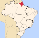
Macapá Mazagão Oiapoque Calçoene, OiapoqueCategories:- Amapá geography stubs
- Populated places established in 1945
- Populated coastal places in Amapá
- Brazil–French Guiana border crossings


Wikimedia Foundation. 2010.