- Plymouth Township, Michigan
Infobox Settlement
official_name = Charter Township of Plymouth, Michigan
settlement_type = Township
imagesize =
image_caption =
image_
imagesize =
image_caption =
image_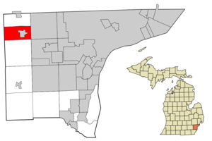
mapsize = 250x200px
map_caption = Location in Wayne County and the state ofMichigan
mapsize1 =
map_caption1 =
subdivision_type = Country
subdivision_type1 = State
subdivision_type2 = County
subdivision_name =United States
subdivision_name1 =Michigan
subdivision_name2 = Wayne
government_type =
leader_title = Supervisor
leader_name = Richard Reaume
established_date =
area_magnitude =
area_total_km2 = 41.4
area_total_sq_mi = 16
area_land_km2 = 41.2
area_land_sq_mi = 15.9
area_water_km2 = 0.3
area_water_sq_mi = 0.1
elevation_ft = 787
elevation_m = 240
population_as_of = 2000
population_footnotes =
population_total = 27798
population_metro =
population_density_km2 = 674.2
population_density_sq_mi = 1746.3
timezone = EST
utc_offset = -5
latd = 42 |latm = 22 |lats = 12 |latNS = N
longd = 83 |longm = 28 |longs = 55 |longEW = W
timezone_DST = EDT
utc_offset_DST = -4
postal_code_type =ZIP code
postal_code = 48170
area_code = 734
blank_name = FIPS code
blank_info = 26-65080GR|2
blank1_name = GNIS feature ID
blank1_info = 1626920 [gnis|1626920]
footnotes =
website =Plymouth Township is a
charter township of Wayne County in theU.S. state ofMichigan . The population was 27,798 at the 2000 census. The City of Plymouth is located within the township but is administratively autonomous.Geography
According to the
United States Census Bureau , the township has a total area of 16.0square mile s (41.3km² ), of which, 15.9 square miles (41.2 km²) of it is land and 0.04 square miles (0.1 km²) of it (0.25%) is water.Education
Plymouth Township is served by the Plymouth-Canton Community Schools. P-CCS includes most of Canton & Plymouth Townships, and portions of Salem, Superior, and Northville Townships.
chools
Plymouth-Canton Community Schools operates 26 schools and educational buildings in both Plymouth and Canton Townships:
*Allen Elementary School
*Bentley Elementary School
*Bird Elementary School
*Canton High School *
*Central Middle School
*Discovery Middle School
*Dodson Elementary School
*East Middle School
*Eriksson Elementary School
*Farrand Elementary School
*Fiegel Elementary School
*Field Elementary School
*Gallimore Elementary School
*Hoben Elementary School
*Hulsing Elementary School
*Isbister Elementary School
*Miller Elementary School
*Pioneer Middle School
*Plymouth High School *
*Salem High School *
*Smith Elementary School
*Starkweather Center (Alternative Education)
*Tanger Center (Alternative Education)
*Tonda Elementary School
*West Middle School
*Workman Elementary School(* Part of the
Plymouth-Canton Educational Park )Demographics
As of the
census GR|2 of 2000, there were 27,798 people, 10,757 households, and 7,680 families residing in the township. Thepopulation density was 1,746.3 per square mile (674.2/km²). There were 11,043 housing units at an average density of 693.7/sq mi (267.8/km²). The racial makeup of the township was 92.38% White, 2.96%African American , 0.27% Native American, 2.73% Asian, 0.01% Pacific Islander, 0.40% from other races, and 1.25% from two or more races. 1.64% of the population wereHispanic orLatino of any race. 17.7% were of German, 13.8% Polish, 13.1% Irish, 9.5% English and 7.1% Italian ancestry according toCensus 2000 .There were 10,757 households out of which 30.7% had children under the age of 18 living with them, 63.1% were married couples living together, 6.1% had a female householder with no husband present, and 28.6% were non-families. 24.7% of all households were made up of individuals and 9.2% had someone living alone who was 65 years of age or older. The average household size was 2.49 and the average family size was 3.01.
In the township the population was spread out with 22.6% under the age of 18, 6.5% from 18 to 24, 30.4% from 25 to 44, 28.2% from 45 to 64, and 12.3% who were 65 years of age or older. The median age was 40 years. For every 100 females there were 100.9 males. For every 100 females age 18 and over, there were 100.6 males.
According to Money Magazine in 2007, the median income for a family in the township was $108,064, [ [http://money.cnn.com/magazines/moneymag/bplive/2007/snapshots/PL2665085.html MONEY Magazine: Best places to live 2007] ] and the median income for a family was $90,243. Males had a median income of $64,583 versus $36,182 for females. The
per capita income for the township was $37,081. About 0.9% of families and 1.8% of the population were below thepoverty line , including 1.4% of those under age 18 and 1.8% of those age 65 or over.ports
Plymouth Township is home to the
Ontario Hockey League 'sPlymouth Whalers , one of three American teams in the OHL and one of two in Michigan. The Whalers play inCompuware Arena at 14900 Beck Rd. The Whalers are the 2007 OHL Champions.Photo gallery
References
External links
* [http://www.plymouthtwp.org/ Charter Township of Plymouth]
Wikimedia Foundation. 2010.