- East Hampton, Connecticut
-
East Hampton, Connecticut — Town — 
SealNickname(s): Belltown, USA Location within Middlesex County, Connecticut
Coordinates: 41°34′05″N 72°30′20″W / 41.56806°N 72.50556°WCoordinates: 41°34′05″N 72°30′20″W / 41.56806°N 72.50556°W Country United States State Connecticut NECTA Hartford Region Midstate Region Incorporated 1767 Government - Type Council-manager - Council Melissa H. Engel (R), Chair
John W. Tuttle (D), Vice-Chair
Thomas M. Cordeiro (R)
William G. Devine (R)
Christopher J. Goff (D)
Barbara Moore (D)
Susan B. Weintraub (C)- Town Manager Robert Drewry (Interim) Area - Total 36.8 sq mi (95.3 km2) - Land 35.6 sq mi (92.2 km2) - Water 1.2 sq mi (3.2 km2) Elevation 354 ft (108 m) Population (2005)[1] - Total 15,363 - Density 343/sq mi (132/km2) Time zone Eastern (UTC-5) - Summer (DST) Eastern (UTC-4) ZIP code 06424,06414 Area code(s) 860 FIPS code 09-22490 GNIS feature ID 0213423 Website www.easthamptonct.org East Hampton is a town in Middlesex County, Connecticut, United States. The population was 13,352 at the 2000 census. The town center village is listed as a census-designated place (CDP). East Hampton includes the villages of Cobalt, Middle Haddam, and Lake Pocotopaug.
The southern trailhead of the Shenipsit Trail is in Cobalt, and the Airline State Park (a rail trail) has its southern trailhead in East Hampton, at Smith Street. The 884-acre (358 ha) Hurd State Park, Meshomasic State Forest, and Salmon River State Forest are located in town. Comstock's Bridge, more commonly known as the Comstock Covered Bridge and the only remaining covered bridge in eastern Connecticut, spans the Salmon River near Route 16 in East Hampton. Local legend says that the bridge is haunted.
The Chatham Historical Society Museum and the Joseph N. Goff House Museum and Cultural Center are located in the town.
Contents
History
The first settlers of the area arrived in 1739 by sea from Eastham, Massachusetts. They traveled up the Connecticut River to Middle Haddam parish between the two adjacent towns of Middletown and Haddam. Led by Isaac Smith, some of these settlers went on to the hills near Lake Pocotopaug, the present-day location of East Hampton. In 1746, the settlers named their community Easthampton parish after their former home of Eastham. In 1767, the community was separated from Middletown incorporated by the Connecticut General Assembly as the township of Chatham, after Chatham, Medway due to the important shipbuilding industries that both places had in common. In the 19th century, East Hampton became the center of the manufacturing of bells, with the first factory being constructed in 1808. During this period, thirty firms were known to have built and run factories producing these bell products, the four most prominent being Bevin Brothers Manufacturing Company, Starr, Hill, and Gong Bell. In 1841, the East Middletown parish, which had been a part of Chatham, separated and became a new township called Conway (later renamed to Portland).
 Main Street, about 1907
Chatham was renamed to East Hampton in 1915, which had long been a second name for the township. The name "East Hampton", however, is confusing, since the town is, in fact, approximately 30 miles (48 km) southwest of Hampton, Connecticut. In addition, there is often confusion between East Hampton and the contiguous town of East Haddam, which was named in 1734. The bell companies that dominated the economy of East Hampton continued to flourish until The Great Depression. Today, the only remaining company is Bevin Brothers Manufacturing Company, at a much reduced scale. Many of the brick factories from this remain untouched in the center of the town, due to heavy metal poisoning. Others have been converted into offices, stores, and other small businesses.
Capt. Jesse Hurd was a master ship builder in Middle Haddam after the Revolutionary War until his death in 1839. Interest in ship building in Middle Haddam dwindled thereafter. Captain Hurd was also the owner and creator of the New York Screw Dock Company, a "dry dock" facility for ship repairs.
 Railroad station, about 1907
Geography
According to the United States Census Bureau, the town has a total area of 36.8 square miles (95 km2), of which, 35.6 square miles (92 km2) of it is land and 1.2 square miles (3.1 km2) of it (3.37%) is water, due to the large Lake Pocotopaug, which used to be inhabited by Native American tribes. The town center CDP has a total area of 2.6 square miles (6.7 km2). 2.5 square miles (6.5 km2) of it is land and 0.04 square miles (0.10 km2) of it (0.78%) is water.
Demographics
As of the census[2] of 2000, there were 13,352 people, 4,126 households, and 3,003 families residing in the town. The population density was 375.2 people per square mile (144.9/km²). There were 4,412 housing units at an average density of 124.0 per square mile (47.9/km²). The racial makeup of the town was 93.36% White, 2.04% Black or African American, 0.19% Native American, 2.39% Asian, 0.05% Pacific Islander, 0.44% from other races, and 1.51% from two or more races. Hispanic or Latino of any race were 1.69% of the population.
There were 4,126 households out of which 36.6% had children under the age of 18 living with them, 60.7% were married couples living together, 8.5% had a female householder with no husband present, and 27.2% were non-families. 20.5% of all households were made up of individuals and 5.5% had someone living alone who was 65 years of age or older. The average household size was 2.63 and the average family size was 3.07.
In the town the population was spread out with 21.4% under the age of 18, 22.4% from 18 to 24, 27.0% from 25 to 44, 21.3% from 45 to 64, and 7.9% who were 65 years of age or older. The median age was 32 years. For every 100 females there were 99.0 males. For every 100 females age 18 and over, there were 96.8 males.
The median income for a household in the town was $66,326, and the median income for a family was $74,409. Males had a median income of $50,157 versus $35,867 for females. The per capita income for the town was $22,769. About 2.2% of families and 3.7% of the population were below the poverty line, including 2.7% of those under age 18 and 8.0% of those age 65 or over.
Town center
As of the census2 of 2000, there were 2,254 people, 821 households, and 596 families residing in the CDP. The population density was 883.0 inhabitants per square mile (341.3/km²). There were 858 housing units at an average density of 336.1 per square mile (129.9/km²). The racial makeup of the CDP was 97.96% White, 0.80% Black or African American, 0.13% Native American, 0.58% Asian, 0.04% from other races, and 0.49% from two or more races. Hispanic or Latino of any race were 0.67% of the population.
There were 821 households out of which 37.1% had children under the age of 18 living with them, 58.6% were married couples living together, 9.9% had a female householder with no husband present, and 27.3% were non-families. 20.0% of all households were made up of individuals and 5.2% had someone living alone who was 65 years of age or older. The average household size was 2.70 and the average family size was 3.15.
In the CDP the population was spread out with 27.3% under the age of 18, 6.0% from 18 to 24, 33.4% from 25 to 44, 23.3% from 45 to 64, and 9.9% who were 65 years of age or older. The median age was 37 years. For every 100 females there were 96.9 males. For every 100 females age 18 and over, there were 93.2 males.
The median income for a household in the CDP was $53,464, and the median income for a family was $64,150. Males had a median income of $50,727 versus $31,181 for females. The per capita income for the CDP was $25,207. About 1.2% of families and 4.1% of the population were below the poverty line, including 2.7% of those under age 18 and 2.8% of those age 65 or over.
Voter Registration and Party Enrollment as of October 25, 2005[3] Party Active Voters Inactive Voters Total Voters Percentage Democratic 2,185 85 2,270 27.49% Republican 1,648 75 1,723 20.86% Unaffiliated 4,036 212 4,248 51.44% Minor Parties 15 2 17 0.21% Total 7,884 374 8,258 100% Historic sites
Historic sites in East Hampton include the following three sites listed on the National Register of Historic Places:
- Comstock's Bridge, southeast of East Hampton off CT 16
- Middle Haddam Historic District, Moodus and Long Hill Rds.
- Rapallo Viaduct, Flat Brook and former Air Line railroad right-of-way
Notable residents
- William A. O'Neill (1930–2007), Governor of Connecticut, 1980-1991, native and lifelong resident of East Hampton
- Mark Mulcahy, former front-man for the New Haven-based band Miracle Legion and current solo recording artist, a native of East Hampton
- Eleanor Hoyt Brainerd, novelist, lived at "Faraway Farm" near East Hampton in the early 20th century
References
 Summit Thread Company, 1906
- ^ U.S. Census Bureau Population Estimates
- ^ "American FactFinder". United States Census Bureau. http://factfinder.census.gov. Retrieved 2008-01-31.
- ^ "Registration and Party Enrollment Statistics as of October 25, 2005" (PDF). Connecticut Secretary of State. Archived from the original on 2006-09-23. http://web.archive.org/web/20060923151511/http://www.sots.ct.gov/ElectionsServices/lists/2005OctRegEnrollStats.pdf. Retrieved 2006-10-02.
External links
 State of Connecticut
Topics - Index
- Culture
- Constitution
- Delegations
- Elections
- Geography
- Government
- History
- Images
- People
- Visitor Attractions
Regions Counties Cities Places Municipalities and communities of Middlesex County, Connecticut City 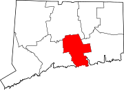
Towns Chester | Clinton | Cromwell | Deep River | Durham | East Haddam | East Hampton | Essex | Haddam | Killingworth | Middlefield | Old Saybrook | Portland | Westbrook
Borough Unincorporated
communitiesCenterbrook | Essex Village | Higganum | Ivoryton | Lake Pocotopaug | Leesville | Middle Haddam | Millington | Moodus | Saybrook Manor
Categories:- East Hampton, Connecticut
- Towns in Middlesex County, Connecticut


Wikimedia Foundation. 2010.