- Norway, Maine
-
This article is about the Maine town. For other uses, see Norway (disambiguation).
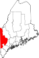
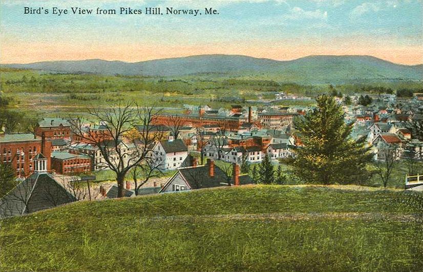
Norway, Maine — town — Bird's-eye view from Pikes Hill c. 1912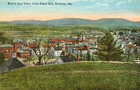 Location within the state of Maine
 Norway, Maine
Coordinates: 44°12′42″N 70°32′18″W / 44.21167°N 70.53833°WCoordinates: 44°12′42″N 70°32′18″W / 44.21167°N 70.53833°W Country United States State Maine County Oxford Area – Total 47.5 sq mi (123 km2) – Land 45.1 sq mi (116.8 km2) – Water 2.4 sq mi (6.2 km2) Elevation 387 ft (118 m) Population (2000) – Total 4,611 – Density 102.3/sq mi (39.5/km2) Time zone Eastern (EST) (UTC-5) – Summer (DST) EDT (UTC-4) ZIP code Area code(s) 207 FIPS code GNIS feature ID Norway is a town in Oxford County, Maine, United States. The population was 4,611 at the 2000 census. It is home to Lake Pennesseewassee, a recreation area.
Contents
History
The town was first called Rustfield after Henry Rust of Salem, Massachusetts, a large landowner. It was cleared and settled after 1786 by Joseph Stevens, followed by George Leslie, Amos Hobbs, Jeremiah Hobbs, Jonas Stevens and Nathaniel Stevens, together with their families from Gray. Many who moved here had been soldiers in the Revolutionary War, including Phineas Whitney, who fought at the Battle of Bunker Hill. A sawmill and gristmill were established in 1789, and in 1796 the first road was built. Rustfield Plantation was incorporated on March 9, 1797 as Norway.[1] The town had petitioned the Massachusetts General Court to be named Norage, although what the word signified, and why it was changed, is unknown—fire destroyed the town records in 1843.[2] During the Civil War, Norway and other municipalities in Oxford County provided a militia company to the 1st Maine Volunteer Infantry Regiment under the command of George Lafayette Beal, who would later rise to the rank of major general and serve as state treasurer from 1888 to 1894.
The town had fertile soil for cultivation. The Pennesseewassee Stream, which drains Lake Pennesseewassee into the Little Androscoggin River, provided water power for industry. At the falls were established two grain mills, a cloth and carding mill, furniture factory, box factory and a shovel handle factory. There was a tannery, with other businesses making harness and trunks. A shoe manufactory was established in 1872. The busy stage route from Paris, the county seat, to Fryeburg passed through Norway. By 1878, there were 32 stores in the town, which for a number of years had the fastest growing population of any similar town in the state.[3] On December 30, 1879, the Norway Branch Railroad opened, running from Norway village on a line 1.45 miles (2.3 kilometers) long to connect with the Atlantic and St. Lawrence Railroad (later Grand Trunk Railroad) at South Paris.[4] But the Great Norway Fire of May 9, 1894 would destroy a substantial portion of the business district. Started in the C. B. Cummings & Sons mill, it was spread by a strong wind down Main Street. The opera house, Congregational Church, tannery, and 80 homes and other buildings were lost. Much of Norway was rebuilt the same year, with several structures in brick.[5]
Norway was once called the "Snowshoe Capital of the World" because of the many snowshoes manufactured here. In 1906, Walter Tubbs established the Tubbs Snowshoe Company to produce ash snowshoes, skis, sleds and furniture. The firm made 70% of the snowshoes ordered by the U.S. government during World War II, and also supplied the polar expeditions of Byrd and Peary.[6] In the 1940s, the Tubbs Company moved to Vermont, and in 2004, it was bought by K2 Sports. The snowshoes are now made at a factory in Guangzhou, China.[7] In 1997, the New Balance Shoe Company built a new manufacturing facility at Norway. The C. B. Cummings & Son Company, founded in 1860 to make dowels and other wood products, closed and auctioned its downtown plant in 2001 because of competition from China. In addition, the business had lost customers when furniture factories in the Carolinas shut down.[8]
-
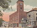
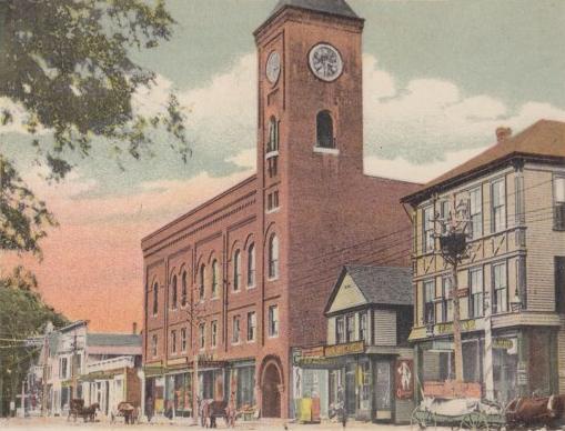
Opera House in 1906
-
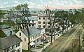
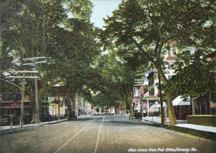
Main Street in 1908
-

Downtown in 1907
-
Street scene in 1906
Geography
According to the United States Census Bureau, the town has a total area of 47.5 square miles (123.0 km²), of which, 45.1 square miles (116.8 km²) of it is land and 2.4 square miles (6.2 km²) of it (5.03%) is water. Norway is drained by the Pennesseewassee Stream and Little Androscoggin River.
The town is crossed by state routes 26, 117 and 118. It borders the towns of Greenwood and West Paris to the north, Paris to the east, Oxford to the southeast, Otisfield to the south, Harrison to the southwest, Waterford to the west, and Albany to the northwest.
Demographics
See also: Norway (CDP), MaineAs of the census[9] of 2000, there were 4,611 people, 1,972 households, and 1,256 families residing in the town. The population density was 102.3 people per square mile (39.5/km²). There were 2,551 housing units at an average density of 56.6 per square mile (21.8/km²). The racial makeup of the town was 97.83% White, 0.30% Black or African American, 0.37% Native American, 0.37% Asian, 0.02% Pacific Islander, 0.13% from other races, and 0.98% from two or more races. Hispanic or Latino of any race were 0.50% of the population.
There were 1,972 households out of which 27.7% had children under the age of 18 living with them, 49.3% were married couples living together, 11.0% had a female householder with no husband present, and 36.3% were non-families. 29.3% of all households were made up of individuals and 13.4% had someone living alone who was 65 years of age or older. The average household size was 2.29 and the average family size was 2.78.
In the town the population was spread out with 22.5% under the age of 18, 7.0% from 18 to 24, 26.2% from 25 to 44, 26.0% from 45 to 64, and 18.2% who were 65 years of age or older. The median age was 42 years. For every 100 females there were 87.9 males. For every 100 females age 18 and over, there were 85.2 males.
The median income for a household in the town was $28,497, and the median income for a family was $34,464. Males had a median income of $26,612 versus $20,417 for females. The per capita income for the town was $17,020. About 9.8% of families and 12.7% of the population were below the poverty line, including 16.1% of those under age 18 and 10.1% of those age 65 or over.
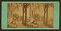
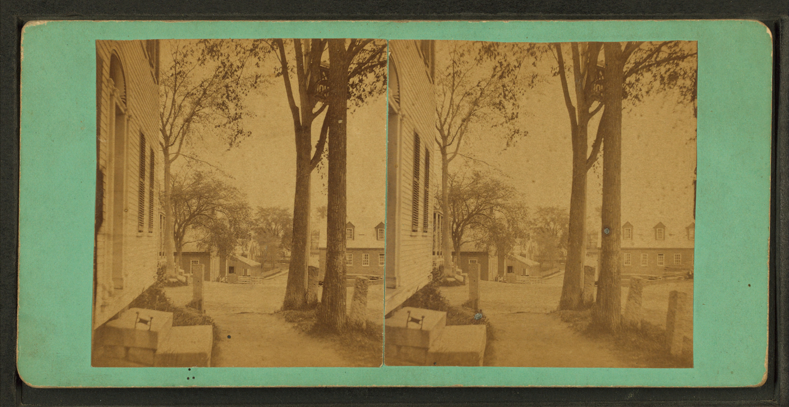
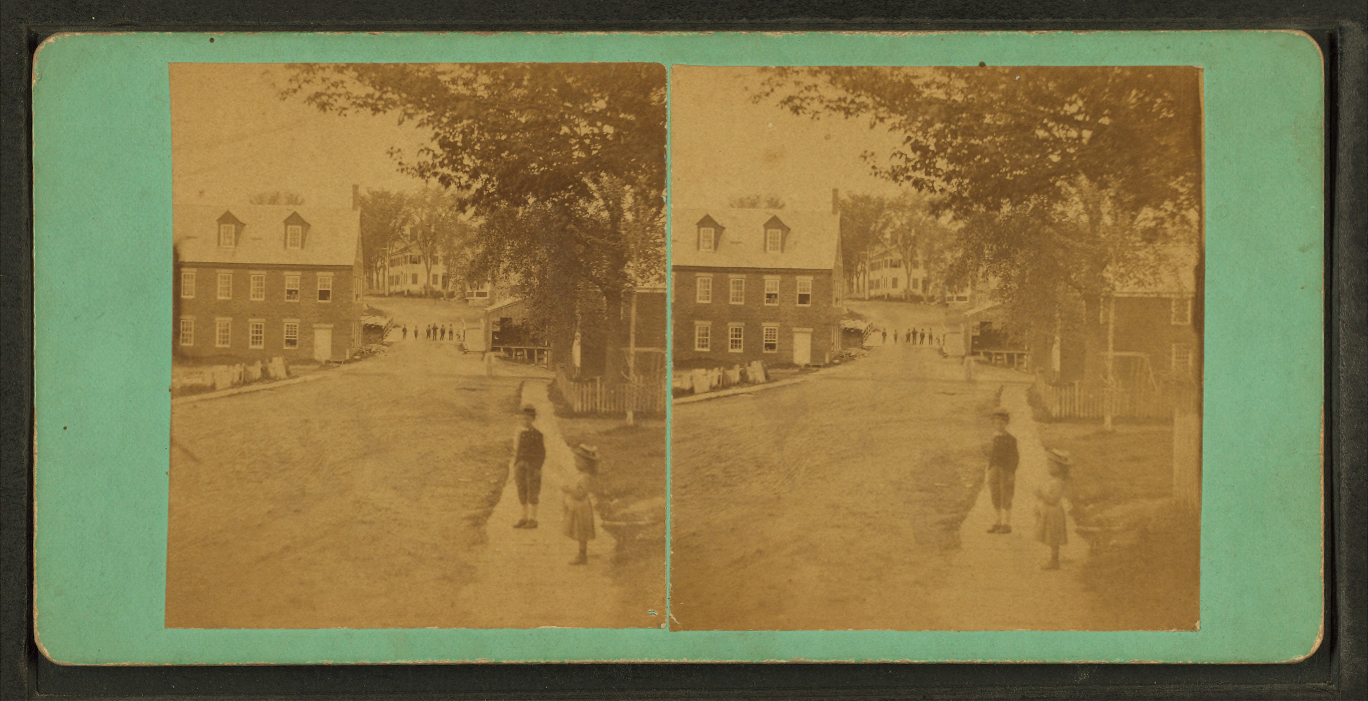
Stereographic cards of Norway
-

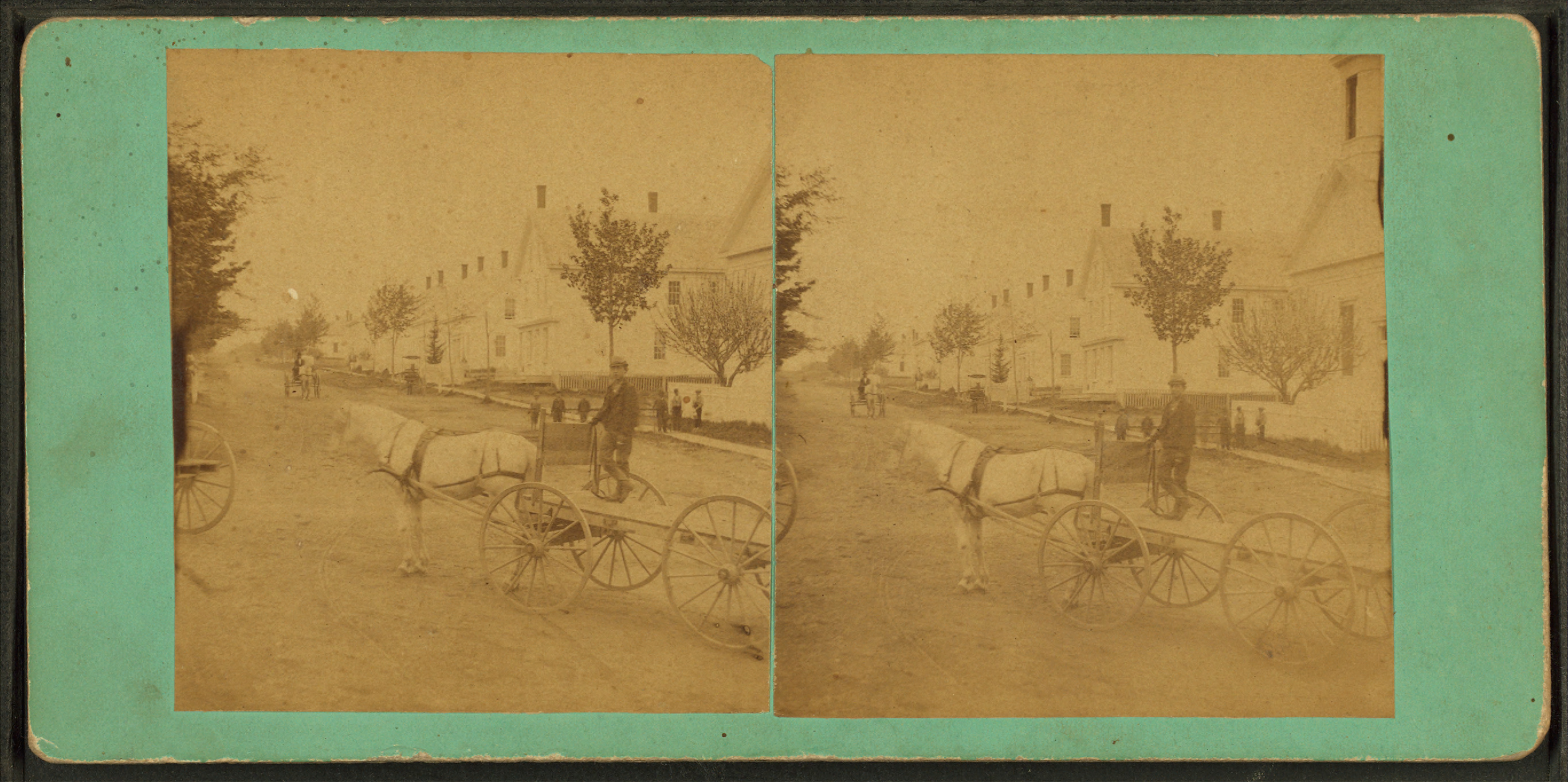
Horse pulling cart
-

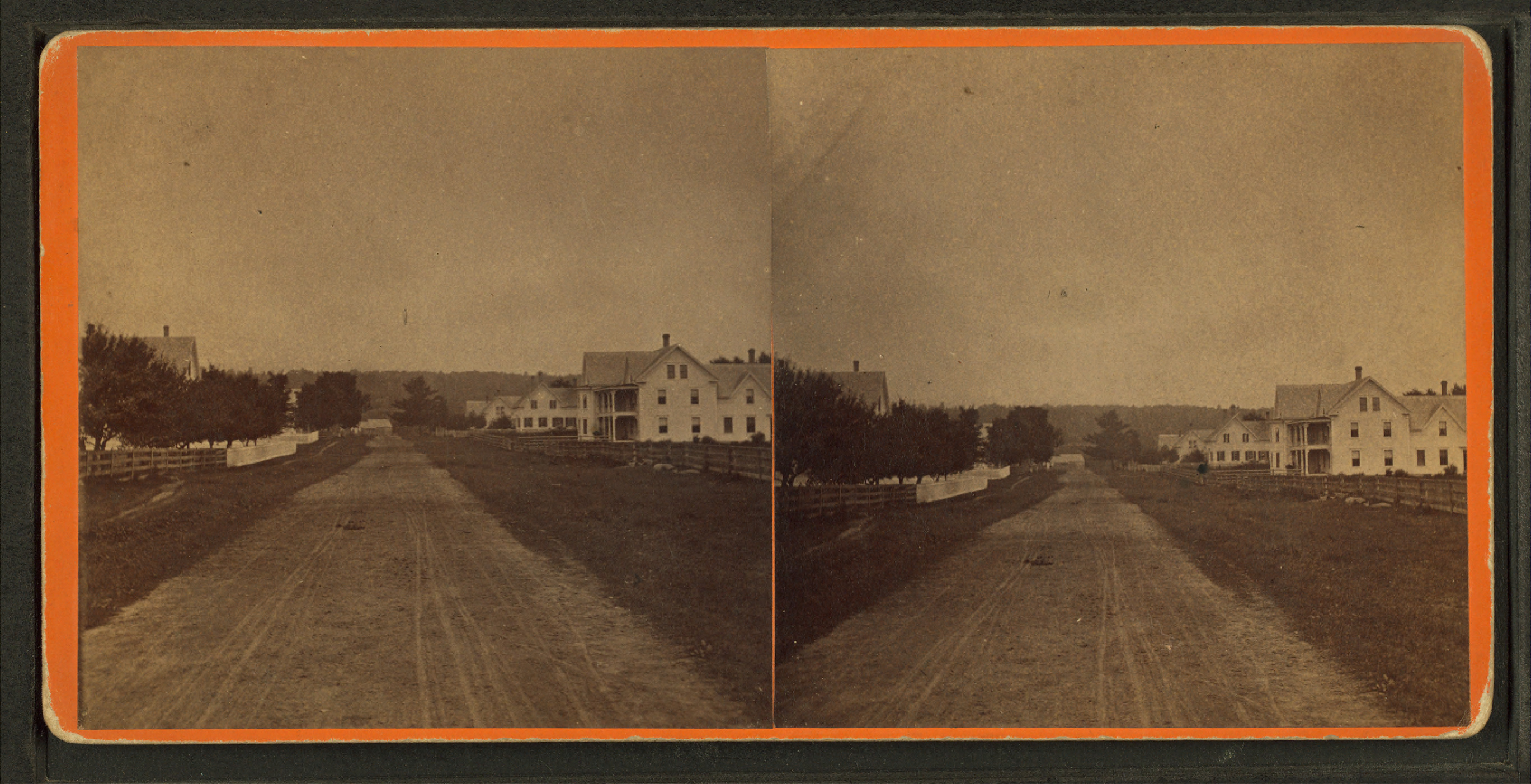
Streets of Norway
-

Street view
-
Norway dwellings
-

Dwellings and streets
Sites of interest
Notable people
 Lake Pennesseewassee in 1906
- George Lafayette Beal, Civil War era general, state treasurer
- Mellie Dunham, fiddler, snowshoe maker
- Marshall Kirk, genealogist, writer
- George Lorenzo Noyes, naturalist, writer, artist
- Donald B. Partridge, congressman
- Don Carlos Seitz, author, journalist
- C. A. Stephens, writer
References
- ^ Coolidge, Austin J.; John B. Mansfield (1859). A History and Description of New England. Boston, Massachusetts. pp. 239–240. http://books.google.com/books?id=OcoMAAAAYAAJ&lpg=PA9&dq=coolidge%20mansfield%20history%20description%20new%20england%201859&pg=PA239#v=onepage&q&f=false.
- ^ Origins of the Name: Norway, Maine
- ^ Varney, George J. (1886), Gazetteer of the state of Maine. Norway, Boston: Russell, http://history.rays-place.com/me/norway-me.htm
- ^ "Historical Sketch of Norway, Maine", Boston, Massachusetts 1889
- ^ Oxford County Genealogy Notebook -- Norway, Maine
- ^ Maine League of Historical Societies and Museums (1970). Doris A. Isaacson. ed. Maine: A Guide 'Down East'. Rockland, Me: Courier-Gazette, Inc.. pp. 399.
- ^ Business People, Vermont -- Tubbs Snowshoe Company
- ^ Blethen Maine Newspapers -- Foreign competition kills dowel mill 2002
- ^ "American FactFinder". United States Census Bureau. http://factfinder.census.gov. Retrieved 2008-01-31.
External links
- Town of Norway, Maine
- Norway Memorial Library
- Oxford Hills Visitor Center
- Norway Trackers Snowmobile Club
- University College at Norway/South Paris
- Advertiser Democrat, regional weekly newspaper
- NorwayLake.com, info about Norway Lake
- Lakes Association of Norway
- Maine.gov -- Norway, Maine
- Maine Genealogy: Norway, Oxford County, Maine
Municipalities and communities of Oxford County, Maine Towns Andover | Bethel | Brownfield | Buckfield | Byron | Canton | Denmark | Dixfield | Fryeburg | Gilead | Greenwood | Hanover | Hartford | Hebron | Hiram | Lovell | Mexico | Newry | Norway | Otisfield | Oxford | Paris | Peru | Porter | Roxbury | Rumford | Stoneham | Stow | Sumner | Sweden | Upton | Waterford | West Paris | Woodstock
Plantations Unorganized
territoriesCDPs Other
villagesDickvale | Kezar Falls | North Waterford | Waterford Flat
Categories:- Towns in Oxford County, Maine
-


Wikimedia Foundation. 2010.