- Fowey Rocks Light
Infobox Lighthouse
caption = Fowey Rocks Light
location = seven miles southeast of Cape Florida onKey Biscayne
coordinates = coor dms|25|35.4|00|N|80|05.8|00|W|region:US_type:landmark
yearlit = 1878
automated = May 7, 1974
yeardeactivated =
foundation = screw-pile
construction =cast-iron
shape = skeletal octagonal pyramid
height = 110 feet
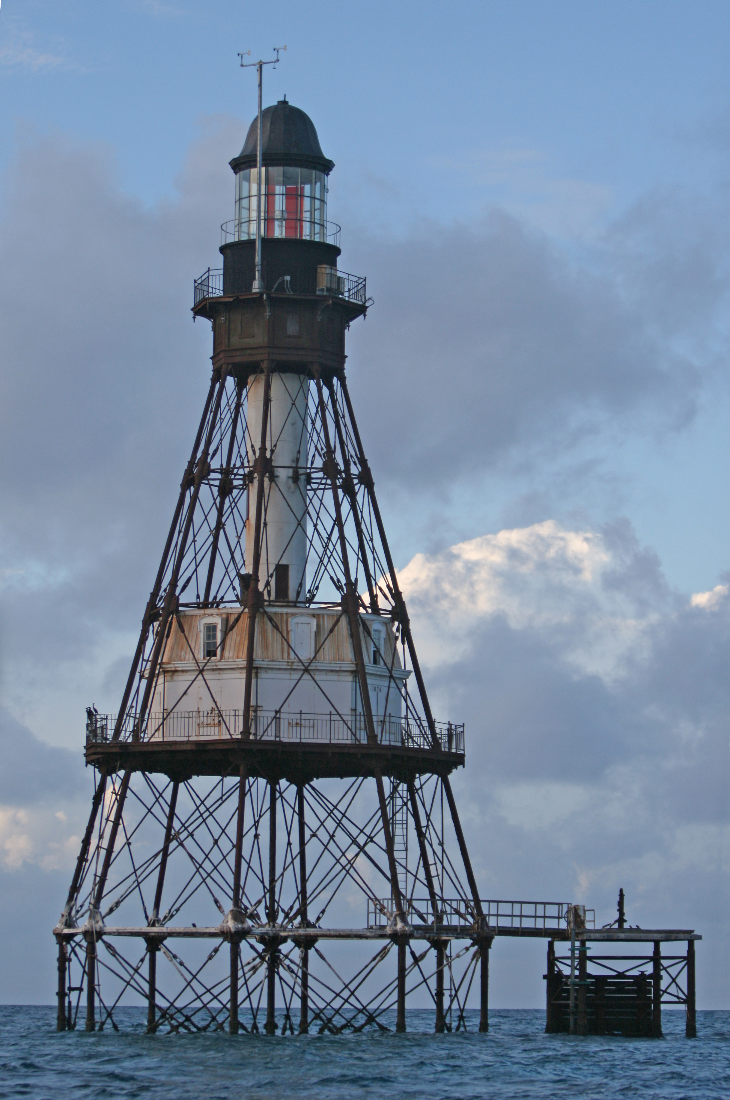
lens = first-order drumFresnel lens Fowey Rocks Light is located seven miles southeast of Cape Florida on
Key Biscayne . The lighthouse was completed in 1878, replacing theCape Florida lighthouse . It was automated on May 7, 1974 and is still in operation (in 2005). The structure iscast iron , with a screw-pile foundation with a platform and a skeletal tower. The light is 110 feet above the water. The tower framework is painted brown, while the dwelling and enclosed circular stair to the lantern is painted white. The original lens was a first-order drumFresnel lens . The light has a nominal range of 17 miles in the white sectors, and 13 miles in the red sectors.Fowey Rocks are named for the
Royal Navy ship HMS Fowey which wrecked on the reef in 1748. During construction of the lighthouse the workers lived on a platform built over the water to minimize the danger of transporting them and their supplies each day from the mainland. TheLabor Day Hurricane of 1935 washed away the first deck of the lighthouse, 15 feet above the water, but the tower survived. The lighthouse is inside the boundaries ofBiscayne National Park .References
*Harvard reference | Surname=McCarthy | Given=Kevin M. | Title=Florida Lighthouses | Publisher=University of Florida Press | Place=
Gainesville, Florida | Year=1990 | URL=http://www.upf.com/archive/mccarthy.html ISBN 0-8130-0982-0.
*U.S. Coast Guard - Historic Light Station Information & Photography - Florida [http://www.uscg.mil/history/weblighthouses/LHFL.asp] - accessedJune 29 2008
*Harvard reference | Surname=Dean | Given=Love | Title=Reef Lights: Seaswept Lighthouses of the Florida Keys | Publisher=The Historic Key West Preservation Board | Place=Key West, Florida | Year=1982 | URL= ISBN 0-943528-03-8.
Wikimedia Foundation. 2010.