- Conway, New Hampshire
-
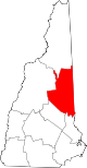
Conway, New Hampshire — Town — Location in Carroll County, New Hampshire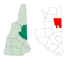
Coordinates: 43°58′43″N 71°07′08″W / 43.97861°N 71.11889°WCoordinates: 43°58′43″N 71°07′08″W / 43.97861°N 71.11889°W Country United States State New Hampshire County Carroll Incorporated 1765 Government - Type New England town - Board of Selectmen Lawrence Martin, Chair
David Weathers
Howard "Crow" Dickinson
Mary Seavey
Michael DiGregorioArea - Total 71.7 sq mi (185.6 km2) - Land 69.4 sq mi (179.8 km2) - Water 2.2 sq mi (5.8 km2) 3.15% Elevation 465 ft (142 m) Population (2010) - Total 10,115 - Density 141.2/sq mi (54.5/km2) Time zone Eastern (UTC-5) - Summer (DST) Eastern (UTC-4) ZIP code 03818 Area code(s) 603 FIPS code 33-14660 GNIS feature ID 0873570 Website www.conwaynh.org Conway is a town, the largest (by population) in Carroll County, New Hampshire, United States. The population was 10,115 at the 2010 census.[1] Parts of the White Mountain National Forest are in the west and north. Cathedral Ledge (popular with climbers) and Echo Lake State Park are in the west. Villages within the town include Conway, North Conway, Center Conway, Redstone and Kearsarge, as well as a portion of the village of Intervale.[2] The town has two covered bridges.
Contents
History
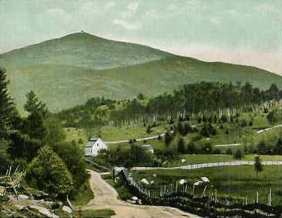
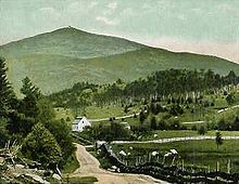 Mount Kearsarge in 1910
The region was once home to the Pequawket Indians, an Algonquian Abenaki tribe. Along the Saco River they fished, hunted or farmed, and lived in wigwams sheltered within stockades. In 1642, explorer Darby Field of Exeter paddled up the Saco in a canoe, and would report seeing "Pigwacket," an Indian community stretching from present-day Conway to Fryeburg, Maine. The Pequawket tribe dwindled from disease, probably smallpox brought from abroad. In May 1725, during Dummer's War, 36 men from Dunstable, Massachusetts led by John Lovewell skirmished with the Pequawket. The Pequawket losses are not known but the result of the day's battle was the withdrawal of the tribe from the area.
In 1765, Colonial Governor Benning Wentworth chartered sixty-five men to establish "Conway", named for Henry Seymour Conway, Commander in Chief of the British Army. To keep his land, a settler had to plant 5 acres (20,000 m2) for every fifty in his share, and to do it within five years. The first roads were built in 1766. Construction of the first meetinghouse began at Redstone. Never completed, it could only be used in summer, with services held whenever a minister visited. Eventually, the partly finished meetinghouse was moved to Center Conway. In 1775, the town raised small sums to build two schoolhouses, one in North Conway. By 1849, however, the town had twenty school districts.
By the middle-19th century, artists had discovered the romantic beauties of the White Mountains, and "Artist Falls Brook" became a favorite setting for landscape paintings. King Edward VII would buy twelve White Mountain paintings to hang in Windsor Castle. Among the artists to work here were Asher B. Durand and Benjamin Champney, the latter known to paint Mount Washington while sitting in the middle of Main Street.
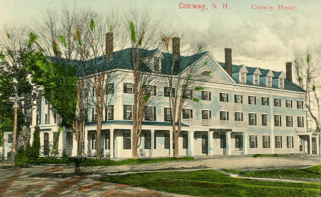
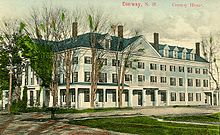 Conway House c. 1910
The Portsmouth, Great Falls & Conway Railroad entered Conway in 1871. The railroad would be bought by the Boston & Maine, and joined in town by rival Maine Central. They transported freight, mostly wood and wood products, away from Conway, and they brought tourists. Numerous inns and taverns were built in the 19th and 20th centuries, and tourism remains today a principal business. The first ski trail began operating in 1936 at Mount Cranmore, where Hannes Schneider of Austria would provide instruction starting in 1939. In 1959, the Kancamagus Highway opened, connecting Conway with Lincoln. It travels through Kancamagus Pass, named for a Pennacook chief, and at 2,850 feet (870 m) above sea level is the highest paved through-road in New Hampshire.
Geography
According to the United States Census Bureau, the town has a total area of 71.7 square miles (186 km2), of which 69.4 square miles (180 km2) is land and 2.2 square miles (5.7 km2) is water, comprising 3.15% of the town.[3] Conway is drained by the Saco and Swift rivers. The highest point in the town is Black Cap at 2,369 feet (722 m) above sea level. Conway lies fully within the Saco River watershed.[4]
Demographics
This article describes the town of Conway as a whole. Additional demographic detail is available which describes only the central settlement or village within the town, although that detail is included in the aggregate values reported here. See: Conway (CDP), New Hampshire.
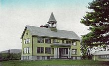 Conway Grammar School c. 1915
As of the census of 2000, there were 8,604 people, 3,714 households, and 2,243 families residing in the town. The population density was 123.5 people per square mile (47.7/km²). There were 5,927 housing units at an average density of 32.9 persons/km² (85.1 persons/sq mi). The racial makeup of the town was 97.43% White, 0.24% African American, 0.31% Native American, 0.78% Asian, 0.00% Pacific Islander, 0.24% from other races, and 0.99% from two or more races. 0.42% of the population were Hispanic or Latino of any race.
There were 3,714 households out of which 27.5% had children under the age of 18 living with them, 46.5% were married couples living together, 9.5% have a woman whose husband does not live with her, and 39.6% were non-families. 31.2% of all households were made up of individuals and 11.9% had someone living alone who was 65 years of age or older. The average household size was 2.27 and the average family size was 2.85.
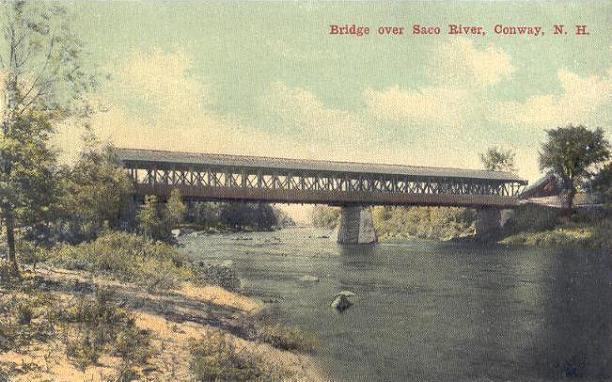
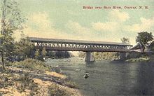 Bridge over Saco River in 1911
In the town the population was spread out with 22.5% under the age of 18, 7.1% from 18 to 24, 29.0% from 25 to 44, 25.9% from 45 to 64, and 15.4% who were 65 years of age or older. The median age was 40 years. For every 100 females there were 94.0 males. For every 100 females age 18 and over, there were 91.1 males.
The median income for a household in the town was $35,873, and the median income for a family was $41,818. Males had a median income of $30,366 versus $21,275 for females. The per capita income for the town was $19,673. 10.3% of the population and 8.0% of families were below the poverty line. Out of the total people living in poverty, 13.3% are under the age of 18 and 13.7% are 65 or older.
Economy
Tourism plays a major role in Conway's economy, with the town providing access to the White Mountains. There is one ski area, Cranmore Mountain Resort, in Conway and several others nearby. North Conway village is a major shopping destination with outlet and department stores. Hotels, bed and breakfasts, and inns can be found in every village, including the historic Eastern Slope Inn in North Conway.
In addition to tourism, the Mount Washington Valley Economic Council has been growing the technology industry through business parks and economic assistance.[5]
With 21.15% of Carroll County's population residing in Conway, the town is the commercial center for the county as well as a large area of rural western Maine, with heavy development along the portion of U.S. Route 302 and New Hampshire Route 16 that are co-signed through town. In addition to the factory outlet stores, there are also big-box stores, supermarkets, restaurants, and hotels.
Education
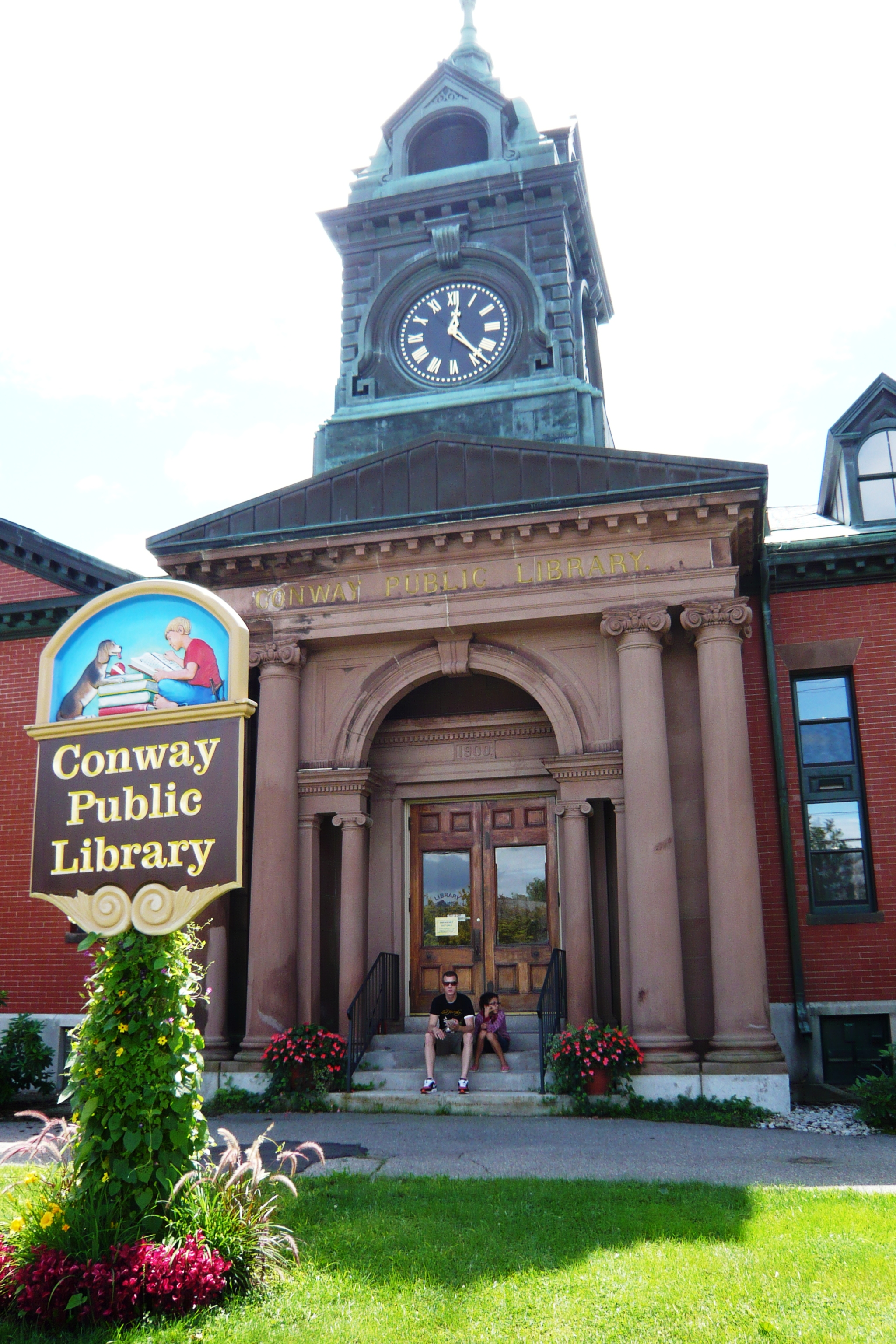
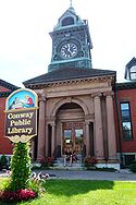 Library in Conway, New Hampshire
- Kennett High School
- A. Crosby Kennett Middle School
- Conway Elementary School
- Pine Tree School
- John Fuller Elementary School
- Granite State College
- White Mountain Waldorf School
A. Crosby Kennett High School, built in 1923, was located at 176 Main Street in Conway until 2007, when a new building opened near the village of Redstone. The former high school building now houses the middle school.
The White Mountain Waldorf School, an independent private school, offers grades 1 through 8, plus kindergarten and pre-school programs. The school moved to its present 70-acre (280,000 m2) campus in 2008.
Transportation
New Hampshire Route 16 is the primary road through Conway, connecting Portsmouth, New Hampshire to Conway village, and continuing into North Conway where it intersects with US Route 302, which runs southeast to Portland, Maine. The combined roads continue north into Bartlett. The Kancamagus Highway connects Conway with Lincoln, New Hampshire.
A privately operated shuttle service is provided through North Conway village.[6]
The nearest airports are Portland International Jetport in Portland, Maine and Manchester-Boston Regional Airport in Manchester, New Hampshire. Bus service connects Conway and Manchester via Concord Coach Lines.
Media
The free Conway Daily Sun is published in Conway. Two other papers, The Carroll County Independent and The Mountain Ear also serve Conway. A local RSN affiliate broadcasts from North Conway. Several radio stations are based in or have outlets in Conway, including WHOM, WBNC, WMWV, WOKQ, and WVMJ.
Sites of interest
- Conway Scenic Railroad
- Echo Lake State Park
- Tuckerman Brewing Company
- Eastman Lord Museum
- Cranmore Mountain Resort
References
- ^ United States Census Bureau, American FactFinder, 2010 Census figures. Retrieved March 23, 2011.
- ^ U.S. Geological Survey North Conway West 7.5 minute topographic map, from Topozone website. Accessed December 24, 2007.
- ^ "Geographic Identifiers: 2010 Demographic Profile Data (G001) - Conway town, New Hampshire". U.S. Census Bureau American Factfinder. http://factfinder2.census.gov. Retrieved November 7, 2011.
- ^ Foster, Debra H.; Batorfalvy, Tatianna N.; and Medalie, Laura (1995). Water Use in New Hampshire: An Activities Guide for Teachers. U.S. Department of the Interior and U.S. Geological Survey. http://nh.water.usgs.gov/Publications/nh.intro.html.
- ^ Mount Washington Valley Economic Council
- ^ Fast Taxi Shuttle
External links
- Town website
- Conway Historical Society
- Conway Public Library
- Conway Fire and Rescue
- New Hampshire Economic and Labor Market Information Bureau Profile
- North Conway Online
Municipalities and communities of Carroll County, New Hampshire County seat: Ossipee Towns Albany | Bartlett | Brookfield | Chatham | Conway | Eaton | Effingham | Freedom | Hart's Location | Jackson | Madison | Moultonborough | Ossipee | Sandwich | Tamworth | Tuftonboro | Wakefield | Wolfeboro
Township Villages Center Conway | Center Ossipee | Center Sandwich | Chocorua | Conway | East Wakefield | Ferncroft | Glen | Intervale | Kearsarge | Melvin Village | North Conway | Redstone | Sanbornville | Silver Lake | Suissevale | Union | Wonalancet
Categories:- Towns in Carroll County, New Hampshire


Wikimedia Foundation. 2010.