- Newport, New Hampshire
-
Newport, New Hampshire — Town — Main Street in 1906 Location in Sullivan County, New Hampshire
Coordinates: 43°21′55″N 72°10′24″W / 43.36528°N 72.17333°WCoordinates: 43°21′55″N 72°10′24″W / 43.36528°N 72.17333°W Country United States State New Hampshire County Sullivan Incorporated 1761 Government – Board of Selectmen Virginia O. Irwin, Chair
Elizabeth W. Maiola
Gary E. Nichols
Beverly T. Rodeschin
Jeffrey KesslerArea – Total 43.7 sq mi (113.1 km2) – Land 43.6 sq mi (112.8 km2) – Water 0.1 sq mi (0.2 km2) 0.18% Elevation 814 ft (248 m) Population (2010) – Total 6,507 – Density 148.9/sq mi (57.5/km2) Time zone Eastern (UTC-5) – Summer (DST) Eastern (UTC-4) ZIP code 03773 Area code(s) 603 FIPS code 33-52580 GNIS feature ID 0873684 Website www.newportnh.net Newport is a town in and the county seat of Sullivan County, New Hampshire, United States.[1] It is 43 miles (69 km) west-northwest of Concord. The population was 6,507 at the 2010 census.[2] A covered bridge is in the northwest. The area is noted for maple sugar and apple orchards.
The central settlement in town, where 4,769 people resided at the 2010 census,[2] is defined as the Newport census-designated place (CDP) and is located next to the Sugar River at the junction of New Hampshire routes 10 and 11. The town also includes the villages of Kelleyville and Guild.
Contents
History
Granted in 1753 by Colonial Governor Benning Wentworth, the town was named Grenville after George Grenville, Prime Minister of the United Kingdom and brother-in-law of William Pitt. But ongoing hostilities during the French and Indian War, as close as the Fort at Number 4 at Charlestown, delayed settlement. Nevertheless, in 1761 the town would be incorporated as Newport, for Henry Newport, a distinguished English soldier and statesman.
It was first settled in 1763 by pioneers from North Killingworth, Connecticut. At that time, the Connecticut River was the only route for travel, until a road was cut through the wilderness to Charlestown in 1767. The following year, the first gristmill was established. But dissatisfied with treatment by the state government far beyond the mountains, Newport in 1781 joined 33 other towns along the Connecticut River and seceded from New Hampshire to join Vermont. George Washington, however, would dissolve their union with Vermont in 1782, and the towns rejoined New Hampshire. [3]
With excellent soil for farming, and abundant water power from the Sugar River and its South Branch to run mills, Newport grew prosperous. The first cotton mill was established by Colonel James D. Wolcott in 1813. Local cabinet making flourished, producing much fine furniture. And then in 1817, perhaps inspired by the Erie Canal, businessmen proposed digging a canal to connect the Connecticut and Merrimack rivers—beginning with the Sugar River, and using its source, Lake Sunapee, as a reservoir. The plan was abandoned before it got started. In 1871, the Sugar River Railroad connected to Newport from Bradford.
But the river was recognized as central to industrial development, and in 1820, mill owners from Claremont, Sunapee and Newport united to create the Sunapee Dam Corporation, which built a dam to regulate the Sugar River's flow, running mill machinery even during drought. This plan worked, and over 120 water wheels would turn along the stream's course. By 1859, when the population was 2,020, Newport had three woolen mills and two tanneries. [3] It also had the Sibley Scythe Company, established in 1842, which manufactured the scythes that cleared jungle during construction of the Panama Canal. It closed in 1929.
The venerable mill town has significant architectural landmarks, including the 1823 South Congregational Church designed by Elias Carter, the Newport Opera House built in 1886, and the Richards Free Library, built as the home of Colonel Seth Mason Richards in 1898.
-

Pollards Mill in 1906
-

North Main Street c. 1908
-

Sunapee Street in 1908
-

Methodist Church in 1909
Geography
According to the United States Census Bureau, the town has a total area of 43.7 square miles (113 km2), of which 43.6 sq mi (113 km2) is land and 0.1 sq mi (0.26 km2) is water, comprising 0.18% of the town. The central village of Newport, a census-designated place (CDP), has an area of 10.9 sq mi (28 km2), all land.
Newport is drained by the Sugar River and its South Branch, with the town center at their confluence. The highest point in town is along its southern border, where an unnamed ridge has an elevation of approximately 1,920 feet (590 m) above sea level.
The town is served by state routes 10, 11 and 103. Newport is home to Parlin Field Airport.
Demographics
 North Main Street in 1914
In 1900, 3,126 people lived in Newport; in 1910, 3,765; and in 1940, 5,304. As of the census of 2000, there were 6,269 people, 2,473 households, and 1,656 families residing in the town. The population density was 143.9 people per square mile (55.6/km²). There were 2,633 housing units at an average density of 23.3 persons/km² (60.4 persons/sq mi). The racial makeup of the town was 98.01% White, 0.14% African American, 0.21% Native American, 0.35% Asian, 0.00% Pacific Islander, 0.11% from other races, and 1.18% from two or more races. 0.56% of the population were Hispanic or Latino of any race.
There were 2,473 households out of which 31.9% had children under the age of 18 living with them, 51.1% were married couples living together, 10.4% have a woman whose husband does not live with her, and 33.0% were non-families. 25.7% of all households were made up of individuals and 12.2% had someone living alone who was 65 years of age or older. The average household size was 2.49 and the average family size was 2.95.
 B. & M. Railroad Station in 1907
In the town the population was spread out with 26.5% under the age of 18, 7.1% from 18 to 24, 29.2% from 25 to 44, 21.8% from 45 to 64, and 15.3% who were 65 years of age or older. The median age was 37 years. For every 100 females there were 97.0 males. For every 100 females age 18 and over, there were 88.3 males.
The median income for a household in the town was $37,442, and the median income for a family was $45,508. Males had a median income of $31,807 versus $22,788 for females. The per capita income for the town was $16,964. 14.4% of the population and 10.8% of families were below the poverty line. Out of the total people living in poverty, 19.3% are under the age of 18 and 10.0% are 65 or older.
Town center
 South Congregational Church c. 1910
As of the census of 2000, there were 4,008 people, 1,581 households, and 1,019 families residing in the central village, a census-designated place. The population density was 366.5 people per square mile (141.6/km²). There were 1,676 housing units at an average density of 59.2 persons/km² (153.3 persons/sq mi). The racial makeup of the town was 98.13% White, 0.22% African American, 0.22% Native American, 0.17% Asian, 0.07% from other races, and 1.17% from two or more races. Hispanic or Latino of any race were 0.45% of the population.
There were 1,581 households out of which 31.8% had children under the age of 18 living with them, 48.1% were married couples living together, 10.8% have a woman whose husband does not live with her, and 35.5% were non-families. 27.8% of all households were made up of individuals and 13.5% had someone living alone who was 65 years of age or older. The average household size was 2.47 and the average family size was 3.00.
In the CDP the population was spread out with 27.0% under the age of 18, 7.7% from 18 to 24, 29.8% from 25 to 44, 20.1% from 45 to 64, and 15.3% who were 65 years of age or older. The median age was 36 years. For every 100 females there were 93.7 males. For every 100 females age 18 and over, there were 84.7 males.
The median income for a household is $35,788, and the median income for a family was $44,453. Males had a median income of $31,676 versus $22,146 for females. The per capita income for the town was $16,389. About 10.7% of families and 16.1% of the population were below the poverty line, including 20.6% of those under the age of 18 and 12.9% ages 65 or older.
Sites of interest
Notable inhabitants
- George Belknap, admiral
- Edmund Burke, congressman
- Horatio Hale, ethnologist
- Sarah Josepha Hale, editor and writer
- Edwin Obed Stanard, congressman
- Mason Weare Tappan, congressman and state attorney general
- Billy B. Van, vaudeville star
References
- ^ "Find a County". National Association of Counties. http://www.naco.org/Counties/Pages/FindACounty.aspx. Retrieved 2011-06-07.
- ^ a b United States Census Bureau, American FactFinder, 2010 Census figures. Retrieved March 23, 2011.
- ^ a b Coolidge, Austin J.; John B. Mansfield (1859). A History and Description of New England. Boston, Massachusetts. pp. 602–603. http://books.google.com/books?id=OcoMAAAAYAAJ&lpg=PA9&ots=cUndZkVSIF&dq=coolidge%20mansfield%20history%20description%20new%20england%201859&pg=PA602#v=onepage&q&f=false.
Further reading
- Wheeler, Edmund (1879). The History of Newport, New Hampshire, from 1766 to 1878, with a Genealogical Register. Concord, NH: Republican Press Association. LCCN 01-008046.
External links
- Town of Newport
- Richards Free Library
- New Hampshire Economic and Labor Market Information Bureau Profile
- Historical Chronology of Newport NH
Municipalities and communities of Sullivan County, New Hampshire County seat: NewportCity 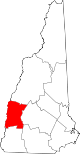
Towns Acworth | Charlestown | Cornish | Croydon | Goshen | Grantham | Langdon | Lempster | Newport | Plainfield | Springfield | Sunapee | Unity | Washington
Villages Balloch | Cornish Flat | East Lempster | Georges Mills | Guild | Meriden
Categories:- Towns in Sullivan County, New Hampshire
- Populated places established in 1761
- County seats in New Hampshire
-


Wikimedia Foundation. 2010.