- Istanbul
-
Istanbul — City — Top: Topkapı Palace – Hagia Sophia – Blue Mosque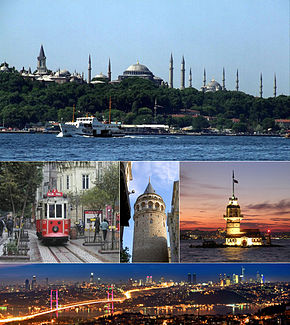
Center: Beyoğlu; Galata Tower; Maiden's Tower
Bottom: Bosphorus Bridge connecting Europe and Asia, with the skyline of Levent financial district.
LogoLocation in Turkey
 Istanbul
Coordinates: 41°01′N 28°58′E / 41.017°N 28.967°E Country  Turkey
Region Marmara Province Istanbul Established - Byzantium c. 660 BCE[note 1] - Constantinople 330 CE - Istanbul 1453 (Ottoman Turkish)
1923 (Modern Turkish)
1930 (internationally)Districts 39 Government – Mayor Kadir Topbaş (AKP) Area – Metro[note 2] 5,343 km2 (2,062.9 sq mi) Population (2000–10 city proper, 2010–12 metro area)[1][2] – City 8,803,468 – Metro 13,255,685 – Metro density 2,481/km2 (6,425.8/sq mi) Time zone EET (UTC+2) – Summer (DST) EEST (UTC+3) Postal code 34000 to 34850 Area code(s) (+90) 212 (European side)
(+90) 216 (Asian side)Website Istanbul Metropolitan Municipality Istanbul (Turkish: İstanbul), historically known as Byzantium and Constantinople[3] (see names of Istanbul for further information), is the largest city of Turkey. Istanbul metropolitan province (municipality) had 13.26 million people living in it as of December, 2010,[1] which is 18% of Turkey's population and the 3rd largest metropolitan area in Europe (including the Asian side of the city) after London and Moscow. The city in its administrative limits had 8.8 million residents counted in the latest Turkish census from 2000.[2] Istanbul is a megacity, as well as the cultural, economic, and financial centre of Turkey. It is located on the Bosphorus Strait and encompasses the natural harbour known as the Golden Horn, in the northwest of the country. It extends both on the European (Thrace) and on the Asian (Anatolia) sides of the Bosphorus, and is thereby the only metropolis in the world that is situated on two continents. Istanbul is a designated alpha world city.
During its long history, Istanbul has served as the capital of the Roman Empire (330–395), the Eastern Roman (Byzantine) Empire (395–1204 and 1261–1453), the Latin Empire (1204–1261), and the Ottoman Empire (1453–1922). When the Republic of Turkey was proclaimed on 29 October 1923, Ankara, which had previously served as the headquarters of the Turkish national movement during the Turkish War of Independence, was chosen as the new Turkish State's capital. Istanbul was chosen as a joint European Capital of Culture for 2010 and the European Capital of Sports for 2012.[4] Istanbul is currently bidding to host the 2020 Summer Olympics.[5] The historic areas of the city were added to the UNESCO World Heritage List in 1985.[6] The city covers 39 districts of the Istanbul province.[7]
Contents
Toponymy
Main article: Names of Istanbul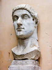 Constantine I was the source of the long-standing name Constantinople, which means the "City of Constantine."
Byzantium (Greek: Βυζάντιον, Byzántion) is the first known name of the city. Around 660 BC,[note 1] Greek settlers from the city-state of Megara founded a Doric colony on the present-day Istanbul, and named the new colony after their king, Byzas.[13] After Constantine I (Constantine the Great) made the city the new eastern capital of the Roman Empire in 330 AD, the city became widely known as Constantinopolis or Constantinople, which, as the Latinised form of "Κωνσταντινούπολις" (Kōnstantinoúpolis), means the "City of Constantine".[14] He also attempted to promote the name Nea Roma ("New Rome"), but this never caught on.[15] Constantinople remained the official name of the city throughout the Byzantine period, and the most common name used for it in the West until the establishment of the Republic of Turkey.
By the 19th century, the city had acquired a number of names used by either foreigners or Turks. Europeans[16][17] used Constantinople to refer to the whole of the city, while using the name Stamboul – as the Turks also did – to describe the walled peninsula between the Golden Horn and the Sea of Marmara. Pera was used to describe the area between the Golden Horn and the Bosphorus, but Turks also used the name Beyoğlu, which is still in use today.[18] However, with the Turkish Postal Service Law of 28 March 1930, the Turkish authorities formally requested foreigners to adopt İstanbul, a name in existence since the 10th century,[19] as the sole name of the city within their own languages.[20]
Etymologically, the name "İstanbul" (Turkish pronunciation: [isˈtanbuɫ], colloquially [ɯsˈtambuɫ]) derives from the Medieval Greek phrase "εἰς τὴν Πόλιν" [is tim ˈbolin] or, in the Aegean dialect, "εἰς τὰν Πόλιν" [is tam ˈbolin] (Greek: εις την πολιν, Modern Greek "στην Πόλη" [stim ˈboli]), which means "in the city" or "to the city".[14][19][21] In modern Turkish, the name is written "İstanbul", with a dotted İ, as the Turkish alphabet distinguishes between a dotted and dotless I. Also, while in English the stress is on the first syllable ("Is"), in Turkish it is on the second syllable ("tan"). Like Rome, Istanbul has been called "The City of Seven Hills" because the oldest part of the city is supposedly built on seven hills, each of which bears a historic mosque.[22]
History
First settlements
Main article: Byzantium Byzantine remains of a column found at Byzantium's acropolis, located today within the Topkapı Palace complex.
Recent construction of the Marmaray tunnel unearthed a Neolithic settlement underneath Yenikapı on Istanbul's peninsula. Dating back to the 7th millennium BC, before the Bosphorus was even formed, the discovery indicated that the peninsula was settled thousands of years earlier than previously thought.[23] Thracian tribes established two settlements—Lygos and Semistra—on the Seraglio Point, near where Topkapı Palace now stands, between the 13th and 11th centuries BC. On the Asian side, artifacts have been found in Fikirtepe (present-day Kadıköy) that date back to the Chalcolithic period.[24] The same location was the site of a Phoenician trading post at the beginning of the 1st millennium BC as well as the town of Chalcedon, which was established by Greek settlers from Megara in 685 BCE.[11]
 Istanbul in Byzantine times
However, the history of Istanbul generally begins around 660 BCE,[note 1] when the settlers from Megara, under the command of King Byzas, established Byzantion (Latinised as Byzantium) on the European side of the Bosphorus. By the end of the century, an acropolis was established at the former locations of Lygos and Semistra, on the Seraglio Point.[13] The city experienced a brief period of Persian rule at the turn of the 5th century BC, but the Greeks recaptured it during the Greco-Persian Wars.[25] Byzantium then continued as part of the Athenian League and its successor, the Second Athenian Empire, before ultimately gaining independence in 355 BCE.[26] Long protected by the Roman Republic, Byzantium officially became a part of the Roman Empire in AD 73.
Byzantium's decision to side with the usurper Pescennius Niger against Roman Emperor Septimus Severus cost it dearly; by the time it surrendered at the end of 195, two years of siege had left the city devastated.[27] Still, five years later, Severus began to rebuild Byzantium, and the city regained—and, by some accounts, surpassed—its previous prosperity.[28]
Rise and fall of Constantinople
Main article: ConstantinopleFurther information: Fall of Constantinople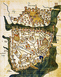 Created in 1422 by Cristoforo Buondelmonti, this is the oldest surviving map of Constantinople and the only one that predates the Ottoman conquest.
When Constantine I defeated Licinius at the Battle of Chrysopolis in September 324, he effectively became the emperor of the whole of the Roman Empire.[29] Just two months later, Constantine laid out the plans for a new, Christian city to replace Byzantium. Intended to replace Nicomedia as the eastern capital of the empire, the city was named Nea Roma (New Rome); however, most simply called it Constantinople ("the city of Constantine"), a name that persisted into the 20th century.[30] Six years later, on 11 May 330, Constantinople was proclaimed the capital of an empire that eventually became known as the Byzantine Empire or Eastern Roman Empire.[31]
The establishment of Constantinople served as one of Constantine's most lasting accomplishments, shifting Roman power eastward and becoming a center of Greek culture and Christianity.[31][32] Numerous churches were built across the city, including the Hagia Sofia, which remained the world's largest cathedral for a thousand years.[33] The Ecumenical Patriarchate of Constantinople developed in the city, and its leader is still one of the foremost figures in the Greek Orthodox Church. Constantinople's location also ensured its existence would stand the test of time; for many centuries, its walls and seafront protected Europe against invaders from the east as well as from the advance of Islam.[32] During most of the Middle Ages and the latter part of the Byzantine period, Constantinople was the largest and wealthiest city on the European continent, and during parts of this period the largest in the world.[34]

Constantinople began to decline after the Fourth Crusade, during which it was sacked and pillaged.[36] The city subsequently became the center of the Latin Empire, created by Catholic crusaders to replace the Orthodox Byzantine Empire, which was divided into splinter states.[37] However, the Latin Empire was short-lived, and the Byzantine Empire was restored, weakened, in 1261.[38] Constantinople's churches, defenses, and basic services were in disrepair,[39] and its population had dwindled to forty thousand from nearly half a million during the 9th century.[40][41]
Various economic and military policies instituted by Andronikos II, such as the reduction of forces, weakened the empire and left it more vulnerable to attack.[42] In the mid-14th century, the Ottoman Turks began a strategy by which they took smaller towns and cities over time, cutting off Constantinople's supply routes and strangling it slowly.[43] Finally, on 29 May 1453, after an eight-week siege (during which the last Roman Emperor, Constantine XI, was killed), Sultan Mehmed II "the Conqueror" captured Constantinople and declared it the new capital of the Ottoman Empire.[44][45] Hours later, the sultan rode to the Hagia Sofia and summoned an imam to proclaim the Islamic creed, converting the grand cathedral into an imperial mosque.[46]
Ottoman and Turkish rule
Main article: History of Istanbul
Following the fall of Constantinople, Mehmed II immediately set out to revitalize the city, now also known as Istanbul. First he deported all the Christian population of the City, leaving only the Jewish inhabitants of Balat[47] then he invited and forcibly resettled many Muslims, Jews, and Christians from other parts of Anatolia and Rumelia into the city,[48] creating a cosmopolitan society that persisted through much of the Ottoman period.[49] By the end of the century, Istanbul had returned to a population of two hundred thousand, making it the second-largest city in Europe.[50] Meanwhile, Mehmed II repaired the city's damaged infrastructure and began to build the Grand Bazaar. Also constructed during this period was Topkapı Palace, which served as the official residence of the sultan for four hundred years.[51]
The Ottomans quickly transformed Constantinople from a bastion of Christianity to a symbol of Islamic culture. Religious foundations were established to fund the construction of grand imperial mosques, often adjoined by schools, hospitals, and public baths.[51] Suleiman the Magnificent's reign from 1520 to 1566 was a period of especially great artistic and architectural achievements; chief architect Mimar Sinan designed the Süleymaniye Mosque and other grand buildings in the city, while Ottoman arts of ceramics, calligraphy and miniature flourished.[52] The total population of Constantinople amounted to 570,000 by the end of the 18th century.[53]
 View of the Galata Bridge spanning the Golden Horn, with the Galata Tower in the background, ca. 1892–1893.
A period of rebellion at the start of the 19th century led to the rise of the progressive Sultan Mahmud II and eventually the Tanzimat period, which produced reforms that aligned the empire along Western European standards.[54][55] Bridges across the Golden Horn were constructed during this period,[56] and Istanbul was connected to the rest of the European railway network in the 1880s.[57] The Tünel, one of the world's oldest subterranean urban rail lines, opened in 1875;[58] other modern facilities, such a stable water network, electricity, telephones, and trams, were gradually introduced to Istanbul over the following decades, although later than to other European cities.[59]
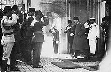 The last Ottoman sultan, Mehmed VI, departing from the backdoor of the Dolmabahçe Palace a year before the declaration of the Republic of Turkey.
Still, the modernization efforts were not enough to forestall the decline of the Ottoman regime. The early 20th century saw the Young Turk Revolution, which disposed of Sultan Abdul Hamid II, and a series of wars that plagued the ailing empire's capital.[60] The last of these, World War I, resulted in the British, French, and Italian occupation of Istanbul. The final Ottoman sultan, Mehmed VI, was exiled in November 1922; the following year, the occupation of Istanbul ended with the signing of the Treaty of Lausanne and the recognition of the Republic of Turkey, which was declared by Mustafa Kemal Atatürk on 29 October 1923.[61]
On 24 April 1915, on the orders of Ottoman authorities, hundreds of Armenian leaders were arrested in Istanbul.[62][63][64][65] They were later deported, with the adoption of the Tehcir Law, on 29 May 1915. Thereafter, the Ottoman military uprooted Armenians from their homes and forced them to march for hundreds of miles, depriving them of food and water, to the desert of what is now Syria.[66][67][68][69][70][71] These actions are commonly regarded to be the precursor events which led to the mass persecution of Armenian People, resulting in the deaths of between 1 million and 1.5 million,[72][73][74][75][76][77] and has come to be known as the The Armenian Genocide.[78][79]
In the early years of the republic, Istanbul was overlooked in favor of the country's new capital, Ankara. However, starting from the late 1940s and early 1950s, Istanbul underwent great structural change, as new public squares (such as Taksim Square), boulevards, and avenues were constructed throughout the city, sometimes at the expense of historical buildings.[80] In 1955, the Istanbul Pogrom targeted the city's ethnic Greek community. The pogrom greatly accelerated the emigration of the city's ethnic Greeks to Greece.[81] The population of Istanbul began to rapidly increase in the 1970s, as people from Anatolia migrated to the city to find employment in the many new factories that were built on the outskirts of the sprawling metropolis. This sudden, sharp rise in the city's population caused a large demand for housing development, and many previously outlying villages and forests became engulfed into the greater metropolitan area of Istanbul.[82]
Geography
Further information: Geography of Turkey and Geology of Turkey Satellite view of Istanbul and the Bosporus, connecting the Black Sea at the north with the Sea of Marmara at the south.
Istanbul is located in northwestern Turkey within the Marmara Region on a total area of 5,343 square kilometers (2,063 sq mi).[note 2] The Bosphorus, which connects the Sea of Marmara to the Black Sea, divides the city into a European side, comprising the historic and economic centers, and an Asian, Anatolian side; as such, Istanbul is one of the two bi-continental cities in Turkey, along with Çanakkale. The city is further divided by the Golden Horn, a natural harbor bounding the peninsula where the former Byzantium and Constantinople were founded. In the late-19th century, a wharf was constructed in Galata at the mouth of the Golden Horn, replacing a sandy beach that once formed part of the inlet's coastline.[87] The confluence of the Sea of Marmara, the Bosphorus, and the Golden Horn at the heart of present-day Istanbul has deterred attacking forces for thousands of years and still remains a prominent feature of the city's landscape.
The historic peninsula is said to be built on seven hills, each topped by an imperial mosque, surrounded by 22 kilometers (14 mi) of city walls; the largest of these hills is the site of Topkapı Palace on the Sarayburnu.[88] Rising from the opposite side of the Golden Horn is another, conical hill, where the modern Beyoğlu district is situated. Because of the topography, buildings were once constructed with the help of terraced retaining walls (some of which are still visible in older parts of the city), and roads in Beyoğlu were laid out in the form of steps.[87] Üsküdar on the Asian side exhibits similarly hilly characteristics, with the terrain gradually extending down to the Bosphorus coast, but the landscape in Şemsipaşa and Ayazma is more abrupt, akin to a promontory. The highest point in Istanbul is Çamlıca Hill (also on the Asian side), with an altitude of 288 meters (945 ft).[87]
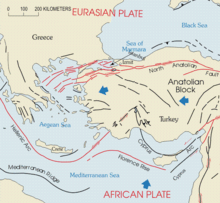 Faults in western Turkey are concentrated just southwest of Istanbul, under the Sea of Marmara and northern Aegean Sea.
Istanbul is situated near the North Anatolian Fault on the boundary between the African and Eurasian plates. This fault zone, which runs from northern Anatolia to the Sea of Marmara, has been responsible for several deadly earthquakes throughout the city's history. Among the most devastating of these seismic events was the 1509 earthquake, which caused a tsunami that broke over the walls of the city, destroyed over 100 mosques, and killed more than 10,000 people. More recently, in 1999, an earthquake with its epicenter in nearby İzmit left 17,000 people dead, including 1,000 people in Istanbul's suburbs.[89] The people of Istanbul remain concerned that an even more catastrophic seismic event may be in Istanbul's near future, as thousands of structures recently built to accommodate the city's rapidly increasing population may not have been constructed properly.[89] Seismologists say the risk of a 7.6-magnitude earthquake striking Istanbul by 2030 is greater than sixty percent.[90][91]
Climate
 Levent financial district in winter.
Istanbul has a borderline humid subtropical climate and warm-summer mediterranean climate which is influenced by the oceanic climate.
However under the Köppen climate classification systems minimum precipitation threshold limit of 30 mm (1.2 in) Istanbul has a humid subtropical climate (Cfa) or under Köppen-Geiger classification systems minimum precipitation threshold limit of 40 mm (1.6 in) Istanbul has a warm-summer Mediterranean climate (Csa),[92] although its climate becomes more oceanic (Cfb) toward the north.[92][93]
In summer the weather in Istanbul is hot and humid, with the temperature in July and August averaging 23 °C (73 °F).[94] Summers are relatively dry, but rainfall is significant during that season. Extreme heat, however, is uncommon, as temperatures rise above 32 °C (90 °F) on only five days per year on average.[95] During winter it is cold, wet and often snowy, with the temperature in January and February averaging 4 °C (39 °F).[94] Snowfalls tend to be heavy, but the snowcover and temperatures below the freezing point rarely last more than a few days. Spring and autumn are mild, but are unpredictable and often wet, and can range from chilly to warm, however the nights are chilly.
Istanbul has a persistently high humidity, which can exacerbate the moderate summer heat.[94] The humidity is especially salient during the morning hours, when humidity generally reaches eighty percent and fog is very common. The city receives fog an average of 228 days each year, with the highest concentration of foggy days being in the winter months, although it usually dissipates by noontime. Thunderstorms are uncommon, occurring just 23 days each year, but they occur most frequently in the summer and early autumn months.[95] Istanbul has an annual average of 124 days with significant precipitation, which together generate around 844 mm (33 in) of rain. The highest recorded temperature was 40.5 °C (105 °F) on 12 July 2000, and the lowest recorded temperature was −16.1 °C (3 °F) on 9 February 1927.[96] Istanbul also tends to be a windy city, having an average wind speed of 18 km/h (11 mph).[95] Due to the city's huge size, topography and maritime influences, Istanbul exhibits a multitude of distinct microclimates.
Climate data for Istanbul TurkeyMonth Jan Feb Mar Apr May Jun Jul Aug Sep Oct Nov Dec Year Average high °C (°F) 8.7
(47.7)9.1
(48.4)11.2
(52.2)16.5
(61.7)21.4
(70.5)26.0
(78.8)28.4
(83.1)28.5
(83.3)25.0
(77.0)20.1
(68.2)15.3
(59.5)11.1
(52.0)18.8 Average low °C (°F) 2.9
(37.2)2.8
(37.0)3.9
(39.0)7.7
(45.9)12.0
(53.6)16.0
(60.8)18.5
(65.3)18.7
(65.7)15.5
(59.9)12.0
(53.6)8.5
(47.3)5.3
(41.5)10.5 Precipitation mm (inches) 98.4
(3.874)80.2
(3.157)69.9
(2.752)45.8
(1.803)36.1
(1.421)34.0
(1.339)38.8
(1.528)47.8
(1.882)61.4
(2.417)96.9
(3.815)110.7
(4.358)123.9
(4.878)843.9
(33.224)Avg. precipitation days 17.7 15.3 13.6 10.3 7.8 5.3 3.6 4.0 6.1 10.3 12.9 16.9 123.8 Source: World Meteorological Organization,[97] Turkish State Meteorological Service,[98] BBC Weather[99] and Climatetemp Info.[100] Cityscape
See also: List of urban centers in Istanbul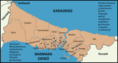 Istanbul's districts extend far from the city center along the full length of the Bosphorus (with the Black Sea at top and the Sea of Marmara at bottom).
 City center of Istanbul, showing the original core of the metropolis, which includes the historic peninsula south of the Golden Horn and Galata north of the Golden Horn on the European side; with Üsküdar and Kadıköy on the Asian side.
Istanbul has thirty-nine districts administered by the Istanbul Metropolitan Municipality (MMI).[85] The district of Fatih, which includes the neighborhood and former district of Eminönü, is among the most central of these, residing on the historic peninsula south of the Golden Horn. The district corresponds to what was until the Ottoman conquest the whole of the city, across from which stood the Genoese citadel of Galata in the late Byzantine era. Those Genoese fortifications were largely demolished in the 19th century, leaving only the Galata Tower, to make way for northward expansion of the city.[101] Galata is now a part of the Beyoğlu district, which forms Istanbul's commercial and entertainment center and includes İstiklal Avenue and Taksim Square.[102]
 The historic core of Istanbul from the air
 The waterfront yalıs on the Bosphorus are among the most noticeable traits of Istanbul's cityscape.
Dolmabahçe Palace, the seat of government during the late Ottoman period, is located in Beşiktaş, just north of Beyoğlu, across from BJK İnönü Stadium, home to Turkey's oldest football club.[103] The former village of Ortaköy is situated within Beşiktaş and provides its name to the Ortaköy Mosque, along the Bosphorus near the First Bosphorus Bridge. Lining the shores of the Bosphorus north of there are yalıs, luxurious chalet mansions originally built by 19th-century aristocrats and elites as summer homes.[104] Today, some are homes within the city's most exclusive neighborhoods, including Bebek. Further inland, between the Bosphorus Bridge and the Fatih Sultan Mehmet (Second Bosphorus) Bridge, are Levent, Maslak, and Mecidiyeköy, Istanbul's primary economic centers. Officially part of the Beşiktaş and Şişli districts, they contain Istanbul's tallest buildings and the headquarters of Turkey's largest companies.
Like Beyoğlu, the districts of Üsküdar and Kadıköy on the Asian side were originally separate cities, Chrysopolis and Chalcedon, respectively.[11] During the Ottoman period, they continued to remain outside the scope of urban Istanbul, serving as tranquil outposts with seaside yalıs and gardens. However, during the second half of the 20th century, the Asian side experienced massive urban growth, owning in part to the development of Bağdat Avenue into an upscale shopping hub similar to İstiklal Avenue on the European side. The fact that these areas were largely empty until the 1960s also provided the chance for developing better infrastructure and tidier urban planning when compared with most other residential areas in the city. While now officially parts of Istanbul, much of the Asian side of the Bosphorus, which accounts for one third of the city's population, functions as a suburb of the economic and commercial centers in European Istanbul.
As a result of Istanbul's exponential growth during the 20th century, a significant portion of the city's outskirts comprised gecekondus (a Turkish term meaning built overnight), referring to the illegally constructed squatter buildings run rampant outside the centers of the country's largest cities.[105] At present, some gecekondu areas are being gradually demolished and replaced by modern mass-housing compounds.
Architecture
Main article: Architecture of IstanbulFurther information: Architecture of ancient Rome, Byzantine architecture, and Ottoman architectureHistoric Areas of Istanbul * UNESCO World Heritage SiteCountry Turkey Type Cultural Criteria I, II, III, IV Reference 356 Region ** Europe and North America Inscription history Inscription 1985 (9th Session) * Name as inscribed on World Heritage List
** Region as classified by UNESCO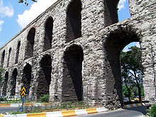 A mix of old and new, as roads now travel through the arches of the 4th-century Valens Aqueduct.
Istanbul is primarily known for its Byzantine and Ottoman architecture, but its buildings reflect the various peoples and empires that have ruled its predecessors. Genoese, Roman, and even Greek forms of architecture remain visible in Istanbul alongside their Ottoman counterparts. Similarly, while the Hagia Sophia and imperial mosques dominate much of the city's skyline, the city is also home to a number of historic churches and synagogues.
More than two thousand years following the departure of the Greeks, few examples of Istanbul's Greek architecture have survived. Perhaps the most prominent relic of the Greek era is Maiden's (Leander's) Tower. Residing on an islet in the Bosphorus just off the coast of Üsküdar, Maiden's Tower was first built by the Greeks in 411 BC to guide ships within the strait. Since then, however, the tower has undergone a number of enlargements and restorations, rendering its connection to the Greeks tenuous, and today merely serves as an observation point.[106]
Examples of Roman architecture have proved themselves to be more durable. Obelisks from the Hippodrome of Constantinople, modeled after the Circus Maximus in Rome, are still visible in Sultanahmet Square.[107] A section of the Valens Aqueduct, constructed in the late 4th century to carry water to the city, stands relatively intact over 970 meters (3,200 ft) in the west of the Fatih district.[108] Similarly, the Walls of Constantinople, which were erected in stages well into the Byzantine period, are still visible along much of their original 4-mile (6.4 km) course from the Sea of Marmara to the Golden Horn.[109] Finally, the Column of Constantine, erected in 330 AD to mark the new Roman capital, still stands not far from the Hippodrome.[108]
 The Hagia Sophia, from Byzantine times, as it stands today, with the minarets added by the Ottomans.
Early Byzantine architecture followed the classical Roman model of domes and arches, but further improved these architectural concepts, as in the Church of the Saints Sergius and Bacchus. The oldest surviving Byzantine church in Istanbul (albeit partially in ruins) is the Stoudios (İmrahor) Monastery, which was built in 454.[110] Other extant structures from the early Byzantine period include the Hagia Irene, initially the first church in the new capital, and the Prison of Anemas, which was incorporated into the city walls. After the recapture of Constantinople in 1261, the Byzantines constructed two of their most important churches, Chora Church and Pammakaristos Church. Across the Golden Horn, the Genoese contributed Galata Tower, then the highest point in the citadel of Galata. Still, the pinnacle of Byzantine architecture, and one of Istanbul's most iconic structures, is the Hagia Sophia. Topped by a dome 31 meters (102 ft) in diameter,[111] the Hagia Sofia stood as the largest cathedral for more than a thousand years, before being converted into a mosque and, now, a museum.[33][46]
 Dolmabahçe Palace, an example of the Ottoman Baroque architecture.
Among the oldest extant examples of Ottoman architecture in Istanbul are the Anadoluhisarı and Rumelihisarı fortresses, which helped block sea traffic aimed at assisting the Byzantines during the Turkish siege of the city.[112] Over the next four centuries, the Ottomans continued to make an indelible impression on the skyline of Istanbul, building towering mosques and ornate palaces. These grand imperial mosques include Sultan Ahmed Mosque (the Blue Mosque), Süleymaniye Mosque, and Yeni Mosque, all of which were built at the peak of the Ottoman Empire, in the 16th and 17th centuries.
In the following centuries, and especially after the Tanzimat reforms, Ottoman architecture was supplanted by European styles. In contrast to the traditional elements of Topkapı Palace and the mosques on the historic peninsula, Dolmabahçe Palace, Yıldız Palace, and Ortaköy Mosque in Beşiktaş, and Beylerbeyi Palace across the Bosphorus in Üsküdar are clearly of Neo-Baroque style. At the same time, the areas around İstiklal Avenue were filled with grandiose European embassies and rows of buildings in European (mostly Neoclassical and, later, Art Nouveau) style started to appear along the avenue. Istanbul was one of the major centers of the Art Nouveau movement in the late-19th and early-20th centuries, with famous architects of this style building palaces and mansions in the city.
 Panoramic view of the Golden Horn in Istanbul, as seen from the Galata Tower. The Galata Bridge can be seen in the centre of the picture. The Seraglio Point where the Topkapı Palace is located is seen at the left tip of the historic peninsula; followed by (left to right) the Hagia Sophia, the Sultan Ahmed Mosque, the Yeni Mosque near the Galata Bridge, the Beyazıt Tower rising high in the background, and the Süleymaniye Mosque at far right, among others. The Sea of Marmara and the Princes' Islands are seen in the background, on the horizon. At the extreme left of the picture, the district of Kadıköy (ancient Chalcedon) on the Asian side of the city can be seen. Behind the Galata Bridge, towards the horizon, the Column of Constantine (which was surrounded by iron bars for restoration) rises.
Administration
See also: List of mayors of IstanbulSince 2004, Istanbul, the capital of the Istanbul Province, has been one of only two cities in Turkey whose city boundaries are equivalent to the boundaries of its province. The city is administered by the Istanbul Metropolitan Municipality (MMI), which oversees the thirty-nine districts of the city-province.[note 2] The main decision-making body of the Municipality is the Municipal Council, headed by the mayor; among its responsibilities are controlling the award of contracts, setting the fare prices on public transport, and regulating taxes.[113][114] All members of the council, including the mayor, are elected to five-year terms. The mayor of Istanbul has been Kadir Topbaş since first being elected in March 2004 and being re-elected in March 2009.[115] The governor of Istanbul province is Hüseyin Avni Mutlu.[116]
Istanbul is a home rule city and municipal elections are mainly partisan. The metropolitan model of governance has been used with the establishment of metropolitan administration in 1930. The metropolitan council is responsible for all authority when it comes to making city decisions.[117]
The metropolitan government structure consists of three main organs: (1) The Metropolitan Mayor (elected every five years), (2) The Metropolitan Council (decision making body with the mayor, district Mayors, and one fifth of the district municipal councillors), (3) The metropolitan executive committee. There are three types of local authorities: (1) municipalities, (2) special provincial administrations, (3) village administrations. Among the local authorities, municipalities are gaining greater importance with the rise in urbanisation.
The current Istanbul Metropolitan Municipality City Hall building in the Saraçhane quarter of the Fatih district, the construction of which began on 17 December 1953 and was completed and inaugurated on 26 May 1960, will soon be demolished and replaced by a new building, designed by Istanbul-based Arolat Architects.[118]
Demographics
See also: Demographics of TurkeyHistorical population of Istanbul Year Population Year Population 330 40,000 1914  909,978
400  200,000
1927 680,857530 550,0001935 741,148545 350,0001940 793,949715 300,0001945 860,558950 400,0001950 983,0411200 250,0001955 1,268,7711453 36,0001960 1,466,5351477 70,0001965 1,742,9781566 600,0001970 2,132,4071690 750,000–800,0001975 2,547,3641817 500,0001980 2,772,7081860 715,0001985 5,475,9821885 873,5701990 6,629,4311890 874,0002000 8,803,4681897 1,059,0002007 11,372,6131901 942,9002010 13,120,596The population of the metropolis more than tripled during the 25 years between 1980 and 2005. Roughly 70% of all inhabitants of Istanbul live in the European section and around 30% in the Asian section. Owing to high unemployment in the south-east of Turkey, many people from that region migrated to Istanbul, where they established themselves in the outskirts of the city. Migrants, predominantly from eastern Anatolia, arrive in Istanbul expecting improved living conditions and employment, which usually ends with little success. This results each year in new shanties (gecekondus) appearing at the outskirts of the city, which are later developed into neighbourhoods and integrated into the greater metropolis.
According to the address-based birth recording system of the Statistical Institute, the metropolitan municipality (entire Istanbul Province), had a population of 13,255,685 people as of 2010,[1] making the city one of the largest metropolitan areas today. On the last census in 2000, Istanbul had a proper population of 8,803,468 inhabitants.[2] According to present estimates the rate of population growth in the city is currently at 3.45% a year on average, mainly due to the influx of people from the surrounding rural areas. Istanbul's population density of 2,742 people per square mile (1,700 per square km) far exceeds Turkey's 130 people per square mile (81 people per square km).[119]
During the early Middle Ages, Istanbul was the largest city in the world[citation needed], and has been one of the world's largest and most important cities during much of its history[citation needed] (excepting the period of collapse of the Byzantine Empire, before the Ottomans). Its geopolitical significance since ancient times brought representatives of ethnic groups from all over Europe, Asia, and Africa, many of whom became assimilated with the local Greek and later Turkish populations.[citation needed]
At the beginning of the 20th century Istanbul was a very multicultural city, with over 100,000 Greeks living in the city,[120] and over 1.5 million in Anatolia as a whole.[121] Due to their role in the Turkish economy, the ethnic Greeks of Istanbul living in the city before 30 October 1918 (the etablis) were excluded by the 1923 population exchange. However, because of the 1942 wealth tax, the 1955 Istanbul Pogrom, the 1964 expulsions[120] and the 1974 Cyprus crisis, the number of Greeks in Istanbul diminished enormously, and is today estimated to comprise around 2,000, mostly elderly, citizens.[122]
The following overview shows the numbers of inhabitants by year[citation needed]. Population tallies up to 1914 are estimated with variations of up to 50% depending upon researcher. The numbers from 1927 to 2000 are results of censuses. The numbers of 2005 and 2006 are based on computer simulation forecasts. The doubling of the population of Istanbul between 1980 and 1985 is due to a natural increase in population as well as the expansion of municipal limits.[citation needed]
Religion
Main article: Religion in Istanbul
The Muslims are by far the largest religious group in Istanbul. Among them, the Sunnis form the most populous sect, while a number of the local Muslims are Alevis. In 2007 there were 2,944 active mosques in Istanbul.[123]
Religious minorities include: Greek Orthodox Christians, Armenian Christians, Syriac Oriental Orthodox Christians, Catholic Levantines and Sephardic Jews. According to the 2000 census, there were 2,691 active mosques, 123 active churches and 26 active synagogues in Istanbul; as well as 109 Muslim cemeteries and 57 non-Muslim cemeteries.[citation needed] Some districts used to have sizeable populations of these ethnic groups, such as the Kumkapı district, which had a sizeable Armenian population; the Balat district, which had a sizeable Jewish population; the Fener and Samatya districts, which had a sizeable Greek population; and some neighbourhoods in the Nişantaşı and Beyoğlu districts that had sizeable Levantine populations. Very few remain in these districts, as they either emigrated or moved to other districts. In some quarters, such as Kuzguncuk, an Armenian church sits next to a synagogue, and on the other side of the road a Greek Orthodox church is found beside a mosque.
The seat of the Ecumenical Patriarch of Constantinople, patriarch of the autocephalous Greek Orthodox Church, is located in the Fener (Phanar) quarter. Also based in Istanbul are the archbishop of the Turkish Orthodox Church, an Armenian archbishop, and the Turkish Grand-Rabbi. A number of places reflect past movements of different communities into Istanbul, most notably Arnavutköy (Albanian village), Polonezköy (Polish village) and Yenibosna (New Bosnia).
Istanbul was the final seat of the Islamic Caliphate, between 1517 and 1924, when the Caliphate was dissolved and its powers were handed over to the Turkish Parliament. On 2 September 1925, the tekkes and tarikats were banned, as their activities were deemed incompatible with the characteristics of the secular democratic Republic of Turkey; particularly with the secular education system and the laicist state's control over religious affairs through the Religious Affairs Directorate. Most followers of Sufism and other forms of Islamic mysticism practiced clandestinely afterwards, and some of these sects still boast numerous followers. To avoid the still active prohibition, these organisations represent themselves as "cultural associations."

 The Armenian Patriarchate.
The city has been the seat of the Ecumenical Patriarchate of Constantinople since the 4th century AD. The city is also seat of the Autocephalous Turkish Orthodox Patriarchate and the Armenian Patriarchate. The city was formerly also the seat of the reduced Bulgarian Orthodox Exarchate, before its autocephaly was recognised for a second time by other bodies of the Orthodox Church.
The everyday life of the Christians, particularly the Greeks and Armenians living in Istanbul changed significantly following the bitter conflicts between these ethnic groups and the Turks during the fall of the Ottoman Empire, which began in the 1820s and continued for a century. The conflicts reached their culmination in the decade between 1912 and 1922; during the Balkan Wars, the First World War and the Turkish War of Independence. The Christian population declined from 450,000 to 240,000 between 1914 and 1927.[124] Today, most of Turkey's remaining Greek and Armenian minorities live in or near Istanbul. The number of the local Turkish Armenians in Istanbul today amount to approximately 45,000[125] (not including the nearly 40,000 Armenian workers in Turkey who came from Armenia after 1991 and mostly live and work in Istanbul);[126] while the Greek community, which amounted to 150,000 citizens in 1924,[127] currently amounts to approximately 2,000–4,000 citizens.[125] There are also 60,000 Istanbul Greeks who currently live in Greece but continue to retain their Turkish citizenship.[125]
Sephardic Jews have lived in the city for over 500 years, after fleeing the Iberian Peninsula during the Spanish Inquisition of 1492, when they were forced to convert to Christianity after the fall of the Moorish Kingdom of Andalucia. The Ottoman Sultan Bayezid II (1481–1512) sent a sizable fleet to Spain under the command of Kemal Reis to save the Sephardic Jews.[citation needed] More than 200,000 Jews fled first to Tangier, Algiers, Genova, and Marseille, later to Salonica, and finally to Istanbul.[citation needed] The Sultan granted over 93,000 of these Spanish Jews to take refuge in the Ottoman Empire.[citation needed] Another large group of Sephardic Jews came from southern Italy, which was under Spanish control. The İtalyan Sinagogu (Italian Synagogue) in Galata is mostly frequented by the descendants of these Italian Jews in Istanbul.[citation needed]
At the beginning of the 20th century, there were over 200,000 Jews in Istanbul. However with the formation of the Turkish Republic and accompanying nationalism, many Jews emigrated along with other minorities.[128][129] The 1934 anti-Jewish pogrom,[128] the 1942 Varlık Vergisi ("Wealth Tax"),[128] and recent terrorist bombings of synagogues have contributed to the exodus. Today, according to the World Jewish Congress, 23,000 Jews remain in Turkey, the vast majority being located in Istanbul.[130] There are about 20 synagogues, the most important of them being the Neve Shalom Synagogue inaugurated in 1951, in the Beyoğlu district.[citation needed]
Economy
Main article: Economy of Istanbul Bankalar Caddesi was the street where the prominent financial institutions were located during the Ottoman period.
Apart from being the largest city and former political capital of the country, Istanbul has always been the centre of Turkey's economic life because of its location as a junction of international land and sea trade routes. Istanbul is also Turkey's largest industrial centre. It employs approximately 20% of Turkey's industrial labour and contributes 38% of Turkey's industrial workspace. Istanbul and its surrounding province produce cotton, fruit, olive oil, silk, and tobacco. Food processing, textile production, oil products, rubber, metal ware, leather, chemicals, pharmaceuticals, electronics, glass, machinery, automotive, transport vehicles, paper and paper products, and alcoholic drinks are among the city's major industrial products. According to Forbes magazine, Istanbul had a total of 35 billionaires as of March 2008, ranking fourth in the world.[131]
 Maslak financial district.
Originally established as the Ottoman Stock Exchange (Dersaadet Tahvilat Borsası) in 1866, and reorganised to its current structure at the beginning of 1986, the Istanbul Stock Exchange (ISE) is the sole securities market of Turkey.[132] During the 19th century and early 20th century, Bankalar Caddesi (Banks Street) in Galata was the financial centre of the Ottoman Empire, where the headquarters of the Ottoman Central Bank (established as the Bank-ı Osmanî in 1856, and later reorganised as the Bank-ı Osmanî-i Şahane in 1863)[133] and the Ottoman Stock Exchange (1866) were located.[134] Bankalar Caddesi continued to be Istanbul's main financial district until the 1990s, when most Turkish banks began moving their headquarters to the modern central business districts of Levent and Maslak.[134] In 1995, the Istanbul Stock Exchange moved to its current building in the İstinye quarter.[135]
 Levent financial district at night.
Today, the city generates 55% of Turkey's trade and 45% of the country's wholesale trade, and generates 21.2% of Turkey's gross national product. Istanbul contributes 40% of all taxes collected in Turkey and produces 27.5% of Turkey's national product. In 2005 the City of Istanbul had a GDP of $133 billion.[136] In 2005 companies based in Istanbul made exports worth $41,397,000,000 and imports worth $69,883,000,000; which corresponded to 56.6% and 60.2% of Turkey's exports and imports, respectively, in that year.[137]
Istanbul is one of the most important tourism spots of Turkey. There are thousands of hotels and other tourist oriented industries in the city, catering to both vacationers and visiting professionals. In 2006 a total of 23,148,669 tourists visited Turkey, most of whom entered the country through the airports and seaports of Istanbul and Antalya.[138] The total number of tourists who entered Turkey through Atatürk International Airport and Sabiha Gökçen International Airport in Istanbul reached 5,346,658, rising from 4,849,353 in 2005.[139] Istanbul is also one of the world's major conference destinations and is an increasingly popular choice for the world's leading international associations.[140]
Public services
Education
Main article: Education in TurkeySee also: List of universities in Istanbul, List of schools in Istanbul, and List of libraries in Istanbul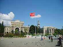 Main entrance gate of Istanbul University on Beyazıt Square. Beyazıt Tower, located within the campus, is seen in the background.
Istanbul holds some of the finest institutions of higher education in Turkey, including more than 35 public and private universities. Most of the reputable universities are public, but in recent years there has also been an upsurge in the number of private universities. Istanbul University, founded as a madrasa in 1453, is the oldest Turkish educational institution in the city,[141] while Istanbul Technical University (1773) is the world's third-oldest technical university dedicated entirely to engineering sciences.[142] Other prominent state universities in Istanbul include Boğaziçi University, Mimar Sinan University of Fine Arts, Yildiz Technical University and Marmara University. The major private universities in the city include Koç University, Sabancı University, Istanbul Bilgi University, Bahçeşehir University, Yeditepe University, Istanbul Kültür University, and Kadir Has University. Almost all Turkish private high schools and universities in Istanbul teach in English, German or French as the primary foreign language, usually accompanied by a secondary foreign language.

 The Robert College.
Among the best public schools of Turkey, the Galatasaray High School, established in 1481 as Galata Sarayı Enderun-u Hümayunu (Galata Palace Imperial School) and later known as Galatasaray Mekteb-i Sultanisi (Galatasaray School of the Sultans), is the oldest Turkish high school in Istanbul and the second oldest Turkish educational institution in the city. Istanbul High School, also commonly known as İstanbul Erkek Lisesi (established in 1884), abbreviated İEL, is one of the oldest and internationally renowned public high schools of Turkey. Kuleli Military High School is the only military high school in Istanbul, located in Çengelköy district. Another important school in Turkey is Darüşşafaka which has no similar world-wide, providing children opportunities around the Turkey without receiving any money from any of them. The school accepts only yetim children (a child without father), children with both parents or öksüz children (a child without mother) are not accepted. This school was built in 1873 by Darüşşafaka community. The primary person who came up with creating this school and community is Yusuf Ziya Pasha. Darüşşafaka is located in Maslak.
 The Boğaziçi University
Anadolu Liseleri (Anatolian High Schools) were originally furnished for the Turkish children who returned home from foreign countries, such as the Üsküdar Anadolu Lisesi with German as the primary foreign language and technical instruction in German. Kabataş Erkek Lisesi(Kabatas Highschool)is one of Anatolian High Schools and also one of the oldest and the most prominent schools in Turkey. Established in 1908 by the Ottoman Empire Sultan Abdulhamid II, the high school has been educating for 103 years and still does. The Queen of the UK has visited the school in 2008. Furthermore, Kadıköy Anadolu Lisesi which is also commonly known as Kadıköy Maarif College is one of the first six special Ministry of Education Colleges established in 1950s in big cities across Turkey. Those English-medium colleges were renamed as "Anadolu Lisesi" in subsequent decades. There are also many foreign high schools in Istanbul, most of which were established in the 19th century to educate foreigners in Istanbul. Following the establishment of the Republic of Turkey, most of these schools went under the administration of the Turkish Ministry of Education, but some of them still have considerable foreign administration, such as the Liceo Italiano Statale I.M.I. (Özel İtalyan Lisesi), which is still regarded as an Italian state school by the government of Italy and continues to receive funding and teachers from Rome.[143] Robert College established in 1863 and Üsküdar American Academy established in 1876, are other remarkable foreign schools in the city, among numerous others.
Fen Liseleri (Science High School) were originally furnished for the Turkish children who wants to be scientist, doctor or a job about the "Science", such as Atatürk Fen Lisesi, Yaşar Acar Fen Lisesi and 2 other science high schools.
 The Kuleli Military High School, on the Bosphorus.
Istanbul has numerous libraries, many of which contain vast collections of historic documents from the Roman, Byzantine and Ottoman periods, as well as from other civilisations of the past. The most important libraries in terms of historic document collections include the Topkapı Palace Library, Library of the Archaeological Museum, Library of the Naval Museum, Beyazıt State Library, Nuruosmaniye Library, Süleymaniye Library, Istanbul University Library, Köprülüzade Fazıl Ahmed Paşa Library, Atatürk Library and Çelik Gülersoy Library.
Healthcare
See also: List of hospitals in IstanbulThe city has many public and private hospitals, clinics and laboratories within its bounds and numerous medical research centers. Many of these facilities have high technology equipment, which has contributed to the recent upsurge in "medical tourism" to Istanbul,[144] particularly from West European countries like the United Kingdom and Germany where governments send patients with lower income to the city for the inexpensive service of high-tech medical treatment and operations.[145] Istanbul has particularly become a global destination for laser eye surgery and plastic surgery.[144] The city also has an Army Veterans Hospital in the military medical centre.
Pollution-related health problems increase especially in the winter, when the combustion of heating fuels increase. The rising number of new cars in the city and the slow development of public transportation often cause urban smog conditions. Mandatory use of unleaded gas was scheduled to begin only in January 2006.[146]
Utilities
Main article: Utilities in IstanbulIstanbul's first water supply systems date back to the foundation of the city. The two greatest aqueducts from the Roman period are the Mazulkemer Aqueduct and the Valens Aqueduct. These were built to channel water from the Halkalı area in the western edge of the city to the Beyazıt district in the city centre, which was called the Forum Tauri in the Roman period.[147] After reaching the city centre, the water was later collected in the city's numerous cisterns, such as the famous Philoxenos (Binbirdirek) Cistern and the Basilica (Yerebatan) Cistern. Sultan Suleiman the Magnificent commissioned Mimar Sinan, his engineer and architect-in-chief, to improve the water needs of the city. Sinan constructed the Kırkçeşme Water Supply System in 1555.[147] In later years, with the aim of responding to the ever-increasing public demand, water from various springs was channeled to the public fountains by means of small supply lines; see German Fountain.
Today, Istanbul has a chlorinated and filtered water supply and a sewage disposal system managed by the government agency İSKİ.[148] There are also several private sector organisations distributing clean water. Electricity distribution services are covered by the state-owned TEK. The first electricity production plant in the city, Silahtarağa Termik Santrali, was established in 1914 and continued to supply electricity until 1983.[149]
The Ottoman Ministry of Post and Telegraph was established in the city on 23 October 1840.[150] The first post office was the Postahane-i Amire near the courtyard of Yeni Mosque.[150] In 1876 the first international mailing network between Istanbul and the lands beyond the vast Ottoman Empire was established.[150] In 1901 the first money transfers were made through the post offices and the first cargo services became operational.[150] Samuel Morse received his first ever patent for the telegraph in 1847, at the old Beylerbeyi Palace (the present Beylerbeyi Palace was built in 1861–1865 on the same location) in Istanbul, which was issued by Sultan Abdülmecid who personally tested the new invention.[151] Following this successful test, installation works of the first telegraph line between Istanbul and Edirne began on 9 August 1847.[152] In 1855 the Telegraph Administration was established.[150] In July 1881 the first telephone circuit in Istanbul was established between the Ministry of Post and Telegraph in Soğukçeşme and the Postahane-i Amire in Yenicami.[152] On 23 May 1909, the first manual telephone exchange with a 50 line capacity was established in the Büyük Postane (Grand Post Office) of Sirkeci.[152]
Transportation
Main article: Public transport in IstanbulAirports
 Atatürk International Airport on the European side is the main airport of the city and one of the largest international hubs in the region.
Istanbul has two international airports: The larger one is the Atatürk International Airport located in the Yeşilköy district on the European side, about 24 kilometres (15 mi) west from the city centre. When it was first built, the airport was situated at the western edge of the metropolitan area but now lies within the city bounds. The smaller one is the Sabiha Gökçen International Airport located in the Kurtköy district on the Asian side, close to the Istanbul Park GP Racing Circuit. It is situated approximately 20 kilometres (12 mi) east of the Asian side and 45 kilometres (28 mi) east of the European city centre.
 Commuter ferries have been operating on the Bosphorus since 1837.
Sea transport is vital for Istanbul, as the city is practically surrounded by sea on all sides: the Sea of Marmara, the Golden Horn, the Bosphorus and the Black Sea. Many Istanbul people live on the Asian side of the city but work on the European side (or vice-versa) and the city's famous commuter ferries form the backbone of the daily transition between the two parts of the city – even more so than the two suspension bridges that span the Bosphorus. The commuter ferries, along with the high speed catamaran Seabus (Deniz Otobüsü), also form the main connection between the city and the Princes' Islands.
The first steam ferries appeared on the Bosphorus in 1837 and were operated by private sector companies.[153] On 1 January 1851, the Şirket-i Hayriye (literally the Goodwill Company, as the Istanbul Ferry Company was originally called) was established by the Ottoman state.[153] The Şirket-i Hayriye continued to operate the city's landmark commuter ferries until the early years of the Republican period, when they went under the direction of Türkiye Denizcilik İşletmeleri (Turkish State Maritime Lines).[153] Since March 2006, Istanbul's traditional commuter ferries are operated by İstanbul Deniz Otobüsleri (Istanbul Sea Buses), which also operates the high speed catamaran Seabus.[153]

İDO (İstanbul Deniz Otobüsleri – Istanbul Sea Buses) was established in 1987 and operates the high-speed catamaran Seabuses that run between the European and Asian parts of Istanbul—and also connect the city with the Princes' Islands and other destinations in the Sea of Marmara. The Yenikapı High Speed Car Ferry Port on the European side, and the Pendik High Speed Car Ferry Port on the Asian side, are where the high speed catamaran "car ferries" are based. The car ferries that operate between Yenikapı (on the European side of Istanbul) and Bandırma reduce the driving time between Istanbul and İzmir and other major destinations on Turkey's Aegean coast by several hours; while those that operate between Yenikapı or Pendik (on the Asian side of Istanbul) and Yalova significantly reduce the driving time between Istanbul and Bursa or Antalya.
The port of Istanbul is the most important one in the country. The old port on the Golden Horn serves primarily for personal navigation, while Karaköy port in Galata is used by the large cruise liners. Regular services as well as cruises from both Karaköy and Eminönü exist to several port cities in the Mediterranean Sea and Black Sea. Istanbul's main cargo port is located in the Harem district on the Asian side of the city. Istanbul also has several marinas of varying size for personal navigation, the largest of which are the Ataköy Marina on the European side and Kalamış Marina on the Asian side.
Motorways
 Fatih Sultan Mehmet Bridge spanning from Asia to Europe.
The State Road D.100 and the European route E80, the Trans European Motorway (TEM) O-3 are the two main motorway connections between Europe and Turkey. The motorway network around Istanbul is well developed and is constantly being extended. Motorways lead east to Ankara and west to Edirne. There are also two express highways circling the city. The older one, the O-1, is mostly used for inner city traffic; while the more recent one, the O-2, is mostly used by intercity or intercontinental traffic.
The Bosphorus Bridge on the O-1 and the Fatih Sultan Mehmet Bridge on the O-2 establish the motorway connection between the European and the Asian sides of the Bosphorus. The southern and northern shores of the Golden Horn, an inlet of the Bosphorus on the European side of the city, are connected through the Galata Bridge, the Atatürk Bridge and the Haliç Bridge; the latter also being a part of the O-1 motorway network.
 The Bosphorus Bridge, one of the busiest bridges in the world.
Büyükdere Avenue is the main artery that runs through the central business districts of Levent and Maslak on the European side, and is also accessible through a number of subway stations. At the point where the O-1 motorway junctions and tunnels between the quarters of Gayrettepe and Zincirlikuyu come together, Büyükdere Avenue connects with Barbaros Boulevard, which descends towards the ferry port of Beşiktaş. There it connects with the coastal highway that runs along the European shore of the Bosphorus, from Eminönü in the south to Sarıyer in the north.
Railways

In 1883, a Belgian entrepreneur, Georges Nagelmackers, began a rail service between Paris and Istanbul, using a steamship to ferry passengers from Varna to Constantinople. In 1889, a rail line was completed going directly from Istanbul to Bucharest, making the whole journey via land possible. The route was known as the Orient Express, made even more famous by the works of Agatha Christie and Graham Greene.[154]
Today, the Sirkeci Terminal of the Turkish State Railways (TCDD), which was originally opened in 1890 as the terminus of the Orient Express, is the terminus of all the lines on the European side and the main connection node of the Turkish railway network with the rest of Europe.
 A view of the Haydarpaşa Terminal from the Sea of Marmara.
Currently, international connections are provided by the line running between Istanbul and Thessaloniki, Greece, and the Bosphorus Express serving daily between Sirkeci and Bucharest, Romania. Lines to Sofia, Belgrade, Budapest are established over the Bosphorus Express connection to Bucharest.
Beyond the Bosphorus, the Haydarpaşa Terminal on the Asian side serves lines running several times daily to Ankara, and less frequently to other destinations in Anatolia. The railway networks on the European and Asian sides are currently connected by the train ferry across the Bosphorus, which will be replaced by an underwater tunnel connection with the completion of the Marmaray project, scheduled for 2012. Marmaray (Bosphorus Rail Tunnel) will also connect the metro lines on the European and Asian parts of the city. Inaugurated in 1908, the Haydarpaşa Terminal was originally opened as the terminus of the Istanbul-Konya-Baghdad and Istanbul-Damascus-Medina railways.
 Electric multiple unit, TCDD E8000, running past the roman fortifications along the coast on the European side in the summer of 1979. Red was the original colour of the livery.
A suburban railway line runs between the main train station of the European part, the Sirkeci Terminal, and the Halkalı district towards the west of the city centre, with 18 stations along its 30 km length. A single trip takes 48 minutes. Another suburban line runs on the Anatolian part from the main train station, the Haydarpaşa Terminal, to Gebze at the eastern end of the city. The 44 km long line has 28 stations and the trip takes 65 minutes. 720,000 passengers use the urban rail lines on the European side of the city every day.[155]
Trams
 Istanbul tram.
Trams first entered service in Istanbul on 3 September 1869, at the Tophane – Ortaköy line.[156] In 1871 the Azapkapı – Galata; Aksaray – Yedikule; Aksaray – Topkapı; and Eminönü – Aksaray lines entered service.[156] Other lines that entered service in the late 19th century included the Voyvoda Caddesi – Kabristan Sokağı – Tepebaşı – Taksim – Pangaltı – Şişli line; the Bayezid – Şehzadebaşı line; the Fatih – Edirnekapı – Galatasaray – Tünel line; and the Eminönü – Bahçekapı line.[156] Since 1939 the trams of the city are operated by the İETT.[156] On 12 August 1961, the historic red trams of Istanbul were removed from the city's European side; and on 14 November 1966, they were removed from the city's Asian side.[156] Towards the end of 1990, replicas of these historic red trams were put in service along the İstiklal Avenue between Taksim and Tünel, which is a single 1.6 km-long (1640 m) line.[156] On 1 November 2003, another nostalgic tram line (T3) was reopened on the Anatolian part of Istanbul between Kadıköy and Moda.[157] It has 10 stations on a 2.6 km long route.[157] The trip takes 21 minutes.[157]
A fast tram (T1) was put in service in 1992 on standard gauge track with modern cars, connecting Sirkeci with Topkapı. The line was extended on one end from Topkapı to Zeytinburnu in March 1994, and on the other end from Sirkeci to Eminönü in April 1996. On 30 January 2005 it was extended from Eminönü to Fındıklı, crossing the Golden Horn through the Galata Bridge for the first time after 44 years. A final extension to Kabataş was opened in June 2006. The line has 24 stations on a length of 14 km. Service was initially operated with 22 LRT vehicles built by ABB, now reassigned to other lines; while stations were provided with temporary high platforms. These vehicles were replaced by 55 low-floor Bombardier Flexity Swift trams in 2003. An entire trip takes 42 minutes. The daily transport capacity is 155,000 passengers. The amount of investment totaled US$110 million. In September 2006, a second tram line (T2) was added, running west from Zeytinburnu to Bağcılar. Service on this line is operated with 14 ABB LRT cars. Stations have high platforms at the level of the car floor.
Funiculars
 The historical Beyoğlu Tünel station
Istanbul is served by two underground funicular railways, of very different ages and styles. The older of these lines is the Tünel (1875). Inaugurated on 17 January 1875,[158] the Tünel is the second-oldest subterranean urban rail line in the world after the London Underground (1863) (arguably third in the world, if one counts Brooklyn, New York's abandoned Atlantic Avenue Tunnel) and the first subterranean urban rail line in continental Europe; though the first full subway line with multiple underground stations in continental Europe was the Line 1 of the Budapest Metro (1896). The Tünel is 573 m (1,879.92 ft) long with an altitude difference of 60 m and no intermediate stations between Karaköy and Tünel Square.[158] It has been continuously in service since 1875.[158] Two trains run on a single rail every 3.5 minutes, and a trip takes 1.5 minutes.[158] Making 64,800 trips, totaling 37,066 kilometres a year, the Tünel carries 15,000 passengers per day.[158]
 The Kabataş-Taksim funicular
A second funicular line, the Kabataş-Taksim Funicular, entered service on 29 June 2006, connecting Kabataş and Taksim.[159] This system connects the Seabus station and the tram stop in Kabataş to the metro station at Taksim Square.[159] It is about 600 meters long and climbs approximately 60 meters in 110 seconds, carrying 9,000 passengers per day.[159]
Light rail
Main article: Istanbul LRTThe Istanbul LRT is a light rail transit system consisting of 2 lines. The first line (M1) began service on 3 September 1989 between Aksaray and Kartaltepe. The line was further developed step-by-step and reached Atatürk Airport on 20 December 2002. The other line (T4) was opened in 2007 between Edirnekapı and Mescid-i Selam. There are 36 stations, including 12 underground and 3 viaduct stations, on the line's 32 km length. The lines are totally segregated from other traffic, without level crossings, and run underground for 10.4 km. Service is operated with LRT vehicles built by ABB in 1988.
Metro
Main article: Istanbul Metro Osmanbey subway station.
 Map of the Istanbul rail transit network. (Not including some of the Subway lines currently under construction).
Construction works of the Istanbul Metro (M2) began in 1992 and the first completed section between Taksim and 4. Levent entered service on 16 September 2000.[160] This section of the line is 8.5 km (5.3 mi) long and has 6 stations.[160] In 2000, there were 8 Alstom-built 4-car train sets in service, which ran every 5 minutes on average and transported 130,000 passengers daily. On 30 January 2009, the first train sets built by Eurotem entered service.[161] Eurotem will build a total of 92 new wagons for the M2 line.[161][162] As of 30 January 2009, a total of 34 train sets, each with 4 cars, were being used on the M2 line.[162]
A northern extension from 4. Levent to Maslak was opened on 30 January 2009.[163] The southern extension of the M2 line from Taksim to Yenikapı, across the Golden Horn on a bridge and underground through the historic peninsula, has thus far been completed up to the Şişhane station in Beyoğlu, which also entered service on 30 January 2009.[163] At Yenikapı the M2 network will intersect with the extended light metro and suburban train lines, and with the Marmaray tunnel.
At present, the M2 line has 10 stations in service on the European side of the city; while 6 new stations on the European side and 16 new stations on the Asian side are currently under construction. The trip between the Şişhane station in Beyoğlu and the Atatürk Oto Sanayi station in Maslak is 15.65 km (9.7 mi) long and takes 21 minutes.[164][165] The total length of the European side of the M2 line will reach 18.36 km (11.4 mi) when all 16 stations from Hacıosman to Yenikapı will be completed;[160][161][166] not including the 936 metres long Golden Horn metro bridge,[167] the 0.6 km long Taksim-Kabataş tunnel connection with the Seabus port,[159] the 0.6 km long Yenikapı-Aksaray tunnel connection with the LRT network,[161] and the 13.6 km long Marmaray tunnel.[168]
On the Asian side, construction of the 21.66 km (13.5 mi) long M2 line from Kadıköy to Kartal continues, which will have a total of 16 stations.[169] The Marmaray tunnel (Bosporus undersea railway tunnel) will connect the metro lines of the Asian and European parts of the city. According to the scheduled construction timeline, the tunnel will enter service in 2013.
Bus rapid transit
Bus rapid transit (also known as metrobus or quality bus) is a useful public transportation system in Istanbul.
Culture and contemporary life
Fine arts

Istanbul is becoming increasingly colourful in terms of its rich social, cultural, and commercial activities. While world famous pop stars fill stadiums, activities like opera, ballet and theatre continue throughout the year. During seasonal festivals, world famous orchestras, chorale ensembles, concerts and jazz legends can be found often playing to a full house. The Istanbul International Film Festival is one of the most important film festivals in Europe,[170] while the Istanbul Biennial is another major event of fine arts.
Annually Istanbul hosts music and opera festivals. These festival are an outgrowth of Turkey's government policy starting in the early 1930s to introduce and instutionalize the teaching and performing of polyphonic music and opera. The policy was implemented using highly acclaimed musicologists, performers, composers, etc. who were at risk in their native Germany. Among them were Paul Hindemith, Licco Amar, Carl Ebert, and Ernst Praetorius. They are part of a music and opera directorate bound to the Ministry of Culture and Tourism.

Istanbul Modern frequently hosts the exhibitions of renowned Turkish and foreign artists. Pera Museum and Sakıp Sabancı Museum have hosted the exhibitions of world famous artists and are among the most important private museums in the city. The Doğançay Museum – Turkey’s first contemporary art museum – is dedicated almost exclusively to the work of its founder Burhan Doğançay. The Rahmi M. Koç Museum on the Golden Horn is an industrial museum that exhibits historic industrial equipment such as cars and locomotives from the 19th century and early 20th century, as well as boats, submarines, aircraft, and other similar vintage machines from past epochs.
Istanbul Archaeology Museum, established in 1881, is one of the largest museums of its kind in the world. The museum contains more than 1,000,000 archaeological pieces from the Mediterranean basin, the Balkans, Middle East, North Africa and Central Asia. Istanbul Mosaic Museum contains the late Roman and early Byzantine floor mosaics and wall ornaments of the Great Palace of Constantinople. The nearby Turkish and Islamic Arts Museum displays a vast collection of items from various Islamic civilisations. Sadberk Hanım Museum contains a wide variety of artifacts, dating from the earliest Anatolian civilisations to the Ottomans.[171]
Occasionally, in November, the Silahhane (Armory Hall) of Yıldız Palace hosts the Istanbul Antiques Fair, which brings together rare pieces of antiques from the Orient and Occident.[172] The multi-storey Mecidiyeköy Antikacılar Çarşısı[173] (Mecidiyeköy Antiques Bazaar) in the Mecidiyeköy quarter of Şişli is the largest antiques market in the city, while the Çukurcuma neighbourhood of Beyoğlu has rows of antiques shops in its streets. The Grand Bazaar, edificed between 1455–1461 by the order of Sultan Mehmed the Conqueror also has numerous antiques shops, along with shops selling jewels, carpets and other items of art and artisanship. Historic and rare books are found in the Sahaflar Çarşısı near Beyazıt Square, and it is one of the oldest book markets in the world, and has continuously been active in the same location since the late Roman, Byzantine and Ottoman periods.
Live shows and concerts are hosted at a number of locations including historical sites such as the Hagia Irene, Rumeli Fortress, Yedikule Castle, the courtyard of Topkapı Palace, and Gülhane Park; as well as the Atatürk Cultural Center, Cemal Reşit Rey Concert Hall and other open air and modern theatre halls.
Turkish baths

A significant culture has been developed around what is known as a Hamam, the Turkish word for a Turkish Bath. It was a culture of leisure during the Ottoman period, one of the finest example being the Çemberlitaş Hamamı (1584) in Istanbul, located on the Çemberlitaş (Column of Constantine) Square.[174] Another fine example from the 17th century is the Galatasaray Hamamı, located on the Beyoğlu district, known for the quality of service and its cleanliness. In the Ottoman Empire, many Hamams were also actually build adjacent to mosques, as part of the "külliye" (complex). A very fine example to this is the Hamam of the Kılıç Ali Paşa Mosque built by Mimar Sinan.
Recreation

Recently, old beaches have reopened in the city. The most popular places for swimming in the city are in Bakırköy, Küçükçekmece, Sarıyer and the Bosphorus. Outside the city are the Marmara Sea's Princes' Islands, Silivri and Tuzla; as well as Kilyos and Şile on the Black Sea.
The Princes' Islands (Adalar) are a group of islands where motor transportation is prohibited, located in the Marmara Sea, south of the Kartal and Pendik districts. Pine and stone-pine wooden neoclassical and art nouveau-style Ottoman era summer mansions from the 19th century and early 20th century, horse-drawn carriages and seafood restaurants make them a popular destination. They can be reached by commuter ferries or high-speed catamaran Seabus (Deniz otobüsü) from Eminönü and Bostancı. Of the nine islands, only five are settled.
 Büyükada island, where motor transportation is prohibited.
Şile is a distant and well-known Turkish seaside resort on the Black Sea, 50 kilometres (31 mi) from Istanbul, where unspoiled white sand beaches can be found. Kilyos is a small calm seaside resort not far from the northern European entrance of the Bosphorus at the Black Sea. The place has good swimming possibilities and has become popular in the recent years among the inhabitants of Istanbul as a place for excursions. Kilyos offers a beach park with seafood restaurants and night clubs, being particularly active in the summer with many night parties and live concerts on the beach.
Shopping
See also: List of shopping malls in Istanbul The Grand Bazaar is the oldest and one of the largest covered markets in the world.
 The Kanyon Mall, winner of the Cityscape Architectural Review Award.
Istanbul has numerous historic shopping centers, such as the Grand Bazaar (1461), Mahmutpaşa Bazaar (1462) and the Egyptian Bazaar (1660). The first modern shopping mall in Turkey was Galleria Ataköy (1987), which was followed by dozens of others in the later decades, such as Akmerkez (1993), which is the only mall to win both "Europe's Best" and "World's Best" awards by the ICSC; Metrocity (2003); Cevahir Mall (2005), which is the largest mall in Europe; and Kanyon Mall (2006), which won the 2006 Cityscape Architectural Review Award for its interesting design. İstinye Park (2007) and City's Nişantaşı (2008) are two new malls that target high-end consumers and are almost exclusively dedicated to world-famous fashion brands.
Restaurants
 The quarters of Arnavutköy and Yeniköy on the Bosphorus are famous for their seafood restaurants.
Along with the traditional Turkish restaurants, many European and Far Eastern restaurants and numerous other cuisines are also thriving in the city. Most of the city's historic winehouses (meyhane in Turkish) and pubs are located in the areas around İstiklal Avenue in Beyoğlu. The 19th century Çiçek Pasajı (literally Flower Passage in Turkish, or Cité de Péra in French) on İstiklal Avenue, which has many historic meyhanes, pubs and restaurants, was built by Hristaki Zoğrafos Efendi at the former site of the Naum Theatre and was inaugurated in 1876. The famous Nevizâde Street, which has rows of historic meyhanes next to each other, is also in this area.
Other historic pubs are found in the areas around Tünel Pasajı and the nearby Asmalımescit Sokağı. Some historic neighbourhoods around İstiklal Avenue have recently been recreated, with differing levels of success; such as Cezayir Sokağı near Galatasaray High School, that has rows of pubs, cafés and restaurants playing live music.[175]
Istanbul is also famous for its historic seafood restaurants; as an example, the Kumkapı neighbourhood has a pedestrian-only area that is dedicated to fish restaurants. Some 30 fish restaurants are found there, many of them among the best of the city. Also, many of the most popular and upscale seafood restaurants (with picturesque views) are found along the shores of the Bosphorus, particularly in Bebek, Arnavutköy, Yeniköy, Beylerbeyi and Çengelköy; and by the Marmara Sea shore towards the south of the city.[176][177] The largest of the Princes' Islands in the Sea of Marmara (namely Büyükada, Heybeliada, Burgazada and Kınalıada) and Anadolu Kavağı near the northern entrance of the Bosphorus towards the Black Sea (close to Yoros Castle, which was also known as the Genoese Castle due to Genoa's possession of it in the mid-15th century) also have many historic seafood restaurants.
Nightlife
 The quarter of Nişantaşı has some of the finest shops, restaurants, cafés, bars and night clubs of Istanbul.
 Bağdat Avenue is the main shopping and leisure street of the Anatolian side.
There are many night clubs, pubs, restaurants and taverns with live music in the city. The night clubs, restaurants and bars increase in number and move to open air spaces in the summer. The areas around Istiklal Avenue, Nişantaşı, Bebek and Kadıköy offer all sorts of cafés, restaurants, pubs and clubs as well as art galleries, theaters and cinemas. Babylon[178] and Nu Pera in Beyoğlu are popular night clubs both in the summer and in the winter.
The most open air summer time seaside night clubs are found on the Bosphorus, such as Sortie,[179][180] Reina[181][182] and Anjelique[183] in the Ortaköy district. Q Jazz Bar in Ortaköy offers live jazz music in a stylish environment.
Venues such as Istanbul Arena in Maslak and Kuruçeşme Arena[184] on the Bosphorus frequently host the live concerts of famous singers and bands from all corners of the world. Parkorman[185] in Maslak hosted the Isle of MTV Party in 2002 and is a popular venue for live concerts and rave parties in the summer.
Media
The first Turkish newspaper, Takvim-i Vekayi, was printed on 1 August 1831 in the Bâbıâli (Bâb-ı Âli, meaning The Sublime Porte) district. Bâbıâli became the main centre for print media. Istanbul is also the printing capital of Turkey with a wide variety of domestic and foreign periodicals expressing diverse views, and domestic newspapers are extremely competitive. Most nationwide newspapers are based in Istanbul, with simultaneous Ankara and İzmir editions.[146] Major newspapers with their headquarters in Istanbul include Hürriyet, Milliyet, Sabah, Radikal, Cumhuriyet, Zaman, Türkiye, Akşam, Bugün, Star, Dünya, Tercüman, Güneş, Vatan, Posta, Takvim, Vakit, Yeni Şafak, Fanatik and Turkish Daily News. There are also numerous local and national TV and radio stations located in Istanbul, such as Star TV, Show TV, Sky Türk, MTV Türkiye, Fox Türkiye, Fox Sports Türkiye, NTV, Samanyolu TV, Kanal D, ATV, CNBC-e, CNN Türk, Cine5, TGRT Haber, Kanal 7, Kanal Türk, Flash TV and many others. In the city of Istanbul, there are over a hundred FM-radio stations.[186]
Sports
See also: List of sport facilities in Istanbul The Hippodrome was where during the Roman and Byzantine periods the chariot races took place.
During the Roman and Byzantine periods, the most important sporting events were the quadriga chariot races that were held at the Hippodrome of Constantinople, which had a capacity to accommodate more than 100,000 spectators.[187] Today, sports like football, basketball and volleyball are very popular in the city. In addition to Beşiktaş, Galatasaray and Fenerbahçe, which field teams in multiple sports, several other clubs have also excelled in particular team sports; such as Efes Pilsen, Fenerbahçe Ülker, Galatasaray Cafe Crown and Beşiktaş Cola Turka in basketball; or Eczacıbaşı, Vakıfbank and Fenerbahçe in volleyball.
 The Türk Telekom Arena, Galatasaray's new stadium.
The Atatürk Olympic Stadium, the largest multi-purpose stadium in Turkey, is a 5-star UEFA stadium and a first-class venue for track and field; having reached the highest required standards set by the International Olympic Committee and sports federations such as the IAAF, FIFA and UEFA. The stadium hosted the 2005 UEFA Champions League Final. The Şükrü Saracoğlu Stadium, home of Fenerbahçe, which is also a 5-star UEFA stadium, hosted the 2009 UEFA Cup Final that went down to history as the last Final of the UEFA Cup football tournament when the competition was replaced by the UEFA Europa League in the 2009–2010 season.[188][189]

The Sinan Erdem Dome, the largest multi-purpose indoor arena in Turkey, hosted the Final of the 2010 FIBA World Basketball Championship, and will also be the venue for the 2012 IAAF World Indoor Championships and the 2012 FINA Short Course World Championships. The Abdi İpekçi Arena hosted the Final of EuroBasket 2001, and was also the venue for the 1992 Euroleague Final Four.

Istanbul hosts several annual motorsports events, such as the Formula One Turkish Grand Prix, the MotoGP Grand Prix of Turkey, the FIA World Touring Car Championship, the GP2 and the Le Mans Series 1,000 km (621 mi) races at the Istanbul Park GP Racing Circuit. From time to time Istanbul also hosts the Turkish leg of the F1 Powerboat Racing on the Bosphorus. Several annual sailing and yacht races take place on the Bosphorus and the Sea of Marmara. The Golden Horn is where the rowing races take place. Major clubs like Galatasaray, Fenerbahçe and Beşiktaş, and major universities such as the Bosphorus University have rowing teams. Air racing is new to the city. On 29 July 2006, Istanbul hosted the 5th leg of the spectacular Red Bull Air Race World Series, as well as the 4th leg on 2 June 2007, in both cases above the Golden Horn.
Personal sports like golf, horse riding and tennis are gaining popularity as the city hosts international tournaments such as the WTA Istanbul Cup. For aerobics and bodybuilding, numerous fitness clubs are available. The Paintball sport has recently gained popularity and is practiced by two large clubs in the proximity of Istanbul. Martial arts and other Eastern disciplines and practices such as Aikido and Yoga can be exercised in several centers across the city. Istanbul also hosts the annual MTB races in the nearby Belgrad Forest and Büyükada Island. Two of the most prominent cycling teams of Turkey, namely the Scott/Marintek MTB Team and the Kron/Sektor Bikes/Efor Bisiklet MTB Team, are from Istanbul.
Istanbul is currently bidding to host the 2020 Summer Olympics.[190]

Twin towns and sister cities of Istanbul
Main article: List of twin towns and sister cities of IstanbulReferences
Notes
- ^ a b c The foundation of Byzantion (Byzantium) is sometimes, especially in encyclopedic or other tertiary sources, placed firmly in 667 BC. However, historians have disputed the precise year the city was founded. Commonly cited is the work of 5th-century-BC historian Herodotus, which says the city was founded seventeen years after the city of Chalcedon,[8] which came into existence around 685 BC. However, Eusebius of Caesarea, while concurring with 685 BC as the year Chalcedon was founded, places Byzantion's establishment in 659 BC.[9] Among more modern historians, Carl Roebuck proposed the 640s BC[10] while others have suggested even later. Further, the foundation date of Chalcedon is itself subject to some debate; while many sources place it in 685 BC,[11] others put it in 675 BC[12] or even 639 BC (with Byzantion's establishment placed in 619 BC).[9] As such, some sources have opted to refer to Byzantium's foundation as simply located in the 7th century BC.
- ^ a b c Sources have provided conflicting figures on the area of Istanbul. The most authoritative source on this figure ought to be the Istanbul Metropolitan Municipality (MMI), but the English version of its website suggests several figures for this area. An area of 1,830.92 square kilometers (706.92 sq mi) is given by them for the "MMI Authority Area",[83] while another page states that "Each MM is sub-divided into District Municipalities ("DM") of which there are 27 in Istanbul" [emphasis added] with a total area of 1,538.9 square kilometers (594.2 sq mi).[84] However, the Municipal History Page appears to be the most explicit and most updated, saying that in 2004, "Istanbul Metropolitan Municipality's jurisdiction was enlarged to cover all the area within the provincial limits". It also states a 2008 law merged the Eminönü district into the Fatih district (a point that is not reflected in the previous source) and increased the number of districts in Istanbul to 39.[85] That total area, as corroborated on the Turkish version of the MMI website,[86] is 5,343 square kilometers (2,063 sq mi).[83]
- ^ The end of Byzantium Empire is universally regarded as 1453, despite the temporary survival of remnants in Morea and Trebizond.[35]
Footnotes
- ^ a b c [1] Address-based population survey 2010.
- ^ a b c http://www.citypopulation.de/Turkey-C20.html Principal cities as of 2000 census
- ^ Britannica, Istanbul:When the Republic of Turkey was founded in 1923, the capital was moved to Ankara, and Constantinople was officially renamed Istanbul in 1930.
- ^ "ACES > Home". ACES. http://www.aces-europa.eu/. Retrieved 5 December 2010.
- ^ "Media". Olympic.org. http://www.olympic.org/media?articleid=138217. Retrieved 15 September 2011.
- ^ "UNESCO | Historic Areas of Istanbul". Whc.unesco.org. http://whc.unesco.org/en/list/356. Retrieved 28 May 2009.
- ^ "Istanbul Metropolitan Municipality: Districts of Istanbul". Ibb.gov.tr. http://www.ibb.gov.tr/en-US/Organisation/AuthorityArea/Pages/Districts.aspx. Retrieved 28 May 2009.[dead link]
- ^ Herodotus Histories 4.144, translated in De Sélincourt 2002, p. 288
- ^ a b Isaac 1986, p. 199
- ^ Roebuck 1959, p. 114, also as mentioned in Isaac 1986, p. 199
- ^ a b c Lister 1979, p. 35
- ^ Freely 1998, p. 10
- ^ a b Evans 2000, p. 16
- ^ a b Room 2006, pp. 177
- ^ Gregory 2010, pp. 62–3
- ^ Gautier & 1851 passim
- ^ De Amicis & 1881 passim
- ^ Wheatcroft 1995, pp. 138–9
- ^ a b Lewis 1963, p. ix
- ^ Robinson, Richard D. (1965). The First Turkish Republic: A Case Study in National Development. Cambridge: Cambridge University Press.
- ^ Browning 1969, pp. 33–34
- ^ Dwight 1915, p. 4
- ^ Rainsford, Sarah (10 January 2009). "Istanbul's ancient past unearthed". BBC. http://news.bbc.co.uk/2/hi/europe/7820924.stm. Retrieved 21 April 2010.
- ^ Alkım & Metzger 1969, p. 78
- ^ De Souza 2003, p. 88
- ^ Smith 1897, p. 287
- ^ Grant 1996, pp. 8–10
- ^ Limberis 1994, pp. 11–2
- ^ Barnes 1981, p. 77
- ^ Barnes 1981, p. 212
- ^ a b Barnes 1981, p. 222
- ^ a b Gregory 2010, p. 63
- ^ a b Evans 2000, p. 217
- ^ Haldon 2002, p. 9
- ^ Kazhdan 1991, p. 344
- ^ Gregory 2010, pp. 324–9
- ^ Gregory 2010, pp. 330–3
- ^ Gregory 2010, p. 340
- ^ Gregory 2010, pp. 341–2
- ^ Madden 2004, p. 113
- ^ Chandler & Fox 1974, p. 374
- ^ Reinert 2002, pp. 258–60
- ^ Baynes 1949, p. 47
- ^ Gregory 2010, pp. 394–9
- ^ Haldon 2003, p. 89
- ^ a b Lewis 1963, p. 6
- ^ Mamboury (1953), p. 98
- ^ Mamboury (1953), p. 99
- ^ Holt, Lambton & Lewis 1977, pp. 306–7
- ^ Chandler & Fox 1974, p. 376
- ^ a b Holt, Lambton & Lewis 1977, pp. 307
- ^ Atıl 1987
- ^ Chandler & Fox 1974, p. 377
- ^ Boyar & Fleet 2010, p. 97
- ^ Shaw & Shaw 1977, p. 55
- ^ Çelik 1993, pp. 87–9
- ^ Harter 2005, p. 251
- ^ Çelik 1993, pp. 96–8
- ^ Shaw & Shaw 1977, pp. 230, 287, 306
- ^ Çelik 1993, p. 31
- ^ Landau 1984, p. 50
- ^ Kamuran Gürün, Tarih Boyunca Ermeni Meselesi, p. 213.
- ^ Walker, Christopher J (1997), "World War I and the Armenian Genocide", in Hovannisian, Richard G, The Armenian People From Ancient to Modern Times, II: Foreign Dominion to Statehood: The Fifteenth Century to the Twentieth Century, Palgrave Macmillan, p. 252, ISBN 0-333-61974-9.
- ^ Chisholm, Hugh, ed. (1911), Encyclopædia Britannica, 7, "Constantinople, the capital of the Turkish Empire".
- ^ Shiragian, The legacy: Memoirs of an Armenian Patriot
- ^ The Encyclopædia Britannica, Vol. 7, Edited by Hugh Chisholm, (1911), 3; Constantinople, the capital of the Turkish Empire…
- ^ Britannica, Istanbul: When the Republic of Turkey was founded in 1923, the capital was moved to Ankara, and Constantinople was officially renamed Istanbul in 1930.
- ^ (PDF) Resolution on genocides committed by the Ottoman empire, International Association of Genocide Scholars, http://www.genocidescholars.org/images/Resolution_on_genocides_committed_by_the_Ottoman_Empire.pdf.
- ^ Gaunt, David. Massacres, Resistance, Protectors: Muslim-Christian Relations in Eastern Anatolia during World War I. Piscataway, New Jersey: Gorgias Press, 2006.
- ^ Schaller, Dominik J; Zimmerer, Jürgen (2008). "Late Ottoman genocides: the dissolution of the Ottoman Empire and Young Turkish population and extermination policies – introduction". Journal of Genocide Research 10 (1): 7–14. doi:10.1080/14623520801950820.
- ^ United Nations Sub-Commission on Prevention of Discrimination and Protection of Minorities, Armenian Genocide, July 2, 1985, http://www.armenian-genocide.org/Affirmation.169/current_category.6/affirmation_detail.html.
- ^ Totten, Samuel, Paul Robert Bartrop, Steven L. Jacobs (eds.)Dictionary of Genocide. Greenwood Publishing Group, 2008, p. 19. ISBN 0-313-34642-9.
- ^ Noël, Lise. Intolerance: A General Survey. Arnold Bennett, 1994, ISBN 0-7735-1187-3, p. 101.
- ^ Schaefer, T (ed.). Encyclopedia of Race, Ethnicity, and Society. Los Angeles: SAGE Publications, 2008, p. 90.
- ^ Henham, Ralph J; Behrens, Paul (2007), The criminal law of genocide: international, comparative and contextual aspects, p. 17.
- ^ Marashlian, Levon (1991), Politics and Demography: Armenians, Turks, and Kurds in the Ottoman Empire, Cambridge, Massachusetts, USA: Zoryan Institute.
- ^ Hans-Lukas Kieser, Dominik J. Schaller, Der Völkermord an den Armeniern und die Shoah: The Armenian genocide and the Shoah, Chronos, 2002, ISBN 303400561X, p. 114.
- ^ The International Association of Genocide Scholars, Affirmation, Armenian Genocide, http://www.armenian-genocide.org/Affirmation.69/current_category.5/affirmation_detail.html, "That this assembly of the Association of Genocide Scholars in its conference held in Montreal, June 11–3, 1997, reaffirms that the mass murder of Armenians in Turkey in 1915 is a case of genocide which conforms to the statutes of the United Nations Convention on the Prevention and Punishment of Genocide. It further condemns the denial of the Armenian Genocide by the Turkish government and its official and unofficial agents and supporters".
- ^ United Nations Sub-Commission on Prevention of Discrimination and Protection of Minorities, Armenian Genocide, July 2, 1985, http://www.armenian-genocide.org/Affirmation.169/current_category.6/affirmation_detail.html.
- ^ Keyder 1999, pp. 11–2, 34–6
- ^ Birand, Mehmet Ali. “The shame of 6–7 Sept. is always with us,” Turkish Daily News, 7 September 2005.
- ^ Feyen 2008, p. 178
- ^ a b "Authority Area". Istanbul Metropolitan Municipality. http://www.ibb.gov.tr/en-US/Organization/AuthorityArea/Pages/AnaSayfa.aspx. Retrieved 20 June 2010.
- ^ "Districts". Istanbul Metropolitan Municipality. http://www.ibb.gov.tr/EN-US/ORGANIZATION/AUTHORITYAREA/Pages/Districts.aspx. Retrieved 20 June 2010.
- ^ a b "History of Local Governance in Istanbul". Istanbul Metropolitan Municipality. http://www.ibb.gov.tr/EN-US/ORGANIZATION/AUTHORITYAREA/Pages/Districts.aspx. Retrieved 20 June 2010.
- ^ "İstanbul İl ve İlçe Alan Bilgileri [Istanbul Province and District Area Information]" (in Turkish). Istanbul Metropolitan Municipality. http://www.ibb.gov.tr/tr-TR/kurumsal/Pages/IlceveIlkKademe.aspx. Retrieved 20 June 2010.
- ^ a b c "The Topography of İstanbul". Republic of Turkey Ministry of Culture and Tourism. http://www.tourism.gov.tr/EN/Genel/BelgeGoster.aspx?17A16AE30572D3130239EEA0FCDF038B91FBF5F1F3911EBA. Retrieved 13 June 2010.
- ^ "Istanbul from a Bird's Eye View". Governorship of Istanbul. http://english.istanbul.gov.tr/Default.aspx?pid=294. Retrieved 13 June 2010.
- ^ a b Revkin, Andrew C. (24 February 2010). "Disaster Awaits Cities in Earthquake Zones". The New York Times. http://www.nytimes.com/2010/02/25/science/earth/25quake.html. Retrieved 13 June 2010.
- ^ Parsons et al. 2000
- ^ Traynor, Ian (9 December 2006). "A Disaster Waiting to Happen – Why a Huge Earthquake Near Istanbul Seems Inevitable". The Guardian (UK). http://www.guardian.co.uk/world/2006/dec/09/turkey.naturaldisasters. Retrieved 13 June 2010.
- ^ a b McKnight, Tom L; Hess, Darrel (2000). "Climate Zones and Types". Physical Geography: A Landscape Appreciation. Upper Saddle River, NJ: Prentice Hall. ISBN 0-13-020263-0. :200–1
- ^ Eisma 1995, p. 174
- ^ a b c "Average Conditions – Istanbul". World Weather. BBC Weather Centre. http://www.bbc.co.uk/weather/world/city_guides/results.shtml?tt=TT004370. Retrieved 27 June 2010.
- ^ a b c "Historical Weather for Istanbul, Turkey". WeatherBase. http://www.weatherbase.com/weather/weatherall.php3?s=6071&refer=&units=us. Retrieved 27 June 2010.
- ^ (Turkish) "İstanbul Bölge Müdürlüğü'ne Bağlı İstasyonlarda Ölçülen Ekstrem Değerler (Extreme Values Measured in Istanbul Regional Directorate)". Meteor.gov.org. http://www.dmi.gov.tr/files/kurumsal/ekitap/4mevsim2/s5152.pdf. Retrieved 27 July 2010.
- ^ <"World Weather Infromation - Climatological Information - Istanbul". WMO. http://www.worldweather.org/014/c00047.htm. Retrieved 29 June 2010.
- ^ "Yıllık Toplam Yağış Verileri – Meteoroloji Genel Müdürlüğü". Meteor.gov.tr. http://www.dmi.gov.tr/veridegerlendirme/yillik-toplam-yagis-verileri.aspx?m=istanbul. Retrieved 19 May 2010.
- ^ "Weather – Average Conditions have moved!". BBC. http://www.bbc.co.uk/weather/world/city_guides/results.shtml?tt=TT004370. Retrieved 2 June 2011.
- ^ "Istanbul Climate, Temperature, Graph, Average Weather, Rainfall, Sunshine". Climatetemp.info. http://www.climatetemp.info/turkey/istanbul.html. Retrieved 2 June 2011.
- ^ Çelik 1993, pp. 70, 169
- ^ Çelik 1993, p. 127
- ^ "Besiktas: The Black Eagles of the Bosporus". FIFA. http://www.fifa.com/classicfootball/clubs/club=44163/index.html. Retrieved 15 July 2010.
- ^ Bertram 2008, pp. 33–4
- ^ Karpat 1976, pp. 78–96
- ^ Chamber of Architects of Turkey 2006b, pp. 105–6
- ^ Chamber of Architects of Turkey 2006a, p. 80
- ^ a b Chamber of Architects of Turkey 2006a, p. 118
- ^ Gregory 2010, p. 394
- ^ Chamber of Architects of Turkey 2006a, p. 176
- ^ Gregory 2010, p. 138
- ^ Freely, John (2000). Blue Guide Istanbul. W. W. Norton & Company. ISBN 0-393-32014-6.
- ^ "The Municipal Council". Istanbul Metropolitan Municipality. http://www.ibb.gov.tr/en-US/Organization/BelediyeMeclisi/Pages/AnaSayfa.aspx. Retrieved 13 Mar 2011.
- ^ "Legal Frame". Istanbul Metropolitan Municipality. http://www.ibb.gov.tr/en-US/Organization/BelediyeMeclisi/Pages/LegalFrame.aspx. Retrieved 13 Mar 2011.
- ^ "Istanbul". Britannica. 2008. http://www.britannica.com/EBchecked/topic/296962/Istanbul/12387/Administration-and-social-conditions. Retrieved 15 May 2008.
- ^ "Istanbul". Governorship of Istanbul. 2011. http://www.istanbul.gov.tr/?pid=113. Retrieved 8 March 2011.
- ^ "Council". İstanbul Büyükşehir Belediyesi. 2008. http://www.ibb.gov.tr/en-US/Organisation/belediyemeclisi/Pages/AnaSayfa.aspx. Retrieved 15 May 2008.[dead link]
- ^ "The new Istanbul Metropolitan Municipality City Hall, designed by Arolat Architects". Atolyek.com. http://www.atolyek.com/calismalar.php?menu=yarismalar&proje=istanbul&dil=en. Retrieved 28 May 2009.
- ^ "Presentation of Reference City: Istanbul" (in Turkish). Urban Green Environment. http://www.urge-project.ufz.de/istanbul/general.htm. Retrieved 27 September 2007.
- ^ a b "The Greek Minority and its foundations in Istanbul, Gokceada (Imvros) and Bozcaada (Tenedos)". 21 March 2011. http://www1.mfa.gr/en/issues-of-greek-turkish-relations/relevant-documents/the-greek-minority-and-its-foundations-in-istanbul-gokceada-imvros-and-bozcaada-tenedos.html. Retrieved 15 September 2011.
- ^ Kilic, Ecevit (7 September 2008). "Sermaye nasıl el değiştirdi?" (in Turkish). Sabah. Retrieved 25 December 2008. "6–7 Eylül olaylarından önce İstanbul'da 135 bin Rum yaşıyordu. Sonrasında bu sayı 70 bine düştü. 1978'e gelindiğinde bu rakam 7 bindi."
- ^ Gilson, George. “Destroying a minority: Turkey’s attack on the Greeks”, book review of (Vryonis 2005), Athens News, 24 June 2005
- ^ "Vatan – Diyanet: Türkiye’de 79 bin 096 cami var". W9.gazetevatan.com. http://w9.gazetevatan.com/haberdetay.asp?Newsid=188144&Categoryid=1. Retrieved 6 June 2009.
- ^ Globalization, Cosmopolitanism, and the Dönme in Ottoman Salonica and Turkish Istanbul. Marc Baer, University of California, Irvine.
- ^ a b c "Foreign Ministry: 89,000 minorities live in Turkey". Today's Zaman. 15 December 2008. http://www.todayszaman.com/tz-web/detaylar.do?load=detay&link=161291. Retrieved 15 December 2008.
- ^ "Armenians in Turkey". The Economist. 16 November 2006. http://www.economist.com/world/europe/displaystory.cfm?story_id=8173275. Retrieved 28 May 2009.
- ^ Gilson, George. “Destroying a minority: Turkey’s attack on the Greeks”, book review of (Vryonis 2005), Athens News, 24 June 2005.
- ^ a b c Rifat Bali, Yeni Bilgiler ve 1934 Trakya Oraylari-I, in Tarih ve Toplum 186/1999
- ^ "Электронная еврейская энциклопедия – ЭЕЭ ®". Eleven.co.il. http://www.eleven.co.il/. Retrieved 15 September 2011.
- ^ "Türkiye Hahambaşılığı". Musevi Cemaati. http://www.musevicemaati.com/index.php?contentId=33. Retrieved 15 September 2011.
- ^ Jenkins, Gareth (9 March 2008). "Turkey’s new rich find the Midas touch". The Sunday Times (UK). http://www.timesonline.co.uk/tol/news/world/europe/article3511875.ece. Retrieved 18 June 2009.
- ^ "Istanbul Stock Exchange: History of the Istanbul Stock Exchange". Imkb.gov.tr. http://www.imkb.gov.tr/genel/tarih.htm. Retrieved 14 July 2009.
- ^ "Ottoman Bank Museum: History of the Ottoman Bank". Obarsiv.com. http://www.obarsiv.com/ob-tarih.html. Retrieved 14 July 2009.
- ^ a b "Ottoman Bank Museum". Ottoman Bank Museum. http://www.obmuze.com/eng/voyvoda.asp. Retrieved 18 June 2009.
- ^ "Istanbul Stock Exchange: "İMKB’nin Kuruluşundan İtibaren Önemli Gelişmeler" (Timeline of important events since 1985)". Imkb.gov.tr. 31 July 2000. http://www.imkb.gov.tr/genel/gelismeler.htm. Retrieved 14 July 2009.
- ^ PriceWaterhouseCoopers: U.K. Economic Outlook and Global City GDP Ranking 2005–2020 Full Report (PDF)
- ^ CNN Türk: Dış ticaretin lokomotifi İstanbul (Istanbul is the locomotive of foreign trade)
- ^ "Hürriyet: 2006’da Türkiye’ye gelen turist başına harcama 728 dolara indi". Hurriyet.com.tr. http://www.hurriyet.com.tr/ekonomi/5865839.asp?gid=52. Retrieved 28 May 2009.
- ^ "Turist sayısı genelde düştü İstanbul'da arttı". Sabah. Archived from the original on 26 February 2008. http://web.archive.org/web/20080226073501/http://www.sabah.com.tr/2007/01/09/gnd121.html. Retrieved 28 May 2009.
- ^ "EIBTM 2007 – The Global Meetings & Incentive Exhibition for the MICE Industry". Reed Exhibitions Limited (member of the Association of Event Organisers (AEO)). Archived from the original on 29 September 2007. http://web.archive.org/web/20070929043740/http://www.eibtm.com/app/homepage.cfm?linkid=23044&moduleid=3336&pram=364&K_NP_id=8324&LocParam=Y&appname=100486. Retrieved 11 March 2006.
- ^ İ.Ü. Bilgisayar Bilimleri. "History of Istanbul University (Turkish)". Istanbul.edu.tr. http://www.istanbul.edu.tr/english/history.php. Retrieved 20 June 2009.
- ^ "World Oldest Universities". Topuniversities.com. Archived from the original on 26 May 2008. http://web.archive.org/web/20080526154238/http://www.topuniversities.com/worlduniversityrankings/results/2007/overall_rankings/worlds_oldest_universities. Retrieved 20 June 2009.
- ^ "Official website of the Liceo Italiano Statale I.M.I. in Istanbul". Liceoitaliano.net. http://www.liceoitaliano.net/. Retrieved 28 May 2009.
- ^ a b Dış Ekonomik İlişkiler Kurulu (2006). Emerging Turkey. Oxford Business Group. p. 176. ISBN 1902339479. http://books.google.com/?id=A4zwKghEGHYC&pg=RA6-PA46&lpg=RA6-PA46&dq=.
- ^ Briggs, Helen (19 December 2006). "Health – Personal story: IVF in Istanbul". BBC News. http://news.bbc.co.uk/2/hi/health/5360608.stm. Retrieved 28 May 2009.
- ^ a b "CIA – The World Factbook". CIA. https://www.cia.gov/library/publications/the-world-factbook/geos/tu.html. Retrieved 11 March 2006.
- ^ a b "İSKİ İstanbul Su ve Kanalizasyon İdaresi: Tarihce". Istanbul water and sewerage administration (history). Archived from the original on 29 September 2007. http://web.archive.org/web/20070929003533/http://www.iski.gov.tr/en-US/arasayfalar.php?sayfa=0-1&dosya=tarihce_1.phtm. Retrieved 11 March 2006.
- ^ "İSKİ Administration". Istanbul water and sewerage administration. Archived from the original on 29 September 2007. http://web.archive.org/web/20070929003514/http://www.iski.gov.tr/en-US/arasayfalar.php?sayfa=0-1&dosya=tarihce_2.phtm. Retrieved 11 March 2006.
- ^ Silahtarağa Santral becomes Santralistanbul Museum[dead link]
- ^ a b c d e PTT Chronology[dead link]
- ^ Istanbul City Guide: Beylerbeyi Palace[dead link]
- ^ a b c Türk Telekom: History[dead link]
- ^ a b c d "Şirket-i Hayriye". Şirket-i Hayriye. http://www.sirketihayriye.com/. Retrieved 18 June 2009.
- ^ "Orient Express". Britannica Online. September 2007. http://www.britannica.com/eb/article-9057368/Orient-Express. Retrieved 27 September 2007.
- ^ "Raylı Sistemler Günde 90.000 Özel Aracın Trafiğe Çıkmasını Önlüyor". Istanbul Metropolitan Municipality, Department of Urban Transportation. 25 July 2008. http://www.istanbul-ulasim.com.tr/habergoster.asp?haber=41&sayfano=17. Retrieved 3 June 2009.[dead link]
- ^ a b c d e f "İstanbul'da ulaşımın miladı". İ.E.T.T.. http://www.iett.gov.tr/metin.php?no=45. Retrieved 18 June 2009.
- ^ a b c "Kadıköy-Moda Tramvayı 37 Yıl Sonra Yeniden". İ.E.T.T.. http://www.istanbul.net.tr/istanbul_raylisistemler_nostaljiktramvay.asp. Retrieved 18 June 2009.
- ^ a b c d e "The Tunnel". IETT. http://www.iett.gov.tr/en/section.php?sid=46. Retrieved 20 June 2009.
- ^ a b c d "FUNİKÜLER SİSTEM Kabataş – Taksim". İstanbul Ulaşım. http://www.istanbul.net.tr/istanbul_raylisistemler_funikuler_taksimkabatas.asp. Retrieved 20 June 2009.
- ^ a b c "Istanbul Metropolitan Municipality: Taksim – 4. Levent metro hattı". Ibb.gov.tr. http://www.ibb.gov.tr/tr-TR/SubSites/raylisistemler/Pages/taksim-4Levent.aspx. Retrieved 21 July 2009.
- ^ a b c d "Istanbul Metropolitan Municipality: Taksim-Yenikapı Metro Hattı". Ibb.gov.tr. 23 January 2002. http://www.ibb.gov.tr/tr-TR/SubSites/raylisistemler/Pages/taksimyenikapielektro.aspx. Retrieved 21 July 2009.
- ^ a b "İstanbul Ulaşım: Metro Şişhane'den Maslak'a uzandı". Istanbululasim.com. 30 January 2009. http://www.istanbululasim.com/default.asp?ml_pn=1&menu_id=7&makale_tip=guncel&makale_id=00163.txt&modul_id=guncel. Retrieved 21 July 2009.
- ^ a b "Metro, Şişhane’den Maslak’a uzadı". Istanbul Metropolitan Municipality. 30 January 2009. http://www.ibb.gov.tr/tr-TR/Haberler/Pages/BasinBultenleri.aspx?bbulteniID=5501. Retrieved 20 July 2009.
- ^ "İstanbul Ulaşım: Şişhane – Atatürk Oto Sanayi (M2)". Istanbululasim.com. http://www.istanbululasim.com/default.asp?menu_id=3&sayfa_id=1. Retrieved 21 July 2009.
- ^ "İstanbul Ulaşım: Metro Şişhane'den Maslak'a uzadı". Istanbululasim.com. 30 January 2009. http://www.istanbululasim.com/default.asp?ml_pn=1&menu_id=7&makale_tip=guncel&makale_id=00163.txt&modul_id=guncel. Retrieved 21 July 2009.
- ^ "Istanbul Metropolitan Municipality: Taksim-Ayazağa-Hacıosman metro hattı". Ibb.gov.tr. http://www.ibb.gov.tr/tr-TR/SubSites/raylisistemler/Pages/4Levent-ayazaga-haciosman.aspx. Retrieved 21 July 2009.
- ^ "Istanbul Metropolitan Municipality: Golden Horn metro bridge". Ibb.gov.tr. 19 December 2008. http://www.ibb.gov.tr/tr-TR/SubSites/raylisistemler/Pages/halic_metro_ge%c3%a7i%c5%9f_insaati.aspx. Retrieved 21 July 2009.
- ^ "Marmaray Railway Engineering Project, Istanbul, Turkey". Railway Technology. http://www.railway-technology.com/projects/marmaray/. Retrieved 21 July 2009.
- ^ "Istanbul Metropolitan Municipality: Kadıköy-Kartal Metro Hattı". Ibb.gov.tr. 28 January 2005. http://www.ibb.gov.tr/tr-TR/SubSites/raylisistemler/Pages/kadikoy-kartal.aspx. Retrieved 21 July 2009.
- ^ Istanbul Film Festival history, retrieved 10 June 2009
- ^ "Sadberk Hanım Museum official website". 2009 Büyükdere Piyasa Cad. No: 27–29 Sarıyer, İstanbul. http://www.sadberkhanimmuzesi.org.tr/english/main/frame_corporate.html. Retrieved 9 June 2009.[dead link]
- ^ "İstanbul: Yıldız Palace". http://www.pointsfromturkey.com/yildiz_palace.html/. Retrieved 9 June 2009.
- ^ Official website of the Mecidiyeköy Antiques Bazaar
- ^ "Istanbul's Hamam". Where to go in Istanbul. Archived from the original on 7 May 2008. http://web.archive.org/web/20080507025402/http://wheretogoinistanbul.blogspot.com/2007/02/istanbuls-baths-hamam.html. Retrieved 22 February 2007.
- ^ "Fransız Sokağı". Governorship of Istanbul. http://www.istanbul.gov.tr/Default.aspx?pid=1878. Retrieved 13 July 2009.
- ^ Zeynep Üner (February 2008). "En iyi balıkçılar". TimeOut Istanbul. http://www.timeoutistanbul.com/index.php?sid=205. Retrieved 13 July 2009.
- ^ Dale M. Brown (14 October 1999). "Hooked on Istanbul seafood". CNN TravelGuide. http://www.cnn.com/TRAVEL/PURSUITS/FOOD/9910/istanbul.seafood.lat/. Retrieved 13 July 2009.
- ^ "Official website of Babylon night club in Istanbul". http://www.babylon.com.tr/english/BabylonNedir.aspx. Retrieved 24 June 2009.
- ^ "Official website of Sortie Beyoğlu and Sortie Ortaköy night clubs in Istanbul". http://www.sortie.com.tr/. Retrieved 24 June 2009.
- ^ "Fashion TV Formula 1 Grand Prix Party at Sortie, Istanbul". Fashion TV. 2007. http://www.youtube.com/watch?v=fRzOXHz4h1o. Retrieved 24 June 2009.
- ^ "Official website of Reina night club in Ortaköy, Istanbul". http://www.reina.com.tr/. Retrieved 24 June 2009.
- ^ "Formula 1 Party at Reina, Istanbul". F1 TV. 2006. http://www.youtube.com/watch?v=lk8p-uL6TDQ. Retrieved 24 June 2009.
- ^ "Official website of Istanbul Doors – Anjelique night club in Istanbul". http://www.istanbuldoors.com/en/. Retrieved 24 June 2009.
- ^ "Official website of Kuruçeşme Arena". http://www.kurucesmearena.net. Retrieved 24 June 2009.
- ^ "Official website of Parkorman". http://www.parkorman.com.tr/. Retrieved 24 June 2009.
- ^ "Radiomap.eu – Radio Stations in Istanbul". Radiomap.eu. http://radiomap.eu.com/tr/istanbul.htm. Retrieved 24 February 2010.
- ^ Sarah Guberti Bassett (1991). "The Antiquities in the Hippodrome of Constantinople". Dumbarton Oaks Papers (Dumbarton Oaks, Trustees for Harvard University) 45: 87–96. doi:10.2307/1291694. JSTOR 1291694.
- ^ "Uefa Cup gets new name in revamp". BBC. 26 September 2008. http://news.bbc.co.uk/sport1/hi/football/europe/7637600.stm. Retrieved 26 September 2008.
- ^ "UEFA Cup to become UEFA Europa League". uefa.com. http://www.uefa.com/uefa/keytopics/kind=64/newsid=754085.html. Retrieved 26 September 2008.[dead link]
- ^ "Istanbul 2020 will be "platform for change" promises Turkish Prime Minister | 2020 Summer Olympics". insidethegames.biz. 14 August 2011. http://www.insidethegames.biz/olympics/summer-olympics/2020/13893-istanbul-2020-will-be-qplatform-for-changeq-promises-turkish-prime-minister. Retrieved 15 September 2011.
Further reading
- Gül, Murat. The Emergence of Modern Istanbul: Transformation and Modernisation of a City (I.B. Tauris, distributed by Palgrave Macmillan; 242 pages; 2010). Pays particular attention to modernization under the Democratic Party government (1950–60) of Prime Minister Adnan Menderes.
Bibliography
- Alkım, U. Bahadır; Metzger, Henri (1969). Anatolia: From the Beginnings to the End of the 2nd Millennium B.C. London: Barrie & Rockliff the Cresset Press.
- Atıl, Esin (1987). The Age of Sultan Süleyman the Magnificent. Washington, D.C.: National Gallery of Art. ISBN 9780894680984.
- Barnes, Timothy David (1981). Constantine and Eusebius. Cambridge, Mass.: Harvard University Press. ISBN 0674165314.
- Baynes, Norman H. (1949). Baynes, Norman H.; Moss, Henry S. L. B.. eds. Byzantium: An Introduction to East Roman Civilization. Oxford: Clarendon Press. ISBN 1406756598.
- Bertram, Carol (2008). Imagining the Turkish House: Collective Visions of Home. Austin, Texas: University of Texas Press. ISBN 9780292718265.
- Borrego, Carlos; Schayes, Guy (2002). Air Pollution Modeling and its Application XV. New York: Kluwer Academic. ISBN 0306472945.
- Boyar, Ebru; Fleet, Kate (2010). A Social History of Ottoman Istanbul. Cambridge: Cambridge University Press. ISBN 9780521136235.
- Browning, Robert (1969). Medieval and Modern Greek. London: Hutchinson University Library. pp. 33–34. ISBN 090996001.
- Chandler, Tertius; Fox, Gerald (1974). 3000 Years of Urban Growth. London: Academic Press.
- Çelik, Zeynep (1993). The Remaking of Istanbul: Portrait of an Ottoman City in the Nineteenth Century. Berkeley & Los Angeles: University of California Press. ISBN 9780520082397.
- Chamber of Architects of Turkey (2005). Architectural Guide to Istanbul: Galata. 2. Istanbul: Chamber of Architects of Turkey, Istanbul Metropolitan Branch. ISBN 9753958951.
- Chamber of Architects of Turkey (2006a). Architectural Guide to Istanbul: Historic Peninsula. 1. Istanbul: Chamber of Architects of Turkey, Istanbul Metropolitan Branch. ISBN 9753958994.
- Chamber of Architects of Turkey (2006b). Architectural Guide to Istanbul: Bosphorus & The Asian Side. 3. Istanbul: Chamber of Architects of Turkey, Istanbul Metropolitan Branch. ISBN 9753958978.
- Chamber of Architects of Turkey (2006c). Architectural Guide to Istanbul: Modern & Contemporary. 4. Istanbul: Chamber of Architects of Turkey, Istanbul Metropolitan Branch. ISBN 975395896X.
- De Amicis, Edmondo (1881) (in Italian). Costantinopoli. Milan: Fratelli Treves.
- De Souza, Philip (2003). The Greek and Persian Wars, 499-386 B.C.. London: Routledge. ISBN 0415968542.
- Dwight, Harrison G. (1915). Constantinople: Old and New. C. Scribner's Sons.
- Eisma, Doeke (1995). Climate Change: Impact on Coastal Habitation. CRC Press. ISBN 087371301X.
- Evans, James A. S. (2000). The Age of Justinian: The Circumstances of Imperial Power (illustrated, reprint ed.). London: Routledge. ISBN 0415237262.
- Feyen, Jan (2008). Feyen, Jan; Shannon, Kelly; Neville, Matthew. eds. Water and Urban Development Paradigms: Towards an Integration of Engineering, Design and Management Approaches (illustrated ed.). London: Taylor & Francis. ISBN 9780415483346.
- Gautier, Théophile (2008) [1851] (in French). Constantinople. Paris: Editions Bartillat.
- Grant, Michael (1996). The Severans: The Changed Roman Empire. London: Routledge. ISBN 0415127726.
- Gregory, Timothy E. (2010). A History of Byzantium. Oxford: John Wiley and Sons. ISBN 140518471X.
- Haldon, John F. (2002). Byzantium: A History (2nd ed.). Stroud, Eng.: Tempus. ISBN 0752434721.
- Haldon, John F. (2003). Byzantium at War, AD 600–1453 (illustrated ed.). New York: Routledge. ISBN 0415968615.
- Harter, Jim (2005). World Railways of the Nineteenth Century: A Pictorial History in Victorian Engravings (illustrated ed.). Baltimore: Johns Hopkins University Press. ISBN 9780801880896.
- Holt, Peter M.; Lambton, Ann K. S.; Lewis, Bernard, eds (1977). The Cambridge History of Islam. 1 (illustrated, reprint ed.). Cambridge: Cambridge University Press. ISBN 0521291356.
- Isaac, Benjamin H. (1986). The Greek Settlements in Thrace Until the Macedonian Conquest (illustrated ed.). Leiden, the Netherlands: BRILL. ISBN 9004069216.
- Karpat, Kemal H. (1976). The Gecekondu: Rural Migration and Urbanization (illustrated ed.). Cambridge: Cambridge University Press. ISBN 0521209544.
- Kazhdan, Alexander, ed (1991). Oxford Dictionary of Byzantium. Oxford: Oxford University Press. ISBN 9780195046526.
- Kelkit, Abdullah; Ak, Tutku (July 2006). "Coastal Land Use Planning: A Case Study of Kordonboyu (Çanakkale)". Journal of Coastal Research 22 (4): 951–7. doi:10.2112/03-0137.1.
- Keyder, Çağlar (1999). Istanbul: Between the Global and the Local. Lanham, Maryland: Rowman & Littlefield. ISBN 084769495X.
- Landau, Jacob M. (1984). Atatürk and the Modernization of Turkey. Leiden, the Netherlands: E.J. Brill. ISBN 9004070702.
- Lewis, Bernard (1963). Istanbul and the Civilization of the Ottoman Empire (illustrated, reprint ed.). Norman, Oklahoma: University of Oklahoma Press. ISBN 0806110600.
- Limberis, Vasiliki (1994). Divine Heiress: The Virgin Mary and the Creation of Christian Constantinople. London: Routledge. ISBN 0415096774.
- Lister, Richard P. (1979). The Travels of Herodotus. London: Gordon & Cremonesi. ISBN 0860330818.
- Madden, Thomas F., ed (2004). Crusades: The Illustrated History. Ann Arbor, Mich.: University of Michigan. ISBN 0472114638.
- Mamboury, Ernest (1953). The Tourists' Istanbul. Istanbul: Çituri Biraderler Basımevi.
- Parsons, Tom; Toda, Shinji; Stein, Ross S.; Barka, Aykut; Dieterich, James H. (2000). "Heightened Odds of Large Earthquakes Near Istanbul: An Interaction-Based Probability Calculation". Science 288 (5466): 661–5. doi:10.1126/science.288.5466.661. PMID 10784447.
- Reinert, Stephen W. (2002). "Fragmentation (1204–1453)". In Mango, Cyril. The Oxford History of Byzantium. Oxford: Oxford University Press. ISBN 0198140983.
- Room, Adrian (2006). Placenames of the World: Origins and Meanings of the Names for 6,600 Countries, Cities, Territories, Natural Features, and Historic Sites (2nd ed.). Jefferson, North Carolina: McFarland & Company. ISBN 0786422483.
- Shaw, Stanford J.; Shaw, Ezel K. (1977). History of the Ottoman Empire and Modern Turkey. 2. Cambridge: Cambridge University Press. ISBN 9780521291668.
- Smith, William (1897). A Smaller History of Greece, From the Earliest Times to the Roman Conquest. New York: Harper & Brothers.
- Wheatcroft, Andrew (1995). The Ottomans: Dissolving Images. London: Penguin Books. ISBN 0140168796.
External links
- Istanbul travel guide from Wikitravel
- Official website of Istanbul Governorship
- Official website of Istanbul Metropolitan Municipality
- Istanbul Metropolitan Municipality: Interactive aerial photos (maps) of Istanbul from 1946, 1966, 1982 and 2005
Coordinates: 41°00′44″N 28°58′34″E / 41.01224°N 28.976018°E
Categories:- Istanbul Province
- Cities in Turkey
- Marmara Region
- World Heritage Sites in Turkey
- Istanbul
- Ancient Greek sites in Turkey
- Ancient Greek cities
- Archaeological sites in Turkey
- Byzantine Empire
- Populated places along the Silk Road
- Port cities and towns in Turkey
- Holy cities
- Roman sites in Turkey
- Former national capitals
- Capitals of former nations
- Places illustrated on Turkish banknotes
- European Capitals of Culture


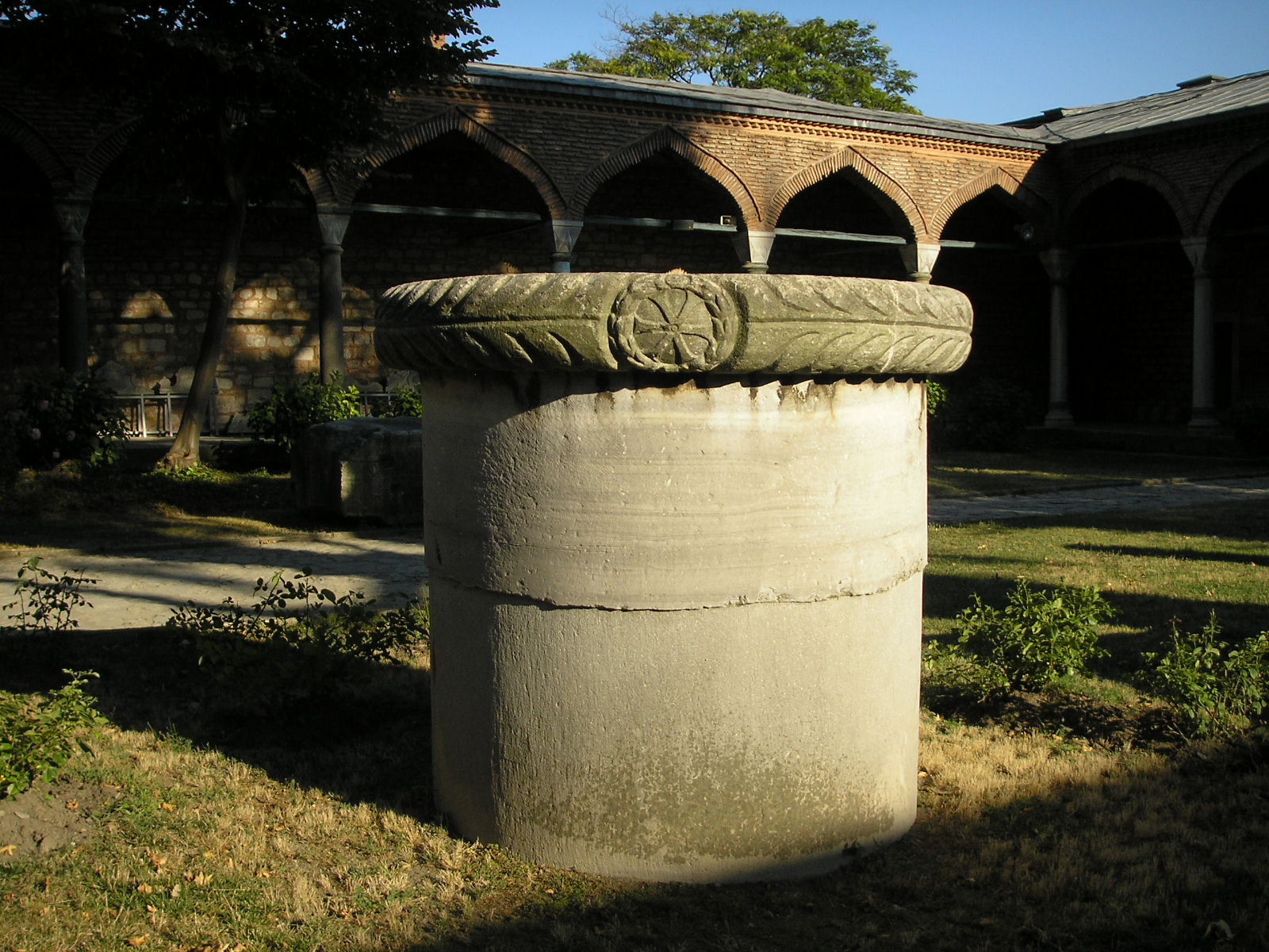
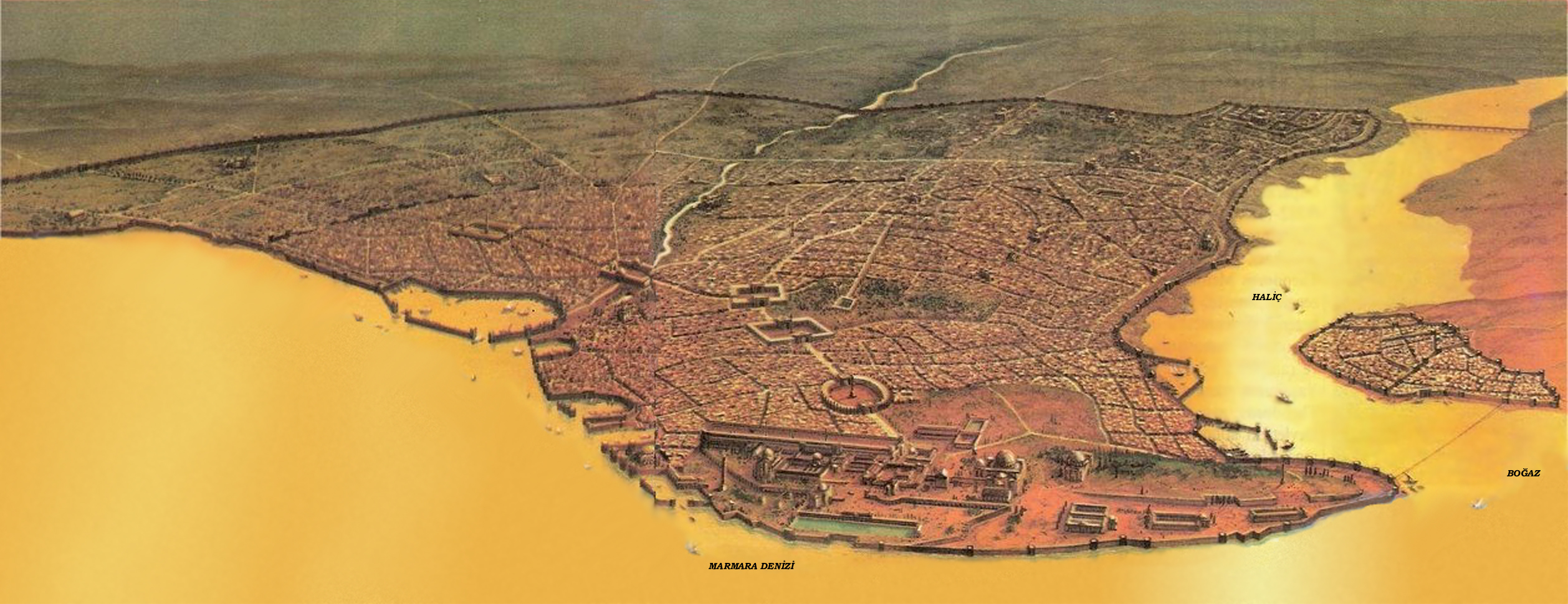
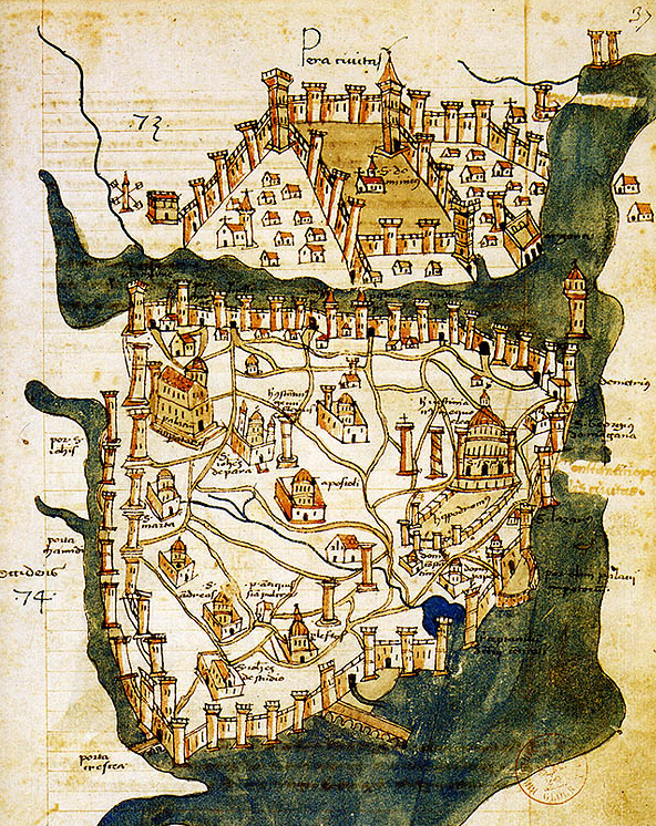
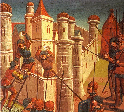
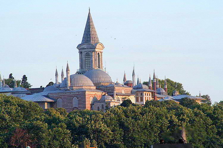
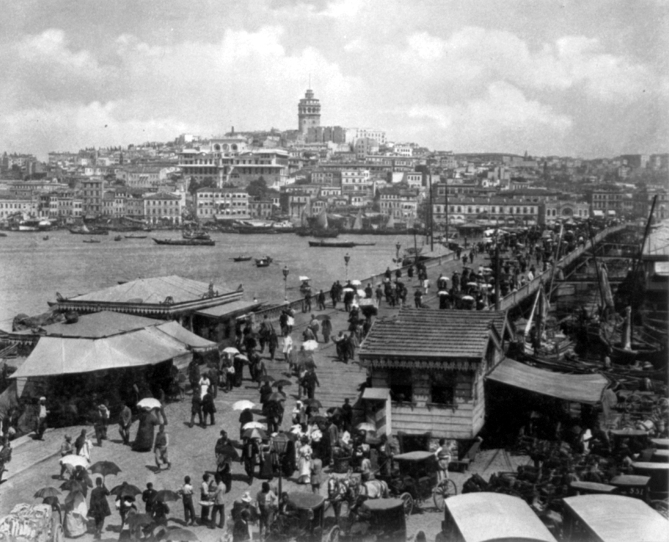

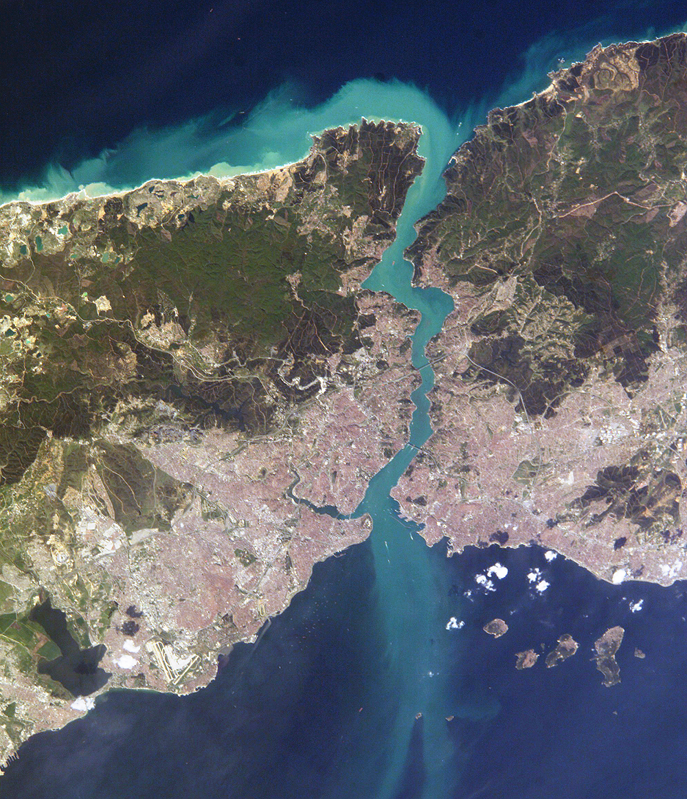
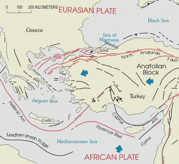
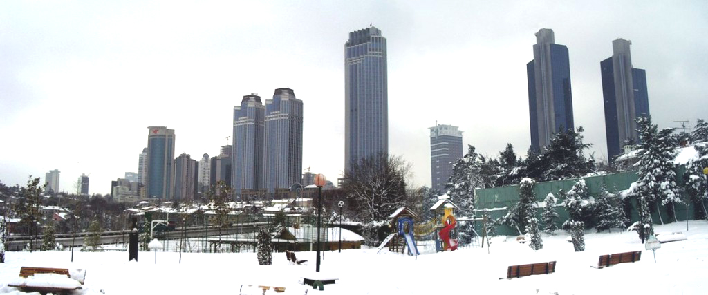

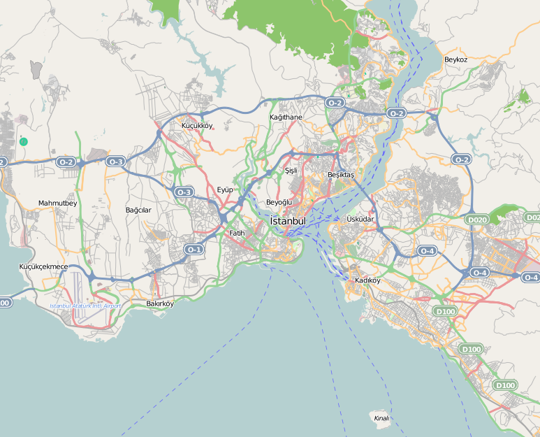
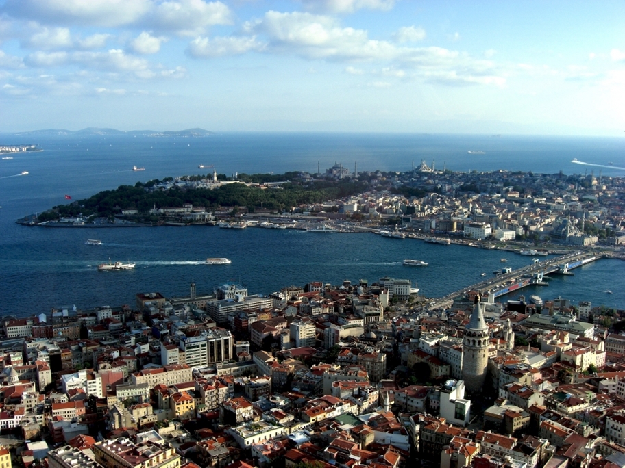
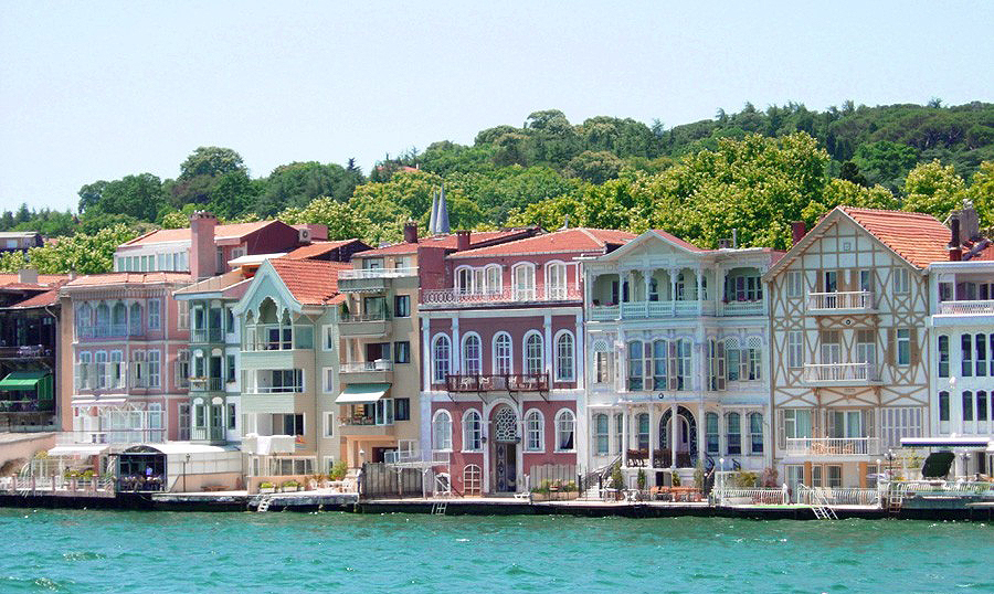
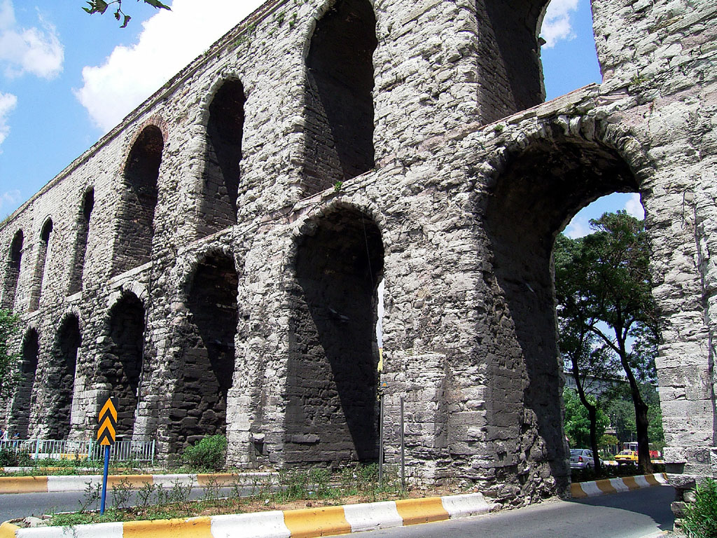

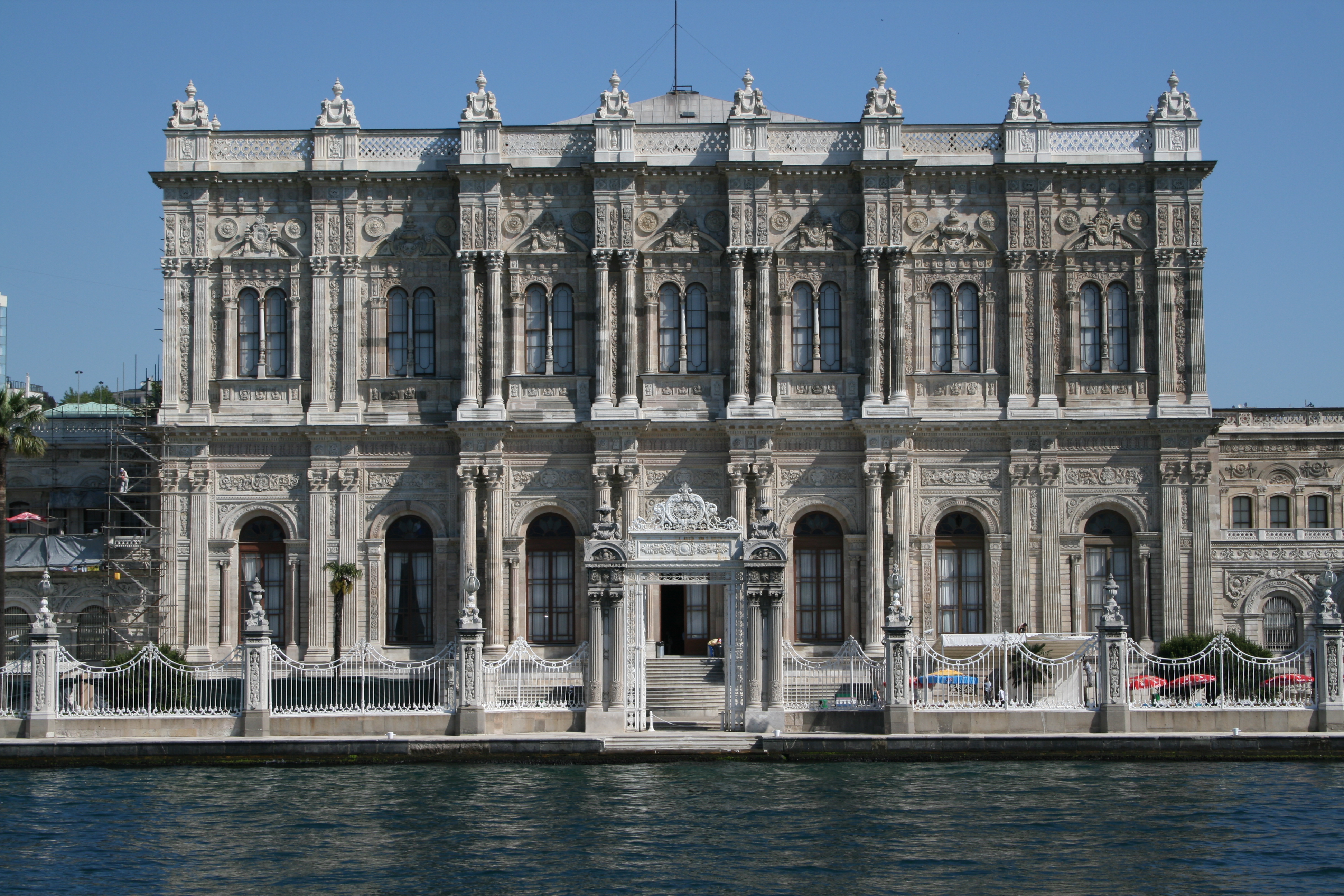


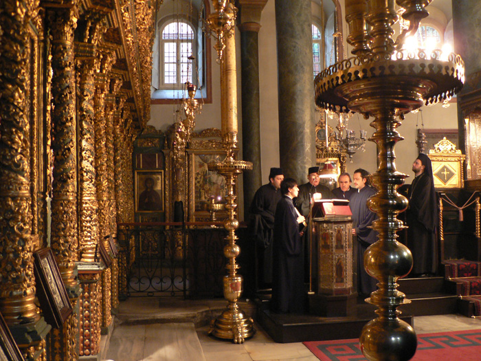
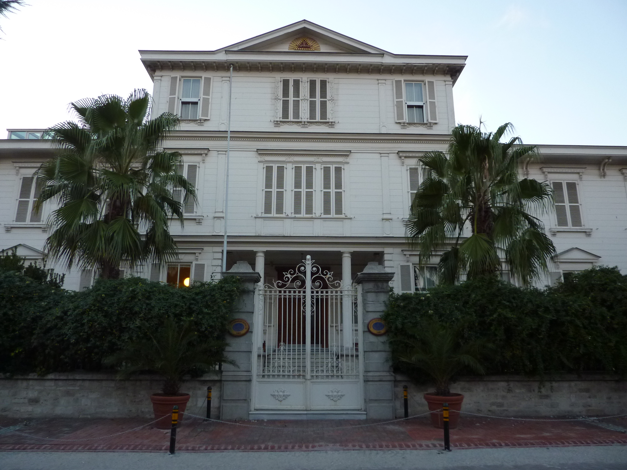


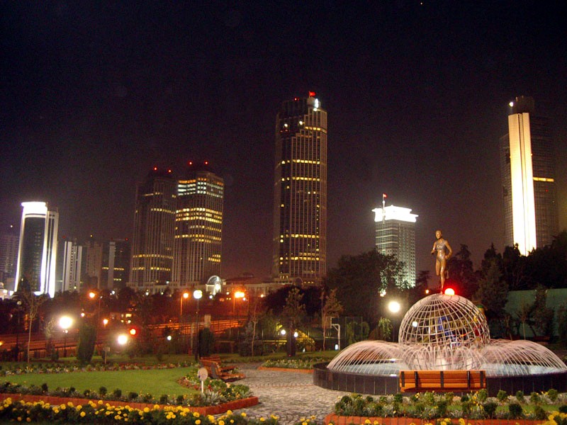

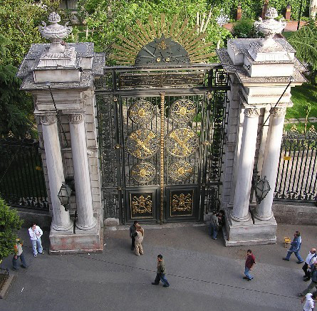
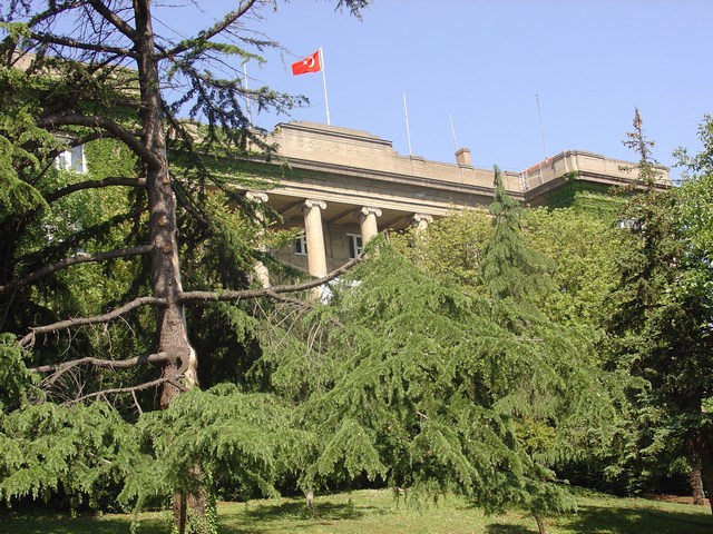
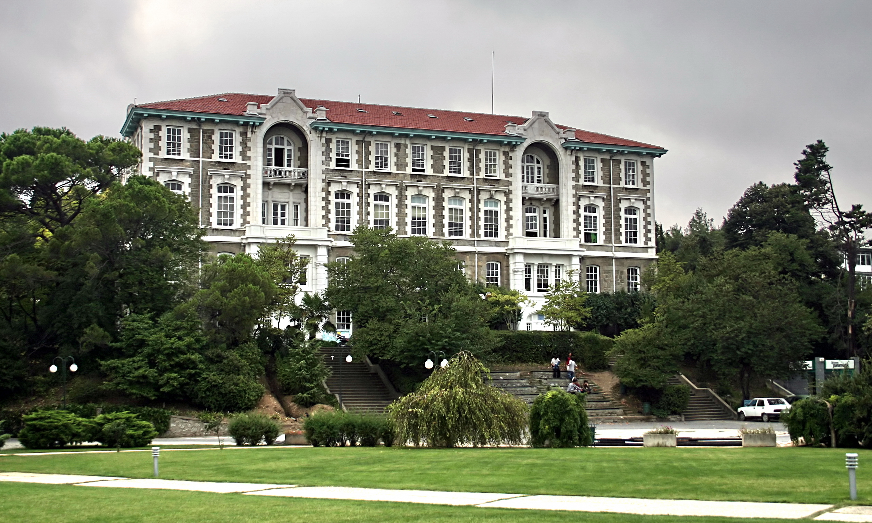
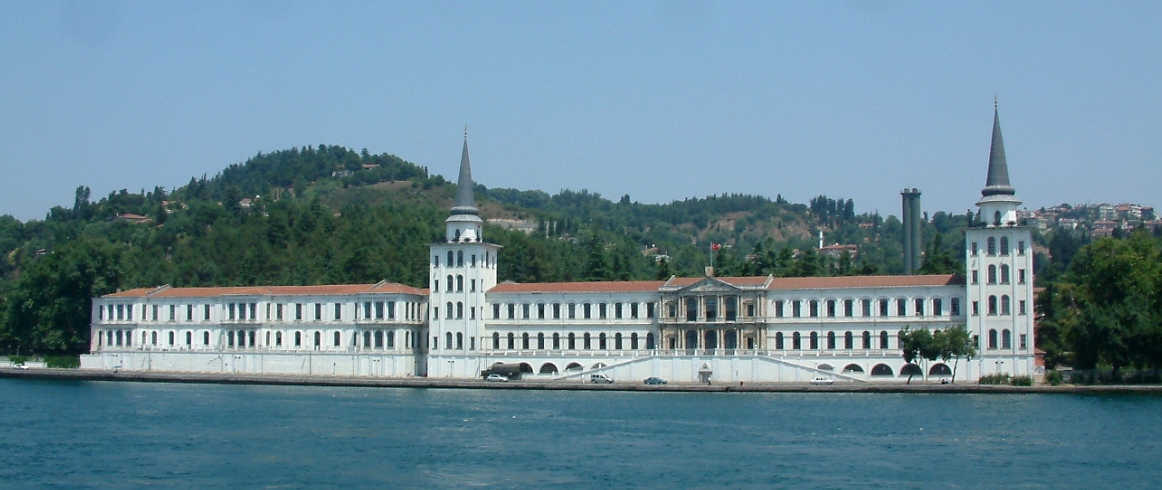
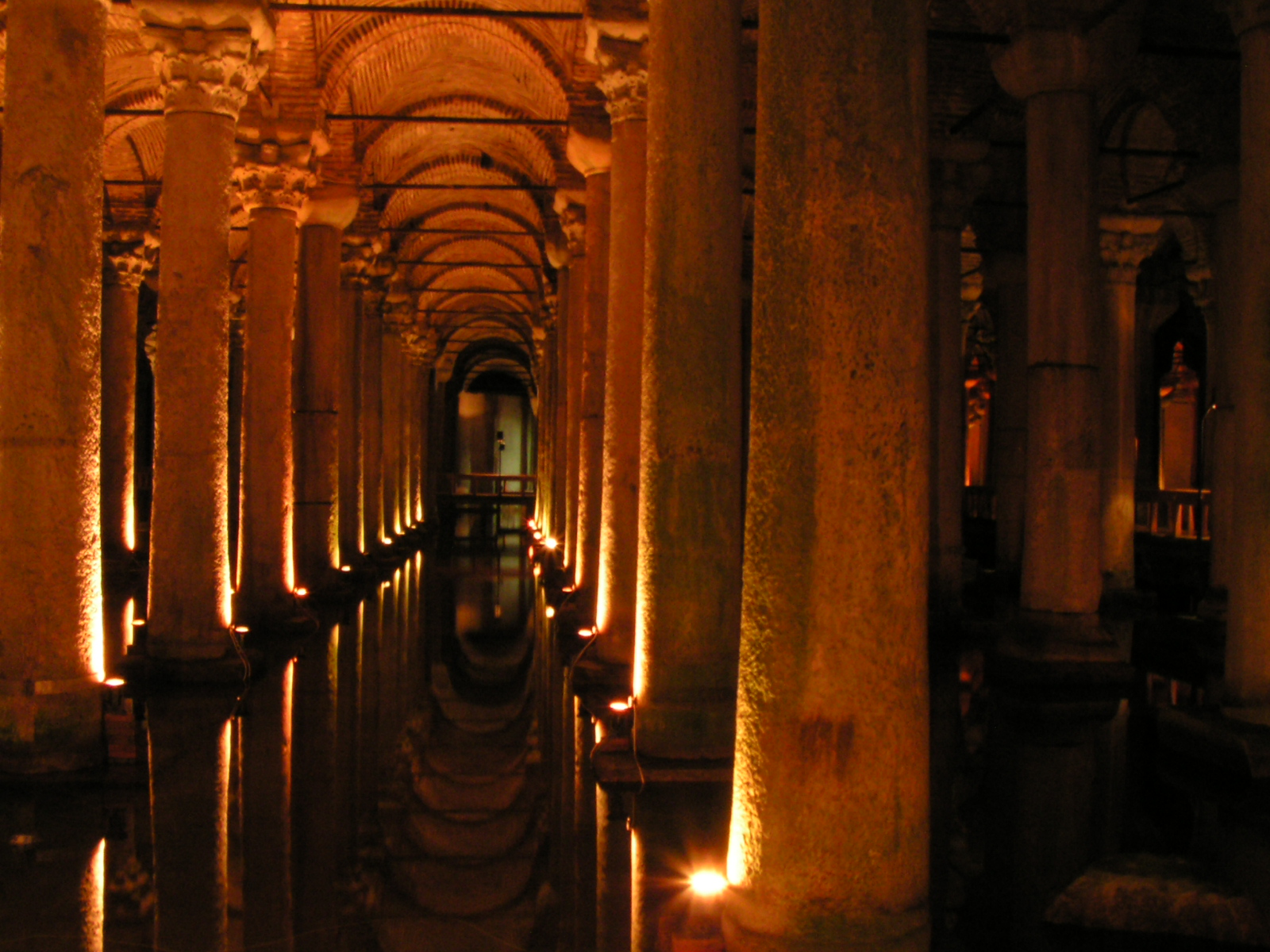


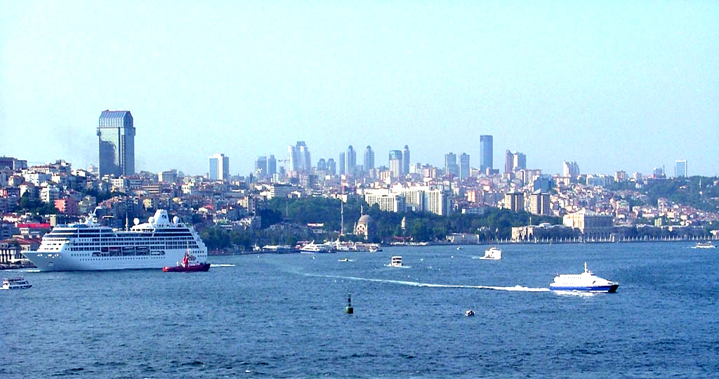


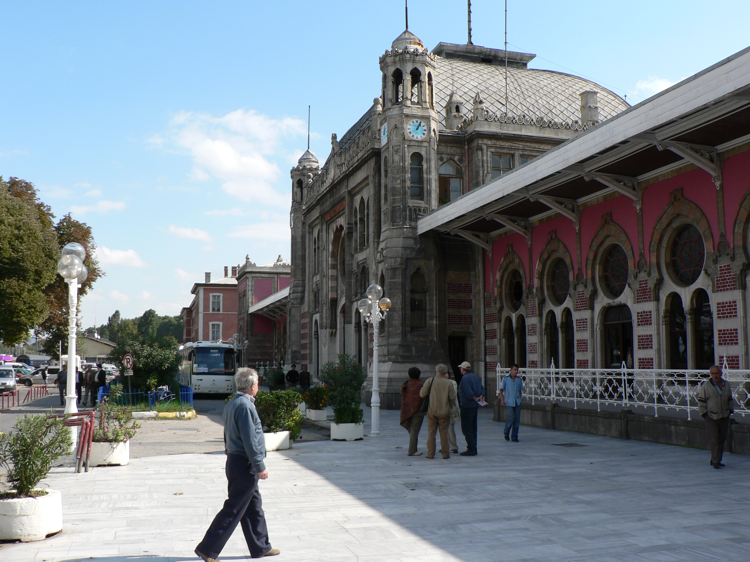
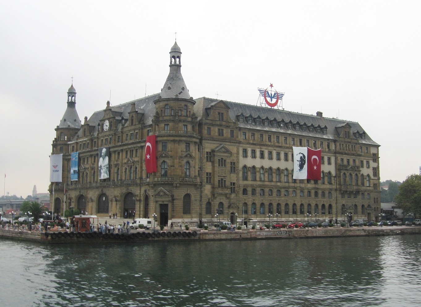

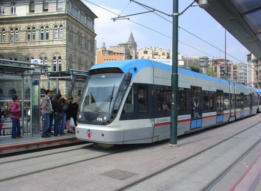
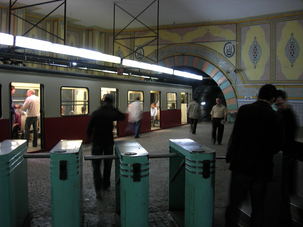


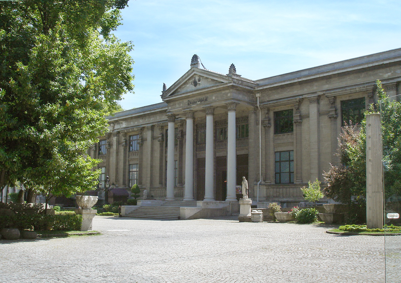
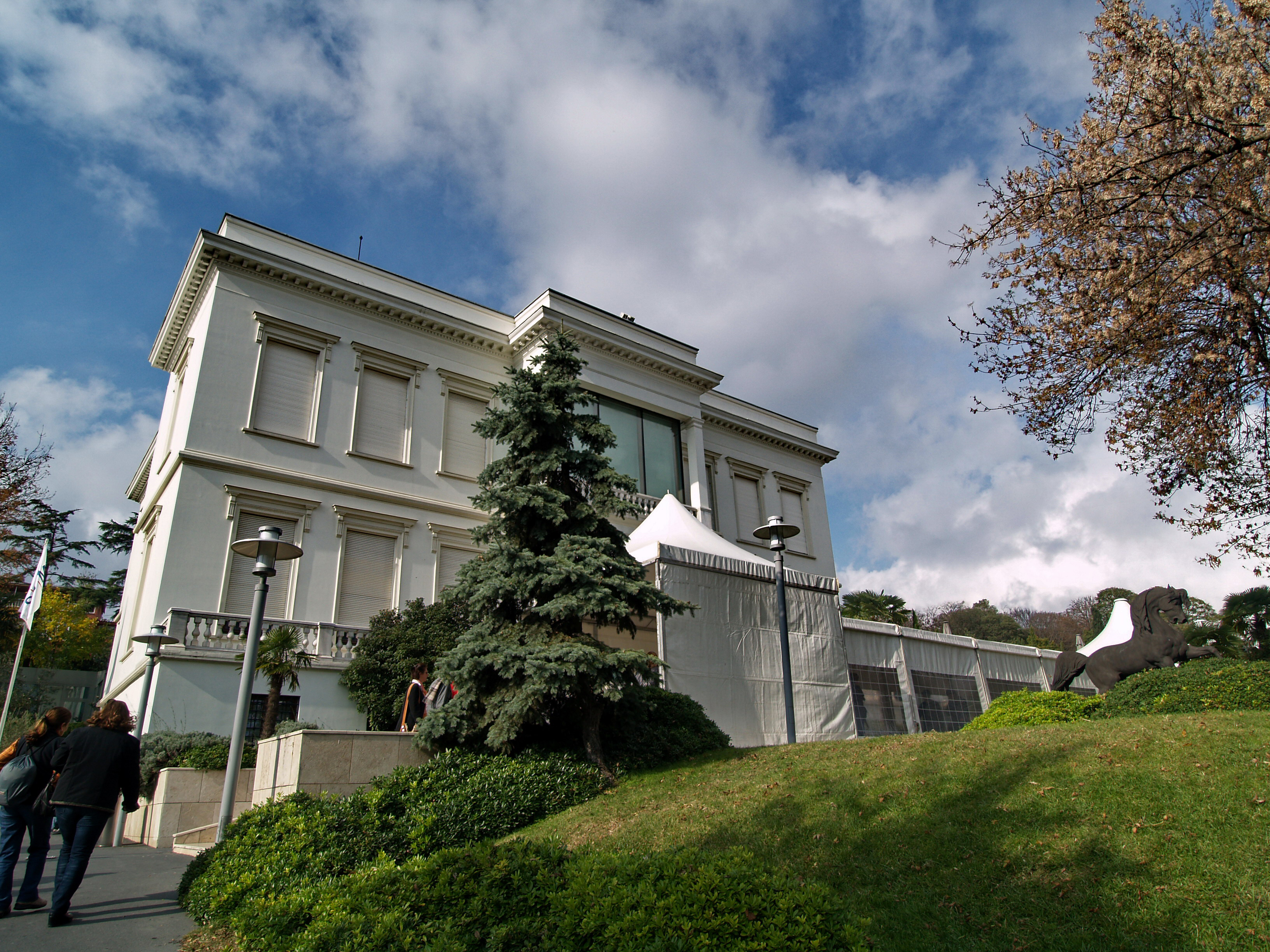
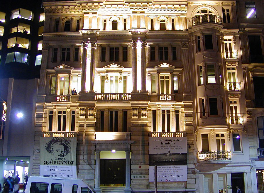
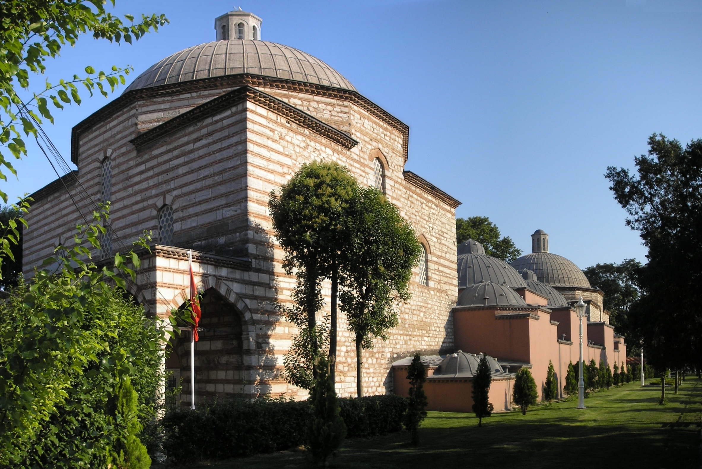
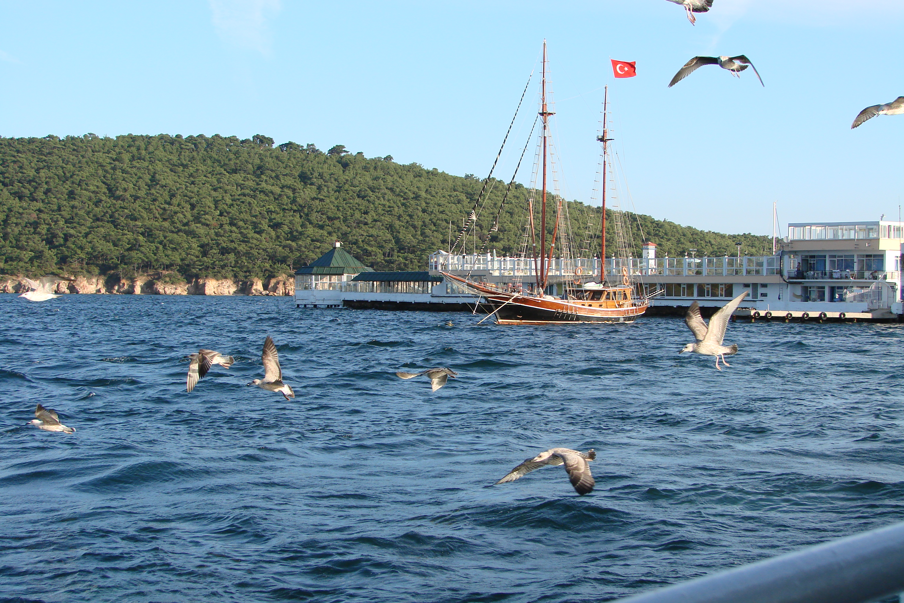
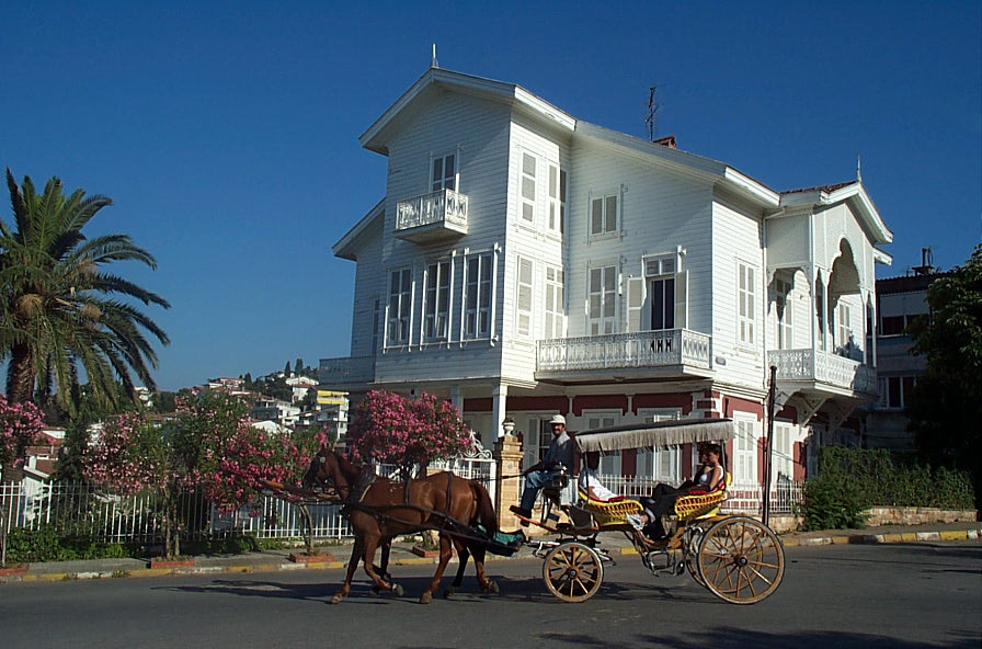
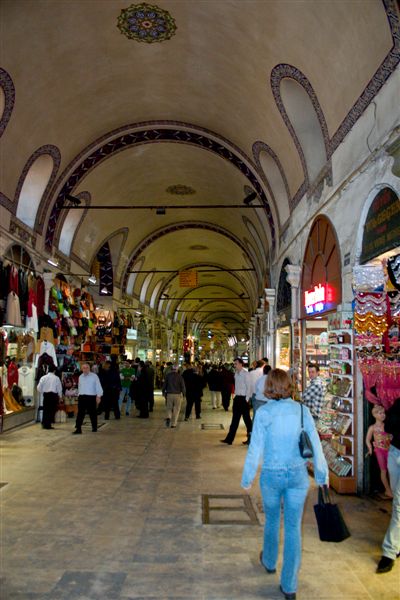
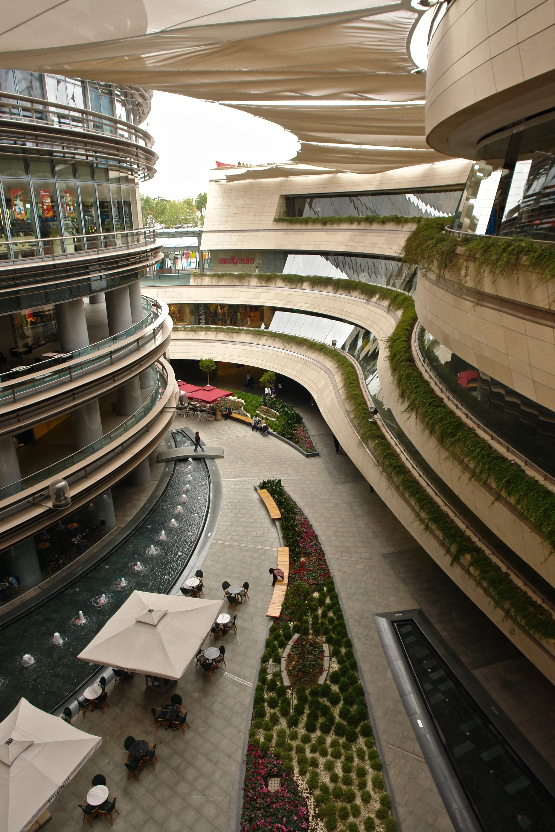


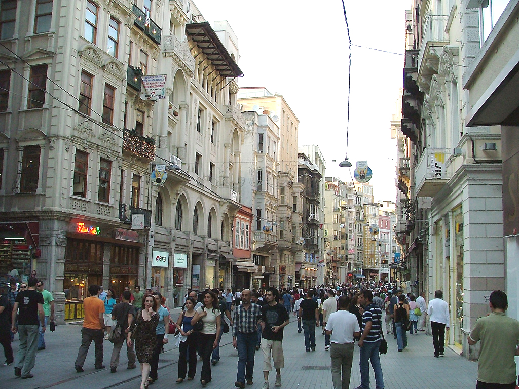

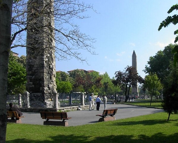
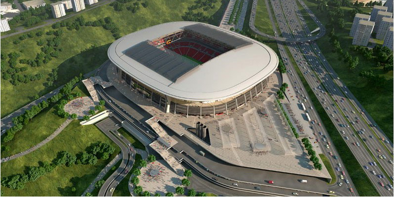


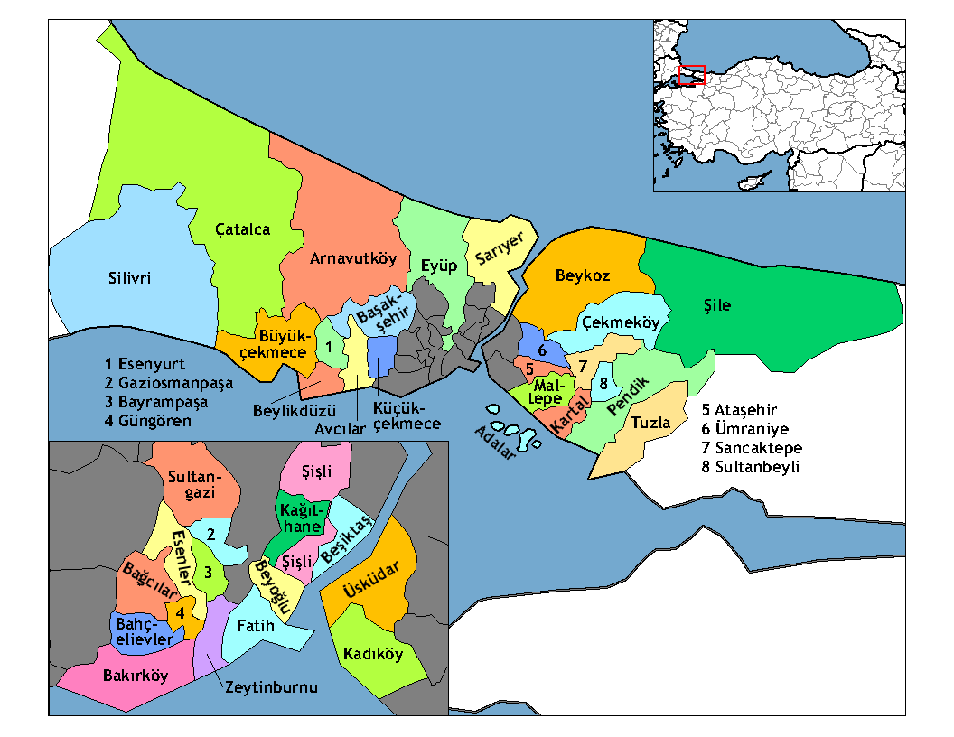

Wikimedia Foundation. 2010.