- Coxsackie (village), New York
-
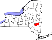
Coxsackie, New York — Village — Location within the state of New York
 Coxsackie, New York
Coordinates: 42°21′15″N 73°48′18″W / 42.35417°N 73.805°WCoordinates: 42°21′15″N 73°48′18″W / 42.35417°N 73.805°W Country United States State New York County Greene Area – Total 2.6 sq mi (6.7 km2) – Land 2.2 sq mi (5.6 km2) – Water 0.4 sq mi (1.1 km2) Elevation 141 ft (43 m) Population (2010) – Total 2,813 Time zone Eastern (EST) (UTC-5) – Summer (DST) EDT (UTC-4) ZIP codes 12051, 12192 Area code(s) 518 FIPS code 36-18718 GNIS feature ID 0947608 Coxsackie is a village in Greene County, New York, USA. The population was 2,813 at the 2010 census. The village name is a native word mak-kachs-hack-ing, and when purchased by the Dutch settlers was written as Koxhackung.[1] It is generally translated as "Hoot-owl place"[2], "place of many owls" or "piklikken".
The Village of Coxsackie is in the eastern part of the Town of Coxsackie.
Contents
History
The original plot of land was sold by American Indians to Pieter Bronck in 1661 for 150 guilders in Beaver pelts.[3]
The lower part of the village was once called "Reeds Landing." In the late 19th century, this area contained several factories and a steam boat landing, now replaced by a waterfront park.
The remains of the steam freighter Storm King still rest here, in the river just north of the park, where she sank at her moorings in the 1930s. She is still visible except at the highest tide or during flooding.
Near this area in the early 20th century was a popular sandy beach that drew thousands of visitors on summer weekends. The beach eroded away after channelization of the Hudson during the 1930s, when deep water navigation was extended up to Albany NY.
A ferry service connected the village to "Newtons Hook" across the river in Columbia County until 1928.
In 1947, the Coxsackievirus was isolated from an outbreak in upstate New York, and was named after the location where the outbreak first began, Coxsackie, NY.[4]
Geography
According to the United States Census Bureau, the village has a total area of 2.6 square miles (6.7 km2), of which, 2.2 square miles (5.6 km2) of it is land and 0.4 square miles (1.1 km2) of it (16.54%) is water.
Coxsackie is on the west bank of the Hudson River and is near U.S. Route 9W. The Hudson is an estuary. Although Coxsackie is 120 miles from the ocean, tides here range about three feet (the river flows both ways depending on time of day).
Demographics
As of the census[5] of 2000, there were 2,895 people, 1,188 households, and 723 families residing in the village. The population density was 1,332.1 people per square mile (515.1/km2). There were 1,307 housing units at an average density of 601.4 per square mile (232.6/km2). The racial makeup of the village was 95.89% White, 2.28% Black or African American, 0.28% Native American, 0.48% Asian, 0.03% Pacific Islander, 0.24% from other races, and 0.79% from two or more races. Hispanic or Latino of any race were 2.59% of the population.
There were 1,188 households out of which 32.0% had children under the age of 18 living with them, 43.6% were married couples living together, 12.5% had a female householder with no husband present, and 39.1% were non-families. 32.7% of all households were made up of individuals and 15.3% had someone living alone who was 65 years of age or older. The average household size was 2.38 and the average family size was 3.09.
In the village the population was spread out with 27.1% under the age of 18, 7.8% from 18 to 24, 27.6% from 25 to 44, 23.8% from 45 to 64, and 13.7% who were 65 years of age or older. The median age was 37 years. For every 100 females there were 88.0 males. For every 100 females age 18 and over, there were 81.9 males.
The median income for a household in the village was $36,098, and the median income for a family was $44,565. Males had a median income of $36,349 versus $28,182 for females. The per capita income for the village was $17,914. About 10.4% of families and 12.7% of the population were below the poverty line, including 13.9% of those under age 18 and 18.4% of those age 65 or over.
References
- ^ [1] New York State Museum of Natural History, New York State Museum, New York State Museum and Science Service, Bulletin Issues 332-337, page 40. retrieved 9 July 2010 from Google Books.
- ^ [2] Old Dutch Place Names from www.ancestry.com.
- ^ [3] Collections on the history of Albany: from its discovery to the present time, By Joel Munsell, page 298. Retrieved 8 July 2010 from Google Books.
- ^ "Coxsackie, NY and the virus named after it". virology.ws. http://www.virology.ws/2009/08/10/coxsackie-ny-and-the-virus-named-after-it/. Retrieved 2009-09-15.
- ^ "American FactFinder". United States Census Bureau. http://factfinder.census.gov. Retrieved 2008-01-31.
External links
- Village of Coxsackie
- Coxsackie, New York
- Greene County Tourism Official Site
- Photos of Reed Street Historic District in Coxsackie
Municipalities and communities of Greene County, New York Towns Ashland | Athens | Cairo | Catskill | Coxsackie | Durham | Greenville | Halcott | Hunter | Jewett | Lexington | New Baltimore | Prattsville | Windham
Villages Athens | Catskill | Coxsackie | Hunter | Tannersville
CDPs Cairo | Greenville | Jefferson Heights | Leeds | Palenville | Windham
Other
hamletsFreehold | Haines Falls | Oak Hill
Categories:- Villages in New York
- Populated places in Greene County, New York
- Place names in New York of Native American origin


Wikimedia Foundation. 2010.